Best Hikes Near Glendale, AZ: Easy Walks, Views, and Desert Trails
Last updated: May 23, 2026
If you’re looking for the best hikes near Glendale, Arizona, start with the trails at Thunderbird Conservation Park, then branch out to nearby Phoenix preserves when you want steeper climbs or longer desert routes. You’ll find easy family walks, sunrise viewpoints, rocky ridgeline loops, and tough summit hikes within a practical driving range.
This guide helps you choose the right route by distance, difficulty, shade, terrain, and purpose. You’ll also get safety tips for desert heat, notes on family-friendly trail choices, and current planning advice for Thunderbird trailhead construction.
Quick Answer: The best all-around hike near Glendale is Cholla Loop at Thunderbird Conservation Park because it gives you desert scenery, moderate climbing, and easy access without leaving the city. For families, choose Flatlander Loop. For sunrise views, choose Arrowhead Point Trail. For a tougher local challenge, choose Thunderbird Park Three Peaks Loop.
What’s in This Guide
Top Trails Around Glendale
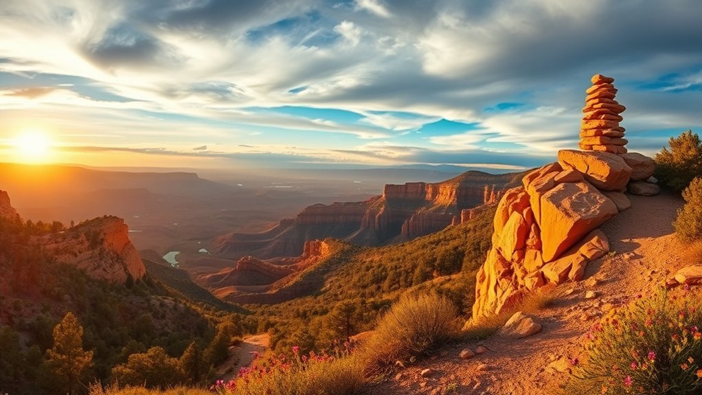
Glendale’s strongest hiking base is Thunderbird Conservation Park, a 1,185-acre desert preserve in the Hedgpeth Hills. The City of Glendale describes the park as a natural preserve with about 15 miles of multi-use trails for hiking, biking, running, horseback riding, and bird watching. You can check current park details on the official Thunderbird Conservation Park page.
For a balanced first hike, try Cholla Loop. It gives you a moderate desert workout with switchbacks, loose gravel, rocky footing, and broad views. Start early because shade is limited, especially in warm months.
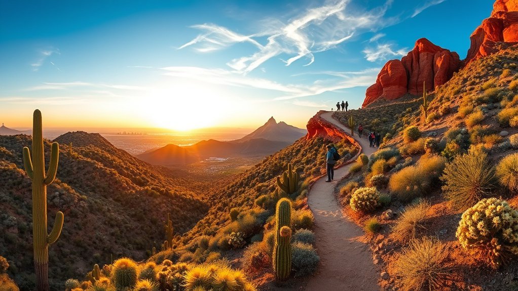
For a shorter outing, choose Coach Whip, Ridgeline and Sunrise Loop. It mixes suburban access with rocky trail sections, so it works well for hikers, runners, and older kids who can handle uneven ground. For a tougher local challenge, Thunderbird Park Three Peaks Loop links several high points and gives you the biggest local payoff for city and desert views.
Current planning note: As of May 23, 2026, Glendale says all Thunderbird trails remain open during trailhead improvements, but temporary trailhead closures are scheduled. The 59th Avenue trailhead closure runs from April to December 2026, the 55th Avenue work is expected from August 2026 to February 2027, and the 67th Avenue work is projected from January to August 2027. Check the City of Glendale trailhead closure notice before you drive out.
Short Family-Friendly Walks Near Glendale

Pick a trail that matches your child’s energy, not your own fitness level. Glendale-area trails can look short on a map but still feel hard for kids because of heat, rocks, and exposed desert sun.
For young children, choose short, gentle routes with simple exits. For older kids, choose a route with a viewpoint, benches, or a clear turnaround point. Bring water, salty snacks, hats, sunscreen, and a plan to turn around before anyone gets tired.
- Flatlander Loop: A short, easy loop in Thunderbird Conservation Park with gentle terrain. It is the best starting point for families, beginners, and relaxed walks.
- Arrowhead Point Trail: A short but more uneven route with a rewarding viewpoint. It works better for kids who can climb rocky steps and handle a moderate grade.
- Coach Whip, Ridgeline and Sunrise Loop: A better choice for older children, active families, and beginner trail runners because it adds rocky sections and more movement variety.
- Short Cholla Loop section: Use part of Cholla Loop as an out-and-back when you want desert scenery without committing to the full route.
Family tip: In summer, a “short” desert hike can still become unsafe fast. Start near sunrise, keep the route flexible, and turn around before children show signs of fatigue.
Best Sunrise and Sunset Hikes Near Glendale
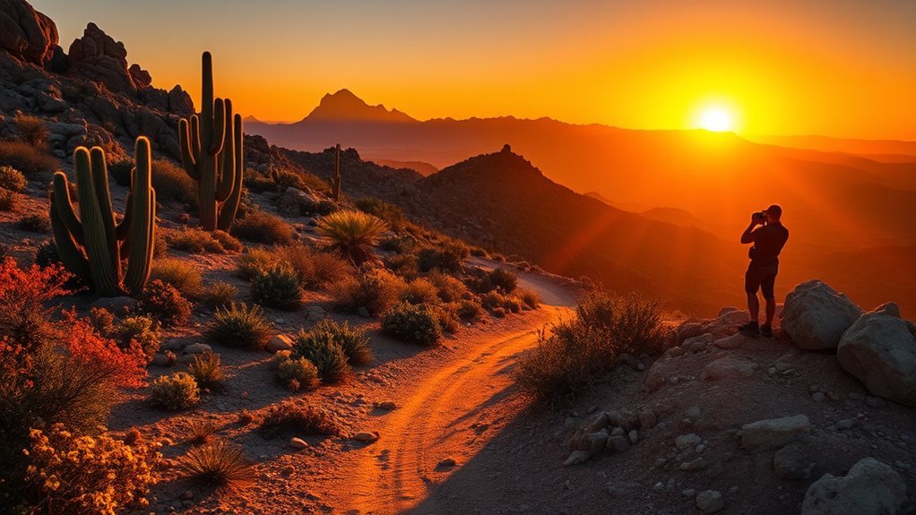
For sunrise or sunset, choose trails with open ridgelines, clear viewpoints, and simple navigation. The Glendale area gives you dramatic desert light, but the same open terrain also means little shade and fast temperature changes.
Arrowhead Point Trail is one of the most practical sunrise choices near Glendale. It gives you a short climb, open views, and a clear destination. Bring a headlamp before dawn and use extra care on rocky sections when the light is low.
Coach Whip, Ridgeline and Sunrise Loop also works well for sunrise because it combines open views with a manageable distance. If you want a longer golden-hour hike, choose Cholla Loop or link Cholla with nearby Thunderbird routes.
For sunset, leave enough time to return safely before dark. Desert trails can look simple in daylight but become harder to follow after the sun drops behind the ridges.
Challenging Climbs and Summits Near Glendale
These routes demand more fitness, better footing, and more planning than the easy Thunderbird loops. They reward you with wider views, steeper climbs, and a stronger sense of accomplishment.
- Thunderbird Park Three Peaks Loop: The toughest close-to-Glendale option in this guide. Expect sustained climbing, exposed slopes, rocky footing, and multiple viewpoints. It is a strong local training route when you want a bigger effort without driving far.
- Echo Canyon Trail on Camelback Mountain: The City of Phoenix rates Echo Canyon as Extremely Difficult and describes it as steep, rocky, exposed, and partly assisted by handrails and other aids. This is not a beginner hike. Review the official Camelback Mountain trail details before you go.
- Flatiron via Siphon Draw: This is a serious Superstition Mountains route from Lost Dutchman State Park. Arizona State Parks describes Siphon Draw as a challenging hike to the top of the Flatiron. It requires route awareness, comfort on steep rock, and a conservative turnaround plan. Check the Lost Dutchman State Park page for current park information.
- Piestewa Peak Summit Trail: This is a steep Phoenix classic with big city views. The City of Phoenix lists trail hours from 5 a.m. to 11 p.m. and prohibits dogs year-round on the Piestewa Peak Summit Trail. Confirm rules on the official Piestewa Peak and Dreamy Draw page.
Safety warning: Do not treat Camelback, Flatiron, or Piestewa Peak like casual city walks. These hikes can involve steep rock, exposure, heat risk, crowded trailheads, and rescue situations when hikers underestimate the route.
Best Glendale-Area Hikes Compared
Use this quick table to match your route to your time, energy, and comfort with desert terrain. Distances can vary by exact starting point, connector choice, and trail app, so confirm your route before you leave.
| Trail | Best For | Difficulty | What to Expect |
|---|---|---|---|
| Flatlander Loop | Families, beginners, short walks | Easy | Gentle desert terrain with flexible connector options |
| Arrowhead Point Trail | Sunrise, sunset, short viewpoints | Moderate | Rocky climb, open views, limited shade |
| Cholla Loop | Best all-around Thunderbird hike | Moderate | Switchbacks, gravel, rocks, desert views |
| Thunderbird Park Three Peaks Loop | Longer local challenge | Moderate to hard | Multiple high points, sustained climbing, city views |
| Deem Hills Circumference Trail | Longer ridgeline outing | Moderate | Phoenix-area views, basalt rock, longer desert loop |
| Piestewa Peak Summit Trail | Steep city-view workout | Hard | Steep climb, crowds, no dogs on summit trail |
Scenic Loop Routes
You’ll find several scenic loop options around Glendale, from short family walks to longer rocky circuits. Choose your loop based on footing, shade, total climbing, and how easily you can shorten the route if heat or fatigue becomes a problem.
Popular Loop Options
These loop routes suit different needs. Start with Flatlander if you want an easy introduction. Move up to Cholla or Coach Whip when you want more rocks, views, and effort. Choose Three Peaks only when you have enough time, water, and energy for a longer outing.
- Flatlander Loop: Best for an easy warm-up, family walk, or quick outing near Glendale.
- Coach Whip, Ridgeline and Sunrise Loop: Best for runners, older kids, and hikers who want rocky sections without a long day.
- Cholla Loop: Best all-around loop for moderate terrain, switchbacks, and desert views.
- Thunderbird Park Three Peaks Loop: Best for hikers who want the biggest local loop challenge near Glendale.
Tips for Loop Hikes
Plan loop hikes more carefully than short out-and-backs because you may not reach your car quickly if the route feels harder than expected. Check the map before you start, identify bailout points, and note which connectors can shorten the hike.
Start early on exposed routes. Many Glendale-area trails have hard-packed dirt, loose gravel, and rocky steps that heat up fast. Wear sturdy shoes, carry more water than you expect to need, and avoid pushing for the full loop if the weather changes or your group slows down.
Trails With the Best City Views
The best city views come from ridgelines and summits that rise above the neighborhood grid. Near Glendale, Thunderbird Conservation Park gives you the easiest access to desert-to-city views without a long drive.
- Arrowhead Point Trail: Best for a short sunrise or sunset viewpoint close to Glendale.
- Thunderbird Park Three Peaks Loop: Best for multiple high points and broader Phoenix-area panoramas.
- Deem Hills Circumference Trail: The City of Phoenix says this trail traverses the recreation area and offers excellent Phoenix-area views. Deem Hills also features basalt volcanic rock formations. Review the official Deem Hills Recreation Area page before you go.
- Piestewa Peak Summit Trail: Best for a steep Phoenix skyline hike when you want a bigger challenge beyond Glendale.
Bring water, a headlamp for dawn or dusk, and a downloaded map. Cell service can vary, and trail junctions feel less obvious in low light.
Desert Flora, Fauna, and Wildflower Hotspots
Glendale-area trails sit in Sonoran Desert terrain, where you may see saguaros, creosote, palo verde, cholla, ocotillo, brittlebrush, and seasonal wildflowers. After good winter rain, spring hikes can bring desert primrose, lupine, chuparosa, and other blooms along flatter sections and sunny slopes.
Thunderbird Conservation Park, Cholla Loop, Arrowhead Point, and Deem Hills are all good choices for desert plant viewing. Wildlife sightings can include Gambel’s quail, desert cottontails, jackrabbits, woodpeckers, lizards, and snakes. Early morning gives you the best chance to see wildlife while temperatures stay lower.
Do not step off trail to reach flowers or cactus. The National Park Service’s Leave No Trace guidance recommends concentrating use on existing trails in popular areas, which helps protect fragile desert surfaces.
Multi-Use Trails for Running and Biking
Glendale-area multi-use trails give runners, hikers, mountain bikers, and horseback riders shared access to desert terrain. Thunderbird Conservation Park is the main local hub for this because Glendale identifies hiking, biking, jogging, horseback riding, and bird watching as park activities.
Choose your route based on speed and surface. Runners may prefer Coach Whip, Ridgeline and Sunrise Loop for short technical efforts. Mountain bikers should expect loose rock, exposed sections, and other users on the trail.
- Coach Whip, Ridgeline and Sunrise Loop: Good for technical trail running and short mountain-bike efforts.
- Deem Hills Circumference Trail: A longer moderate route with Phoenix-area views and varied terrain.
- Thunderbird connectors: Useful for building custom runs or rides without committing to one long loop.
- Mixed surfaces: Expect hard-packed dirt, gravel, loose rocks, and exposed sun.
Trail etiquette: Slow down at blind corners, announce your pass, yield appropriately, and keep earbuds low enough to hear other trail users.
Safety, Timing, and Trail Etiquette
Desert hiking near Glendale requires heat planning, even on short routes. Many trails have limited shade, exposed rock, and dry air that can hide how much water you are losing.
The City of Phoenix’s Take a Hike. Do it Right guidance tells hikers to wear proper shoes, clothing, a hat, and sunscreen. It also tells hikers to hydrate before they go, carry more water than they think they need, and turn around before drinking all their water.
Phoenix also expanded its Trail Heat Safety Program in 2024 to reduce risk during extreme heat. Some Phoenix trails can close during extreme heat conditions, so check official updates before hiking Camelback, Piestewa Peak, or South Mountain. You can review the Phoenix Trail Heat Safety Program for current restrictions.
- Start early: Sunrise hikes are safer and more comfortable than midday hikes in warm seasons.
- Carry extra water: Bring more than your minimum estimate, especially for kids, dogs, and longer loops.
- Wear real trail shoes: Loose gravel and rock can make casual shoes unsafe.
- Download a map: Trail junctions can be confusing in low light.
- Respect desert wildlife: Watch where you step and never put your hands where you cannot see.
- Leave no trace: Pack out trash, stay on trail, and pick up pet waste.
Connecting Longer Routes and Trail Networks
You can turn short Glendale-area hikes into longer outings by linking loops, ridgelines, and connector trails. This works especially well at Thunderbird Conservation Park because the trail system gives you several ways to adjust distance.
- Use Coach Whip as a spine: Link Ridgeline, Sunrise, and nearby connectors for a longer run or hike.
- Combine Arrowhead Point and Cholla: Build a longer Thunderbird outing with a viewpoint and a moderate loop.
- Add Three Peaks when you want more climbing: Use it only when you have enough water, time, and heat margin.
- Use Deem Hills for a different feel: Choose Deem Hills when you want basalt rock, longer terrain, and Phoenix-area views.
Always check your exit options before linking trails. A route that looks simple on a map may feel harder when sun, rocks, and elevation gain add up.
How to Choose the Right Glendale Hike
Choose your hike by matching the trail to your goal. Do not choose by distance alone because a short rocky climb can feel harder than a longer flat walk.
- For young kids: Flatlander Loop or a short Thunderbird connector.
- For sunrise: Arrowhead Point or Coach Whip, Ridgeline and Sunrise Loop.
- For moderate exercise: Cholla Loop.
- For a longer local challenge: Thunderbird Park Three Peaks Loop.
- For city views beyond Glendale: Deem Hills or Piestewa Peak.
- For serious scrambling: Echo Canyon or Flatiron, only with proper preparation.
Frequently Asked Questions
What Is the Best Easy Hike Near Glendale, Arizona?
Flatlander Loop at Thunderbird Conservation Park is one of the best easy hikes near Glendale because it is short, gentle, and close to parking. It works well for beginners, families, and quick morning walks when you want desert views without a steep climb.
What Is the Best Sunrise Hike Near Glendale?
Arrowhead Point Trail and the Coach Whip, Ridgeline and Sunrise Loop are strong sunrise choices near Glendale. Both offer open views, rocky desert scenery, and manageable distances. Start before first light, bring a headlamp, and expect little shade after sunrise.
Are Glendale Hiking Trails Good for Kids?
Yes, some Glendale-area trails work well for kids, especially short routes at Thunderbird Conservation Park. Choose Flatlander Loop for younger children and stroller-friendly terrain. Pick Arrowhead Point or a short Cholla section for older kids who can handle rocks and uneven steps.
Can You Hike With Dogs Near Glendale?
Many Glendale-area multi-use trails allow dogs, but rules vary by park and trail. Keep dogs leashed, carry extra water, avoid hot pavement and rock, and check the official park page before you go. Dogs are prohibited year-round on Phoenix’s Piestewa Peak Summit Trail.
When Is the Best Time of Year to Hike Near Glendale?
The most comfortable hiking season near Glendale usually runs from late fall through spring. Summer hiking requires extra caution because many trails have little shade. Start early, carry more water than you think you need, and avoid exposed routes during extreme heat.
Where Can You See Wildflowers Near Glendale?
Thunderbird Conservation Park, Cholla Loop, Arrowhead Point, and Deem Hills can show wildflowers after good winter rain. Blooms vary by year, but spring is usually the best window. Stay on the trail because desert plants and biological soil crusts damage easily.
Is Thunderbird Conservation Park Open During Construction?
Yes, Glendale says all Thunderbird trails remain open during the 2026–2027 trailhead improvement project, but some trailheads will close temporarily. Check Glendale’s official closure notice before visiting because parking access and construction timing can change.
What Should You Bring for a Glendale Desert Hike?
Bring water, sun protection, sturdy shoes, a hat, snacks, a charged phone, and a downloaded map. For sunrise or sunset hikes, bring a headlamp. For longer routes, carry extra water and tell someone your route before you start.
Conclusion
The best hikes near Glendale, AZ range from easy Thunderbird walks to serious Phoenix-area summit climbs. Start with Flatlander Loop if you want a relaxed family walk, choose Arrowhead Point for sunrise, pick Cholla Loop for the best all-around local hike, and save Thunderbird Park Three Peaks Loop for a longer challenge.
Before you go, check current trailhead access, start early, carry more water than you think you need, and choose a route that matches your group’s real fitness level. For your next step, bookmark this guide and compare the trail table before your next Glendale hiking day.