If you’re planning hikes around Horseshoe Bend, you’ll feel the dry sun on your skin and hear wind along the canyon rim as you choose routes for every skill level. Walk the short sandy overlook for dramatic views, tackle longer rim trails for wide panoramas, or join a guided slot-canyon tour to step into sculpted sandstone light. Keep going—there’s more about routes, access, and timing that’ll help you pick the perfect trail.
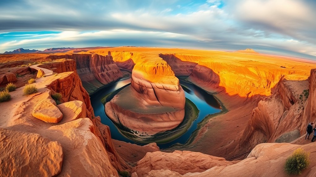
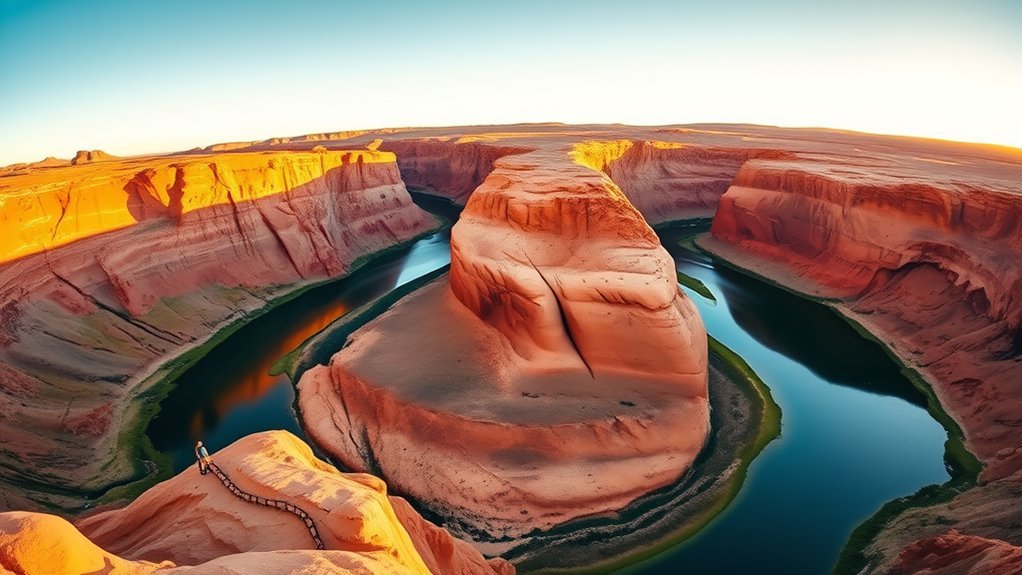
Horseshoe Bend Overlook Trail Details
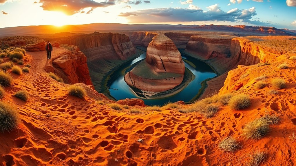
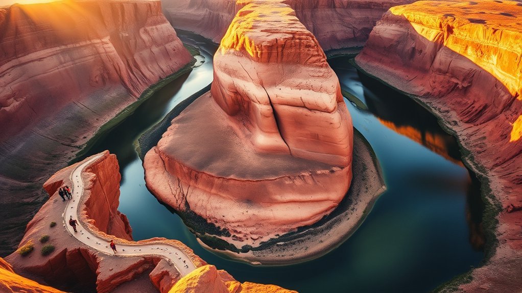
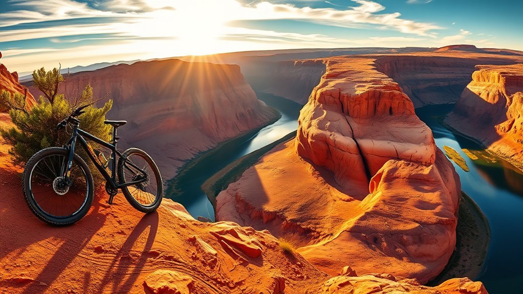
Although it’s short, the Horseshoe Bend Overlook Trail rewards you with dramatic views after a gentle 1.5-mile round trip and only about 150 feet of elevation gain, making it an easy-to-moderate outing for families and casual hikers. You’ll walk on soft, sandy terrain that cushions your steps while the desert air warms as the sun rises. Aim for sunrise to avoid crowds and watch the Colorado River gleam below; the light sharpens every contour. The path is well-maintained and open year-round, but shade’s scarce and peak times get busy. Bring water, wear sturdy shoes, and arrive early for the best photography and comfort. It’s one of the must-do hiking trails near Horseshoe for quick, memorable views.
Glen Canyon Rim Trail Guide
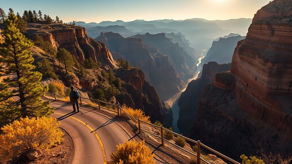
Stretching about nine miles round trip, the Glen Canyon Rim Trail gives you a moderate, scenic outing with panoramic views of Glen Canyon Dam and shimmering Lake Powell. You’ll follow a well-maintained path that’s less trafficked than other trails near Horseshoe Bend, so you can savor quiet overlooks and crisp desert light. Expect moderate elevation gain underfoot; your breath will match the steady rhythm of the trail as red rock edges frame wide water reflections. Bring a map or GPS—signage is sparse—and pack plenty of water and snacks because there are no facilities. Photographers will love sunrise and sunset hues that deepen canyon contours. Move at your own pace, respect fragile surfaces, and leave the route ready for the next hiker.
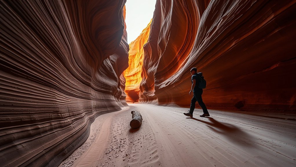
Antelope Canyon (Guided Tour) Information
If you enjoyed the sweeping vistas along the Glen Canyon rim, you’ll find Antelope Canyon offers a very different kind of awe—tight, sculpted corridors of sandstone that funnel light into otherworldly patterns. You’ll walk 1–2 miles on a guided tour that’s rated easy with moderate elevation gain, so it’s accessible if you’ve done other Horseshoe trails. Expect narrow passages, warm sandstone textures under your fingertips, and iconic midday light beams spotlighting swirling walls. Tours run on Navajo land, so you must book in advance and follow your guide’s instructions for safety and respect. Aim for midday for peak lighting, bring a small tripod if allowed, and wear comfortable shoes for sandy footing and occasional steps.
Wire Pass to Buckskin Gulch Essentials
You’ll follow a sandy wash and narrow ledges on the 5.6-mile out‑and‑back to reach Buckskin Gulch, so carry a map or GPS and watch for unmarked forks. Keep an eye on the sky and check forecasts before you go—flash floods can turn those beautiful narrows deadly in minutes. Wear grippy shoes, bring plenty of water, and be prepared to turn back if conditions or your route‑finding feel risky.
Route and Navigation Tips
When you start the Wire Pass trailhead, keep your eyes on the sandy track and the distant sandstone fins—a clear route for the first miles, but one that requires attention as it narrows toward Buckskin Gulch. You’ll follow faint footprints, wind-scoured ripples, and cairns where present; trails around Horseshoe Bend can be quiet, so don’t assume a beaten path. Use navigational aids—map, compass, or reliable GPS—to confirm junctions and the slot-canyon entry. Expect moderate elevation gain and uneven footing: choose sturdy boots and steady your pace on slicksand and rock. Carry extra water, watch landmarks like fins and washes, and mark your turnaround time so you return before dusk.
Safety and Weather Risks
After following the sandy track and sandstone fins toward Buckskin Gulch, shift your focus to weather and safety—this stretch can change from calm to hazardous fast. You’ll feel the air tighten before a storm; light on the sandstone can shift to a distant rumble. Check forecasts and avoid the slot after rain; flash floods arrive with little warning and fill narrow passages in minutes. Carry ample water, layers, sturdy shoes, and a reliable map or GPS—trail markers thin and footing becomes demanding. Be honest about fitness: the route’s moderate to strenuous nature tests endurance and balance. Watch clouds constantly, turn back if thunder or darkening skies appear, and prioritize safety over reaching a landmark.
Hanging Garden Trail Overview
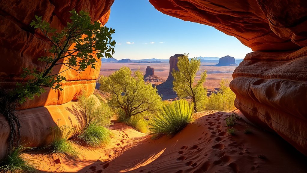
Although tucked into the arid rim it feels like a secret, the Hanging Garden Trail is a short, 1-mile round trip that delivers a surprisingly lush oasis with minimal elevation gain—perfect for hikers of all skill levels. You’ll step from sun-baked sandstone into a cool, green pocket where dripping water feeds ferns and wildflowers. The well-maintained path at the Recreation Area invites slow, sensory exploration—birdsong, damp earth, and the scent of sage. It’s ideal for families or anyone wanting a peaceful outdoor pause without a long commitment.
- Distance: 1 mile round trip — easy and quick.
- Terrain: minimal elevation, clear path.
- Scenery: contrasting desert and lush vegetation.
- Use: family-friendly, restorative outing.
Deer Point Trail and Biking Options
If you’re looking for a longer outing that still feels rewarded at every turn, the Deer Point Trail stretches about 9.1 miles round trip and blends sweeping vistas with well-marked, bike-friendly singletrack. You’ll follow signs at the trailhead that keep navigation simple as you move through stands of cottonwood and juniper, the air smelling faintly of pine and dry earth. The path’s moderate grade lets you soak in panoramic overlooks—especially vivid in fall when colors ignite the ridgelines. With a 4.7-star community rating from 750 reviews, the route’s upkeep shows. Mountain bikers find smooth changes and occasional technical sections that spice the ride without overwhelming. Pack water, snap photos, and relish the rhythm of the trail.
Accessibility and Parking at Trailheads
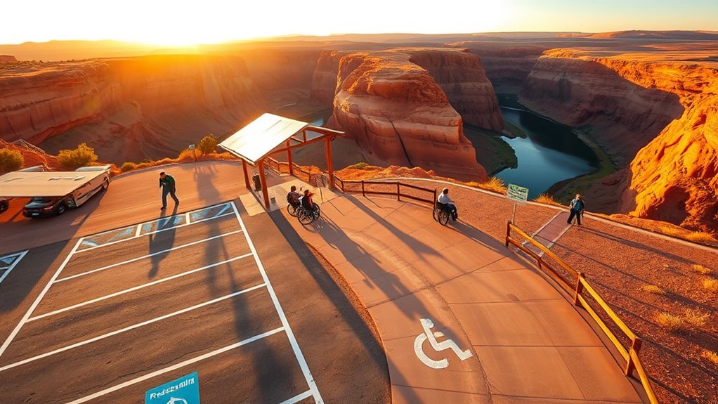
When you arrive, you’ll find generous, free parking in a paved lot with seven van-accessible spaces—each marked with striped access aisles—so loading and unloading is straightforward before you set out. The overlook trail emphasizes accessibility: a packed-dirt surface, typically six feet wide, and a gentle grade near 5% make movement steady for wheelchairs, strollers, or mobility equipment, though all-terrain tires can help on firmer sections. Restrooms sit at the trailhead for quick comfort stops. You’ll notice wind and sun on open stretches, and the firm footing underfoot.
- Parking is free and plentiful in a paved lot.
- Seven van-accessible spaces with aisles ease transfers.
- Trail is wide, packed dirt, mostly gentle grade.
- Restrooms at trailhead support accessibility needs.
Best Times to Visit and Weather Tips
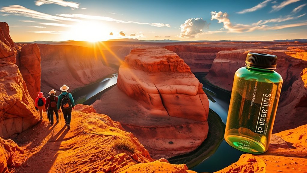
Because mornings bring cooler air, softer light, and far fewer people, plan to arrive at sunrise to enjoy Horseshoe Bend at its most peaceful—especially in October, when daytime highs usually sit between about 61°F and 72°F. You’ll feel the canyon’s hush as the sun washes warm amber across sandstone, and that quiet makes early hours one of the best times to visit for both views and cooler hiking. Check forecasts before you go; storms can bring sudden runoff and flash floods on exposed trails. Carry plenty of water, wear sun protection, and layer for chilly mornings that warm quickly. If you prefer fewer people, aim for weekday dawns. These weather tips help you stay safe and savor the landscape.
Frequently Asked Questions
Is Horseshoe Bend a Difficult Hike?
No, it isn’t a difficult hike; you’ll find the difficulty level easy, with sandy trail conditions and mild elevation gain. You’ll feel warm sun, crunching sand, and should arrive early, hydrated, and ready for views.
Is Sunrise or Sunset Better at Horseshoe Bend?
Think of waking to a quiet studio—sunrise photography wins: you’ll catch soft golden light, fewer crowds, cooler temps, and vivid river reflections; sunset colors can be dramatic, but crowds often dilute that peaceful, intimate view.
Is There a Hike in Horseshoe Bend?
Yes — you can hike Horseshoe Bend’s 1.5-mile trail to breathtaking scenic views; you’ll feel river breezes, see red cliffs, and should bring water, sun protection, sturdy shoes, and follow hiking tips to avoid crowds and stay safe.
What Are the Big 3 Thru Hikes?
The Big 3 thru hike routes are the Appalachian Trail, Pacific Crest Trail, and Continental Divide Trail; you’ll smell pine, feel alpine wind, and plan serious hike preparation, permits, logistics, and months-long gear testing for each epic route.
Conclusion
You’ve walked sun-baked sand and peered into stone cradles of light—each trail sings a different song. Let the overlook’s sheer drop take your breath, the rim’s long sweep fill your lungs, and Antelope’s light beams paint your skin. Follow slickrock whispers through Buckskin, taste hanging-garden moisture, pedal Deer Point’s wind. Plan for heat, snag shade, and come early; Horseshoe Bend will etch itself into you like river-carved memory.