The Superstition Mountains rise east of Phoenix near Apache Junction, with short desert walks, difficult summit routes, backcountry camps, petroglyph sites, and wide views across the Sonoran Desert. A good trip starts with choosing the right trailhead, checking the correct land manager, carrying enough water, and avoiding extreme heat or thunderstorms.
Quick Answer
Visit the Superstition Mountains from late fall through early spring, use a vehicle to reach the trailheads, and choose a route that matches your fitness. Lost Dutchman State Park is the easiest starting point for first-time visitors. Carry your full water supply, download maps, and avoid hiking during extreme heat, lightning, or flash-flood conditions.
Key Takeaways
- Late fall through early spring offers the most practical hiking weather, although cold nights, strong sun, and sudden storms are still possible.
- Lost Dutchman State Park, Tonto National Forest trailheads, and the Superstition Wilderness have different fees, hours, camping rules, and restrictions.
- Native Plant Trail and Treasure Loop suit many first-time visitors. Siphon Draw, Flatiron, and longer wilderness routes require more fitness, water, time, and navigation skill.
- Do not depend on springs, seasonal pools, unverified water caches, or cell service.
- Leave petroglyphs, ruins, rocks, plants, and artifacts untouched. Never enter an abandoned mine or unstable structure.
At a Glance
| Time Required | About 1 hour for a short park walk, 3–8 hours for a major day hike, or 2–3 days for a backpacking trip |
| Difficulty | Easy paved walks to strenuous, unmaintained scrambling routes |
| Tools Needed | Water, offline map or GPS, sun protection, sturdy footwear, headlamp, first aid, and emergency communication for remote routes |
| Cost | Many forest trailheads are currently free. Lost Dutchman State Park lists day-use fees, and campground rates vary by site and date. |
Note: Access information in this guide was checked on July 23, 2026. Weather, fire restrictions, roads, fees, hours, and closures can change without much notice. Recheck every linked official page before leaving.
Planning Your Trip: Land Managers, Fees, and Rules
The term “Superstition Mountains” covers places managed under different systems. Identifying where you will park, hike, or camp prevents confusion about fees, hours, dogs, fires, drones, and overnight use.
Lost Dutchman State Park
Lost Dutchman State Park is the most convenient introduction for many first-time visitors. It has developed parking, restrooms, a visitor center, marked trails, campsites, and direct access toward Siphon Draw.
The park currently lists trail and gate hours of 6 a.m. to 8 p.m. and visitor-center hours of 6 a.m. to 4 p.m., with possible seasonal or holiday changes. Its listed entrance fees are $10 for a vehicle with one person, $20 for a vehicle with two to four people, and $5 for an individual or bicyclist. Confirm these details on the official camping and fee page before your visit.
Walk-in entry and hiker drop-off or pick-up are not permitted. Arrive in a vehicle, park in an approved area, and return before the gates close.
Tonto National Forest Trailheads
Peralta and First Water are Forest Service trailheads that provide access to the Superstition Wilderness. They do not operate like the state park. Facilities are limited, access roads may be rough, and trailhead camping may be prohibited even when backcountry camping is allowed farther inside the wilderness.
Check the Tonto National Forest alerts and orders for temporary closures, fire restrictions, occupancy rules, and road notices. Do not assume that a restriction posted by Arizona State Parks also applies to the national forest, or that a forest notice applies inside the state park.
Superstition Wilderness
The designated wilderness is managed for primitive, non-motorized recreation. Standard hiking and typical backpacking from the main Forest Service trailheads generally do not require a separate backcountry permit, but group-size limits, closures, camping orders, and special-use requirements may apply.
Motorized and mechanized travel is prohibited in the wilderness. Do not use bicycles, e-bikes, motorized equipment, or drones in a way that conflicts with wilderness rules.
Pro Tip: Save screenshots of the park page, Forest Service alert page, trail map, and weather forecast before leaving home. Mobile service can disappear soon after you enter the mountains.
How to Get to the Superstition Mountains
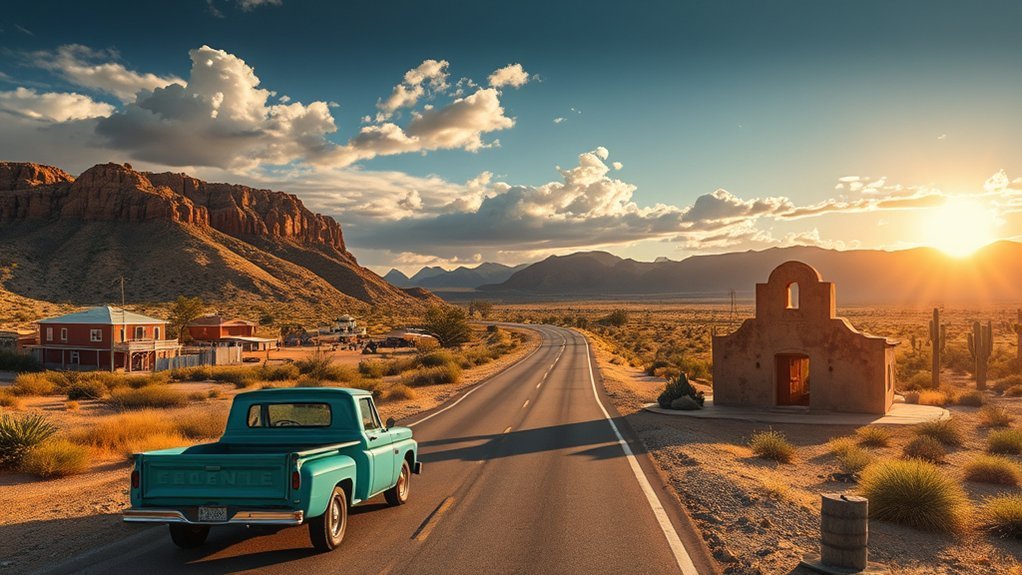
Driving from Phoenix, Mesa, or Apache Junction
For Lost Dutchman State Park and the west side of the mountains, take US 60 east toward Apache Junction and follow the park’s posted directions. US 60 is also the main approach for Peralta Road and Gold Canyon trail access.
Do not use “Superstition Mountains” alone as your navigation destination. Enter the exact trailhead or park entrance, download the route for offline use, and compare it with the official directions. Mapping apps may suggest private roads, washed-out shortcuts, or routes that do not match your vehicle.
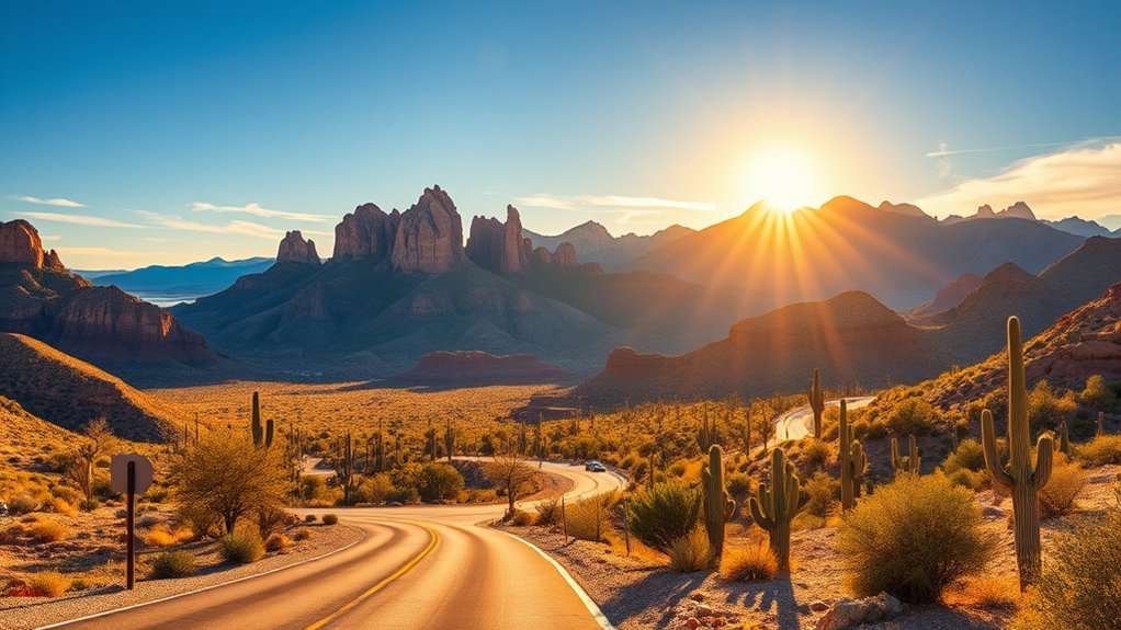
Using State Route 88
State Route 88, also called the Apache Trail, provides scenic access north and east of Apache Junction, but it is not required for Lost Dutchman, Peralta, First Water, or Hieroglyphic Trail.
ADOT’s current project page says the Fish Creek area is open, while a section remains steep, narrow, winding, and unpaved. Rockfall, flooding, construction, or storm damage can change access. Check the ADOT SR 88 project page and AZ511 before using this road.
Can You Reach the Trailheads by Public Transit?
Public transportation is not a practical way to reach the primary Superstition trailheads. Valley Metro can take you through Phoenix, Tempe, and Mesa, but the final distance to the mountains normally requires a personal vehicle, rental car, or permitted tour operator.
Do not plan to use ride-hail for Lost Dutchman State Park because the park prohibits hiker drop-off and pick-up. Ride-hail availability near remote Forest Service trailheads may also be limited or nonexistent at the end of a hike.
Trailhead Access and Parking
| Access Point | Best For | Access Notes | Facilities and Fees |
|---|---|---|---|
| Lost Dutchman State Park | Native Plant Trail, Treasure Loop, Siphon Draw, camping, visitor information | Paved access and developed parking. No walk-ins or hiker drop-off/pick-up. | Restrooms and visitor facilities. Entrance and camping fees apply. |
| Peralta Trailhead | Fremont Saddle, Weaver’s Needle views, wilderness backpacking | Reached by Peralta Road/Forest Road 77. Slow down for rough sections and check conditions after storms. | No potable water. No current trailhead fee listed. Camping begins in the wilderness, not in the parking area. |
| First Water Trailhead | Longer loops, backcountry routes, Dutchman and Black Mesa trail connections | The Forest Service describes the access road as unpaved and recommends high clearance and four-wheel drive. | Vault toilet and no current fee listed. Day use only at the trailhead; no overnight parking-lot camping. |
| Gold Canyon access | Hieroglyphic Trail and shorter southern approaches | Residential access and limited parking make early arrival important. Obey signs and do not block driveways. | Facilities and parking rules vary by access point. Carry water and verify current signage. |
Park only on durable, legal surfaces. Do not create new pull-offs, drive over desert vegetation, block gates, or enter private property. If a lot is full, use a different approved trailhead rather than improvising a parking space.
Best Time to Visit the Superstition Mountains
Late fall through early spring is the most practical period for hiking. Even then, exposed trails can become hot by afternoon, while winter nights and shaded canyons can feel cold.
- October and November: Warm days become more manageable, but early-season heat can continue. Start early and check the forecast.
- December through February: Often the best period for longer routes. Bring layers for cold mornings, wind, and short winter daylight.
- March and April: Wildflowers may appear after favorable winter rain. Weekends are busy, temperatures rise quickly, and parking fills early.
- May through September: Extreme heat and monsoon hazards make normal hiking plans unsafe on many days. Choose another season whenever possible.
Warning: Do not hike during an extreme-heat warning, thunderstorm, or flash-flood threat. Never shelter in a wash or narrow drainage. Rain several miles away can send fast-moving water through otherwise dry terrain.
Use the National Weather Service Phoenix monsoon-safety guidance and a location-specific forecast. If you hear thunder, leave exposed ridges and seek a substantial building or hard-topped vehicle. Wait at least 30 minutes after the last thunder before returning to exposed terrain.
Best Superstition Mountains Day Hikes
Trail distances and recorded times can vary slightly by map, turnaround point, and GPS device. The estimates below are planning ranges, not guarantees. Add time for heat, navigation, loose rock, photography, and slower members of your group.
| Route | Approximate Distance | Difficulty | Typical Time | Main Appeal |
|---|---|---|---|---|
| Native Plant Trail | About 0.25 mile | Easy and accessible | 20–45 minutes | Desert plants, interpretive signs, and a short introduction near the visitor area |
| Treasure Loop | About 2.4 miles round trip | Moderate | 1.5–2.5 hours | Open desert views and a manageable first hike for active visitors |
| Hieroglyphic Trail | About 3 miles round trip | Moderate and rocky | 2–3 hours | Petroglyphs, canyon scenery, and seasonal pools after suitable rain |
| Siphon Draw Basin | About 4 miles round trip | Moderate to strenuous | 3–5 hours | A rocky canyon and dramatic basin without committing to Flatiron |
| Peralta Trail to Fremont Saddle | Roughly 5 miles round trip | Moderate to strenuous | 3–5 hours | The classic view of Weaver’s Needle from Fremont Saddle |
| Flatiron via Siphon Draw | About 5.8 miles round trip | Very strenuous, with unmaintained scrambling | 5–8 hours or more | High views and a demanding physical challenge for experienced hikers |
Easier and Family-Friendly Options
The Native Plant Trail is the safest starting point for visitors who want a short, interpreted route. Its developed surface also makes it the most practical choice for many people with limited mobility, although current accessibility conditions should be confirmed with the park.
Treasure Loop can work for active families and newer hikers when temperatures are cool. It still has elevation gain, exposed sun, cactus, and uneven desert footing. Carry water for every person and turn around before anyone becomes overheated or exhausted.
Hieroglyphic Trail is commonly described as a short outing, but it is not a flat nature walk. Expect rocky ground, little shade, and a steady climb. Young children need close supervision around cactus, rocks, seasonal water, and petroglyph panels.
Challenging Routes
Siphon Draw becomes steeper and rougher as it approaches the basin. The route beyond the maintained trail toward Flatiron requires route-finding, hands-on scrambling, careful descent, and enough daylight for a slow return. It is not suitable as a spontaneous extension for an unprepared group.
Peralta Trail to Fremont Saddle is a demanding but nontechnical hiking objective for many fit visitors. The saddle provides the well-known view of Weaver’s Needle. Do not confuse this viewpoint hike with climbing Weaver’s Needle itself. The Needle is not a normal walk-up summit and may require technical rock-climbing skills and equipment.
Plan the hike around the return trip, not the summit. Turn around while you still have water, daylight, and enough energy to descend safely.
Sample Superstition Mountains Itineraries
Half-Day First Visit
- Arrive at Lost Dutchman State Park shortly after opening.
- Stop at the visitor center and confirm trail, weather, and fire information.
- Walk the Native Plant Trail or complete Treasure Loop.
- Use designated viewpoints for mountain photos.
- Leave before afternoon heat, storms, or closing time.
Full-Day Hiking Visit
- Choose either Siphon Draw Basin or Peralta Trail to Fremont Saddle based on road conditions and fitness.
- Begin near sunrise with offline navigation, a headlamp, layers, food, electrolytes, and an emergency water margin.
- Set a firm turnaround time before starting.
- Return to Apache Junction or Gold Canyon for food and rest rather than adding an unplanned second hike.
Weekend Camping Visit
- Reserve a developed campsite at Lost Dutchman State Park and confirm check-in instructions.
- Use the first afternoon for the visitor center, Native Plant Trail, and sunset views from an approved area.
- Start a longer hike early the next morning.
- Keep the final morning flexible for weather changes, a short trail, or an early departure.
Overnight Backpacking and Camping
Developed camping at Lost Dutchman State Park and wilderness backpacking are different experiences. State-park campsites have defined sites, reservations, check-in rules, and campground restrictions. Backcountry sites are primitive and require stronger navigation, sanitation, weather, and water planning.
Developed Camping
Lost Dutchman State Park has tent and RV sites. Reservations are wise during cool-season weekends and holidays. Check the official campground page for current nightly prices, reservation fees, vehicle fees, check-in times, pet rules, fire restrictions, and facility notices.
Wilderness Camping
Choose an established, durable campsite away from trails, cultural sites, water sources, and fragile vegetation. Do not camp in washes, narrow drainages, mine areas, or locations exposed to falling rocks. Avoid enlarging a site or building new fire rings.
Camping is not permitted in the First Water parking area. At Peralta, camping is available after entering the wilderness, not at the trailhead. Current Forest Service orders control stay limits, group size, fires, and temporary closures, so check them before every trip.
- Carry the water needed for the planned route plus an emergency margin.
- Do not depend on a spring, seasonal pool, or water cache.
- Treat any natural water you use by filtering or purifying it, but remember that treatment cannot create water where none exists.
- Pack out food scraps, wipes, and toilet paper.
- Follow current human-waste rules and stay well away from camps, trails, drainages, and water.
- Use a stove when allowed instead of building a fire.
- Store food and scented items securely against rodents and other wildlife.
Warning: An unverified water cache is not public water. It may belong to another hiker, be empty, or contain unsafe water. Never build a desert itinerary around water you did not place and confirm yourself.
Viewpoints and Photography
Popular subjects include Flatiron, Weaver’s Needle, the western mountain face, cactus-covered foothills, and layered desert ridges. Lost Dutchman State Park offers easy roadside and short-trail compositions, while Fremont Saddle provides the classic distant view of Weaver’s Needle.
Early morning and late-afternoon light reveal more texture than harsh midday sun. A wide-angle lens works well for ridges and foreground cactus, while a telephoto lens can isolate formations. Carry a lens cloth for dust and keep equipment protected from sudden rain.
Stay on trails or durable surfaces. Do not step on biological soil crust, move rocks, break plants, approach wildlife, or leave the trail merely to copy a photograph. At roadside pull-offs, park fully within legal areas and remain alert for traffic.
Safety: Navigation, Water, Weather, and Wildlife
Navigation
Carry an offline topographic map and know how to read it. A phone is useful, but heat, cold, weak reception, and navigation apps can drain its battery. Bring a power bank and keep a paper map or backup device for remote routes.
Check your location at every junction. Do not follow cairns blindly because unofficial cairns may lead toward climbing routes, old use trails, camps, or dead ends.
Water and Heat
Water needs depend on temperature, sun exposure, route length, exertion, body size, and individual health. Lost Dutchman State Park advises at least one gallon, about four liters, per person per day in summer conditions. A strenuous exposed route may require more, and carrying that amount does not make extreme-heat hiking safe.
Drink regularly, eat salty food or use electrolytes when appropriate, and watch for headache, dizziness, nausea, confusion, unusual fatigue, loss of coordination, or stopped sweating. End the hike early when someone is deteriorating. Severe confusion, collapse, or very hot skin is an emergency.
Weather, Lightning, and Flash Floods
Check the forecast for the exact mountain area, not only Phoenix. Conditions can differ across the range. During monsoon season, storms can develop quickly and make unpaved roads difficult or impassable.
- Do not enter a narrow canyon when thunderstorms or heavy rain are possible.
- Move away from ridges, isolated tall objects, and exposed summits when thunder develops.
- Never cross flowing floodwater on foot or by vehicle.
- Do not camp or park in a dry wash.
- Expect loose rock and damaged roads after a storm.
Wildlife and Desert Plants
Rattlesnakes, javelina, coyotes, mule deer, rodents, scorpions, bees, and other desert animals may be present. Give every animal room to leave. Do not feed wildlife or place hands where you cannot see.
Cholla cactus segments and other spines can attach to shoes, clothing, skin, and dog fur. Carry a small comb or multitool for cactus removal without using bare fingers. Watch for agave points and loose rock along narrow paths.
Emergency Plan
Leave your trailhead, route, vehicle description, turnaround time, and expected return with a reliable person. Tell that person when to contact emergency services if you do not check in.
Cell coverage is unreliable. For remote routes, consider carrying a satellite messenger or personal locator beacon. Keep it attached to your body rather than buried in a pack that could be lost during a fall.
Turn around when any of the following occurs:
- You have used half of the water or time allocated for the outward trip.
- Clouds, thunder, strong wind, or flood conditions are developing.
- You are no longer confident about the route.
- A member of the group is unusually tired, confused, dizzy, injured, or unable to keep a steady pace.
- You cannot return before darkness or the trailhead’s closing time.
What to Pack
| Day-Hike Essentials | Backpacking Additions |
|---|---|
| Planned water supply plus an emergency margin | Additional carried water and a filter or purification backup |
| Food, salty snacks, and appropriate electrolytes | Meals, stove, fuel, and odor-resistant food storage |
| Offline map, compass or GPS, and power bank | Paper topographic map and satellite communication device |
| Wide-brim hat, sunglasses, sunscreen, and sun-protective clothing | Insulating layers, rain shell, sleeping bag, pad, and shelter |
| Sturdy footwear, first-aid kit, headlamp, and emergency shelter | Repair kit, sanitation supplies, extra batteries, and backup lighting |
Keep frequently needed items near the top of your pack. Protect electronics and insulating layers from rain, and do not rely on a cotton sweatshirt as your only cold-weather layer. Pack a headlamp even when you expect to finish before dark.
Petroglyphs, Mining Remains, and Local History
Petroglyphs and Other Cultural Resources
Petroglyphs and archaeological materials are irreplaceable cultural resources connected to Indigenous history. Observe them quietly and leave the entire setting unchanged.
- Do not touch, trace, chalk, wet, rub, or lean against a panel.
- Do not climb above or sit on rock art.
- Do not move pottery pieces, tools, rocks, or other objects.
- Keep dogs and children from contacting panels.
- Photograph from a respectful distance without adding artificial markings.
- Report vandalism or damage to the appropriate land manager without publicizing a sensitive location.
The National Park Service rock-art care guidance explains why skin oils, abrasion, vandalism, climbing, and moved objects can permanently damage a site.
Historic Mining Remains
Old foundations, equipment, tailings, shafts, and prospects reflect the area’s mining history, but abandoned workings can conceal vertical drops, unstable air, rotten timbers, wildlife, sharp metal, and contaminated material.
Warning: Never enter a mine shaft, tunnel, adit, building, fenced area, or collapsed opening. Do not climb tailings or remove artifacts. Observe from stable, legal ground.
For a safer introduction to mining stories and the Lost Dutchman legend, use a staffed museum or developed historical attraction near Apache Junction rather than searching for unmarked ruins.
Nearby Towns, Visitor Information, and Lodging
- Apache Junction: The most convenient general base for Lost Dutchman State Park, with fuel, groceries, restaurants, motels, and other services.
- Gold Canyon: Convenient for Peralta Road and Hieroglyphic Trail, with resorts, vacation lodging, dining, and golf nearby.
- Mesa: Offers a wider range of hotels, gear shops, restaurants, and transportation services, but requires a longer morning drive.
- Superior: A useful eastern side trip for mining history, local food, and access to other desert recreation areas.
- Florence: A separate historic-town visit that may fit a longer regional itinerary, but it is not within 20–30 minutes of every Superstition trailhead.
Do not depend on an unattended kiosk for current trail conditions. Use the state park visitor center when open, contact the appropriate Forest Service office, and check official alerts online. Reserve lodging and camping early for cool-season weekends, holidays, and spring wildflower periods.
Frequently Asked Questions
Are guided tours or local outfitters available?
Yes. Local companies may offer hiking, jeep, photography, history, or climbing trips. Ask whether the operator holds every permit or authorization required for the exact state-park or national-forest location. Confirm the route, group size, cancellation policy, included water, emergency equipment, and guide qualifications before booking.
Can I bring my dog on the trails or to a campground?
Leashed dogs are allowed in many areas, including Lost Dutchman State Park, but individual sites and temporary orders can differ. Carry extra water and waste bags, keep the leash short near wildlife and cactus, and test the ground with your hand. Hot rock and pavement can burn paws even when the air feels manageable. Do not take a dog on exposed desert trails during dangerous heat.
Are drones allowed for photography?
Do not launch, land, or operate a drone from the designated Superstition Wilderness. Lost Dutchman State Park can also control launch and landing from park property, so obtain a direct answer from the park before bringing a drone. Any flight outside those areas must still follow FAA recreational-drone rules, registration requirements, airspace restrictions, and temporary flight restrictions.
Where are the nearest grocery stores and gear shops?
Apache Junction and Mesa provide the broadest selection of groceries, water, fuel, pharmacies, outdoor supplies, and replacement gear. Gold Canyon has useful services but fewer choices. Buy water, food, batteries, sun protection, and emergency items before driving to a remote trailhead.
Is cell service available on the trails?
Coverage is inconsistent and may disappear behind ridges or inside canyons. Download maps before the trip, carry a power bank, and leave a detailed itinerary with someone. A satellite messenger or personal locator beacon provides a stronger emergency backup for remote routes, but it does not replace good planning.
Do I need a permit to hike or backpack?
Ordinary day hiking and typical wilderness backpacking from Peralta or First Water generally do not require an individual backcountry permit under the currently published trailhead information. Lost Dutchman State Park charges an entrance fee, and developed campsites require payment. Large groups, commercial trips, special activities, closures, and temporary orders may create additional requirements.
Which trail is best for a first visit?
Choose the Native Plant Trail for the easiest introduction or Treasure Loop for a longer hike with open views. Active hikers who are comfortable on rocky trails can consider Siphon Draw Basin or Peralta Trail to Fremont Saddle in cool weather. Flatiron should be reserved for experienced, well-prepared hikers.
Can I hike in the Superstition Mountains during summer?
Summer hiking is often unsafe because of extreme heat, exposed terrain, warm overnight temperatures, and monsoon storms. Do not hike during heat warnings, thunderstorms, or flash-flood threats. Choosing a cooler season is safer than trying to make a major route acceptable by starting slightly earlier.
Sources
- Arizona State Parks: Lost Dutchman camping, fees, access, and hours — supports state-park entry, camping, facility, and drop-off information.
- Tonto National Forest Alerts — provides current closures, fire information, restrictions, and occupancy orders.
- Forest Service: Peralta Trailhead — supports directions, water availability, camping, stay-limit, and fee information.
- Forest Service: First Water Trailhead — supports road, vehicle, group-size, facility, fee, and trailhead-camping guidance.
- Arizona Department of Transportation: State Route 88 Apache Trail — supports current road configuration and Fish Creek travel cautions.
- National Weather Service Phoenix: Monsoon Safety — supports lightning, flash-flood, heat, wash, and storm guidance.
Conclusion
The Superstition Mountains can support anything from a short accessible nature walk to a difficult wilderness trip, but the landscape leaves little room for casual mistakes. Choose a route that fits the least-experienced member of your group, arrive in the correct vehicle, carry your planned water supply, and set a firm turnaround time.
Before leaving, check Arizona State Parks, Tonto National Forest alerts, the local National Weather Service forecast, and AZ511. Respect cultural resources, avoid mines and unstable ruins, keep dogs safe from heat and cactus, and pack out everything you bring. Careful planning protects both your group and the desert places you came to see.