

The sun slants through cottonwoods as you glide along the Salt River, the water cool and blue beside rust-red cliffs—it’s the kind of escape that makes Mesa feel like a starting point, not a limit. You can paddle past wild horses, hike volcanic ridgelines, or cruise a scenic byway to a turquoise lake in a single day. Keep going and you’ll find practical tips, short routes, and picnic stops to fit whatever pace you want.
Salt River Paddle and Wild Horse Viewing
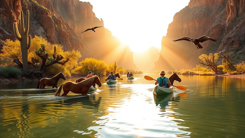
Roll up your sleeves and get ready to glide down the Salt River, where mild rapids, wide-open desert views, and the chance to spot wild horses make for an unforgettable half-day escape from Mesa. You’ll launch from a sandy bank into calm pools and gentle riffles, paddling past cottonwood groves and exposed basalt boulders that frame the river corridor. Guides point out local plants and explain water flows, safety, and where horses tend to graze, so you feel confident even if you’re new to kayaking or tubing. Bring sun protection, sturdy water shoes, and a dry bag for your phone; temperatures shift quickly once the shade falls away. Timing matters—early mornings deliver cooler air and better wildlife sightings, while later floats offer warmer water. Parking and permit rules change seasonally, so check current regulations before you go. End your trip refreshed, with photos of wild horses and a clearer sense of Sonoran Desert river life.
Tonto Natural Bridge State Park
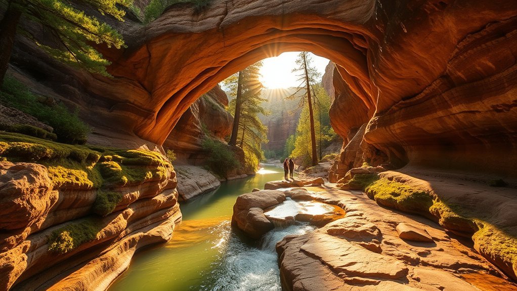
A cool grotto of travertine arches and fern-lined pools waits about an hour from Mesa at Tonto Natural Bridge State Park, where the world’s largest natural travertine bridge spans a shaded canyon you can explore on foot. You’ll follow short, well-maintained trails that drop into the canyon rim and reveal waterfalls, stalactite-like formations, and lush microclimates that feel otherworldly in the Sonoran landscape. Bring sturdy shoes for uneven steps and a light jacket — the grotto stays cool and damp. Picnic areas and a small visitor center give you context about the bridge’s limestone-and-calcium carbonate origins and local wildlife like canyon wrens and lizards. Photography is rewarding at golden hour when light filters through openings in the bridge. Park hours are seasonal and parking fills quickly on weekends, so aim for an early arrival. You can comfortably pair this with a leisurely drive back to Mesa the same day, refreshed by the park’s surprising tranquility.
Sedona Red Rock Day Trip
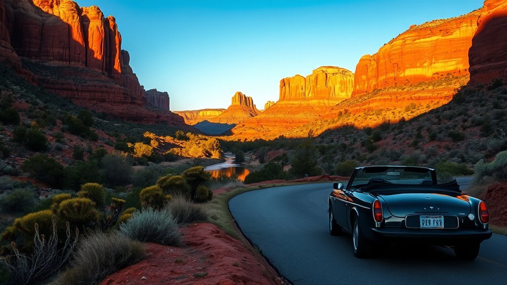
Head north to Sedona and you’ll be treated to unforgettable red rock drives that unfold like a moving panorama. Park and stretch your legs on easy, well-marked trails that offer close-up views and perfect photo spots. With short hikes and scenic overlooks, it’s an ideal day trip for relaxed outdoor exploration.
Scenic Red Rock Drives
Often you’ll find the drive from Mesa to Sedona feels like stepping into a living postcard: red sandstone spires, winding canyons, and sudden overlooks unfold as you climb toward cooler air. Choose State Route 87 to Highway 179 for classic views, or take Bell Rock Drive for dramatic close-ups of formations. Stop at designated pullouts — Crescent Moon Picnic Area and Schnebly Hill Vista offer photo-worthy panoramas without straying off road. Time your trip for golden hour when shadows sharpen contours and parking is easier midweek. Bring water, a camera, and a map; cell service can be patchy on scenic byways. Drive slowly to spot wildlife and scrub oaks, respect speed limits, and enjoy a meditative, ever-changing landscape.
Easy Hiking Trails
When you pull off at a scenic overlook and snap those red-rock panoramas, don’t skip the short trails that let you get up close without committing to a full-day trek. You’ll find well-marked loops and slickrock paths that reward you fast: sun-warmed stone underfoot, juniper scent, and sudden V-shaped canyons. Pick a trail that matches your energy, bring water, and wear sturdy shoes. Three quick picks to picture:
- A smooth, 1-mile loop hugging a red fin with postcard views and easy switchbacks.
- A half-mile paved path to a natural amphitheater framed by towering buttes.
- A gentle creekside stroll past cottonwoods and exposed sandstone shelves.
These hikes are perfect for stretching legs and soaking in Sedona’s iconic geology.
Superstition Mountains and Lost Dutchman State Park
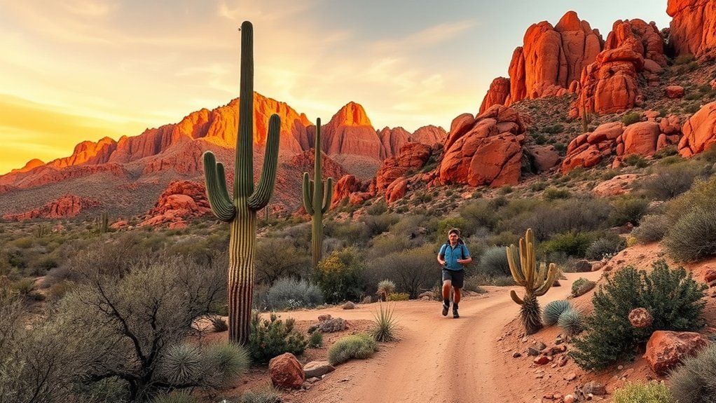
If you’re craving rugged desert scenery and a touch of legend, the Superstition Mountains and Lost Dutchman State Park deliver both in spades. You’ll find dramatic volcanic ridgelines, cactus-studded slopes, and the famous silhouettes that inspired tales of the Lost Dutchman’s gold. Trail options range from gentle loops near the park’s visitor center to challenging climbs like Siphon Draw and Flatiron, where exposed sections reward you with panoramic valley views. Watch for desert wildlife—javelina, roadrunners, and hawks—and enjoy seasonal wildflowers after good rains. Park rangers offer maps, safety tips, and insights into local history and geology, so check in before you head out. Pack water, sun protection, sturdy shoes, and a small first-aid kit; heat and sudden terrain changes can surprise you. If you arrive early or late in the day, you’ll catch cooler temperatures and softer light that make hikes more pleasant and photos more striking.
Canyon Lake and Apache Trail Scenic Drive
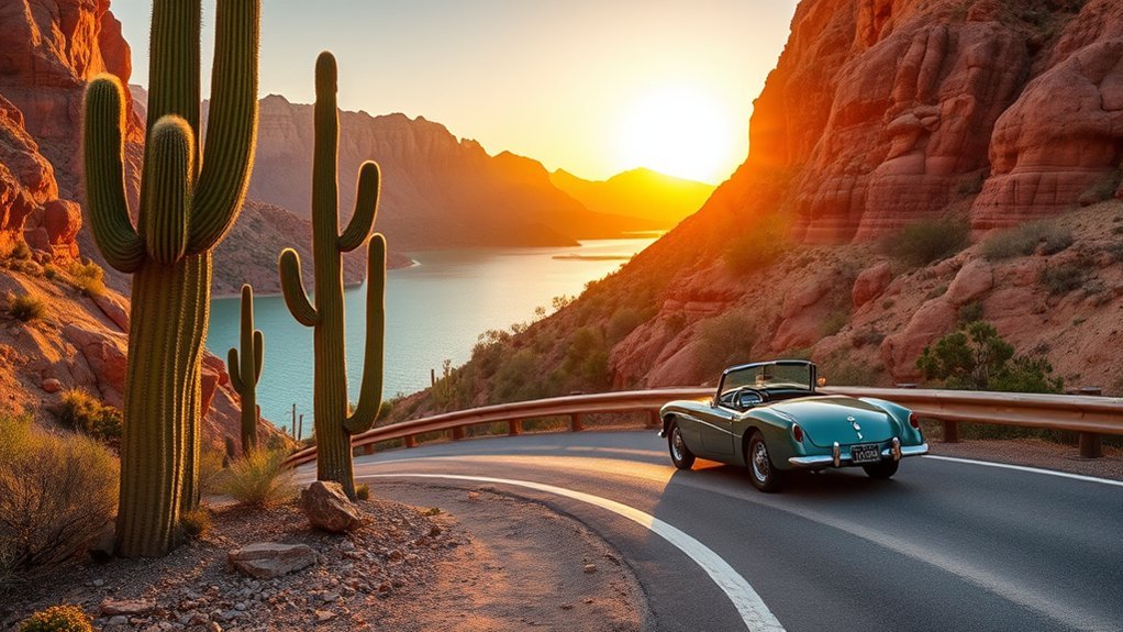
After exploring the jagged ridgelines of the Superstitions, head north to the Apache Trail for a contrasting mix of water, desert cliffs, and old-west character. You’ll wind along narrow, switchbacked roadways with dramatic drop-offs, watching the Sonoran landscape give way to Saguaros framed against shimmering blue water. Canyon Lake invites you to pause — rent a boat, hop a cruise, or picnic on a rocky bank while kayakers paddle past sheer canyon walls.
- Sun-washed red cliffs slicing into cobalt water, reflected like a watercolor.
- Wind-ruffled cottonwoods and desert scrub lining quiet coves and hidden beaches.
- Rusted mining relics and wooden bridges hinting at the trail’s 19th-century grit.
You’ll find short trailheads for views, fishing spots, and photo ops around every bend. Drive carefully, bring water, and plan for limited services; the reward is a rugged, scenic escape that feels far from the city but’s only an hour away.
Prescott Historic Square and Whiskey Row
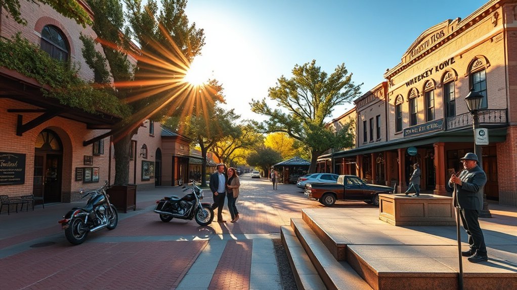
You’ll want to start at Prescott’s Historic Courthouse Square, where the sandstone courthouse anchors a walkable plaza lined with shops and vintage storefronts. Stroll over to Whiskey Row to learn about its raucous origins during the mining boom and peek into restored saloons that still echo their rowdy past. When you’re ready, grab a meal at a local eatery and browse antiques for one-of-a-kind finds.
Historic Courthouse Square
Stepping onto Prescott’s Historic Courthouse Square, you’ll feel the Old West pulse through broad granite blocks, Victorian storefronts, and the famous Whiskey Row where saloons once lined the streets. You can stroll the brick paths, study ornate facades, and sit on benches that face the courthouse clocktower. The square’s compact layout makes exploration easy; interpretive plaques tell brief stories without overwhelming you. Picture these details as you walk:
- Sun-warmed granite steps leading to a courthouse framed by mature shade trees.
- Wrought-iron lampposts and detailed cornices on preserved 19th-century storefronts.
- A town bandstand and seasonal flowers that brighten the central green.
You’ll leave with a clear sense of Prescott’s layered history and inviting small-town charm.
Whiskey Row Origins
From the courthouse square, your feet naturally wander toward Whiskey Row, the narrow strip of storefronts that once made Prescott one of the rowdiest boomtowns in the West. You’ll feel the pulse of history in brick facades scarred by fires and rebuilt with grit; oil lamps gave way to gas and then electric light, but the street’s stubborn layout stayed the same. Picture miners, cowboys and gamblers spilling onto boardwalks, where saloons competed for loudest music and fastest deals. Today plaques mark former businesses and you can imagine the clatter of spurs and dice. Guided tours and interpretive signs explain temperance movements, the courthouse’s role in order, and how Whiskey Row survived — a compact, tangible slice of territorial Arizona.
Dining and Antiques
Craving a meal with history on the side? You’ll find Prescott Historic Square and Whiskey Row full of character: brick sidewalks, swinging saloon doors, and diners serving hearty fare. Wander between antique shops where every piece has a story, then sit down for comfort food or craft cocktails in venues that preserved original beams and vintage photographs.
- A sunlit café patio overlooking the courthouse, steaming soup and pie on your table.
- A narrow antique store, stacked trunks and brass lamps waiting to be rediscovered.
- A dim Whiskey Row bar, amber spirits, a piano, and laughter spilling into the street.
You’ll leave with a full belly, a unique find tucked under your arm, and memories of a living, historical downtown.
Saguaro National Park East (Tucson) Loop
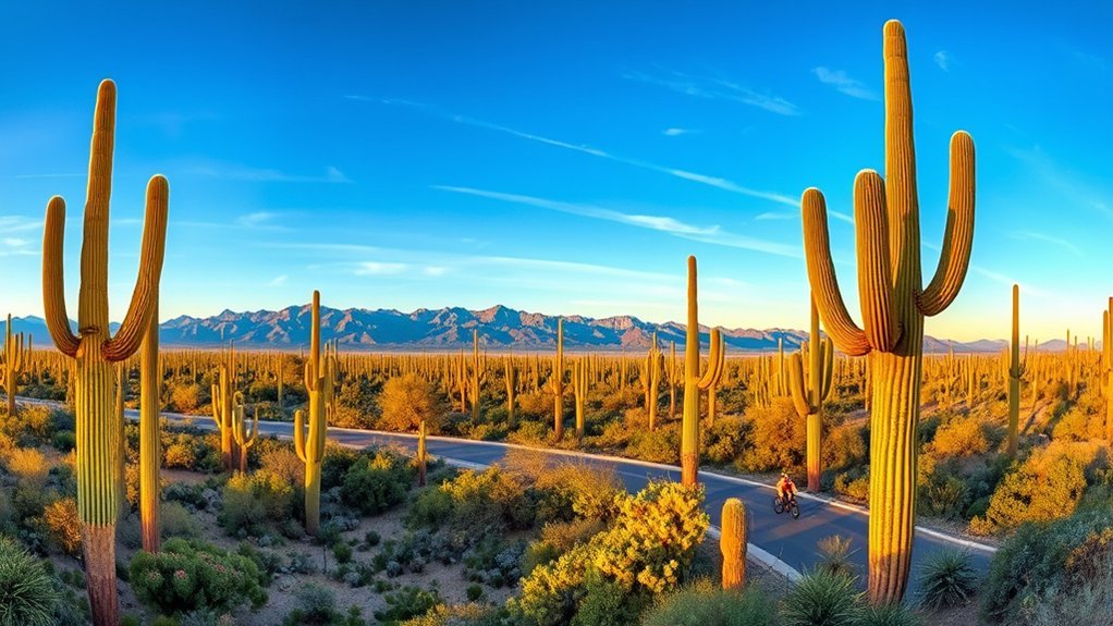
Nestled just east of Tucson, Saguaro National Park East offers a peaceful loop through iconic desert scenery where towering saguaro cacti punctuate wide skies and distant mountains. You’ll drive the 8-mile Cactus Forest Drive or hike shorter trails like the Signal Hill Loop to get up close to these majestic giants. Interpretive signs explain saguaros’ slow growth, their role for wildlife, and cultural ties to the Tohono O’odham people. Morning and late afternoon light make for the best photos, and temperatures are milder outside peak summer heat, so plan accordingly. Watch for javelina, coyotes, and a chorus of birds; bring water, sun protection, and sturdy shoes for loose, rocky paths. If you want a short challenge, take Tanque Verde Ridge for panoramic views, then return to the loop for a relaxed picnic at a shaded turnout. The loop’s accessibility and clear markers make it an easy, rewarding half-day trip from Mesa.
Petrified Forest National Park and Painted Desert
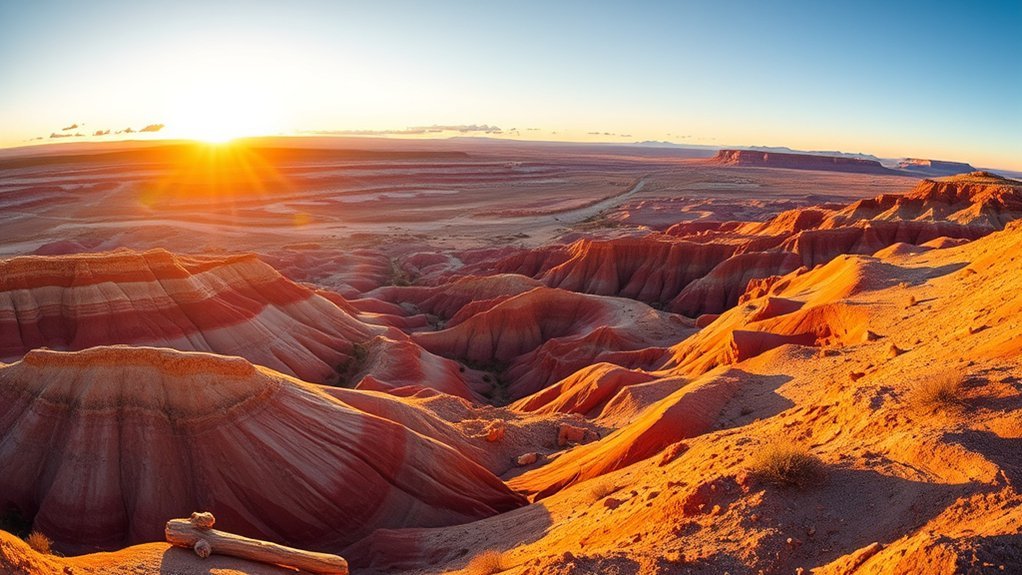
A journey to Petrified Forest National Park and the Painted Desert feels like stepping into a prehistoric canvas, where fossilized logs glint in shades of red and purple and layered badlands stretch to the horizon. You’ll drive through dramatic vistas, stop at overlooks, and walk short trails that reveal ancient trees turned to stone and vivid striped mesas. Plan for sun, bring water, and allow time for the visitor center exhibits to explain the geology and history.
Step into a prehistoric canvas of glinting petrified logs, layered badlands, and vivid Painted Desert vistas—bring sun and water.
- Windswept badlands: multicolored layers that photograph like watercolors.
- Petrified wood deposits: chunky, iridescent logs you can view from boardwalks.
- Historic Route 66 relics: rusted signage and nostalgic stops near the park.
You’ll find easy hikes and interpretive signs that make the landscape readable. With about a 2–3 hour drive from Mesa, this is a manageable, otherworldly day trip that mixes science, scenery, and solitude.
Frequently Asked Questions
Are Pets Allowed on These Day-Trip Trails and Attractions?
Generally, yes — many trails and parks allow pets, but rules vary: you’ll need leashes, pickups, and sometimes permits; national parks, preserves, or specific attractions may restrict pets, so always check the site’s current pet policy first.
What Are the Cell Phone and GPS Signal Conditions?
Signal varies: you’ll get strong LTE in towns but spotty reception on remote trails and canyon bottoms, and GPS may lag in narrow slots or heavy cloud cover. Carry offline maps, a charger, and a paper route.
Are Entrance Fees or Permits Required for Each Site?
Some sites require entrance fees or permits, and others don’t — you’ll pay for national parks, certain preserves, or guided tours, but many trails are free; check each destination’s official site for up-to-date fees and permit rules.
What Safety Gear or Clothing Should I Bring for Seasonal Weather?
Think of your pack as armor: you’ll bring layered clothing, sun hat, sunglasses, sunscreen, sturdy hiking boots, waterproof jacket, insulated layer for cold nights, gloves, hydration system, map, headlamp, and basic first-aid supplies.
Are There Accessible (ADA) Facilities at These Destinations?
Yes — many destinations offer ADA-accessible parking, restrooms, paved paths, and visitor centers; you’ll find varying accessibility levels, so check specific sites ahead, call ahead for details, and plan routes to match mobility needs and comfort.
Conclusion
You’ve got a wealth of easy, rewarding day trips right from Mesa—paddle the Salt River past cottonwoods and wild horses, wander Tonto’s cool grotto, marvel at Sedona’s red rocks, hike the Superstitions, cruise the Apache Trail to Canyon Lake, sip history in Prescott, or loop Tucson’s saguaro‑studded roads to the Painted Desert. Which one will you pick first to swap city hum for open skies and big views? Pack water, snacks, and a camera.
