

If you’re near Mesa and want great desert hikes, you’ll find routes that match any mood — short alcoves with sweeping valley views, ridgelines that test your legs, and rugged canyons that feel remote. I’ll point out trails from easy family loops to strenuous summits, note what to expect on each, and share practical tips so you get the most out of the desert — keep going for the picks that fit your pace.
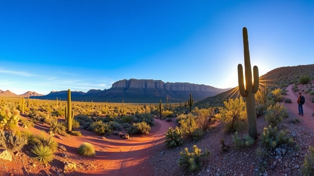
Usery Mountain Regional Park — Wind Cave Trail
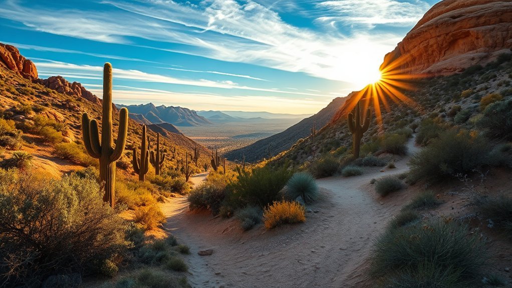
Start your day at Usery Mountain Regional Park with the Wind Cave Trail, a short but rewarding route that climbs through classic Sonoran Desert scenery to a dramatic rock alcove with sweeping valley views. You’ll follow a well-marked path that gains elevation steadily, passing creosote, palo verde, and towering saguaro that frame the route. The switchbacks tighten as you approach the cave, where a natural opening in the rhyolite offers shade and a panoramic perch. You can scramble into the alcove for photos or pause on exposed ledges to watch light shift across the valley below. Wildlife sightings are common—lizards, occasional jackrabbits, and a variety of birds—so move quietly and keep water handy. The trail’s moderate length makes it ideal for early starts to avoid heat; bring sun protection and sturdy shoes for rocky sections. The payoff is a compact, dramatic view that feels much bigger than the short hike.
San Tan Mountain Regional Park — Goldmine Loop
Although the route quickly reveals rolling desert ridgelines and layered rock, the Goldmine Loop at San Tan Mountain Regional Park keeps you engaged with a mix of wide-open vistas and tight, sun-baked singletrack. You’ll navigate undulating climbs, dodge saguaros, and spy distant cityscapes that make each vista feel earned. The trail’s hard-packed dirt rewards steady footing, while short rocky sections test your balance. Bring water, sun protection, and steady shoes; heat builds fast and shade’s scarce. Early mornings deliver cooler air and golden light for photography. Wildlife—cottontails, lizards, and hawks—adds life to the scrub. You can loop clockwise for gentler ascents or counterclockwise for sharper drops and quicker views. Trail signs are clear, but cell service can be spotty; download maps if you need them. Expect a satisfying mix of speed and scenery that keeps you moving and watching the horizon.
| Feature | Note |
|---|---|
| Distance | 4.4–7 miles |
| Elevation Gain | Moderate |
| Surface | Singletrack & dirt |
| Best Time | Fall–spring mornings |
| Difficulty | Moderate |
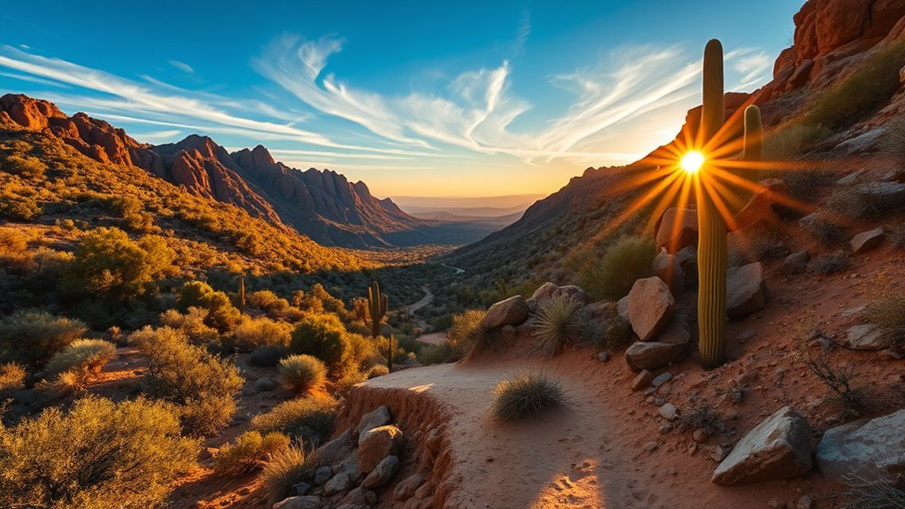
Lost Dutchman State Park — Siphon Draw Trail to Flatiron
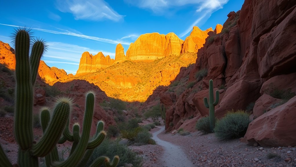
Climb the Siphon Draw Trail and you’ll quickly feel the Superstitions’ raw character as the route chisels upward through rugged boulder fields toward the Flatiron’s jagged silhouette. You’ll gain steep switchbacks and exposed rock that demand steady footing and a head for heights; sections require basic scrambling, so bring gloves and sturdy shoes. Water is nonnegotiable—carry more than you think—and start early to avoid heat and afternoon storms. The trail narrows as you approach the siphon draw, where wind-carved cliffs frame dramatic vistas of the valley and distant ridgelines. At the Flatiron saddle, you’ll be rewarded with panoramic views worthy of the effort: layered mesas, saguaro-studded desert, and sunrise or sunset lighting that turns the stone to bronze. Navigation can be tricky in poor light; use a map, GPS, or local guidance. Expect a full-day outing, moderate-to-strenuous effort, and memories of one of Arizona’s most iconic ridge climbs.
Tonto National Forest — Peralta Trail (Weaver’s Needle View)
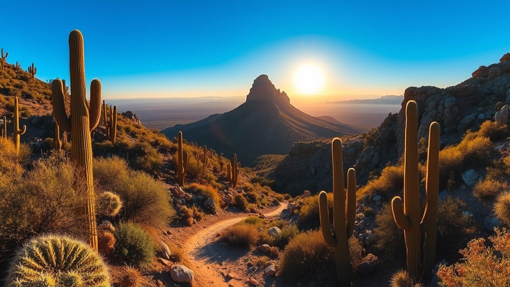
You’ll find the Peralta Trail in Tonto National Forest offers a rugged 6–7 mile out-and-back route with roughly 1,200 feet of elevation change, so plan for steady climbs and some exposed rocky sections. Expect moderate to strenuous footing that rewards you with sweeping views of Weaver’s Needle, red volcanic spires, and sweeping desert basins. Bring water, sun protection, and a camera — the scenic highlights make the effort worthwhile.
Trail Overview
While the Peralta Trail threads through a sunbaked canyon in Tonto National Forest, it rewards hikers with sweeping views of Weaver’s Needle and jagged volcanic spires rising from the desert floor. You’ll follow a well-marked route that alternates sandy washes, rocky ledges, and narrow gullies, passing sculpted cliffs and scattered saguaro. The trail curves around dramatic basalt formations and opens onto panoramic overlooks where the Needle dominates the skyline. Seasonal wildflowers and palo verde provide splashes of color, while exposed rock offers natural seating for breaks and photos. Water sources are scarce, so plan accordingly. Trailheads have basic signage and parking, but services are limited. This route invites exploration, photography, and a close-up encounter with Sonoran Desert geology.
Difficulty & Elevation
Because the Peralta Trail gains and loses elevation across rocky washes and ledges, expect a moderately strenuous hike that tests balance and endurance more than technical climbing. You’ll climb short, steep pitches and descend into sandy gullies; footing can be loose, so steady, purposeful steps matter. The trail’s cumulative ascent over ridgelines will elevate your heart rate and reward you with open desert air. Carry enough water, wear shoes with grippy soles, and pace yourself on exposed sections where wind and sun make effort feel harder. Know your limits; turn back if footing or fatigue becomes unsafe.
- Narrow ledge with loose gravel underfoot.
- Short scramble over fractured boulder steps.
- Deep sandy wash that saps your energy.
- Steep, sun‑baked ridge approaching the viewpoint.
Scenic Highlights
When the trail crests the final ridge, you’ll be greeted by the jagged silhouette of Weaver’s Needle rising like a stone cathedral against the desert sky, its sheer spire drawing your eye across layers of rust-red cliffs and sculpted mesas. From this vantage you’ll see the Superstition Wilderness unfold: braided washes, volcanic outcrops, and distant saguaros punctuating the horizon. Light shifts rapidly, turning sandstone to deep orange at sunset and bathing canyons in cool blue at dawn. You can pick out faint game trails and ancient petroglyph-bearing ledges if you scan carefully. Wind-carved fins and talus fields give texture to the scene, while seasonal wildflowers add surprising color. It’s a view that rewards patience, framing the desert’s raw, rugged drama.
Superstition Wilderness — Jacob’s Crosscut Trail
Strike out from the trailhead into the Superstition Wilderness and you’ll find Jacob’s Crosscut Trail carving a mix of shaded washes, rocky ridgelines, and cactus-studded slopes that showcase the range’s raw, sun-baked beauty. You’ll follow a well-marked path that undulates through scrub and boulder fields, passing sudden viewpoints where the valley spills away below. The route offers moderate challenge—rocky footing, occasional steep pitches, and exposed sections—so bring sturdy shoes, water, and sun protection. Listen for birds and the whisper of wind through creosote as you traverse narrow saddles and open benches. The trail connects to spurs that reward you with ledger-like vistas and quiet desert solitude. If you time your hike for morning or late afternoon, light sculpts the cliffs into deep ochres and long shadows.
- Jagged silhouettes against bright sky
- Tight washes lined with palo verde
- Weathered boulders perfect for brief rests
- Panoramic drops to scattered Sonoran flats
Brown Canyon Trail at Usery Mountain
You’ll find Brown Canyon Trail at Usery Mountain is a moderate, well-marked route with rocky stretches and some steady climbs that reward you with varied terrain underfoot. Keep your eyes open for sweeping valley and ridge views, plus mule deer, quail, and occasional raptors that make the canyon come alive. Start early, pack plenty of water, and use the main trailhead near the park entrance to avoid parking hassles and midday heat.
Trail Difficulty & Terrain
Though the path looks gentle at first, Brown Canyon Trail quickly shifts between easy stretches and short, steep sections that demand steady footing and a bit of scrambling. You’ll navigate packed dirt, loose gravel, and occasional sandstone slabs that can feel slick after rain. Narrow singletrack threads through creosote and palo verde, then opens to rocky wash crossings where you’ll pick your line. Expect short, uneven switchbacks that test ankles and balance; poles help. Trail markers are present but intermittent, so you’ll watch cairns and blazes. Footwear with good tread and ankle support isn’t optional. Stay mindful of sun-exposed stretches that radiate heat from rocks, and conserve energy for the tougher climbs returning to the trailhead.
- Loose gravel and sandstone slabs
- Narrow singletrack and wash crossings
- Short, steep switchbacks
- Intermittent cairns and blazes
Scenic Views & Wildlife
Often the canyon rewards hikers with sweeping panoramas of the Goldfield and Superstition ranges, where layered ridgelines and sun-scorched mesas shift color as the light changes; pause on exposed rock outcrops to take in the broad desert vista and the way shadows carve the terrain. As you move along Brown Canyon Trail, keep your eyes peeled for desert wildlife: Gambel’s quail dart through creosote, lizards sun themselves on boulders, and black-tailed jackrabbits freeze at your approach. Raptors — red-tailed hawks and kestrels — patrol thermals above the washes. Wildflowers bloom after winter rains, adding bursts of color that attract pollinators. Binoculars and a light field guide enhance sightings; tread quietly and you’ll often watch animals go about their day.
Trailhead Access Tips
At the Usery Mountain trailhead for Brown Canyon Trail, plan your arrival early and pick a shaded parking spot to beat the heat and crowds; trail maps and a kiosk with current conditions sit near the lot so take a moment to study route options before you set out. You’ll want sun protection, sturdy shoes, and water visible in your pack. The trail begins rocky and opens into washes—note cairns and painted blazes. Cell service can be spotty; download maps and tell someone your plan. Respect gate hours and parking rules to avoid fines. Watch for rattlesnakes under rocks and cool pools after rare rains.
- Cacti-lined path glittering at sunrise
- Rocky wash with stacked cairns
- Shaded juniper rest spots
- Wide valley views opening suddenly
Red Mountain Park — Red Mountain Loop
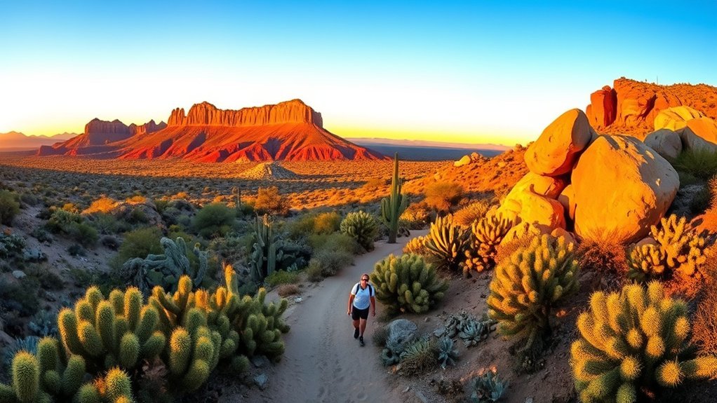
Nestled just east of downtown Mesa, Red Mountain Park‘s Red Mountain Loop delivers a compact, scenic hike that showcases towering red sandstone formations, shaded riparian pockets, and sweeping valley views you can reach without a long drive. You’ll follow a well-marked loop of about 2 miles that mixes packed dirt, rocky steps, and short switchbacks. Expect varied textures underfoot as the trail skirts cliff edges and drops into cooler washes where mesquite and cottonwood offer relief. Bring sturdy shoes, sun protection, and water — shade is intermittent. Photographers will love the layered rock contrasts at golden hour, and trail runners can push a brisk loop before work. Keep an eye out for lizards, desert birds, and seasonal wildflowers after rains. The route is family-friendly but includes some exposed sections, so supervise kids. Park near the visitor area, start early to avoid heat, and savor the intimate desert landscape that feels remote despite being close to the city.
Riverview Trail at Riverview Park (Salt River Overlook)
You’ll find the Riverview Trail at Riverview Park is an easy, well-marked route that winds along the riverbank and offers a pleasant short hike. Keep your camera ready for sweeping Salt River views, riparian vegetation, and occasional wildlife sightings. The trail’s gentle grades and clear overlooks make it a great spot to soak in scenery without a strenuous climb.
Trail Overview
While the Riverview Trail at Riverview Park may seem short, it delivers big views of the Salt River and surrounding desert cliffs, guiding you along a smooth, well-marked path that’s ideal for an easy morning hike or a quick sunset stroll. You’ll follow compacted dirt and packed gravel with gentle grades, making navigation straightforward and pace steady. The trail skirts low palo verde and creosote, opens to small viewpoints, and loops back without tricky junctions. Bring light layers and water; shade is limited but the breeze often cools the route.
- Sun-washed trailhead framed by rocky outcrops and scrub.
- Wide, even surface with occasional sandy patches.
- Low desert plants brushing the trail edges.
- Benches and interpretive signs at short overlooks.
Scenic River Views
Step out onto the overlook and the Salt River opens up below, its ribbon of shimmering water cutting through red cliffs and sunbaked desert—perfect for spotting wading birds, occasional rafters, and the play of light across sandstone. You’ll follow Riverview Trail along scrubby mesas and compacted dirt, where brief switchbacks reward you with successive vantage points. Binoculars help you pick out herons, kingfishers, and debris lines that mark seasonal flows. In spring the banks green; summer brings stark contrast between blue water and ochre rock. Trail is moderate, well-marked, and family-friendly, with short spur paths to clearer overlooks. Bring water, sun protection, and a camera — early morning or late afternoon gives the richest colors and best wildlife activity.
Hawes Trail to Granite Reef Dam
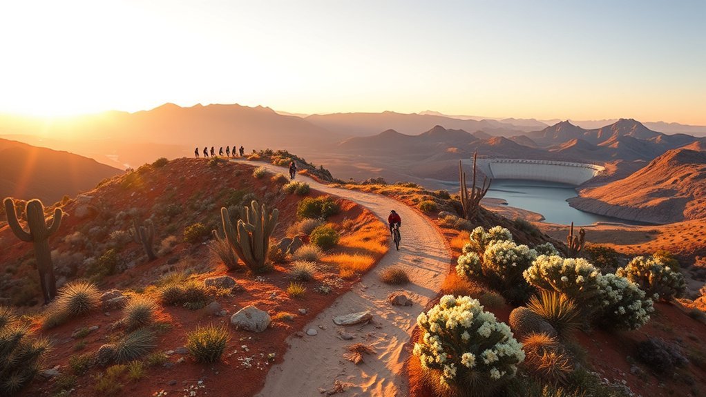
Set out from Hawes Trail and you’ll quickly find why hikers love the route to Granite Reef Dam: the trail winds through classic Sonoran scrub, opens onto sweeping views of the Salt River, and offers a mix of packed dirt, rocky sections, and occasional wash crossings that keep the walk engaging. You’ll follow faint cairns and worn tread as the path drops toward riparian cottonwoods, where shade and water sounds contrast the surrounding desert. The dam itself rewards you with a broad concrete span, migrating birds, and a sense of scale that’s rare so close to town. Bring sturdy shoes, sun protection, and water; sections can be loose or sunbaked. You’ll find opportunities to pause, photograph river reflections, and watch kayakers drift below. The route suits steady day-hikers and anyone wanting dramatic river access without technical scrambling.
- Cactus-studded ridgelines under bright sky
- Rocky stretches that test your footing
- Cottonwood-shaded banks and river murmurs
- The broad concrete arc of Granite Reef Dam
Pass Mountain Trail (Mcdowell Mountains Foothills)
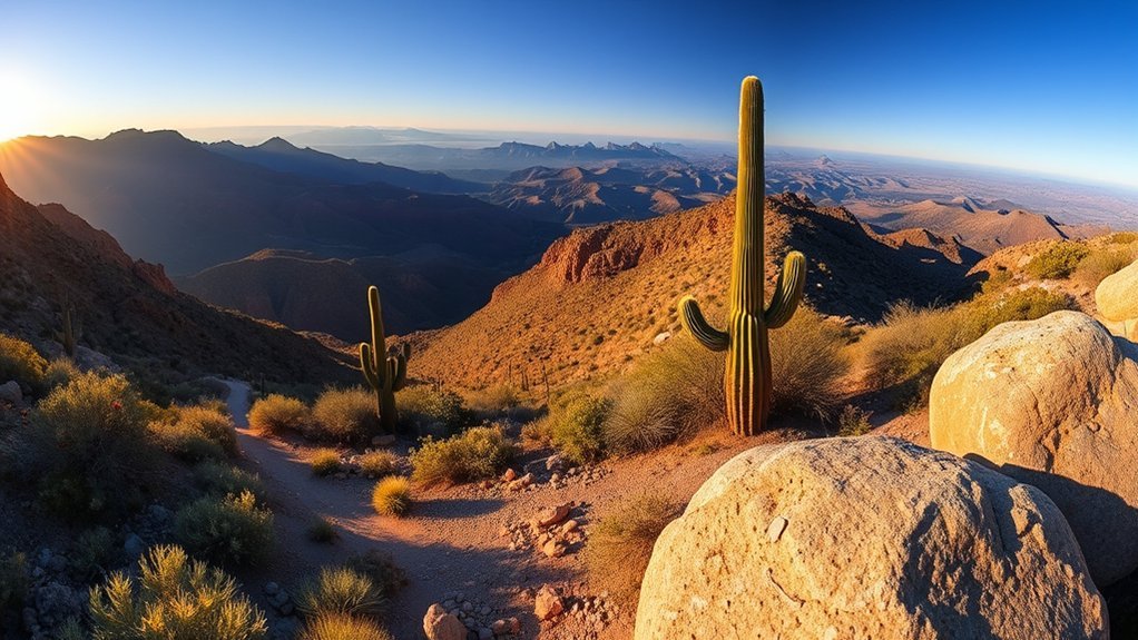
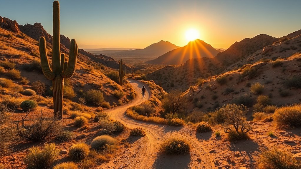
Rising from the McDowell foothills, the Pass Mountain Trail rewards hikers with panoramic desert vistas and a steady climb that quickly earns those views; you’ll navigate rocky switchbacks, tight cacti corridors, and exposed ridgelines that make every summit step feel earned. You’ll start on well-marked singletrack that gains about 1,400 feet over roughly 3.5 miles one way, so plan for steep sections and loose rock underfoot. Water and sun protection are nonnegotiable—shade is scarce and temperatures soar. Along the route, jagged granite outcrops and creosote flats frame sweeping views of Fountain Hills, the Salt River, and distant Superstition peaks. The summit delivers a 360-degree payoff and a natural spot for lunch or photos before a brisk descent. Expect moderate to strenuous effort; good footwear and steady pacing matter. You can loop into nearby trails for longer outings or head back the same way. Early starts yield cooler air, softer light, and quieter trails.
Frequently Asked Questions
Are Dogs Allowed on These Trails and Are Leashes Required?
Yes — you can bring dogs on many trails, but you’ll need to keep them leashed in most areas. You’ll encounter leash-required signs, occasional off-leash areas, and must pack water, waste bags, and respect wildlife and hikers.
What Are the Nearest Public Transportation Options to Trailheads?
About 60% of trailheads lie within a mile of public transit. You’ll find bus routes and Valley Metro connections, occasional shuttles, and light-rail transfers; you’ll plan routes, check schedules, and pack water for adventurous last-mile walks.
Which Trails Have Restroom or Potable Water Facilities?
You’ll find restrooms and potable water at Usery Mountain Regional Park main trailhead, Saguaro Lake Ranch area, and some Salt River access points; pack water elsewhere, as most desert trails won’t have reliable facilities.
Are Any Trails Accessible for Strollers or Wheelchairs?
Yes — some trails offer paved, stroller- and wheelchair-friendly sections with gentle grades and scenic views; you’ll find accessible parking, ramps, and boardwalks at select trailheads, but check specific trail maps and seasonal conditions first.
What Cell Phone Reception Can Hikers Expect on These Trails?
Coincidentally, you’ll find mixed reception: cell service is usually strong near trailheads and in town, but it weakens on remote ridges and in canyons. Bring a map, download offline routes, and expect occasional dead zones.
Conclusion
You’ll find invigorating routes right near Mesa, each offering scenic sprints or strenuous scrambles to satisfy your spirit of adventure. Pack plenty of water, sturdy shoes, sun protection and a sense of curiosity, then set out early to savor softer skies and safer temperatures. From wind-swept ridgelines to shaded washes, these diverse desert trails deliver memorable moments, panoramic perspectives and peaceful pauses—perfect for purposeful, playful exploration under Arizona’s wide, warm wilderness.
