

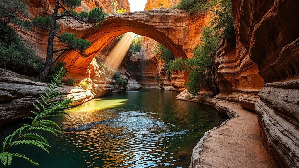
You’ll find Tonto Natural Bridge State Park both surprising and calm, a place where a massive travertine arch shades cool pools and red rock vistas. This guide will steer you from how to get there and what to pack to which trails suit kids or avid hikers, plus safety tips and nearby stops. Keep going if you want clear, practical advice to make the visit smooth and memorable.
Getting to Tonto Natural Bridge State Park
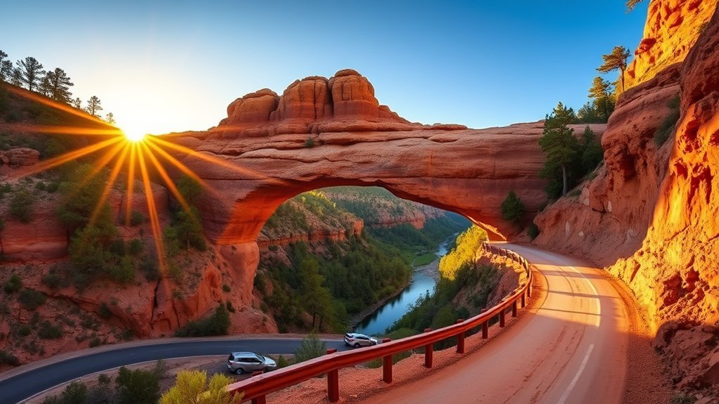
How will you find Tonto Natural Bridge State Park? You’ll approach via winding travel routes off Highway 260, turning toward Payson and Pine before a narrower road leads into ponderosa pines. Drive with intent: signs are sparse, so follow GPS waypoints and a printed map as backup. As you descend, you’ll notice sudden scenic views of red rock and juniper that frame the bridge’s hidden entrance. Parking areas sit near trailheads; you’ll pick the path that matches your energy and time. The last stretch narrows to a shaded lane where you’ll slow for walkers and wildlife. Expect basic facilities at the lot; carry water and sturdy shoes. Arrive prepared, and the landscape will reveal itself without fuss.
Park Hours, Fees, and Permits
While the park welcomes visitors most days, plan ahead: Tonto Natural Bridge State Park’s hours vary seasonally and some areas close at dusk, so check current opening times before you go. You’ll find modest entrance fees that support upkeep; pay attention to posted entrance guidelines and have exact change or card ready at the kiosk or online. Day-use passes are common, with occasional discounts for residents, seniors, or veterans—confirm rates before arrival. Permits are required for organized events, commercial shoots, and some research activities; apply in advance to avoid disappointment. Follow park regulations: stay on trails, leash pets, and pack out trash. Respect quiet hours and fragile habitats so the bridge’s quiet beauty stays for everyone.
Parking, Visitor Center, and Facilities
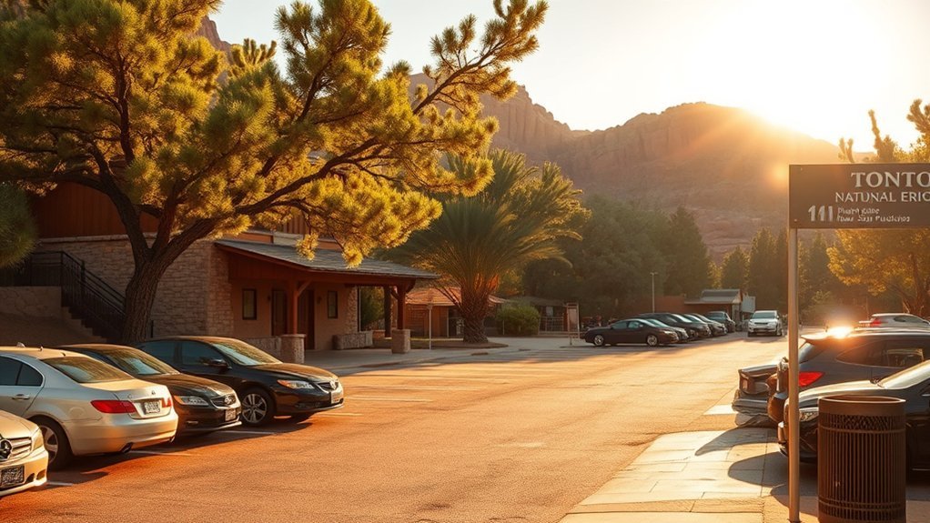
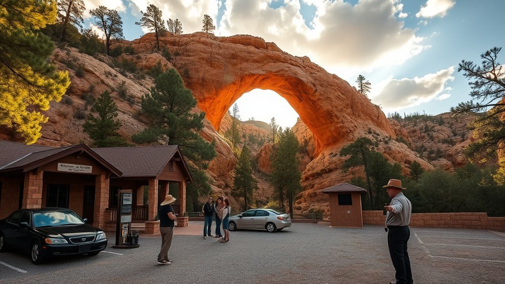
Wondering where to leave the car and get oriented? You’ll find clear parking options near the park entrance and lower bridge; signs guide you to lots with easy access, and a handful of overflow spots handle busy weekends. The compact visitor center offers maps, exhibits, restrooms, and a staffed desk where rangers answer questions about conditions and safety. Visitor amenities are modest but thoughtful — shaded benches, water fountains, and interpretive panels that set the scene.
| Facility | Details |
|---|---|
| Main Parking | Paved, near entrance |
| Overflow Lot | Gravel, limited shade |
| Visitor Center | Maps, staff hours |
| Restrooms | Vault toilets, maintained |
| Picnic Area | Tables, limited shade |
Plan to arrive early for best parking and a calm start.
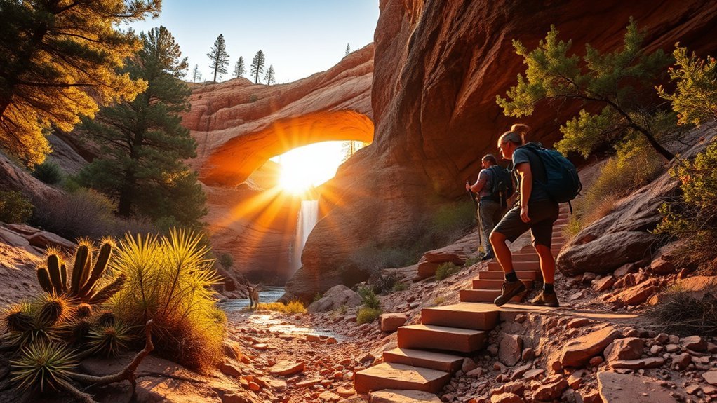
Trails and Hike Difficulty Levels
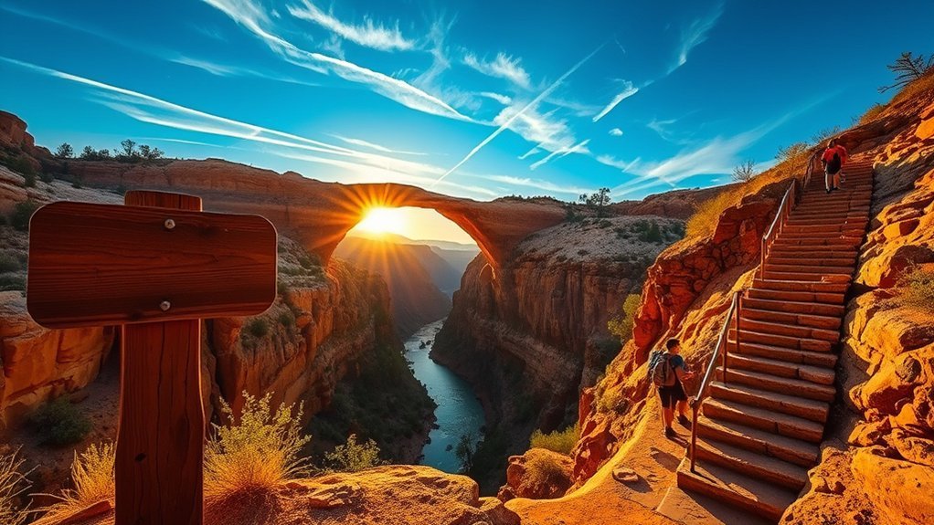
You’ll find a mix of short interpretive loops and longer routed trails that range from easy boardwalks to steeper, rocky paths—each labeled with distance so you can pick a route that fits your time. The park’s difficulty ratings explain what to expect regarding footing, elevation change, and exposure, so you won’t be caught off-guard. Bring sturdy shoes, water, and a map, and use common-sense trail safety like pacing yourself and watching for loose rock.
Trail Types and Lengths
Several short, well-marked trails loop through the park, and each offers a distinct way to experience the bridge and surrounding canyon—easy paved paths for casual walkers, steeper switchbacks for hikers wanting a workout, and rougher footpaths for those seeking solitude and closer scrub-and-rock views. You’ll notice varied trail features: interpretive signs, benches at scenic viewpoints, and occasional steps carved into stone. Choose routes based on time and energy—short connector loops, a moderate rim trail, or a longer descent into the grotto. Wear sturdy shoes; some paths get uneven. The table below outlines typical options so you can pick a route that matches your pace and interests.
| Type | Typical Length |
|---|---|
| Connector loop | 0.2–0.5 mi |
| Rim/moderate | 0.6–1.2 mi |
| Grotto/descent | 0.4–0.8 mi |
Difficulty Ratings Explained
When planning your visit, match the trail rating to your fitness and comfort—ratings condense steepness, footing, exposure, and length into simple categories so you know what to expect before you start. You’ll read Easy to Strenuous; picture quiet creekside walks versus steep switchbacks beneath pinyon and juniper. Use the ratings to choose appropriate hiking gear and observe trail etiquette: yield, pack out trash, and keep noise low so others enjoy the bridge’s hush.
- Easy — mostly flat, short; good for relaxed photos and families.
- Moderate — uneven footing, some elevation; you’ll want sturdy shoes.
- Difficult — sustained climbs, rock steps; bring water and focus.
- Strenuous — long, exposed, demanding; reserve for confident hikers.
Safety and Trail Tips
If you’re matching a trail to your skill, read the difficulty rating as a promise about what the path will demand: footing, exposure, climb length, and terrain all shape how much energy and gear you’ll need. Choose shoes with solid tread, carry water and a map, and set a turnaround time — simple preparations cut risk. On steep switchbacks or slick rock, slow your pace and test each step; handrails and cairns aren’t substitutes for attention. Practice wildlife awareness: give animals space, keep food sealed, and never approach nesting birds or bobcats. Tell someone your route, check weather before you go, and know basic first aid. Respect trail signs; they protect both you and the fragile canyon.
Accessibility and Family-Friendly Options
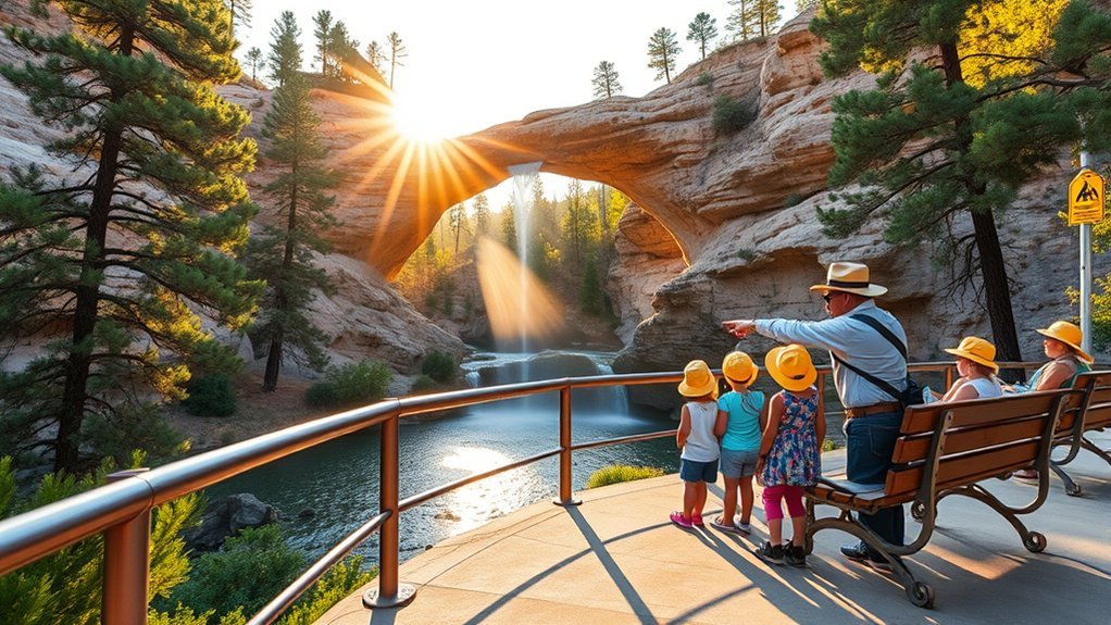
You’ll find clear notes on which trails have hard-packed surfaces, gradual grades, or steep steps so you can plan around mobility needs. Some viewpoints and picnic areas are wheelchair-friendly, with paved access and accessible restrooms, though a few overlooks require uneven paths or stairs. Bring a stroller or lightweight wheelchair, pack sun protection and snacks, and use park maps to pick the most family-friendly routes.
Trail Accessibility Details
Because the park’s trails vary from smooth, stroller-friendly paths to rocky switchbacks, plan your route around who’s in your group and what gear you have. You’ll notice different trail surface types underfoot — packed dirt, flagstone, gravel, and loose rock — and small accessibility features like handrails, rest benches, and graded approaches that make choices easier. Observe shade breaks and water access points when mapping time and energy.
- Choose shorter, even-surfaced loops for little legs or toddlers with a carrier.
- Bring sturdy shoes and trekking poles for steeper, uneven stretches.
- Use rest stops and benches to pace older adults or anyone with limited stamina.
- Check signage for slope warnings and surface-change alerts before you descend.
Wheelchair-Friendly Areas
When planning a visit with mobility needs in mind, take heart: several areas of Tonto Natural Bridge State Park are designed to be navigable for wheelchairs and strollers, offering accessible viewpoints and paved approaches to key overlooks. You’ll find firm, level surfaces near the main bridge overlook and picnic area that provide reliable wheelchair access and clear sightlines to the stone spans and verdant canyon. Accessible trails branch from the lot, short and thoughtfully graded, letting you experience canyon ambiance without steep steps. Park signage notes accessible routes and restroom locations; staff can confirm current conditions. Bring a companion if you like — the park’s accessible sections invite slow, sensory exploration of light, water, and texture without demanding difficult terrain.
Family Facilities & Tips
A visit to Tonto Natural Bridge State Park can be both easy and enriching for families and visitors with accessibility needs—paths near the main parking and picnic areas are graded and paved, restrooms include accessible stalls, and shaded picnic tables give parents a place to pause while kids explore nearby short trails. You’ll find practical touches and simple ways to enjoy family activities without stress.
- Bring a lightweight stroller or wheelchair — paved loops connect the picnic areas to overlooks.
- Pack layers and sun protection — shaded benches help during hot afternoons.
- Plan short nature games — scavenger hunts and photo prompts keep kids engaged.
- Check park hours and facilities ahead — ranger offices can advise on trail conditions.
Best Times of Year and Day to Visit
Ever wondered when Tonto Natural Bridge feels most magical? You’ll find the best viewing in spring and fall when temperatures are mild, water flow is lively, and light enhances the bridge’s textures. Spring offers wildflower pops and higher creek levels; fall brings warm hues and clearer skies — seasonal highlights that shape your photos and comfort.
Visit early morning for soft, angled light and smaller crowds; late afternoon offers golden tones and cooling air. Midday can be harsh and hot in summer, so avoid it then; if you come in summer, aim for dawn or dusk to escape heat. Winter’s cool, quiet days suit solitude seekers, though trails can be slick. Plan around weather and sunrise/sunset for the most rewarding experience.
Wildlife, Plants, and Geology to Look For
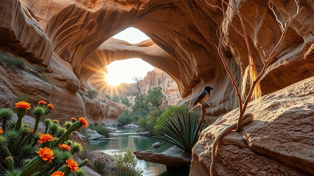
Several habitats converge here, so you’ll spot a surprising mix of wildlife, native plants, and exposed rock that tell the area’s story. You’ll notice canyon wrens calling from limestone cliffs, swallows skimming the creek, and mule deer slipping through piñon-juniper shade. Look for riparian cottonwood and willow pockets, plus resilient cactus and agave on drier slopes.
- Birds — canyon wren, red-tailed hawk, and summer tanager during migration.
- Mammals & reptiles — mule deer, black-tailed jackrabbit, lizards basking on sunlit slabs.
- Native plants — Arizona walnut, cliffrose, prickly pear; seasonal wildflowers burst after rains.
- Geology — travertine bridges, layered limestone, and petrified sediments revealing ancient springs.
Safety Tips and Leave-No-Trace Practices
After watching canyon wrens weave through limestone ledges and spotting mule deer in the piñon-juniper shade, you’ll want to protect those same sights by following simple safety and Leave-No-Trace practices. Stay on marked trails; trampling cryptobiotic soil and plants destroys slow-growing life. Pack out all trash, leftover food, and toilet paper—what you carry in, carry out. Practice wildlife awareness: observe from a distance, never feed animals, and store food securely to avoid habituation. Bring ample water, sun protection, a map, and a charged phone; that’s basic emergency preparedness. Tell someone your route and return time. If you encounter unstable rock or slick sections, turn back—no view is worth risk. Leave the landscape as you found it.
Nearby Attractions, Dining, and Overnight Stays
Just a short drive from Tonto Natural Bridge State Park you’ll find a mix of scenic detours and practical comforts to round out your visit: explore the Verde River and its cottonwood-lined banks for easy paddling, hike the rugged trails of the Mogollon Rim for expansive views, or stop in Payson for local cafes, galleries, and supplies. You’ll encounter local attractions that suit quiet reflection or active exploration; dining options range from casual diners to bakeries serving hearty pie; overnight accommodations include inns and vacation rentals; nearby campgrounds offer star-filled solitude. Pick what matches your mood:
- Verde River paddle trips — calm, shady, photographic.
- Mogollon Rim hikes — panoramic lookout points.
- Payson dining options — coffee, comfort food, supplies.
- Nearby campgrounds & overnight accommodations — tent sites to cozy lodges.
Frequently Asked Questions
Are Pets Allowed on Trails and in Park Facilities?
Yes — you can bring pets, but pet policies require leashes and supervision; trails allow pet access on designated paths, and you’re expected to clean up waste. You’ll observe rules protecting wildlife and visitor safety.
Is Rock Climbing or Rappelling Permitted at the Bridge?
You might worry you’ll miss adrenaline, but no—rock climbing isn’t allowed and rappelling’s prohibited without authorization; you’ll follow rock climbing regulations and rappelling safety rules, respecting fragile formations while observing from designated viewpoints.
Can I Host a Wedding or Private Event at the Park?
Yes — you can, but you’ll need event permits and may be limited to specific areas; inquire about wedding packages, fees, guest counts and timing. You’ll want to plan early to guarantee picturesque, permitted arrangements.
Are Drones or Aerial Photography Allowed Over the Park?
No, you can’t fly drones or do unrestricted aerial photography over the park; drone regulations prohibit recreational UAVs and require permits for commercial aerial photography, so you’ll need prior approval and must follow safety and wildlife-protection rules.
Is There Cell Phone Service or Wi‑Fi at the Park?
Like a lone signal tree, you won’t find reliable cell coverage or public Wi‑Fi here; you’ll have patchy internet access at best, so plan offline maps and downloads, and enjoy the unplugged, scenic solitude.
Conclusion
You’ll leave Tonto with travertine still ringing in your head, sunlight through the bridge matching the dappled pattern on your picnic blanket; coincidence or intention, the trail’s switchbacks echo the ribs of the arch above. Bring water, a camera, and patience—late afternoon light and quiet birds reward those who wait. Respect the fragile rocks, pack out your trash, and plan a return: this place draws you back like a well‑timed shadow across red stone.
