DeSoto State Park on Lookout Mountain near Fort Payne, Alabama, is one of the state’s most rewarding destinations for waterfall hikes. The 3,502-acre park has more than 35 miles of hiking trails, seasonal cascades along Laurel Creek, and easy-to-reach falls near its main facilities. The famous 104-foot DeSoto Falls is also part of DeSoto State Park, but it is located in a separate picnic area about seven miles from the main park.
Quick Answer
DeSoto State Park’s waterfalls include Indian Falls, Laurel Falls, Lodge Falls, Lost Falls, and Azalea Cascade in the main park, plus 104-foot DeSoto Falls in a separate area seven miles away. Spring, late fall, and winter usually bring the strongest flow, while several smaller falls can become nearly dry in summer.
Key Takeaways
- DeSoto Falls is a 104-foot waterfall in a separate DeSoto State Park area about seven miles from the main park.
- Indian Falls is one of the easiest main-park waterfalls to reach, while Lost Falls requires a longer hike.
- Spring, late fall, and winter generally provide the most reliable waterfall flow.
- The park’s smaller waterfalls are rainfall-dependent and may have little or no flow during dry summer weather.
- Swimming and wading are permitted in certain natural-water areas, but there are no lifeguards and conditions can change quickly.
- Little River Falls is a nearby 45-foot waterfall in Little River Canyon National Preserve, not one of the waterfalls inside DeSoto State Park.
The Beauty of DeSoto State Park’s Waterfalls
The waterfalls around DeSoto State Park range from the dramatic 104-foot DeSoto Falls to small seasonal cascades tucked into the forest. Because several falls depend heavily on rainfall, visitors can have very different experiences depending on when they arrive.
Alabama State Parks identifies spring, late fall, and winter as the periods that usually produce the best water flow. Many of the smaller falls and streams can become dry during summer.
| Waterfall | Location / Size | Typical Access |
| DeSoto Falls | Separate DeSoto Falls Picnic Area; 104 feet | Side viewpoint, Overlook Trail, and River Trail |
| Indian Falls | Main park; about 20 feet | About 0.1 mile from Talmadge Butler Trailhead |
| Lodge Falls | Behind the Lodge; about 25 feet | Short hike into a small ravine and along the Yellow Trail |
| Lost Falls | Main park; about 5 feet | About 1.5 miles from the Country Store; moderate to mildly strenuous terrain |
| Laurel Falls | Laurel Creek in the main park | About 0.75 mile from the Country Store on rugged, moderate terrain |
| Azalea Cascade | Laurel Creek in the main park | Talmadge Butler Boardwalk or Red Trail |
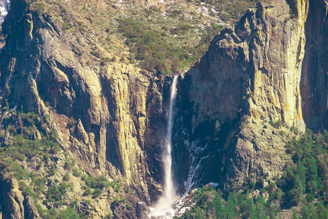
DeSoto Falls drops 104 feet, but several of the park’s smaller waterfalls are seasonal and may nearly disappear during dry summer periods.
It is also important not to confuse DeSoto Falls with Little River Falls. Little River Falls is a 45-foot waterfall in nearby Little River Canyon National Preserve. It makes an excellent additional stop, but it is managed by the National Park Service rather than as part of the main DeSoto State Park waterfall trail system.
Hiking Trails to the Waterfalls

DeSoto State Park has more than 35 miles of hiking trails, and the difficulty ranges from easy walks to strenuous mountain terrain. Printed trail maps are available at park facilities, and the park recommends checking the terrain before starting because rocky sections can be more difficult than they first appear.
Indian Falls
Indian Falls is one of the easiest waterfalls to add to a short visit. The approximately 20-foot waterfall is about 0.1 mile from the Talmadge Butler Trailhead, just across the road. A wooden footbridge crosses above the falls.
Lost Falls
Lost Falls requires more effort. The waterfall is roughly 1.5 miles from DeSoto’s Country Store & Information Center, so a simple out-and-back visit can approach three miles. The terrain ranges from moderate to mildly strenuous. Lost Falls is only about five feet high and is especially dependent on recent rainfall, which explains its name: when the creek is dry, the waterfall can seem to disappear.
Laurel Falls
Laurel Falls is located off the Orange Trail about 0.75 mile from the Country Store. The park rates the route as rugged and moderate, with uphill sections.
Azalea Cascade and the Talmadge Butler Boardwalk
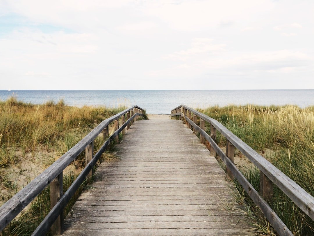
Visitors looking for an easier experience should consider the Talmadge Butler Boardwalk. This 360-yard trail can be enjoyed by people of varying abilities and ends at a viewing deck over the pool created by Azalea Cascade. The boardwalk also provides an excellent introduction to the forest habitat without requiring a long mountain hike.
Visiting DeSoto Falls
The main 104-foot DeSoto Falls is not reached from the main park trail network. Drive to the separate DeSoto Falls Picnic Area, about seven miles from the main park.
The park identifies three primary viewing options: the easiest side view from the picnic area, the moderate Overlook Trail for a front view, and the River Trail for a basin view. The latter routes cross rocky mountain terrain and range from moderate to strenuous.
Pro Tip: Visit the smaller waterfalls after a period of rain rather than assuming they will be flowing year-round. Lost Falls, Lodge Falls, Laurel Falls, and other small cascades can be dramatically reduced during dry weather.
Planning Your Visit to DeSoto Falls
DeSoto Falls Picnic Area operates during daylight hours and closes at dusk. Alabama State Parks currently lists a $5 per-vehicle parking fee for this separate area. Because fees and operating details can change, check the official park page before traveling.
Parking is limited, particularly on busy weekends, and the park warns that the lot can fill to capacity. There is no overflow roadside parking. Large RVs and trailers are not suitable for the DeSoto Falls access road, and Alabama State Parks specifically warns visitors that GPS directions can be unreliable in this mountain area.
The easiest side view of DeSoto Falls is reached from the picnic area by sidewalk and approximately 50 steps to the observation platform. The historic A. A. Miller Dam and upper-falls area provide easier access for visitors who cannot manage the longer rocky trails.
For the main portion of DeSoto State Park, trails and picnic areas are generally open from dawn to dusk. The main park does not have a general entrance gate fee, although individual facilities, activities, parking areas, or accommodations can have separate charges. Check the official trip-planning page for current details.
Wildlife and Flora Surrounding the Waterfalls
The forests surrounding the park’s waterfalls support a broad range of plant and animal life. Alabama State Parks describes DeSoto’s trail system as containing diverse plant communities and plentiful wildlife, while the streams and pools provide habitat for aquatic organisms such as crayfish, tadpoles, mussels, and other small animals.
Hardwood forests, shrubs, ferns, wildflowers, and creekside vegetation create changing scenery throughout the year. Spring is especially attractive for wildflower viewing, while autumn brings colorful foliage across Lookout Mountain.
Birdwatchers may also find the mixture of forest, river, bluff, and open habitat rewarding. Rather than expecting a fixed list or guaranteed population count, visitors should treat wildlife sightings as seasonal and unpredictable. The park encourages observations through Alabama State Parks’ nature programs and citizen-science resources.
Note: Observe wildlife from a respectful distance, stay on marked trails, and avoid disturbing animals or removing plants, rocks, or other natural features.
Best Times to Visit the Waterfalls
Water flow is one of the most important factors when planning a waterfall trip. According to Alabama State Parks, spring, late fall, and winter normally offer the best chance of seeing the park’s waterfalls with substantial flow.
Spring combines flowing creeks with wildflowers and fresh green foliage. Temperatures are also often more comfortable for longer hikes than during the hottest part of summer.
Late fall can be especially photogenic because colorful hardwood foliage surrounds the streams and cliffs. Winter removes much of the leaf cover, opening views through the forest, and rainfall can keep the falls active.
Summer can still be enjoyable for hiking, swimming, camping, and exploring the park, but visitors should not assume every waterfall will be running. Alabama State Parks warns that many small waterfalls and streams may become dry during summer.
Safety Tips for Exploring the Waterfalls

Waterfall terrain can become slippery even when nearby trails appear dry. Wear sturdy closed-toe shoes with reliable traction, watch for wet rock, and remain on marked paths and established viewing areas.
The park recommends carrying enough drinking water and snacks, checking the trail terrain before setting out, and leaving enough time to finish your hike before dusk. Cell coverage can be spotty, so downloading or carrying a trail map is a useful precaution.
Warning: Never treat the top or base of a waterfall as a safe swimming area simply because the water looks calm. Wet rock is extremely slippery, currents change after rainfall, and natural swimming areas at DeSoto State Park do not have lifeguards. Follow signs and current park instructions at the location you visit.
Can You Swim Near the Waterfalls?
Swimming is not universally prohibited in DeSoto State Park. Alabama State Parks currently permits swimming and wading in Laurel Creek and the West Fork of Little River. At the DeSoto Falls Picnic Area, swimming is permitted above the A. A. Miller Dam.
These natural-water areas do not have lifeguards, and swimming is at your own risk. Water depth, current, and flow can change considerably after rain.
Dogs on the Trails
Dogs are allowed on DeSoto State Park trails but must remain on a leash. Bring water for your dog and use extra caution around cliffs, rocky creek crossings, and crowded overlooks.
Photography Tips for Capturing the Waterfalls
Early morning and late afternoon often produce softer light than the middle of the day. Overcast conditions can also work well for waterfall photography because clouds reduce harsh highlights on bright water and deep shadows beneath forest cover.
A tripod is useful when you want to experiment with a slower shutter speed and give moving water a smooth appearance. Faster shutter speeds freeze individual drops and splashes, while slower exposures emphasize motion.
Try compositions that include rocks, leaves, tree trunks, or a bend in the creek rather than placing the waterfall alone in the middle of every frame. These foreground elements can add depth and show how the waterfall fits into the surrounding Appalachian landscape.
Always choose the photograph from a safe position. Do not climb over railings, stand on wet cliff edges, or leave designated routes simply to obtain a different camera angle.
Other Attractions and Activities at DeSoto State Park
Waterfalls are only part of the experience. DeSoto State Park offers hiking, mountain biking, camping, swimming, fishing, paddling, interpretive programs, and opportunities to explore the area’s Civilian Conservation Corps heritage.
The park has lodge rooms, cabins and chalets, improved campsites, primitive camping, and backpacking sites. Its historic lodge includes stonework dating to Civilian Conservation Corps construction in the 1930s.
Fishing is possible along Little River within the park. Alabama State Parks notes that spinning tackle and bait-casting equipment can be used, although the river is especially suited to fly fishing. Anglers should check current Alabama fishing-license and regulation requirements before fishing.
Visitors interested in an additional waterfall can drive to nearby Little River Canyon National Preserve. Little River Falls marks the beginning of the canyon and drops approximately 45 feet. Because it belongs to a separate National Park Service unit, follow NPS parking, swimming, safety, and operating rules there rather than assuming DeSoto State Park rules apply.
The park also offers naturalist and interpretive programs that explore local plants, wildlife, ecology, and cultural history. These activities can add context to a waterfall hike and help visitors understand why Lookout Mountain supports such varied habitats.
If you are planning a picnic during your visit and want to explore an unusual fruit option, you can also read this guide to the delightful world of Asian melon.
Sources
- Alabama State Parks: DeSoto State Park — park size, trails, accommodations, recreation, and general visitor information.
- Alabama State Parks: Waterfalls — official waterfall heights, distances, access information, and seasonal flow.
- Alabama State Parks: DeSoto Falls Picnic Area — DeSoto Falls viewpoints, parking fee, trail difficulty, access, and parking limitations.
- Alabama State Parks: Plan Your Trip — park hours, fees, accessibility, directions, and GPS guidance.
- Alabama State Parks: Swimming — current swimming and wading rules for Little River, Laurel Creek, and the DeSoto Falls area.
- National Park Service: Little River Falls — location, height, access, and safety information for nearby Little River Falls.
Frequently Asked Questions
What are the main waterfalls at DeSoto State Park?
The main park includes Indian Falls, Laurel Falls, Lodge Falls, Lost Falls, and Azalea Cascade. The famous 104-foot DeSoto Falls is also part of DeSoto State Park but is located in a separate picnic area about seven miles from the main park.
How tall are the waterfalls at DeSoto State Park?
DeSoto Falls is 104 feet high. Alabama State Parks lists Indian Falls at about 20 feet, Lodge Falls at about 25 feet, and Lost Falls at about 5 feet. Several other features, including Laurel Falls and Azalea Cascade, are smaller seasonal waterfalls or cascades.
Is DeSoto Falls inside the main area of DeSoto State Park?
No. DeSoto Falls Picnic Area is a separate part of DeSoto State Park approximately seven miles from the main park. Visitors should drive to the dedicated picnic area and trailhead rather than expect to reach the 104-foot waterfall from the main park’s short waterfall trails.
Are the waterfalls at DeSoto State Park easily accessible?
Accessibility varies. Indian Falls is only about 0.1 mile from its trailhead, and Azalea Cascade can be reached by the 360-yard Talmadge Butler Boardwalk. Lost Falls and Laurel Falls require longer or rougher hikes. DeSoto Falls has an easier side-view route as well as moderate and strenuous trail options.
Can visitors swim near the waterfalls at DeSoto State Park?
Swimming and wading are allowed in Laurel Creek and the West Fork of Little River, and swimming is permitted above the A. A. Miller Dam at the DeSoto Falls Picnic Area. These natural-water areas have no lifeguards, so visitors swim at their own risk and should obey all posted restrictions.
When is the best time to visit the waterfalls at DeSoto State Park?
Spring, late fall, and winter generally offer the strongest and most reliable waterfall flow. Many smaller waterfalls and streams can become very low or dry during summer, especially after extended periods without rain.
Is there a fee to visit DeSoto Falls?
Alabama State Parks currently lists a $5 per-vehicle parking fee at the separate DeSoto Falls Picnic Area. The main area of DeSoto State Park does not have a general entrance gate fee, although specific facilities and activities may have separate charges.
Is Little River Falls part of DeSoto State Park?
No. Little River Falls is a 45-foot waterfall in Little River Canyon National Preserve, a nearby National Park Service site. It is easy to combine with a DeSoto State Park trip, but its access and safety rules are managed separately.