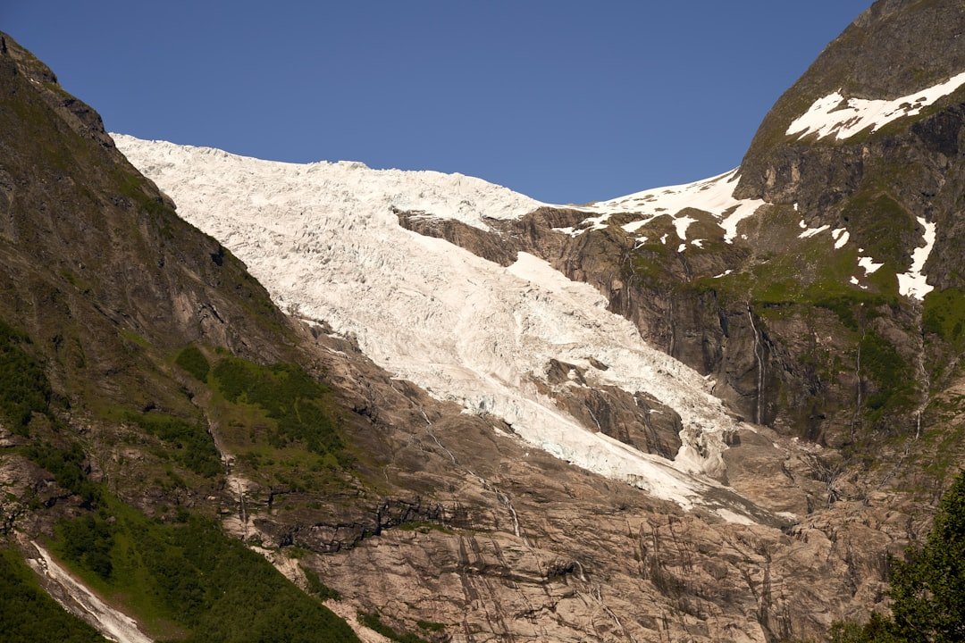
The Great Aletsch Glacier is the largest glacier in the Alps and one of the signature landscapes of Switzerland’s Swiss Alps Jungfrau-Aletsch UNESCO World Heritage property. Current Aletsch Arena material lists the glacier at about 20 km long, with an area of roughly 78.5 km² and ice up to about 800 metres thick at Konkordiaplatz. For hikers, the important thing to know is that there is no single route called the “Aletsch Glacier Trail.” Several marked trails provide glacier views, while walking on the glacier itself is a separate guided activity.
Quick Answer
Aletsch Glacier hikes range from easy walks of about 2.5 hours to moderate mountain hikes of 3–6 hours and a T4 alpine ridge route. The official Aletsch Panoramaweg takes roughly 11 walking hours over three stages. Walking on the glacier requires a guided glacier tour, which usually takes about six hours.
Key Takeaways
- There is no single Aletsch Glacier trail. Choose a specific route based on distance, altitude, trail category, and your experience.
- Popular marked day hikes range from about 6.7 to 15.1 km and roughly 2.5 to 5.5 hours.
- SwitzerlandMobility’s Aletsch Panoramaweg, Route 39, covers about 30 km in three stages rather than one short day hike.
- Do not confuse a hiking trail beside the glacier with glacier travel. Aletsch Arena states that visitors may go onto the Great Aletsch Glacier only as part of a guided tour.
- Check the official trail and lift status, mountain weather, and your return transport before starting.
At a Glance
| Time Required | About 2.5–5.5 hours for popular day hikes; about 11 hours over three stages for Route 39; about 6 hours for a standard guided glacier excursion |
| Difficulty | Easy hiking trails through moderate mountain trails to a T4 alpine route |
| Tools Needed | Hiking boots, weather layers, sun protection, water, food, map or GPS; technical glacier equipment is handled through guided glacier tours |
| Cost | No separate fee for using marked hiking trails; cable cars, trains, food, and guided glacier tours cost extra |
What Does “Aletsch Glacier Trail” Mean?
The phrase can refer to several different hikes in the Aletsch Arena. This is why published distances and hiking times can look contradictory. A short panoramic walk from Fiescheralp is not the same trip as the three-stage Aletsch Panoramaweg, and neither should be confused with a guided walk on the glacier.
The Great Aletsch Glacier itself begins in the high Jungfrau region. Aletsch Arena identifies three major firn streams that join to form it: the Grosser Aletschfirn, Jungfraufirn, and Ewigschneefeld. The neighboring Fiescher Glacier is a separate glacier.
Aletsch Arena’s 2026 summer map lists the Great Aletsch Glacier at about 20 km long, 78.5 km² in area, and up to 800 metres thick at Konkordiaplatz.
The glacier lies within the wider Swiss Alps Jungfrau-Aletsch UNESCO World Heritage property. The Aletsch Forest is another important protected landscape beside the glacier rather than an area containing most of the glacier.
Aletsch Glacier Trail Difficulty Ratings
Difficulty depends on the exact route. Swiss hiking maps distinguish ordinary hiking trails, mountain hiking trails, and alpine hiking trails. The Aletsch Arena 2026 summer map uses T1 for hiking trails, T2/T3 for mountain hiking trails, and T4-T6 for alpine hiking trails.
An easy plateau walk may have good paths and limited climbing. A mountain hiking trail can include rocky ground, steep sections, and greater exposure to changing weather. A T4 alpine hiking route is a major step up and requires stronger route-finding ability, sure-footedness, a head for heights, and suitable alpine experience.
Warning: A marked hiking trail overlooking the glacier is not the same as a route across glacier ice. Aletsch Arena states that visitors may go onto the Great Aletsch Glacier only as part of a guided glacier tour. Crevasses and changing ice conditions make independent glacier travel dangerous.
If you are unsure about your ability, choose a lower-level marked trail rather than relying only on distance. A short alpine route can be much harder than a longer ordinary hiking trail.
Time Estimates for Hiking Near the Aletsch Glacier
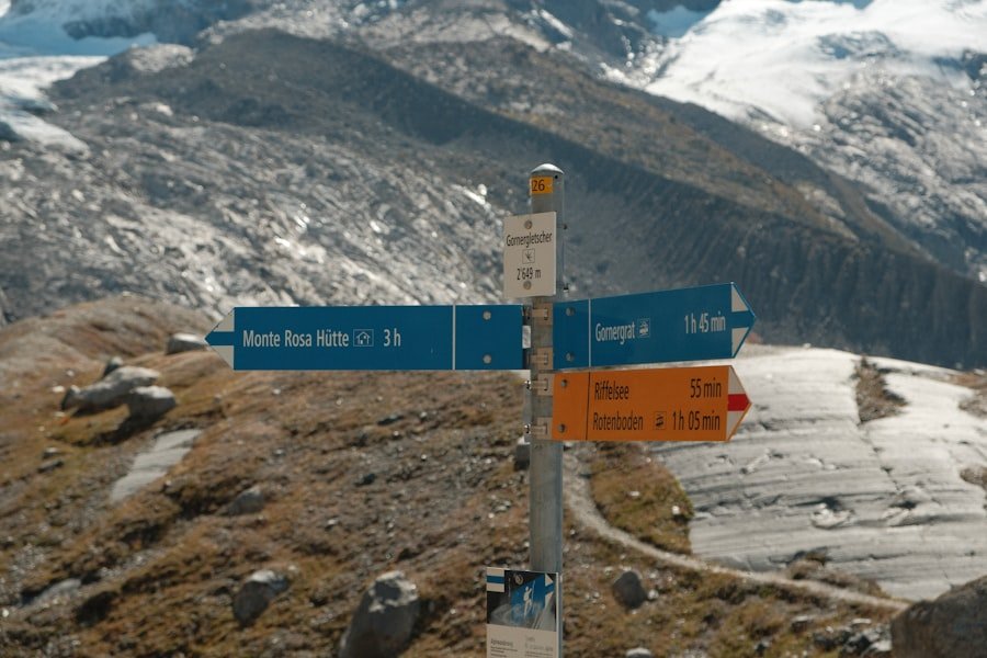
There is no reliable single answer to “How long does the Aletsch Glacier trail take?” The correct time depends on which official route you mean. Published route times also do not account for every photo stop, meal, cable-car wait, or detour.
| Route | Distance | Official Time | Difficulty |
|---|---|---|---|
| Fiescheralp – Bettmeralp – Riederalp | 7.9 km | 2 hr 30 min | Easy |
| Aletsch Glacier View Trail, SwitzerlandMobility Route 195 | 7 km | 2 hr 35 min | Moderate mountain hiking trail |
| Moosfluh – Riederfurka – Riederalp | 6.7 km | 2 hr 40 min | Moderate |
| Eggishorn – Märjela – Fiescheralp | 12.2 km | 3 hr 45 min | Moderate mountain hike |
| Bettmerhorn – Märjela – Bettmeralp | 15.1 km | 5 hr 30 min | Challenging mountain hike |
| Bettmerhorn – Eggishorn UNESCO ridge trail | 3 km | 3 hr | T4 alpine hiking trail |
| Aletsch Panoramaweg, Route 39 | About 30 km over 3 stages | About 11 hr total walking time | Moderate mountain hiking stages |
| Guided Aletsch Glacier excursion from Fiesch | Varies with guided itinerary | About 6 hr walking, including roughly 2–3 hr on the glacier | Guided glacier travel |
The three stages of SwitzerlandMobility Route 39, the Aletsch Panoramaweg, are approximately 10 km in 3 hours 45 minutes, 11 km in 4 hours, and 9 km in 3 hours 15 minutes. That is why describing the full Panoramaweg as a 4–6 hour trail is misleading.
SwitzerlandMobility also notes that this route once crossed the Aletsch Glacier. Because glacier retreat has left unstable moraine slopes, the official route no longer makes that glacier crossing.
Note: Treat published hiking times as planning estimates. Add extra time for viewpoints, food stops, children, slower members of your group, lift connections, and changing trail conditions.
Which Aletsch Glacier Hike Should You Choose?
For a Lower-Effort Walk
The Fiescheralp–Bettmeralp–Riederalp route is one of the easier highlighted walks in the Aletsch Arena. The 2026 summer map lists it at 7.9 km and about 2 hours 30 minutes, with relatively little climbing compared with the higher mountain routes.
For a Classic Glacier View
The 7 km Aletsch Glacier View Trail, Route 195, is a strong choice if your main goal is to see the glacier without committing to a full-day route. SwitzerlandMobility rates it as a moderate mountain hiking trail and gives an approximate time of 2 hours 35 minutes.
For a Longer Mountain Day
Eggishorn–Märjela–Fiescheralp gives you a high starting point and a long descent through dramatic terrain. The official route is 12.2 km with a listed time of about 3 hours 45 minutes. Bettmerhorn–Märjela–Bettmeralp is longer at 15.1 km and about 5 hours 30 minutes.
For Experienced Alpine Hikers
The Bettmerhorn–Eggishorn UNESCO ridge trail is only about 3 km, but distance is misleading here. The Aletsch Arena classifies it as a T4 alpine hiking trail and allows about three hours. It is not a beginner shortcut between two viewpoints.
For Walking on the Glacier
Book a guided glacier excursion rather than attempting to reach or cross the ice independently. The official Aletsch Glacier trip from Fiesch lists about six hours of walking, including roughly two to three hours on the glacier. Participants are roped to a guide, and the listed technical equipment includes a climbing harness and crampons supplied for the excursion.
Getting to the Main Aletsch Glacier Trailheads
The main hiking areas are reached from the car-free mountain villages and lift stations around Riederalp, Bettmeralp, and Fiescheralp. Your exact approach depends on the route you choose.
- Riederalp and Moosfluh: Useful starting points for the western glacier viewpoints, Aletsch Forest, and Route 195.
- Bettmeralp and Bettmerhorn: Useful for high-level mountain hikes toward Märjela and the alpine ridge toward Eggishorn.
- Fiesch, Fiescheralp, and Eggishorn: Useful for the eastern side, the Eggishorn viewpoint, Märjelensee routes, and guided glacier trips.
Several hikes depend on cable cars for the start or finish, so do not plan the walking portion in isolation. Check the last lift of the day and allow enough margin to reach it comfortably.
Best Time to Hike and How to Check Conditions
Most high routes around the glacier are summer and early-autumn hikes, but snow, storms, maintenance, landslides, and lift operations can change access. A route that was straightforward during one visit may not have identical conditions the next season.
Before leaving, check the Aletsch Arena summer status report for hiking trails, lifts, viewpoints, and temporary restrictions. For mountain forecasts and official Swiss weather warnings, check MeteoSwiss.
Pro Tip: Check both the trail status and the lift status. A trail may be technically open while a cable-car connection has reduced hours, maintenance, or a seasonal closure that changes your whole itinerary.
Tips for Hiking the Aletsch Glacier Trails
Mountain weather can change quickly, so prepare for conditions rather than relying only on the forecast you saw the night before. Bring a waterproof outer layer and use several clothing layers that you can add or remove as the temperature changes.
Carry enough water and food for your route. High-energy foods such as nuts, sandwiches, fruit, or energy bars are easy to eat during short stops. Do not assume every mountain restaurant or hut will be open when you arrive.
Use an official map or GPS route and keep enough battery power for navigation and emergency calls. Marked trails are generally clear, but fog and poor weather can make even obvious junctions harder to read.
Start early enough to avoid rushing for the final lift or walking an unfamiliar trail after dark. If your group is slower than expected, shorten the route rather than trying to recover lost time by moving too fast over rocky terrain.
Safety Precautions for Hiking Near the Aletsch Glacier
The main safety distinction is simple: staying on a marked hiking trail is different from travelling on glacier ice. Crevasses may be hidden, ice conditions change, and the safest line across a glacier can change with the season.
Warning: Do not leave a marked trail simply because the glacier looks close. Aletsch Arena’s glacier-tour guidance states that visitors are allowed onto the Great Aletsch Glacier only as part of a guided tour.
For ordinary mountain hiking:
- Stay on the marked route and follow closure signs.
- Turn back if weather, fatigue, snow, or trail conditions exceed your experience.
- Tell someone your intended route and expected return time.
- Carry a charged phone, navigation backup, first-aid supplies, water, and an insulating layer.
- Keep enough daylight and transport margin for an unexpected delay.
- Do not treat a short T4 alpine trail as easier simply because its kilometre figure is low.
For a medical emergency in the Aletsch Arena, the official SOS information directs visitors to call 144.
If you enter the Aletsch Forest nature reserve, follow its protection rules. The Aletsch Arena summer map asks visitors to remain on marked paths, keep dogs on a leash, avoid fires and camping, carry out rubbish, and avoid mountain biking inside the protected area.
Recommended Gear for Hiking the Aletsch Glacier Trails
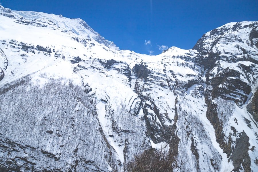
Good footwear matters because many routes use rocky and uneven mountain paths. Hiking shoes or boots should have dependable grip and already be comfortable before you start a long day.
A practical day-hiking kit includes:
- Hiking shoes or boots with good tread
- Moisture-managing base layer
- Warm mid-layer such as fleece
- Windproof and waterproof outer layer
- Sun hat and warm hat
- Sunglasses
- High-SPF sunscreen
- Water
- Food and emergency snacks
- Trail map or offline GPS map
- Charged phone and optional power bank
- Small first-aid kit
- Hiking poles if you find them useful on long descents
Glacier equipment is different. On the official Fiesch glacier excursion, Aletsch Arena lists harnesses and crampons as provided technical equipment. The operator also asks participants to bring suitable hiking or mountain boots, weather protection, gloves, sunglasses, food, and water.
Note: Carrying crampons does not turn an independent hiker into a glacier traveller. Rope-team skills, crevasse awareness, route selection, and current local knowledge are part of why glacier excursions use qualified guides.
Alternative Routes and Side Trails
You do not need to reach the ice to get memorable glacier views. The Aletsch Arena has several viewpoints and trails that let you change the length and difficulty of your day.
Moosfluh and Riederfurka
The Moosfluh–Riederfurka–Riederalp route is about 6.7 km and takes roughly 2 hours 40 minutes according to the 2026 Aletsch Arena map. It is a useful middle option between an easy plateau walk and a longer high-mountain day.
Eggishorn and Märjelensee
The Eggishorn–Märjela–Fiescheralp route combines a high glacier viewpoint with a 12.2 km mountain hike. The official route information lists about 3 hours 45 minutes, with substantial descent from the high starting point.
Aletsch Panoramaweg
For a longer journey, SwitzerlandMobility Route 39 runs from the Belalp side toward Bellwald in three stages. The official stages are approximately 10 km, 11 km, and 9 km. This is better treated as a multi-stage hiking itinerary than a single casual afternoon walk.
Viewpoints Without a Full Hiking Day
Hohfluh, Moosfluh, Bettmerhorn, and Eggishorn are major glacier viewpoints. Using the mountain transport network can give you extensive views even if you do not want to complete one of the longer hiking routes.
Conclusion and Final Thoughts on Exploring Aletsch Glacier
The difficulty and time required for an Aletsch Glacier hike depend entirely on the route. An easier 7.9 km plateau walk can take about 2.5 hours, while longer mountain hikes require four to six hours and the official Aletsch Panoramaweg spans roughly 30 km over three stages. The T4 Bettmerhorn–Eggishorn ridge is short but much more technical.
The most important safety rule is to keep ordinary hiking and glacier travel separate. Stay on marked trails unless you have booked an appropriate guided glacier experience. Check current route and lift conditions, carry proper mountain gear, and choose a trail that matches the least experienced person in your group.
The Great Aletsch Glacier is also a changing landscape. UNESCO highlights the region’s glacier retreat as an important example of climate-related ecological change, while Switzerland’s GLAMOS program continues systematic glacier monitoring. Visiting responsibly helps protect the landscape while giving you a safer and more rewarding hiking experience.
Frequently Asked Questions
What is the difficulty level of the Aletsch Glacier trail?
There is no single Aletsch Glacier trail. Routes range from easy walks such as Fiescheralp–Bettmeralp–Riederalp to moderate mountain trails and the T4 Bettmerhorn–Eggishorn alpine route. Choose by official trail category as well as distance.
How long does it take to hike near the Aletsch Glacier?
Popular day hikes take roughly 2.5 to 5.5 hours. SwitzerlandMobility’s three-stage Aletsch Panoramaweg takes about 11 hours of walking in total, while a standard guided glacier excursion takes about six hours.
Can I walk onto the Aletsch Glacier without a guide?
No. Aletsch Arena states that visitors may access the Great Aletsch Glacier only as part of a guided glacier tour. Crevasses and changing ice conditions make independent glacier travel hazardous.
What is a good easier Aletsch Glacier hike?
The Fiescheralp–Bettmeralp–Riederalp walk is one of the easier highlighted routes. The 2026 Aletsch Arena map lists it at 7.9 km with a walking time of about 2 hours 30 minutes.
Do I need crampons for Aletsch Glacier hiking?
You do not normally need crampons for snow-free marked hiking trails. Crampons are glacier equipment. On the official guided Aletsch Glacier trip from Fiesch, technical equipment such as crampons and a climbing harness is provided.
Are guided tours available on the Aletsch Glacier?
Yes. Aletsch Arena lists guided glacier experiences from areas including Riederalp and Fiesch-Fiescheralp. One standard Fiesch excursion takes about six hours, including roughly two to three hours on the glacier.
When is the best time to hike around the Aletsch Glacier?
The high hiking network is mainly used during the summer and early-autumn operating season, but the usable period varies with snow, weather, trail conditions, and lift schedules. Check the Aletsch Arena status report before every hike.
Is the Aletsch Panoramaweg a one-day hike?
The official SwitzerlandMobility Aletsch Panoramaweg, Route 39, is designed as a three-stage route. Its stages are about 10 km, 11 km, and 9 km, with roughly 11 hours of published walking time in total.
Sources
- Aletsch Arena 2026 Summer Map — glacier dimensions, hiking classifications, highlighted routes, route distances, hiking times, and Aletsch Forest rules.
- SwitzerlandMobility: Aletsch Panoramaweg, Route 39 — official multi-stage route and climate-related route changes.
- SwitzerlandMobility: Aletsch Glacier View Trail, Route 195 — distance, hiking time, and mountain-trail difficulty.
- Aletsch Arena Glacier Tours — glacier-access rules, guided trips, equipment, and typical tour duration.
- UNESCO World Heritage Centre: Swiss Alps Jungfrau-Aletsch — World Heritage status, glacier significance, ecology, and climate-change context.
- Glacier Monitoring Switzerland (GLAMOS) — official Swiss glacier length and mass-balance monitoring data.