The Caumasee to Crestasee walk is best approached from Flims Waldhaus in Graubünden, where forest paths lead toward turquoise Caumasee and continue through the Flims forest toward Conn, the Il Spir viewpoint, and Crestasee. You can reach the area easily by public transport or car, while several alternative entry and exit points let you shorten the outing.
Quick Answer
For the Caumasee to Crestasee walk, start around Flims Waldhaus. Take public transport to the Flims Waldhaus Caumasee stop or use paid parking nearby, walk to Caumasee, then follow the signed forest routes toward Conn and Crestasee. You can finish near Crestasee or continue back toward Flims.
Key Takeaways
- Flims Waldhaus is the most practical starting area if you want to visit Caumasee first and continue toward Crestasee.
- The nearest public-transport stop for Caumasee is Flims Waldhaus Caumasee.
- For Crestasee, the Trin, Felsbach-Crestasee bus stop is about a 15-minute walk from the lake.
- The longer official four-lake circuit that includes both lakes is rated medium and covers 12.9 km in about 3 hours 40 minutes.
- Crestasee is reached on foot. Boats at the lakes are recreational and are not a way to reach the trail.
At a Glance
| Time Required | Allow several hours if visiting both lakes. The official four-lake circuit takes about 3 hours 40 minutes of walking. |
| Difficulty | Short lake-access walks are relatively gentle. The official 12.9 km four-lake route is rated medium. |
| Tools Needed | Supportive walking shoes, water, weather-appropriate clothing, sun protection, and an offline map or downloaded route. |
| Cost | Walking the trails does not require a hiking ticket. Public transport, parking, food, and seasonal bathing facilities can cost extra. |
Warning: As of August 16, 2026, the official Lake Cauma page says the Caumasee lift will be temporarily out of service from September 2 because of renovation work. If you depend on the lift for easier access, check its current status before your visit.
Choose Your Starting Point in Flims
For most visitors, the simplest plan is to begin in Flims Waldhaus, visit Caumasee first, and continue through the forest toward Crestasee. The official Flims tourism information describes a longer walking option from Flims Waldhaus that passes Caumasee before continuing toward Crestasee.
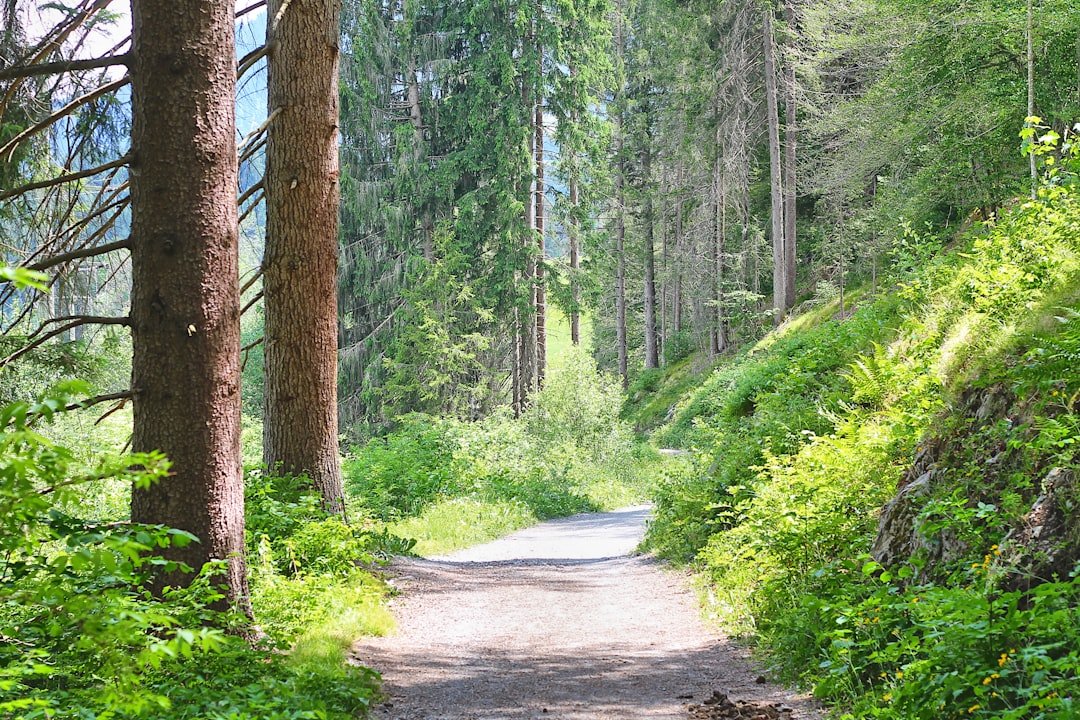
A scenic version continues from Caumasee toward Conn and the Il Spir viewing platform before reaching Crestasee. This follows the same landscape used by the official four-lake hike, which starts in the Flims Waldhaus area and links several lakes before returning to Flims.
If you only want to visit Crestasee, it can be faster to approach from the Trin side rather than walking all the way from Caumasee.
Traveling by Car
Driving gives you flexibility, but you cannot drive directly to either lakeshore. Plan to park and complete the final approach on foot.
Parking for Caumasee
The official Lake Cauma information lists paid parking in Flims Waldhaus. From the parking area, allow roughly 10 minutes to walk toward the Caumasee lift. If nearby spaces are full, additional parking is available around the Stenna underground garage and the event hall in Flims Dorf.
The free Caumasee lift normally saves about 80 vertical metres between the upper approach and lake level when it is operating. You can also continue on foot through the forest instead.
Parking for Crestasee
For direct access to Crestasee, drive toward Trin Mulin. The official Lake Cresta information says the route to parking areas 3 to 5 in the Flimser Grosswald is signposted from Trin Mulin. From those parking areas, allow about 20 minutes on foot to reach the lake.
Pro Tip: If you are walking from Caumasee to Crestasee, starting at Flims Waldhaus and using public transport can be easier than trying to return to the same parking space after a one-way walk.
Taking Public Transportation
Public transport works particularly well for this walk because you can enter the trail from one location and leave from another.
If you are coming from elsewhere in Switzerland, travel by train to Chur and continue toward Flims by PostBus. According to the official Flims Laax getting-there guide, the PostBus journey from Chur to the Flims Laax area takes under 40 minutes. Check your exact connection using SBB.
Best stop for Caumasee
Use the stop Flims Waldhaus Caumasee. The official lake information says it is about a 15-minute walk from the bus stop to the Caumasee lift. If you continue down through the forest instead of using the lift, allow additional walking time.
Best stop for Crestasee
For direct Crestasee access, take the bus toward Trin or Chur and get off at Trin, Felsbach-Crestasee. From there, the official estimate is about 15 minutes on foot to the lake.
You can also start from Trin Mulin, but the walk from that stop to Crestasee takes about 40 minutes.
Coming from Zurich Airport
If you arrive at Zurich Airport, use SBB to plan the train journey toward Chur, then continue by PostBus to Flims. Do not rely on a fixed connection written into an article because railway timetables and transfer patterns can change.
Cycling to the Starting Point
Cycling can work well if you are already staying in Flims, Laax, or nearby. Official Flims information describes forest-road approaches to Caumasee from Staderas, the Flims Waldhaus playground, and Flims Waldhaus Post. Crestasee can also be approached by bike through the Flims forest from Staderas toward Conn.
Remember that many paths in Graubünden are shared between hikers and cyclists. Slow down around walkers, give people enough room, and follow signs where local restrictions apply. Graubünden’s Fairtrail guidance promotes respectful sharing of the trail network.
If your main goal is to complete the route on foot, it is usually simpler to park or secure your bicycle before beginning the walking section rather than trying to ride every trail around the lakes.
Hiking from a Nearby Trail
There are several ways to turn Caumasee and Crestasee into either a short walk or a longer forest hike. The best option depends on your fitness, available time, and whether you want to return to Flims or finish near Trin.
| Option | Starting Area | Main Stops | Best For |
|---|---|---|---|
| Caumasee visit | Flims Waldhaus | Caumasee | A shorter outing |
| Caumasee to Crestasee | Flims Waldhaus | Caumasee, forest paths, Crestasee | Visiting both lakes |
| Scenic extended walk | Flims Waldhaus | Caumasee, Conn, Il Spir, Crestasee | Views and a longer hike |
| Official four-lake circuit | Flims Waldhaus area | Four lakes, Conn, Il Spir, Crestasee, Felsbach Gorge | A half-day hiking experience |
The official four-lake hike is 12.9 km, takes about 3 hours 40 minutes of walking, gains and loses about 333 metres, and is rated medium. It is a useful benchmark when deciding whether you want a complete circuit or only the shorter walk between the two best-known lakes.
Arriving by Boat
Boat transport does not apply to the Caumasee to Crestasee walk. These are inland mountain lakes, not stops on a navigable ferry route. Crestasee is officially described as accessible only on foot.
Both lakes may offer recreational activities on the water during their operating seasons. Caumasee has activities such as pedal boats and stand-up paddleboards, while Crestasee lists boat rental and stand-up paddling. These activities begin after you reach the lake and do not provide transportation to the trailhead.
Using a Shuttle Service
You do not need to book a special hiking shuttle just to reach Caumasee or Crestasee. Scheduled trains, PostBus services, local buses, and walking connections cover the main access points.
For Caumasee, use the Flims Waldhaus Caumasee stop. For a Crestasee exit or direct approach, use Trin, Felsbach-Crestasee when its connection fits your itinerary.
Always check the day’s connections in SBB before leaving, especially if you plan a one-way hike and are depending on public transport for the return journey.
Organized Tour Options
You do not need an organized tour for a normal Caumasee-Crestasee walk. The paths can be explored independently using official signs and a current hiking map.
If you prefer a structured experience, the region also offers seasonal walking experiences that use the same landscape. The official Flims Laax Forest & Water culinary trail, for example, travels through the Caumasee, Conn, Rhine Gorge, and Crestasee area.
An organized experience can be useful if food stops and a fixed itinerary appeal to you, but independent walkers have more freedom to shorten the route, spend extra time at a lake, or change plans if the weather changes.
Accessibility for People with Disabilities
Accessibility differs significantly between simple Caumasee access and the complete forest walk to Crestasee.
The official Caumasee information states that the approach from Flims Waldhaus can be used with a buggy and by wheelchair users. When operating, the free Caumasee lift removes about 80 metres of descent to lake level.
However, you should not assume that the entire Caumasee to Crestasee forest route is wheelchair-accessible. Longer routes include natural forest paths, gradients, and uneven surfaces. The official Forest & Water route through the area is also described as unsuitable for strollers.
Crestasee itself is reached on foot. Visitors with limited mobility should contact local visitor information before the trip and choose the access point that matches their needs rather than committing to the complete through-hike.
Note: If the Caumasee lift is important to your visit, verify its operating status on the official lake page. The current 2026 notice says renovation work will temporarily take it out of service beginning September 2.
Walking from Caumasee to Crestasee
1. Reach Flims Waldhaus
Arrive by bus or car in the Flims Waldhaus area. If using public transport, Flims Waldhaus Caumasee is the most useful stop when beginning with Caumasee.
2. Walk to Caumasee
Follow the signed forest approach toward Caumasee. Depending on the lift’s operating status and your preferred route, you can use the lift or continue down on foot.
3. Continue through the Flims forest
From Caumasee, follow official hiking signs toward Conn and Crestasee. If you have enough time, the Conn area is a natural place for a break.
4. Add the Il Spir viewpoint
For the more scenic version, include the Il Spir viewpoint near Conn. The official four-lake hiking route uses this area before continuing toward Crestasee.
5. Reach Crestasee
Continue through the forest to Crestasee. During the bathing season, you can stop at the natural bathing lake, restaurant, or kiosk when facilities are open.
6. Choose your return
You can continue through the Felsbach Gorge area toward Flims for a longer circuit, retrace part of your walk, or leave toward the Trin, Felsbach-Crestasee bus stop. The bus stop is about a 15-minute walk from Crestasee according to official local information.
Pro Tip: Download your route before entering the forest. The free swisstopo app includes official Swiss maps, hiking routes, public-transport information, and offline planning tools.
Facilities, Swimming, and Costs
Both lakes have seasonal facilities, but opening times can change with weather and season.
Caumasee
For the 2026 summer season, the official Caumasee page lists its public bathing facility as normally open daily from 8:30 a.m. to 5:00 p.m., subject to weather. As of August 16, 2026, visitor bathing admission is listed at CHF 18 for adults and CHF 9 for visitors up to age 16. Guest-card and local rates differ.
Caumasee also has restaurant and self-service food options. The restaurant can be accessed outside the public bathing area, so visiting the restaurant is not the same as buying a bathing ticket.
Crestasee
The official Crestasee page currently lists bathing admission at CHF 7 for adults, CHF 5 for adults with a guest pass, CHF 3 for children and school pupils ages 6 to 16, and free admission for children under six.
Crestasee has a guesthouse, kiosk, changing facilities, and seasonal water activities. Check current opening information before planning your day around a meal or swim.
What to Bring
- Supportive walking or trekking shoes.
- Water, even if you expect to stop at a restaurant.
- Weather-appropriate clothing and a light rain layer.
- Sun protection.
- A charged phone with the route downloaded for offline use.
- Swimwear if you plan to use the bathing facilities.
- A small snack if you are walking the longer route.
If you are preparing a picnic and can keep food properly chilled, the site’s homemade cottage cheese recipe can be part of a meal before or after the walk. For the trail itself, simple foods that are easy to carry are usually more convenient.
Safety and Route Planning
Check the weather, route conditions, and your planned return transport before starting. Forest trails can become slippery after rain, and seasonal conditions can change quickly.
The official four-lake route recommends trekking shoes, clothing suited to the weather, sun or rain protection, water, food if needed, and optional hiking poles.
You can use the free swisstopo app to view Swiss national maps, official hiking routes, cycling information, and public-transport details. Downloading the required map area before leaving is useful if mobile coverage becomes weak.
Be considerate on shared forest paths. Hikers and cyclists use parts of the same network, so stay alert around bends and give other users room.
At Caumasee, follow the posted lake rules. The official rules include a fire and barbecue ban around the Caumasee area and restrictions on dogs within the bathing area.
Frequently Asked Questions
What is the Caumasee to Crestasee walk?
It is a forest walk in the Flims area of Graubünden connecting two well-known mountain lakes. A scenic version can include Conn and the Il Spir viewpoint, while a longer official four-lake circuit also visits additional lakes and returns to Flims.
How do I get to Caumasee?
From Chur, travel toward Flims by PostBus and use the Flims Waldhaus Caumasee stop. From there, walk toward the lake or the Caumasee lift. Drivers can use paid parking in the Flims Waldhaus area and complete the final approach on foot.
How do I get to Crestasee?
You can walk to Crestasee from Flims through the forest or approach from the Trin side. The Trin, Felsbach-Crestasee bus stop is about 15 minutes away on foot. Drivers can follow signs from Trin Mulin toward designated forest parking and then walk about 20 minutes.
Is the Caumasee to Crestasee walk suitable for beginners?
Short approaches to the lakes can be manageable for casual walkers, but do not assume every version is an easy beginner walk. The official four-lake circuit that includes Caumasee and Crestasee is rated medium, covers 12.9 km, and takes about 3 hours 40 minutes.
Are there facilities or restaurants along the route?
Yes. Caumasee and Crestasee have seasonal food and bathing facilities, and Conn is another possible food stop on longer versions of the walk. Opening times can change by season and weather, so check before relying on a particular restaurant.
Can I take a stroller or wheelchair from Caumasee to Crestasee?
Do not assume the complete through-route is accessible. The official Caumasee approach from Flims Waldhaus is described as suitable for buggies and wheelchairs, but longer natural forest routes toward Conn and Crestasee include terrain that may not be suitable. Check current local accessibility information before setting out.
Can I cycle between Caumasee and Crestasee?
Bikes can use several forest-road approaches around the area, and official bike routes include both lakes. Follow local signs and shared-trail rules, slow down around pedestrians, and be prepared to walk or park the bike where cycling is restricted.
Can I reach Caumasee or Crestasee by boat?
No. Boats are recreational activities once you are at the lakes. They are not public transportation to the trailhead, and Crestasee is officially described as accessible only on foot.
Sources
- Flims Laax Falera: Lake Cauma – Caumasee access, public transport, parking, lift, facilities, current prices, and lake rules.
- Flims Laax Falera: Lake Cresta – Crestasee access, bus stops, parking approach, facilities, and current prices.
- Graubünden Tourism: 4-Lake Hike – official route length, walking time, difficulty, elevation, route sequence, and equipment guidance.
- Flims Laax Falera: Getting There – regional car and public-transport access through Chur.
- Swiss Federal Railways, SBB – current train and PostBus journey planning.
- Federal Office of Topography swisstopo – official maps, hiking-route information, and offline route-planning tools.