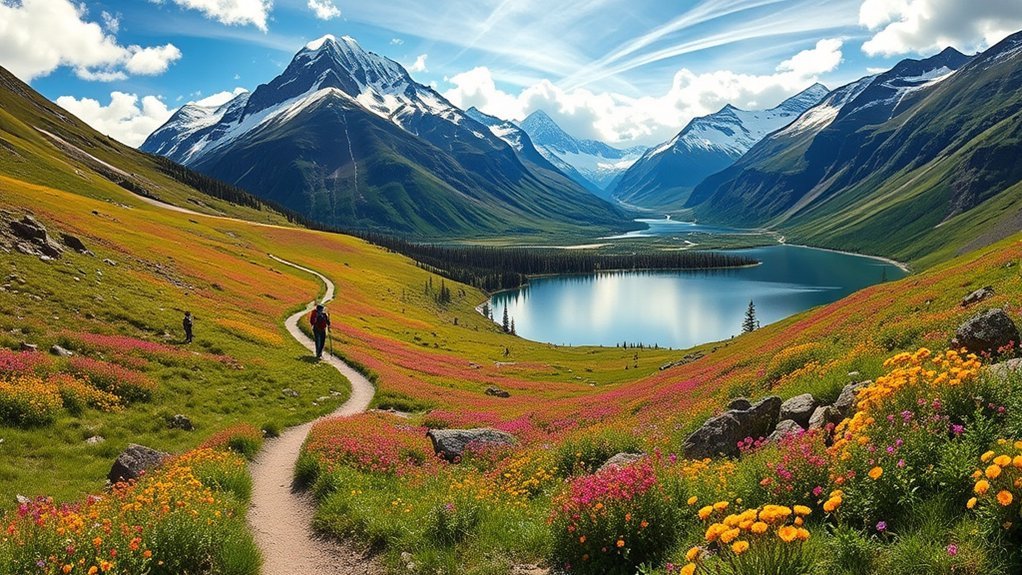
Hiking in Kobuk Valley National Park is unlike hiking in a developed national park. You will not find marked paths, trail signs, roads, bridges, or staffed facilities once you enter the backcountry. Instead, the park offers self-guided travel across sand dunes, tundra, riverbanks, forests, and remote mountain ridges.
Quick Answer
Kobuk Valley National Park has no maintained hiking trails. The best hiking is self-guided, cross-country travel at the Great Kobuk Sand Dunes, from the Kobuk River to the dunes, near Onion Portage, and in the Baird Mountains. Every trip requires air-taxi planning, strong navigation, backcountry skills, and full self-sufficiency.
Key Takeaways
- There are no maintained trails, roads, developed campgrounds, or visitor services inside Kobuk Valley National Park.
- The Great Kobuk Sand Dunes are the most practical destination for a day hike or overnight backcountry trip.
- The unmarked route from the Kobuk River to the dunes is approximately two to three miles each way and requires strong navigation skills.
- Most visitors reach the park by chartered aircraft from Kotzebue or Bettles.
- Carry navigation equipment, emergency communication, rain gear, insect protection, and everything needed to remain self-sufficient.
Are There Hiking Trails in Kobuk Valley National Park?
No maintained hiking trails exist within Kobuk Valley National Park. The National Park Service also provides no fixed route mileages, trail markers, bridges, shelters, or developed trailheads. Every hike is a cross-country route that you must plan around terrain, water, aircraft access, weather, and your own experience.
The lack of trails gives you unusual freedom, but it also removes many safeguards found in developed parks. Tundra can be wet, uneven, brushy, and much slower to cross than it looks on a map. River channels may change, mountain approaches can require long stretches through forest and soft ground, and aircraft pickup may be delayed by weather.
Warning: Kobuk Valley is advanced backcountry terrain. Cell phones do not work reliably in the park, help may be hours away, and poor weather can prevent aircraft from reaching you. Carry a satellite communicator, satellite phone, or personal locator beacon, and leave a detailed trip plan with someone who will report you overdue.
Note: The Noatak River is primarily within Noatak National Preserve, not Kobuk Valley National Park. Kobuk Valley’s main river corridor is the Kobuk River, and there is no official Noatak River Trail inside the park.
Best Hiking Areas at a Glance
| Hiking Area | Best For | Distance or Duration | Main Challenges |
|---|---|---|---|
| Great Kobuk Sand Dunes | First-time visitors, photography, day hikes, and camping | Several hours to several days; choose your own route | Loose sand, exposure, wind, heat, cold, and no marked route |
| Kobuk River to the Dunes | Experienced navigators seeking a defined objective | Approximately 2 to 3 miles each way; about 4 hours round trip | Tundra, brush, route finding, creek crossings, and slow travel |
| Onion Portage and Nearby Bluff | Scenery, cultural history, and possible fall wildlife viewing | Variable; no official measured trail | Private allotments, cultural sensitivity, wildlife, and river access |
| Baird Mountains | Experienced backpackers and ridge walkers | Usually a multi-day, custom route | Long approaches, limited landing areas, steep terrain, and changing weather |
| Kobuk River Base-Camp Hikes | Paddlers combining a float trip with short hikes | Variable out-and-back routes from camp | Unstable banks, wet tundra, bears, navigation, and changing water levels |
1. Explore the Great Kobuk Sand Dunes
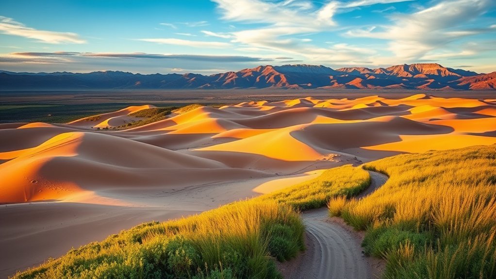
The Great Kobuk Sand Dunes are the park’s most recognizable landscape and the simplest place to arrange a hiking-focused visit. A wheeled aircraft may be able to land directly on the sand when conditions permit, allowing you to begin walking near your campsite or drop-off point.
There is no single route to follow. You can climb ridges, cross broad sandy flats, walk along the edge of the surrounding vegetation, or plan a loop using visible dune features. Hiking on firm, wind-packed sand may feel easy, while climbing loose slopes can require much more effort.
Because the landscape is open, it may appear easy to navigate. However, dune shapes repeat, cloud cover can reduce visual references, and changing light can make your return route difficult to recognize. Record your landing location, take a compass bearing, and save the coordinates in more than one navigation device.
Be cautious near streams, springs, and visibly wet sand. Water-saturated sections can lose stability and behave like quicksand. Test uncertain ground with a trekking pole and move away from areas where the surface looks unusually wet, soft, or unstable.
Pro Tip: Ask your pilot which dune features will remain easy to identify from the ground and agree on a precise pickup location before the aircraft leaves. Do not depend only on footprints, because wind can erase them.
2. Hike From the Kobuk River to the Great Kobuk Sand Dunes
Hiking from the Kobuk River to the dunes provides a more demanding alternative to landing directly on the sand. According to the National Park Service, the cross-country route is approximately two to three miles each way and normally takes about four hours round trip.
The short mileage can be misleading. There is no established path, and you may need to cross soft tundra, low vegetation, forest patches, creeks, and uneven ground. A straight line on a map may not be the safest or fastest line on the ground.
In Kobuk Valley, two or three cross-country miles can take several hours. Terrain and navigation matter more than the number shown on the map.
Study a topographic map before your flight and discuss the route with park staff and your pilot. Mark the river landing, the dune edge, possible creek crossings, and a firm turnaround time. Keep enough food, clothing, and emergency equipment to remain overnight if weather prevents pickup.
3. Explore Onion Portage and the Nearby Bluff
Onion Portage, known as Paatitaaq in Iñupiaq, lies along the Kobuk River and has supported Indigenous life and caribou harvesting for thousands of years. It remains a living cultural landscape rather than an abandoned historic attraction.
The north-bank area and nearby bluff can provide views across the river and toward the Jade Mountains. Around the fall migration period, visitors may have a chance to see caribou crossing the river, but timing and sightings are never guaranteed.
There is no measured public hiking trail. Coordinate access carefully, remain aware of private Native allotments, avoid disturbing archeological features, and respect local subsistence activities. Do not remove artifacts or enter cabins. The Giddings Cabin is not available for public use.
Note: Paatitaaq is culturally important to Iñupiat communities today. Give residents and subsistence users space, follow your pilot’s landing guidance, and ask the Northwest Arctic Heritage Center about current access considerations.
4. Plan a Baird Mountains Ridgeline Backpack
The Baird Mountains rise north of the Kobuk River and offer the park’s strongest option for experienced mountain backpackers. Once you reach higher, drier ground, walking may be firmer than it is on the wet tundra below.
Access is the main difficulty. Aircraft generally cannot land high on the ridges, so your pilot may need to leave you at a lower landing area or along the river. Reaching the mountains can require a long approach through tundra, brush, forest, and drainage channels before the climbing begins.
These are custom wilderness routes with no published trail mileage, campsites, or rescue infrastructure. Plan conservative daily distances, identify several possible camps, and avoid committing to terrain that would become dangerous in rain, low clouds, high wind, or early snow.
This option suits travelers who already have experience with multi-day, off-trail navigation in remote terrain. Less-experienced hikers should consider arranging a guided trip or limiting their visit to a pilot-supported dune excursion.
5. Take Short Hikes From a Kobuk River Base Camp
A float trip on the Kobuk River can be combined with short exploratory hikes from gravel bars or suitable camps. This approach lets you experience several parts of the valley without carrying a full backpack over every mile.
Potential walks include riverbank viewpoints, nearby tundra rises, forest edges, and open bluffs. Treat each trip as an unmarked out-and-back route. Record your camp location, watch for side channels, and do not assume that the bank will look the same when you return.
River levels and landing conditions can change. Gravel bars may flood, banks may collapse, and wet vegetation can hide uneven ground. Choose camps above obvious high-water marks and secure boats well away from rising water.
How to Plan a Kobuk Valley Hiking Trip
Arrange Air Access Before Finalizing Your Route
There are no roads into Kobuk Valley National Park. Most visitors first fly from Anchorage to Kotzebue or from Fairbanks to Bettles, then use an authorized air taxi to enter the park. Review the current NPS directions and transportation guidance before booking.
Discuss the following details with your pilot:
- Your group’s total weight, including food and fuel.
- The aircraft’s baggage and container limits.
- Whether the proposed landing surface requires wheels or floats.
- Your primary and backup drop-off locations.
- Your pickup date, location, and overdue procedure.
- How weather delays will be handled.
- Whether your communication device can reach the operator.
Build at least one weather-flexibility day into both ends of your schedule. Low clouds, wind, rain, smoke, and landing conditions may delay a flight even when conditions look acceptable elsewhere.
Carry Independent Navigation and Communication
The National Park Service recommends carrying topographic maps, a compass, and a GPS unit, and knowing how to use them. Do not depend on a phone app as your only navigation method. Cold, moisture, impact damage, and battery failure can disable electronics.
A suitable communication plan may include:
- A two-way satellite communicator or satellite phone.
- A registered personal locator beacon for life-threatening emergencies.
- Offline maps stored on two separate devices.
- A paper topographic map protected from rain.
- A baseplate compass.
- Spare batteries or a protected power bank.
- A written trip plan held by a trusted contact.
Pack for Full Self-Sufficiency
There are no stores, shelters, maintained toilets, or equipment-rental services inside the park. Carry everything required for the planned trip plus extra supplies for an aircraft delay.
- Waterproof jacket and pants.
- Warm insulating layers, hat, and gloves.
- Sturdy footwear suitable for wet tundra and loose sand.
- Topographic map, compass, GPS, and satellite communication.
- Tent capable of handling exposed wind.
- Sleeping bag and pad suitable for near-freezing nights.
- Reliable water-treatment equipment.
- Stove, fuel, food, and at least one extra day of meals.
- Bear-resistant food storage and odor-control bags.
- Insect repellent, head net, and clothing that covers exposed skin.
- Sunscreen, sunglasses, and a sun hat.
- First-aid supplies and any essential medication.
- Repair materials for tents, boats, packs, and footwear.
- Human-waste supplies appropriate for Leave No Trace travel.
Weather, Insects, and the Best Time to Hike
Most hiking and floating trips take place during summer or early fall, but no month guarantees easy conditions. The NPS weather guidance notes that summer can bring warm sunshine, near-freezing temperatures, snow, extended rain, clouds, and strong wind.
June
June offers long daylight, but the Kobuk River may still be frozen early in the month. Wet ground, lingering snow, and heavy insect activity can complicate travel.
July and August
July and August are generally the most practical months for river access and backcountry hiking. July can bring warm days and intense mosquitoes. Insects often begin to decrease during August, although black flies may remain active.
Early September
Early September can bring cooler temperatures, fewer mosquitoes, fall colors, and a possibility of seeing migrating caribou near Onion Portage. However, frost, snow, storms, and river ice become more likely as the month progresses.
Winter travel requires advanced cold-weather survival skills and specialized equipment. It should not be treated as a normal hiking trip.
Wildlife and Bear Safety
Kobuk Valley supports caribou, moose, grizzly bears, black bears, wolves, river otters, beavers, eagles, waterfowl, and many smaller animals. Sightings are possible, but wildlife is widely dispersed and should never be promised as part of a route.
Follow current park safety guidance and give every animal space. If an animal changes its behavior because of your presence, you are too close.
- Make your presence known in brush, near streams, and around blind terrain.
- Never approach a bear, moose, caribou, den, nest, carcass, or young animal.
- Keep food, garbage, toiletries, and other scented items out of your tent.
- Use a bear-resistant food container and keep a clean camp.
- Cook and store food away from your sleeping area.
- Carry bear spray where it is immediately accessible and understand airline transport restrictions before traveling.
- Use binoculars or a telephoto lens instead of moving closer.
Camping, Permits, and Leave No Trace
Kobuk Valley has no developed campgrounds or designated backcountry campsites. You must select a durable and safe location for your tent. The Great Kobuk Sand Dunes are a popular camping area, while river travelers often use suitable gravel bars or elevated ground.
No entry permit is required for an ordinary recreational visit. However, the National Park Service may require a special-use or commercial authorization for activities such as organized events, certain filming, commercial guiding, and some professional photography. Check the current permit guidance before departure.
Protect the park by following Leave No Trace practices:
- Camp on durable surfaces when possible.
- Avoid damaging vegetation at the edges of the dunes.
- Pack out all food, wrappers, and other garbage.
- Do not disturb cultural sites or remove artifacts.
- Keep soap and food waste out of rivers, streams, and lakes.
- Follow current park guidance for human-waste disposal.
- Avoid building new fire rings or cutting live vegetation.
Frequently Asked Questions
Are there marked hiking trails in Kobuk Valley National Park?
No. Kobuk Valley has no maintained trails, trail signs, developed trailheads, roads, or bridges. All hiking is cross-country, and visitors must create and navigate their own routes.
What is the best hike for a first visit?
A pilot-supported visit to the Great Kobuk Sand Dunes is the most practical choice. When landing conditions permit, you can begin hiking directly from the sand and choose a route that matches your available time and experience.
How difficult is the hike from the Kobuk River to the dunes?
The route is approximately two to three miles each way and takes about four hours round trip, according to NPS guidance. The difficulty comes from unmarked tundra, vegetation, creeks, uneven ground, and the need for accurate navigation.
What is the best time of year to hike in Kobuk Valley?
July and August are generally the most practical months for hiking and river access. Early September may bring fewer mosquitoes and possible caribou movement, but colder weather, frost, snow, and river ice become more likely.
Are there camping facilities inside the park?
No. There are no developed campgrounds, designated campsites, shelters, stores, maintained toilets, or staffed facilities inside the park. Backcountry visitors must carry all equipment and supplies and select their own campsites.
Do I need a permit to hike or camp?
No permit is normally required for an ordinary recreational visit, hike, or backcountry camping trip. Special events, certain filming and photography, organized activities, research, and commercial services may require authorization.
How do I reach Kobuk Valley National Park?
Most visitors fly from Anchorage to Kotzebue or from Fairbanks to Bettles, then charter an authorized air taxi into the park. Drop-off and pickup locations depend on the aircraft, weather, water levels, and landing conditions.
Are pets allowed in Kobuk Valley National Park?
The National Park Service currently lists the Great Kobuk Sand Dunes activity as allowing pets with restrictions. Confirm current rules with the Northwest Arctic Heritage Center before traveling. Consider aircraft limits, bears, caribou, insects, river crossings, paw injuries, and the lack of veterinary care before bringing a pet.
Does cell service work in the park?
Do not plan on having cell service in the backcountry. Carry a satellite communication device or satellite phone, and consider a personal locator beacon for life-threatening emergencies.
Conclusion
The best hikes in Kobuk Valley National Park are not named trails. They are carefully planned cross-country journeys through the Great Kobuk Sand Dunes, along the Kobuk River, near Onion Portage, and into the Baird Mountains.
The freedom to choose your own route is part of what makes this park remarkable, but that freedom comes with responsibility. Arrange reliable transportation, prepare for delayed flights, carry independent navigation and emergency communication, and choose a route that matches your real backcountry experience. With careful planning, Kobuk Valley can offer one of the most remote and memorable hiking experiences in the national park system.
Sources
- National Park Service: Great Kobuk Sand Dunes — dune access, river-to-dunes distance, navigation, camping, and water-saturated sand hazards.
- National Park Service: Backpacking in Kobuk Valley — Baird Mountains, Onion Portage, wildlife, camping, and trail-free travel.
- National Park Service: Directions — access through Kotzebue or Bettles, air taxis, river travel, and winter access.
- National Park Service: Safety — navigation, wildlife, insects, hypothermia, and self-sufficiency.
- National Park Service: Weather — summer temperature ranges, rain, snow, wind, exposure, and hypothermia risk.
- National Park Service: Permits and Reservations — entry rules and activities that may require special authorization.