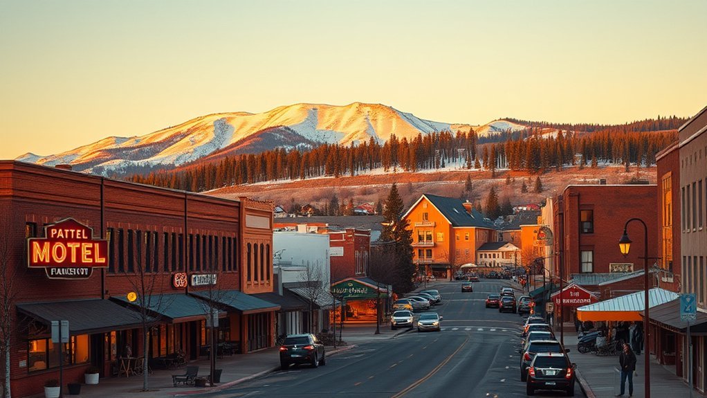
Close to urban heat and wide-open desert, you’ll find surprisingly varied hikes that test different skills and senses. You’ll walk river trails shaded by cottonwoods, scramble rocky switchbacks for skyline views, or follow quiet sand tracks under big sky. Each option has its own rhythm, hazards, and rewards, so keep your water, sun protection, and a map handy—you’ll want to pick the right trail for the kind of day you’ve got.
Colorado River State Historic Park Trails
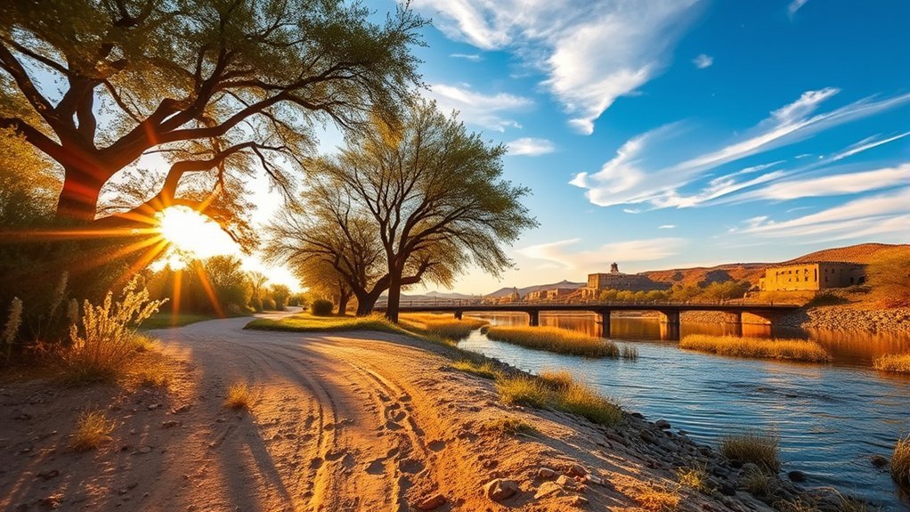
Step onto the Colorado River State Historic Park Trails and you’ll immediately feel the river’s history underfoot — short, well-marked loops trace old levees, historic railroad grades, and shaded cottonwood groves, giving you close-up views of interpretive exhibits, restored riverboats, and abundant birdlife along the riverbank. You’ll follow compacted dirt and gravel paths that loop 0.5–1.5 miles, so you can tailor your outing to time and energy. Along the way, interpretive panels explain steamboat commerce, river engineering, and local ecology; you’ll spot nesting herons, kingfishers, and occasional raptors in the riparian canopy. Benches and shaded spots offer rest and photography opportunities; trails are stroller- and pet-friendly on leash. Wear sun protection and sturdy shoes for uneven surfaces near water. Peak bird activity is early morning; interpretive staff often lead brief talks or demonstrations on site. The trails provide a compact, educational, and low-effort riverside hike that connects you directly to Yuma’s riverine past and present.
Gateway Trail at Yuma East Wetlands
The Gateway Trail at Yuma East Wetlands welcomes you with a flat, well-maintained path that winds through marshy ponds, tamarisk stands, and desert scrub—perfect for birding, casual walks, and easy bike rides. You’ll find clear signage, benches, and shady spots where you can pause and scan for herons, egrets, and migratory songbirds. The trail loops gently, so you can choose a short outing or extend your route along connected paths without encountering steep grades. Expect interpretive kiosks that explain wetland ecology and seasonal water management, which helps you appreciate how this green corridor supports wildlife in the desert. Wear sun protection and bring water; temperatures climb quickly, but morning and late-afternoon visits are pleasant. Dogs on leash are allowed, and the firm surface handles strollers and hybrids. Parking is limited during peak times, so arrive early on weekends. The Gateway Trail offers a low-effort, high-reward nature experience close to Yuma’s urban edge.
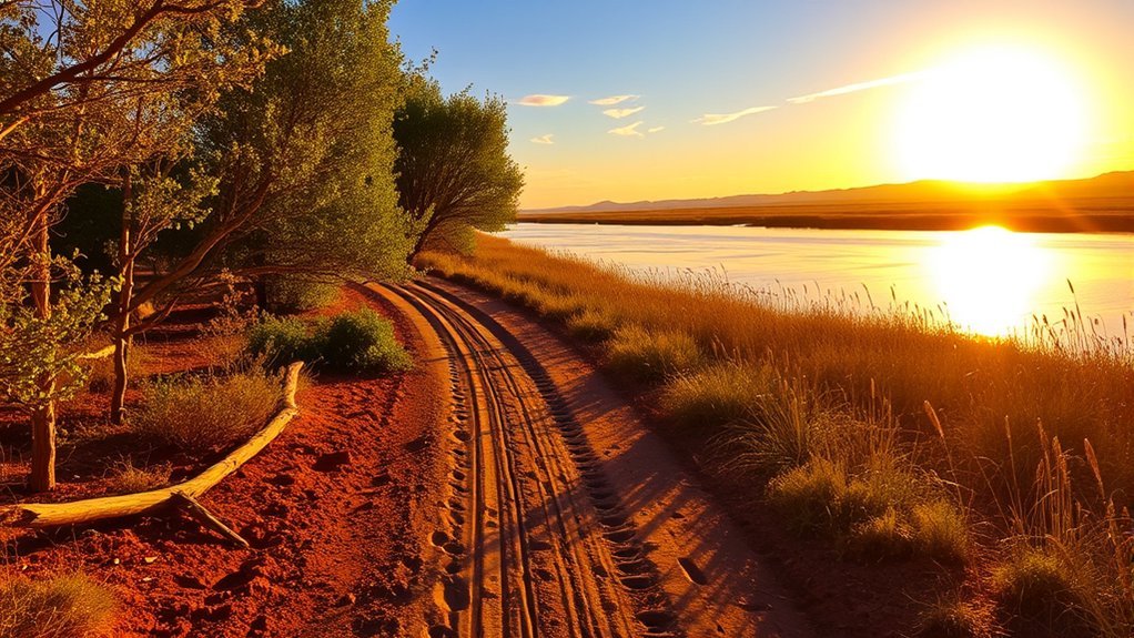
Martinez Lake Loop
From the wetlands you’ll head east toward Martinez Lake, where a loop trail skirts sandy shores and low dunes, offering wide water views and easy beach walking. You’ll follow a roughly 3- to 4-mile loop that stays mostly flat, so you can set an easy pace and focus on the landscape. Early morning or late afternoon brings cooler temperatures and better light for photographing shorebirds, terns, and occasional herons. The trail surface alternates packed sand and hardpan; expect some soft spots near the waterline and a few brief stretches of loose dune sand. Carry water, sun protection, and footwear you don’t mind getting sandy. There are limited shade spots and no services along the loop, so plan accordingly. You’ll find several informal pullouts for picnics and fishing access if you want to pause. Wildlife viewing and quiet lakeside walking make this loop a relaxed escape from the busier trails near Yuma.
Mittry Lake Nature Path
Bordering a broad marsh, Mittry Lake Nature Path gives you an easy, well-marked stroll through riparian habitat where cottonwoods and tamarisk shade a mix of boardwalk and packed-earth trail. You’ll follow turns that reveal marsh edges, open water and shallow channels where shorebirds feed. Benches and interpretive signs let you pause and ID plants and migrating species; bring binoculars in spring and fall. The trail is flat and family-friendly, good for strollers and short outings; mornings bring cooler air and more wildlife activity. Watch for mud near side channels after rains and expect mosquitoes in summer evenings. Parking is limited, so arrive early on weekends. Dogs on leash are allowed. The path’s modest length makes it ideal for a quick nature break without committing to a long hike.
| Feature | What to expect |
|---|---|
| Length | Short loop, under 2 miles |
| Surface | Boardwalk + packed earth |
| Wildlife | Waterfowl, herons, songbirds |
| Access | Small lot, restroom nearby |
Telegraph Pass and Union Pacific Bridge Viewpoints
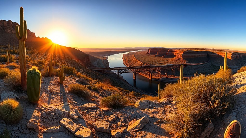
Climb up Telegraph Pass for sweeping views and then pause at the Union Pacific Bridge overlook to watch trains thread the Colorado River corridor—you’ll get panoramic desert ridgelines, rugged rock formations, and a striking human-made contrast where rails cross the water. You’ll follow a steep, well-worn trail that rewards you with layered vistas, sun-baked boulders, and wide sky. The overlook is compact but dramatic; binoculars bring distant barges and train cars into crisp focus. Pack water, sun protection, and steady shoes—trail sections are rocky and exposed. Time your visit for morning or late afternoon light; shadows carve the terrain and temperatures are kinder.
Climb Telegraph Pass to the compact Union Pacific Bridge overlook—steep trail, panoramic ridgelines, trains threading the Colorado River.
- Wind-scoured ridgelines stepping down to the river.
- Jagged volcanic and metamorphic rock faces up close.
- The linear geometry of the Union Pacific Bridge against natural curves.
- Trains and river traffic punctuating the quiet desert soundscape.
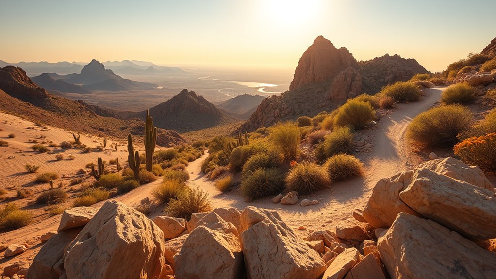
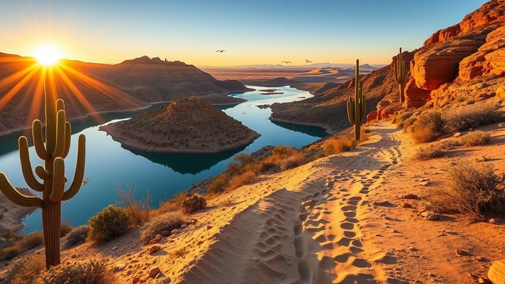
Dome Rock Mountain Trail
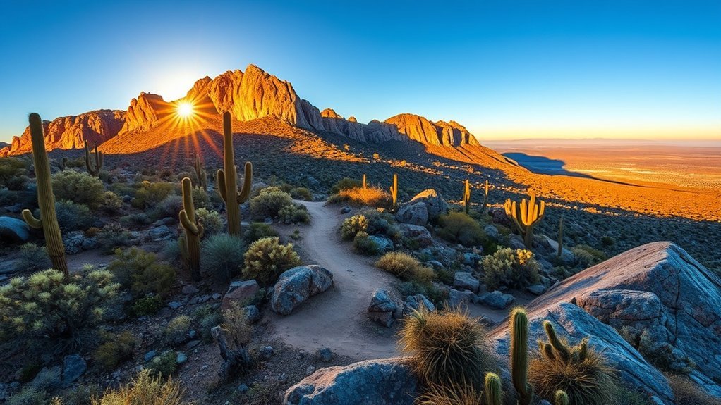
You’ll find the Dome Rock Mountain Trail offers steep switchbacks, rocky footing, and panoramic views of the desert and Colorado River basin. Bring sturdy shoes, plenty of water, sun protection, and start early to avoid midday heat. Expect a strenuous out-and-back hike with rewarding summit vistas if you stay prepared and pace yourself.
Trail Overview
If you’re looking for a short but rewarding hike, the Dome Rock Mountain Trail delivers steep switchbacks, granite outcrops, and sweeping desert views in about 2.5 miles round-trip. You’ll gain elevation quickly, moving from sandy wash to rocky spine as the trail narrows; expect exposed sections with panoramic vistas of the surrounding desert and distant mountains. The path is well-defined but uneven, so you’ll pick your footing among boulders and packed dirt. Seasonal wildflowers and creosote scent the air after rains, while sun and wind dominate most days. Wildlife sightings are common but fleeting. Below are visual highlights to set expectations:
- Jagged granite fins catching late-afternoon light.
- Cactus clusters dotting steep slopes.
- Wide valley views from ridge points.
- Compact summit plateau with skyward views.
Hike Tips
After enjoying the ridgeline views and granite fins, get ready for a few practical tips to keep the outing safe and smooth. Start early to avoid heat and glare; temperatures spike fast and shade is sparse. Wear sturdy shoes with good traction for loose gravel and occasional scrambling. Bring 2–3 liters of water per person and sip frequently—electrolytes help on longer outings. Apply sunscreen, wear a hat and sunglasses; granite reflects sun intensely. Use trekking poles for balance on descents and when negotiating boulder fields. Check the weather and cell coverage; storms and flash floods can develop quickly. Pack a basic first-aid kit, map or GPS, and a flashlight. Leave no trace: pack out trash and respect fragile desert plants and wildlife.
Gila Bend Riparian Trail
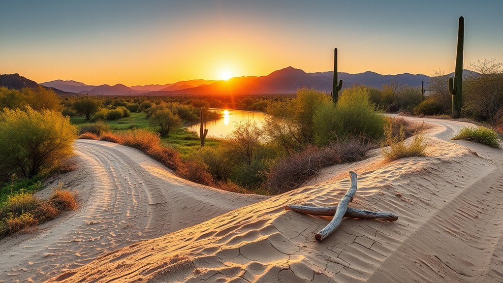
A short, shaded walk along the Gila Bend Riparian Trail shows you a surprisingly green side of the desert, with cottonwoods and mesquites lining a narrow ribbon of water that attracts birds and wildlife. You’ll follow a flat, easy path that’s ideal for a reflective morning stroll or a quick nature break. The trail’s pocket of shade and steady breeze feel strikingly cool against the surrounding arid landscape. You can spot warblers, herons, and occasional rabbits while listening to rustling leaves and trickling water. Benches and interpretive signs make it user-friendly and informative.
- Dappled sunlight through cottonwood leaves.
- A narrow stream with reflective pools.
- Mesquite silhouettes against bright sky.
- Small birds flitting between branches.
Bring water, sun protection, and binoculars. The loop is short enough for families and accessible hikers, but rewarding if you slow down and watch for subtle desert life concentrated along this green corridor.
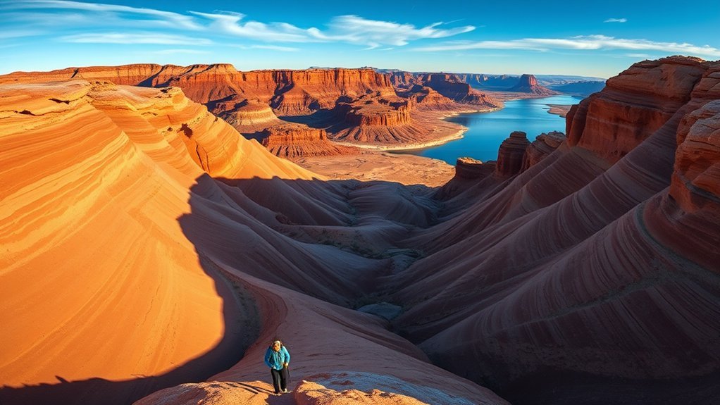
Kofa National Wildlife Refuge — Palm Canyon Trail
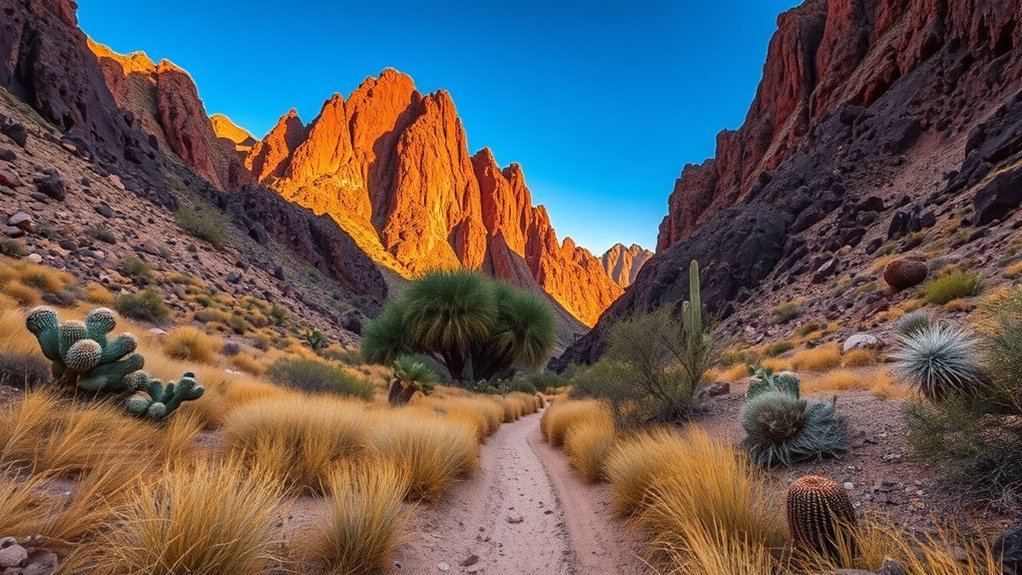
Often surprisingly cool for the Sonoran, the Palm Canyon Trail drops you into a shaded grotto where native California fan palms cluster around a seasonal spring, offering a rare, ancient-feeling oasis in the Kofa Wilderness. You’ll park at a small pullout, grab water and a hat, and follow a well-marked wash that climbs and dips through volcanic boulders. The round-trip is about 4 to 6 miles depending on how far you push beyond the palms; terrain is rocky with loose scree in sections, so steady shoes and trekking poles help. Wildlife sightings are common — bighorn tracks, peregrine perches, and desert songbirds — but the palms themselves are the highlight: fragrant, cool shade and a pool after rains. There are few facilities, so plan for no services, carry at least a liter per hour in heat, and leave no trace. Aim for morning or late afternoon to avoid peak sun and to experience the canyon’s quiet light.
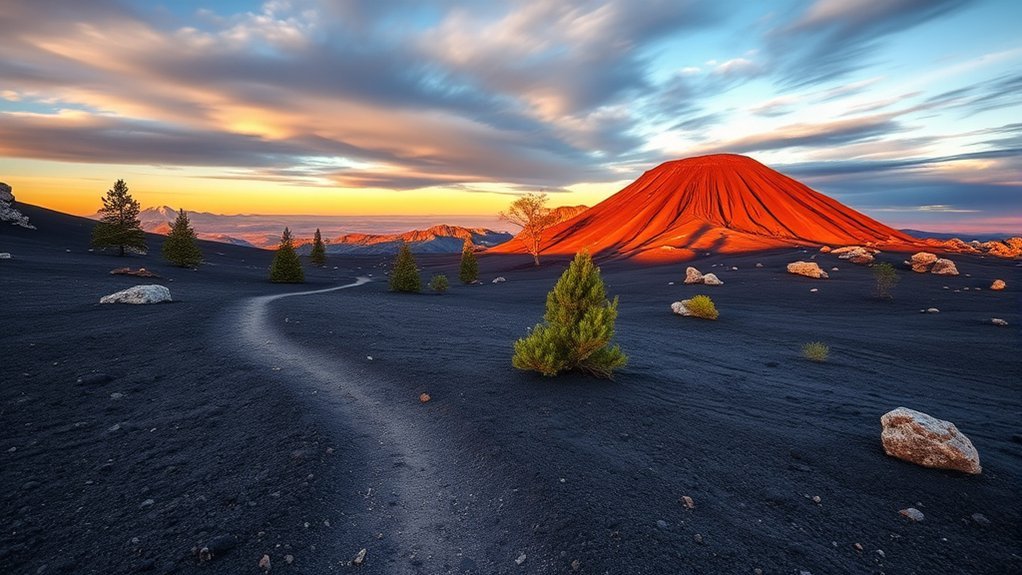
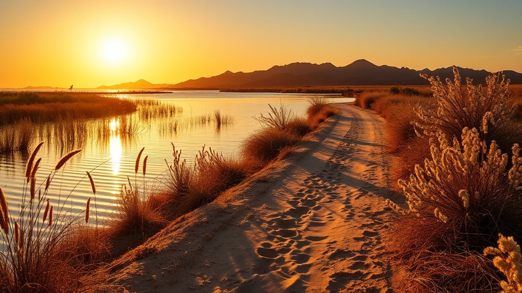
Imperial Sand Dunes Edge Walk
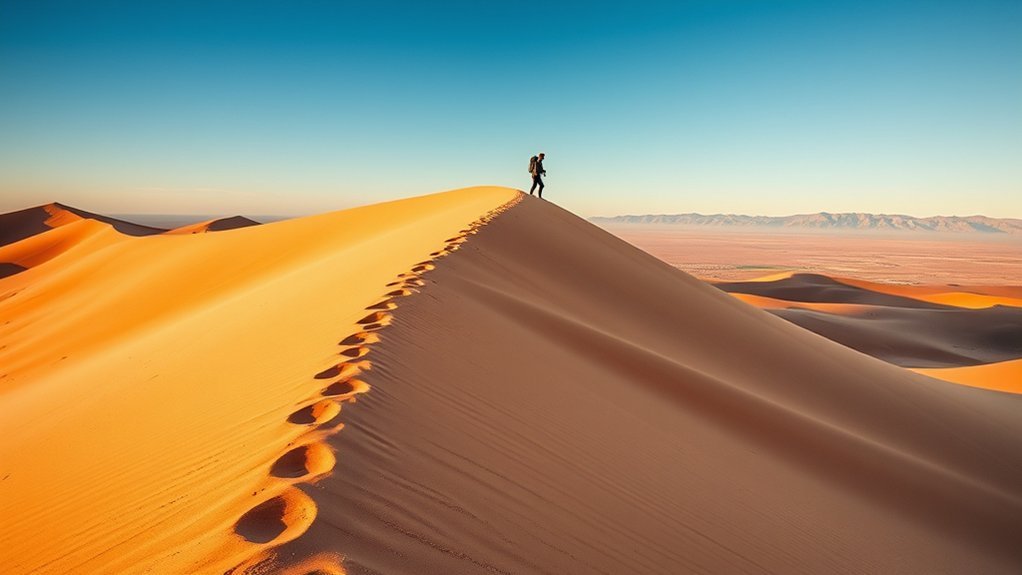
Wind-carved ridges trace the skyline as you walk the Imperial Sand Dunes edge, where compacted crust gives way to soft, shifting sand and wide desert views. You’ll move along a flat, firm rim that’s easier on your feet than the interior drifts, watching textures change with each step. Morning and late afternoon light sharpen dune contours; midday flattens them. Bring sun protection, sturdy shoes, and plenty of water—there’s no shade. You’ll hear wind and distant engines, smell creosote, and see a vast, minimalist landscape that feels both ancient and active.
- Hard-packed edge underfoot, then sudden soft slopes dropping into sweeping hollows.
- Long, serrated dune silhouettes against a big western sky at sunset.
- Scattered desert shrubs and occasional tracks of small mammals and birds.
- Wide-open views toward the Colorado River valley and distant mountain ranges.
Stay aware of changing surface conditions and avoid deep sand unless you’re prepared to bushwhack.
El Camino Del Diablo Backcountry Route
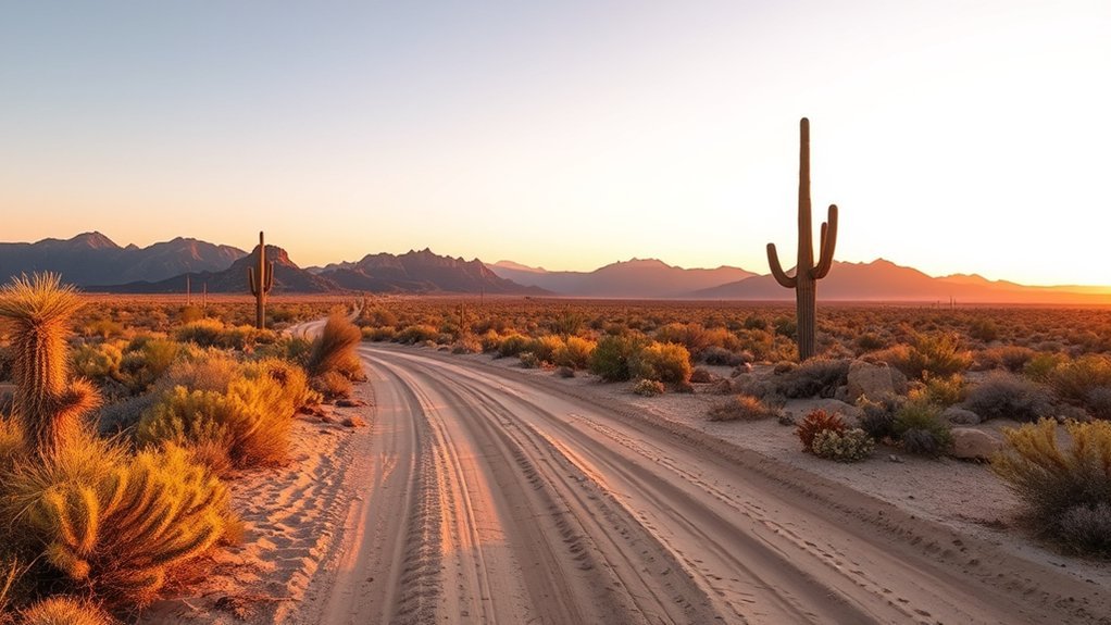
Following ancient footsteps, you’ll traverse El Camino Del Diablo where a rugged backcountry track threads stark desert, rocky washes, and sunbaked flats that demand preparation and respect. You’ll follow an old travel corridor that crosses miles of fragile terrain; landmarks are sparse, so you’ll rely on a detailed map, GPS, and route markers where present. Temperatures soar; you’ll carry ample water (one gallon per person per 4–6 hours minimum), sun protection, and a first-aid kit. Vehicles with high clearance and four-wheel drive help access trailheads, but many sections are best hiked or daypacked from roadside pullouts. You’ll note historic artifacts, desert flora like creosote and ironwood, and occasional wildlife—observe from a distance. Plan trips in cooler months, notify someone of your itinerary, and check for border or land access restrictions. You’ll respect private property and cultural sites, pack out all waste, and accept that this route rewards self-reliance and keen navigation more than marked trails or facilities.
Frequently Asked Questions
Are There Guided Tours Available for Any of These Trails?
Yes — you can join guided hikes and ranger-led tours on several nearby trails; local outfitters and visitor centers run seasonal guided trips, birding walks, and historical tours, so check schedules, book early, and pack water and sun protection.
What Permits Are Required for Backcountry Routes Like El Camino Del Diablo?
You need a permit from the Bureau of Land Management for El Camino del Diablo, plus a vehicle permit if driving, and desert safety registration; you’ll also follow border-area restrictions, so check current BLM and local requirements before heading out.
Are Dogs Allowed on These Hikes and Are There Leash Rules?
You can bring dogs on most trails, but they’ve got to be leashed and under control; exception routes like El Camino del Diablo may restrict pets for safety. Carry water, watch heat, and pack out pet waste.
What Are the Nearest Medical Facilities for Emergencies?
The nearest emergency options are Yuma Regional Medical Center (downtown, Level III trauma), Yuma Regional Medical Center Emergency Department, and small urgent cares; carry a map, call 911 for severe trauma, and keep cell reception and directions handy.
Which Trails Are Suitable for Mountain Biking or Horseback Riding?
You’ll find La Milagrosa Wash and the River’s Edge trails suitable for mountain biking, while Martinez Hill and Telegraph Pass have equestrian-friendly routes; carry water, check trail conditions, and avoid midday heat for safer, more enjoyable rides.
Conclusion
You’ve seen trails from shaded riverside loops to sand-swept backcountry; now test a rumor: can a single day cover both cottonwood shade and dune silence? Yes—with an early Colorado River stroll, a midday Telegraph Pass climb, then a late drive to the Imperial Sand Dunes’ edge you’ll taste each landscape. Pack sun protection, two liters minimum, and a map; you’ll finish knowing Yuma’s hikes aren’t just diverse — they’re doable.