The park unfolds like a well-worn map, its trails inviting you to explore at your own pace. You’ll find flat, riverside paths for easy strolls and shady cottonwood groves for quiet birdwatching, plus steeper routes that reward you with wide valley views. Practical tips on access, trail combinations, and seasonal conditions will help you pick the right hike — and plan the rest of your day.
Getting to the Trails: Park Access and Parking
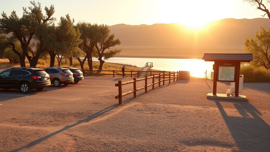
When you arrive at Dead Horse Ranch State Park, head for the main entrance off State Route 89A — it puts you closest to the trailheads and the staffed visitor center where you can grab a map and ask about current trail conditions. From there, you’ll find clear signage directing you to dispersed and designated parking options near Cottonwood and Sycamore day-use areas. Parking fills early on weekends, so plan to arrive at first light or use the overflow lot and walk a short connector trail. Trail accessibility varies: some loops are firm, wide, and suitable for strollers or mobility aids, while others are narrow with rocky tread. Check the map, pick routes that match your ability, and carry water and sun protection.
Verde River Trail: Riverside Strolls and Birding
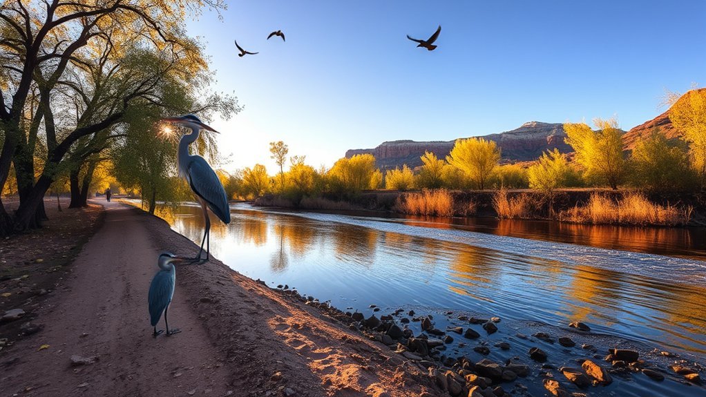
The Verde River Trail follows the river’s edge through cottonwood groves and willow thickets, giving you easy, mostly flat walking with plenty of spots to pause and watch birds or dip your toes. You’ll find clear signage, benches and shady stretches ideal for morning or late-afternoon outings. Binoculars help you pick out common bird species — kingfishers, herons and warblers — and seasonal migrants boost diversity. Stay on the path to protect riparian plants and nests; practice quiet observation and basic trail etiquette like packing out trash and keeping dogs leashed. The soft river sounds and frequent wildlife sightings make this a restorative, low-effort hike. Bring water, sun protection and a field guide to enrich your stroll.
Black Bridge Loop: Easy Family-Friendly Circuit
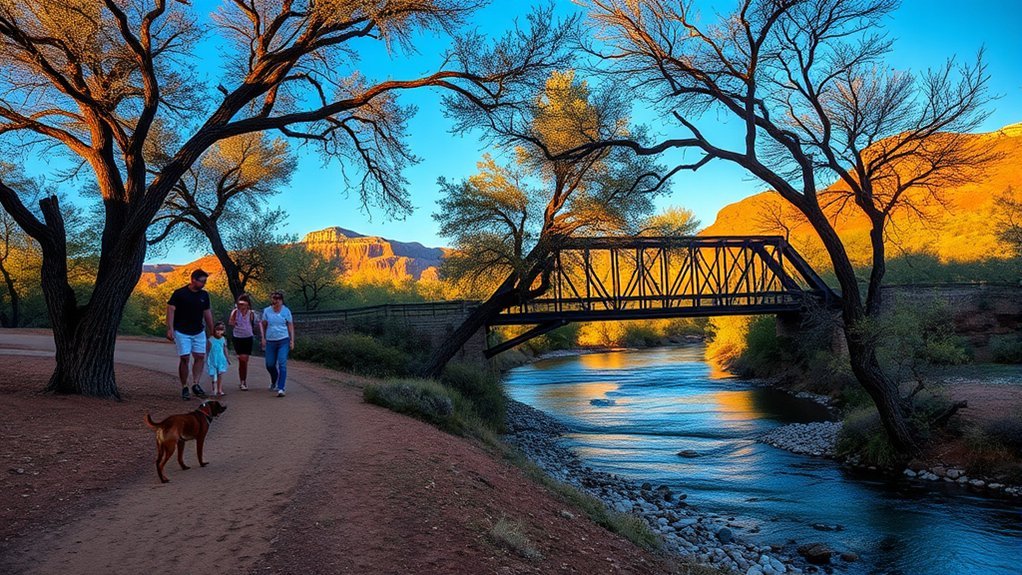
You’ll find the Black Bridge Loop is an easy, well-marked circuit of packed dirt and gentle grades that’s perfect for strollers and first-time hikers. Keep your eyes open for songbirds, herons along the water, and the occasional mule deer that graze near the trail edges. Several shaded picnic tables and restroom facilities near the trailhead make it an ideal spot to pack a lunch and linger.
Trail Description and Terrain
A gentle loop winds across packed dirt and crushed gravel, offering easy footing for strollers and little hikers while hugging the Verde River’s shady banks. You’ll follow a mix of trail types — singletrack near riparian edges, wider multiuse paths by picnic areas, and a short boardwalk over marshy spots — all clearly signed. Terrain features are low-gradient slopes, occasional exposed roots, and well-graded switchbacks that keep elevation changes gentle. Surfaces drain well after rain, though some sandy patches collect near river access points. Benches and shady cottonwoods punctuate the route so you can rest. The loop’s compact distance and forgiving ground make it ideal for families, beginners, and anyone wanting an easy, scenic stroll.
Wildlife and Birdwatching
When you stroll the Black Bridge Loop, keep your binoculars ready—shade from cottonwoods and riverside reeds concentrates songbirds, waterfowl, and occasional raptors into viewable corridors. You’ll spot common bird species like willow flycatchers, white-crowned sparrows, and herons, plus kingfishers zipping along the river. Move slowly, listen for calls, and scan branches and reed edges; mornings and late afternoons are best. For wildlife photography, bring a telephoto lens and steady hands or a monopod to capture shy subjects without disturbing them. Keep to the path, avoid sudden movements, and let children observe quietly. Note tracks, nests, and feeding areas but don’t touch. Respecting habitat gives you clearer sightings and preserves the park’s wildlife for others.
Picnic Spots and Facilities
After watching birds along the river, bring your group to one of the shady picnic groves that line the Black Bridge Loop—several tables and grills sit beneath cottonwoods near the water, offering easy access and pleasant views. You’ll find several designated picnic areas spaced along the route, each with sturdy tables and metal grills for simple meals. The sites sit close to the trail so you won’t carry gear far, and surfaces are level for strollers or wheelchairs. You’ll appreciate nearby restroom facilities at the trailhead and mid-loop, stocked seasonally and clearly signed. Pack out trash, secure food from wildlife, and use provided grills. These practical conveniences make the loop ideal for families looking for a relaxed, scenic outdoor lunch.
Floating Island Trail: Cottonwood Grove Walk
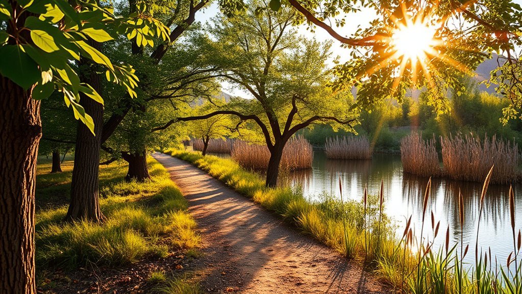
Cottonwood Grove welcomes you with a cool, shaded stroll along the Floating Island Trail, where towering cottonwoods filter sunlight and the Verde River murmurs nearby; you’ll find easy footing, frequent benches, and plenty of photo-worthy river views that make this section ideal for families and casual walkers. You’ll follow a mostly flat path that feels like a floating island of green amid arid terrain, with clear trail markers and short spur paths to quiet river overlooks. Trail highlights include interpretive signs about riparian habitat, birdwatching opportunities, and convenient restroom access at nearby trailheads. Wear comfortable shoes, bring water, and plan for slow pauses to enjoy songbirds and reflections. Dogs are allowed on leash; pack out waste.
Mesquite Creek Path: Desert Flora and Wildflowers
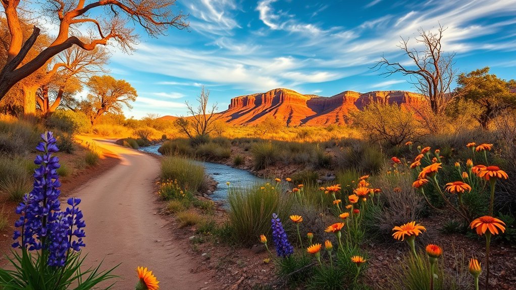
Step off the shaded cottonwoods and head toward Mesquite Creek Path, where desert sunlight and a quieter, more open landscape reveal a vivid tapestry of creosote, mesquite, and seasonal wildflowers. You’ll notice how the desert ecosystem shapes plant spacing and bloom timing; practice wildflower identification by looking for color, leaf shape, and bloom height. Stay on the trail to protect fragile seedlings and minimize impact. Bring water, a field guide, and a loupe for close inspection of petals and seed pods. Photographs with a scale help later ID. Expect low shrubs, occasional cactus, and bursts of color after rains. Use the table below to orient yourself to common sights.
| Plant | Characteristic |
|---|---|
| Creosote | Resinous smell, small yellow flowers |
| Mesquite | Feathered leaves, bean pods |
| Prickly Pear | Flat pads, vivid blooms |
| Desert Marigold | Bright yellow, daisy-like petals |
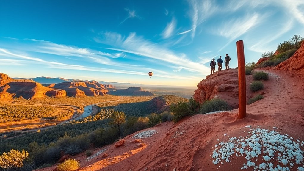
Sycamore Canyon Spur: Short Hike With Scenic Overlooks
Start at the small trailhead parking off the main loop where you’ll find room for a few cars and a clear sign for Sycamore Canyon Spur. You’ll climb a short, rocky grade to several overlooks that frame the Verde River corridor and red-rock ridgelines—perfect spots for photos or a quick rest. The footing is uneven but the route is brief and suitable for most hikers comfortable with short ups and some loose gravel.
Trailhead and Parking
If you arrive early, you’ll find the Sycamore Canyon Spur trailhead just off the main Dead Horse Ranch parking lot, with a small pull-through area and a few marked spots for cars and trailers. You’ll see a kiosk with trail maps and a bulletin about parking fees and seasonal rules; take a photo of the map before you go. The lot is compact, so if it’s full, you can park in the adjacent overflow area and walk a short distance to the signed access point. There’s space to unload bikes or stow a daypack safely, and the trailhead surface is firm for easy footing. Keep valuables out of sight, obey posted rules, and be ready to start your short, scenic walk.
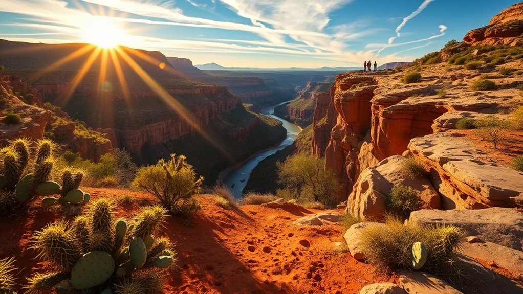
Scenic Overlook Spots
Want a quick payoff for minimal effort? The Sycamore Canyon Spur delivers immediate scenic overlook spots that reward you with big views and excellent overlook photography opportunities. You’ll reach several vantage points that frame the Verde River corridor, cottonwoods, and distant mesas — ideal for sunset vistas.
- First small overlook: wide bench rock with river glimpse, great for golden-hour shots.
- Mid-trail ridge: layered red rock and valley lines, good for framing silhouettes.
- East knob: unobstructed mesa views, bring a polarizer for vivid skies.
- Final spur: picnic-worthy ledge facing west, perfect for sunset vistas and packing up gear.
Pack water, a lightweight tripod, and a camera; stay aware of edges and other hikers while you savor the views.
Terrain and Difficulty
The Sycamore Canyon Spur is a short, moderately easy out-and-back that gives you big views without demanding technical gear or a long day. You’ll follow well-defined trails with occasional rocky paths that require steady footing; sturdy shoes with good tread make the walk more comfortable. Expect gentle elevation changes rather than sustained climbs, so your heart rate will rise in short bursts but you won’t need trekking poles unless you prefer them. The surface alternates packed dirt, small stones, and exposed roots, so watch your step where the trail narrows along ridgelines. Because the route is brief, you can savor overlooks and turn back if conditions change. Bring water, sun protection, and a light jacket for breezy summits.
Grassland Loop: Open Views and Wildlife Viewing
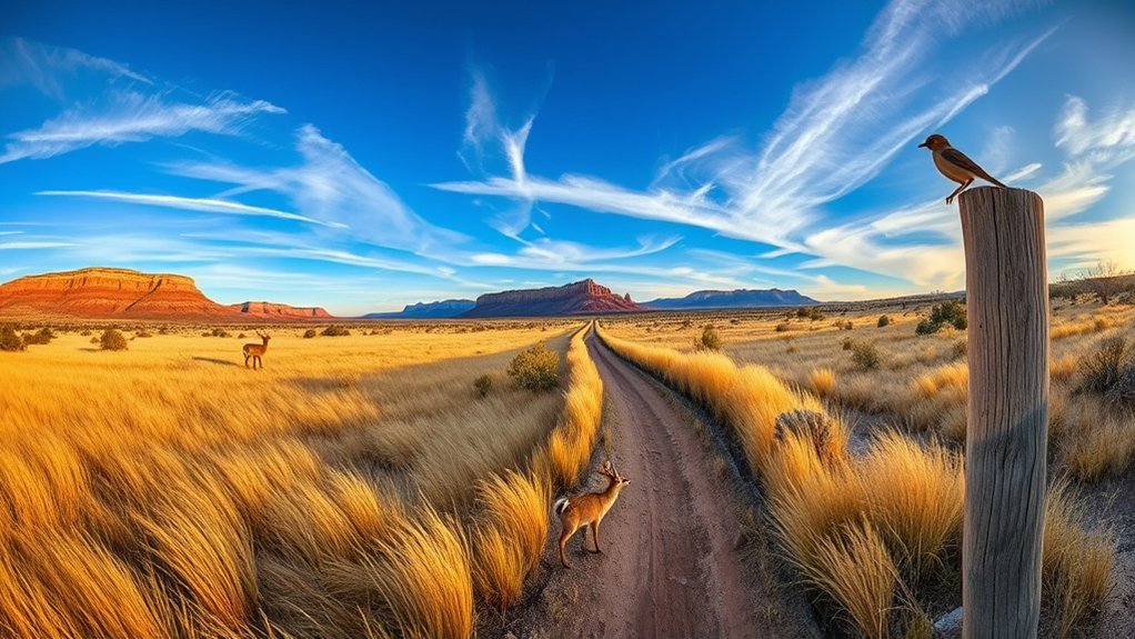
Though the loop’s gentle trail winds through wide, sun-drenched meadows, you’ll feel immersed in open sky and long sightlines that make spotting wildlife easy and rewarding. You’ll move steadily on soft soil, scanning for birds, deer, and coyotes while you practice wildlife photography or simply enjoy scenic vistas unfolding around you. The loop is flat and accessible, so you can stop often without losing momentum.
Though the gentle loop winds through sun-drenched meadows, it offers open skies, easy wildlife viewing, and steady, accessible walking.
- Bring a telephoto lens or binoculars for close, noninvasive views.
- Time your walk for golden hour to get richer colors and active animals.
- Wear layered clothing and sun protection; shade is sparse.
- Leave no trace: pack out trash and keep dogs leashed to protect nesting birds.
This route rewards patience and quiet observation.
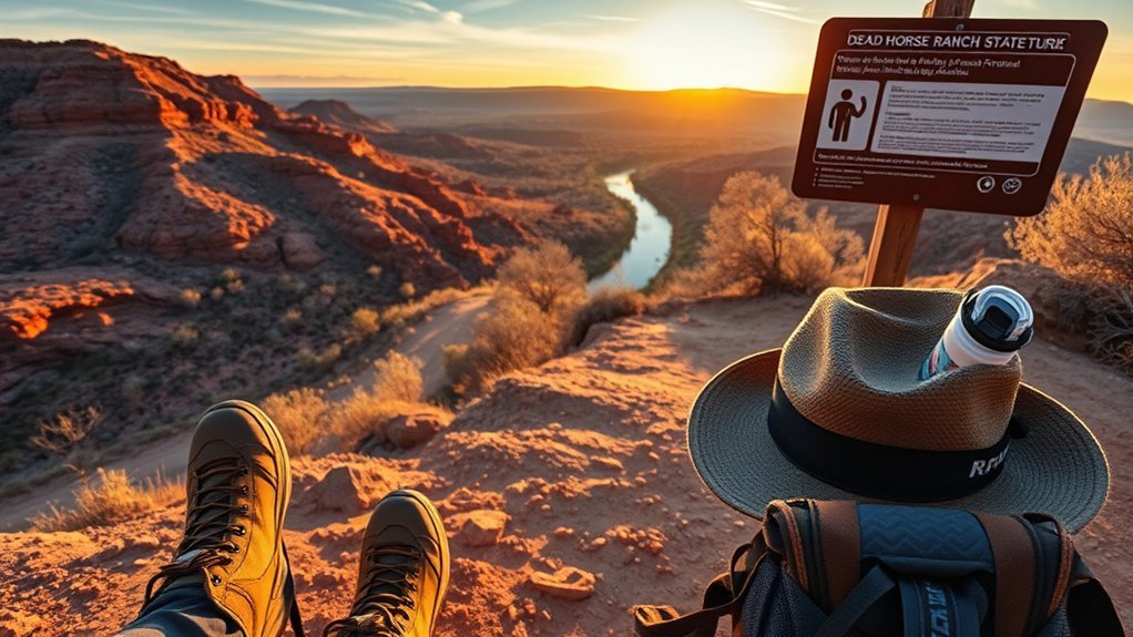
Hillside Ridge Trail: Steeper Climbs and Panoramas
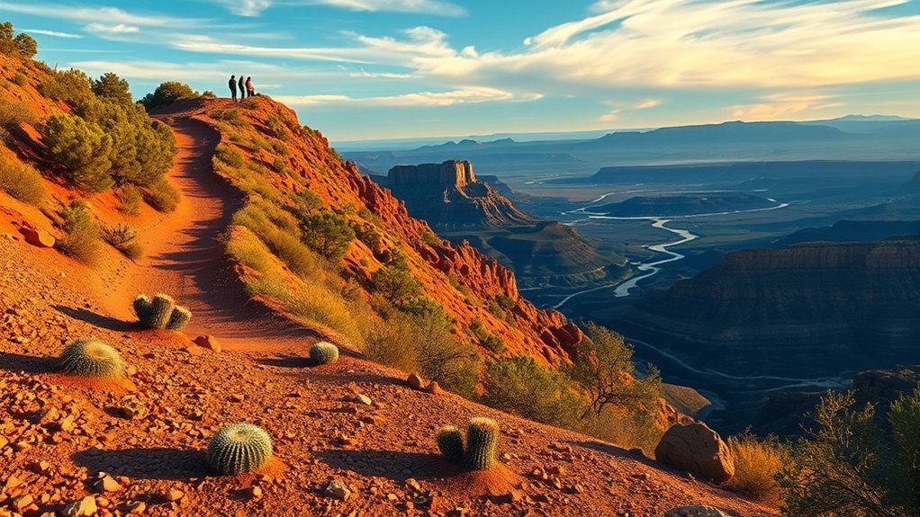
Expect steeper grades on Hillside Ridge Trail, so pace yourself and use trekking poles if you need extra support. The climb rewards you with broad summit viewpoints where you can take in the Verde Valley and distant red-rock ridgelines. Check your fitness level and bring water—those panoramas come after effort.
Gradient and Difficulty
When you turn onto Hillside Ridge Trail, you’ll feel the grade change quickly as the path climbs into a series of short, steeper pitches that reward effort with wide panoramas; prepare for sustained inclines rather than gentle rollers. You’ll encounter frequent elevation changes that affect pacing and breathing, so check trail ratings before you go and match effort to experience. Expect rocky steps, occasional switchbacks, and firm tread underfoot.
- Short but steep sections that test leg strength
- Variable footing: loose gravel, exposed rock, packed soil
- Moderate technical demand; suitable for fit beginners with caution
- Carry water, trekking poles, and adjust pace on climbs
Know your limits, watch for rapid grade shifts, and plan turnaround points based on endurance, not views.
Summit Viewpoints
After you’ve worked through the steeper pitches on Hillside Ridge Trail, the effort pays off with a series of compact summits that open up rewarding panoramas. You’ll find summit views that frame the Verde Valley, cottonwoods, and distant mesas; panoramic vistas stretch wide enough to plan your next photo or pause. Choose a wind-sheltered ledge, sip water, and scan for birds. The trail’s short climbs mean you can hit multiple viewpoints in one outing; pack layers for changing exposure. For safety, watch loose rock on approach and keep to cairned routes. Below is a simple table to evoke how those moments feel and what they offer.
| Emotion | Detail |
|---|---|
| Awe | Wide panoramic vistas |
| Calm | Quiet cottonwood shadows |
| Pride | Reached summit views |
| Clarity | Route and weather cues |
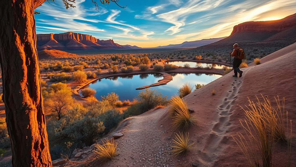
Connector Routes: Combining Trails for Longer Outings
Because several shorter paths intersect throughout Dead Horse Ranch State Park, you can easily stitch together loops and out-and-back routes to match your time and energy, whether you’re aiming for a brisk three-mile morning hike or a full-day ramble. Use connector routes and simple trail combinations to extend views, vary terrain, and avoid backtracking. Plan a clockwise loop or link riparian stretches to higher, windier ridges for contrast.
- Start on the Verde River trail, then take the riparian connector to Cottonwood.
- Combine the Mesa spur with the Loop Trail for expansive vistas.
- Link the Horsepasture segment to the oak-lined South Path for shade.
- Use spur trails to shorten or lengthen distance based on daylight and fitness.
You’ll feel purposeful control over distance, scenery, and challenge.
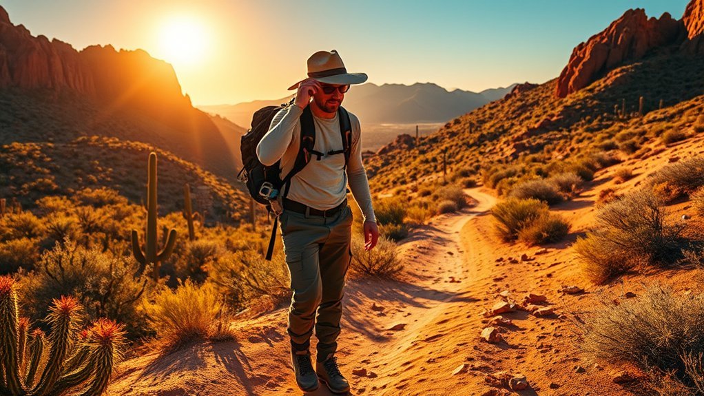
Trail Tips: Best Times, Safety, and What to Bring
You can plan route combinations to fit daylight and energy, but timing, safety, and packing make the difference between a great hike and an uncomfortable one. Aim for the best seasons—spring and fall—when temperatures are mild and wildflowers or foliage shine; avoid midday summer heat. Check sunrise and sunset times, trail conditions, and weather before you go. Tell someone your route and expected return, and carry a charged phone, map, and headlamp. For safety, know basic first aid, watch for rattlesnakes, and stay on marked trails to protect habitat. Pack essential gear: layered clothing, sun protection, 1–2 liters water per person, snacks, a compact first-aid kit, and a lightweight emergency blanket. Adjust weight to trip length.
Frequently Asked Questions
Are Dogs Allowed on All Trails and Are Leashes Required?
Yes — you can bring dogs on many dog friendly trails, but leash regulations require you to keep them leashed. You’ll enjoy scenic routes; carry water, pick up waste, and follow posted signs to protect wildlife and visitors.
Are Trailheads Wheelchair- or Stroller-Accessible?
Think of a gentle promenade; yes, some trailheads offer trail accessibility features and firm surfaces for strollers or wheelchairs. You’ll find family friendly trails near the river with parking, ramps, and clear signage for easy access.
Are There Restroom or Water Refill Stations on the Trails?
No — you won’t find restrooms or water refill stations out on the trails; bring water, practice water conservation, and use trailhead facilities. Pack extra, respect trail maintenance needs, and plan breaks at designated areas.
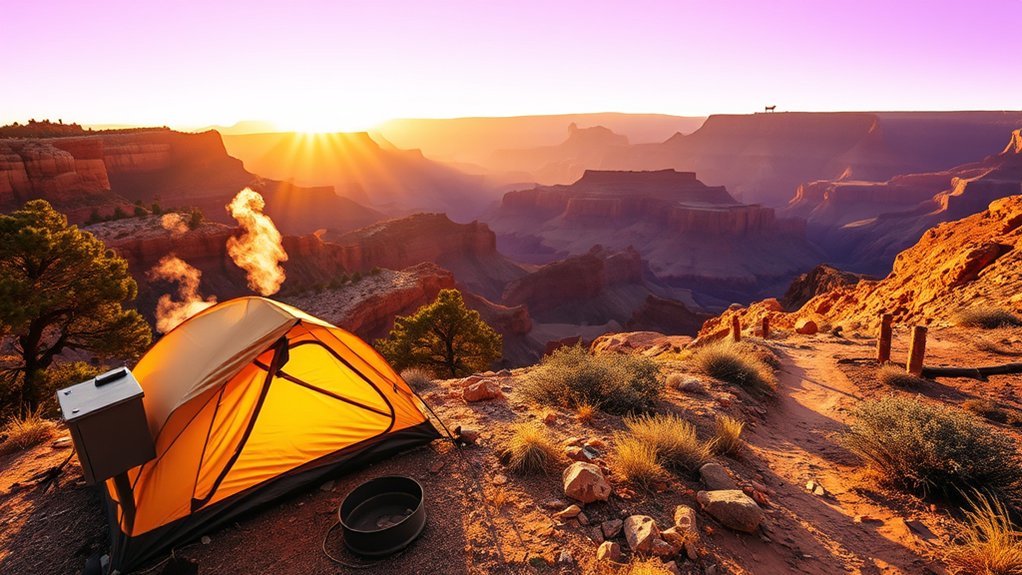
Is Camping Permitted Within the Park or Near Trailheads?
Yes — you can camp nearby, but you must follow camping regulations at Dead Horse Ranch State Park; you’ll find nearby campgrounds with sites, hookups, and primitive options, so plan reservations, permits, and pack out all trash.
Are Permits or Entrance Fees Required to Hike or Park?
You don’t need hiking permits to explore the park, though entrance fees apply for vehicle access; you’ll pay at the gate or kiosk, so plan accordingly, bring cash/card, and keep your receipt visible while parked.
Conclusion
You’ll find trails for every pace at Dead Horse Ranch State Park, from flat riverside strolls to steep ridge climbs, so plan routes that match your energy and interests. About 75% of visitors spot at least one bird species here, so bring binoculars and a field guide. Hike earlier to avoid heat, pack water, sun protection, and layered clothing, and use trail maps to combine loops for longer, rewarding outings with great views.