Think of the Superstition Mountains as a place that keeps its mysteries politely tucked away. You’ll find practical routes, scenic drives, and day hikes that suit most abilities, along with quieter backcountry spots if you’re prepared. Weather, wildlife, and navigation demand respect, and local history adds flavor to every trailhead—keep going to learn exact routes, safety tips, and the permits you’ll need to make your trip smooth and memorable.
Planning Your Visit: Best Times and Permits
When should you go to the Superstition Mountains? You’ll pick the best seasons—fall through spring—for comfortable daytime temps, clearer skies, and blooming desert life; summer’s heat and monsoon storms make trails risky. Aim for morning or late afternoon starts to avoid peak hours between 10 a.m. and 3 p.m., when trails crowd and temperatures spike. Weekdays generally mean fewer people and better parking, while weekends bring more hikers and limited space.
Check permit rules before you go: some areas require free permits for day use or wilderness access, and overnight backcountry trips need permits with group-size limits. If you’re planning a technical climb or organized event, secure special-use permits well in advance. Always verify current regulations and trail closures on official park or forest websites, and carry printed or offline copies of permits. That way you’ll minimize surprises and focus on enjoying the landscape safely.
Getting There and Parking Options
With your timing and permits sorted, plan how you’ll actually get to trailheads and where you’ll park — access can shape the whole day. Drive carefully on winding desert roads; some trailheads have small, unpaved lots that fill early. You’ll want to scout parking alternatives: official trailhead lots, dispersed roadside pullouts (legal only where signed), and private lots at nearby businesses—always follow signs and local rules to avoid fines or towing.
Consider transportation options beyond solo driving. Carpool to save spaces and reduce impact; arrange drop-offs if lots are full. Ride-hailing or shuttle services can work for shorter visits, though coverage is limited in remote areas. If you arrive late or during busy weekends, park farther away and walk in, or choose alternate access points. Bring water, a flashlight, and a reflective vest if you’ll cross roads after dark. Planning where you’ll leave your vehicle keeps your day safe and stress-free.
Top Day Hikes and Scenic Drives
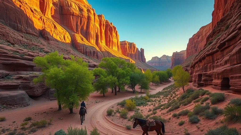
Looking for a standout day hike or a scenic drive that shows off the Superstition Mountains? You’ll find classic routes like the Treasure Loop, Siphon Draw to Flatiron (if you’re fit), and the Peralta Trail’s Hieroglyphic Canyon for varied terrain and dramatic rock faces. Pack proper hiking gear—sturdy boots, sun protection, plenty of water—and start early to avoid heat and crowds. For easier outings, try the Dripping Springs Trail or the Siphon Draw lower sections; both offer short distances with big views.
For drives, take Apache Trail (State Route 88) for winding desert vistas and lake overlooks, or follow Usery Pass and Lost Dutchman Mine Road for roadside pullouts ideal for scenic photography. Stop at viewpoints to catch golden-hour light on red cliffs, use a polarizer for clearer skies, and bracket exposures for contrasty scenes. Stay on designated trails and roads to protect fragile desert habitat while you enjoy the best day-trip experiences.
Overnight Backpacking and Camping Areas
When you plan an overnight in the Superstitions, start with the backcountry campsites map so you can pick legal, level spots and estimate distances between water and trailheads. Check current water sources and carry a reliable filter or enough water, because springs can be seasonal or dry. Don’t forget permits and campsite rules—get them before you go to avoid fines and protect fragile desert terrain.
Backcountry Campsites Map
A detailed map of backcountry campsites helps you plan overnight routes, identify legal camping zones, and locate reliable water sources and natural shelters. Use the map to cross-check trail difficulty, contour lines, and approach times so you won’t get surprised after sunset. Prioritize sites marked for dispersed camping and respect campsite etiquette: camp at least 200 feet from water, use existing pads, and pack out all trash. For safe backcountry navigation carry a compass, GPS backup, and waypoint notes from the map; mark potential emergency exits and shaded bivy spots. Note seasonal closures, sensitive habitat areas, and noisy ridgelines to avoid. Before you head out, photograph map sections and download offline tiles so you’ll stay oriented when cell service drops.
Water Sources & Permits
Because water can make or break an overnight trip, know where reliable sources sit on your route and how to treat them before you drink, cook, or resupply. Scout springs, stock tanks, and washes on maps and note seasonal availability — many see little flow outside monsoon months. Check recent trip reports or ranger updates for spring health and water quality; algae, livestock, and runoff can foul sources fast. Carry a filter or purification tablets even if you plan to refill at established sites. Permits are required for overnight camping in some zones; reserve them early, follow quota rules, and display them as instructed. Pack extra water where sources are scarce, cache at your own risk, and always minimize impact at collection points.
Safety Tips: Weather, Wildlife, and Navigation
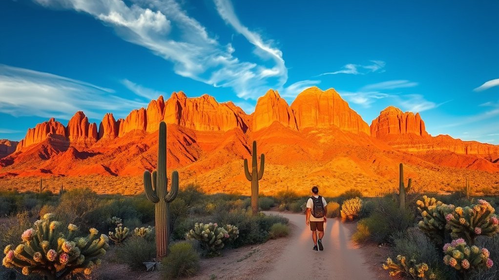
If you plan to explore the Superstition Mountains, prepare for fast-changing weather, encounter varied wildlife, and navigate rugged, often confusing terrain so you stay safe and enjoy your trip. Check forecasts, then pack layers, sun protection, and rain gear—weather preparedness prevents hypothermia and heat illness. Start early to avoid afternoon storms and extreme heat, and turn back if clouds build or winds increase.
Respect wildlife encounters by keeping distance, securing food, and never feeding animals. Know basic responses: give rattlesnakes space, back away from bighorn or javelina, and store food in your vehicle or a bear-safe container. Carry a whistle, mirror, and fully charged phone plus a paper map and compass; GPS can fail in canyons. Mark your route and note landmarks; tell someone your plan and expected return time. Hike with companions when possible, stay on established trails, and pace yourself. With preparation and attention, you’ll reduce risks and enjoy the landscape responsibly.
Flora, Fauna, and Natural Features to Spot
Count on seeing a dramatic mix of Sonoran Desert life as you explore the Superstition Mountains: creosote and brittlebush dominate lower slopes, saguaros and paloverde stand sentinel on the washes, and higher elevations give way to scrub oak and manzanita. You’ll spot mule deer, javelina, and coyotes, plus raptors circling canyon rims. Keep an eye out for desert wildflowers after rains and watch for smaller life—lizards, hummingbirds, and tarantulas.
- Trailside plants: note cholla, prickly pear, and other unique cacti—observe, don’t touch.
- Water sources: seasonal pools attract wildlife; approach quietly for viewing.
- Birding hotspots: look for Gambel’s quail, verdins, and zone-tailed hawks along ridges.
- Rock features: volcanic tuff, cliffs, and slot washes create dramatic lookout points.
Bring binoculars, sunscreen, and a field guide. Photograph, record tracks, and respect habitat—leave no trace to preserve these vivid natural features.
History, Legends, and Cultural Points of Interest
You’ll encounter traces of Ancient Native American heritage in petroglyphs and historic trails that connect you to the region’s deep past. You’ll hear the gripping Lost Dutchman legend that still draws treasure hunters and shapes local lore. You’ll also find tangible mining era remnants—old shafts, ruins, and artifacts—that show how prospecting transformed the landscape.
Ancient Native American Heritage
Although the Superstition Mountains have long drawn hikers and treasure hunters, they’re first and foremost a landscape shaped by centuries of Native American life, stories, and ceremony. You’ll notice rock art sites, ancient trails, and springs that reveal the deep cultural significance tied to local native tribes. Visit respectfully, stay on trails, and avoid touching fragile petroglyphs.
- Learn: read signage and park materials explaining tribal histories.
- Observe: spot grinding mortars and shelter alcoves from a distance.
- Listen: join ranger-led talks or tribal community events when available.
- Give space: treat sacred sites as living places, not photo props.
These practical steps help you honor living traditions while exploring vivid traces of ancestral life.
Lost Dutchman Legend
When you follow the winding trails and listen to old-timers talk, the Lost Dutchman legend quickly becomes more than a treasure tale — it’s a thread that ties local history, mystery, and cultural memory to the Superstition landscape. You’ll hear versions about Jacob Waltz, the so-called Dutchman, and his hidden Dutchman’s Gold, but you’ll also learn how stories shaped place names and visitor behavior. Take guided talks or museum stops to separate folklore from fact; locals blend exaggeration with cautionary notes about rugged terrain. Visit nearby Ghost Towns to sense how boom-and-bust history fuels the myth without assuming treasure hunts are safe or sanctioned. Respect signs, stay on trails, and treat the legend as cultural heritage, not a map.
Mining Era Remnants
Because the Superstition Mountains were carved by prospectors as much as by water and wind, traces of the mining era punctuate the landscape and local memory: rusty headframes, collapsed adits, and scattered tailings tell stories of boom-and-bust ambition, while nearby ghost towns and interpretive signs reveal how those dreams shaped settlement patterns and regional identity. You can still follow remnant roads and interpretive trails to see where gold mining reshaped canyons and water use. Expect hazards; don’t enter unstable structures. Practical tips and points of interest:
- Visit preserved shafts with guides to learn extraction techniques.
- Explore marked ghost towns; respect fragile ruins.
- Photograph headframes at golden hour for dramatic context.
- Check local museums for maps, miner biographies, and artifact displays.
These remnants connect landscape, legend, and community history.
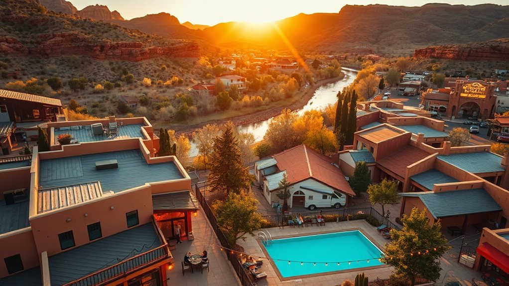
Local Services, Gear Rentals, and Guided Tours
If you’re heading into the Superstition Mountains, plan ahead for basic services, rental gear, and guided options to keep your trip safe and enjoyable. You’ll find visitor centers in nearby towns where rangers and volunteers brief you on trail conditions, water sources, and wildlife. Local services like gas stations, grocery stores, and urgent care are sparse—stock up and check hours before you go. Gear rentals for hiking, backpacks, GPS units, and climbing equipment are available from regional outfitters; reserve specialty items in advance during peak season. Guided tours range from short interpretive walks to multi-day desert survival and archaeological trips led by experienced guides; choose based on fitness and interest. Guides provide navigation, safety equipment, and regional knowledge you won’t get from maps alone. If you’re unsure which option fits, call visitor centers or outfitters to compare costs, group size limits, cancellation policies, and required permits so you can pick the right support for your adventure.
Frequently Asked Questions
Are There Cell Service or Wi‑Fi Hotspots in the Superstition Mountains?
You’ll find limited cell coverage and sparse internet access deep in the Superstition Mountains; near trailheads and nearby towns you’ll get signals, but on remote trails you shouldn’t expect reliable service, so plan offline and carry emergency gear.
Can I Bring a Drone for Aerial Photography?
Yes — you can, but you’ll follow drone regulations: register, avoid restricted areas, and respect wildlife. For aerial photography tips, scout launch sites, plan golden‑hour shoots, use ND filters, and pack spare batteries for safe, stunning shots.
Are There Designated Spots for Rock Climbing or Bouldering?
Absolutely — you’ll find a handful of officially recognized rock climbing and bouldering spots, but most routes are on rugged, unmaintained terrain; you’ll need permits, route knowledge, and leave no trace while climbing responsibly and safely.
What Time of Year Are Wildflower Blooms at Their Peak?
Late winter to early spring—February through April—offers peak wildflower species displays; you’ll see vivid blooms. Check local reports for exact bloom duration, since elevation and rainfall shift timing and extend or shorten displays.
Are There Restrictions for Bringing Pets on Trails and Campsites?
Yes — you’ll find pet friendly trails but you must follow campsite regulations: keep pets leashed, clean up waste, supervise them, and obey quiet hours and fire restrictions; some sensitive areas and backcountry sites prohibit pets.
Conclusion
You’ve got the essentials to plan, explore, and stay safe in the Superstition Mountains — from best seasons and permits to top hikes, campsites, and cultural lore. Will you chase sunrise views, test a rugged trail, or trace ghostly legends? Pack water, navigation, and respect for wildlife, and tap local guides or rentals when needed. With preparation and curiosity, this landscape rewards you with unforgettable desert vistas and stories that stick with you long after you leave.