While Camelback Mountain is one of the most iconic hiking landmarks in the American Southwest, planning an overnight stay requires understanding local desert regulations. Camelback Mountain itself is strictly a day-use municipal preserve with no on-site camping, but the surrounding Phoenix metropolitan area and Sonoran Desert offer world-class developed campgrounds, scenic regional parks, and rugged public lands just a short drive from the trailheads. This comprehensive guide covers the best campgrounds near Camelback Mountain, essential desert survival strategies, trailhead regulations, and how to safely summit Phoenix’s premier peak.
Quick Answer
You cannot camp on Camelback Mountain because the preserve is strictly day-use only (open sunrise to sunset). However, exceptional developed and tent camping is located 30 to 45 minutes away at McDowell Mountain Regional Park, Usery Mountain Regional Park, and Lost Dutchman State Park. Book sites in advance and start Camelback summit hikes at dawn to avoid lethal desert heat.
Key Takeaways
- No On-Mountain Camping: Camelback Mountain closes at sunset; setting up camp on the mountain is illegal and subject to fines.
- Top Basecamps: McDowell Mountain, Usery Mountain, and Lost Dutchman State Park provide modern campsites, RV hookups, and hot showers within 35 miles of the trailheads.
- Strict Regulations: Dogs and mountain bikes are strictly prohibited on Camelback Mountain summit trails.
- Extreme Heat Closures: The City of Phoenix closes Echo Canyon and Cholla trails from 9:00 AM to 7:00 PM during National Weather Service Excessive Heat Warnings.
- Hydration Rule: Carry at least 1 liter of water per hour of hiking and turn around when half your supply is gone.
Understanding Camelback Mountain & Desert Basecamping
Rising to 2,704 feet above sea level, Camelback Mountain stands as a prominent red-sandstone and granite monolith dividing Phoenix, Scottsdale, and Paradise Valley. Because it sits entirely within the City of Phoenix Parks and Recreation system, the mountain is managed as a delicate urban nature preserve. It offers intense, world-class day scrambling through Sonoran Desert vegetation, where saguaro cactus, jumping cholla, and palo verde trees thrive among jagged boulder fields.
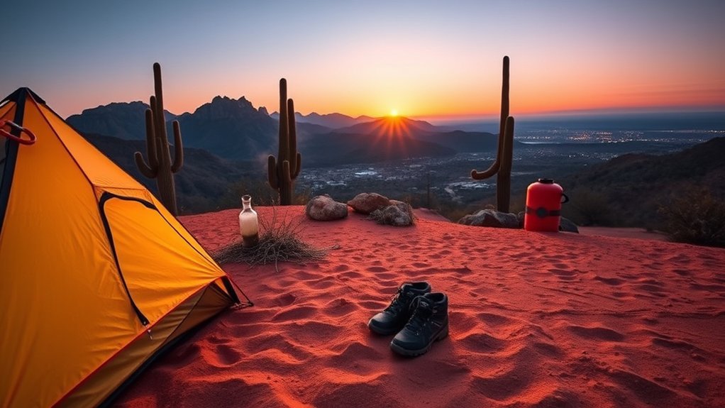
Because overnight stays are prohibited on the preserve itself, experienced outdoor enthusiasts use a “basecamp model”: setting up camp at nearby regional or state parks, enjoying campground amenities by night, and arriving at Camelback’s trailheads at first light. This allows you to experience the vibrant Sonoran Desert ecosystem while complying with municipal conservation laws and avoiding the intense thermal radiation of daytime desert rock.
Warning: Never attempt to bivouac or pitch a tent on Camelback Mountain. Park rangers actively patrol after dark. Trespassers face municipal citations, eviction, and severe safety hazards along vertical rock faces without nighttime lighting.
Best Developed Campgrounds Near Camelback Mountain
If you are looking for secure tent sites, RV hookups, restrooms, and potable water, several regional and state parks surround the Phoenix-Scottsdale corridor. These parks offer a genuine desert camping ambiance under star-filled skies while keeping you within 30 to 45 minutes of Camelback’s Echo Canyon and Cholla trailheads.
Campground Comparison at a Glance
| Campground | Drive to Camelback | Key Amenities | Site Types |
| McDowell Mountain Regional Park | ~35–40 minutes | Water, Electric (30/50A), Showers, Flush Toilets, Dump Station | 76 Developed Sites, Tent & RV |
| Usery Mountain Regional Park | ~35–40 minutes | Water, Electric, Modern Restrooms, Hot Showers, Picnic Tables | 73 Individual RV/Tent Sites |
| Lost Dutchman State Park | ~40–45 minutes | Electric/Water Hookups, Showers, Fire Rings, Rental Cabins | 134 Sites (68 with electric) |
| Cave Creek Regional Park | ~40 minutes | Water, Electric, Clean Showers, Nature Center, Hiking Trails | 44 Developed Sites |
Top Family & RV Campgrounds
For campers seeking well-maintained family infrastructure, McDowell Mountain Regional Park in Fountain Hills is often regarded as the premier choice. Nestled in the Verde River basin, it offers spacious asphalt pads suitable for both large travel trailers and family tents, complete with barbecue grills, fire pits, and covered ramadas. Kids can enjoy gentle desert interpretive walks and mountain bike loops right from the campsite.
Another standout option is Lost Dutchman State Park, situated along the base of the dramatic Superstition Mountains. It features newly renovated restroom facilities, climate-controlled camper cabins for non-tent campers, and ranger-led junior ranger astronomy programs under low-light desert skies.
Amenities and Reservation Guidelines
During the peak desert camping season (October through April), campsites across Greater Phoenix fill up weeks or months in advance. Follow these booking protocols to secure your spot:
- County Parks Booking: Reservations for McDowell Mountain, Usery Mountain, and Cave Creek are managed online via the Maricopa County Parks reservation system up to six months in advance.
- State Park Booking: Lost Dutchman State Park reservations must be booked through the Arizona State Parks portal.
- Vehicle Limits & Quiet Hours: Most developed loops enforce a maximum limit of two vehicles per campsite and strict quiet hours from 10:00 PM to 6:00 AM. Generator use is prohibited during quiet hours in non-hookup areas.
Pro Tip: If weekend sites at McDowell Mountain or Usery are booked, check mid-week availability (Tuesday–Thursday) or look at Lake Pleasant Regional Park (45 minutes northwest), which offers 148 developed sites along pristine desert waters.
Dispersed & Backcountry Camping on Surrounding Public Lands
If you prefer off-grid, primitive dispersed camping without neighbors or fees, you will need to head into the federally managed public lands that border Phoenix. While Camelback Mountain contains zero backcountry zones, millions of acres of Tonto National Forest and Bureau of Land Management (BLM) land surround the Valley of the Sun.
Popular nearby dispersed camping zones include:
- Bartlett Dam Road & Horseshoe Reservoir (Tonto NF): Located roughly 45 miles northeast of Camelback, offering dispersed camping on designated spur roads among towering saguaros and granite boulder fields. A Tonto Daily Pass or Discovery Pass may be required depending on the shoreline site.
- Table Mesa BLM Area: Situated north of Phoenix off Interstate 17, Table Mesa provides primitive boondocking opportunities for self-contained rigs and tent campers on durable desert crust.
- Needle Rock Recreation Area: Primitive recreation along the Verde River (day-use only at the river bank, with dispersed camping on designated forest access roads further north).
When dispersed camping, you must be 100% self-sufficient: pack in all drinking water, carry a portable chemical toilet or adhere to strict 6-to-8-inch cat-hole waste burial away from water sources, and pack out every ounce of trash.
Permits, Regulations, and Seasonal Restrictions
To ensure a safe and legal trip, campers and hikers must understand the distinct jurisdictional rules separating municipal Phoenix preserves from surrounding federal and county parklands.
Park Hours and Trailhead Rules
Camelback Mountain operates under municipal preserve regulations:
- Hours: Open daily from sunrise to sunset (parking lot gates open around 5:00 AM and lock promptly at 7:00 PM).
- Fees: Free admission and parking at both Echo Canyon and Cholla trailheads; no day-use permits are required.
- No Pets Policy: Under Phoenix City Code § 24-54, dogs are completely prohibited on Echo Canyon and Cholla trails due to extreme heat risks and steep, technical climbing surfaces.
- No Mountain Bikes: Bicycles are prohibited on all Camelback Mountain pedestrian trails.
Phoenix Extreme Heat Trail Closures
Due to life-threatening summer temperatures and the physical danger of heat-related helicopter rescues, the City of Phoenix implements mandatory seasonal safety closures. Whenever the National Weather Service issues an Excessive Heat Warning for the Phoenix area, both the Echo Canyon Trail and Cholla Trail are closed to all hikers from 9:00 AM to 7:00 PM.
Warning: Summer temperatures on Camelback’s exposed rock frequently exceed 115°F (46°C). Attempting to bypass trail closure gates during an Excessive Heat Warning carries hefty legal penalties and puts first responders at extreme risk.
Water, Food, and Heat Management Strategies
The Sonoran Desert is an arid, unforgiving environment. The low humidity causes sweat to evaporate almost instantly, frequently masking severe fluid loss until dehydration or heat exhaustion sets in.
- The 1-Liter-Per-Hour Rule: Carry at least 1 liter (32 oz) of water for every hour you plan to be active. For a standard 2.5 to 3.5-hour Camelback ascent and descent, carry a minimum of 3 to 4 liters per person in a durable hydration reservoir or insulated bottles.
- Electrolyte Balance: Pure water is not enough. Consume electrolyte replacement packets, salty snacks (pretzels, salted almonds), and complex carbohydrates to replace lost sodium and prevent hyponatremia.
- The “Rule of Halves”: When your water reservoir is half empty, your hike is over. Turn around immediately and begin your descent, regardless of how close you are to the summit.
- Pre-Hydration: Drink 16 to 20 ounces of water before leaving your campsite in the morning, and keep a cooler of chilled liquids in your vehicle at the trailhead for your return.
“In desert mountaineering, turning around when half your water supply is gone is not a recommendation—it is your primary life-insurance policy.”
Recommended Gear for Camelback’s Terrain
Ascending Camelback Mountain is not a standard walk in the park; both primary routes involve Class 2 and Class 3 scrambling over steep sandstone, polished granite boulders, and handrail-assisted ascents. Equipping yourself with the proper gear ensures stability and safety.
- Footwear: Wear trail runners or lightweight hiking boots with sticky, high-traction rubber outsoles (Vibram Megagrip or equivalent). Smooth gym sneakers slip easily on dusty rock faces.
- Sun Protection: A wide-brim hat, polarized UV-blocking sunglasses, lightweight UPF 50+ long-sleeve sun hoodies, and broad-spectrum mineral sunscreen (SPF 50+).
- Hands-Free Packs: Use a compact daypack with a built-in hydration sleeve. Avoid carrying handheld bottles, as you will need both hands free for scrambling over boulder fields and gripping metal handrails.
- Grip Gloves: Lightweight, rubber-palm work gloves or climbing gloves can protect your hands from burning on sun-baked rock and metal safety cables during warmer months.
- Emergency Essentials: Compact LED headlamp with fresh batteries, a loud rescue whistle, blister kit, comb/tweezers (for removing cactus needles), and a fully charged cell phone with an external battery bank.
Trail Breakdown: Echo Canyon vs. Cholla Trail
Camelback Mountain features two distinct summit routes. Both gain roughly 1,250 to 1,280 vertical feet in under 1.5 miles, making them exceptionally steep and physically demanding.
1. Echo Canyon Trail (1.2 miles one way / 2.4 miles round-trip)
Starting from the western trailhead off McDonald Drive, Echo Canyon is intense and direct. The trail begins with steep stairs, passes the “Camel’s Head” formation, and ascends a 30-to-40-degree incline equipped with dual metal handrails. The final third of the trail requires full-body scrambling through giant red boulder chutes before topping out on the summit ridge.
2. Cholla Trail (1.42 miles one way / 2.84 miles round-trip)
Starting from the eastern trailhead along Invergordon Road, Cholla is slightly longer and features a more gradual initial climb along the mountain’s eastern spine. However, the final half-mile transitions into an exposed ridgeline scramble with significant drop-offs on either side. Hikers with vertigo or a fear of heights often find the Cholla ridgeline challenging.
Note: Parking at both trailheads is strictly limited. The Echo Canyon parking lot frequently fills by 5:30 AM on weekends between October and April. Arrive early or use a rideshare service to avoid long waits at the entrance gate.
Wildlife, Plants, and Leave No Trace Practices
The Sonoran Desert is alive with specialized flora and fauna adapted to survive extreme conditions. Protecting this fragile ecosystem requires strict adherence to Leave No Trace principles:
| Desert Best Practice (DO) | Environmental Hazard (DON’T) |
|---|---|
| Stay strictly on designated trails to prevent soil erosion. | Cut switchbacks or trample biological soil crusts. |
| Pack out all trash, including organic waste like banana peels. | Leave food scraps behind (desert decomposition takes years). |
| Give rattlesnakes, Gila monsters, and bees a wide berth. | Approach, harass, feed, or attempt to handle desert wildlife. |
| Use established fire rings only at designated regional campgrounds. | Light open campfires during seasonal fire bans or in preserves. |
Be aware of native desert wildlife during your trip. Western diamondback rattlesnakes are active from spring through autumn, especially at dawn and dusk. Always look before placing your hands or feet onto rock ledges. If you encounter Africanized honeybees, do not swat at them; walk away calmly and seek sheltered ground.
Emergency Preparedness and Rescue Resources
The Phoenix Fire Department conducts dozens of technical mountain rescues each year on Camelback Mountain, primarily for dehydration, heat stroke, and slip-and-fall injuries. Proper preparation can keep you off a rescue helicopter:
- Recognize Heat Illness: Symptoms of heat exhaustion include dizziness, headache, nausea, pale skin, and profuse sweating. If symptoms progress to confusion, hot/dry red skin, or vomiting, the patient is experiencing life-threatening heat stroke—call 911 immediately and move them into shade.
- Cell Service & Location: Cell coverage is generally reliable across Camelback Mountain. Note mile markers, trail post numbers, and physical landmarks (such as the Handrail Section or Cholla Saddle) as you hike so you can report your exact position in an emergency.
- Emergency Contacts: Dial 911 for life-threatening mountain emergencies. For non-emergency park questions, contact Phoenix Parks Dispatch at (602) 262-6862.
Frequently Asked Questions
Can you camp overnight on Camelback Mountain?
No. Camelback Mountain is a municipal day-use preserve operated by the City of Phoenix. It is open strictly from sunrise to sunset. Overnight camping, tent pitching, and overnight parking are illegal and strictly enforced by park rangers and law enforcement.
Where is the closest developed campground to Camelback Mountain?
The closest developed campgrounds are McDowell Mountain Regional Park (Fountain Hills) and Usery Mountain Regional Park (Mesa), both located approximately 35 to 40 minutes (25–30 miles) driving distance from Camelback Mountain’s trailheads. Both feature modern restrooms, hot showers, and full electric/water hookups.
Are dogs allowed on Camelback Mountain trails?
No. Under Phoenix City Code § 24-54, dogs are strictly prohibited on both the Echo Canyon Trail and the Cholla Trail. This rule protects pets from fatal heat stroke and foot-pad burns on scorching granite boulders. Leashed dogs are permitted at surrounding regional parks like McDowell Mountain and Cave Creek.
Are campfires or charcoal grills allowed at nearby campgrounds?
Campfires and charcoal grills are permitted only in designated metal fire rings and barbecue grills at developed campgrounds (such as Maricopa County Parks), provided no seasonal Stage 1 or Stage 2 fire restrictions are active. Open fires and charcoal grills are never allowed in City of Phoenix mountain preserves.
Where can I find free dispersed camping near Phoenix?
Free dispersed camping on public lands can be found approximately 45 to 60 minutes northeast of Phoenix in Tonto National Forest along Bartlett Dam Road, Horseshoe Lake, and Table Mesa BLM lands north of Carefree. Dispersed sites have no water or restrooms, requiring self-contained gear and Leave No Trace waste disposal.
Are mountain bikes allowed on Camelback Mountain?
No. Mountain bikes are completely prohibited on all Camelback Mountain trails due to extreme steepness, exposed drop-offs, and heavy pedestrian foot traffic. For world-class mountain biking, visit the competitive track loops at McDowell Mountain Regional Park or the Brown’s Ranch Trailhead in North Scottsdale.
Conclusion
While you cannot pitch a tent on Camelback Mountain itself, basing your trip out of nearby regional campgrounds like McDowell Mountain, Usery Mountain, or Lost Dutchman State Park offers the ultimate Sonoran Desert adventure. By pairing comfortable campground amenities with early-morning trail ascents, carrying ample water and electrolytes, and respecting municipal day-use rules, you can conquer Phoenix’s most famous summit safely and legally. Book your campsite reservations early, monitor local weather alerts, and enjoy an unforgettable desert trekking experience.
Sources
- City of Phoenix Parks and Recreation — Official preserve hours, parking regulations, and trail closure policies for Camelback Mountain.
- Maricopa County Parks & Recreation — Camping reservations, campground amenities, and trail systems for McDowell Mountain, Usery, and Cave Creek regional parks.
- Arizona State Parks — Lost Dutchman State Park camping facilities, camper cabin details, and Superstition Wilderness access.
- National Weather Service (Phoenix Forecast Office) — Excessive Heat Warning criteria and regional desert weather safety protocols.
- Leave No Trace Center for Outdoor Ethics — Arid land recreation ethics, waste management, and biological soil crust protection.