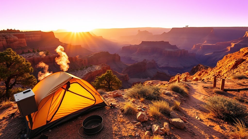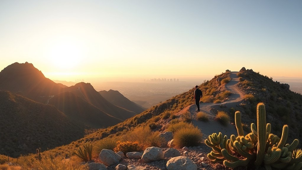
South Mountain Park/Preserve in Phoenix offers more than 16,000 acres of Sonoran Desert, more than 100 miles of trails, scenic roads, accessible paths, historic features, and wide views across the Valley. A good visit starts with choosing the correct entrance, matching the route to your ability, and checking heat restrictions and road closures before leaving.
Last updated: July 23, 2026
Quick Answer
Visit South Mountain Park early in the morning during warm weather. Drive to Dobbins Lookout for the classic city view, use Judith Tunell Accessible Trail for a paved outing, try Kiwanis Trail for a short desert hike, or take Mormon Trail toward Hidden Valley for a steeper route. Check current heat and road restrictions first.
Key Takeaways
- Vehicle entrance and parking hours are 5 a.m. to 7 p.m., while designated trails remain open from 5 a.m. to 11 p.m.
- Dobbins Lookout is the easiest choice for a major viewpoint when Summit Road is open.
- Judith Tunell offers two half-mile hard-surface loops near accessible parking, water, benches, and ramadas.
- Holbert, Mormon, Hau’pal Loop, and one Pima Canyon access point face daytime restrictions during National Weather Service Extreme Heat Warnings.
- Silent Sunday closes Summit Road to public motor vehicles during posted Sunday periods.
- Official trail distances often describe individual trail segments, not the total mileage of a complete loop or out-and-back trip.
At a Glance
| Time Required | About 1–2 hours for a viewpoint or accessible walk; 2–5 hours for longer hikes |
| Difficulty | Easy paved paths through steep, rocky desert routes |
| Gear Needed | Water, sturdy footwear, sun protection, charged phone, and downloaded map |
| Cost | The City’s current park page does not list a standard general day-use entrance or parking fee; reservations and special activities may cost extra |
Planning Your Visit: Hours, Entrances, and Parking
The City of Phoenix lists parking and gated entrance hours as 5 a.m. to 7 p.m. and trail hours as 5 a.m. to 11 p.m. Vehicle access does not remain open for the full trail-hours period, so plan your parking and transportation around the earlier closing time. Check the official South Mountain Park/Preserve page before leaving.
The South Mountain Visitor Center is at 10409 S. Central Avenue and is normally open Thursday through Sunday from 9 a.m. to 3 p.m. The facility was formerly called the South Mountain Environmental Education Center, so the old name may still appear on some maps or City trail descriptions.
Which Entrance Should You Use?
| Entrance or Trailhead | Address | Best For |
|---|---|---|
| Main entrance | 10919 S. Central Ave. | Summit Road, Dobbins Lookout, Holbert Trail, Kiwanis Trail, and the Activity Complex |
| South Mountain Visitor Center | 10409 S. Central Ave. | Visitor information and Judith Tunell Accessible Trail |
| Mormon Trailhead | 8610 S. 24th St. | Mormon Trail, National Trail, Hidden Valley, and Fat Man’s Pass |
| Pima Canyon Trailhead | 4500 E. Pima Canyon Rd. | Desert Classic, Pima loops, and east-side routes |
| Beverly Canyon Trailhead | 8800 S. 46th St. | Beverly Canyon and connections toward Desert Classic |
| Desert Foothills Trailhead | 14251 S. Desert Foothills Pkwy. | Telegraph Pass and southwest-side access |
Parking is easiest early in the day, especially on weekends and near sunset. Dobbins Lookout has limited parking near the top, and congestion can build when many visitors arrive for evening views.
Pro Tip: If Dobbins Lookout is your main goal, arrive well before sunset. A full upper parking area may require you to wait, turn around, or choose another viewpoint.
Entrance Fees, Permits, and Reservations
The City’s current South Mountain overview does not list a standard general day-use entrance or parking fee. A normal self-guided visit does not require a hiking permit. However, reserved ramadas, commercial photography, organized classes, large gatherings, and other special activities may require approval, reservations, or fees through Phoenix Parks and Recreation.
Silent Sunday and Road Access
Check whether your trip falls on Silent Sunday before planning to drive up Summit Road:
- Fourth Sunday of each month: Summit Road is closed to public motor vehicles from 5 a.m. to 7 p.m.
- First, second, third, and fifth Sundays: Summit Road is closed at the 1-mile marker from 5 a.m. to 10 a.m.
During these closures, park roadways are reserved mainly for walking, running, cycling, and other non-motorized activities. City staff, tower workers, and emergency vehicles may still use the roads.
San Juan Road has a separate limited schedule. The City lists it as open from 5 a.m. to 7 p.m. on the first Saturday of the month and from 10 a.m. to 7 p.m. on the first Sunday of the month.
Best Times to Visit South Mountain Park
The most comfortable seasons are generally fall, winter, and spring. Temperatures are easier to manage, and you have more flexibility when choosing a trail and start time.
During late spring, summer, and early fall, begin near sunrise and choose a shorter route than you would in cool weather. Desert temperatures can rise quickly, while exposed rock and pavement become much hotter than the surrounding air.
Sunrise offers cooler conditions and soft light on the ridgelines. Sunset is especially popular at Dobbins Lookout, but it also brings heavier traffic and tighter parking. Weekdays are usually quieter than weekends.
Warning: During a National Weather Service Extreme Heat Warning, Holbert Trail, Mormon Trail, Hau’pal Loop Trail, and access to National Trail from Pima Canyon Trailhead are restricted from 8 a.m. to 5 p.m. Check the official Phoenix Trail Heat Safety Program on the day of your visit.
Other routes and temporary projects may also affect access. Review the alert banners and current-project notices on the official South Mountain trail page before traveling.
Best South Mountain Trails by Difficulty
South Mountain has paved paths, short canyon hikes, long multiuse routes, and steep ridge climbs. Choose by terrain, exposure, elevation change, and total route length rather than mileage alone.
Note: Distances below are official figures for individual trail segments. A complete out-and-back hike or loop may be much longer after connecting trails are included. Confirm your full route on the City map before starting.
| Trail or Route | Best For | Official Segment Details | Start Point |
|---|---|---|---|
| Judith Tunell Accessible Trail | Paved and accessible outing | Two half-mile hard-surface loops with minimal elevation change | South Mountain Visitor Center |
| Kiwanis Trail | Short beginner-to-moderate desert hike | 1 mile and 480 feet of elevation change | Kiwanis Trailhead inside the main entrance |
| Holbert Trail | Steady climb and major views | 2.5 miles and 1,100 feet of elevation change; extension reaches Dobbins Lookout | Holbert Trailhead near the main entrance |
| Mormon Trail | Steeper terrain and Hidden Valley connections | 1.1-mile trail segment with 720 feet of elevation change | Mormon Trailhead |
| Hidden Valley Trail | Rock formations and natural passageways | 0.5-mile segment with 140 feet of elevation change, reached through connecting trails | Usually approached from Mormon and National trails |
| Desert Classic Trail | Longer east-side hiking or mountain biking | 9 miles with about 270 feet of elevation change | Pima Canyon Trailhead |
| Dobbins Lookout by road | Major viewpoint without a long hike | Drive Summit Road when open, then walk a short distance from the upper parking area | Main park entrance |
Judith Tunell Accessible Trail
Judith Tunell is the easiest developed trail option in the preserve. It consists of two half-mile hard-surface loops, allowing you to complete one loop or combine both for about one mile. The area has accessible parking, benches, drinking fountains, and covered ramadas nearby.
The trail remains available during normal park hours even when the Visitor Center building is closed. Surfaces and grades can still be affected by weather, maintenance, or debris, so visitors using mobility devices should review current conditions before arrival.
Kiwanis Trail
Kiwanis Trail is a useful introduction to desert mountain hiking. The route passes through a rock-studded canyon and by rock-wall dams built by the Civilian Conservation Corps in the 1930s. It is short, but the 480-foot elevation change and exposed terrain can make it demanding in warm weather.
Holbert Trail to Dobbins Lookout
Holbert Trail provides a steady climb into the upper park and can be extended toward Dobbins Lookout. It is a better choice for experienced hikers who want a workout and broad views rather than the easier drive-up experience.
Mormon Trail and Hidden Valley
Mormon Trail is steep in places and frequently busy. Most Hidden Valley trips combine Mormon Trail with National Trail and Hidden Valley Trail. The area includes Fat Man’s Pass, a naturally smooth rock feature, and a natural tunnel.
Do not treat Mormon Trail’s 1.1-mile listing as the length of the complete Hidden Valley outing. Map the entire route, including all connecting segments and the return trip.
Desert Classic Trail
Desert Classic is a longer east-side route popular with hikers and mountain bikers. Its modest net elevation change does not make it effortless. The distance, sun exposure, repeated rolling terrain, and multiuse traffic still require preparation.
Phoenix reports that more than 200 hikers are rescued from its desert and mountain parks each year. A familiar-looking urban trail can still become a serious desert emergency.
Dobbins Lookout, Photo Spots, and Park History
Dobbins Lookout sits at 2,330 feet and is the highest point in the park that is open to the public. It offers broad views of downtown Phoenix, Camelback Mountain, surrounding neighborhoods, and distant ranges.
You can normally reach it by driving Summit Road or by using trails such as Holbert. The scenic road has narrow sections, blind corners, steep drop-offs, cyclists, pedestrians, and other vehicles. Drive slowly and follow all posted directions.
For rock formations and more active photography, use the Mormon Trail connection toward Hidden Valley. Stay on marked trails and avoid touching, tracing, climbing on, or otherwise disturbing petroglyphs and cultural features.
The City of Phoenix purchased the original 13,000 acres in 1924 for $17,000. South Mountain marked 100 years of City stewardship in 2024 and now covers more than 16,000 acres.
Safety, Gear, Weather, and Trail Etiquette
Heat and Hydration
Wear sturdy footwear, lightweight clothing, a brimmed hat, and sunscreen. Carry more water than you expect to drink and begin hydrating before the hike. Turn around while you still have enough water and energy for the return trip.
Do not rely on a drinking fountain as your only water source. Water is concentrated near developed facilities and may be unavailable because of maintenance or service interruptions.
If someone becomes confused, collapses, stops sweating despite severe heat, or shows other signs of a medical emergency, call 911 and move the person toward shade if it is safe to do so.
Monsoon Storms, Lightning, and Flash Floods
Summer heat is not the only weather hazard. Monsoon storms can bring lightning, strong wind, blowing dust, sudden rain, and fast runoff through washes and narrow canyon areas.
Do not enter a confined wash or canyon when storms are nearby. If thunder is audible, leave exposed ridges and high points. Never attempt to cross moving floodwater on foot, by bicycle, or in a vehicle.
Navigation and Emergency Planning
Download the official trail map before leaving and carry a charged phone or backup navigation device. Cell service can be inconsistent among ridges, canyons, and remote sections.
Tell someone which trailhead and route you plan to use and when you expect to return. If you change routes, update that person when possible. In an emergency, call 911. For non-emergency park information, the City lists the South Mountain ranger office at 602-262-7393.
Dogs, Wildlife, and Multiuse Trails
Keep dogs leashed and carry waste bags and extra water. Phoenix’s leash law applies outside designated fenced dog parks. The City also prohibits endangering dogs on difficult trails or in adverse weather, including temperatures above 100°F. In hot conditions, leaving your dog at home is often the safest choice.
Check pavement and rock temperatures before allowing a dog to walk on them. Hot surfaces can burn paws quickly.
Watch wildlife from a distance, never feed animals, and pack out all trash. Stay on designated routes and do not cut switchbacks or create new paths.
On multiuse trails, hikers and bicyclists yield to horses, bicyclists yield to hikers, and downhill traffic yields to uphill traffic. Slow down near blind turns and communicate before passing.
Frequently Asked Questions
Are dogs allowed off-leash anywhere in South Mountain Park?
No. Dogs must remain leashed outside designated fenced dog parks. Bring waste bags and water, and leave dogs at home during dangerous heat.
Are there restrooms and drinking water?
Restrooms and drinking water are concentrated near developed trailheads and visitor facilities rather than along most backcountry routes. Judith Tunell Accessible Trail has drinking fountains, benches, and ramadas nearby. Always carry your own water.
Is there an entrance or parking fee?
The current City park page does not list a standard general day-use entrance or parking fee. Reserved ramadas, commercial activities, organized events, and other special uses may require approval or fees.
Do I need a permit for a normal hike?
A normal self-guided hike does not require a general hiking permit. Large groups, paid instruction, organized events, commercial photography, and reserved facilities may require City approval.
Are mountain bikes allowed on every trail?
No. Follow posted signs and use only routes open to bicycles. Bikes are allowed but not recommended on Mormon Trail because it is steep and often busy with hikers.
Are ranger-led hikes or nature programs available?
Yes. Phoenix Parks offers ranger-led hikes, outdoor nature programs, family workshops, and related activities. Dates, locations, capacity, and registration requirements change by season.
Can you drive to Dobbins Lookout?
Yes, you can normally drive Summit Road to Dobbins Lookout when the road is open. Silent Sunday, special events, maintenance, weather, or temporary closures can block vehicle access.
What closes during an Extreme Heat Warning?
From 8 a.m. to 5 p.m. on National Weather Service Extreme Heat Warning days, restrictions apply to Holbert Trail, Mormon Trail, Hau’pal Loop Trail, and access to National Trail from Pima Canyon Trailhead.
Are the listed trail distances round-trip?
Not necessarily. Phoenix’s trail page often lists the length of one named trail segment. Your complete route may include additional connecting trails and a return trip, so calculate the full mileage before starting.
Can I hike after the vehicle gate closes?
Designated trails are listed as open until 11 p.m., but parking and gated entrance hours end at 7 p.m. Plan where you will park and how you will leave before beginning an evening hike, and follow all posted gate instructions.
Conclusion
Plan your South Mountain Park/Preserve visit around weather, gate access, parking, and the total difficulty of your route. Judith Tunell Accessible Trail is the easiest developed option, while Dobbins Lookout provides a major viewpoint without requiring a long hike when Summit Road is open.
Kiwanis offers a short introduction to desert hiking. Holbert provides a stronger climb, and the Mormon Trail–Hidden Valley area is better for visitors prepared for steeper terrain and multiple connecting trails.
Before leaving, check the City of Phoenix pages for current hours, trail projects, Silent Sunday closures, and heat restrictions. Carry your own water, download a map, start early in warm weather, and protect the desert’s wildlife, trails, and cultural features.
Sources
- City of Phoenix: South Mountain Park/Preserve — park hours, Dobbins Lookout, Silent Sunday, San Juan Road, history, and contact information
- City of Phoenix: South Mountain Trails — official trailhead addresses, trail distances, elevation figures, difficulty, and route descriptions
- Phoenix Trail Heat Safety Program — current Extreme Heat Warning restrictions and affected South Mountain routes
- City of Phoenix: South Mountain Visitor Center — current facility name, address, contact details, and operating hours
- Phoenix Parks and Recreation Code of Conduct — trail hierarchy, off-trail activity, wildlife protection, dog safety, and visitor conduct
- City of Phoenix: Wheelchair Accessible Trails — Judith Tunell loop configuration, accessible parking, grades, and access information