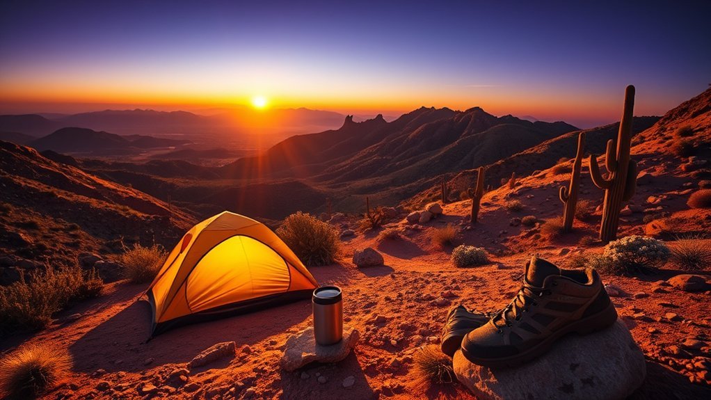
You’ll notice how each turn can suddenly open into a view you didn’t expect, from canyon rims to red-rock cathedrals, and you’ll want to stop every few miles. As you drive the South Rim, Sedona loop, or Route 66 stretches, plan short hikes and photo breaks, carry water and layers, and respect fragile sites. Keep going — there are specific overlooks, trailheads, and practical tips that’ll shape your best route.
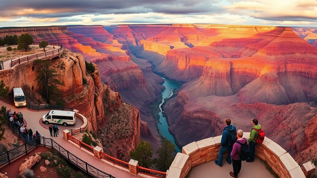
Grand Canyon South Rim: Desert View Drive & Mather Point
Start your drive along Desert View Drive and you’ll feel the canyon opening up in stages, each pullout offering a new composition of rock, light, and sky. You’ll stop at viewpoints that demand you breathe deeper, framing the Grand Canyon in wide panoramas for bold scenic photography. Trails near Mather Point let you edge closer to rim views; you’ll sense wind and time shaping stone. Keep an eye out for desert wildlife—ravens, mule deer, coyotes—moving in quiet, patient rhythms that mirror your own wish to break free. Interpretive signs and the Desert View Watchtower outline the site’s historical significance, connecting ancestral stories with geology. You’ll leave with images, knowledge, and a lighter sense of self.
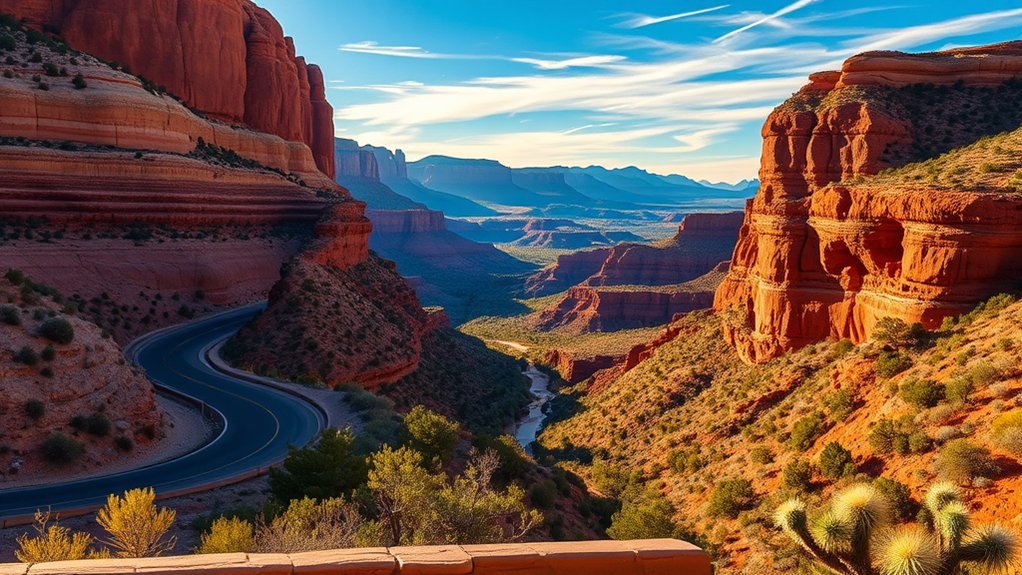
Sedona Red Rock Loop: Oak Creek Canyon & Cathedral Rock Views
Drive the Oak Creek Canyon road and you’ll feel the air cool as red walls rise around you, with pullouts that let you step out into ferned creeks and photo-ready vistas. Stop at the Cathedral Rock viewpoints to walk short trails and watch sunlight slice the butte’s layers into glowing reds and oranges. These spots are perfect for a brief hike, scenic photos, and timing your stop for golden-hour light.
Oak Creek Canyon Drive
Winding through a narrow, forested gorge between Sedona and Flagstaff, Oak Creek Canyon Drive delivers some of the Red Rock Country’s most intimate vistas — towering red sandstone walls, verdant riparian corridors, and glimpses of Cathedral Rock framed by cottonwoods. You’ll feel the air change as you descend: cooler, pine-scented, alive. Pull over at turnout overlooks and let the creek’s riffle reset your pace; short oak creek canyon hikes fork from trailheads, offering creekside solitude or cliffside panoramas. Drive deliberately—narrow lanes and photo stops reward patience. Pack water, sturdy shoes, and leave no trace so the landscape stays free. This road isn’t just a route; it’s a brief, freeing escape into wild, open clarity.
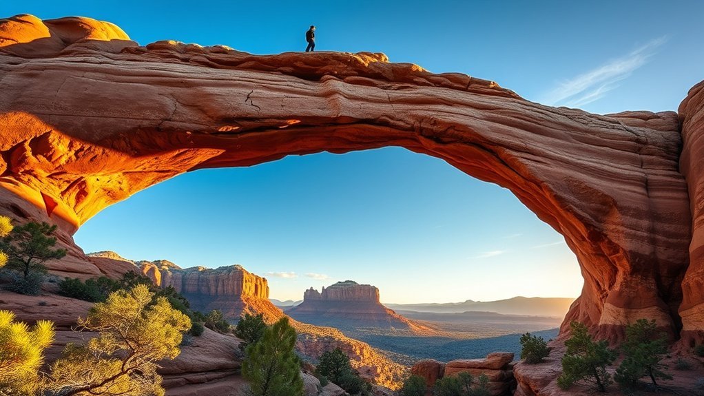
Cathedral Rock Viewpoints
Want a view that feels carved for your camera and your quiet? You drive into Sedona’s swirl of red, hop out at pullouts or the trailhead, and feel gravity shift toward light. Cathedral Rock hiking rewards you with narrow steps, slickrock ledges, and summit shoulders opening to vortex panoramas—bring sturdy shoes, water, and intention. For Cathedral Rock photography, aim for sunrise or late afternoon for warm contrast; use a wide lens for the base and a telephoto to isolate spires against sky. Several viewpoints along the Red Rock Loop and Oak Creek give different frames: creekside reflections, elevated profiles, and silhouetted domes. Move deliberately, respect private land and fragile desert, and let the landscape loosen whatever’s been holding you back.
Route 66 to Flagstaff: Historic Stops & Walnut Canyon Overlook
You’ll roll east along classic Route 66, spotting neon signs, vintage motels, and other landmarks that whisper of mid-century road trips. Stop in Flagstaff for hearty local dining — from brewpubs to Southwestern cafes — before you head to Walnut Canyon. At the overlook you’ll get a crisp, close-up view of cliff dwellings and the canyon’s layered geology that explain why this stretch is worth the detour.
Route 66 Landmarks
As you follow historic Route 66 from the desert towns toward Flagstaff, the road unfolds a mix of neon-soaked nostalgia, roadside curiosities, and sudden pockets of ancient landscape—each stop telling a different chapter of Arizona history. You’ll feel Route 66 nostalgia in faded motels and restored diners, where Historic roadside attractions invite you to wander, photograph, and imagine. Pull over for the Wigwam Village, old gas stations, and quirky museums that celebrate freedom on the open road. Near Flagstaff, the Walnut Canyon overlook gives a contrast: cliffside ruins and skywide views that reconnect you to time deeper than asphalt. Travel slow, claim detours, talk to locals — these landmarks free you from the hurry and anchor you in place.
Flagstaff Dining Stops
Just a few miles off Route 66, Flagstaff’s dining scene blends classic roadside comfort with high-desert flavor, so you can refuel after a day of neon-hunting and canyon views. You’ll find flagstaff breweries pulsing with character—tasting rooms where pine-scented ales pair with reclaimed-wood bars and conversations that make you feel unbound. Local eateries line downtown and Historic Route 66, offering everything from wood-fired pizza to Navajo-inspired dishes; you can choose bold spice or simple, honest fare. Walkable blocks mean spontaneous stops: grab a craft beer, a tray of tamales, or a coffee and let the mountain air reset your pace. Plan for busy nights, call ahead for groups, and leave room to savor Flagstaff’s free-spirited palate.
Walnut Canyon Overlook
When you step out at the Walnut Canyon Overlook, the rim opens to a startling cross-section of life carved into red rock—cliff dwellings clinging to the canyon walls, junipers punctuating the rim, and a ribbon of blue sky that makes the canyon’s layers sing. You’ll feel liberated by the wide air and the way history sits humble in the stone. Follow the short trail to peer down at ancestral homes and imagine daily rhythms preserved in masonry. Interpretive signs give precise context; bring water and sturdy shoes. Photographers chase the light that sculpts the strata, while you soak in Scenic Views that quiet the mind and loosen constraints. It’s a compact stop that rewards curiosity and invites you to breathe freer.
Monument Valley Scenic Drive: Tribal Park Viewpoints
Although Monument Valley’s red sandstone monoliths look like timeless sculptures, you’ll feel their scale and stories most clearly from the Tribal Park viewpoints along the scenic drive. You’ll move through vantage points where Navajo culture echoes in place names, storytelling panels, and respectful guides who invite you to learn. Stand with wind on your face, breathe wide, and let the landscape unsettle familiar limits.
- Arrive early or late for golden light and better photography tips from locals.
- Pause at interpretive signs to connect history, ceremony, and land stewardship.
- Respect restricted areas and follow guides to support Navajo sovereignty.
- Use a wide lens, tripod, and patience for silhouette and shadow-rich compositions.
These stops free perspective and ground you in living history.
Apache Trail (State Route 88): Canyon Lake to Tortilla Flat
Shift from the red mesas of Monument Valley to the jagged, water-carved corridors of the Superstition Mountains as you take State Route 88—the Apache Trail—from Canyon Lake toward the tiny, storied stop of Tortilla Flat. You’ll feel freedom in tight switchbacks, desert blooms and shimmering reservoirs. Apache Trail highlights include hidden coves, sheer canyon walls and old mining relics. Stop at Scenic viewpoints to watch light fracture across basalt and turquoise water. Drive slowly, breathe, choose a dirt pullout to stretch and listen to canyon wind. The road invites independent exploration but respect fragile terrain and private property. Below is a quick guide to salient stops and what to expect.
| Stop | Why go |
|---|---|
| Canyon Lake | Boat views |
| Apache Creek | Photo ops |
| Fish Creek | Quiet cove |
| Mine Ruins | History |
| Tortilla Flat | Final charm |
Mount Lemmon Scenic Byway: Sky Island Views & Aspen Groves
Climb the Mount Lemmon Scenic Byway and you’ll watch desert scrub give way to pine-scented forests and pockets of trembling aspen as the road gains nearly 6,000 feet in less than 30 miles. You’ll feel freer with each switchback, the air cooler, the view opening to Sky Island horizons. Stop at Lemmon Meadows to stretch, breathe, and picnic among wildflowers. Try Scenic Hiking on higher slopes—routes vary from gentle walks to ridgeline challenges that reward solitude and sweeping vistas.
- Park at pullouts for vista photos and quiet reflection.
- Hike short loops to reach aspen groves in sunlight.
- Carry water, layers, and a map for safety.
- Visit during fall for brilliant yellow aspen displays.
Hohokam Trail to Saguaro National Park: Cactus-Studded Vistas
When you step onto the Hohokam Trail, the desert unfolds in sculpted ridges and a sea of saguaros that seem to guard the park’s broad, sunlit valleys; the path threads you through classic Sonoran scenery where every bend reveals a new cactus silhouette against a vast blue sky. You’ll move deliberately, feeling liberated by open space as you read the landscape: stone terraces and petroglyph sites nod to Hohokam history while interpretive signs tie human story to place. The Saguaro ecosystem surrounds you—nurse plants, creosote, and busy pollinators sustaining spiny giants. Hike with water, early light, and respect; every viewpoint rewards quiet reflection and a clearer sense of your own smallness and freedom within this enduring desert.
Lake Powell & Glen Canyon: Wahweap Overlook & Rainbow Bridge Access
At Wahweap Overlook you’ll stand above Lake Powell’s brilliant, canyon-carved water and feel the scale of Glen Canyon sweep outward—turquoise in the shadows, copper along sunlit cliffs—while boat wakes stitch white lines through the maze of inlets. You’ll breathe freer here, sensing both ancient rock and wide-open possibility. Walk the rim, scan for hidden coves, and plan boat or shuttle access if you want to reach Rainbow Bridge. Pack light, move deliberately, claim your view.
Stand above Lake Powell’s turquoise corridors—breathe deep, scan hidden coves, and claim the canyon’s wide-open possibility.
- Time your visit for golden hour to enliven colors and shadows.
- Reserve a boat shuttle or kayak trip to approach Rainbow Bridge respectfully.
- Bring water, sun protection, and a small map or GPS for shore routes.
- Leave no trace; let the canyon stay wild for others.
Vermilion Cliffs and Marble Canyon: Horseshoe Bend & Lee’s Ferry
Stand on the rim and you’ll watch the Colorado River carve a perfect, green ribbon through rust-red cliffs—Horseshoe Bend’s dramatic curve feels almost sculpted for the camera, but Lee’s Ferry offers a quieter, storied access point where rafters launch and anglers cast into calmer water. You’ll feel small beneath Vermilion Cliffs’ towering walls and in Marble Canyon’s tight, echoing corridor; both demand reverence and reward daring. Walk trails at sunrise to claim solitude, drone-free, or join a guided raft to trace ancient stone and learn Navajo and pioneer histories. Pack water, sun protection, and a permit if you go off easy paths. Move deliberately, leave no trace, and let this landscape unchain you.
Frequently Asked Questions
Are Any of These Routes Wheelchair-Accessible or Ada-Friendly?
Yes — some routes and stops offer wheelchair accessibility and ADA compliance; you’ll find paved viewpoints, accessible restrooms, and designated parking, letting you experience sweeping desert vistas and liberated exploration with dignity and practical, inclusive design.
What Are the Best Months to Avoid Crowds on These Drives?
Late fall and late spring are the best driving months to avoid crowds; you’ll relish cooler roads, vivid light, and smoother parking. Use flexible timing and crowd management tactics to seize quieter vistas and liberating solitude.
Can I Bring My Dog to Overlooks and Trails Along These Routes?
Sometimes — you can bring your dog, but check dog friendly trails and site rules first. You’ll want pet safety tips: bring water, a leash, shade, waste bags, and avoid midday heat so you both stay free and energized.
Where Can I Find Gas, Food, and Emergency Services on Remote Stretches?
Of course you’ll find endless amenities in the desert—only kidding: plan ahead. Use mapped gas station locations, pack food, and note emergency service contacts; you’ll rely on waypoints, local towns, and GPS caches for freedom.
Do I Need Permits or Passes for Photography or Commercial Filming?
Yes — you’ll often need permits: check photography regulations and secure filming permits for commercial shoots on public lands. You’ll feel empowered by knowing rules, applying online, and respecting sites to keep creative freedom and access intact.
Conclusion
You’ll leave Arizona changed — like a postcard folded into memory. Walk canyon rims where sunlight carves stories, drive roads that thread red cathedrals and saguaro sentinels, and let lake reflections steady your breath. Pack water, layers, and respect; tread lightly where bones of the earth rise and tribal histories speak. Whether you chase sunrise at Mather Point or dusk at Cathedral Rock, these drives will stay with you long after the odometer stops.