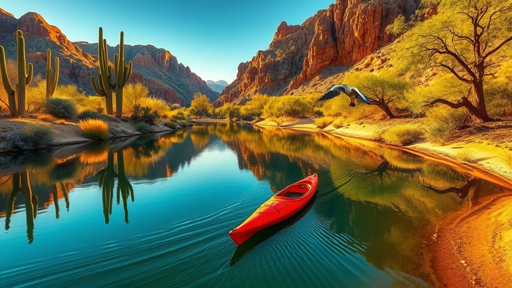
Kayaking the Lower Salt River is one of Arizona’s premier desert water adventures, offering calm Class I moving water, dramatic Sonoran Desert canyon walls, and frequent sightings of the famous Salt River wild horses and desert nesting bald eagles. Located just 40 minutes east of Phoenix within the Tonto National Forest, this river corridor provides a refreshing escape from the desert heat when approached with the right planning, permits, and safety knowledge.
Quick Answer
To kayak the Lower Salt River, launch from Water Users Recreation Area and take out at Phon D Sutton or Granite Reef for a 2- to 4-hour float (5 to 10 miles). You will need a Tonto Daily Pass, a Coast Guard-approved PFD, and flow rates between 800 and 1,500 CFS, which are standard during the summer release season (May through September).
Key Takeaways
- Water Flow Controls the River: Flow is regulated by Stewart Mountain Dam; recreational flows are highest (800–1,800 CFS) from May through September.
- Permit Requirements: A valid Tonto Recreation Pass or America the Beautiful Pass is mandatory on vehicle dashboards at all river access parking lots.
- Popular Route: The standard full-day float runs ~10 miles from Water Users Recreation Area down to Phon D Sutton (approx. 3.5 to 4.5 hours).
- Wildlife Ethics: Maintain a minimum 50-foot distance from Salt River wild horses and respect seasonal bald eagle nesting closures.
At a Glance
| Time Required | 2 to 5 hours (depending on launch/take-out sites and flow rates) |
| Difficulty | Beginner to Intermediate (Class I moving flatwater with occasional riffles, gravel bars, and wood strainers) |
| Tools & Gear Needed | Kayak/paddle, USCG-approved PFD, sound signaling device (whistle), dry bag, river booties, 3–4 liters of water per person, sun protection, Tonto Pass |
| Cost | $8–$12 per vehicle (Tonto Daily Pass) or America the Beautiful Pass; kayak rentals range from $35–$65 |
Planning Your Lower Salt River Trip
Successful river outings depend on checking real-time water conditions and securing necessary permits before you arrive at the boat ramp. The Lower Salt River flows through public lands managed by the US Forest Service — Tonto National Forest, meaning specific recreation rules apply.
Every vehicle parked at official river recreation areas must display a Tonto Daily Pass, a Tonto Discovery Pass, or an America the Beautiful Interagency Pass. Because on-site automated fee machines are not available at all river parking lots, purchase your pass online or at local retail outlets and gas stations along Bush Highway before entering the recreation area.
Water flow on the Lower Salt River is controlled upstream by the Salt River Project (SRP) via releases from Stewart Mountain Dam at Saguaro Lake. Flow rates dictate your paddling experience:
- Below 500 CFS: Low water. Common during late autumn and winter. Kayakers frequently scrape bottom on shallow gravel bars and may need to walk sections of the riverbed.
- 800 to 1,500 CFS: Ideal recreational flow. Common from May through Labor Day weekend. Provides steady downstream current, clean channels, and minor riffles.
- Above 2,500 CFS: Fast water. High current sweeps quickly around river bends and into brush; recommended only for experienced paddlers.
Pro Tip: Check real-time discharge levels via the USGS Salt River below Stewart Mountain Dam Gauge (Station 09502000) on the morning of your trip to confirm water speed.
Where to Launch and Take Out
All official access points along the Lower Salt River are located along the Bush Highway corridor northeast of Mesa. Because the river flows east to west, your launch site (put-in) must always be further upstream (east) from your take-out point (west).
| Launch Site (Put-In) | Take-Out Site | River Distance | Estimated Duration (at 1,000 CFS) |
|---|---|---|---|
| Water Users Recreation Area | Blue Point Recreation Area | ~4.5 miles | 1.5 – 2.0 hours |
| Water Users Recreation Area | Phon D Sutton Recreation Area | ~9.8 miles | 3.5 – 4.5 hours |
| Water Users Recreation Area | Granite Reef Dam Recreation Area | ~12.2 miles | 4.5 – 5.5 hours |
| Blue Point Recreation Area | Phon D Sutton Recreation Area | ~5.3 miles | 2.0 – 2.5 hours |
| Phon D Sutton Recreation Area | Granite Reef Dam Recreation Area | ~2.4 miles | 1.0 hour |
Most paddlers set up a two-vehicle shuttle: leave one vehicle at your designated take-out point before driving the second vehicle carrying your kayaks to the upstream put-in. Stage your gear deliberately and avoid parking in red-curbed emergency turnarounds.
Essential Gear and Safety Tips
Even though the Lower Salt River is largely calm, dynamic river hazards and extreme desert temperatures require disciplined preparation. Under Arizona Game and Fish Department Boating Regulations, every watercraft must carry a wearable, properly fitting USCG-approved personal flotation device (PFD) for each passenger, and children 12 and under must wear their PFD at all times while underway.
Warning: Desert summer temperatures along the river regularly exceed 105°F (40.5°C). Dehydration, heat exhaustion, and sun stroke are the most common emergencies on the river. Pack a minimum of one gallon (3.8 liters) of fresh drinking water per person, wear broad-spectrum sunblock, and avoid relying solely on alcoholic beverages.
Pack the following essentials for every run:
- Personal Flotation Device (PFD): Type III recreational life jacket equipped with an attached emergency whistle.
- Protective Footwear: Hard-soled water shoes or secure river sandals. Broken glass and sharp rocks are common along gravel bars.
- Dry Bag & Communication: Waterproof dry bag containing your cell phone, first-aid kit, vehicle keys, and repair tape.
- Hydration & Sun Protection: Insulated water jugs, electrolyte packets, wide-brim hat, UV sunglasses with retaining straps, and UPF-rated long-sleeve clothing.
- Throw Bag & Spare Paddle: A 50-foot floating throw line to assist swimmers caught in currents.
Note: Watch out for “strainers” — submerged willow and mesquite branches along outside river bends. Water flows through these branches while trapping boats and paddlers underwater. Steer your kayak toward the inside of river bends to maintain a safe cushion from riverbank brush.
Wildlife and Natural Highlights
The riparian corridor of the Lower Salt River cuts a vibrant green ribbon through the Sonoran Desert, creating a vital sanctuary for native and migratory wildlife. Paddling early in the morning offers the highest chance of quiet, close-range animal sightings.
“Watching a band of Salt River wild horses ford the cool morning water beneath towering red canyon cliffs is one of the most unforgettable wilderness encounters in the American Southwest.”
Keep your eyes open for these primary river species:
- Salt River Wild Horses: Descendants of historic Spanish and ranch stock, these protected horses frequent shallow riffles between Blue Point and Phon D Sutton to feed on eelgrass and cool off. State law and USFS guidelines require paddlers to stay at least 50 feet away. Never paddle directly between a mare and her foal or block a band’s access to the riverbank.
- Desert Nesting Bald Eagles: The Lower Salt River supports a rare population of desert-dwelling bald eagles. Watch for them in the branches of tall Fremont cottonwoods. Obey seasonal cliff closures (December through June) marked along certain river bluffs to avoid disturbing active nesting sites.
- Desert Bighorn Sheep: Occasionally seen grazing high on the volcanic cliffs above Water Users and Pebble Beach.
- Riparian Birds & Aquatic Life: Great blue herons, snowy egrets, osprey, river otters, and large sonoran suckers are common in slow-moving eddies.
Paddle Routes and Difficulty Levels
The Lower Salt River offers a straightforward class rating, but seasonal water releases and weekend traffic change river dynamics. Choose a route that matches your endurance and equipment.
Route Options Overview
Three primary float options serve varying schedules:
- The Quick Float (Water Users to Blue Point — 4.5 Miles): Perfect for beginners, late-afternoon paddles, or trial runs with new gear. Features scenic canyon walls and straightforward navigating.
- The Classic Salt River Run (Water Users to Phon D Sutton — 9.8 Miles): The quintessential day trip. Covers deep canyon stretches, popular horse crossings, and the confluence where the Verde River joins the Salt River just above Phon D Sutton.
- The Full Corridor Float (Water Users to Granite Reef — 12.2 Miles): Best for high-endurance paddlers seeking flat, quiet water below the Verde River confluence. Watch for headwinds across open flats on the final mile.
Difficulty Rating Scale
Under normal recreational summer flows (800–1,500 CFS), the Lower Salt River is rated Class I (Moving Flatwater) with brief moments of Class I+ riffles:
- Class I Riffles: Small wave trains occur near gravel bars (notably just below Water Users and near Pebble Beach). Easy to navigate by keeping your kayak pointed straight downstream.
- River Maneuvers Required: Paddlers must be comfortable back-paddling, ferrying across currents, and steering clear of tubers and anchored recreational groups.
- Self-Rescue: In the event of a capsize, hold onto your paddle, stay on the upstream side of your kayak to avoid being pinned, and back-stroke to the nearest gravel bar.
Access and Exit Points
Pay close attention to visual landmarks so you do not miss your designated take-out ramp:
- Water Users (Launch): Wide paved ramp with gravel shorelines just 2 miles below Stewart Mountain Dam on Bush Highway.
- Blue Point (Access/Exit): Located immediately downstream of the Blue Point bridge on the river left (south bank).
- Phon D Sutton (Exit): Marked by a large concrete ramp and shade ramadas on river left, situated just after the river bends past the Verde River confluence.
- Granite Reef (Final Exit): The last take-out before the impassable Granite Reef Dam structure. Exit on river left well before the safety buoys.
Local History, Conservation, and Leave-No-Trace Practices
Centuries before modern recreation, the ancestral Hohokam people engineered over 500 miles of hand-dug irrigation canals originating along this river basin, creating a thriving agricultural society in the Valley of the Sun. Today, the Lower Salt River remains the primary water lifeline for millions of Phoenix metropolitan residents.
Preserving this fragile desert river corridor requires strict adherence to Leave-No-Trace (LNT) principles:
- Pack It In, Pack It Out: Secure all trash, water bottle caps, and food wrappers in a secured dry bag or zippered mesh trash sack. Micro-trash harms river wildlife and aquatic birds.
- No Glass Containers: Glass bottles are illegal on the Lower Salt River and subject to hefty USFS citations. Use aluminum cans or stainless steel flasks.
- Respect Cultural Artifacts: Do not deface cliff faces, disturb historical sites, or remove natural objects from public land.
- Protect Water Quality: Apply mineral-based, biodegradable sunscreen to minimize chemical films in calm eddies.
Frequently Asked Questions
Are guided kayak tours available for beginners on the Lower Salt River?
Yes. Several licensed commercial outfitters in Mesa and Scottsdale offer guided 2- to 4-hour kayak and paddleboard tours on the Lower Salt River. These tours include equipment rental, safety briefings, river shuttles, and natural history guides who help spot wild horses and eagles.
What permits or parking passes are required for kayaking the Lower Salt River?
Every parked vehicle at USFS recreation sites (Water Users, Blue Point, Phon D Sutton, Granite Reef) must display a valid Tonto Daily Pass ($8–$12), Tonto Discovery Pass, or America the Beautiful Interagency Pass on the dashboard. Large commercial groups or organized events of 75+ participants require a special use permit from the Mesa Ranger District.
Are there kayak rental shops near the launch points?
Yes. Multiple outfitters operate along North Power Road and Bush Highway near Mesa. Many rental companies offer inflatable or hard-shell kayaks equipped with straps and soft roof racks for your vehicle, and select outfitters provide dedicated shuttle drop-off and pickup services directly to the river ramps.
Can dogs accompany paddlers on the Lower Salt River?
Yes, dogs are permitted on the river. Dogs should always wear a properly fitted canine life jacket equipped with a top grab handle. Keep dogs leashed at parking areas, ensure they remain seated in your craft around wild horses, and bring dedicated drinking water and booties to protect their paws from scorching river rocks.
What are the best months and times of day to kayak the river?
The best months for guaranteed floating water are May through September when SRP releases agricultural flows (800–1,500 CFS). During peak summer, launch between 6:00 AM and 8:00 AM to beat extreme desert afternoon temperatures and avoid heavy recreational tubing crowds.
Conclusion
Kayaking the Lower Salt River provides an accessible desert paddling experience that combines scenery, gentle Class I riffles, and iconic wildlife sightings just minutes from the Phoenix metro area. By securing your Tonto Pass in advance, checking USGS gauge flow rates, preparing for desert heat, and maintaining a respectful buffer around wild horses and nesting bald eagles, you can enjoy a safe, memorable, and conservation-minded float down this historic Arizona waterway.
Sources
- US Forest Service — Tonto National Forest: Lower Salt River Recreation Area — Official recreation area guidelines, day pass rules, and site management.
- USGS Water Data: Salt River below Stewart Mountain Dam, AZ (Station 09502000) — Real-time discharge rates (CFS) and gauge height.
- Salt River Project (SRP) Water Operations — Dam release schedules, canal diversion operations, and watershed management.
- Arizona Game and Fish Department: Boating Regulations & Safety — State PFD mandates, watercraft safety regulations, and eagle conservation closures.