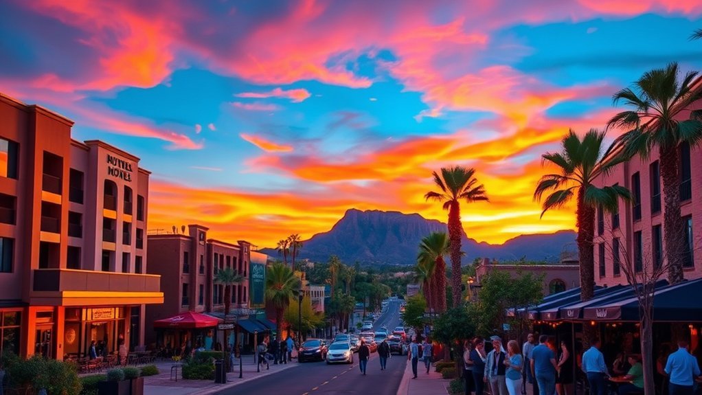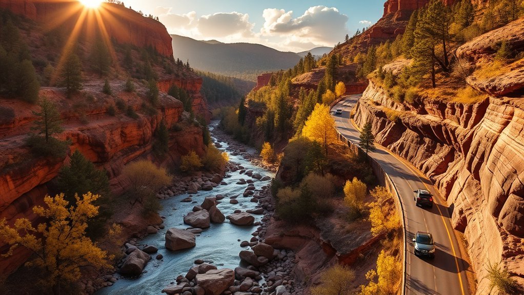
The route runs on a 15-mile stretch of State Route 89A between Sedona and Flagstaff. Expect tight curves, narrow lanes, and busy pullouts—especially on weekends.
Plan a few key stops, arrive early for popular trailheads, and leave extra time for photos and short walks.
This guide covers routes, overlooks, short hikes, safety tips, dog access, and local eats so you can shape a thoughtful, flexible outing—including which hidden turns (like the lane into West Fork) reward the best views.
Key takeaways
- The scenic drive is a 15-mile stretch of SR 89A between Sedona and Flagstaff (about an hour of driving, not counting stops).
- Fall color often starts in late September, peaks through October, and can linger into November.
- Parking is limited at the most popular sites—arrive early, especially for Call of the Canyon/West Fork.
- Some sites use Forest Service day-use passes, while West Fork/Call of the Canyon uses the separate Coconino Pass fee program.
- Drone rules vary by location; recreational drone use is prohibited in designated Wilderness areas.
Planning Your Oak Creek Canyon Drive
Ready to plan your Oak Creek Canyon drive? Pick a direction (Sedona to Flagstaff or vice versa), then choose a few overlooks and easy trails that match your pace. Parking is the main limiter, so keep one backup stop in mind.
- Check conditions before you go (winter ice, summer storms, and occasional construction can affect travel).
- Bring the basics: water, layers, sun protection, snacks, and sturdy shoes for slick rocks.
- Know the fees: some sites use Forest Service day-use passes, while others use the separate Red Rock & Coconino Passes program.
Best Times to Visit and Seasonal Considerations
Oak Creek Canyon is beautiful year-round, but timing matters. As of 2026-01-22, the Coconino National Forest notes that fall color in northern Arizona often begins in late September and peaks throughout October. In Oak Creek Canyon, color can continue well into November. Temperatures can change quickly with elevation.
Peak Foliage Timing
Because elevation and weather shift along the canyon, the exact peak changes year to year—and from rim to river. For the best odds, plan around October, with flexibility into early November. Weekdays and early mornings feel quieter, and canyon light is often best before midday glare.
Weather and Road Conditions
Spring can bring runoff. Summer brings crowds and monsoon storms. Fall is crisp (and busy). Winter can mean icy patches on shaded curves.
Before you go, check Arizona DOT’s AZ511 travel information for closures, construction, and road conditions.
- Early spring: muddy trails, higher water, fewer crowds
- Summer afternoons: warm mornings, possible storms, busy pullouts
- October: peak color potential, high visitor volume
- Late fall: clearer skies, earlier sunsets
- Winter: ice in shaded spots, limited services, quiet views
How to Get There and Parking Tips
If you’re coming from Flagstaff or Sedona, the classic canyon route is State Route 89A. It’s paved and suitable for regular passenger vehicles, but it’s narrow and winding—especially at the northern switchbacks—so take it slow and use pullouts to let faster traffic pass.
Parking can be the biggest challenge. During busy seasons, the Forest Service notes that Call of the Canyon / West Fork parking typically fills by 9:30 a.m. If that lot is full, pivot to an overlook or a less-busy picnic area and save West Fork for another morning.
Products Worth Considering

【Precise Garage Parking Assist】 SARDVISA 2-Pack garage tennis ball parking aid adopts eye-catching fluorescent yellow color to let you see it at a glance, which can accurately detect the position and distance of your vehicle. You can park your car in the garage easily with this parking guide system, you will never worry about scratching or colliding your car.

[New Wider Angle Upgrade] This updated product from Fosmon is perfect for a one or two car garage. The angle of the two lasers is widened up to 75 degrees, which can safely and efficiently assist two cars.
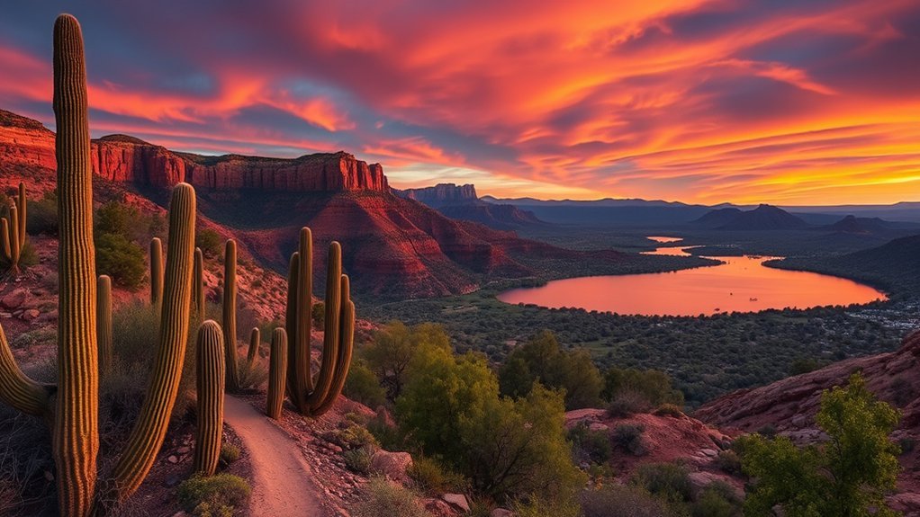
Scenic Pullouts and Photo Stops
Pullouts and overlooks let you soak in the canyon without stressing traffic. A few reliable, well-signed stops:
- Oak Creek Vista: near the top of the north-end switchbacks—big-picture views of the canyon.
- Midgley Bridge: a classic overlook with wide canyon scenery.
- Slide Rock State Park: historic orchard + creek access (state park entry fee applies).
- Grasshopper Point (day-use area): popular creek swimming and picnicking in warm months.
Slow for scenic pullouts along 89A—step out, breathe creek air, and capture red-cliff panoramas and intimate water reflections.
Hidden turn to know: the entrance lane for Call of the Canyon / West Fork is easy to miss and leads behind creekside homes. Watch signage and slow down early so you don’t brake hard at the last second.
Products Worth Considering

80*80 Oversized for 4-8 Adults: ZAZE Picnic blankets unfolded size is 80''x 80'', it’s large enough to fit for 6-8 adults for siting or 4 adults of lying, giving your family and pets a large area to play

Waterproof and sandproof This blanket is made of acrylic fibers+ PE waterproof membrane, the surface is soft and comfortable. And the PE waterproof membrane blocks moisture, anti sand and waterproof. Easily wiped away by simply shaking and slapping. It is your perfect partner to keep dry in a rainy camp site or wet grass for picnic or sandy beach

Thicker Filler for Comfort: TigeJoy picnic blanket is fully upgraded for next-level comfort. Thick, high-resilience cotton padding offers better support and softness. Whether sitting or lying down, you can fully relax, even on hard or uneven ground.
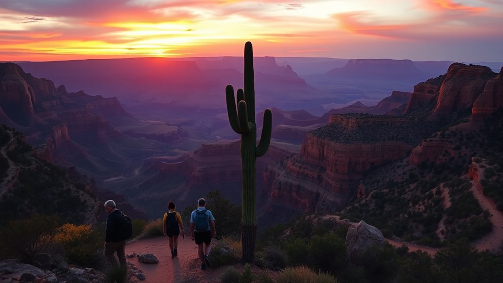
Short Hikes and Creekside Walks
After the pullouts, take a short walk to hear the creek and get under the trees.
- West Fork Trail (No. 108): easy for the first 3 miles, with multiple stream crossings; many visitors hike out-and-back for 2–3 hours.
- Other nearby options: Wilson Canyon, Huckaby, and Sterling Pass trails have trailheads along the corridor—choose based on your time and comfort with elevation.
Products Worth Considering

Unique Strap Design: Our small backpack features an innovative strap design with a zippered phone pocket on the left and a drawstring pocket on the right. The breathable mesh shoulder straps ensure comfort during your outdoor adventures, while reinforced stress points prevent strap breakage.

High-Quality Material:Hiking backpack is made of high quality rip-stop 210d nylon fabric,which is water resistant,tear resistant,anti-scratch and wear resistant. Furthermore,we also give away a rain cover with a clear silver reflective logo. It is putted in the little pocket under the backpack. So it is no doubt that all your things will keep dry during rain. Just take this outdoor backpack,no matter the weather.

FOLDABLE DESIGN: Unfold size 16.9*11.4*5.5in, folded size 8.7*6.3in.You can fold this backpack when you don't need it, which saves space and allows you to easily pack it in your suitcase, backpack
Picnic, Fishing, and Swimming Spots
Oak Creek is a magnet for warm-weather waterplay and shaded picnics. Stick to established day-use areas, wear shoes on slippery rocks, and keep an eye on changing weather.
- Developed picnic sites: Call of the Canyon and other signed picnic areas offer tables and (at some sites) restrooms.
- Swimming-style stops: Slide Rock State Park and Grasshopper Point are popular for wading and cooling off when conditions allow.
Safety, Wildlife, and Weather Advice
Stay alert to changing conditions and wildlife so your outing stays safe and respectful. Give animals space, store food securely, and watch for slick rock near the creek. During storms, water can rise quickly—if thunder builds, move away from the channel and avoid narrow drainages.
- Park fully off the road and never stop in travel lanes.
- Carry water and a basic first-aid kit; cell service can be unreliable in canyon walls.
- If the road is icy, skip the switchbacks and choose a lower-commitment stop.
Access for Dogs and Families
For kids and dogs, choose mellow stops with shade and easy footing. On Forest Service sites like West Fork and Call of the Canyon, dogs must be leashed. Bring extra water for pets, pack out waste, and avoid hot pavement in summer.
Local Eats, Rest Stops, and Nearby Towns
Services inside the canyon are limited. Plan to refuel in Sedona/Oak Creek Village or Flagstaff, then treat canyon pullouts as scenic breaks rather than guaranteed restroom-and-snack stops. Packing a simple picnic is often the smoothest option.
Hidden Gems and Lesser-Known Stops
Want quieter moments? Instead of circling the busiest lots, try less-hyped day-use areas and off-peak timing.
- Bootlegger, Encinoso, and Halfway picnic areas: smaller Forest Service sites that can feel calmer than the marquee stops.
- Early-morning Oak Creek Vista: sunrise light over the switchbacks with fewer people.
- Shoulder-season walks: in late fall and winter, short creekside strolls can feel almost private (watch for ice).
Seek solitude, tread lightly, and savor the wild.
Frequently Asked Questions
Are there entrance or recreation fees along Oak Creek Canyon Drive?
Yes. Some sites use Forest Service day-use passes, and others charge separate fees. For example, Call of the Canyon / West Fork accepts a Coconino Pass or a daily rate at the gate (as of 2026-01-22, $15 daily covers up to 5 people). Interagency “America the Beautiful” passes aren’t accepted there. Slide Rock State Park also charges its own entry fee, which can vary by season.
Is there cell service or emergency coverage on the canyon road?
Expect gaps. Canyon walls and elevation changes can make cell coverage unreliable, so download offline maps and tell someone your plan if you’re hiking away from the road.
Can I rent a kayak or paddleboard nearby?
Oak Creek itself is generally shallow and rocky, so most “paddling day” plans happen on nearby waters. For rentals and shuttles, look to the Verde River area around Cottonwood/Clarkdale and check current conditions and permit needs before you go.
Are there restroom facilities at major pullouts?
Some developed day-use areas have restrooms (for example, Call of the Canyon does), but many roadside pullouts are just viewpoints. If restrooms are essential, plan around state parks, visitor centers, or developed picnic sites.
Is drone flying permitted in Oak Creek Canyon?
Rules depend on where you launch. The Forest Service notes that recreational drone use is allowed in many places on National Forest System lands, but it’s prohibited in congressionally designated Wilderness areas. Always follow FAA rules and any posted local restrictions (including temporary closures).
Conclusion
You’ll think you’ve found paradise—until a raven photobombs your sunset selfie and a squirrel judges your trail mix choices. Still, Oak Creek Canyon’s red-rock walls, whispering creek, and classic overlooks can reset your pace. Arrive early, tread lightly, and let spontaneous detours lead you to quiet pullouts and creekside shade.