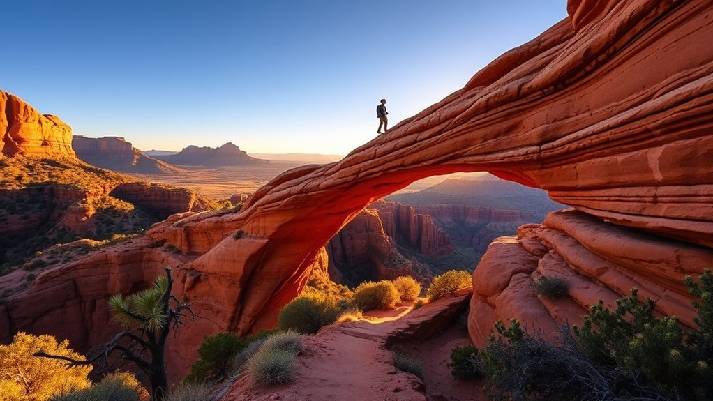
Devils Bridge is the largest natural sandstone arch in the Coconino National Forest, towering 54 feet above the wash floor. Carved over millions of years through wind and water erosion of the Schnebly Hill Formation, this geological landmark offers panoramic views of Sedona’s red rock country. Whether you approach via the family-friendly Mescal Trailhead or tackle the Chuckwagon Trail connector, reaching the bridge requires understanding trailhead options, parking limitations, rock scramble terrain, and local transit logistics.
Quick Answer
The standard hike to Devils Bridge via the Mescal Trailhead is 4.0 miles roundtrip with approximately 400 feet of elevation gain and takes 2 to 3 hours. Vehicles without high-clearance 4WD must park at the Mescal or Dry Creek Vista paved lots, or take the free Sedona Shuttle. The final quarter-mile features a steep natural stone staircase before reaching the 5-foot-wide natural bridge.
Key Takeaways
- Best Route: The Mescal Trailhead connector (4.0 miles RT) offers superior scenery and better trail conditions than walking the dusty Dry Creek 4WD road (4.6 miles RT).
- Transit & Parking: Paved parking fills by sunrise; use the free Sedona Shuttle (Line 11 to Dry Creek or Line 12 to Mescal) running Thursday through Sunday.
- Trail Difficulty: Rated moderate overall, with an easy dirt path leading to a steep, unrailed rock staircase scramble at the summit approach.
- Photo Protocol: Expect a 20- to 60-minute wait in line during peak midday hours to walk onto the bridge span for photos.
At a Glance
| Distance & Time | 4.0 miles RT (via Mescal) | 2–3 hours |
| Difficulty & Elevation | Moderate | 400–564 ft elevation gain |
| Passes & Fees | Red Rock Pass or America the Beautiful Pass required at paved trailheads |
| Trailhead Coordinates | Mescal Trailhead: 34°54’08.2″N 111°49’58.8″W | Dry Creek: 34°53’22.9″N 111°49’06.5″W |
Getting to Devils Bridge Trail: Trailheads and Parking
Planning your route to Devils Bridge starts with choosing the right trailhead. The true Devils Bridge Trailhead (#120) sits at the end of Forest Road 152 (Dry Creek Road), a deeply rutted, unpaved track accessible strictly by high-clearance 4WD vehicles (such as lifted Jeeps or OHVs). Standard passenger vehicles, sedans, and AWD crossovers cannot navigate this road.
Most hikers choose between two primary paved staging areas managed by the US Forest Service Coconino National Forest:
- Mescal Trailhead (Recommended): Located off Long Canyon Road. This route joins the Mescal Trail to the Chuckwagon Trail, leading directly to the Devils Bridge junction. It covers 4.0 miles roundtrip across scenic red sandstone singletrack.
- Dry Creek Vista Trailhead: Located at the paved start of Dry Creek Road. Hikers without 4WD must either walk the dusty 2.0-mile dirt road alongside motorized Jeep traffic or take the singletrack Chuckwagon Trail (#158) connector (4.6 miles roundtrip).
Pro Tip: Board the free Sedona Shuttle (Line 11 to Dry Creek Vista or Line 12 to Mescal) from the West Sedona Park and Ride lot (905 Upper Red Rock Loop Rd). The shuttle runs Thursday through Sunday year-round, eliminating parking congestion during peak visiting hours.
Devils Bridge Loop Hike: Route Breakdown and Scramble
Starting from the Mescal Trailhead, the hike follows an approachable, moderate grade through high-desert pinion-juniper forest before ascending the canyon wall. The trail divides into two distinct stages:
- The Lower Approach (Miles 0.0 to 1.5): Wide singletrack across red dirt and sandstone benches with gradual elevation change. This portion is suitable for casual hikers and supervised children.
- The Upper Scramble (Miles 1.5 to 2.0): The final quarter-mile climbs steeply via natural stone steps cut directly into the canyon cliff. This section requires three points of contact on steeper ledges and careful footing.
Warning: The upper rock staircase features steep drop-offs without handrails. Exercise caution with young children, hold handrails or rocks where available, and keep dogs on a secure, non-retractable 6-foot leash.
Mescal Trail Link: Desert Flora and Views
The Mescal Trail Link threads through a mosaic of high-desert plant communities along the base of Mescal Mountain. Hikers traverse exposed slickrock benches lined with Utah juniper, pinyon pine, banana yucca, and blooming Engelmann prickly pear cactus. Spring visits between March and May showcase vibrant yellow brittlebush and red penstemon blooms in the canyon washes.
| Trail Feature | Terrain Description | Key Vantage Points |
|---|---|---|
| Mescal Connector | Smooth slickrock & packed dirt | Mescal Mountain & Boynton Canyon mouth |
| Chuckwagon Junction | Dry wash crossings & red sandy soil | North view of Capitol Butte (Thunder Mountain) |
| Devils Bridge Spur | Natural stone staircase & rock shelves | Sub-arch canyon floor & upper arch bridge span |
“The bridge span measures approximately 5 feet wide and 45 feet in length, providing a stable walking surface despite the 54-foot drop directly beneath.”
Sunset Hike to Devils Bridge: Best Light and Photo Spots
Late afternoon brings golden hour illumination that accentuates the rust-red iron oxide of the Schnebly Hill sandstone. If you time your ascent for sunset, plan your photo positions carefully:
- Center Arch Perspective: Have your photography partner stand on the viewing ledge 50 feet away to frame you against the open sky and distant red-rock canyon walls.
- Eastern Rim Overlook: Step along the side shelf to capture the natural arch framing the Verde Valley below.
- Sub-Arch Trail: Take the lower fork before the staircase to walk directly under the span for dramatic upward-angle silhouettes.
Note: Darkness settles rapidly in the canyon after sunset. Always carry a dedicated headlamp with fresh batteries for the descent; smartphone flashlights are insufficient for navigating the upper stone steps.
Sunrise Hike: Beat the Heat and Crowds
An early morning departure remains the most reliable strategy to secure parking, avoid peak desert temperatures, and bypass long photo lines at the bridge.
Early Start Benefits
Temperatures during Sedona summers routinely exceed 95°F (35°C) by midday. Starting at civil twilight (30 to 45 minutes before official sunrise) ensures you complete the uphill scramble in cool morning temperatures. Furthermore, trail traffic between 6:00 AM and 7:30 AM is significantly lighter than midday peaks.
Trail Lighting Tips
When starting in pre-dawn darkness, use a headlamp with an adjustable beam (minimum 200–300 lumens). Keep light pointed downward at your immediate step path to spot loose sandstone gravel, drop-offs, and early-morning desert wildlife.
Wildlife & Safety
Dawn and dusk are peak activity hours for local wildlife, including mule deer, javelina, and western diamondback rattlesnakes. Stay centered on marked singletracks, watch hand and foot placements on rock ledges, and maintain a safe distance from all desert fauna.
Winter and Monsoon Season Considerations
Sedona experiences distinct seasonal weather shifts that directly affect trail safety and rock grip.
Winter Trail Hazards
Between December and February, winter storms occasionally dust Sedona’s higher elevations with snow. Sandstone becomes extremely slippery when covered with melting snow or black ice, especially along shaded cliff ledges on the upper staircase. Pack slip-on microspikes or traction cleats in your daypack during winter months.
Monsoon Safety Tips
From July through September, the North American Monsoon brings sudden afternoon thunderstorms. Wet sandstone loses traction rapidly, and low-lying trail crossings across Dry Creek wash can experience flash flooding. Check local forecasts with the National Weather Service Flagstaff Station and descend immediately if storm clouds build overhead.
Safety, Gear, and Trail Etiquette
Proper preparation ensures a safe outing and preserves the fragile desert ecosystem for future hikers:
- Hydration: Carry a minimum of 2 to 3 liters of water per person. There is no potable water available at any of the trailheads.
- Footwear: Wear trail runners or hiking boots equipped with sticky rubber outsoles (such as Vibram) to grip slickrock surfaces.
- Bridge Queue Etiquette: A natural line forms on the viewing platform during peak hours. Hikers take turns walking onto the bridge span; take 2–3 photos efficiently, and offer to photograph the solo traveler or group ahead of you.
- Leave No Trace: Pack out all waste (including organic food scraps and citrus peels), stay strictly on established singletracks to protect biological soil crusts, and avoid carving into sandstone walls.
Nearby Trails to Combine With Devils Bridge
If you want to extend your hike into a half-day or full-day outing in the Dry Creek and Boynton Canyon basins, consider these authorized trail linkages:
- Chuckwagon Trail (#158): A 5.4-mile scenic loop encircling the red rock hills around Dry Creek basin, ideal for rolling singletrack walking.
- Long Canyon Trail (#122): Extends northward into a secluded canyon corridor framed by towering 800-foot sandstone ramparts.
- Boynton Canyon Trail (#47): A nearby classic Sedona canyon trail featuring box-canyon views and accessible via a short road/connector link from Long Canyon.
Frequently Asked Questions
Is the Devils Bridge Formation Natural or Man-Made?
Devils Bridge is an entirely natural geological formation. It was created over millions of years as wind, rain, and freeze-thaw cycles eroded a weakness in the Schnebly Hill sandstone layer, leaving behind a 54-foot-high natural arch bridge.
Are Dogs Allowed on the Devils Bridge Trail?
Yes, dogs are permitted on Devils Bridge Trail but must be kept on a physical leash (maximum 6 feet) at all times per Coconino National Forest regulations. Be cautious on the final steep stone staircase, and bring ample water and paw protection for hot rock surfaces.
Is There an Entrance Fee for Sedona Vortex Sites Nearby?
Access to natural vortex areas on Coconino National Forest land is free. However, parking your vehicle at designated paved trailhead lots (including Dry Creek Vista and Mescal) requires a valid Red Rock Pass ($5/day, $15/week) or an America the Beautiful Interagency Pass displayed on your dashboard.
Can I Mountain Bike on Any Sections of the Devils Bridge Trail?
Mountain bikes are allowed on the lower Chuckwagon and Mescal connector trails, but bikes are strictly prohibited once you enter the designated Red Rock-Secret Mountain Wilderness boundary on the upper Devils Bridge Trail (#120) and on the bridge itself.
Are There Restroom Facilities at the Trailhead or Along the Trail?
Vault toilets are available at the Dry Creek Vista and Mescal Trailhead parking areas. There are no restroom facilities along the trail or at Devils Bridge itself. Plan ahead and pack out all human sanitation supplies in accordance with Leave No Trace principles.
Conclusion
Hiking to Devils Bridge is one of Sedona’s premier outdoor adventures. By opting for the scenic Mescal Trailhead route or using the free Sedona Shuttle, you avoid the rough 4WD road and parking congestion. Starting around dawn allows you to tackle the upper stone scramble in cool temperatures and enjoy the panoramic canyon views before midday crowds arrive. Pack plenty of water, wear grippy trail shoes, respect fellow hikers in the photo line, and leave no trace on this iconic red-rock trail.
Sources
- US Forest Service — Coconino National Forest — Official Devils Bridge Trail (#120) specifications, wilderness regulations, and trailhead management details.
- City of Sedona Trailhead Shuttle Services — Public transit routes, line schedules, and park-and-ride operational days for Mescal and Dry Creek trailheads.
- National Weather Service Flagstaff Office — Regional climate data, monsoon thunderstorm alerts, and seasonal temperature tracking for Sedona and Oak Creek Canyon.