If you’re looking for the best hikes near Jonesboro, Arkansas, you have several good choices without driving across the state. Craighead Forest Park and the Forrest L. Wood Crowley’s Ridge Nature Center provide the strongest trail networks inside Jonesboro, while Lake Frierson and Crowley’s Ridge State Park add easy and moderate hikes nearby. This guide also explains which originally listed destinations are better treated as Arkansas road trips rather than local Jonesboro hikes.
Quick Answer
For hiking close to Jonesboro, start with Craighead Forest Park for the widest variety of routes, Crowley’s Ridge Nature Center for short wildlife-focused walks, Lake Frierson State Park for an easy lake-area outing, and Crowley’s Ridge State Park for short forest hikes with more elevation and varied terrain.
Key Takeaways
- Craighead Forest Park is the best all-around local choice, with a 2.4-mile lake-side chat trail and a much larger network of wooded routes open to hikers.
- Crowley’s Ridge Nature Center has 3.1 miles of trails, including a short universally accessible boardwalk trail.
- Lake Frierson State Park is only 10 miles north of Jonesboro and works well for short hikes, birding, fishing, and family outings.
- Crowley’s Ridge State Park adds easy and moderate trails such as Lake Ponder, Dancing Rabbit, Spider Creek, and Walcott Lake.
- The Jonesboro Greenway is still being built in phases; 29 miles is the planned completed system, not a currently continuous 29-mile path.
- Bear Creek Cycle Trail, the Ozark Highlands Trail, and Mount Magazine are Arkansas road-trip destinations rather than hikes close to Jonesboro.
Best Hikes Near Jonesboro at a Glance
| Location | Trail Options | Difficulty | Best For |
|---|---|---|---|
| Craighead Forest Park | 2.4-mile chat trail plus wooded hiking and biking routes | Easy to challenging | Best overall local variety |
| Crowley’s Ridge Nature Center | 3.1 miles total; 0.25-mile Habitats Trail and 1-mile Craighead Forest Trail | Easy | Wildlife, families, accessible walking |
| Joe Mack Campbell Sports Complex | Paved walking track | Easy | Exercise walks and families |
| Jonesboro Greenway | Completed sections of a planned 29-mile network | Easy | Walking, jogging, cycling, transportation |
| Lake Frierson State Park | 0.5-mile Dogwood Lane Trail; Boundary Trail options | Easy to moderate | Short hikes, birding, lake views |
| Crowley’s Ridge State Park | 0.45-mile Lake Ponder, 1.25-mile Dancing Rabbit, 1-mile Spider Creek and others | Easy to moderate | Forest terrain and short day hikes |
| Village Creek State Park | Short nature trails plus longer hiking and multi-use routes | Easy to moderate | Longer Northeast Arkansas day trip |
Craighead Forest Park
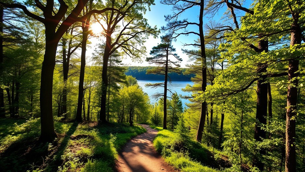
Craighead Forest Park is the strongest all-around hiking option inside Jonesboro. According to the City of Jonesboro Parks and Recreation Department, the park has approximately 13 miles of updated mountain-bike trails, a 2.4-mile chat trail around the lake, and a 3.2-mile paved road circling the park.
All of the park’s trails are open to hikers, so you can choose between an easy lake-side walk and longer wooded routes. The mountain-bike network includes beginner terrain as well as more demanding sections, making the park useful whether you want a casual stroll or a longer workout.
The 2.4-mile chat trail is the simplest choice if you mainly want lake views and a predictable route. Hikers seeking more distance can explore the wooded trail network, while runners may also use the paved road loop.
Warning: Craighead Forest Park is a mixed-use recreation area. Mountain bikes use many trails, and ATVs are allowed in a designated northwest section. Stay alert at intersections, listen for approaching riders, and avoid blocking the trail when stopping.
Craighead Forest Park also offers fishing, camping, playgrounds, picnic facilities, disc golf, restrooms, and other recreation. Three trails connect the park with the nearby Forrest L. Wood Crowley’s Ridge Nature Center, allowing you to combine both destinations in one outing.
Crowley’s Ridge Nature Center
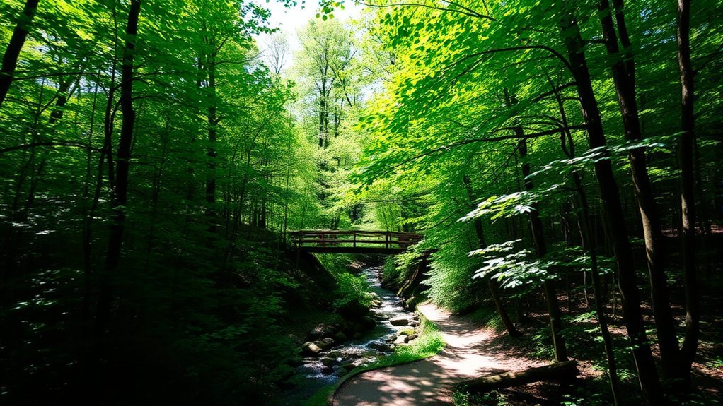
Located at 600 E. Lawson Road, the Forrest L. Wood Crowley’s Ridge Nature Center combines short hikes with wildlife exhibits and environmental education. The Arkansas Game and Fish Commission lists 3.1 miles of trails on the property, and admission to the nature center is free.
The nature center is one of the easiest places in Jonesboro to combine a short hike with wildlife viewing and hands-on learning.
The easiest route is the Habitats Trail, a universally accessible trail and boardwalk about a quarter-mile long. It loops around Willow Pond and passes ridge-top, prairie, levee, and seasonally flooded forest habitat.
The center also has a roughly 1-mile Craighead Forest Trail connecting toward Craighead Forest Park. Together with the other property trails, this gives you several ways to extend your walk beyond the accessible loop.
Inside the nature center, you can explore:
- A two-story wildlife diorama
- An exhibit hall with hands-on displays
- Live native wildlife in aquariums and terrariums
- Educational programs and seasonal events
- Gardens and wildlife-viewing areas
The building is currently open Tuesday through Saturday from 8:30 a.m. to 4:30 p.m., although holiday closures apply. The outdoor hiking trails are open every day from dawn to dusk.
Pro Tip: For a longer local outing, start at Craighead Forest Park and use the connecting trail system to include Crowley’s Ridge Nature Center. You can pair wooded hiking with the center’s exhibits without driving to another part of Jonesboro.
Joe Mack Campbell Park
Joe Mack Campbell Sports Complex is better considered a walking and exercise destination than a traditional nature hike. The City of Jonesboro facility listing confirms a walking track along with playgrounds, tennis, picnic tables, restrooms, and extensive baseball and soccer facilities.
Walking Track Options
The walking track provides a straightforward option when you want predictable footing instead of roots, rocks, mud, or uneven forest terrain. The city does not currently publish an official 1.1-mile or 1.5-mile hiking-loop measurement for the facility, so it is more accurate to describe Joe Mack as a maintained walking-track destination rather than a mapped hiking trail system.
Because the complex is built primarily around organized sports, it is especially useful for exercise walks, jogging, or getting steps in while other family members are using the athletic facilities.
Family-Friendly Activities
Families can combine a walk with the playground, picnic areas, tennis, or scheduled sports activities. Restrooms and picnic tables are also listed among the facility amenities, making Joe Mack convenient for a simple outdoor outing with children.
Unlike Craighead Forest Park, the complex is not a wooded hiking destination, so choose Craighead, Lake Frierson, or Crowley’s Ridge State Park when natural scenery is your main priority.
Accessibility Features Available
The official facility page lists handicap parking, and the maintained walking track can be easier to navigate than an unpaved forest trail. Visitors who need a specifically documented accessible nature trail should consider the universally accessible Habitats Trail at Crowley’s Ridge Nature Center or the barrier-free Lake Ponder Trail at Crowley’s Ridge State Park.
Note: Joe Mack Campbell Sports Complex has a no-pets policy except for service animals. Service dogs must remain leashed.
Jonesboro Greenway Trail
The Jonesboro Greenway is an important local walking, jogging, and cycling project, but the planned 29-mile network should not be confused with a completed 29-mile continuous trail. The City of Jonesboro says the Greenway is being constructed in phases and will connect major destinations around the city when complete.
Scenic Trail Views
Completed Greenway sections can provide an easy alternative to unpaved hiking. Because these routes are designed for transportation as well as recreation, they work well for walking, running, and cycling without committing to a forest trail.
Scenery varies by section. Rather than expecting wilderness, think of the Greenway as a way to move through Jonesboro while connecting neighborhoods, parks, and other destinations.
Multi-Use Pathways
The Greenway’s long-term purpose is to create a connected multi-use system for recreation and transportation. That makes it especially useful for walkers or cyclists who prefer developed paths and want to incorporate outdoor activity into a trip around the city.
Note: Check the City of Jonesboro’s active Greenway map before planning a long route. The final system is planned to total 29 miles, but individual completed segments should be used for current trip planning.
Connecting Community Destinations
When complete, the Greenway is intended to form a linear park and transportation connection around Jonesboro. Its value is therefore different from a single hiking trail: it is part recreation corridor and part local transportation network.
If your priority is forest scenery, start with Craighead Forest Park. If you mainly want a smooth urban walk or bike ride, the completed Greenway sections may be a better fit.
Lake Frierson State Park
Lake Frierson State Park deserves a place near the top of any Jonesboro hiking list. According to Arkansas State Parks, the park is only 10 miles north of Jonesboro on Highway 141 and sits beside a 335-acre lake.
For an easy hike, try the Dogwood Lane Trail, an approximately 0.5-mile route known for flowering dogwoods. The park also uses the Boundary Trail for longer moderate hikes. Depending on the planned route, this trail can provide a more substantial outing than Dogwood Lane.
Lake Frierson works especially well if you want to combine hiking with birding, fishing, a picnic, or time near the water. The park has a fishing pier, playground, launch ramp, picnic sites, campground, and visitor center.
The park is particularly attractive in spring when dogwoods are flowering, but its lake, birding opportunities, and trails can be enjoyed at other times of year as conditions allow.
Crowley’s Ridge State Park
Located near Paragould and conveniently positioned between Paragould and Jonesboro, Crowley’s Ridge State Park provides more traditional forest hiking than an urban walking track or Greenway.
The park has nearly five miles of hiking paths spread among several short trails. Good choices include:
- Lake Ponder Trail: about 0.45 mile, easy and barrier-free, with a boardwalk, stone overlook, and Civilian Conservation Corps history.
- Walcott Lake Trail: about 0.5 mile and easy, with birding and lake views.
- Dancing Rabbit Trail: about 1.25 miles and moderate, with varied terrain and swinging bridges.
- Spider Creek Trail: about 1 mile and moderate.
You can review current Arkansas State Park routes through the official state trail directory.
Crowley’s Ridge State Park is a strong choice when you want something more rugged than a paved city walk without committing to an all-day mountain hike. The short distances also make it easy to combine two or three trails in the same visit.
Village Creek State Park
For a longer Northeast Arkansas day trip, Village Creek State Park offers a much larger trail system through the distinctive ridges and stream valleys of Crowley’s Ridge.
Short options include the roughly 0.5-mile Big Ben Nature Trail, while longer routes include Lake Dunn Trail at about 2.77 miles and Austell Trail at a little over 2 miles. The park also has an extensive multi-use trail network for visitors who want significantly more distance.
Village Creek makes more sense when you have several hours available and want a deeper forest experience. For a quick hike close to Jonesboro, Craighead Forest Park, the Nature Center, or Lake Frierson will usually be more convenient.
Bear Creek Cycle Trail
Bear Creek Cycle Trail should not be treated as one of the best hikes near Jonesboro. It is located at Daisy State Park near Kirby in southwest Arkansas, making it a statewide road-trip destination rather than a Northeast Arkansas trail.
More importantly, the current Arkansas State Parks trail directory describes Bear Creek Cycle Trail as a 31-mile ATV trail following the Lake Greeson shoreline through rocky pine and oak terrain. That differs substantially from describing it as a 4-mile beginner-to-intermediate mountain-bike route.
| Feature | Current Information |
|---|---|
| Length | 31 miles |
| Primary Use | ATV trail |
| Terrain | Rocky terrain through mixed pine and oak forest |
| Location | Daisy State Park / Lake Greeson area near Kirby |
| Best Fit for This Guide | Farther-afield Arkansas recreation option, not a Jonesboro-area hike |
Ozark Highlands Trail
The Ozark Highlands Trail is one of Arkansas’s major long-distance hiking routes, but it is also well outside the immediate Jonesboro area. It is best viewed as a dedicated hiking or backpacking road trip.
The classic western section begins at Lake Fort Smith State Park and runs to Woolum on the Buffalo National River. The Arkansas State Parks description gives a distance of up to 165 miles and notes that hikers can tackle the route in sections instead of completing the entire trail at once.
The trail crosses ridges, valleys, streams, and rugged Ozark terrain, so preparation requirements are much greater than for a walk at Craighead Forest Park or Lake Frierson. Day hikers should select a defined trailhead and turnaround point rather than treating the full route like a casual local hike.
Warning: Current trail rules and alerts can change. A USDA Forest Service order running through December 31, 2026, unless rescinded earlier, restricts motorized vehicles, bicycles, horses, and similar use on designated hiking trails including the Ozark Highlands Trail and its connectors. Review current Forest Service alerts before a backcountry trip.
Mount Magazine State Park
Mount Magazine State Park is another excellent Arkansas hiking destination that does not belong in the immediate Jonesboro category. At 2,753 feet above sea level, Mount Magazine contains the highest point in Arkansas and offers a substantially more mountainous landscape.
The current Mount Magazine trail directory lists 14.2 miles of trails within the park system, with individual park trails generally ranging from about 0.5 to 2.8 miles.
Popular options include:
- Signal Hill Trail: 1.5 miles, moderate, leading to Arkansas’s highest point.
- Bear Hollow Trail: 2.8 miles, moderate.
- North Rim Trail: 2.2 miles, moderate to strenuous.
- Mossback Ridge Trail: 2.1 miles, moderate.
- Benefield Loop Trails: 2 miles, easy.
- Will Apple’s Road Trail: 1.6 miles, easy.
The park also connects with longer U.S. Forest Service routes outside the state-park boundary. That makes Mount Magazine appropriate for everything from a short high-point hike to a much longer outdoor trip.
The previously stated “12.4-mile Bench Trail” does not match the park’s current official trail list. For reaching the high point itself, Signal Hill is the relevant 1.5-mile route.
When Is the Best Time to Hike Near Jonesboro?
Spring and fall are generally the easiest seasons for longer walks because temperatures are typically more comfortable than during the hottest part of summer. Spring also brings flowering dogwoods at Lake Frierson and other Crowley’s Ridge locations, while fall can add seasonal color to wooded routes.
Summer hiking is still possible, but carry enough drinking water, use sun and insect protection, and consider starting earlier in the day. After heavy rain, unpaved forest trails may also become muddy or slippery.
Winter can provide quieter trails and clearer views through leafless forests, but always check the local forecast and park conditions before leaving home.
Hiking Safety and Trail Etiquette
Most Jonesboro-area hikes are short enough for beginners, but a few simple habits make them safer and more enjoyable:
- Carry drinking water even on short hikes during warm weather.
- Wear footwear appropriate for dirt, roots, mud, or uneven surfaces when leaving paved paths.
- Use insect repellent during tick and mosquito season.
- Stay on designated trails instead of cutting switchbacks or creating shortcuts.
- On mixed-use trails, remain alert for cyclists, horses, or motorized users where permitted.
- Keep children close near water, bridges, steep slopes, and trail intersections.
- Pack out litter and leave plants, wildlife, and natural objects where you find them.
- Check the managing agency’s current map or alerts before driving to a trail you have not visited recently.
Frequently Asked Questions
Are dogs allowed on hiking trails near Jonesboro?
Dog rules depend on the property. Do not assume every Jonesboro trail is pet-friendly. Joe Mack Campbell Sports Complex, for example, prohibits pets except service animals. Arkansas State Park trails commonly allow controlled, leashed pets, but you should follow the posted rules at the specific park you visit.
What is the best time of year to hike in Jonesboro?
Spring and fall are usually the most comfortable seasons for longer hikes. Spring is especially attractive for dogwoods and other blooms on Crowley’s Ridge, while fall brings changing foliage. Summer hikers should plan for heat, humidity, insects, and higher water needs.
Are there restroom facilities available on the trails?
Facilities vary by location. Craighead Forest Park and Joe Mack Campbell Sports Complex list restrooms among their amenities. Lake Frierson also has restroom facilities, although some facilities are seasonal. Do not assume restrooms will be located directly beside every trail or trailhead.
Is there a fee to access the hiking areas?
Fees depend on the activity rather than being identical everywhere. Admission to the Forrest L. Wood Crowley’s Ridge Nature Center is free. Camping, equipment rentals, reserved facilities, and certain programs at other parks may have separate charges, so check the managing park’s current information when planning paid activities.
Can I fish or swim in the lakes at the parks?
Fishing is available at several destinations, including Craighead Forest Park, Lake Frierson State Park, and Crowley’s Ridge State Park. Swimming rules are location-specific. Never assume a lake is open for swimming simply because fishing or boating is allowed; follow posted rules for the particular park and designated swimming areas.
What is the easiest hike near Jonesboro for beginners?
The quarter-mile Habitats Trail at Crowley’s Ridge Nature Center is one of the easiest choices. Lake Frierson’s roughly 0.5-mile Dogwood Lane Trail and the 0.45-mile Lake Ponder Trail at Crowley’s Ridge State Park are also good short options.
Which trail near Jonesboro is best for accessibility?
The Habitats Trail at the Forrest L. Wood Crowley’s Ridge Nature Center is specifically described as universally accessible. Lake Ponder Trail at Crowley’s Ridge State Park is also classified as a barrier-free trail and provides an easy boardwalk-and-overlook experience.
Conclusion
You do not need to cross Arkansas to find worthwhile hiking near Jonesboro. Craighead Forest Park offers the broadest local trail network, while Crowley’s Ridge Nature Center is ideal for short wildlife-focused and accessible walks. Lake Frierson State Park and Crowley’s Ridge State Park add easy and moderate trails within a convenient drive.
For a paved exercise walk, Joe Mack Campbell Sports Complex and completed portions of the Jonesboro Greenway offer alternatives to dirt trails. If you are willing to make a much longer Arkansas road trip, the Ozark Highlands Trail and Mount Magazine provide more demanding terrain, but they should not be confused with hikes in the immediate Jonesboro area.
Choose your trail based on distance, surface, difficulty, and facilities, check current park information before leaving, and carry enough water for the conditions. With those basics covered, Northeast Arkansas gives you plenty of ways to explore Crowley’s Ridge and the landscapes around Jonesboro on foot.
Sources
- City of Jonesboro: Craighead Forest Park Trails — official hiking, mountain-bike, ATV, paved-road, and lake-trail information.
- Arkansas Game and Fish Commission: Forrest L. Wood Crowley’s Ridge Nature Center — trail mileage, accessibility, hours, admission, and facilities.
- City of Jonesboro: Trails & Greenways — current status and planned 29-mile Jonesboro Greenway network.
- City of Jonesboro: Joe Mack Campbell Sports Complex — walking track, accessibility-related facilities, restrooms, recreation, and pet policy.
- Arkansas State Parks: Lake Frierson State Park — location, trails, facilities, fishing, and visitor information.
- Arkansas State Parks Trail Directory — verified Arkansas trail types, locations, distances, and difficulty information.