

Like a map unfolding, you’ll find hikes around Williams that shift from pine rims to desert canyons and alpine peaks. You’ll get clear route options, realistic effort estimates, and notes on trail conditions and seasons. I’ll point out standout views, logistics like parking and permits, and practical tips for water, timing, and sudden weather. Stick with me and you’ll know which trails match your pace and what to prepare for.
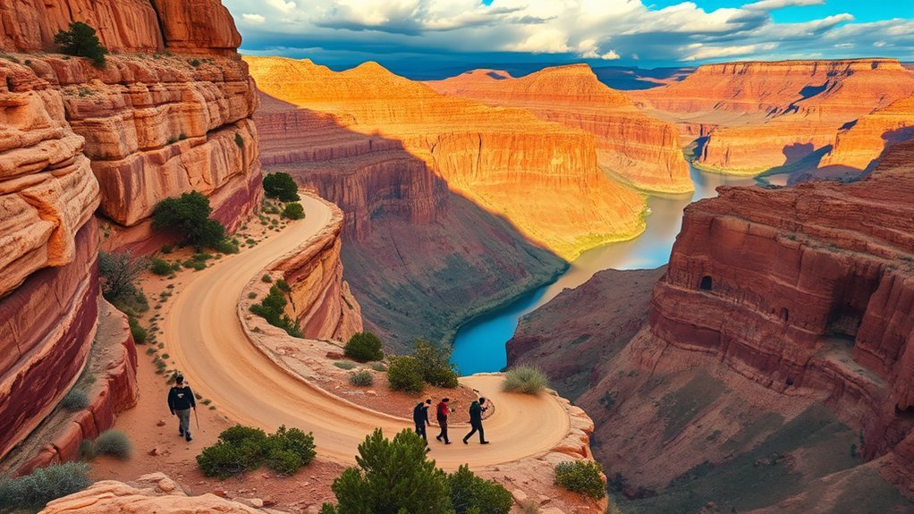
South Kaibab Trail to Ooh Aah Point

Starting from the ridge, you’ll follow the South Kaibab Trail as it drops sharply toward Ooh Aah Point, a short but steep out-and-back that rewards you with one of the Grand Canyon’s most immediate panoramic overlooks; the trail gains exposure quickly, uses switchbacks and carved steps, and covers about 1.8 miles round trip with roughly 400 feet of elevation change. You’ll feel the canyon open beneath you as layers of rock and light shift with each turn. Stay on the trail—there’s little margin for error where exposure increases—and use trekking poles for stability on the descent and return. Carry water and sun protection; there’s no shade. Expect wind and rapid temperature swings between rim and point. Arrive early to avoid crowds and harsh midday sun; lighting at sunrise or late afternoon enhances color and depth. Photograph carefully from the designated viewpoints, then retrace your steps with measured pace to manage energy on the climb out.
Bright Angel Trail to Plateau Point
You’ll follow the Bright Angel Trail down to Plateau Point, a steady path with well-marked switchbacks that rewards you with a broad Colorado River vista. Pack plenty of water and note the limited shade sections—there are water stations at the trailhead and at Indian Garden but none beyond. At Plateau Point you’ll get an unobstructed, panoramic lookout perfect for photos and short breaks before returning.
Trail Overview
Drop down from the rim on the Bright Angel Trail and follow the switchbacks and carved ledges as the trail descends toward the Colorado River, then branch off eastward along the relatively flat path to Plateau Point. You’ll cover about 3.5 miles each way from the trailhead to the overlook if you start at Indian Garden; distances vary if you start higher. Expect firm, well-maintained tread with occasional rock steps and narrow sections where you’ll pass other hikers. The grade eases after the junction, giving you steady walking on packed dirt and small gravel. Trail markers and cairns keep the route clear. At Plateau Point the path widens into a broad overlook with panoramic views of the river, inner canyon, and layered geology.
Water & Shade
Because the canyon is hot and dry, plan your water and shade strategy before you descend: carry at least 2–3 liters per person for the round trip from Indian Garden to Plateau Point and more if you’re starting higher or hiking in summer. You’ll pass limited natural shade; cottonwoods at Indian Garden are your main respite, but they’re crowded and brief. Start early, sip frequently, and monitor urine color.
- Bring a lightweight hat, breathable clothing, and a sun-protective neck gaiter to reduce evaporation and sun exposure.
- Use a hydration bladder or multiple bottles for easy access; ration to reach Indian Garden, refill, then conserve on the return.
- Plan breaks in shaded spots only; avoid lingering in exposed sun midafternoon and know emergency water-resupply options.
Scenic Lookout
When you round the final switchbacks of Bright Angel Trail and approach Plateau Point, the canyon suddenly opens into a broad, layered panorama that rewards the climb with a clear view of the Colorado River slicing through ochre and rust cliffs below. You’ll find a wide, flat ledge ideal for pausing, photographing, and studying geology: terraces, cross-bedded sandstone, and shadowed alcoves reveal the river’s erosive history. Wind can be sharp; dress in layers and secure loose items. Morning and late afternoon light produce the best color contrast and cooler temperatures. Stay behind railings where present and keep children close—edges are abrupt. If you time your visit near sunrise, you’ll watch sunlight creep down the walls, turning stone to molten color.
Humphreys Peak Trail
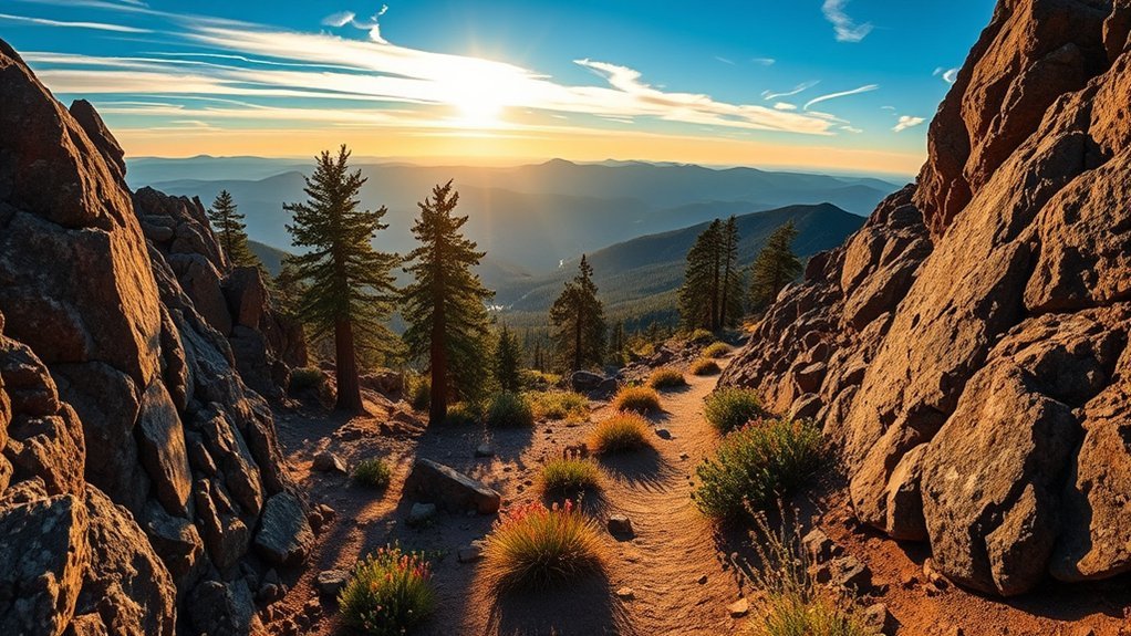
Tackle Humphreys Peak Trail to stand on Arizona’s highest point: a strenuous 10–12 mile out-and-back route (depending on trailhead) that gains about 3,500–4,000 feet and rewards you with alpine views, volcanic terrain, and seasonal snowfields. You’ll start through mixed forest, move into krummholz and tundra, and face sustained climbs and exposed ridgelines. Pace yourself, carry layers, and expect altitude effects above 10,000 feet.
- Choose your start: the standard trailhead from the Arizona Trail parking is steeper but direct; the Agassiz option adds distance with gentler grades.
- Time and season: summer offers clear trails and wildflowers; late spring and early fall can hold significant snow—microspikes or crampons may be required.
- Safety and logistics: bring 2–3 liters water, a map or GPS, sun protection, and an early start to avoid afternoon storms.
Summit time is typically 4–8 hours round-trip depending on fitness and conditions; descend conservatively.
Bill Williams Mountain Trail
After summiting Humphreys Peak you might want a gentler but still rewarding climb—Bill Williams Mountain offers that, rising to about 9,259 feet with mixed Ponderosa and aspen forests, open meadows, and sweeping views of the San Francisco Peaks and surrounding Coconino National Forest. You’ll find a well-marked trail that gains about 1,200 feet over roughly 3 miles one-way, making it a moderate out-and-back for most hikers. Expect shaded sections beneath tall trunks, intermittent clearings with wildflowers in season, and a summit ridge that exposes panoramic views ideal for photos or a quiet lunch. Trail footing is mostly packed dirt with some rocky stretches; wear sturdy shoes and carry water, as shade thins near the top. Wildlife sightings—elk, deer, and birds—are common at dawn and dusk. Cell service is limited; tell someone your plan and pack layers—the elevation can bring brisk winds and rapid temperature changes even in summer.
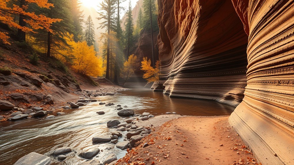
Sycamore Canyon Trail
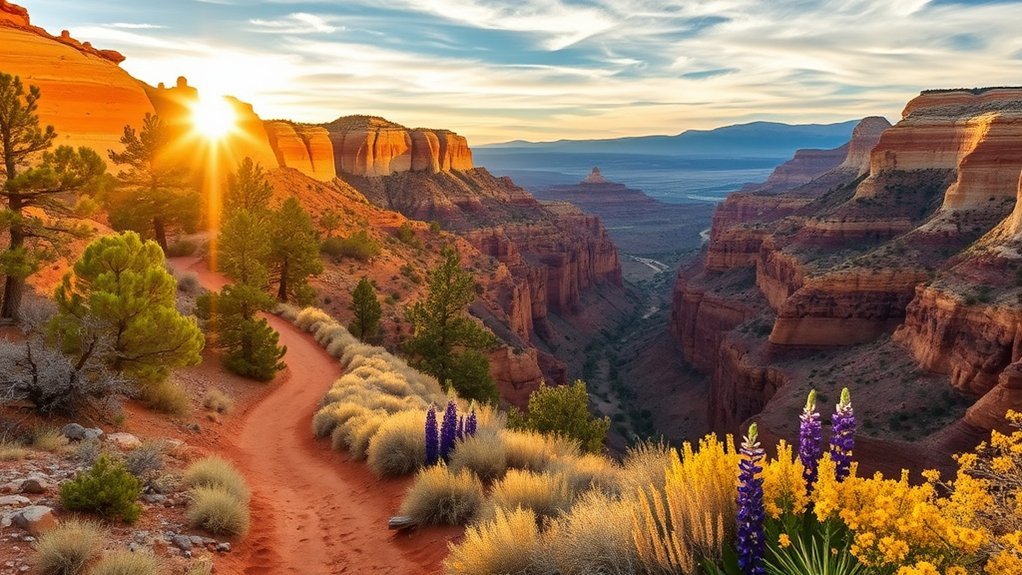
If you’re looking for a lush canyon hike that contrasts with the high, open slopes around Williams, Sycamore Canyon Trail delivers cool shade, towering cottonwoods, and a sinuous creek running through a deep, red-rock gorge. You’ll start on a well-marked path that drops steadily into the canyon; footing varies from packed dirt to rocky steps. Expect multiple creek crossings—some require stepping stones—so waterproof shoes help. Wildlife is common: mule deer browse the understory and songbirds flit among the cottonwoods. Carry water, sun protection for exposed approach sections, and a map or GPS; cell service can be spotty.
- Distance & difficulty: Moderate, typically 4–7 miles round-trip depending on turnarounds.
- Best time: Spring and fall for mild temperatures; spring brings green understory and streams.
- Hazards & tips: Watch for slippery rocks after rain, respect private land boundaries, and pack out all trash.
The trail rewards you with a cool, quiet canyon experience distinct from the surrounding high country.
West Fork Oak Creek Trail
While the drive into Oak Creek Canyon eases you down from the high plateaus, the West Fork Oak Creek Trail plunges you into a cool, fern-lined corridor where the creek weaves under towering sycamores and redrock walls. You’ll follow a well-marked path that often runs in the streambed, so expect multiple rock hops and shallow wades; sturdy shoes with grip are essential. The route’s 6.5 to 7.2 miles round-trip (depending on your turn-around) gains minimal elevation, making it approachable, yet navigation requires attention where side channels and private property intersect. Spring and fall offer the best temperatures and vibrant foliage; summer stays shaded but can be crowded. Pack water, a light first-aid kit, and a map or GPS—cell service is spotty. Photography opportunities abound: reflected cliffs, mossy banks, and seasonal wildflowers. Stay on trail to protect fragile riparian habitat, respect posted signs, and plan for decreased daylight in cooler months so your return stays safe and comfortable.
Kaibab National Forest Pine Trails Loop
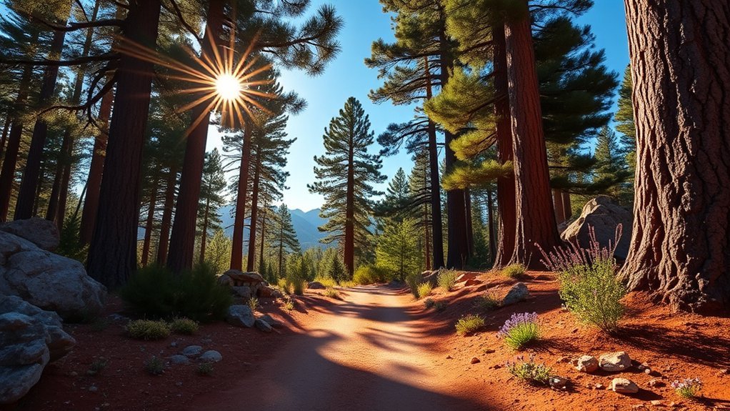
Often overlooked by day-trippers, the Kaibab National Forest Pine Trails Loop offers a shaded, high-country circuit of fragrant ponderosa and mixed conifer that’s ideal for a half-day hike or trail run. You’ll start on well-marked singletrack, switchbacking gently as elevation and views open toward rolling ridgelines. Expect soft needle beds underfoot, crisp forest air, and frequent benches for quick rests or photos. Navigation is straightforward, but pack a map and layers—weather shifts fast at higher elevations. Wildlife sightings (deer, birds) are common in mornings and evenings; keep distance and quiet. Trail surfaces vary from packed dirt to rocky tread; trail shoes with good traction work best. Water sources are scarce—carry what you’ll need. Dogs are allowed on leash; check seasonal closures for fire restrictions.
Often-overlooked Kaibab Pine Trails Loop: shaded ponderosa singletrack, crisp high-country air, easy navigation—bring water, layers, and a leash.
- Distance & time: ~6–8 miles, 2–4 hours depending on pace.
- Difficulty: Moderate—steady climbs, manageable grade.
- Best seasons: Late spring through early fall for trails and wildflowers.
Fossil Creek Trail
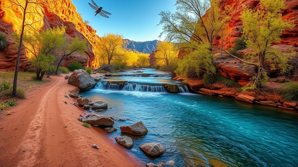
From the cool, pine-scented ridgelines of Kaibab, head east for a very different hike—Fossil Creek Trail delivers clear, spring-fed waters, riparian corridors, and striking travertine formations. You’ll follow a well-marked route that descends to the creek, where turquoise pools and small waterfalls reward steady footing and quiet observation. Expect a mix of packed dirt, rocky steps, and boardwalk over sensitive areas; good shoes and trekking poles help. Water levels vary seasonally, so plan swims or creek crossings accordingly and respect posted closures designed to protect native fish and springs. Bring a water filter if you’ll refill from tributaries, but pack out everything else—this basin’s ecology recovers slowly. Wildflowers and cottonwoods line shady reaches; wildlife sightings are common at dawn and dusk. The round-trip distance you choose can range from a short interpretive stroll to a longer canyon jaunt, so check trail maps and permit requirements before you go and allocate extra time for crossings and photo stops.
Sedona Red Rock Crossing and Cathedral Rock
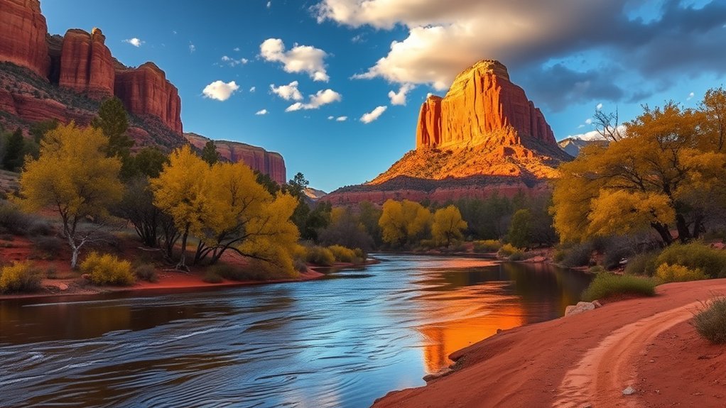
Start at Red Rock Crossing to step into some of Sedona’s most iconic scenery: the trail follows Oak Creek beneath towering red sandstone fins and leads you to the base of Cathedral Rock, where reflection pools and seasonal cascades make for excellent photos and a cool place to rest. You’ll follow a mostly flat path that becomes steeper and rockier as you approach the saddle; bring sturdy shoes and water. The site offers both easy creekside walking and a short, exposed scramble to the Cathedral Rock saddle for expansive views of Oak Creek Valley. Expect ankle-high water in spring runoff and calm pools in late summer; both create sharp reflections of the buttes. Photography is best in morning or late afternoon light. Wildlife sightings include songbirds and occasional mule deer. Parking fills early on weekends, so arrive before 9 a.m. or use shuttle/ride options.
Start at Red Rock Crossing for creekside strolls, reflections, and a short scramble to Cathedral Rock’s saddle—best in soft morning or late afternoon light.
- Trail type: mixed creekside walk and short rock scramble
- Distance: ~1–2 miles round trip (depending on route)
- Difficulty: easy to moderate
Williams Rim Trail
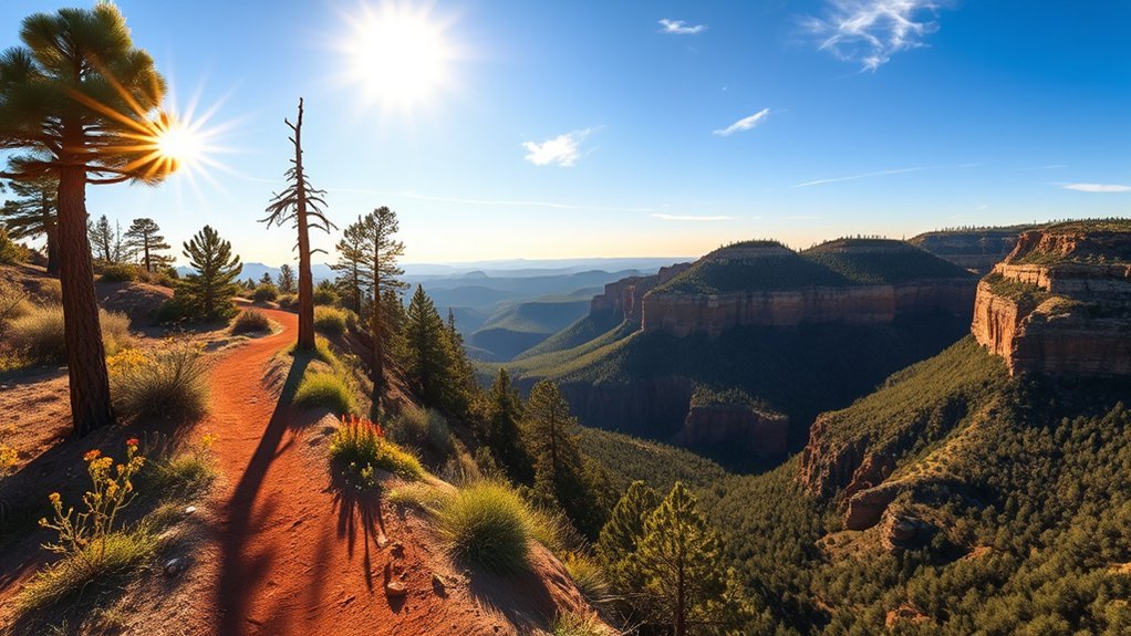
You’ll find the Williams Rim Trail offers a mix of smooth forest singletrack, rocky ridge sections, and open meadows that reward steady pacing. Keep an eye for elk, mule deer, and pinyon-juniper and ponderosa pine stands that change with elevation. For access, park at the signed trailhead off Forest Road 103A—arrive early in summer to snag a spot and pack water since services are limited.
Trail Overview and Terrain
Although the Williams Rim Trail stretches along the Kaibab Plateau for roughly 11 miles, it breaks naturally into several manageable sections that suit day hikes or overnight trips. You’ll follow a mostly well-marked singletrack that alternates between packed dirt, rocky tread, and occasional rooty stretches. Elevation changes are gradual but persistent, with short climbs and descents that test your legs without technical scrambling. Expect exposed ridgewalking with panoramic views and a few narrow segments where you should watch your footing. Trailheads offer clear access points and spurs connect to campsites and service roads, making bailouts straightforward if weather or time forces you to turn back.
- Distance and sectioning: choose loops or point-to-point
- Surface: dirt, gravel, rock
- Grade: steady, moderate inclines
Wildlife and Vegetation
When you hike the Williams Rim Trail you’ll notice a change from montane pine-fir stands to open meadow and rim-edge scrub, and that variety shapes the wildlife you encounter. You’ll move through Ponderosa pine and Douglas-fir where mule deer bed down and songbirds — scrub jays, warblers, and nuthatches — feed in the canopy. In meadows expect butterflies, grasshoppers, and occasional elk tracks; small mammals like chipmunks and ground squirrels are common near boulder fields. Raptors patrol the rim: red-tailed hawks and American kestrels use thermals to hunt. Plant life shifts to Gambel oak, manzanita, and native grasses with wildflower blooms in late spring. You should watch quietly at dawn or dusk for the best, least disruptive wildlife views.
Access and Parking Tips
Because the Williams Rim Trailhead sits just off Forest Road 618 and a short drive from Route 66, plan your arrival around parking and seasonal road conditions to avoid surprises. You’ll find a small unpaved lot with limited spaces; if it’s full, park safely on the shoulder where permitted and avoid blocking gates or driveways. In winter and early spring expect snow, ice, or muddy approaches—four-wheel drive or chains may be necessary. Leave valuables at home or stowed out of sight. Cell service is spotty, so screenshot maps and note landmarks before you leave town. Check the Coconino NF website or call the ranger district for closures or fire restrictions the morning of your hike.
- Arrive early on weekends.
- Carry a shovel or traction aids in winter.
- Respect signed parking limits.
Frequently Asked Questions
Are Dogs Allowed on These Trails?
Yes — you can bring dogs on many trails, but you’ll need to keep them leashed, clean up after them, and follow park-specific rules; some areas restrict pets, so check trail regulations and seasonal closures before you go.
What Is the Best Season to Visit Williams for Hiking?
Spring and fall are best for hiking in Williams; you’ll avoid extreme summer heat and winter snow, enjoy mild days, blooming wildflowers or colorful foliage, and find trails more accessible and less crowded for a better outdoor experience.
Are Permits or Fees Required for Any Nearby Hikes?
A stitch in time saves nine: yes, you’ll encounter fees and permits—Grand Canyon and some Kaibab areas require passes, Red Rock access or parking may charge, and backcountry camping mandates permits, so plan accordingly.
What Wildlife Should Hikers Expect to Encounter?
You’ll encounter mule deer, elk, coyotes, javelina, and numerous songbirds; you’ll spot ravens and hawks overhead, plus occasional rattlesnakes and mountain lions signs—stay alert, keep distance, store food securely, and respect wildlife behavior and habitats.
Where Are the Nearest Medical Facilities or Emergency Services?
The nearest emergency services are in Williams: Flagstaff Medical Center Northland (about 30–40 minutes) and Williams Fire/EMS downtown; for major trauma you’ll be transferred to Flagstaff or Prescott. Carry a first aid kit and call 911 immediately.
Conclusion
You’ve seen hikes from quick, creekside strolls to alpine summit pushes — now plan smart. Nearly 80% of day-hikers in the region start before 9 a.m., so beat the heat, carry 2–3 liters of water, layers, and a map. Expect sudden weather on Humphreys Peak, bring snacks, and leave no trace. Pick a route that matches your fitness: scenic rim walks for reflection, steep trails for a real challenge.
