Rochers de Naye is one of the easiest places to reach high-alpine scenery from Montreux. A cogwheel train climbs from the shore of Lake Geneva to a summit station above 2,000 meters, where you can enjoy viewpoints, seasonal alpine plants, marmot colonies, mountain restaurants, and hiking routes. This guide explains how to plan the trip, what is open by season, and which trails require extra care.
Quick Answer
Rochers de Naye is a 2,042-meter mountain above Montreux, Switzerland. The easiest way to visit is the cogwheel train from Montreux, which takes about 55 minutes. Allow half a day for the train and viewpoints, or a full day if you plan to hike, visit La Rambertia, or eat near the summit.
Key Takeaways
- Use the cogwheel train from Montreux for the simplest trip and check the live timetable before leaving.
- Plan two to four hours at the top for viewpoints and short walks, or most of a day for a longer hike.
- La Rambertia alpine garden is seasonal and normally opens from June to mid-October when snow conditions allow.
- The Naye Caves are currently closed until further notice; the steep Ladder Trail is for experienced hikers only.
- The Montreux-Rochers-de-Naye service is not accessible to wheelchair or walker users, according to MOB.
At a Glance
| Time Required | About 55 minutes each way by train, plus two hours to a full day at the mountain |
| Difficulty | Easy for the train and nearby viewpoints; moderate to difficult for marked mountain hikes |
| Tools Needed | Sturdy shoes, layered clothing, water, sun protection, and a weatherproof outer layer |
| Cost | Train fares vary by age, date, and rail pass; check the official MOB booking page |
What’s in This Article
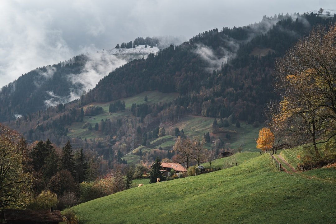
Rochers de Naye rises to 2,042 meters, or about 6,700 feet, in the Vaud Alps. On a clear day, the summit area opens to Lake Geneva, Montreux, the Swiss and French Alps, and distant high peaks. The railway climbs more than 1,600 meters from the lakeside region, so the landscape changes quickly from town and forest to open alpine ground.
The mountain works well for different travel styles. You can ride up, enjoy the view, and return without taking a long hike. You can also spend several hours exploring seasonal attractions or follow a marked mountain trail. The key is to match your plan to the weather, trail status, last return train, and your experience on steep ground.
How to Get to Rochers de Naye
The simplest route is the cogwheel train from Montreux. The ride takes about 55 minutes and passes Glion, Caux, forests, meadows, and steep slopes before reaching the summit station. Check the official MOB Rochers-de-Naye page and the live timetable on the day of travel because service patterns can change with the season, maintenance, snow, or special events.
Train Times, Tickets, and Reservations
Fares depend on your travel date, age, and discount card. Swiss Travel Pass, Half Fare Card, GA travelcard, Junior Card, and regional offers can affect the final price, so confirm the conditions shown during booking. General seat reservations are usually not required, but special packages and holiday events may use timed or assigned departures.
Arrive at Montreux station early enough to find the correct platform and board without rushing. Keep the return timetable saved on your phone or take a screenshot in case mobile service is weak. In winter, MOB may reduce service to Haut-de-Caux on selected weekdays, so never assume every train continues to the summit.
You can also hike from Caux, Jaman, or farther away, but these are mountain routes with meaningful elevation gain or descent. They are not simple substitutes for the train. Use an official map, check trail status, and choose a route that fits your fitness and experience.
Note: The train is the best choice if you want the high-mountain view without a long uphill hike. The journey itself is a major part of the experience.
Accessibility and Reduced Mobility
MOB states that the Montreux-Rochers-de-Naye service is not accessible for wheelchair or walker users. The summit area also includes steep, rocky, and uneven ground. Travelers with reduced mobility should review the current MOB accessibility information before buying tickets.
Families with small children should expect steps, narrow paths, and changing weather. A baby carrier may be more practical than a stroller beyond the immediate station area, but you should choose equipment based on current conditions and your child’s needs.
Things to Do at Rochers de Naye
Start with the viewpoints near the station and summit area. Clear conditions can reveal Lake Geneva, Montreux, the Savoy Alps, and distant peaks. Visibility can change within minutes, so take advantage of open views when you get them rather than saving every photo stop for later.
Look for Marmots
Rochers de Naye is known for marmot colonies. Sightings are never guaranteed, especially during cold weather, poor visibility, or busy periods. Watch quietly, keep your distance, and never feed or chase wildlife. A small pair of binoculars or a camera zoom lets you observe without disturbing the animals.
Visit La Rambertia Alpine Garden
La Rambertia alpine garden grows almost 1,000 alpine species, including hundreds of local varieties. It normally opens from June to mid-October when snow allows. Because the exact opening and flowering period depend on weather, confirm the current status before making it the main reason for your trip.
Enjoy Seasonal Activities
Summer is best for hiking and alpine plants. Winter can bring skiing and other snow activities when lifts, trails, and snow conditions allow. December may also include Santa-themed excursions that require separate booking. Treat every seasonal activity as conditional and check the official operator before traveling.
The main appeal is the contrast: in less than an hour, you can travel from Montreux’s lakeside setting to open alpine scenery above 2,000 meters.
Hiking and Nature Trails at Rochers de Naye
Rochers de Naye has short walks near the summit and demanding routes that connect with Jaman, Caux, and Montreux. Distances and times below come from official tourism or SwitzerlandMobility listings, but mountain conditions can change the difficulty. Always check the live route status and allow extra time.
| Route | Difficulty | Distance | Listed Time | Important Note |
|---|---|---|---|---|
| Rochers-de-Naye to Jaman in summer | Intermediate | 2.7 km | 1 hour 30 minutes | Short mountain route; confirm trail and return-train plans |
| Jaman to Rochers-de-Naye by Ladder Trail | Difficult | 3 km | 1 hour 20 minutes | Very steep steps, ropes, and exposed sections; experienced hikers only |
| Caux to Rochers-de-Naye | Difficult | 8 km | 3 hours | About 929 meters of ascent; a strong uphill hike |
| Via Alpina: Rochers de Naye to Montreux | Medium mountain trail | 14 km | About 4 hours | Roughly 1,700 meters of descent; steep and tiring despite limited ascent |
Current Naye Caves Closure
The Naye Caves route is closed until further notice for safety. Do not enter a closed route or rely on an older blog post that says the caves are seasonally open. The signed alternative is the Ladder Trail, but it includes steep stairs, ropes, a footbridge, and exposed terrain. It is not suitable in snow and is not recommended for inexperienced hikers or anyone uncomfortable with heights.
Warning: Do not start a long descent late in the day. Fog, thunderstorms, snow patches, wet rock, or a missed return train can turn a simple plan into a serious problem.
How to Choose a Safe Route
- Use official route maps rather than copying a trail name from an unverified travel article.
- Check the forecast, trail status, and last train before leaving the station area.
- Carry water, food, a charged phone, an offline map, and a rain or wind layer.
- Turn back if visibility drops or the ground becomes more exposed than expected.
- Avoid ridges, peaks, isolated trees, and open ground when thunderstorms threaten.
Wildlife and Flora at Rochers de Naye
Marmots are the best-known animals at Rochers de Naye, but they are wild and may stay hidden. You may also see alpine birds around cliffs and open ground. Other mountain animals live in the wider region, but sightings depend on season, time of day, noise, and luck.
The most reliable plant experience is La Rambertia. Its collection includes alpine species from different mountain regions as well as hundreds of local varieties. Peak flowering changes through the summer, so June, July, August, and September can each look different.
Stay on marked paths, keep dogs under control, and do not pick flowers. Alpine soil and plants recover slowly from trampling. Quiet movement also improves your chance of seeing wildlife.
Dining and Accommodation Options at Rochers de Naye
L’Alpin is the main mountain restaurant near the station and serves visitors who want a meal or drink. The Plein Roc venue is built into the rock and offers wide views, but access and service can be limited by opening hours, group bookings, or events. Check the current MOB restaurant information before relying on a specific menu or meal time.
Do not assume fondue, raclette, or another particular dish will always be available. Menus and hours can change by season. Carry water and a snack even when you plan to eat at the summit, especially if you are hiking.
There is no regular visitor accommodation at the summit. For an overnight stay, choose Montreux, Glion, Caux, Les Avants, or another nearby town. Montreux gives you the largest choice of hotels, restaurants, and transport connections, while Caux places you closer to mountain trails.
Note: A flexible stay in Montreux makes it easier to choose the clearest day for your mountain trip.
Best Time to Visit Rochers de Naye
Summer
Summer offers the broadest choice of hiking routes, longer daylight, and the best chance to visit La Rambertia. It is also a busy period, especially on clear weekends. An early train can give you quieter viewpoints and more time before afternoon weather changes.
Early Autumn
Early autumn can bring crisp air, clearer visibility, and fewer visitors. The alpine garden may remain open until mid-October if snow allows. Days become shorter, so check sunset and the return timetable before taking a long route.
Winter
Winter gives Rochers de Naye a very different atmosphere, with snow views and seasonal sports when conditions permit. Trails that are straightforward in summer may be unsafe or closed under snow and ice. Train and lift operations can also follow reduced schedules.
Clear weather matters more than the calendar if your main goal is the panorama. Use the official webcam, live timetable, and MeteoSwiss hazard map shortly before departure.
One-Day Rochers de Naye Itinerary
Morning
Take an early train from Montreux and use the ride to watch the scenery change. At the top, go to the nearby viewpoints first while visibility is good. Check the return departures before walking away from the station.
Midday
Visit La Rambertia if it is open, look for marmots from a respectful distance, and eat at the mountain restaurant or have the food you carried. If you plan a hike, start only after confirming the route status and enough remaining daylight.
Afternoon
Choose a short marked walk or return to the station area for more views. Take an earlier return train than the final possible departure so one delay does not leave you stranded. Back in Montreux, you can continue along the lakefront or visit another nearby attraction.
Pro Tip: Keep one flexible day in your Montreux schedule and choose the clearest morning for Rochers de Naye.
Tips for Visiting Rochers de Naye
- Check three things: the live train timetable, the mountain forecast, and trail or attraction status.
- Dress for the summit: conditions can be colder and windier than the Montreux lakefront.
- Wear proper shoes: smooth city shoes are a poor choice for rocky or wet alpine paths.
- Carry water and food: restaurant hours and queues can change.
- Protect yourself from the sun: use sunscreen, sunglasses, and a hat even on cool days.
- Save your return plan: take a screenshot of train times and avoid depending on the last departure.
- Respect wildlife: never feed marmots or approach them for a close photo.
- Leave no trace: pack out rubbish and stay on marked paths.
Frequently Asked Questions
What is Rochers de Naye?
Rochers de Naye is a 2,042-meter mountain above Montreux in Switzerland. It is known for its cogwheel railway, views over Lake Geneva, alpine hiking, marmot colonies, seasonal botanical garden, and winter activities.
How do I get to Rochers de Naye?
Take the cogwheel train from Montreux. The journey usually takes about 55 minutes. You can also hike from Caux or Jaman, but those routes are steep mountain hikes rather than easy walks.
How much time do I need?
Allow about half a day for the return train ride, viewpoints, and a short walk. Plan a full day if you want a meal, La Rambertia, wildlife watching, or a longer hike.
Do I need to reserve the train?
A general seat reservation is usually not required, but special packages and seasonal events may have timed departures or reserved seats. Check the booking conditions for your exact ticket.
Is Rochers de Naye suitable for children?
The train and nearby viewpoints can work well for families, but the summit has steep, rocky, and uneven areas. Keep children close and avoid exposed hiking routes unless everyone has suitable experience and equipment.
Is Rochers de Naye wheelchair accessible?
No. MOB currently states that the Montreux-Rochers-de-Naye train service is not accessible for wheelchair or walker users. Review the latest operator guidance before purchasing tickets.
Are the Naye Caves open?
No. Montreux Riviera currently lists the Naye Caves as closed until further notice for safety. The Ladder Trail is the signed alternative, but it is steep, exposed, and intended for experienced hikers.
Can I visit Rochers de Naye in winter?
Yes, the railway operates in winter, but service may be reduced and activities depend on snow and operating conditions. Check the live timetable, lift status, and weather warnings before leaving Montreux.
Can I take a dog on the train?
MOB allows dogs on its trains. Larger dogs normally need a second-class half-fare ticket or a dog pass, while small dogs may travel free in a suitable carrier. Keep your dog controlled around wildlife and on narrow trails.
What should I wear?
Wear layers, sturdy shoes with good grip, and sun protection. Carry a windproof or waterproof layer because the summit can be much colder and windier than Montreux.
Conclusion and Final Thoughts on Rochers de Naye
Rochers de Naye is one of the most rewarding day trips from Montreux because the train gives you easy access to real alpine scenery. You can keep the visit simple with viewpoints and lunch, or turn it into an active day with a verified mountain route.
The best visit is not the most ambitious one. It is the plan that fits the weather, current trail status, return timetable, and your experience.
Before leaving Montreux, confirm the train, weather, and opening status of the attractions you care about. Start early, carry basic mountain gear, and turn back when conditions worsen. With that preparation, Rochers de Naye can deliver a memorable view of Lake Geneva and a safe introduction to the Vaud Alps.
Sources
- MOB: Montreux-Rochers-de-Naye line — railway operation, winter service notes, seasonal activities, and safety planning
- Montreux Riviera: Rochers-de-Naye in Summer — journey time, elevation, hiking, and seasonal attractions
- SwitzerlandMobility: Via Alpina Stage 20 — official Rochers de Naye to Montreux route data
- Montreux Riviera: The Naye Caves — current closure and Ladder Trail warning
- Montreux Riviera: La Rambertia Alpine Botanical Garden — plant collection and seasonal opening
- MeteoSwiss Thunderstorm Safety — official guidance for exposed mountain terrain