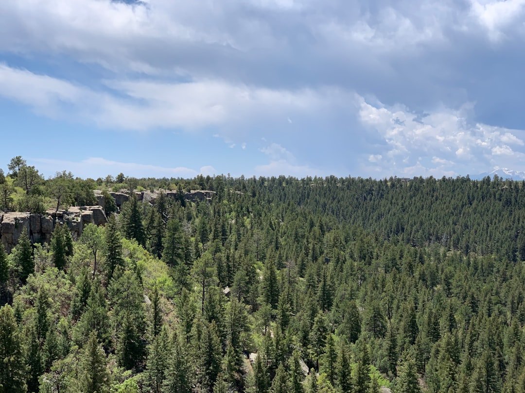
Schynige Platte is one of the Jungfrau Region’s classic mountain excursions, combining a historic cogwheel railway, a panoramic ridge walk, alpine flowers, and broad views toward the Eiger, Mönch, Jungfrau, Lake Thun, and Lake Brienz. The main visitor area is around 1,967 meters above sea level, and the best-known Panorama Trail is a roughly 6-kilometer circular mountain hike that starts and finishes near the Schynige Platte railway station.
Quick Answer
The Schynige Platte Panorama Trail is a roughly 6 km circular mountain hike with about 340 m of ascent. Plan around 2 to 2.5 hours for the walk, plus time for the historic railway and Alpine Garden. The trail offers exceptional views but includes uneven mountain terrain, so sturdy footwear and good weather are important.
Key Takeaways
- The Panoramaweg Schynige Platte is about 6 km long with approximately 340 m of ascent, and most visitors should allow around 2 to 2.5 hours.
- The historic Schynige Platte Railway starts in Wilderswil, not central Interlaken, and the mountain journey takes roughly 53 minutes.
- For the 2026 season, Jungfrau Railways lists Schynige Platte access from June 13 through October 25, so this should not be treated as a normal winter hiking excursion.
- The much longer Schynige Platte-Faulhorn-First hike takes around six hours and should not be confused with the short Panorama loop.
- The Botanical Alpine Garden displays around 800 plant species native to the Swiss Alps, representing roughly two-thirds of Swiss alpine flora.
At a Glance
| Time Required | About 2 to 2.5 hours for the Panorama hike; allow at least half a day when including the railway, viewpoints, meals, and Alpine Garden. |
| Difficulty | Moderate mountain walking. The physical demand is modest for regular hikers, but parts of the route are uneven and require steady footing. |
| Gear Needed | Supportive hiking shoes, water, weather layers, sun protection, snacks, and a phone or map for navigation. |
| Cost | A railway ticket is normally required unless you hike up. Jungfrau Railways lists Schynige Platte Railway tickets from CHF 34 for the 2026 season, but the actual fare depends on ticket type, age, travel pass, and discount eligibility. |
Getting to Schynige Platte
The normal journey to Schynige Platte begins at Wilderswil railway station. If you are staying in Interlaken, travel to Wilderswil first and transfer to the historic Schynige Platte cogwheel railway there. The mountain railway does not start in central Interlaken.
According to Jungfrau Railways, the Schynige Platte Railway covers 7.3 km while climbing approximately 1,420 vertical meters. Regular operation on the line began in 1893, and the railway still provides one of the most distinctive approaches to the mountains above Interlaken.
The historic railway climbs about 1,420 vertical meters over only 7.3 km between Wilderswil and Schynige Platte.
The mountain journey takes roughly 53 minutes. As the train climbs through forest and alpine pasture, views gradually open toward Lake Thun, Lake Brienz, and the high peaks of the Bernese Alps.
Note: For 2026, Jungfrau Railways lists Schynige Platte Railway and Panorama Trail operation from June 13 through October 25. Operating dates change between seasons, so check the official Jungfrau timetable before traveling.
Pro Tip: Check your return train before starting the hike, especially late in the season or late in the afternoon. A two-hour hike can become a transport problem if you finish after the final useful connection.
The Panorama Trail: What to Expect
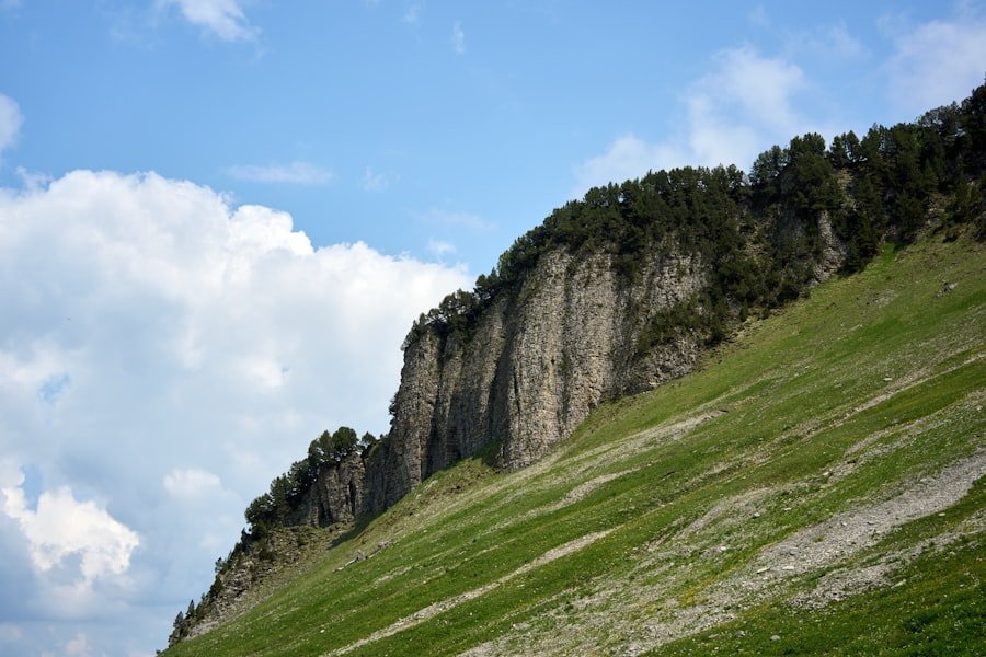
The main Panoramaweg Schynige Platte is a circular mountain route beginning and ending near the Schynige Platte visitor area. Switzerland Tourism lists the route at approximately 6 km with about 340 m of ascent and descent. Its published walking time is about 1 hour 55 minutes, while Jungfrau Railways recommends roughly 2.5 hours. For most visitors, planning 2 to 2.5 hours is sensible because you will probably stop repeatedly for views and photographs.
The route leads through alpine meadows and higher ridge terrain, with viewpoints toward the Eiger, Mönch and Jungfrau on one side and the Interlaken lakes on the other. Depending on the exact signed variation you follow, landmarks around the route include the Tuba or Daube viewpoint, Oberberghorn area, the direction of Loucherhorn, and the Oberberg huts.
The scenery is impressive, but this is still a mountain trail rather than a flat sightseeing promenade. Switzerland Tourism rates its physical requirement as easy while giving it a medium technical requirement. Expect natural surfaces, stones, uneven footing, climbs and descents.
Warning: Do not treat the Panorama Trail as an all-weather walk. Turn back or choose a shorter route if visibility deteriorates, thunderstorms approach, the trail is slippery, or someone in your group is uncomfortable on uneven mountain terrain.
Panorama Trail vs. Schynige Platte to First
Two hikes with very different demands are often confused. The Panorama Trail is the short circular hike that returns to Schynige Platte. The Schynige Platte-Faulhorn-First route is a long point-to-point high-altitude hike.
| Route | Approx. Distance | Typical Time | What to Expect |
|---|---|---|---|
| Panoramaweg Schynige Platte | About 6 km | About 2 to 2.5 hours | Circular mountain trail with roughly 340 m ascent; moderate technical terrain. |
| Swiss Flower & Panorama Trail | Short walk near station and hotel | About 30 minutes | Easier option focused on alpine flowers and mountain views. |
| Schynige Platte to First via Faulhorn | Roughly 16 km, depending on mapped variant | About 6 hours | Long high-altitude traverse via the Loucherhorn area, Faulhorn, Bachalpsee and First. |
If Loucherhorn or Faulhorn is your specific goal rather than the complete First traverse, use the current signed routes and a reliable hiking map. Distance and walking time depend on exactly where you turn around and whether you include additional viewpoints or summit sections, so a single fixed statistic can be misleading.
Hiking Schynige Platte: Tips and Advice
Preparation is straightforward, but it matters. Mountain weather can change much faster than conditions around Interlaken, and the exposed sections of the route can feel very different in wind, rain or poor visibility.
Check the Weather Before Leaving
Use a mountain forecast rather than relying only on what the weather looks like from the valley. The Swiss Federal Office of Meteorology and Climatology provides current forecasts and warnings through MeteoSwiss.
Thunderstorm activity in Switzerland is especially important during the warmer summer months. If storms are forecast, choose a shorter excursion or another day instead of committing to exposed ridge terrain.
Wear Proper Footwear
Supportive hiking or trekking shoes with good grip are a better choice than smooth-soled casual shoes. Some portions are rocky or uneven, and wet ground can make otherwise straightforward sections more difficult.
Carry the Basics
- Enough drinking water for your group
- Snacks or a packed lunch
- Sun protection, including sunscreen, sunglasses and a hat
- A light insulating layer
- A rain or wind shell
- A charged phone
- A basic first-aid kit
- A current hiking map or offline navigation
Start With Enough Time
Do not calculate your day using hiking time alone. You also need time for the railway journey, viewpoints, meals, the Alpine Garden and your return connection. Starting earlier gives you more flexibility if the hike takes longer than expected.
Season, Trail Conditions, and Safety
Schynige Platte is primarily a summer and early-autumn excursion. For 2026, the official visitor information lists the Schynige Platte season from June 13 through October 25. Snow, storms, maintenance or other mountain conditions can still affect individual days.
Stay on marked trails. Leaving the path can damage sensitive vegetation and may lead onto steeper or less stable terrain. If a signed trail is closed, do not bypass the closure.
Families should judge the Panorama Trail by the least experienced person in the group. A child who is comfortable walking several kilometers on rough mountain paths may enjoy it, but the route should not be described as universally suitable for every young child or complete beginner.
If your group wants mountain scenery with much less walking, the official Swiss Flower & Panorama Trail takes roughly 30 minutes and stays close to the main visitor area.
Wildlife and Flora on the Panorama Trail
The Schynige Platte area is especially well known for alpine flowers. What is blooming changes throughout the short mountain growing season, so the landscape can look different from June to August and into early autumn.
Marmots are associated with the wider Panoramaweg area, although sightings are never guaranteed. You may also encounter alpine birds and other mountain wildlife. Observe animals quietly from a distance and do not feed or approach them for photographs.
The plant life deserves the same care. Alpine flowers grow in a short and demanding season, so stay on the trail rather than stepping into meadows for a closer photograph. Edelweiss, gentians, alpine roses and many less familiar species can be seen in the wider Schynige Platte environment depending on the date and exact location.
Exploring the Alpine Garden
The Botanical Alpine Garden Schynige Platte is one of the most valuable additions to the hiking experience. Rather than displaying alpine plants gathered from around the world, it focuses on plants native to the Swiss Alps.
The garden states that visitors can see around 800 species, or roughly two-thirds of Swiss alpine flora, growing in communities designed to reflect natural alpine habitats. Its paths cover about 1,000 meters with only around 40 meters of elevation difference, making it much easier to explore than the main Panorama Trail.
The Alpine Garden Society was founded in 1927. Work on the garden began in 1928, and the garden opened in 1929. Its purpose has included education, scientific research, conservation and helping visitors understand how alpine plants adapt to demanding mountain environments.
Plant labels make it possible to identify species while walking through the garden. This is particularly useful if you have noticed flowers on the Panorama Trail but do not know their names.
Pro Tip: Visit the Alpine Garden before or after the Panorama hike instead of rushing through it. Around an hour gives you much more time to read the plant labels and photograph individual species.
Photography Opportunities on the Panorama Trail
Schynige Platte works particularly well for landscape photography because a relatively short hike provides several different compositions: the Bernese Alps, alpine meadows, ridge terrain, Lake Brienz, Lake Thun and the valleys around Interlaken.
The Eiger, Mönch and Jungfrau form the most recognizable mountain backdrop. From other parts of the route, turning away from the high peaks reveals a completely different view across the lakes and lower landscape.
Morning and later-afternoon light can provide softer contrast than the middle of a clear summer day, but your photography schedule should always fit the railway timetable and weather. If you want sunrise or sunset photographs, an overnight stay may be more practical than trying to force those times into a normal day trip.
Wildflowers can create useful foreground interest, but avoid leaving the path or standing in vegetation to obtain a photograph. A longer focal length can also help photograph flowers or wildlife without approaching them.
Useful Photo Subjects
- Eiger, Mönch and Jungfrau panorama
- Lake Brienz and Lake Thun
- Historic Schynige Platte Railway
- Ridge and meadow sections of the Panorama Trail
- Alpine flowers in the Botanical Alpine Garden
- Marmots or alpine birds when encountered naturally
- Mountain hotel and railway-station scenes
Dining and Relaxation Options
After hiking, you do not need to return immediately to Wilderswil. The Schynige Platte visitor area includes the traditional mountain hotel and Panorama Restaurant, where you can eat while looking toward the Eiger, Mönch and Jungfrau. Jungfrau Railways also lists a bistro near the summit station for drinks and snacks.
Regional Swiss food is part of the mountain-hotel experience. Rösti and fondue are familiar Swiss mountain dishes, but menus and individual dishes can change, so check the current offering rather than planning your visit around one specific item.
If you prefer a quieter break, allow time to walk around the visitor area, explore the garden or sit at a viewpoint before boarding the train down. That slower pace is often more enjoyable than trying to combine the railway, full Panorama loop, garden, meal and every viewpoint in the shortest possible visit.
Planning the Right Schynige Platte Visit
A half-day visit works well if your main goals are the railway, Panorama Trail and a quick meal. A fuller day gives you more time for the Alpine Garden, photography and relaxed stops.
Before leaving your accommodation, check three things: the mountain weather, current Schynige Platte operating information and the return timetable. Then choose your walking route according to your group’s experience rather than automatically selecting the longest option.
If your goal is the classic Panorama Trail, there is no reason to commit to the six-hour hike toward First. Conversely, experienced hikers planning the Schynige Platte-Faulhorn-First traverse should prepare for a substantially longer day and coordinate both the Schynige Platte Railway and transport from First/Grindelwald.
Sources
- Jungfrau Railways: Schynige Platte — current visitor information, altitude, railway tickets, attractions, restaurant and seasonal offers.
- Jungfrau Railways: Panorama Hike Schynige Platte — official Panorama hike description and walking-time guidance.
- Jungfrau Railways: Schynige Platte Railway — railway distance, elevation gain and operating history.
- Switzerland Tourism: Panoramaweg Schynige Platte — route distance, ascent, duration and difficulty.
- Botanical Alpine Garden Schynige Platte — plant count, Swiss alpine flora and garden information.
- MeteoSwiss Weather Hazards — official Swiss weather warnings for hiking-day planning.
Frequently Asked Questions
What is the Schynige Platte Panorama Trail?
The Schynige Platte Panorama Trail, also known as Panoramaweg Schynige Platte, is a circular mountain hiking route above Interlaken. It is about 6 km long, includes roughly 340 m of ascent and descent, and offers views of the Eiger, Mönch, Jungfrau, Lake Brienz and Lake Thun.
How do I get to the Schynige Platte Panorama Trail?
Travel to Wilderswil and take the historic Schynige Platte cogwheel railway to the mountain station. If you are starting in Interlaken, first travel to Wilderswil and transfer there. The mountain train journey takes roughly 53 minutes.
How long does the Schynige Platte Panorama Trail take?
Plan about 2 to 2.5 hours for the Panorama Trail itself. Published estimates differ slightly, and your actual time will depend on walking speed, trail conditions and how often you stop at viewpoints.
Is the Schynige Platte Panorama Trail suitable for beginners?
A fit beginner who is comfortable on uneven mountain paths may enjoy the route in dry, stable weather, but it should not be treated as a flat beginner walking path. Switzerland Tourism describes the physical requirement as easy but the technical requirement as medium. Sturdy footwear is recommended.
What are the highlights of the Schynige Platte Panorama Trail?
Highlights include views toward the Eiger, Mönch and Jungfrau, elevated views over Lake Brienz and Lake Thun, alpine meadows, ridge scenery, possible marmot sightings and easy access to the Botanical Alpine Garden.
Are there facilities or services available along the trail?
The main facilities are concentrated around the Schynige Platte station and mountain hotel area, where you can find food, drinks and visitor services. Do not depend on finding water or food once you are well into the Panorama Trail, so carry what you need.
What should I bring for the Schynige Platte hike?
Bring supportive hiking shoes, water, snacks, sun protection, an insulating layer, a rain or wind shell, a charged phone and basic first-aid supplies. Check the mountain forecast before leaving Wilderswil.
Can you hike the Schynige Platte Panorama Trail in winter?
Do not plan the normal Schynige Platte Panorama Trail as a winter railway excursion. For 2026, Jungfrau Railways lists the Schynige Platte season from June 13 through October 25. Always confirm the current operating dates and trail status for the year of your visit.
Is Schynige Platte to First the same hike as the Panorama Trail?
No. The Panorama Trail is a short circular hike of about 6 km. The Schynige Platte-to-First route via the Faulhorn is a much longer high-altitude hike of roughly 16 km that takes around six hours and finishes at First rather than returning to Schynige Platte.