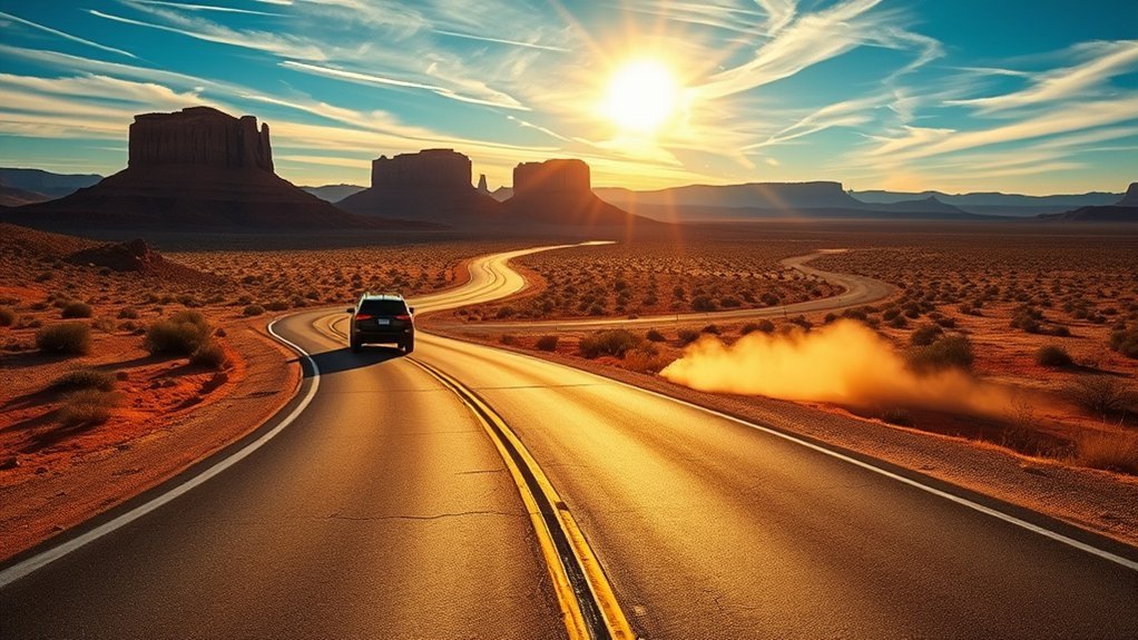
The drive from Flagstaff to Page is a straight shot on U.S. 89, but it deserves more planning than the map suggests. The route leaves Flagstaff’s pine forest, crosses open high desert and Navajo Nation lands, then reaches Page, Horseshoe Bend, Lake Powell, and the Antelope Canyon tour area. A full tank, an early start, and a realistic stop plan make the trip safer and far more enjoyable.
Quick Answer
The direct Flagstaff to Page drive follows U.S. 89 north for about 130 miles and usually takes around 2 hours 15 minutes without stops. Allow 4 to 8 hours if you add Wupatki, Cameron, Horseshoe Bend, meals, or a guided Antelope Canyon tour. Check AZ511, carry water, and leave extra time.
Key Takeaways
- Use U.S. 89 north for the fastest and simplest route from Flagstaff to Page.
- Fill your tank in Flagstaff and plan your next fuel stop before services spread out.
- Treat Oak Creek Canyon, Lees Ferry, and the Vermilion Cliffs as real detours, not quick roadside stops.
- Reserve an Antelope Canyon tour through an authorized operator because unguided entry is not allowed.
- Check road, heat, wind, and flash-flood alerts before driving, hiking, boating, or entering canyon country.
At a Glance
| Time Required | About 2 hours 15 minutes direct; 4 to 8 hours with meaningful stops |
| Difficulty | Easy highway driving, with extra planning for weather, fuel, and desert stops |
| Tools Needed | Full fuel tank, offline map, water, snacks, sun protection, layers, charger, and basic emergency kit |
| Cost | No tolls on the direct route; budget for fuel, parking, park entry, food, and guided-tour fees |
What’s in This Article
- Route Options and Driving Times
- Preparing for the Drive
- Best Time to Drive From Flagstaff to Page
- Scenic Stops Along the Way
- Flagstaff to Page Itinerary Options
- Hiking and Outdoor Activities
- Iconic Photo Opportunities
- Where to Eat and Refuel
- Overnight Stays and Camping
- Frequently Asked Questions
- Conclusion
- Sources
Route Options and Driving Times
The standard Flagstaff to Page route is about 130 miles on U.S. 89 north. In normal conditions, the nonstop drive takes about 2 hours 15 minutes. Traffic, road work, winter weather, high winds, slow vehicles, and photo stops can push the trip closer to 2.5 or 3 hours.
Direct Route on U.S. 89 North
- Leave Flagstaff on U.S. 89 north.
- Continue past the turnoffs for Sunset Crater Volcano and Wupatki National Monuments.
- Drive through the Cameron area and stay on U.S. 89 toward Page.
- At the U.S. 89 and U.S. 89A split near Bitter Springs, remain on U.S. 89 for Page.
- Continue through the Echo Cliffs area and follow signs into Page.
You do not need I-17 for the direct drive once you are in Flagstaff. The route is paved and suitable for normal passenger vehicles. Large RVs can also use U.S. 89, but drivers should check wind, road work, length restrictions at planned side stops, and fuel access before leaving.
Pro Tip: Check AZ511 before departure and again before leaving Page. It reports current crashes, closures, construction, weather alerts, and highway restrictions.
Scenic Route Options and Realistic Detour Times
The direct route is already scenic, so you do not need a major detour to see changing landscapes. Add a side trip only when it matches your schedule.
- Sunset Crater and Wupatki loop: This paved loop connects with U.S. 89 at two points north of Flagstaff. It works well for volcanic scenery and ancestral Pueblo sites, but stops and short walks can turn it into a multi-hour addition.
- Oak Creek Canyon: Oak Creek Canyon is south of Flagstaff on SR-89A, which is the opposite direction from Page. Treat it as a separate pre-drive excursion. A visit as far as Slide Rock or Sedona can take a large part of the day once you include backtracking, traffic, and stops.
- Lees Ferry and Navajo Bridge: Turn west onto U.S. 89A near Bitter Springs. Lees Ferry is about 42 miles from Page by road, so this is a meaningful out-and-back detour, not a quick pullout.
- Vermilion Cliffs area: U.S. 89A gives access to Marble Canyon and broad cliff views. Backcountry roads may require permits, high-clearance vehicles, or four-wheel drive. Do not follow an unverified GPS shortcut onto unpaved land.
Note: Much of the drive crosses or borders Navajo Nation lands. Stay on public roads, use signed parking areas, and follow all posted access, photography, and permit rules.
Preparing for the Drive: Essentials and Packing
Flagstaff sits at a much higher elevation than Page, so you can leave in cool mountain air and arrive in hot desert conditions. Pack for temperature changes, wind, strong sun, and limited shade.
- Start with enough fuel to reach your planned stop without relying on a single remote station.
- Carry drinking water for every passenger, plus extra for delays.
- Pack snacks with salt and energy, especially if you plan to hike.
- Bring sunscreen, sunglasses, a brimmed hat, and light layers.
- Wear sturdy shoes for sand, rock, steps, and exposed viewpoints.
- Download an offline map and save tour confirmations before leaving Flagstaff.
- Keep a power bank, flashlight, first-aid kit, paper map, and basic vehicle supplies in the car.
For hot, dry hiking, National Park Service guidance often uses about one quart or one liter of water per hour as a planning point. Your needs change with heat, effort, health, and body size. Sip regularly, eat salty foods or use an appropriate electrolyte source, and avoid drinking excessive amounts of plain water without food.
Warning: Never leave children or pets in a parked vehicle. Desert temperatures and sun-heated surfaces can become dangerous quickly, even during a short stop.
Best Time to Drive From Flagstaff to Page
Spring and fall usually give you the best balance of daylight and comfortable outdoor temperatures. Summer offers long days, but heat, thunderstorms, flash floods, and busy attractions require earlier starts. Winter can be quiet and beautiful, yet snow or ice near Flagstaff may slow the first part of the route.
| Season | What to Expect | Best Plan |
| Spring | Mild days, cool mornings, and possible wind | Bring layers and allow time for viewpoints |
| Summer | High heat near Page, limited shade, and monsoon storm risk | Leave early and avoid exposed hikes during peak heat |
| Fall | Comfortable hiking weather and shorter daylight later in the season | Start early and check sunset time |
| Winter | Cold starts, possible snow or ice near Flagstaff, and fewer daylight hours | Check AZ511 and avoid rushing after dark |
For photos and easier hiking, early morning and late afternoon usually give softer light and cooler air. Slot-canyon lighting depends on the canyon, season, cloud cover, and tour time, so do not book only because a general guide promises a light beam.
Time-zone note: Flagstaff and Page stay on Mountain Standard Time year-round, while the Navajo Nation observes daylight saving time. Phones can switch automatically near the boundary. Confirm the exact time shown on every tour reservation and arrive by the operator’s stated check-in time.
Scenic Stops Along the Way
You can drive straight through, choose one major stop, or build a full road-trip day. The best choice depends on how much walking you want and whether you already have a timed tour in Page.
Sunset Crater Volcano and Wupatki
The paved Sunset Crater-Wupatki Loop Road connects with U.S. 89 north of Flagstaff near mile markers 430 and 444. It combines lava fields, cinder-cone views, and ancestral Pueblo sites. Check Wupatki National Monument’s official visitor information before entering because visitor-center hours, trail access, and alerts can change.
This is the strongest cultural and landscape detour near the start of the drive. Give it several hours if you want to stop at pueblos and walk short trails rather than only drive through.
Cameron and the Little Colorado River Area
Cameron is the most practical mid-route place to pause for food, fuel, restrooms, or a driver change. Nearby viewpoints and tribal park areas may charge separate entry fees and follow Navajo Nation rules. National park passes do not cover Navajo Tribal Parks.
Use only signed entrances and current official information. Do not walk onto unsigned land or stop on the highway shoulder for a photo.
Echo Cliffs and Signed Pullouts
North of Cameron, the landscape opens into long views of mesas and the Echo Cliffs. Use established pullouts only. Avoid sudden stops, soft shoulders, and unsignaled turns because traffic can move quickly on open highway sections.
Horseshoe Bend
Horseshoe Bend sits just off U.S. 89 about five miles south of Page. The official trail is about 1.5 miles round trip on a hardened path. Shade is limited, there is no water along the trail, and much of the rim remains exposed. The City of Page charges for parking, and federal recreation passes do not cover that parking fee.
Leashed pets are allowed on the Horseshoe Bend trail, but hot ground can injure paws. Read the National Park Service Horseshoe Bend guidance before visiting.
Lees Ferry and Navajo Bridge, Optional Detour
Lees Ferry gives you rare road access to the Colorado River within Glen Canyon. It is about 42 miles from Page via U.S. 89 and U.S. 89A. Add it only when you have at least a few extra hours for the detour, river stop, and return drive. Check the official Lees Ferry page for access and service updates.
The best road-trip plan is not the one with the most stops. It is the one that gives you enough time to enjoy each stop without speeding, skipping water, or arriving late for a timed tour.
Flagstaff to Page Itinerary Options
Fastest Transfer: About 2.5 to 3 Hours
- Fill up and eat before leaving Flagstaff.
- Drive U.S. 89 north with one short break in Cameron if needed.
- Continue directly to Page, your hotel, or your tour check-in point.
This plan works when Page is your base and you will visit Horseshoe Bend or Antelope Canyon later.
Half-Day Drive: About 4 to 5 Hours
- Leave Flagstaff early.
- Stop in Cameron for a short break.
- Continue to Horseshoe Bend and allow enough time for parking and the 1.5-mile walk.
- Finish in Page for a meal or hotel check-in.
This is the easiest scenic plan for most first-time visitors because it adds one major stop without overloading the day.
Full-Day Road Trip: About 7 to 9 Hours
- Start early and drive the Sunset Crater-Wupatki loop.
- Pause in Cameron for fuel or food.
- Continue to Page for a reserved Antelope Canyon tour or Horseshoe Bend.
- Stay overnight in Page rather than driving back tired after sunset.
Do not combine every major detour in one day. Oak Creek Canyon, Wupatki, Lees Ferry, Antelope Canyon, and Horseshoe Bend together create a rushed schedule with too much driving.
Hiking and Outdoor Activities
Most road-trip walks near Page are exposed to sun, wind, sand, and sudden weather changes. Match your plan to the least experienced person in your group.
Hiking Trail Highlights
- Horseshoe Bend: A 1.5-mile round-trip walk with limited shade and an exposed rim.
- Wupatki sites: Short walks to ancestral Pueblo structures, with site-specific hours and rules.
- Page-area overlooks: Choose signed public trails and verify parking and access before leaving the highway.
Stay on marked routes, keep children close near drop-offs, and turn back before you use half your water.
Antelope Canyon Tours
Upper Antelope Canyon, Lower Antelope Canyon, and other Antelope Canyon locations on Navajo Nation land require a guide. Book through an operator listed by Navajo Nation Parks and Recreation. Tour prices, entry fees, meeting locations, bag rules, mobility demands, and cancellation terms vary.
Reserve well ahead for busy travel periods. Arrive early, follow the guide’s instructions, and do not enter a wash or slot canyon on your own.
Water and Canyon Activities
Lake Powell and the Colorado River support boating, paddling, fishing, and guided trips, but conditions change with wind, water levels, ramp access, and weather. Check current National Park Service alerts and use a properly fitted life jacket.
Morning can offer cooler air, but it is not a guarantee of calm water. Review the hourly wind forecast and turn back when conditions exceed your skill level.
Warning: Flash floods can travel far from the storm that caused them. Avoid slot canyons, normally dry washes, low-water crossings, and narrow side canyons whenever rain or thunderstorms are possible. Check National Weather Service Flagstaff flash-flood guidance before entering canyon terrain.
Iconic Photo Opportunities
The route gives you strong photo options without leaving the pavement. Pine forest near Flagstaff, volcanic ground near Sunset Crater, broad desert near Cameron, the Echo Cliffs, and the Colorado River near Page each create a different look.
- Use early or late light for broad landscapes and cliff texture.
- Use signed pullouts rather than stopping on the highway shoulder.
- Carry a lens cloth because dust and wind can coat phone and camera glass.
- Keep your body behind railings and away from unstable edges.
- Ask permission before photographing people, homes, ceremonies, livestock operations, or private property on tribal lands.
Drones are prohibited within Glen Canyon National Recreation Area and at Navajo Tribal Park locations. Commercial filming or photography may also require a permit. A recreational camera or phone does not remove your duty to follow site rules and respect privacy.
Where to Eat and Refuel
Flagstaff has the widest choice for breakfast, groceries, coffee, fuel, and last-minute supplies. Cameron is the main practical break between the two cities, while Page has restaurants, supermarkets, lodging, fuel, and tour offices.
- Fill up in Flagstaff when you begin with less than a comfortable range.
- Use Cameron as a planned break, not as your only possible fuel option.
- Top off in Page before driving to Lees Ferry, remote trailheads, or other side trips.
- For an RV or diesel vehicle, confirm pump access, fuel type, turning room, and opening hours before arrival.
Keep water and a simple meal in the vehicle even when you plan to eat at a restaurant. Closures, tour delays, and storms can shift your schedule.
Overnight Stays and Camping Options
Stay in Page when you have an early Antelope Canyon tour, want sunrise or sunset at Horseshoe Bend, or plan to explore Glen Canyon. Stay in Flagstaff when you prefer cooler evenings, pine forest, and a larger dining scene.
Campgrounds and backcountry rules vary across National Park Service, tribal, forest, city, and private land. Some sites are first come, first served, while concession-operated campgrounds may take reservations. Check the current Glen Canyon camping page for closures, fire rules, reservations, and waste requirements.
- Do not assume a remote campsite has water, shade, trash service, or cell coverage.
- Check fire restrictions before using a stove or campfire.
- Bring warm layers because high-desert nights can feel cold after a hot day.
- Use only legal campsites and obtain any required tribal or backcountry permit.
Frequently Asked Questions
How far is Flagstaff from Page, Arizona?
The direct route is about 130 miles on U.S. 89. Most drivers need around 2 hours 15 minutes without long stops, but weather, road work, traffic, and viewpoints can increase the time.
What is the best route from Flagstaff to Page?
Take U.S. 89 north from Flagstaff and stay on U.S. 89 at the U.S. 89A split near Bitter Springs. You do not need I-17 for the direct route once you are in Flagstaff.
Is the road from Flagstaff to Page paved and suitable for an RV?
Yes. The direct U.S. 89 route is paved and commonly used by passenger vehicles and RVs. Check AZ511 for wind, construction, closures, and vehicle restrictions, and confirm access before entering smaller side roads or parking areas.
Can you visit Page as a day trip from Flagstaff?
Yes, but the round trip is roughly 260 miles and at least 4.5 hours of driving before stops. Choose one major attraction, start early, and avoid a late return if weather or fatigue becomes a concern.
Can you bring pets to trails and viewpoints between Flagstaff and Page?
Rules depend on the site. Horseshoe Bend allows leashed pets, but hot ground and limited shade create serious risks. Do not assume pets are allowed on Navajo Tribal Park tours or in buildings. Check each stop before arrival and never leave a pet in the vehicle.
What cell service and internet options exist along the route?
Coverage can weaken between towns and near canyon terrain. Download offline maps, save reservation details, bring a charger, and write down key addresses. Do not rely on continuous streaming or live navigation.
Do you need permits for photography or drone use?
Personal photography is allowed at many public viewpoints, but commercial work may require a permit. Drones are prohibited in Glen Canyon National Recreation Area and at Navajo Tribal Park locations. Follow the rules posted for each site.
Will my phone change time zones near Page?
It may. Flagstaff and Page remain on Mountain Standard Time, while the Navajo Nation observes daylight saving time. Confirm the time on your tour booking and do not rely only on your phone’s automatic clock.
What safety alerts should you check before the drive?
Check road closures, winter weather, high winds, extreme heat, thunderstorms, and flash-flood warnings. Avoid washes, slot canyons, and low crossings when storms are possible, even if the rain is falling far away.
Conclusion
The best Flagstaff to Page drive follows U.S. 89 north with enough time for one or two well-chosen stops. Leave Flagstaff with fuel, water, offline maps, and confirmed reservations. Use Wupatki for a longer cultural detour, Cameron for a practical break, and Horseshoe Bend for the easiest major stop near Page.
Keep Oak Creek Canyon and Lees Ferry for schedules that can handle real backtracking. When you check current conditions, respect tribal and park rules, and avoid packing too much into one day, the drive becomes a highlight instead of a rushed transfer.
Sources
- Arizona 511: current highway incidents, construction, closures, weather alerts, and restrictions.
- National Park Service: Horseshoe Bend: trail distance, parking, heat, pet, edge, and drone guidance.
- Navajo Nation Parks and Recreation: Antelope Canyon Tour Operators: mandatory guided access and authorized operators.
- National Weather Service Flagstaff: Flash Floods: northern Arizona flood risks and safety advice.
- National Park Service: Wupatki National Monument: U.S. 89 access, loop-road details, hours, and visitor information.
- National Park Service: Glen Canyon Camping: current campground closures, regulations, fire rules, and backcountry requirements.