If you’re looking for the best bike trails in Oklahoma City, start with the kind of ride you want: a scenic lake loop, a relaxed river path, a family-friendly neighborhood route, or a true off-road mountain biking challenge. OKC’s trail system includes nearly 100 miles of multi-use trails, plus off-road cycling facilities, so you can plan anything from a short after-work spin to a longer weekend ride.
Quick Answer
The best Oklahoma City bike trails are Bert Cooper Trails for lake views, Oklahoma River Trails for a relaxed urban ride, Lake Stanley Draper Trail for the longest paved loop, Lake Stanley Draper Mountain Bike Trail for off-road riding, Deep Fork Trail for wooded connectivity, and Earlywine Trail for south OKC family outings.
Key Takeaways
- For the most scenic paved ride, choose Bert Cooper Trails around Lake Hefner or the Oklahoma River Trails near Boathouse Row.
- For the longest paved trail listed by the City of OKC, ride the 13.5-mile Lake Stanley Draper Trail.
- For mountain biking, use the separate Lake Stanley Draper Mountain Bike Trail near SE 89th Street and South Post Road; a permit is required.
- For families, Earlywine Trail offers useful park access, but parts of the route use on-street and shared-lane sections, so ride with extra care.
- Before you go, check the City of OKC trails page and the OKC Parks trail closures map for current access information.
Best Bike Trails in Oklahoma City: Quick Comparison
| Trail | Distance | Best For | Surface / Notes |
|---|---|---|---|
| Bert Cooper Trails | 9.8 miles | Lake Hefner views, sunset rides, steady paved mileage | Asphalt and concrete multi-use trail; part of the dam road is shared with vehicles |
| Deep Fork Trail | About 2.9 completed miles | Wooded riding and future east-west connectivity | Multipurpose trail being completed in phases |
| Lake Stanley Draper Trail | 13.5 miles | Longest paved lake loop and hillier paved riding | Wide ADA-compliant asphalt trail with more elevation change than many OKC trails |
| Lake Stanley Draper Mountain Bike Trail | About 12 miles | Singletrack, technical practice, off-road riding | Three connecting dirt loops; permit required |
| Earlywine Trail | 5.69 miles | South OKC parks, golf course access, family outings | On-street and sharrow sections; no trail connections |
| Oklahoma River Trails | 13 miles total | Relaxed river rides, Boathouse District, trail connections | About 6.5 miles of dedicated trail on the north and south banks |
Discover Oklahoma City Bike Trails: Bert Cooper Trails
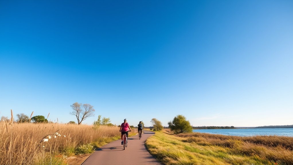
The Bert Cooper Trails, formerly known as the Lake Hefner Trails, are one of the best bike trails in Oklahoma City for lake views and consistent paved mileage. The route stretches 9.8 miles around Lake Hefner between NW Grand Boulevard and Hefner Road, using asphalt and concrete multi-use trail surfaces.
This is a strong choice if you want a scenic ride without leaving the city. Along the way, you’ll pass popular Lake Hefner amenities such as Stars & Stripes Park, Lions’ Children’s Park, the Oklahoma City Yacht Club, East Wharf restaurants, fishing docks, picnic areas, and water fountains. Parking is available at several points, including Stars & Stripes Park, near Lions’ Children’s Park, the East Wharf area off Britton Road, and the north parking lot off Hefner Road.
Note: A portion of the Bert Cooper Trails circles the dam road, which is shared by vehicles. Stay alert, ride predictably, and use extra caution where bikes, pedestrians, and cars mix.
For a longer ride, connect from Bert Cooper Trails to the Hefner-Overholser Trail near Britton Road or Canal Road west of the lake. That connection makes Lake Hefner a practical starting point for riders who want to build a longer paved route.
Explore Deep Fork Trail: Nature and Connectivity
The Deep Fork Trail is one of OKC’s newer multipurpose trail projects and a good pick if you want a more wooded ride with future connectivity in mind. The City of Oklahoma City says the trail is being completed in five construction phases. Three phases are complete, totaling about 2.9 miles, and the finished vision will connect the Katy Trail to the east with the Grand Boulevard Trail to the west along the Deep Fork River.
Deep Fork is especially useful for riders who care about the broader trail network. It is not just a short standalone ride; it is part of a larger plan to improve east-west movement through the city. The $14 million multipurpose trail was funded through the Better Streets, Safer City general obligation bond package.
Pro Tip: Because Deep Fork is being completed in phases, check the current route and access points before making it the centerpiece of a long ride.
Ride Lake Stanley Draper: Paved Loop or Mountain Bike Trail
Lake Stanley Draper offers two very different bike experiences, so it helps to choose the right one before you go. The paved Lake Stanley Draper Trail is a 13.5-mile lake loop for walkers, runners, and cyclists. The separate Lake Stanley Draper Mountain Bike Trail is an off-road dirt trail system near SE 89th Street and South Post Road.
Lake Stanley Draper Trail: Longest Paved Lake Ride
The paved Lake Stanley Draper Trail is a strong choice if you want a longer ride with more elevation change than many other Oklahoma City trails. The City describes it as a wide, ADA-compliant asphalt trail with a concrete curb line. Because it follows the hills around the lake, it feels more rolling than flat river routes.
This paved route is also a good option if you enjoy public art along the way. The trail includes City-funded public art pieces such as “Booya Car,” “Bee 52,” “360 Respite,” and “Convergence.”
Lake Stanley Draper Mountain Bike Trail: Off-Road Challenge
For mountain biking, head to the separate Lake Stanley Draper Mountain Bike Trail near SE 89th Street and South Post Road. The off-road trail system includes three connecting loops that can be ridden consecutively for about 12 miles. Difficulty ranges from very easy on the green loop to more challenging yellow and red loops.
Expect singletrack dirt trail, open sections with changing slopes, bridges, wood plank crossovers, technical drops, and switchbacks on the harder loops. This is the best choice in the article for riders who want dirt, handling practice, and more technical riding.
Warning: The Lake Stanley Draper Mountain Bike Trail requires a permit, which can be purchased at the Marina concession building. Also check current mountain bike trail conditions before riding; wet or muddy singletrack can be unsafe and can damage the trail.
Family-Friendly Activities on the Earlywine Trail
The Earlywine Trail is a useful south Oklahoma City route for families who want access to parks, open space, and the Earlywine Golf Course area. The route covers 5.69 miles and runs east-west between South Santa Fe / I-35 on SW 104th, turns south on Pennsylvania Avenue to SW 119th, then turns west on SW 119th and terminates at Meridian Avenue.
The big thing to know before riding is that Earlywine Trail is not a fully separated park path. It includes on-street and sharrow shared-lane sections, so families with young riders should choose lower-traffic times, ride single file where needed, and stay extra alert at crossings.
Scenic Park Attractions
Earlywine Park and South Lakes Park make the route more appealing for families. You can plan a casual ride, stop for a picnic, let kids enjoy open green space, or use the route as part of a relaxed outdoor afternoon. Earlywine Park is especially convenient if you want parking and park amenities close to the ride.
Golf Course Access
Earlywine Trail also connects riders to the Earlywine Golf Course area. That makes it easy to combine a bike ride with a round of golf, a walk around the park, or a longer family outing. If you are riding with children, treat the on-street sections as the deciding factor for whether this route fits your group’s comfort level.
Family Picnic Areas
For a low-pressure day outside, keep the plan simple: start near Earlywine Park, ride only the portion that feels comfortable, and build in time for snacks or a picnic. South Lakes Park and Earlywine Park both add green-space value, even if you do not ride the full 5.69 miles.
| Park Name | Best Use | Helpful Note |
|---|---|---|
| Earlywine Park | Picnics, parking, family outings, golf course access | Good starting point for a shorter ride |
| South Lakes Park | Open space, relaxed stops, neighborhood ride breaks | Plan your route around comfort with on-street sections |
Enjoy a Relaxing Ride on the Oklahoma River Trails
The Oklahoma River Trails are a great match for riders who want an easygoing urban ride with river views, parking options, and connections to other trails. The system includes two trails running along the Oklahoma River corridor and Boathouse Row to I-35, with 13 miles total and about 6.5 miles of dedicated trails on the north and south banks.
Scenic River Views
As you ride along the river, you’ll get a mix of open views, city energy, and access to the Boathouse District. The route works well for casual rides, fitness rides, and visitors who want a bike-friendly way to see another side of Oklahoma City.
Accessible Trail Amenities
Parking is available at several points along the corridor, including the Oklahoma Boathouse District, Wheeler Park, Wiley Post Park, Mat Hoffman Action Sports Complex, Exchange Avenue Bridge, Lincoln Avenue Bridge, and SW 15th and Portland. The Oklahoma River Trails also connect to the Bricktown Trail, Katy Trail, West River Trail, Lightning Creek Trail, and South Grand Trail.
If you want a relaxed ride with easy add-ons, this is one of the most flexible choices in OKC. You can ride a short out-and-back or use the river corridor as a connector to build a longer route.
Other Oklahoma City Bike Trails Worth Adding to Your List
The trails above are excellent starting points, but OKC’s broader network gives you more options once you know what kind of riding you enjoy.
- Hefner-Overholser Trail: A 7.8-mile route connecting the Bert Cooper Trails to the Overholser area, with mostly dedicated trail space and some on-street biking.
- Katy Trail: A 7.3-mile trail from Washington Park toward NE Grand Boulevard, NE 50th Street, and the Adventure District.
- Overholser Trail: A 3.2-mile route along the east side of Lake Overholser with connections toward Hefner and the Oklahoma River Trails.
- West River Trail: A 7.5-mile trail connecting the Oklahoma River Trails and Overholser Trail.
- Will Rogers Trail: A 9-mile route between the south side of Lake Hefner and the north side of the Oklahoma River.
How to Choose the Right OKC Bike Trail
Pick your trail based on surface, traffic comfort, distance, and the kind of scenery you want.
- Best for lake views: Bert Cooper Trails around Lake Hefner.
- Best for a longer paved loop: Lake Stanley Draper Trail.
- Best for mountain biking: Lake Stanley Draper Mountain Bike Trail.
- Best for a relaxed urban ride: Oklahoma River Trails.
- Best for south OKC park access: Earlywine Trail.
- Best for future connectivity: Deep Fork Trail.
OKC’s trail system is best enjoyed as a network: start with one comfortable route, then use connections like Hefner-Overholser, Katy, West River, and Oklahoma River Trails to build longer rides over time.
Essential Trail Etiquette for a Safe Experience
Good trail etiquette keeps Oklahoma City’s paths safer and more enjoyable for cyclists, walkers, runners, families, and dog owners. The City of OKC recommends staying aware of conditions, yielding courteously, keeping dogs leashed, and using proper lights when riding at night.
| Etiquette | Action | Why It Matters |
|---|---|---|
| Stay to the right | Keep right except when passing | Helps traffic flow smoothly in both directions |
| Signal before passing | Use a bell or say “to the left” | Reduces surprises and collision risk |
| Slow near crossings | Reduce speed around roads, bridges, families, and busy areas | Gives you more time to react |
| Leash dogs | Keep dogs leashed and clean up after them | Loose dogs can create hazards for cyclists and pedestrians |
| Ride prepared | Use a helmet, lights, water, and weather-appropriate gear | OKC heat, wind, night riding, and trail conditions can change the difficulty quickly |
Tips for Planning Your Perfect Biking Day in OKC
To make the most of your biking day in Oklahoma City, plan around weather, distance, parking, and trail conditions. Summer heat and wind can make an easy route feel harder, while wet, icy, or stormy conditions can make both paved and dirt trails less safe.
- Start early in warm weather: Morning rides are usually more comfortable during Oklahoma summers.
- Bring water: Some trails have fountains nearby, but you should not count on water being available exactly when you need it.
- Check closures: Use the OKC Parks trail closures map before you drive across town.
- Check dirt trail conditions: For mountain biking, review updates from the Oklahoma Mountain Bike Association trail conditions page.
- Use a reliable map: Start with the official City of OKC trails page. The Oklahoma Bicycle Society maps page is also a helpful secondary resource.
- Match the route to your group: Families and beginners may prefer shorter paved sections, while experienced riders can link trails for bigger mileage.
Note: Multi-use trails are shared spaces. Pedestrians, runners, children, dogs, skaters, and cyclists may all be using the same path, especially on weekends and near parks.
Frequently Asked Questions
What is the longest paved bike trail in Oklahoma City?
The longest paved trail in this guide is the Lake Stanley Draper Trail, a 13.5-mile paved loop around Lake Stanley Draper. It is a wide asphalt trail for walkers, runners, and cyclists, and it has more elevation change than many other OKC trails.
How long is the trail around Lake Hefner in OKC?
The trail around Lake Hefner is the Bert Cooper Trails, formerly called the Lake Hefner Trails. The City of OKC lists it as 9.8 miles of asphalt and concrete multi-use trail.
What is the best Oklahoma City bike trail for families?
For families, Bert Cooper Trails and the Oklahoma River Trails are strong paved options because they offer scenery, parking, and flexible ride lengths. Earlywine Trail can also work well for south OKC families, but parts of it use on-street and sharrow sections, so it is best for riders who are comfortable near traffic.
Do you need a permit for mountain biking at Lake Stanley Draper?
Yes. The City of OKC says the Lake Stanley Draper Mountain Bike Trail requires a permit, which can be purchased at the Marina concession building. This permit note applies to the off-road mountain bike trail, not the paved Lake Stanley Draper Trail loop.
What is the best map for Oklahoma City bike routes?
The best starting point is the official City of OKC trails page and interactive trail map because it lists trail locations, distances, amenities, and connections. The Oklahoma Bicycle Society maps page is also useful, especially if you want a cyclist-focused secondary resource.
What is the #1 tourist attraction in Oklahoma City?
Rankings vary by travel site, but the Oklahoma City National Memorial & Museum is one of the city’s most meaningful and widely recognized attractions. The National Park Service describes the memorial as one of the most visited places in Oklahoma, and it is a worthwhile stop if you are planning a broader OKC outing around your ride.
Are Oklahoma City bike trails open year-round?
Many OKC trails can be used year-round, but access and comfort depend on weather, construction, resurfacing, and trail conditions. Check the OKC Parks trail closures map before paved rides and the Oklahoma Mountain Bike Association trail conditions page before dirt rides.
Conclusion
Oklahoma City has a bike trail for nearly every kind of rider. Choose Bert Cooper Trails for Lake Hefner scenery, Oklahoma River Trails for an easy urban river ride, Lake Stanley Draper Trail for the longest paved loop in this guide, Lake Stanley Draper Mountain Bike Trail for dirt and technical riding, Deep Fork Trail for wooded connectivity, and Earlywine Trail for south OKC park access. Check the latest trail conditions, bring water, ride courteously, and you’ll have a safer, smoother day exploring OKC by bike.
Sources
- City of Oklahoma City — Trails — official trail distances, amenities, parking, connections, mountain bike permit note, and etiquette guidance.
- OKC Parks Trail Closures Map — current trail closure and access information.
- Oklahoma Mountain Bike Association — Trail Conditions — current off-road mountain bike trail condition updates.
- Oklahoma Bicycle Society — Maps — cyclist-focused map resource for Oklahoma City trails.
- National Park Service — Oklahoma City National Memorial Plan Your Visit — supports the FAQ note about the memorial being one of Oklahoma’s most visited places.