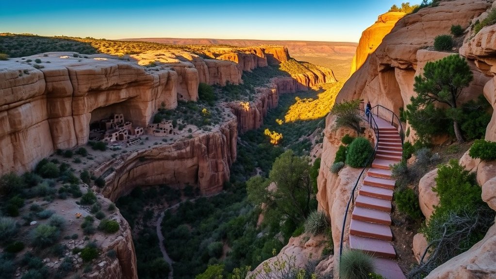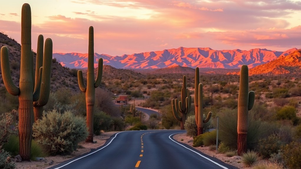
A Tucson to Saguaro National Park loop can look simple on a map, but the park has two separate districts on opposite sides of the city. Choose the district that matches your available time, road comfort, and preferred stops before leaving Tucson. Starting early also gives you cooler trails, softer photo light, and a better chance of finding parking.
Quick Answer
For the easiest Tucson to Saguaro National Park loop, visit one district at a time. Choose Saguaro East for the paved 8-mile Cactus Forest Loop Drive. Choose Saguaro West for the 6-mile unpaved Bajada Loop, Valley View Overlook, Signal Hill petroglyphs, and a nearby Gates Pass sunset.
Key Takeaways
- Pick Saguaro East for a paved scenic road, mountain views, and easy access from east Tucson.
- Pick Saguaro West for a graded dirt loop, denser cactus scenery, petroglyphs, and nearby Gates Pass.
- Allow about 2–4 hours for one district or a full day for both districts.
- The two visitor centers are about 30 miles and 45–60 minutes apart, depending on traffic.
- Enter the district’s complete street address in your map app instead of searching only for Saguaro National Park.
- Start hikes early, carry plenty of water, and check current park alerts before leaving Tucson.
- Bring a credit or debit card because the park does not accept cash.
At a Glance
| Time Required | About 2–4 hours for one district; 7–10 hours for both districts with city driving and short walks |
| Difficulty | Easy driving; short walks range from easy paved paths to rocky desert trails |
| Tools Needed | Vehicle, offline map or NPS app, water, sun protection, closed-toe shoes, snacks, and a payment card |
| Cost | Current seven-day fees are $25 per private vehicle, $20 per motorcycle, or $15 per person entering without a vehicle |
What’s in This Article
- Planning Your Drive and Best Times to Visit
- Directions From Tucson to Each District
- Choosing the Right Saguaro Loop From Tucson
- Sample Saguaro Loop Itineraries
- Must-See Overlooks and Photo Spots
- Top Short Hikes and Easy Trails
- Accessibility and Low-Walking Options
- Wildlife, Plants, and Seasonal Highlights
- Visitor Services, Safety Tips, and Practical Info
- Frequently Asked Questions
Planning Your Drive and Best Times to Visit
Plan your Saguaro drive around heat, light, travel time, and road conditions. Early morning gives you cooler air, softer light, and a better chance to see wildlife. Late afternoon also works well for photos, but leave enough time to finish your walks and exit gated areas before closing.
Saguaro National Park has two districts separated by Tucson. According to the National Park Service trip-planning page, the districts are approximately 30 miles apart, and driving between them normally takes about 45–60 minutes.
Saguaro East and Saguaro West are about 30 miles apart, so visiting both is a full-day trip rather than one continuous park loop.
The best seasons for most visitors run from late fall through spring, when daytime temperatures are generally more comfortable. Summer visits can still work, but walk near sunrise, avoid the hottest hours, and keep your route short. The park’s busiest period usually runs from November through March.
The Cactus Forest Loop Drive in Saguaro East is normally open from 5 a.m. to 8:30 p.m. year-round. Hohokam and Golden Gate Roads, which form the main driving route in Saguaro West, are open to vehicles from dawn to dusk. Temporary weather, construction, fire, or maintenance closures can override normal hours, so review the current park conditions before departure.
Pro Tip: Download the official NPS app and save Saguaro National Park for offline use. Cell service can weaken on scenic roads and at trailheads.
Directions From Tucson to Each District
Use the complete district address in your map app instead of searching only for “Saguaro National Park.” The official NPS directions page warns that mobile map searches can confuse the two districts.
Directions to Saguaro East
Rincon Mountain District address: 3693 S. Old Spanish Trail, Tucson, AZ 85730.
- From central Tucson, travel east on Broadway Boulevard toward Freeman Road.
- Turn right on Freeman Road and continue south for about 3 miles.
- Turn left on Old Spanish Trail.
- Continue about 0.25 mile to the park entrance on the left.
Drivers arriving from Interstate 10 can use Exit 275 at Houghton Road, travel north, turn right on Escalante Road, and then turn left on Old Spanish Trail. Confirm the full route before leaving because construction and traffic patterns can change.
Directions to Saguaro West
Tucson Mountain District address: 2700 N. Kinney Road, Tucson, AZ 85743.
- From central Tucson, travel west on Speedway Boulevard.
- Continue over Gates Pass to Kinney Road.
- Turn right on Kinney Road and travel north.
- Enter the park near Mile Wide Road and continue to Red Hills Visitor Center.
Gates Pass Road is steep, winding, and unsuitable for some large vehicles. The NPS lists a 12,000-pound vehicle weight limit and does not recommend the route for vehicles longer than 25 feet. Larger vehicles should approach from the north using Avra Valley and Sandario Roads or from the south using Ajo Way and Kinney Road.
Note: Neither scenic loop offers convenient RV parking. Contact a visitor center before arrival if you are driving a motorhome, towing a trailer, or traveling in an oversized vehicle.
Choosing the Right Saguaro Loop From Tucson
Choose Saguaro East for a paved scenic drive
Saguaro East suits visitors who want a paved road, mountain views, frequent pullouts, and easier driving conditions. The Cactus Forest Scenic Loop Drive runs 8 miles and provides access to trailheads, picnic areas, desert overlooks, and the Rincon Mountain landscape.
The scenic road includes a one-way section with narrow curves, hills, cyclists, and limited parking at some pullouts. Follow all posted traffic directions and never stop in the travel lane for a photo.
Choose Saguaro West for cactus density and cultural sites
Saguaro West suits visitors who want a less developed desert feel, dense cactus views, Signal Hill petroglyphs, and the Valley View Overlook Trail. The Bajada Loop Drive runs 6 miles on a graded dirt road. Under normal dry conditions, high clearance and four-wheel drive are not required.
Expect dust, washboard surfaces, slower traffic, and fewer services after leaving Red Hills Visitor Center. Road conditions can change after storms, so check alerts before driving the loop.
Current scenic-road vehicle restrictions
Vehicles wider than 102 inches, or 8.5 feet, are prohibited from using the scenic loop roads. A vehicle towing a trailer, semitrailer, or another vehicle is also prohibited when the complete combined length is 40 feet or longer. These restrictions apply to Cactus Forest Loop Drive and the Hohokam and Golden Gate Road portions of the West loop. Review the current Superintendent’s Compendium or call a visitor center if your vehicle is close to either limit.
Sample Saguaro Loop Itineraries
Saguaro East half-day itinerary
- Rincon Mountain Visitor Center: Collect a map, refill water, use the restroom, and confirm current road conditions.
- Desert Ecology Trail: Take the short paved walk for an introduction to Sonoran Desert plants.
- Mica View area: Stop for a gentle cactus-forest walk if parking and weather allow.
- Javelina Rocks Overlook: Photograph the rock formations, saguaros, and Rincon Mountain views.
- Optional Freeman Homestead Trail: Add a longer walk only when temperatures and your water supply remain safe.
- Complete Cactus Forest Loop Drive: Follow the one-way road and posted signs back toward the visitor-center area.
Allow about two hours for the drive and brief pullouts. Allow three to four hours if you add multiple walks, a picnic, or extended photography.
Saguaro West half-day itinerary
- Red Hills Visitor Center: Get a map, refill water, and check the condition of Bajada Loop Drive.
- Hohokam Road: Enter the Bajada Loop approximately 1.5 miles west of the visitor center.
- Valley View Overlook Trail: Walk the 0.8-mile round trip for views over Avra Valley.
- Signal Hill: Take the short rocky trail to view petroglyphs without touching or climbing on them.
- Golden Gate and Sandario Roads: Follow the loop exit, turn toward Kinney Road, and return to the visitor center area.
- Optional Gates Pass sunset: Drive to the county-managed overlook only when enough time remains to leave before its gate closes.
Allow about three hours for the loop and two short walks. Add more time for a picnic, busy-season parking, photography, or a Gates Pass stop.
Full-day itinerary for both districts
- Begin at Saguaro East near sunrise and spend about 2.5–3 hours on Cactus Forest Loop Drive.
- Return through Tucson, allowing 45–60 minutes or more for traffic.
- Stop in the city for lunch, fuel, ice, and additional water.
- Spend about 3–4 hours in Saguaro West on Bajada Loop, Valley View Overlook, and Signal Hill.
- Finish near Gates Pass only when its closing time and current sunset time leave a safe exit margin.
This plan gives you a useful overview, but it can feel rushed during winter crowds or hot weather. Two separate half-day visits provide a slower and safer experience.
Must-See Overlooks and Photo Spots
For Saguaro East, use Cactus Forest Loop Drive as your main photo route. Javelina Rocks gives you bold rock shapes, cactus silhouettes, and wide desert views. Pullouts along the loop also help you frame saguaros against the Rincon Mountains without walking far.
Javelina Rocks sits roughly 6 miles into the scenic loop. Parking is limited, so continue to another legal pullout when the area is full. Do not stop in the road or damage roadside vegetation to create a parking space.
For Saguaro West, stop at Valley View Overlook Trail for a broad view over Avra Valley. Signal Hill adds a strong foreground because its short trail leads to more than 200 known petroglyphs on and around the rocky hill. Stay on the marked route, and do not touch, trace, wet, chalk, or climb on cultural resources.
Note: Gates Pass is in Tucson Mountain Park, just east of Saguaro West. It is managed by Pima County rather than the National Park Service. The overlook is normally open from 6 a.m. to 8 p.m., and vehicles cannot leave after the gates lock.
Skip old or unclear route notes that mention Estes Canyon as part of this Saguaro loop. Estes Canyon belongs to Organ Pipe Cactus National Monument, not Saguaro National Park. For this drive, keep your main stops to Cactus Forest Loop, Bajada Loop, Signal Hill, Valley View Overlook, and nearby Gates Pass.
Top Short Hikes and Easy Trails
Short trails make Saguaro easier for families, first-time visitors, and photographers who want close cactus views. Trail surfaces and shade vary, so a short distance does not always mean an effortless desert walk.
Short walks in Saguaro East
- Desert Ecology Trail: A paved quarter-mile trail with interpretive information about desert plants and wildlife.
- Mica View Trail: A gentle paved route between the Broadway Trailhead and Mica View Picnic Area.
- Mica View Dirt Road: A separate dog-friendly route that can create a roughly 1.5-mile round trip.
- Freeman Homestead Trail: A longer option with desert scenery and historical interpretation for visitors prepared for more walking.
Short walks in Saguaro West
- Desert Discovery Trail: A paved 0.5-mile loop near Red Hills Visitor Center.
- Valley View Overlook Trail: An approximately 0.8-mile round trip over an uneven and sometimes rocky surface.
- Signal Hill Trail: A short climb with uneven rock steps leading toward the petroglyph-viewing area.
Start with the easiest trail first, then decide if your group still has enough energy and water. Desert heat can drain you faster than the mileage suggests. Turn around before anyone becomes weak, dizzy, nauseated, confused, or short of water.
Accessibility and Low-Walking Options
Both districts have accessible visitor centers, restrooms, and selected paths. Conditions can still vary because of heat, slopes, trail damage, sand, gravel, and temporary maintenance.
- Desert Ecology Trail: Paved and approximately one-quarter mile in Saguaro East.
- Mica View Trail: Paved and designed to support visitors using mobility devices, although some approach and parking conditions may vary.
- Desert Discovery Trail: A paved 0.5-mile loop in Saguaro West.
- Scenic pullouts: Both loop roads provide views that require little or no hiking, although not every pullout has an accessible parking space.
- Visitor centers: Both offer maps, staff assistance, water access, restrooms, and accessible facilities.
Review the current NPS accessibility information or contact the park before your visit when a specific surface, grade, doorway, restroom, or parking feature will determine whether a stop is suitable.
Wildlife, Plants, and Seasonal Highlights
The desert may look still from the road, but Saguaro National Park protects a living Sonoran Desert landscape. Watch for birds, lizards, roadrunners, javelina, and other animals from a safe distance. Dawn and dusk usually give you a better chance of seeing wildlife because many animals reduce their activity during intense midday heat.
Saguaro flowers commonly begin appearing in late April and can continue through mid-June, with peak timing changing from year to year. Chollas, ocotillo, palo verde, and other desert plants can add strong color after favorable rainfall. Wildflower displays are never guaranteed.
The official Arizona monsoon season runs from June 15 through September 30. Storm timing varies, but summer can bring dramatic skies, lightning, strong wind, dust, flash floods, and rapidly flowing washes.
Keep your distance from cactus, even when a trail looks easy. Cholla segments and other spines can become embedded in skin, shoes, clothing, and pet paws. Leave flowers, rocks, bones, petroglyphs, and historic items where you find them because the park protects both living and non-living resources.
Visitor Services, Safety Tips, and Practical Info
Visitor centers and supplies
Use the visitor centers before starting your loop. Both districts offer restrooms, maps, water refill access, staff assistance, programs, and local condition updates. Seasonal visitor-center hours are normally 9 a.m.–5 p.m. from October 1 through May 31 and 8 a.m.–4 p.m. from June 1 through September 30. The centers normally close on Thanksgiving and Christmas Day.
The park has no restaurants, concession stands, snack machines, or soda machines. Buy food, fuel, ice, and emergency supplies in Tucson before entering. Do not assume that every trailhead has water, restrooms, shade, or reliable cell service.
Water and heat safety
The National Park Service hiking-safety guidance advises hikers to drink about 1 quart of water per hour on hot, dry summer days. Drink before you feel thirsty, carry electrolyte replacements or salty snacks, and turn around when half of your water supply is gone.
Warning: Avoid summer hiking between 10 a.m. and 4 p.m., the hottest part of the day. Confusion, fainting, seizures, loss of coordination, very hot skin, or an inability to drink can signal a life-threatening heat emergency. Call 911 and begin cooling the person while help is on the way.
Storms and flash floods
Check current alerts and weather before leaving Tucson. Summer storms can fill washes quickly, while rain can create slick trails, debris flows, poor visibility, and flooded roads. Avoid exposed ridges during lightning and never enter a flowing wash.
Never drive across a flooded road, even if the water looks shallow. Water can hide road damage, carry debris, or move a vehicle downstream.
Entrance fees and payment
An entrance pass covers both districts for seven consecutive days. The current NPS fee page lists these standard charges:
- Private vehicle: $25
- Motorcycle: $20
- Individual entering on foot, by bicycle, or on horseback: $15 for each person age 16 or older
- Saguaro annual pass: $45 under the current eligibility rules
The park accepts America the Beautiful passes and does not accept cash. Pay by credit or debit card at an operating fee location or use an approved online option. Verify fees and eligibility before traveling because federal pass rules can change.
Frequently Asked Questions
Which side of Saguaro National Park is better?
Choose Saguaro East for a paved 8-mile scenic loop, Rincon Mountain views, and easier road conditions. Choose Saguaro West for dense cactus scenery, the unpaved Bajada Loop, Valley View Overlook, Signal Hill petroglyphs, and nearby Gates Pass. Neither district is universally better; the best choice depends on your route, vehicle, and interests.
How long does the Saguaro National Park loop take?
Allow about two hours for a scenic drive with a few brief pullouts. Plan three to four hours when adding visitor-center time, short hikes, photography, or a picnic. Visiting both districts normally requires most of a day because they are approximately 30 miles and 45–60 minutes apart.
Can you visit Saguaro East and West in one day?
Yes, but treat it as a full-day trip. Start at one district near sunrise, spend two to three hours there, allow at least 45–60 minutes for the cross-city drive, and spend the afternoon in the second district. Separate half-day visits are less rushed.
Do you need a reservation for Saguaro National Park?
A timed-entry reservation is not normally required for a standard day visit or scenic drive. You still need a valid entrance pass. Backcountry camping, some organized activities, and certain ranger programs may require a permit or advance reservation.
Can you bike the loop road in Saguaro National Park?
Yes. Bicycling is permitted on Cactus Forest Loop Drive in Saguaro East and Bajada Loop Drive in Saguaro West. Cactus Forest Loop is paved but includes hills, curves, narrow sections, and vehicle traffic. Bajada Loop has a gravel and dirt surface. Obey signs and speed limits, carry extra water, and use the required lighting and reflectors after dark.
Are drones permitted over the park?
You may not launch, land, or operate an uncrewed or remotely piloted aircraft from lands or waters administered by Saguaro National Park unless the superintendent has provided written authorization. Federal airspace requirements are separate and do not give you permission to operate a drone from inside the park.
Is there public transportation from Tucson to the park?
Do not plan around a regular park shuttle to the scenic loops or most trailheads. Check current Sun Tran routes, but confirm how you will complete the final part of the trip before departure. A private vehicle, bicycle, taxi, or prearranged rideshare is usually more practical, and return pickups should be confirmed before cell service weakens.
Can I bring my dog on trails or in the park?
Yes, but dogs are limited to approved outdoor areas. Dog-friendly options include roads, picnic and parking areas, Desert Ecology Trail, Desert Discovery Trail, Mica View Trail, Mica View Dirt Road, Cactus Forest Loop Road, Bajada Loop Drive, and the closed-to-public-vehicles section of Golden Gate Road. Keep your dog on a leash no longer than 6 feet, pack out waste, and protect paws from heat and cactus spines. Pets are not allowed inside visitor-center buildings.
Are there entrance fees or annual passes?
Yes. Current seven-day fees are $25 for a private vehicle, $20 for a motorcycle, and $15 per person age 16 or older entering without a motor vehicle. The pass covers both districts. A Saguaro annual pass and America the Beautiful passes are also available under current eligibility rules. The park does not accept cash.
Conclusion
A successful Tucson to Saguaro National Park loop begins with one decision: choose the district that fits your time, vehicle, and preferred scenery. Visit Saguaro East for the paved Cactus Forest Loop, or choose Saguaro West for Bajada Loop, Signal Hill, Valley View Overlook, and a nearby Gates Pass sunset. Visiting both is possible, but the 30-mile cross-city drive makes it a full-day plan. Check alerts, use the correct district address, carry plenty of water, and leave every cactus and cultural resource undisturbed.
Sources
- What to Know Before You Visit and Directions and Transportation — district planning, addresses, services, RV guidance, and driving directions
- Getting Around — scenic-loop distances, road surfaces, biking, and loop access
- Hiking Safety Information and Water in Saguaro National Park — heat, hydration, storms, and flash-flood safety
- Entrance Fees and Passes — current seven-day fees, annual passes, and cashless payment rules
- Pets and Rules and Regulations — approved pet routes, bicycle rules, cultural-resource protection, and park regulations
- Gates Pass Trailhead — location, management, amenities, operating hours, and locked-gate information