The 5 Lakes Walk in Zermatt is one of the region’s best-known panoramic hikes, linking five alpine lakes beneath the Matterhorn. The standard route runs from Blauherd to Sunnegga and visits Stellisee, Grindjisee, Grünsee, Moosjisee, and Leisee. It combines mountain views, varied terrain, photography stops, picnic opportunities, and a moderate T2 hiking route at elevations above 2,000 meters.
Quick Answer
The 5 Lakes Walk in Zermatt is a moderate mountain hike from Blauherd to Sunnegga through Stellisee, Grindjisee, Grünsee, Moosjisee, and Leisee. Allow roughly 2.5 to 3.5 hours of walking, plus extra time for photos and rests, and check lift and weather conditions before setting out.
Key Takeaways
- The standard route is Blauherd → Stellisee → Grindjisee → Grünsee → Moosjisee → Leisee → Sunnegga.
- Riffelsee is a famous Matterhorn reflection lake near the Gornergrat area, but it is not one of the five lakes on this trail.
- Official sources currently describe the walk as moderate, although published distance and time figures vary slightly depending on the mapping used.
- Good footwear, layers, rain protection, water, food, sun protection, and a charged phone are sensible essentials.
- Check mountain railway operations and the weather before starting, and stay on marked paths throughout the hike.
- Swimming is permitted at Leisee and Grünsee when local signs do not indicate otherwise.
At a Glance
| Time Required | Official estimates range from about 2.5 to 3.5 hours of walking. Allow longer for photography, swimming, meals, or family stops. |
| Difficulty | Moderate, officially classified T2 by Zermatt Tourism. |
| Tools Needed | Grippy hiking footwear, weather layers, rain protection, water, food, sun protection, charged phone, and optional trekking poles. |
| Cost | Walking the trail itself does not carry a trail fee, but mountain transport costs extra. For 2026, the Five Lakes/Flower Trail Kombi-Ticket is advertised from CHF 48; always verify live pricing before travel. |
Preparing for the Hike: What to Bring and Wear
Preparation makes the 5 Lakes Walk more comfortable and safer. Although this is not a technical alpine climb, it is still a mountain hike with uneven ground, changing weather, and elevations above 2,500 meters.
Wear hiking shoes or boots with reliable grip. Ankle-supporting boots can be helpful if you prefer extra stability, but experienced hikers may also be comfortable in sturdy trail shoes when conditions are dry. Moisture-managing socks can reduce friction and help prevent blisters.
Dress in layers rather than relying on one heavy garment. A breathable base layer, warm mid-layer, and windproof or waterproof outer layer give you flexibility as temperature and wind change. Bring a hat, sunglasses, and sunscreen because UV exposure can be strong at altitude.
Carry enough water and food for your group, taking the weather, your pace, and planned stops into account. High-energy snacks such as nuts, fruit, sandwiches, or energy bars are easy to carry. A small first-aid kit, charged phone, and optional trekking poles are also useful.
Warning: The standard route begins at Blauherd at about 2,571 meters, and Zermatt Tourism lists a high point of 2,617 meters. The Swiss Alpine Club notes that above 2,500 meters the body may need time to adapt. If you develop headache, dizziness, nausea, or worsening symptoms, stop, reassess, and descend rather than pushing onward.
The Route: A Detailed Description of the Trail
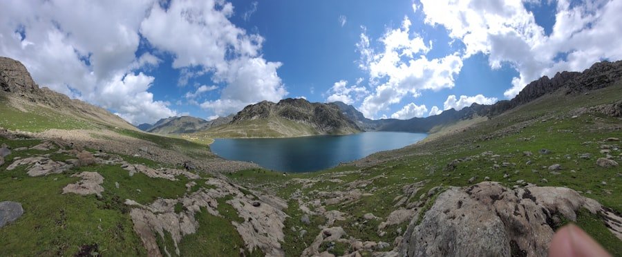
The standard Five Lakes route runs from Blauherd to Sunnegga. According to the current Zermatt Tourism Route No. 11 listing, the hike is a moderate T2 route measuring 11.3 kilometers, with about 265 meters of ascent and 542 meters of descent. The same source gives an estimated walking time of 3 hours 30 minutes.
Zermatt Bergbahnen, which operates the mountain transport, currently describes its Five Lakes Trail as 9.8 kilometers with an estimated time of 2 hours 30 minutes and 454 meters of elevation change. The difference appears to come from the route measurement and mapping used by the two official sources. For practical planning, expect roughly 10 to 11 kilometers and 2.5 to 3.5 hours of walking before longer stops.
The official lake order is Stellisee, Grindjisee, Grünsee, Moosjisee, and Leisee, followed by the finish at Sunnegga.
Getting from Zermatt to Blauherd
The simplest standard approach is to use the mountain railway system from Zermatt toward Sunnegga and continue up to Blauherd. Starting high at Blauherd allows the normal route to finish lower at Sunnegga rather than requiring the larger climb involved in hiking the route in reverse.
Check the latest operating timetable before leaving Zermatt. Mountain railways can have seasonal operating dates, maintenance closures, or weather-related interruptions even when a hiking trail itself is open.
1. Blauherd to Stellisee
From Blauherd, follow the signed Five Lakes route toward Stellisee. The Matterhorn dominates much of the panorama, and Stellisee is one of the classic reflection locations when the water is calm and visibility is clear.
This first part is a good place to settle into your pace rather than rushing. Early in the day, calmer conditions may improve your chance of seeing a clean mountain reflection.
2. Stellisee to Grindjisee
The route continues toward Grindjisee, the lake missing from the original version of this guide. Zermatt Tourism highlights Grindjisee for its alpine flowers and its view of the Matterhorn with larches around the water.
The landscape becomes more varied here, with vegetation, rocky sections, and open mountain views. Take your time on rough or damp ground.
3. Grindjisee to Grünsee
From Grindjisee, continue to Grünsee. Its setting feels different from the earlier lakes, with rocky alpine terrain surrounding the water. Grünsee is also one of the two lakes on this trail where swimming can be permitted.
If you plan to swim, obey every local sign. Zermatt Bergbahnen states that swimming is permitted at Grünsee and Leisee only when no signs indicate otherwise.
4. Grünsee to Moosjisee
The fourth official lake is Moosjisee. It is a reservoir whose glacier-influenced water can have a distinctive pale turquoise or milky appearance. That different color gives this part of the route a noticeably different character from the darker natural lakes.
Moosjisee replaces the incorrect Riffelsee reference in the original route description. Riffelsee is not part of the Five Lakes Walk. Riffelsee is another well-known Zermatt lake and Matterhorn photo location, but visiting it requires a different itinerary in the Gornergrat area.
5. Moosjisee to Leisee and Sunnegga
The final lake is Leisee, near Sunnegga. This is one of the most family-oriented stops on the route. Zermatt Tourism lists swimming, picnic facilities, and a children’s playground at Leisee, making it a logical place for a longer final break.
After Leisee, continue on the signed route to Sunnegga, where the standard Five Lakes Walk ends. From there, use the mountain railway back toward Zermatt according to the current timetable.
Pro Tip: Hike in the standard Blauherd-to-Sunnegga direction unless you specifically want a harder uphill day. Zermatt Tourism estimates about 3 hours 50 minutes for the opposite direction, compared with 3 hours 30 minutes for its standard route.
Highlights of the Hike: The Five Lakes and Surrounding Scenery
| Lake | Order | What Makes It Special |
| Stellisee | 1 | One of Zermatt’s classic Matterhorn reflection viewpoints. |
| Grindjisee | 2 | Known for alpine plants, larches, and another attractive Matterhorn reflection setting. |
| Grünsee | 3 | Rockier surroundings, picnic potential, and swimming when local signs permit it. |
| Moosjisee | 4 | A reservoir with glacier-influenced water and a distinctive pale turquoise appearance. |
| Leisee | 5 | A family-friendly lake near Sunnegga with picnic areas, a playground, swimming when permitted, and Matterhorn views. |
Each lake has a different setting, which is one reason the route remains interesting from beginning to end. Stellisee is especially popular with photographers, while Grindjisee combines reflections with larches and alpine vegetation. Grünsee has a more rugged feel, and Moosjisee stands out for its unusual glacier-fed color.
Leisee changes the mood again. Its picnic and play facilities make it a convenient place for families to slow down before reaching Sunnegga.
Zermatt Tourism states that the Matterhorn can be reflected in three lakes on the route. Reflections depend heavily on wind, cloud, sun angle, and water conditions, so they should be treated as a bonus rather than a guarantee.
Challenges and Considerations: Moderate Difficulty and Potential Hazards
The Five Lakes Walk is officially classified as a moderate T2 hike. It is accessible to many recreational hikers, but “moderate” does not mean effortless. The route includes uneven surfaces, elevation changes, rocky sections, and high-altitude conditions.
Rain can make stones, roots, and packed trail surfaces slippery. Slow down on descents and give other hikers room to pass. Trekking poles can reduce stress on the knees and improve balance for hikers who are comfortable using them.
Altitude
The normal start at Blauherd is around 2,571 meters, and Zermatt Tourism lists the route’s highest point at 2,617 meters. Some people notice headache, dizziness, unusual fatigue, or nausea at elevations like these. If symptoms become significant or worsen, descending is safer than continuing upward or pushing through them.
Weather and Thunderstorms
Mountain weather can change quickly. Check the MeteoSwiss hazard information and local Zermatt conditions shortly before departure, not only the night before.
If thunderstorms threaten, exposed high terrain and bodies of water are poor places to remain. Do not continue toward a lake or exposed viewpoint simply because it is your next planned photo stop. Turn back or move toward appropriate shelter while conditions still allow you to do so safely.
Wildlife
Marmots, ibex, chamois, alpine birds, and other wildlife live in the wider Zermatt mountain environment, although no particular sighting is guaranteed on the Five Lakes Walk. Watch from a respectful distance and never chase an animal for a photograph.
Do not feed wildlife. Human food can change animal behavior and creates unnecessary conflict between wildlife and visitors.
Stay on the Marked Trail
Do not leave the signed route in search of “hidden” viewpoints. Zermatt Tourism specifically asks hikers to use designated paths, both for personal safety and to protect sensitive alpine plants and wildlife habitat.
Warning: If someone is seriously injured or becomes medically unwell, Zermatt Tourism lists 144 as the emergency medical number and 112 as the international emergency number. Give rescuers your precise location and remain with the injured person when it is safe to do so.
Recommended Stops and Rest Areas Along the Route
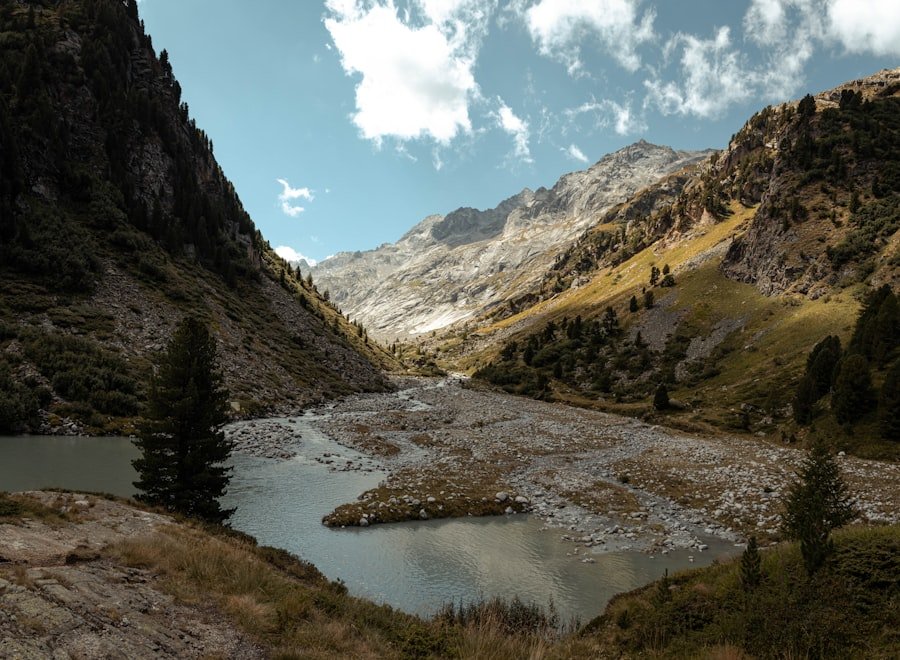
The lakes naturally divide the route into manageable sections, so you do not need to rush from one end to the other. Your best stopping point depends on weather, crowds, your group’s energy, and whether you want to swim or take photographs.
Stellisee for Photography
Stellisee is a logical early photo stop. Calm water can produce a strong Matterhorn reflection, but the effect changes quickly when wind arrives. Keep enough time in reserve for the rest of the hike rather than waiting indefinitely for perfect conditions.
Grindjisee for a Quieter Nature Stop
Grindjisee combines mountain scenery with larches and alpine plant life. It can be an enjoyable place for a short pause while you observe the landscape without leaving the marked path.
Grünsee for a Break or Swim
Grünsee can work well for a longer pause. Swimming is allowed when no local sign prohibits it, but mountain water can be cold even on warm days. Enter only if conditions and your swimming ability make it sensible.
Leisee for Families and Picnics
Leisee is the most practical long stop for many families because Zermatt Tourism lists picnic facilities and a children’s playground there. Swimming may also be possible when permitted by current signs.
The official route additionally lists restaurants along the way, but opening days and hours can vary. Carry your own water and at least some food rather than depending entirely on a restaurant being open.
Note: Do not plan a Five Lakes Walk rest stop at Riffelsee. Although Riffelsee is one of Zermatt’s best-known Matterhorn viewpoints, it is outside the official Five Lakes route.
Wildlife and Nature: What to Look Out for During the Hike
The hike passes through several alpine environments, from grassy areas and larch vegetation to exposed rocky ground. That variety is part of the appeal of the route and gives you more to observe than the lakes alone.
Marmots are among the animals associated with the Zermatt mountain environment. Their whistles can sometimes be heard before the animals themselves are visible. Ibex and chamois also live in the wider alpine region, but sightings on this exact trail should never be assumed.
Birdwatchers may see alpine birds, including choughs, moving across open mountain terrain. Larger birds of prey, including golden eagles, occur in the Alps, but a sighting is a matter of luck rather than a normal feature of every Five Lakes hike.
Plant life also changes as you move around the route. Zermatt Tourism specifically highlights rare flowers around Grindjisee. Observe flowers where they grow instead of picking them or stepping off the trail to reach them.
The best wildlife behavior is simple: keep your distance, keep food to yourself, stay on marked paths, pack out your rubbish, and give animals an easy escape route.
Best Time of Year for the 5 Lakes Walk
The main hiking season is summer into early autumn. Zermatt Bergbahnen lists June through September as the preferred season for the Five Lakes Trail. Actual access depends on snow, trail conditions, and mountain railway operation.
For the 2026 season, the Five Lakes Walk / Flower Trail Kombi-Ticket is currently listed for June 13 through October 4, 2026. Those dates are operational information rather than a guarantee of ideal hiking conditions every day.
Summer
July and August usually bring the busiest period, longer daylight, and more opportunities to see alpine vegetation. They can also bring strong sun and afternoon thunderstorms, so an early start often makes sense.
Early Autumn
September can offer cooler hiking temperatures and changing larch colors. Days become shorter, however, and early snow or cold weather can affect higher trails.
Whenever you visit, use current conditions rather than the calendar alone to decide whether to hike.
Tickets, Lifts, and Practical Transport Planning
The Five Lakes Walk is easiest when you coordinate the trail with the mountain railway timetable. The standard plan is:
- Travel from Zermatt toward Sunnegga.
- Continue from Sunnegga to Blauherd.
- Hike from Blauherd through the five lakes.
- Finish at Sunnegga.
- Return from Sunnegga to Zermatt.
Zermatt Bergbahnen sells a Five Lakes/Flower Trail Kombi-Ticket designed around this journey. As of August 2026, the operator advertises Kombi-Tickets from CHF 48, with reductions available for some children and eligible travel-card holders. Prices and eligibility can change, so use the official ticket page for the amount that applies on your travel date.
Before leaving your accommodation, check both lift operation and the weather. A hiking trail may appear usable while a connecting lift is closed or operating on a reduced timetable.
Tips for Making the Most of Your 5 Lakes Walk Experience
An early start can give you cooler temperatures, more time for stops, and a better chance of calm water for Matterhorn reflection photographs. It also gives you more flexibility if your pace is slower than expected.
Keep your schedule loose enough to enjoy the lakes without turning the day into a race. Families, photographers, and hikers who want a meal or swim should plan substantially more elapsed time than the published walking estimate.
For photography, use the landscape rather than walking off trail for a different angle. Calm water, low wind, and clear visibility matter more than standing in an unofficial location. A phone or compact camera is enough for excellent images when conditions cooperate.
Keep checking your surroundings as you walk. Cloud build-up, stronger wind, falling temperature, fatigue, and worsening visibility are all reasons to reconsider your plan. Turning around early is a normal mountain-safety decision, not a failed hike.
Most importantly, stay on the marked route. The trail already provides numerous viewpoints, lake shores, meadows, and mountain panoramas without requiring off-trail exploration.
Pro Tip: Save or screenshot the route information and mountain railway timetable before heading uphill. Mobile coverage can be good in much of the Zermatt region, but your essential navigation and return-transport information should not depend on loading a webpage at the exact moment you need it.
For a completely separate food-and-nature feature already linked in the original article, you can also read exploring the delightful world of Asian melon.
Frequently Asked Questions
What is the 5 Lakes Walk in Zermatt?
The 5 Lakes Walk is a moderate mountain hiking route above Zermatt that links Stellisee, Grindjisee, Grünsee, Moosjisee, and Leisee before finishing at Sunnegga. The trail is known for Matterhorn views, alpine scenery, and several excellent photography locations.
Which five lakes are on the Zermatt Five Lakes Walk?
In the standard Blauherd-to-Sunnegga direction, the lakes are Stellisee, Grindjisee, Grünsee, Moosjisee, and Leisee. Riffelsee is not part of the official Five Lakes Walk.
What is the difficulty level of the 5 Lakes Walk in Zermatt?
Zermatt Tourism classifies the route as Moderate T2. Many recreational hikers can complete it, but it still includes uneven mountain terrain, elevation changes, and hiking above 2,500 meters. It should not be described as suitable for every ability level.
How long does the 5 Lakes Walk take?
Current official estimates differ. Zermatt Bergbahnen lists about 2 hours 30 minutes, while Zermatt Tourism lists about 3 hours 30 minutes for Route No. 11. Plan roughly 2.5 to 3.5 hours of walking and allow additional time for photographs, rests, meals, swimming, or children.
How long is the 5 Lakes Walk?
Official measurements vary. Zermatt Bergbahnen currently lists 9.8 kilometers, while Zermatt Tourism lists 11.3 kilometers for Route No. 11. Using roughly 10 to 11 kilometers as a planning range is more transparent than presenting one figure as universally definitive.
What is the best time of year to do the 5 Lakes Walk?
Summer through early autumn is the normal hiking period. Zermatt Bergbahnen recommends June through September. Trail access and lift operation still depend on snow, weather, maintenance, and seasonal schedules, so check current conditions before traveling.
Can you swim in the lakes?
Zermatt Bergbahnen states that swimming is allowed at Leisee and Grünsee when there are no signs indicating otherwise. Do not assume swimming is permitted in the other three lakes, and remember that alpine water can be very cold.
Is the 5 Lakes Walk suitable for children?
Zermatt Tourism describes the route as suitable for children from age 6. Whether it is appropriate for a particular child depends on hiking experience, fitness, weather, pace, and comfort on uneven mountain paths. Leisee is especially family-friendly because of its picnic and play facilities.
Are there facilities or services along the route?
Zermatt Tourism lists restaurants along the route and picnic facilities at Leisee. Opening hours can vary, so carry your own water and some food rather than relying completely on a restaurant or other facility being open.
Is Riffelsee part of the Five Lakes Walk?
No. Riffelsee is a famous mountain lake and Matterhorn reflection viewpoint in the wider Zermatt region, but it is not one of the Five Lakes Trail lakes. The five official lakes are Stellisee, Grindjisee, Grünsee, Moosjisee, and Leisee.
Sources
- Zermatt Tourism: 5-Lake Route No. 11 — official route order, T2 difficulty, distance, time, elevations, family suitability, equipment, and safety guidance.
- Zermatt Bergbahnen: Five Lakes Trail — route description, alternate distance/time figures, season, lake order, and swimming rules.
- Zermatt Bergbahnen: Kombi-Tickets — current 2026 Five Lakes transport dates, ticket structure, pricing, and reductions.
- MeteoSwiss: Weather Hazards — current Swiss weather warnings for thunderstorms, rain, snow, wind, and other hazards.
- Swiss Alpine Club: Mountain Safety — altitude adaptation, preparation, weather, equipment, and turn-back guidance.
- Zermatt Tourism: SOS Emergency — local emergency and rescue contact information.