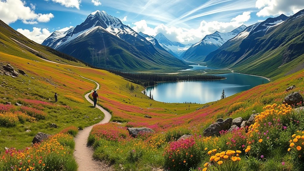
Some of the best hikes in Chugach State Park are only minutes from Anchorage, while others lead deep into alpine valleys and backcountry terrain. The right trail depends on whether you want an easy family walk, a steep summit, Turnagain Arm views, or a multi-day challenge. This guide separates true Chugach State Park trails from nearby hikes that are often confused with them.
Quick Answer
Top Chugach State Park hikes include Flattop Mountain for a classic summit, Bird Ridge for a steep challenge, and the Eagle River Nature Center trails for easier forest-and-river walks. Crow Pass is the standout backpacking route. Thunderbird Falls and Anchorage Overlook are simpler choices for families and casual hikers.
Last checked: September 30, 2026. Dates and figures were verified against official sources.
Key Takeaways
- Flattop and Bird Ridge deliver big views but both include steep terrain; Bird Ridge gains about 3,400 feet in 2.5 miles.
- Eagle River Nature Center has some of the easiest hiking, but Albert Loop is seasonally closed for bear activity and remains closed as of late September 2026.
- Crow Pass is a serious 23.1-mile traverse with backcountry weather, wildlife, and an Eagle River ford.
- Kincaid Park and Winner Creek are worthwhile nearby hikes, but neither should be presented as a Chugach State Park trail.
Best Hikes in Chugach State Park at a Glance
Alaska State Parks’ official hiking information lists options ranging from paved viewpoints to difficult summit trails. Distances below are one way unless a loop or round trip is specifically stated.
| Trail | Distance | Elevation Gain | Best For |
|---|---|---|---|
| Anchorage Overlook | 0.25-mile loop | 53 feet | Easy, accessible views |
| Flattop Mountain | 1.5 miles | 1,300 feet | Classic Anchorage summit |
| Bird Ridge | 2.5 miles | 3,400 feet | Steep workout and Turnagain Arm views |
| South Fork Valley | 4.8 miles to Eagle Lake | 850 feet | Alpine valley and lakes |
| Wolverine Peak | 4.7 miles | 3,500 feet | Long summit day |
| Crow Pass | 23.1 miles | 2,100 feet from Crow Creek trailhead | Backpacking and alpine scenery |
Flattop Mountain Trail
Flattop Mountain is the classic Chugach State Park summit hike for visitors who want a big view close to Anchorage. The official trail is about 1.5 miles one way from Glen Alps and gains roughly 1,300 feet.
The lower trail climbs through open terrain before becoming steeper near the summit. The upper section includes scrambling, so this is not simply a short walk despite its modest mileage.
Warning: Alaska State Parks classifies Flattop as difficult and notes that falls have caused serious injuries and fatalities. Loose rock can also be knocked down by hikers above you.
On clear days, the mountain gives wide views across Anchorage, Cook Inlet, Turnagain Arm, and the Alaska Range. If you want the scenery without the summit climb, the nearby Anchorage Overlook is a much easier alternative.
Kincaid Park: A Nearby Anchorage Alternative
Kincaid Park is a strong hiking option in Anchorage, but it is not inside Chugach State Park. The Municipality of Anchorage manages this 1,500-acre regional park in West Anchorage.
Scenic Trail Highlights
Kincaid has a large network of forested recreation trails and access to the Tony Knowles Coastal Trail. The park’s setting near Turnagain Arm provides views toward Cook Inlet, Fire Island, and surrounding mountains.
The Municipality reports about 60 kilometers of interwoven trails at Kincaid, with hiking, walking, running, biking, skiing, and other uses spread across the network.
Wildlife Spotting Opportunities
Wildlife can appear throughout Kincaid’s forests and open areas. Stay alert, keep your distance, and never approach an animal for a closer photo.
Because the park is an urban recreation area with active trails, expect to share routes with runners, cyclists, skiers, and other users depending on the season.
Trail Accessibility Features
Kincaid contains a mix of paved, gravel, ski, and single-track routes, so accessibility varies by trail. The park also connects with Anchorage’s paved coastal trail system.
For current facilities and planning information, see the Municipality of Anchorage Kincaid Park information. If your goal is specifically to hike inside Chugach State Park, choose one of the state-park trails in the rest of this guide.
Eagle River Nature Center Trails
The Eagle River Nature Center is one of the best places to find shorter and easier Chugach State Park hikes. Trails begin behind the Nature Center and range from a short interpretive loop to longer forest and river routes.
| Trail Name | Difficulty Level | Length (Miles) |
|---|---|---|
| Rodak Nature Trail | Easy | About 0.75-mile loop |
| Albert Loop Trail | Easy to Moderate | About 3-mile loop |
| Dew Mound Trail | Moderately Strenuous | About 6-mile loop |
| Crow Pass/Iditarod Trail to Echo Bend | Easy to Moderate | About 3 miles one way |
| Short Connector Loops | Varies | Multiple options |
The Rodak Nature Trail has interpretive signs and benches, while Dew Mound offers a more rugged outing with roots, rocks, forest, and views across the Eagle River Valley.
Albert Loop is currently closed. The Eagle River Nature Center trail report dated September 26, 2026, says the trail has been closed since August 10 because of the salmon run and bear activity. Other Nature Center trails were reported open at that check.
Powerline Trail and Powerline Pass
Powerline is a good choice when you want an open-valley hike with flexible mileage. You can access the corridor from the Anchorage Hillside trail system and turn around whenever distance, weather, or daylight makes sense.
Trail Overview
The lower portions follow a broad corridor through the South Fork of Campbell Creek valley. Unlike Flattop, you do not need to commit to a summit scramble to enjoy mountain views.
| Feature | Details | Tips |
|---|---|---|
| Length | Flexible; distance depends on access point and turnaround | Choose your turnaround before daylight runs short |
| Elevation Gain | Varies with route | Expect more climbing toward the pass |
| Difficulty Level | Easy to moderate on lower sections; harder farther up-valley | Match the route to weather and fitness |
| Trail Type | Out-and-back or connection to other Hillside trails | Carry a park trail map |
Scenic Highlights
The appeal is the broad alpine setting. As you move farther from the trailhead, Anchorage drops behind you and the surrounding Chugach peaks dominate the view.
The corridor also connects with other Hillside routes, making it useful for hikers who want to build a longer day without committing to one fixed destination.
Crow Pass Trail
Crow Pass is the major backpacking route in this list. Alaska State Parks measures the complete trail at 23.1 miles one way between the Girdwood side and Eagle River Nature Center, with substantial backcountry hazards along the route.
The official Crow Pass trail guide lists about 2,100 feet of elevation gain from the Crow Creek trailhead and about 3,100 feet from the Eagle River Nature Center. It recommends late June through September for the full traverse.
You do not need to hike the entire route to enjoy it. From the Crow Creek side, a roughly four-mile hike to Crow Pass reaches alpine terrain, Crystal Lake, mining history, and glacier views.
Warning: The full traverse includes an Eagle River ford. Water depth and speed can change, and turning back is the correct choice if the crossing looks unsafe. Wet, windy alpine weather can also create hypothermia risk even in summer.
Bear and moose habitat, unpurified surface water, river crossings, and long stretches of backcountry make Crow Pass very different from a frontcountry day hike. Carry appropriate equipment and leave your route and expected return time with someone before starting.
Turnagain Arm Trail
Turnagain Arm Trail is ideal if you want coastal scenery without a summit climb. It follows the mountainside above the Seward Highway between several trailheads and provides repeated views across Turnagain Arm.
The official Turnagain Arm trail guide lists the full Potter-to-Windy Corner route at 9.5 miles one way. The main segments are Potter to McHugh at 3.4 miles, McHugh to Rainbow at 4.2 miles, and Rainbow to Windy Corner at 1.9 miles.
Because several trailheads reach the route, you can choose a shorter section instead of walking all 9.5 miles. Southern exposure also helps parts of this trail lose snow earlier than many higher routes.
Enjoy the views from the trail and established overlooks, but stay off the Turnagain Arm mudflats. The mud can trap people while the tide rises quickly.
Bird Ridge Trail
Bird Ridge is one of the strongest choices for hikers who want a short but very steep climb. The official route is 2.5 miles one way and gains about 3,400 feet to Bird Ridge Point.
The Alaska State Parks Bird Ridge guide rates it moderate to difficult. The climb begins steeply, rises through timberline, and then follows the exposed ridge.
Your reward is an open view across Turnagain Arm and the Kenai Mountains. The exposure also means wind can be strong, and snow may remain on the upper ridge into late spring.
Bring enough water because the official guide notes there is no water source on the ridge. Sturdy footwear also matters on the steep sections and areas that require some scrambling.
Winner Creek Trail: Nearby, but Outside Chugach State Park
Winner Creek is a popular Girdwood hike, but it should not be listed as a Chugach State Park trail. Girdwood’s trail system borders both Chugach State Park and Chugach National Forest, which is one reason the names are easy to mix up.
The forest around Winner Creek has the mossy, wet character that makes Girdwood feel very different from the open alpine trails above Anchorage. The route remains useful for hikers seeking a lower-elevation forest walk.
Do not plan your trip around the old hand tram. The Municipality of Anchorage’s current Girdwood information says the hand tram has been decommissioned and that a suspension bridge replacement is planned, permitted, and pending construction after a contract award in spring 2026.
South Fork Valley Trail to Eagle and Symphony Lakes
The official South Fork Valley Trail is the better verified lake hike for this Chugach State Park guide. It starts at the South Fork Eagle River trailhead and follows a broad alpine valley toward Eagle and Symphony Lakes.
Alaska State Parks lists the route to Eagle Lake at 4.8 miles one way with about 850 feet of elevation gain. Much of the trail crosses open alpine terrain with long views of the surrounding peaks.
The terrain becomes rougher near the lakes. Medium-size boulders between Eagle and Symphony Lakes require stable footing, so footwear matters even though the official trail rating is easy.
- Open valley scenery: Most of the route gives clear views into the South Fork drainage.
- Two alpine lakes: Eagle and Symphony Lakes sit close together but have visibly different water colors.
- Longer day without huge climbing: The elevation gain is much lower than Bird Ridge or Wolverine Peak.
- Backcountry awareness: Parts of the route cross avalanche-prone slopes, especially relevant when snow is present.
Wolverine Peak Trail
Wolverine Peak is a longer summit hike for people who want more distance and climbing than Flattop. Alaska State Parks lists the route from Prospect Heights at about 4.7 miles one way with 3,500 feet of elevation gain.
The trail climbs from the lower Hillside network toward an exposed summit with views across Anchorage, Cook Inlet, the Alaska Range, and Williwaw Lakes. Although the official trail guide rates it moderate, the combination of mileage and elevation makes it a substantial day.
Wolverine is a good step up after Flattop if you are comfortable with longer climbs and changing mountain weather. Plan enough time to return before darkness and turn around if clouds, wind, or footing worsen.
Thunderbird Falls Trail
Thunderbird Falls is one of the simplest family-friendly hikes in Chugach State Park. The official trail is about 1 mile one way with roughly 100 feet of elevation gain.
The route passes through birch forest above Eklutna Canyon and reaches viewing areas for the roughly 200-foot waterfall. Its easy grade and short length make it a practical choice when a steep summit is not the goal.
Parking, Wildlife, and Trail Rules
A little preparation matters in Chugach State Park because an easy-looking trail can quickly become exposed to wind, wildlife, rain, or lingering snow. Parking and pet rules also vary by location.
How Much Is Parking?
Alaska DNR’s current Director’s Order 340, effective January 1, 2024, sets daily parking at designated Chugach State Park lots such as Glen Alps, Bird Ridge, Eklutna Lake, South Fork Eagle River, Thunderbird Falls, and Prospect Heights at $7 per vehicle per day. The annual daily-parking decal is listed at $75.
Eagle River Nature Center and Arctic Valley are separately managed facilities where the standard state annual decal does not apply.
What Wildlife Should You Expect?
Bears and moose occur throughout the park. Stay alert on brushy trails, around salmon streams, and anywhere visibility is limited.
Give wildlife plenty of space and avoid surprising animals. Food and scented items also need careful storage on overnight trips such as Crow Pass.
Can Dogs Use the Trails?
Dogs are allowed on many Chugach State Park trails, but they must remain under control. Specific Eagle River Nature Center routes, including Rodak and Albert Loop, have leash requirements, and individual trailheads may have additional posted rules.
Clean up after your pet and do not assume that an off-leash dog is appropriate simply because a trail is in the backcountry.
Frequently Asked Questions
What Is the Best Time of Year to Hike in Chugach State Park?
Late spring through early fall offers the widest choice of snow-free hiking, but conditions depend heavily on elevation. Crow Pass is generally best for a full traverse from late June through September, while exposed ridges can still hold snow in late spring. Always match the route to current weather and trail conditions.
Are There Any Camping Facilities Within Chugach State Park?
Yes. Chugach State Park has developed camping at locations including Bird Creek, Eagle River, and Eklutna Lake, plus backcountry options subject to park rules. Crow Pass also has established backcountry camping areas along the Eagle River side of the route.
Can I Bring My Dog on the Hiking Trails?
Yes, dogs can use many Chugach State Park trails, but they must remain under control. Some Eagle River Nature Center trails require a leash, and trailhead areas may have additional restrictions. Clean up after your dog and follow any signs posted at the specific trail.
What Are the Parking Options Near the Trails?
Major trails use developed trailheads such as Glen Alps, Bird Ridge, Prospect Heights, South Fork Eagle River, Eklutna Lake, and Thunderbird Falls. Alaska DNR’s current fee order sets daily parking at these designated state lots at $7 per vehicle. Popular lots can fill during busy periods.
Are There Any Guided Hiking Tours Available in the Park?
Yes. The Eagle River Nature Center offers nature programs and guided hikes at various times, and commercial guides also operate in the Anchorage area. Program availability changes, so the exact hike offered will depend on the current schedule and season.
Is Albert Loop Trail Open Right Now?
No. As of the September 26, 2026 Eagle River Nature Center trail report, Albert Loop is closed because of the salmon run and bear activity. The closure began August 10, 2026 and is expected to remain in place until conditions allow the trail to reopen.
Conclusion
Choose your Chugach State Park hike by terrain and commitment, not mileage alone. Flattop offers the classic summit, Bird Ridge delivers the steepest workout in this list, Eagle River has easier options, and Crow Pass belongs in the backcountry category. Check current conditions, carry the right gear, and turn around when weather, wildlife, water, or footing makes continuing unsafe.
Sources
- Alaska State Parks — Chugach State Park Recreational Opportunities: Official trail distances, difficulty, access, and recreation information.
- Eagle River Nature Center — Current Trail Conditions: Current Albert Loop closure and Nature Center trail status.
- Alaska State Parks — Crow Pass Trail Guide: Distance, elevation, season, river crossing, wildlife, and safety information.
- Alaska State Parks — Turnagain Arm Trails Guide: Turnagain Arm Trail distances, segments, and safety information.
- Alaska State Parks — Bird Ridge Trail Guide: Distance, elevation gain, difficulty, water, and exposure information.
- Alaska DNR — Director’s Order 340: Current state-park parking fees and annual decal information.
- Municipality of Anchorage — Kincaid Park: Park ownership, size, location, and recreation facilities.
- Municipality of Anchorage — Girdwood Parks & Recreation: Winner Creek hand-tram decommissioning and suspension-bridge project status.