If you’re planning a trip to the Mogollon Rim, you’ll want clear routes planned before you go. This guide covers the best roads and trailheads. It also flags weather shifts, good seasons for flowers, top photo overlooks, and the basics for camping, fishing, and safety.
The Mogollon Rim is a long, cliff-like edge across Arizona’s high country. Most visitors reach it via SR 87 and SR 260 near Payson and Forest Lakes. From there, head to forest roads and trailheads for big views, lakes, and pine-forest hikes.
Best Routes and Access Points to the Mogollon Rim
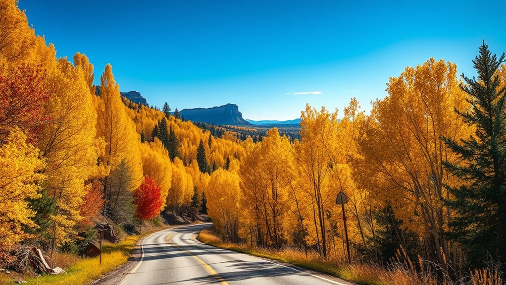
Choose your approach based on what you want to do. SR 260 is the easiest way to reach popular overlooks, lakes, and trailheads. Forest Road (FR) 300 (often called “Rim Road”) and other forest roads offer quieter, rougher access for dispersed campsites and backcountry starts. After snow or storms, conditions can change fast—check official status pages before you commit to remote routes.
- Fast, paved access (most vehicles): Use SR 87 to Payson, then SR 260 east toward Forest Lakes for visitor info, signed turnouts, and trailheads near the Rim Lakes area.
- Scenic dirt drive along the rim (variable conditions): FR 300 runs along big-view stretches of the Rim. In dry weather it’s often graded, but it can turn muddy, rutted, or gated seasonally. Use the Coconino National Forest Forest Roads Status page for up-to-date road notes.
- Quieter north-side access (high-clearance recommended): Routes like FR 504 can be remote and slower, with limited services. Plan fuel and turnarounds.
Dispersed camping note: rules vary by area. For example, within the Rim Lakes Recreation Area, camping is limited to developed campgrounds and marked, numbered dispersed sites unless signed otherwise.
When to Visit: Seasons, Weather, and Timing
Timing matters because elevation brings quick temperature swings and sudden weather. As of , use these season cues when planning:
- Spring (April–June): cooler hiking days and early wildflowers; some dirt roads can stay soft or muddy after late snowmelt.
- Monsoon season (mid-June through September): warm afternoons, cool nights, and fast-building thunderstorms. Start early, avoid exposed edges when thunder is near, and expect slick clay on forest roads.
- Fall (September–October): crisp air, clearer skies, and fall color in pockets of aspen and oak—often the best all-around time for photography and long hikes.
- Winter (November–March): quiet, snowy scenery, but forest roads may be gated or impassable; bring traction and plan shorter daylight.
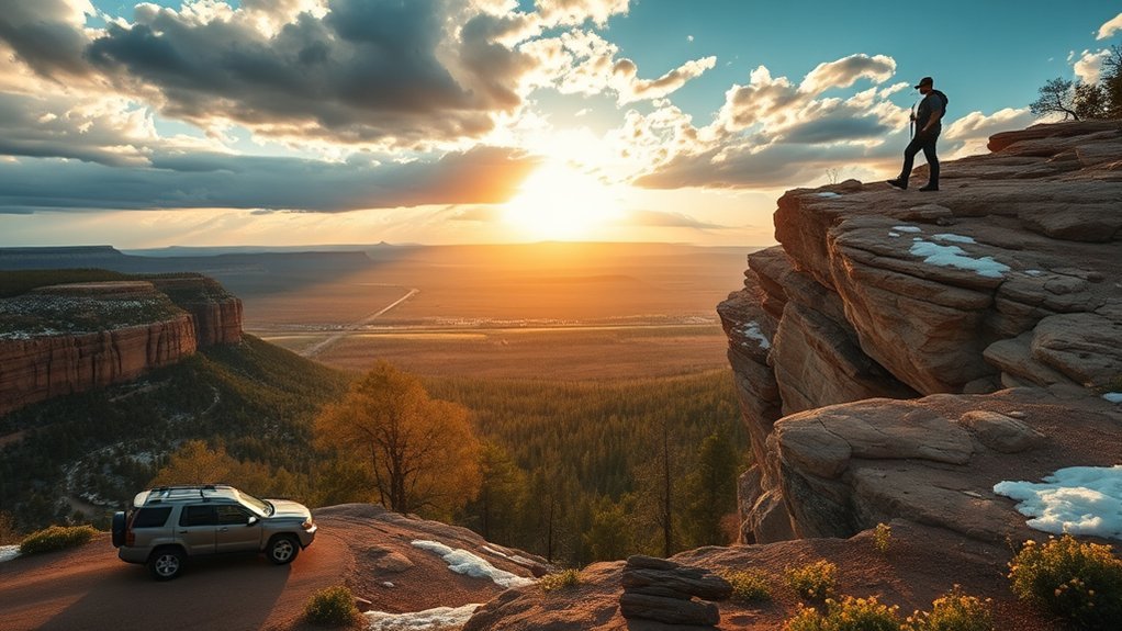
Top Overlooks and Photo Spots
Morning light and late-afternoon glow produce dramatically different photos. These spots are reliable, easy-to-find options (plus a couple of “walk-a-bit” viewpoints):
- Mogollon Rim Visitor Center viewpoint area: quick rim-edge views with interpretive info nearby.
- Al Fulton Picnic Ground (just past the visitor center): wide panoramas over pine forest and the drop-off—great at sunrise and after storms.
- Rim Lake Vista Trail (Trail #622): short hikes to multiple rim viewpoints without needing a long trek.
- Military Sinkhole Vista: a short walk from the vista parking area off FR 300, with a dramatic sinkhole viewpoint and classic Rim scenery.
Helpful photo kit: a small tripod, a polarizer, and a wide-to-tele zoom. Stay back from cliff edges, follow signs, and don’t step on fragile rim vegetation for “one more angle.”
Hiking Trails for Every Skill Level
You’ll find trails that suit everyone, from easy lake loops to longer, steeper routes that demand endurance and careful footing. Pack layers, plenty of water, and offline maps—cell coverage can drop quickly away from towns.
Products Worth Considering

ADVANCED TECHNOLOGY: Columbia Women's Newton Ridge Plus Waterproof Hiking Boot features our lightweight, durable midsole for long lasting comfort, superior cushioning, and high energy return as well as an advanced traction rubber sole for slip-free movement on rough ground.
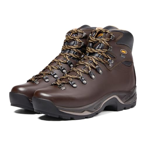
FULL-GRAIN LEATHER UPPER DESIGNED FOR WOMEN – Crafted from 2.6–2.8mm water-resistant full-grain leather, the Asolo TPS 520 GV Evo women's hiking boots deliver long-lasting durability, abrasion resistance, and supportive protection tailored to a woman's foot shape

Waterproof Build: These men’s hiking boots feature a waterproof membrane construction that keeps your feet dry when trudging through any mud or water.
Easy Family Hikes
For a family day, pick short routes with gentle grades and predictable navigation. These are popular, approachable options:
- Woods Canyon Lake Trail: a scenic lake loop in the Rim Lakes area (expect crowds on summer weekends).
- Willow Springs Lake area trails: mellow lake-side walking from the Willow Springs Lake Trailhead, with good birding and calm morning light.
- Rim Lake Vista Trail #622: easy access to rim viewpoints without a big mileage commitment.
Challenging Rim Treks
Longer routes demand planning, especially with storms and winter ice. If you want a bigger workout, consider the Military Sinkhole Trail, which climbs steeply from the “260 Trailhead” up to the rim. Build in time for slower pace on rocky footing, and carry a headlamp, extra food, and a way to treat water.
- Pick a route: check distance, elevation gain, and exposure.
- Gear checklist: boots, trekking poles, map/GPS, first aid, extra food, and a warm layer—even in summer.
- Turnaround rules: set a hard time to head back, and turn around early if thunder, smoke, or road conditions worsen.
Camping, Fishing, and Water Activities
Developed campgrounds put you close to lakes, toilets, and water, while designated dispersed sites are more basic. For water activities, the Rim is known for cool lakes and trout fishing—just remember that water stays cold, and conditions can shift quickly after storms.
Products Worth Considering

PROFESSIONAL AND POWERFUL INFLATION SYSTEM: Rather then two stage patched pump, our electric air pump was born for stand up paddle board(up to 20PSI). With the unique one-stop technology leads more stronger air flow and fast inflation.

High-performance portable navigation light, for kayak, SOT, SUP, canoe, dinghy, inflatable, scull.

Lightweight and Portable : This conventional air adapter conform to eronomic design, lightweight and portable. The adapter allows you to use the air compressor around your home, portable inflator when in the car, and your bicycle pump to inflation. SUP Air Adapter takes the hassle out of going to the service station.
Best Campgrounds Nearby
- Woods Canyon Lake Campground: a classic high-country base near the water.
- Rim Campground (Rim Lakes area): close to rim-edge viewpoints and day hikes.
- Mogollon Campground: convenient access to Rim Lake Vista Trail #622 and nearby viewpoints.
Reserve early for summer weekends and holidays. Always follow posted fire rules and forest orders.
Lakes, Rivers, and Streams
Paddle early when winds are lighter. Fish from shorelines and creek banks when you want a simple setup. Boat rules vary by lake and season. Check local site rules before you launch. For fishing, you’ll usually need an Arizona fishing license and must follow Arizona Game & Fish rules.
Water safety: wear a PFD when paddling, watch for cold water, and never attempt to drive through flooded creek crossings during monsoon storms.
Safety, Permits, and Practical Tips
Conditions on the Rim can change quickly, and services can be limited once you leave the highways. Plan for sudden weather, steep terrain, and smoky fire seasons:
- Weather: carry layers and a rain shell; if you hear thunder, move away from exposed edges and tall, isolated trees.
- Roads: bring a paper map or offline GPS; pack a spare tire, warm layer, and extra water if you’ll be on forest roads.
- Wildlife: store food securely (use bear-resistant storage where provided), keep distance from elk and deer, and never feed animals.
- Fire: check current restrictions before you go, use established rings where allowed, and fully drown-and-stir any allowed fires. For statewide restriction info, use Arizona Interagency Wildfire Prevention: Fire Restrictions.
FAQs
Do I need a high-clearance vehicle for the Mogollon Rim?
Not always. Many popular Rim spots are reached via SR 260, but dirt routes like FR 300 and remote spurs can be rough, muddy, or seasonally gated. Check current forest road status and choose routes that match your vehicle and experience.
When is the best time to visit the Mogollon Rim?
Fall (September–October) is often the easiest mix of cool days and clear skies. Spring is great for hiking, while mid-June through September can bring monsoon storms. Winter can be beautiful, but expect snow and seasonal road closures.
Where are the easiest viewpoints for photos?
Start near the Mogollon Rim Visitor Center and nearby pullouts like Al Fulton Picnic Ground, then add a short walk on Rim Lake Vista Trail #622 for more angles. Arrive early for parking and softer light, and stay back from cliff edges.
Can I camp outside of developed campgrounds?
Sometimes, but follow local rules. Some areas allow dispersed camping, while places like the Rim Lakes Recreation Area limit camping to developed campgrounds and designated numbered dispersed sites unless signed otherwise. Always check posted signs, forest orders, and fire restrictions.
Is fishing good on the Mogollon Rim?
Yes—Rim-country lakes and creeks are known for trout fishing. Regulations and stocking schedules change, so confirm current rules with Arizona Game & Fish before you go, and make sure you have the required license for your age and activity.
Is there cell service along the Rim?
It’s unreliable away from towns. You may have service near Payson, Forest Lakes, or busy trailheads, but expect dead zones on forest roads and at remote overlooks. Download offline maps and share your plan before you lose signal.
Conclusion
Use SR 260 for easy access, then try FR 300 when conditions allow. Time your visit for wildflowers, monsoon drama (with lightning-safe plans), or crisp fall color. Hit the visitor-center viewpoints, add a short rim hike, and camp near cool water—then let the Mogollon Rim remind you who’s boss.