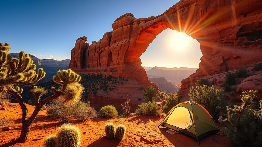
Camping near Devil’s Bridge Trail can make an early hike much easier, but you cannot camp on the trail, at the arch, or beside the trailhead. The best plan is to stay at a developed campground in Oak Creek Canyon or use a legal designated dispersed site west of Sedona, then drive or use the shuttle when access is open.
Quick Answer
Camping is not allowed on Devil’s Bridge Trail. Stay at a developed campground in Oak Creek Canyon or a designated dispersed site west of Sedona, then day-hike the arch. As of July 23, 2026, Devil’s Bridge is closed under the Pocket Fire closure order, so confirm reopening before travel.
Current closure: As of July 23, 2026, Devil’s Bridge Trail and several nearby trails remain closed because of the Pocket Fire. Sedona Shuttle routes to Dry Creek Vista and Mescal are also not operating. Check the official Pocket Fire closure order and the Sedona Shuttle status page before leaving your campsite.
Key Takeaways
- There are no legal campsites on Devil’s Bridge Trail or at the arch.
- Use a developed campground or a marked West Sedona designated dispersed campsite.
- Do not take a normal passenger car down the rough Forest Road 152 approach to the small trailhead.
- Check trail closures, shuttle service, road conditions, and fire restrictions on the day of your visit.
- Start early, carry plenty of water, and turn around when heat, storms, or exposure exceed your comfort level.
At a Glance
| Time Required | About 2–4 hours for the hike, plus driving or shuttle time |
| Difficulty | Moderate, with steep rock steps, uneven footing, and exposed edges near the arch |
| Tools Needed | Water, offline map, sun protection, sturdy shoes, layers, headlamp, and basic first aid |
| Cost | The trail and scheduled trailhead shuttle are normally free; parking, passes, and camping fees depend on your chosen site |
Planning Your Trip: Best Times to Visit Devil’s Bridge Trail
Spring and fall usually offer the most comfortable hiking weather in Sedona. Weekdays and early mornings can also reduce heat, parking stress, and photo lines. Winter can bring cold mornings, snow, or ice on shaded rock. Summer can be dangerously hot and may bring fast-building monsoon storms.
Do not treat sunrise as a guarantee of solitude. Devil’s Bridge is one of Sedona’s best-known hikes, and crowds can build early. Choose a turnaround time before you start, especially in warm weather. Pack layers for changing temperatures and check both the forecast and active Forest Service alerts.
Pro Tip: Build a backup plan before your trip. If the trail, road, shuttle route, or parking area is closed, choose another open Sedona trail instead of parking illegally or entering a closure.
How to Get There: Directions, Parking, and Shuttle Options
Devil’s Bridge is northwest of central Sedona in Coconino National Forest. From the junction of State Routes 89A and 179, travel west on SR 89A and turn north onto Dry Creek Road. The safest access for most visitors is the paved Dry Creek Vista area or another legal paved trailhead that connects to the route.
Forest Road 152, also called Vultee Arch Road in some maps and guides, is rough, rocky, and weather-sensitive. It is not a normal overflow road for passenger cars. Use a suitable high-clearance four-wheel-drive vehicle only when the road is officially open and conditions are dry. Never drive around gates, barriers, or closure signs.
When operating, the free Sedona Shuttle trailhead service serves Dry Creek Vista, which provides hiking access toward Devil’s Bridge. Service schedules and parking restrictions can change because of heat, holidays, road work, or emergencies. Check the live status before relying on the shuttle.
- Dry Creek Vista access: Best for most hikers using a passenger vehicle or the shuttle. It adds walking compared with the small rough-road trailhead.
- Mescal-area access: Another longer route when trails and shuttle service are open. Follow official signs and maps.
- Forest Road 152 trailhead: Shortest approach, but the road is rough and should not be attempted in an unsuitable vehicle.
Note: Parking rules can change when the shuttle runs. Park only in marked legal spaces, never block the road, and do not create a new pullout on vegetation or soft soil.
Camping Options Near Devil’s Bridge Trail
There is no campground at Devil’s Bridge. The main public options are developed campgrounds in Oak Creek Canyon and designated dispersed camping west of Sedona. Private RV parks can offer hookups, but rules, rates, and availability vary.
| Camping option | Best for | What to know |
| Manzanita Campground | Tent campers | Small, tent-only campground beside Oak Creek; sites can fill quickly. |
| Cave Spring Campground | Tents, trailers, and many RVs | Large Oak Creek Canyon campground with drinking water, vault toilets, and token-operated showers; no hookups. |
| Pine Flat Campground | Campers seeking shade and creek access | Sites have picnic tables and fire rings; drinking water and vault toilets are available, but there are no hookups or showers. |
| West Sedona designated dispersed camping | Self-contained campers who want fewer facilities | Camp only in signed designated sites near approved forest roads. Expect no water, toilets, trash service, or hookups. |
Reserve developed sites as early as possible when reservations are offered. If you use a first-come site, arrive with a backup plan rather than assuming a space will open. Never sleep in a trailhead lot unless signs clearly allow overnight use.
Camping Rules, Permits, and Fire Restrictions
A normal day hike to Devil’s Bridge does not require you to register at a ranger station. Standard dispersed camping also does not use a general walk-in permit system, but special uses, commercial guiding, large groups, events, and some other activities may require authorization.
West of Sedona, dispersed camping is limited to marked designated areas near Forest Roads 525, 89B, and 9570. Camping outside those designated areas is prohibited. Coconino National Forest also has a forestwide limit of 14 camping days in any consecutive 30-day period. Developed campground limits may be shorter, so read the rules for your exact campground.
Warning: Fire rules can change with little notice. As of July 23, 2026, Coconino National Forest is under Stage 2 fire restrictions. Do not rely on a campsite’s fire ring as proof that a campfire is legal. Check the current Coconino National Forest alerts before using any flame or stove.
- Camp only where overnight use is allowed.
- Do not camp on the Devil’s Bridge Trail, at the arch, or in a trailhead parking area.
- Pack out trash, food scraps, pet waste, and toilet paper.
- Keep food secured from wildlife and never feed animals.
- Use existing durable sites and do not widen them.
- Follow all closure orders, quiet hours, vehicle rules, and stay limits.
Day Hike to Devil’s Bridge: Trail Details and Difficulty
The official Devil’s Bridge Trail No. 120 is about 1.8 miles round trip from the small rough-road trailhead and gains roughly 400 feet. Most visitors start farther away at a paved access point, so their total hike is several miles longer.
Allow about 2–4 hours for the full outing. Your time will depend on the access route, heat, trail traffic, rest stops, and the line for photos. The route is moderate overall, but the final climb includes steep natural and built rock steps. Near the arch, there are exposed edges and no guardrails.
Turn around if anyone in your group is uncomfortable with steep steps, heat, heights, or the return distance. Children and dogs need close control near exposed rock. Wet or icy sandstone can be slippery.
The shortest trail mileage does not equal the easiest day. Parking, extra approach distance, heat, exposure, and crowds can add much more effort than the map suggests.
Safety Considerations: Heat, Weather, Wildlife, and Terrain
Devil’s Bridge is a desert hike with limited shade. Conditions can change fast, and rescue access may take time. Tell someone your route and return time, download an offline map, and do not depend on cell service.
Heat and Hydration
Start early during warm months and avoid the hottest part of the day. Carry more water than you expect to drink, eat salty snacks, and turn around before your water is half gone. Watch for headache, dizziness, nausea, weakness, confusion, or unusual behavior. Move the person to shade, cool them, and seek emergency help if symptoms are severe or getting worse.
Weather and Storm Preparedness
Northern Arizona’s monsoon season can bring lightning, strong wind, heavy rain, and flash flooding. The National Weather Service advises checking forecasts and moving to a substantial building or enclosed metal-topped vehicle when thunderstorms are near. An exposed ridge, rock shelter, tarp, or lone tree is not safe lightning shelter.
Do not camp, park, or linger in washes during stormy weather. Rain falling far away can send water through a drainage. If thunder is audible, leave exposed rock and return to safe shelter as quickly as conditions allow.
Wildlife and Terrain Awareness
Watch where you place your hands and feet. Rattlesnakes may rest near warm rocks, and scorpions may hide in cracks or under gear. Give every animal space, keep food secured, and never try to move or handle wildlife.
- Stay on the trail: This reduces erosion, protects fragile soil, and lowers the chance of a surprise wildlife encounter.
- Scan ahead: Look for loose rock, steep steps, animals, and people descending toward you.
- Control pets: Keep dogs leashed, carry their waste out, and turn around if hot rock or steep steps are unsafe for them.
- Respect exposure: Stay back from edges and do not pressure anyone to walk onto the arch for a photo.
Gear Checklist for Desert Camping and Hiking
Pack for both the hike and the campsite. Desert days can be hot, while nights and early mornings may feel cold.
- Plenty of drinking water plus extra water in your vehicle
- Electrolytes or salty snacks
- Wide-brim hat, sunglasses, sunscreen, and breathable sun-protective clothing
- Sturdy trail shoes with reliable grip
- Offline map or printed map and a fully charged phone
- Headlamp with spare batteries
- Basic first-aid kit and any personal medication
- Light rain layer and warm layer
- Emergency whistle and compact emergency blanket
- For camping: weather-ready shelter, sleeping system, legal stove if permitted, food storage, trash bags, and enough water for the full stay
Pack weight close to your back and keep water easy to reach. A trekking pole can help on uneven ground, but it does not replace careful foot placement.
Leave No Trace Practices for Sedona’s Fragile Landscape
Sedona’s desert soil and plant life recover slowly from trampling. Follow the Leave No Trace principles at the campsite, on the approach road, and along the trail.
Tread lightly in Sedona. Stay on durable surfaces, pack out every item, and protect fragile soils, plants, wildlife, and cultural sites.
- Use established trails and legal campsites instead of creating shortcuts or new tent pads.
- Pack out all trash, food scraps, toilet paper, and pet waste.
- Leave rocks, plants, artifacts, and natural objects where you find them.
- Keep noise low and let other visitors enjoy the landscape.
- Do not carve, stack rocks, hang decorations, or place gear on sensitive plants.
- Use legal fire and cooking methods only, and follow current restrictions.
Photography Tips: Sunrise, Sunset, and Night Sky
Photography is easiest when you plan around safety instead of chasing one exact shot. Keep bags away from the path, let faster hikers pass, and do not block the arch while setting up equipment.
Golden-Hour Composition
Warm low-angle light can bring out the red and orange layers in the rock. Place the arch off-center, use nearby stone or juniper as foreground, and leave open sky around the subject. A person can show scale, but they should stand only where they feel secure.
- Use the bridge on a third rather than placing it in the center every time.
- Use foreground rock for depth without stepping off the trail.
- Expose for bright highlights and check the histogram before leaving.
Dynamic Exposure Bracketing
When the sky is bright and the arch is in shadow, use exposure bracketing. Take one normal frame, one darker frame, and one brighter frame while keeping the camera still. You can choose the best image later or blend the frames carefully for a natural result. Use a tripod only where it does not block the trail or create a tripping hazard.
Star-Trail Techniques
Night photography requires more planning because the trail has steep steps and exposed rock. Use a sturdy tripod, wide lens, manual focus, interval timer, spare battery, and headlamp with a low setting. Shoot repeated shorter exposures for stacking rather than relying on one very long frame. Do not remain in a closed area or assume that nighttime access or overnight camping is allowed.
Drone rules are more complex than a simple yes or no. Check FAA airspace, temporary flight restrictions, land-manager rules, and any wilderness boundaries before launching. Never fly near a wildfire or emergency operation. The FAA can prohibit drone operations inside a Temporary Flight Restriction.
Nearby Amenities, Campsites, and Alternate Trails
Sedona and the Village of Oak Creek have fuel, groceries, restaurants, outdoor shops, lodging, and private campgrounds. Developed Forest Service campgrounds may provide toilets and water, but facilities vary by site and season. Dispersed campsites generally have no services, so arrive self-contained.
Vultee Arch and Brins Mesa can offer different scenery when open, but they are not automatic backups during a wildfire closure. Brins Mesa is included in the current Pocket Fire closure. Bell Rock Pathway and Airport Mesa may be practical alternatives when their access points are open, but always check the current closure map before choosing a route.
For local maps and current road or trail guidance, contact the Red Rock Ranger District Visitor Center. Do not rely only on an old blog, saved social post, or offline screenshot for closure information.
Frequently Asked Questions
Can I camp on Devil’s Bridge Trail?
No. Camp at a legal developed campground or a marked designated dispersed campsite, then visit Devil’s Bridge as a day hike when the trail is open. Do not sleep at the arch, on the trail, or in the trailhead parking area.
Are drones allowed near Devil’s Bridge for photography?
There is no safe blanket answer. You must check FAA airspace and temporary flight restrictions, Forest Service rules, closure orders, and any wilderness boundary before flying. Never fly near a wildfire, emergency response, crowds, or a posted no-drone area.
Can I bring my dog onto Devil’s Bridge Trail?
Dogs are generally allowed on many Coconino National Forest trails, but they should remain leashed and under control. Carry out pet waste and protect paws from hot rock. The final steep steps and exposed areas may be unsafe for some dogs.
Are campfires permitted at nearby campsites?
Only when the land manager and current fire order allow them. A permanent fire ring does not override a restriction. As of July 23, 2026, Coconino National Forest is under Stage 2 fire restrictions, so check the current order before using any flame or stove.
Is cell service reliable around Devil’s Bridge?
Do not depend on it. Coverage can vary by carrier, terrain, weather, and crowding. Download maps before the hike, share your plan with someone, and carry a backup way to navigate.
Are guided night hikes or ranger-led programs available?
Programs are not guaranteed and schedules change. Check Forest Service event listings or use a properly authorized local guide. Confirm that the selected route is open and that the trip follows nighttime access, group-use, and fire rules.
Do I need a permit or parking pass?
A standard day hike normally does not require a hiking permit, but parking requirements vary by access point. Special activities may require authorization. Read signs at the lot and check current Forest Service and shuttle guidance before your visit.
Conclusion
The safest way to camp near Devil’s Bridge is to choose a legal campground or designated dispersed site, then treat the arch as a day hike. Match the route to your vehicle and fitness, start early, carry enough water, and check closures and fire rules before every trip. As of July 23, 2026, Devil’s Bridge remains closed because of the Pocket Fire, so wait for an official reopening before visiting.
Sources
- U.S. Forest Service: Devil’s Bridge Trail No. 120 — official trail description and base route statistics.
- U.S. Forest Service: Pocket Fire Closure Order — current trail and area closure information.
- Sedona Shuttle Trailhead Routes — current service, trailhead access, and schedule information.
- U.S. Forest Service: West Sedona Designated Dispersed Camping — legal designated dispersed camping framework.
- Recreation.gov: Cave Spring Campground — campground facilities and use details.
- National Weather Service: Northern Arizona Monsoon Safety — heat, lightning, storm, and flash-flood guidance.