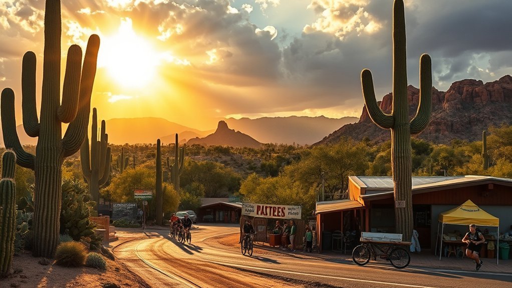
Tucson is surrounded by remarkably different landscapes, so a day trip can mean walking among giant saguaros, climbing into cool pine forests, exploring a living limestone cave, browsing an arts village, paddling on a lake, or looking through telescopes after dark. The best choice depends on whether you want hiking, scenery, history, science, water, or a quieter backcountry escape.
Quick Answer
The best day trips from Tucson include Sabino Canyon, both districts of Saguaro National Park, Mount Lemmon, Tubac, Kartchner Caverns, Biosphere 2, Patagonia Lake, Chiricahua National Monument, Kitt Peak, and Ironwood Forest. Choose Mount Lemmon for cooler mountain air, Kartchner for caves, Tubac for art and history, and Chiricahua for a full hiking day.
Key Takeaways
- For an easy desert escape: Sabino Canyon and Saguaro National Park are among the simplest options from Tucson.
- For cooler temperatures: drive the Catalina Highway toward Mount Lemmon and Summerhaven.
- For history and art: Tubac combines galleries, shops, restaurants, and Arizona’s Spanish-colonial history.
- For reservations-based attractions: plan ahead for Kartchner Caverns, Biosphere 2, and Kitt Peak programs.
- For serious hiking: Chiricahua National Monument deserves most or all of a day.
- For remote desert solitude: Ironwood Forest is rewarding but has no developed visitor facilities and requires more self-sufficiency.
Which Tucson Day Trip Should You Choose?
| Destination | Best For | Planning Level | Main Consideration |
|---|---|---|---|
| Sabino Canyon | Hiking, desert scenery, seasonal water | Easy | Heat, flash floods, shuttle planning |
| Saguaro National Park | Cactus scenery, scenic drives, short hikes | Easy | East and West are separate districts |
| Mount Lemmon | Scenic driving, cooler air, forests | Easy to moderate | Weather and road conditions change with elevation |
| Tubac | Art, history, shopping, dining | Easy | Check individual gallery and historic-site hours |
| Kartchner Caverns | Caves, geology, families | Advance planning recommended | Tours can sell out and have strict rules |
| Biosphere 2 | Science, architecture, families | Easy | Walking route includes indoor/outdoor sections and stairs |
| Patagonia Lake | Boating, fishing, birding | Easy | Swimming area closed through September 2026 |
| Chiricahua | Rock formations, hiking, photography | Moderate to strenuous | Longer drive and demanding trails |
| Kitt Peak | Astronomy and stargazing | Program planning recommended | Night programs require extra time and advance planning |
| Ironwood Forest | Backcountry desert, solitude, wildlife | Higher | No developed facilities; rough roads in places |
Warning: Southern Arizona heat can become dangerous quickly. Carry more water than you expect to need, use sun protection, avoid exposed hikes during extreme heat, and watch weather forecasts during monsoon season. Flash flooding can affect washes, canyons, and low-water crossings even when rain is falling some distance away.
Sabino Canyon Recreation Area
If you want a quick escape into the Sonoran Desert, Sabino Canyon Recreation Area combines towering saguaros, canyon walls, seasonal flowing water, picnic areas, paved access routes, and hiking trails. Routes range from short walks to demanding climbs into the Santa Catalina Mountains.
Popular options include walking sections of the canyon road, exploring the Phoneline Trail, or using Bear Canyon as the approach to Seven Falls. Seasonal streams and pools can be beautiful, but water levels change dramatically with rainfall. Check current conditions before planning a water-focused visit.
The recreation area restricts private vehicle access on the main canyon road, and a concession-operated shuttle can reduce the amount of walking needed to reach upper stops. The USDA Forest Service’s Sabino Canyon information is the best place to check current access, alerts, and visitor guidance.
Note: Ordinary pets are prohibited within Sabino Canyon Recreation Area. ADA-defined service animals are permitted. Check Forest Service rules before bringing an animal.
Wildlife may include deer, javelina, coyotes, reptiles, and many desert bird species. Observe animals from a distance and never rely on seasonal streams as your drinking-water supply.
Saguaro National Park (East & West Options)
Saguaro National Park surrounds Tucson in two separate districts. The Rincon Mountain District, usually called Saguaro East, lies east of the city, while the Tucson Mountain District, or Saguaro West, lies on the opposite side. The two districts are about 30 miles apart, so most day-trippers will enjoy the park more if they choose one side rather than rushing through both.
Saguaro East or West?
Saguaro East is a strong choice for a paved scenic drive, longer hiking opportunities, mountain views, and access to terrain that eventually rises far above the desert floor. The Cactus Forest Loop Drive provides an easy introduction for visitors who want scenery without committing to a long hike.
Saguaro West is often the better choice if your priority is dense-looking stands of saguaros, short interpretive walks, sunset views, and the unpaved Bajada Loop Drive. The Desert Discovery Trail is an easy introduction to Sonoran Desert ecology.
Both districts protect the saguaro and its surrounding ecosystem. Use established roads and trails, do not touch or damage cactus plants, and check the National Park Service Saguaro planning page before visiting.
2026 planning note: Work at the Rincon Mountain District entrance and parking area may affect traffic patterns. Visitor services remain available, but check current NPS conditions before driving to Saguaro East.
Pet access is limited rather than park-wide. Dogs are allowed on only certain designated trails and roads, including a small number of routes in each district. Review the current NPS pet page before choosing a hike with a dog.
Mount Lemmon Scenic Drive and Summerhaven
The Mount Lemmon Scenic Drive, officially the Catalina Highway Scenic Drive, climbs from Sonoran Desert vegetation into oak and pine forests over roughly 27 miles. The rapid change in elevation makes this one of Tucson’s best day trips when you want cooler air, mountain scenery, overlooks, picnic areas, or forest trails.
The Coronado National Forest describes the route as moving through an unusually wide range of vegetation and geology before reaching high country near 9,000 feet. Scenic pullouts make it easy to turn the drive itself into the main activity.
Interpretive areas along the highway introduce the Santa Catalina Mountains’ natural and cultural history. At the upper end of the drive, Summerhaven offers restaurants, small shops, and access to nearby recreation. Depending on weather and season, you can hike shaded trails, picnic beneath pines, visit Mount Lemmon Ski Valley, or simply enjoy the temperature difference from Tucson.
Pro Tip: Check road conditions immediately before leaving Tucson. Weather at Mount Lemmon can be very different from conditions in the city, especially during winter storms, summer monsoons, and periods of high fire danger.
Tubac Historic Arts Village
South of Tucson, Tubac combines an established arts district with one of Arizona’s most important Spanish-colonial historic sites. The village works especially well for travelers who want a slower day of galleries, shops, food, history, and walking rather than a long desert hike.
Galleries and Historic Context
Tubac’s walkable commercial district contains galleries featuring Southwestern painting, ceramics, sculpture, jewelry, photography, and other work. Rather than treating the galleries themselves as colonial relics, it is more accurate to separate today’s arts scene from the area’s much older history.
For that history, visit Tubac Presidio State Historic Park. The park preserves the site of San Ignacio de Tubac, established in 1752, and interprets Indigenous, Spanish, Mexican, territorial, mining, ranching, and community history.
Local Artisan Studios
Tubac is also known for working artists and craft businesses. You may encounter pottery, metalwork, leather, textiles, glass, jewelry, and other handmade goods while moving between galleries and shops. Some businesses offer demonstrations or events, but schedules vary, so check directly with individual studios if watching an artist work is important to your visit.
Take time to speak with makers about materials and techniques when they are available. It gives the shopping experience more context and helps distinguish locally produced work from mass-market souvenirs.
Dining and Shopping
Dining and shopping fit naturally into a Tubac day trip. Restaurants and cafés make it easy to break up several hours of browsing, while boutiques and galleries sell pottery, jewelry, prints, textiles, home décor, and regional art.
| Dining Highlights | Shopping Experiences |
|---|---|
| Patio restaurants and cafés | Artisan jewelry and pottery |
| Southwestern and regional menus | Textiles, prints, paintings, and décor |
Kartchner Caverns State Park
Kartchner Caverns State Park is one of the most distinctive day trips from Tucson because access to the living cave is carefully controlled to protect its formations and ecosystem. Guided tours reveal stalactites, soda straws, columns, flowstone, and other speleothems inside warm, humid chambers.
Reservations are strongly recommended because tours can sell out. Arizona State Parks requires visitors to check in at least 30 minutes before the scheduled tour, and bags, cameras, phones, bottled water, strollers, and many other personal items are not permitted inside the cave.
Cave Tour Options
Current tour choices differ from the original article’s list. Check Arizona State Parks’ official cave-tour page for availability before traveling.
- Rotunda/Throne Tour: roughly a half-mile and about 1½ hours overall. This is the primary standard tour through the Rotunda and Throne Room areas.
- Big Room Tour: roughly a half-mile and about 1¾ hours. It is normally offered from October 15 through April 15 and is not available to children under seven.
- Helmet & Headlamp Tour: a specialty experience that uses helmet-mounted lights and has additional age and schedule restrictions.
- Photo Tour: a limited specialty program with separate rules, scheduling, age limits, and pricing.
There are no self-guided cave tours. All cave access is managed through trained guides.
Wildlife & Flora
The cave is part of a larger desert environment, and the park’s surface trails provide opportunities to see Sonoran and Chihuahuan Desert plants, birds, reptiles, and mammals. Inside the cave, preservation takes priority over visitor freedom of movement. Never touch formations or leave the approved route.
One important seasonal feature is the cave myotis bat colony associated with the Big Room. The Big Room closes during the warmer part of the year so the bats can use the space with minimal disturbance, which is why standard Big Room tours are seasonal.
Visitor Logistics
- Reserve cave tours in advance whenever possible.
- Arrive at least 30 minutes before the scheduled tour.
- Leave prohibited items in your vehicle or use available lockers.
- Expect the cave to remain around 70°F with very high humidity.
- Wear comfortable walking shoes and review accessibility information if stairs, slopes, enclosed spaces, respiratory conditions, or limited mobility could be an issue.
- Pets are not allowed on cave tours and should never be left in a hot vehicle.
2026 planning note: The park has announced limited services from September 14-18, 2026, when the Discovery Center and cave tours will be unavailable. The café and gift shop are also currently listed as closed until further notice. Check the official park page before departure.
Biosphere 2 and Oracle Loop
North of Tucson near Oracle, Biosphere 2 combines unusual architecture, ecological research, and the history of experiments in closed human and natural systems. Two crew missions between 1991 and 1994 lived inside the sealed facility, and the University of Arizona now operates Biosphere 2 as a research and education center.
The current main visitor experience is a self-guided audio walking tour. According to the University of Arizona Biosphere 2 visitor information, most visitors should allow about 75 minutes for the experience.
The route covers about a mile and includes indoor and outdoor sections, roughly 100 stairs, and warm, humid environments inside some biomes. Comfortable shoes and water are sensible even though much of the attraction feels more like a research campus than a wilderness hike.
| Glass & Steel | Rainforest & Ocean | Oracle Area |
|---|---|---|
| Research architecture | Living experimental biomes | High-desert scenery |
| 1990s mission history | Warm, humid conditions | Small-town stops |
| Current science | Self-guided interpretation | Scenic drive extension |
If you have extra time after Biosphere 2, continue into Oracle for a meal or a short drive through the surrounding high-desert landscape rather than treating the stop as a rushed add-on.
Patagonia Lake State Park and Historic Town of Patagonia
Patagonia Lake State Park gives Tucson travelers something most trips on this list do not: a large body of water surrounded by rolling hills and important bird habitat. Boating, kayaking, fishing, picnicking, hiking, and wildlife watching make the park an appealing warm-weather or shoulder-season destination.
Boat and kayak rentals are available through the marina, and anglers fish for species including bass, catfish, bluegill, crappie, and seasonally stocked trout. Check Arizona State Parks’ Patagonia Lake page for current conditions, occupancy notices, and water-related restrictions.
2026 Warning: Arizona State Parks currently lists the Patagonia Lake swimming area as closed through September 2026 because of safety concerns. Do not plan a swimming-focused day trip until the park confirms that the closure has ended.
Nearby, the town of Patagonia adds cafés, local businesses, galleries, and mining and ranching history. Combining a morning on the lake with an afternoon in town creates an easy full-day itinerary.
- Rent a kayak, canoe, rowboat, or other available watercraft from the marina.
- Fish from approved shoreline or boating areas with the required Arizona fishing license.
- Walk park trails and look for birds around shoreline and riparian habitat.
- Picnic beneath shade trees before continuing into the town of Patagonia.
Chiricahua National Monument
Chiricahua National Monument is the longest and most hiking-focused option on this list, but its landscape of rhyolite pinnacles, balanced rocks, wooded canyons, and high viewpoints makes the extra travel worthwhile. The National Park Service calls the area a “wilderness of rocks,” and the monument has about 17 miles of hiking trails plus an 8-mile scenic drive to the high country.
The drive to Massai Point can be rewarding even if you do not want a long hike. For walkers, route difficulty ranges from the short Massai Point Nature Trail to strenuous combinations through the Heart of Rocks.
| Route | Approx. Distance | Best For |
|---|---|---|
| Massai Point Nature Trail | 0.5 mile | Short walk and panoramic views |
| Echo Canyon Loop | About 3.4 miles | Moderate hike among formations |
| Heart of Rocks Route | About 7.3 miles round trip from common trailhead access | Challenging all-day rock formations hike |
| The Big Loop | About 9.5 miles | Experienced hikers wanting a strenuous circuit |
| Scenic Drive to Massai Point | 8-mile road | Non-hikers and scenic overlooks |
Use the National Park Service Chiricahua page to check trail conditions, seasonal hiker transportation, campground status, weather, and alerts. Oversized vehicles and trailers are restricted on the upper scenic drive.
Cell reception can be unreliable, so download maps before arriving. Carry adequate water and do not underestimate the longer routes simply because parts of them trend downhill.
Kitt Peak National Observatory
High above the Sonoran Desert, Kitt Peak National Observatory is one of the most distinctive astronomy destinations in the Southwest. The observatory hosts facilities operated by multiple research organizations, with more than a dozen optical telescopes plus radio telescopes across the summit.
The Kitt Peak Visitor Center provides access to exhibits, daytime telescope tours, nighttime observing programs, and other scheduled astronomy experiences. Program availability varies, so reserve first rather than driving to the mountain and assuming a tour will be available.
Kitt Peak works best as a planned astronomy experience rather than an ordinary scenic pull-off: choose a daytime tour, evening stargazing program, or other scheduled visitor experience before you make the drive.
- Visit the Kitt Peak Visitor Center and exhibits.
- Choose an available daytime telescope tour.
- Reserve an evening stargazing program if you want a night-focused trip.
- Bring an extra layer because summit temperatures and winds can feel much cooler than Tucson.
- Allow enough time for the mountain drive, program check-in, and the return trip after dark.
Kitt Peak is located on Tohono O’odham Nation land, so visitors should follow posted access rules and treat the mountain as both a scientific site and a culturally significant landscape.
Ironwood Forest National Monument
Ironwood Forest National Monument, northwest of Tucson, protects nearly 190,000 acres of Sonoran Desert mountains, valleys, ironwood trees, saguaros, wildlife habitat, archaeological resources, and historic sites. It feels far less developed than Tucson’s national park and recreation areas, which is part of its appeal but also makes preparation more important.
The Bureau of Land Management states that there are no developed visitor facilities in the monument. Some back roads are rugged enough that high-clearance or four-wheel-drive vehicles are recommended.
Best Hiking Areas and Access Points
Ironwood Forest does not have the same network of signed, maintained tourist trails found at Saguaro or Chiricahua. Use BLM maps rather than relying on generic hiking-app names that may lead outside the monument or onto land without public access.
- Ragged Top Trailhead: a recognized BLM recreation access point near one of the monument’s most distinctive mountains.
- Waterman Trailhead: another official access point shown on the BLM monument map.
- Juan Bautista de Anza National Historic Trail corridor: a historic route crossing the broader monument landscape.
- BLM roads and backcountry routes: useful for hiking and exploration where legally open, but road conditions and land ownership require careful map checking.
The original recommendation for a “Vulture Mine Trail” has been removed because the Vulture Peak/Vulture Mine recreation area is near Wickenburg, not an Ironwood Forest National Monument hiking route.
Unique Saguaro Landscapes
Saguaros rise among ironwood, palo verde, mesquite, creosote, rocky washes, and isolated mountain ranges throughout the monument. Ragged Top is especially prominent and is considered one of the monument’s major biological and geological features.
The open landscape is excellent for photography, wildlife watching, and stargazing. Dawn and late afternoon usually provide more comfortable hiking conditions and softer light than midday, especially in warmer months.
Cultural and Historic Sites
Ironwood Forest contains thousands of years of human history, including archaeological sites, rock art, historic ranching landscapes, mining history, and portions of nationally significant historic routes. BLM identifies the Los Robles Archaeological District, Mission of Santa Ana del Chiquiburitac, and Cocoraque Butte Archaeological District among its important cultural resources.
Do not touch, climb on, remove, or publicize precise locations of vulnerable artifacts or rock art. Archaeological materials should remain exactly where they are found.
- Observe rock art and archaeological resources without touching them.
- Leave pottery fragments, stone tools, historic objects, and other artifacts in place.
- Do not enter active or abandoned mine workings.
- Respect private-property boundaries and State Trust Land rules.
Warning: Ironwood Forest has no developed facilities or on-site first aid. BLM also warns that some roads are rugged and that the monument contains BLM land mixed with State Trust and private parcels. Carry offline maps, extra water, a full fuel tank, basic emergency supplies, and verify that your chosen route stays on land legally open to public access.
Planning Tucson Day Trips Safely
These destinations range from developed visitor centers to remote desert backcountry, so one packing list does not fit every trip. Before leaving Tucson, check the managing agency’s current alerts, weather, operating hours, reservation requirements, and road conditions.
- Water: carry your own supply even when a destination has fountains or seasonal streams.
- Heat: move strenuous desert hikes to early morning during warm months.
- Monsoon weather: avoid washes and narrow drainage areas when storms threaten.
- Navigation: download maps before entering remote areas with unreliable cell service.
- Vehicle preparation: start with adequate fuel, especially for Chiricahua, Kitt Peak, and Ironwood Forest.
- Reservations: book cave, science, and astronomy programs before building the rest of your itinerary around them.
- Leave No Trace: stay on appropriate routes, pack out trash, respect wildlife, and leave cultural objects where you find them.
Frequently Asked Questions
Are there guided tours in languages other than English?
Do not assume that every destination offers multilingual guided tours. Some agencies provide Spanish-language web pages or printed information, but actual tour languages depend on the site, date, and program. Contact the individual attraction before booking if a specific language is essential.
What are the pet policies for these Tucson day trips?
Policies vary widely. Dogs are prohibited in Sabino Canyon Recreation Area, Saguaro National Park allows them only on selected routes and developed areas, Kartchner Caverns does not allow pets on cave tours, and Chiricahua restricts pets from many upper-elevation trails. Always check the managing agency’s current pet rules before leaving Tucson.
Is cell service generally available on these trips?
No. Service can become unreliable in mountain, canyon, cave, and remote desert areas. Chiricahua and Ironwood Forest are especially poor places to depend on a live phone connection for navigation. Download maps, save reservation details, and tell someone your route before entering remote backcountry.
Are there family-friendly restrooms and changing facilities?
Developed visitor centers and state or national park facilities commonly have restrooms, but availability varies by trailhead and season, and changing tables should not be assumed. Ironwood Forest National Monument has no developed facilities at all. Check each destination’s facility page when traveling with young children.
Can I rent bikes or kayaks nearby?
Rental availability is destination-specific. Patagonia Lake has marina-based boat and kayak rentals. Do not assume bikes or watercraft are available at the other destinations; check local outfitters or the attraction itself before traveling if a rental is central to your plans.
Which Tucson day trips need advance reservations?
Kartchner Caverns is the clearest reservation priority because cave tours can sell out. Biosphere 2 tickets and Kitt Peak astronomy programs are also worth booking ahead. Most ordinary hiking and scenic-driving visits to Sabino Canyon, Saguaro, Mount Lemmon, Chiricahua, and Ironwood Forest do not require a standard day-use reservation, although fees, special programs, shuttles, permits, or campground reservations may still apply.
What is the best Tucson day trip during hot summer weather?
Mount Lemmon is usually the strongest choice when your main goal is escaping Tucson’s desert heat because the highway climbs into much higher-elevation forest. Kartchner Caverns and Biosphere 2 also include substantial indoor or climate-controlled portions, although you still need to prepare for outdoor heat before and after those experiences.
Can I combine two destinations in one day?
Yes, but choose geographically compatible stops. Biosphere 2 and Oracle fit naturally together, as do Patagonia Lake and the town of Patagonia. Tubac can also be paired with another southern stop if operating hours allow. Avoid combining Chiricahua with another major attraction because the drive and hiking deserve most of a day.
Conclusion
Tucson has 10 excellent day-trip options within reach, and they cover far more than desert scenery. You can walk among saguaros at Sabino Canyon or Saguaro National Park, cool off in the forests of Mount Lemmon, browse art and history in Tubac, explore Kartchner Caverns, learn about Earth systems at Biosphere 2, spend time on the water at Patagonia Lake, hike Chiricahua’s rock formations, look into the night sky at Kitt Peak, or head into the undeveloped landscape of Ironwood Forest.
The best trip is the one that matches the season and your preferred pace. Check current conditions and reservations, pack for Southern Arizona weather, carry enough water, and give the longer destinations enough time to enjoy them without rushing.
Sources
- USDA Forest Service: Sabino Canyon and Catalina Highway Scenic Drive — canyon access, pet rules, Mount Lemmon route, recreation, and current Forest Service guidance.
- National Park Service: Saguaro National Park — district planning, trails, access, pet rules, and current conditions.
- Tubac Presidio State Historic Park, Kartchner Caverns tours, and Patagonia Lake State Park — history, cave tours, seasonal restrictions, boating, and current park notices.
- University of Arizona Biosphere 2 — visitor experience, tour length, route information, and current research facility access.
- National Park Service: Chiricahua National Monument — scenic drive, hiking routes, trail distances, conditions, and visitor planning.
- Kitt Peak National Observatory / NSF NOIRLab and Bureau of Land Management: Ironwood Forest National Monument — astronomy programs, telescope facilities, Ironwood access, land status, safety, and recreation.