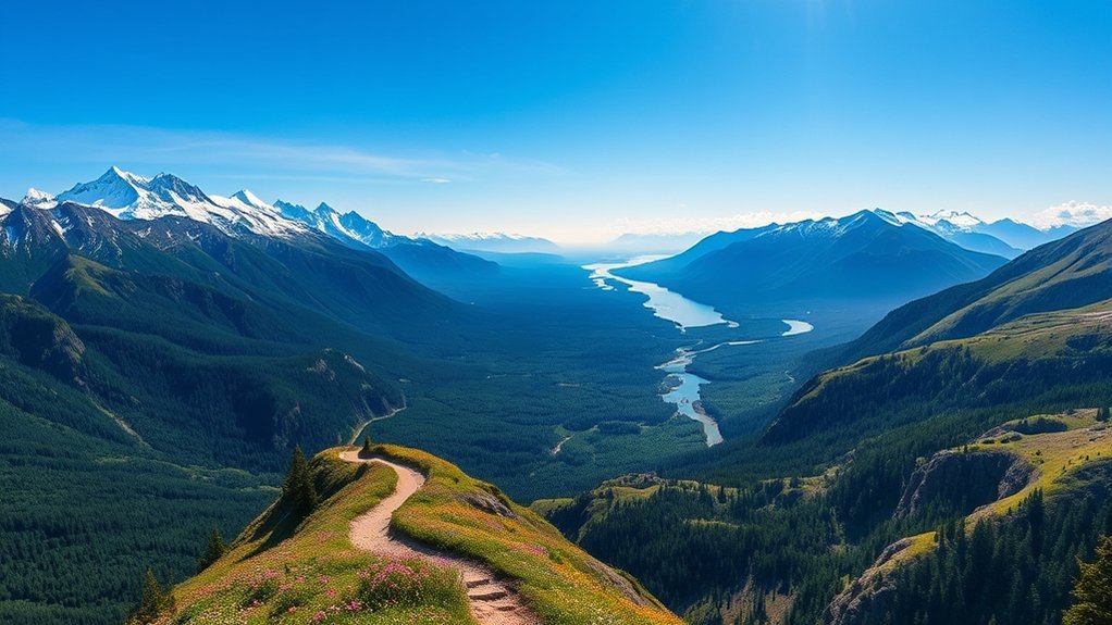
Alaska can turn a short walk into a serious outdoor experience. A trail may be only three miles long but still include steep scrambling, exposed rock, fast-changing weather, wildlife, or remote access. This guide compares scenic Alaska hikes ranging from accessible glacier viewpoints and paved coastal paths to difficult mountain climbs.
Quick Answer
The best hikes in Alaska include Mount Healy for Denali views, the Exit Glacier trails for easy glacier scenery, Root Glacier for a guided ice experience, Flattop for Anchorage panoramas, Grewingk Glacier Lake for a water-taxi adventure, and Tony Knowles Coastal Trail for an easy paved outing.
Key Takeaways
- Choose a route by distance, elevation, terrain, access method, and exposure, not mileage alone.
- Exit Glacier, Bartlett Cove, Matanuska Glacier, Tony Knowles Coastal Trail, and Talkeetna Lakes offer easier options.
- Mount Healy, Flattop, Mount Verstovia, and Mount Marathon require strong fitness and careful weather judgment.
- Do not step onto a glacier without suitable equipment, knowledge, or a qualified guide.
- Carry rain protection, warm layers, water, food, navigation, and emergency communication appropriate for the route.
- Check official trail conditions, transport arrangements, fees, and closures shortly before you leave.
What’s in This Article
- Best Alaska Hikes at a Glance
- Denali National Park: Mount Healy Overlook Trail
- Kenai Fjords: Exit Glacier View Loop and Overlook
- Wrangell-St. Elias: Root Glacier Trail
- Glacier Bay: Forest Trail at Bartlett Cove
- Chugach State Park: Flattop Mountain Trail
- Kachemak Bay: Grewingk Glacier Lake Trail
- Sitka: Mount Verstovia Trail
- Matanuska Glacier: Edge Nature Trail
- Anchorage: Tony Knowles Coastal Trail
- Fairbanks: Angel Rocks Trail
- Kodiak: Fort Abercrombie Trails
- Homer: Diamond Creek Trail
- Talkeetna Lakes Trails
- Seward: Mount Marathon Hiking Trail
- Juneau: Perseverance Trail
- How to Choose the Right Alaska Hike
- Wildlife, Glacier, and Remote-Trail Safety
- What to Pack for an Alaska Day Hike
- Frequently Asked Questions
- Sources
Best Alaska Hikes at a Glance
| Hike | Distance or Time | Difficulty | Access | Best For |
|---|---|---|---|---|
| Mount Healy Overlook | 5.4 miles round trip | Strenuous | Near Denali Visitor Center | Alpine views |
| Exit Glacier trails | 1-mile loop plus optional 0.6-mile extension | Easy to moderate | Seasonal road access | Accessible glacier views |
| Root Glacier | About 3 miles round trip to the glacier | Moderate; ice travel is technical | From Kennecott | Glacier adventure |
| Forest Trail at Bartlett Cove | 1-mile loop | Easy | Bartlett Cove developed area | Families and rainforest |
| Flattop Mountain | 3 miles round trip | Difficult | Glen Alps Trailhead | Anchorage panoramas |
| Grewingk Glacier Lake | 3.2 miles one way; common through-route about 4.2 miles | Easy to moderate | Water taxi from Homer | Glacier lake scenery |
| Mount Verstovia | About 5 miles round trip | Difficult | Road access near Sitka | Coastal mountain views |
| Matanuska Edge Nature Trail | About 20 minutes | Easy | Glenn Highway | Roadside glacier viewing |
| Tony Knowles Coastal Trail | 11 miles one way | Easy | Downtown Anchorage to Kincaid Park | Walking and biking |
| Angel Rocks | 3.5 miles round trip | Moderate | Chena Hot Springs Road | Rock formations |
| Fort Abercrombie trails | Variable network | Easy to moderate | Road access from Kodiak | History and coastline |
| Diamond Creek | About 4.2 miles round trip | Moderate | Road access north of Homer | Forest and beach |
| Talkeetna Lakes trails | Route varies | Easy to moderate | Comsat or Whigmi trailheads | Quiet forest and lakes |
| Mount Marathon hiking route | About 4.5 miles round trip | Difficult | Jeep Trail from Seward | Resurrection Bay views |
| Perseverance Trail | About 3 miles one way | Moderate | Basin Road in Juneau | Waterfalls and mining history |
A short Alaska trail is not always an easy trail. Steep elevation gain, loose rock, weather, wildlife, and remote access can matter more than mileage.
Denali National Park: Mount Healy Overlook Trail
Trail facts: 5.4 miles round trip, about 1,700 feet of elevation gain, strenuous, and roughly four hours for many hikers.
The Mount Healy Overlook Trail starts near the Denali Visitor Center and climbs steadily through spruce forest. The route becomes much steeper after the halfway benches and reaches open alpine terrain near its official endpoint.
The maintained trail ends at an overlook partway up Mount Healy, not at the mountain’s true summit. The overlook provides broad views across the park entrance area and the Alaska Range when clouds allow.
The upper section is exposed and often windy. Stay on the switchbacks, carry layers, and avoid continuing onto the ridge unless you have suitable off-trail mountain experience.
Warning: Terrain beyond the official Mount Healy trail endpoint becomes much steeper and more exposed. Fatal falls have occurred on the mountain.
Kenai Fjords National Park: Exit Glacier View Loop and Overlook
Trail facts: A one-mile accessible loop, with an optional 0.6-mile one-way extension to a closer overlook.
The Exit Glacier trail network offers some of Alaska’s easiest road-accessible glacier views. The Glacier View Loop follows a partly paved and partly compressed-gravel route through cottonwood forest to a panoramic viewpoint.
For a longer walk, continue on the Glacier Overlook Trail. This extension is steeper and moderately strenuous but provides a closer view into the glacier-carved valley.
The Exit Glacier area has no public Wi-Fi or dependable cell service. Pets and bicycles are not allowed on park trails beyond the parking area. The access road is normally closed to cars during much of winter and spring, so check current conditions before driving from Seward.
Note: The eight-mile Harding Icefield Trail begins in the same area but is a separate, strenuous full-day hike. Do not confuse it with the short Exit Glacier viewpoint trails.
Wrangell-St. Elias National Park: Root Glacier Trail
Trail facts: About 1.5 miles one way from Kennecott to the glacier, moderate hiking, with additional equipment required for ice travel.
The Root Glacier Trail begins near the historic Kennecott mining area. The route crosses rugged moraine terrain and reaches one of the most accessible glaciers in Wrangell-St. Elias National Park.
You can hike to the glacier and enjoy views of blue ice, surrounding peaks, and glacial debris without committing to a long backcountry route. Reaching Kennecott still takes planning because visitors generally travel from McCarthy by shuttle, bicycle, or foot.
Walking on the glacier is a separate activity from hiking the trail. Ice spikes or crampons may be appropriate, but equipment alone does not make glacier travel safe. A qualified guide is the better choice when you do not have glacier experience.
Warning: Glaciers can contain hidden crevasses, unstable ice, meltwater channels, and slippery slopes. Do not enter ice caves or travel onto unfamiliar ice without suitable training and equipment.
Glacier Bay National Park: Forest Trail at Bartlett Cove
Trail facts: One-mile loop, easy, usually 30 minutes to 1.5 hours.
The Forest Trail at Bartlett Cove is an easy route through temperate rainforest and beach habitat. The surface includes dirt, gravel, and boardwalk sections, with benches and viewing platforms along the way.
This route fits families, new hikers, and travelers with limited time. You can also add a walk along the separate shoreline route for more views of Bartlett Cove, intertidal habitat, and coastal birds.
Longer Bartlett Cove options include the Bartlett River Trail and Bartlett Lake Trail. Those routes require more time and preparation and should not be confused with the short Forest Trail loop.
Chugach State Park: Flattop Mountain Trail
Trail facts: Three miles round trip, about 1,300 feet of elevation gain, difficult, with scrambling near the summit.
The Flattop Mountain Trail starts at the Glen Alps Trailhead near Anchorage. The route climbs through low forest and tundra before reaching steep, rocky terrain near the top.
Clear conditions can reveal Anchorage, Cook Inlet, Turnagain Arm, and distant mountain ranges. The convenient trailhead makes Flattop popular, but its popularity should not be confused with low difficulty.
The final section involves scrambling and loose rock. Hikers above you may dislodge stones, and wet, icy, windy, or foggy conditions can make the route much more dangerous.
Warning: Falls on Flattop have caused serious injuries and deaths. Turn around below the summit if the rock is wet, icy, crowded, or beyond your comfort level.
Kachemak Bay State Park: Grewingk Glacier Lake Trail
Trail facts: Glacier Lake Trail is 3.2 miles one way. The common point-to-point route using Saddle Trail is about 4.2 miles and requires planned marine transportation.
The Grewingk Glacier Lake route crosses cottonwood and spruce forest before reaching the glacier’s broad outwash plain and lake. The open shoreline provides dramatic views of Grewingk Glacier and surrounding peaks.
Most day hikers arrange a water-taxi drop-off at Glacier Spit, hike to the lake, and continue over the one-mile Saddle Trail for pickup at the Saddle trailhead. Confirm both locations and pickup times with the operator before leaving Homer.
Kachemak Bay weather can delay marine travel. Much of the park lacks cell service, so carry offline navigation and consider a satellite communication device.
Warning: Do not enter glacier caves, climb onto unfamiliar ice, or attempt to ford Grewingk Creek. The creek is swift and extremely cold. Review Alaska State Parks’ current Grewingk Lake hazard information before your trip.
Sitka: Mount Verstovia Trail
Trail facts: About 2.5 miles one way to the official trail endpoint near 2,550 feet, difficult, steep, and often slick.
The Mount Verstovia Trail rises sharply from near sea level through Southeast Alaska forest. Roots, wet soil, rocks, and sustained climbing make the route far harder than its mileage may suggest.
Views begin opening as the trail approaches treeline near 2,000 feet. Higher sections provide panoramas over Sitka Sound, islands, forest, and surrounding peaks.
The maintained trail ends in rocky alpine terrain below the true summit. There is no maintained trail to the summit, and continuing requires a steep, exposed scramble suitable only for experienced hikers.
Pro Tip: Picnic Rock offers a rewarding lower turnaround for hikers who want a strong view without completing the full steep ascent.
Matanuska Glacier: Edge Nature Trail
Trail facts: About a 20-minute walk, easy, with roadside access from the Glenn Highway.
The Edge Nature Trail begins at Matanuska Glacier State Recreation Site and travels through forest to public glacier-viewing platforms.
This is a practical choice for travelers who want a short walk and broad glacier views without entering difficult mountain terrain. The parking area itself also provides views across the Matanuska River valley.
The state recreation site does not provide access to the glacier. Access to the ice occurs through separate land and commercial arrangements, and rules can change. Confirm current requirements directly with an authorized operator before planning a glacier walk.
Note: “Glacier view” and “glacier access” are not the same. The public state recreation site is designed for viewing from safe ground.
Anchorage: Tony Knowles Coastal Trail
Trail facts: 11 miles one way, paved, easy, and open to walkers and cyclists.
The Tony Knowles Coastal Trail follows the Cook Inlet shoreline between downtown Anchorage and Kincaid Park. You can walk a short section or complete a longer ride without committing to a remote trailhead.
The route passes Westchester Lagoon, Earthquake Park, wooded areas, and open coastal viewpoints. Moose and eagles are possible along the trail, particularly near quieter forest sections.
A full out-and-back covers about 22 miles, so many visitors use a bicycle, arrange transportation, or walk only the downtown section. Keep right, watch for faster trail users, and give moose a very wide path.
Fairbanks: Angel Rocks Trail
Trail facts: 3.5 miles round trip, two to three hours, moderate, with a high point near 1,750 feet.
The Angel Rocks Trail climbs through evergreen forest to large granite formations and open views over the Chena River valley.
Steep and rocky sections add challenge, but the route remains manageable for many reasonably fit hikers who take their time. Do not attempt technical climbing on the rock formations without suitable training and equipment.
Carry drinking water rather than relying on untreated streams. Interior Alaska can shift quickly from warm sun to cool wind, and insects can be heavy during part of summer.
Kodiak Island: Fort Abercrombie State Historical Park Trails
Trail facts: A road-accessible network of generally short trails with easy and moderate options.
Fort Abercrombie State Historical Park combines old-growth Sitka spruce, coastal bluffs, lake scenery, wildflower areas, and remains from a World War II coastal defense installation.
Instead of one official “Fort Abercrombie Trail,” the park contains a network of paths that can be combined into short walks. Follow the park map and choose a loop that matches your available time.
Stop at interpretive features to understand the military history, then continue to coastal viewpoints for ocean scenery and birdwatching. Stay away from cliff edges and remain on established paths around historic structures.
Homer: Diamond Creek Trail
Trail facts: About 4.2 miles round trip, moderate, with a steep descent to Cook Inlet.
The Diamond Creek Trail begins several miles north of Homer and descends through meadow, alder, and forest to the beach.
The upper section uses switchbacks and crushed rock. Lower sections become narrower and steeper, and patches of clay can be very slippery after rain.
At the bottom, you can explore the shoreline when conditions allow. Check the tide schedule, stay aware of changing water levels, and leave enough energy for the sustained climb back to the trailhead.
Pro Tip: Trekking poles can improve balance on the steep clay and crushed-rock sections, especially after wet weather.
Talkeetna Lakes Trails
Trail facts: A trail network with route lengths that vary, generally easy to moderate.
The Talkeetna Lakes trail system winds through forest around a group of quiet lakes outside Talkeetna. Access is available from the Comsat and Whigmi Road trailheads.
During summer, the network supports hiking, jogging, biking, fishing access, and relaxed wildlife watching. In winter, several routes serve as skate and classic ski trails.
This area works well when you want a flexible forest outing rather than a steep summit climb. Check the posted map before starting because there is no single route called the Talkeetna Lakes Park Trail.
Seward: Mount Marathon Hiking Trail
Trail facts: About 4.5 miles round trip to Race Point by the hiking route, nearly 3,000 feet of climbing, difficult and strenuous.
Mount Marathon rises directly behind Seward and provides dramatic views over Resurrection Bay. Most recreational hikers should use the Jeep Trail and Skyline hiking route rather than attempting the much steeper race course.
The hiking route begins near Madison Avenue, climbs through forest, crosses the mountainside, and continues through a glacial valley toward Race Point. Although it is more manageable than the race route, it still includes major elevation gain and exposed alpine weather.
The official Mount Marathon race course is about 3.1 miles and gains nearly 3,000 feet. Its roots, cliffs, scree, loose gravel, and extremely steep slopes make it unsuitable as a casual hiking shortcut.
Warning: Use the hiking route, not the race route, unless you have specific experience on Mount Marathon’s terrain. Snow, rain, fog, loose shale, and strong wind can make either route unsafe.
Juneau: Perseverance Trail
Trail facts: About three miles one way, moderate, with options for shorter turnarounds and side routes.
Perseverance Trail begins at the end of Basin Road near downtown Juneau. The route follows the Gold Creek valley through forest, waterfall scenery, and remnants of the area’s mining history.
You can turn around after a short walk or continue toward the upper valley. Junctions also connect with Granite Creek, Mount Juneau, and other routes, but those side trips add considerable difficulty.
Parts of the trail cross steep slopes above the creek. Winter and early spring can bring serious avalanche danger, while summer rain can make rocks and roots slippery.
How to Choose the Right Alaska Hike
Start by deciding how much climbing, exposure, and travel planning you can handle. A short mountain trail may demand more effort than a longer paved or forest route.
Choose an Easier or Family-Oriented Route
- Forest Trail at Bartlett Cove
- Glacier View Loop at Exit Glacier
- Matanuska Edge Nature Trail
- A short section of Tony Knowles Coastal Trail
- Talkeetna Lakes trails
- Short loops at Fort Abercrombie
Choose a Moderate Scenic Hike
- Angel Rocks
- Diamond Creek
- Perseverance Trail
- Grewingk Glacier Lake using planned water-taxi transportation
- Root Glacier Trail without independent glacier travel
Choose a Difficult Mountain Hike
- Mount Healy Overlook
- Flattop Mountain
- Mount Verstovia
- Mount Marathon hiking route
Also consider access. Grewingk Glacier requires a water taxi, Kennecott may require a shuttle, Exit Glacier road access is seasonal, and commercial arrangements govern most Matanuska Glacier ice access.
Wildlife, Glacier, and Remote-Trail Safety
Bear Encounters
Make noise in dense vegetation, stay alert for fresh tracks or food sources, and never approach a bear. Keep bear spray immediately accessible where possession is allowed, not buried inside your pack.
If a bear notices you, stay calm, identify yourself with a steady voice, and do not run. Response details depend on whether the bear is defensive or acting in a persistent, non-defensive way, so review current Alaska Department of Fish and Game bear guidance before hiking.
Moose Encounters
Give moose plenty of space, especially cows with calves and bulls during the fall rut. Do not try to pass closely when a moose is standing on a trail.
If a moose charges, move away quickly and get behind a solid object such as a large tree, vehicle, or building. This differs from bear guidance, where running can trigger a chase response.
Glacier and Swift-Water Hazards
Do not enter ice caves or walk onto a glacier because other visitors appear to be doing it. Crevasses can be hidden, ice can collapse, and meltwater can cut deep channels beneath the surface.
Do not ford cold, fast glacial streams unless the official route and current guidance clearly allow it. Water depth, speed, and channels can change during the day.
Remote Communication
Download maps before leaving service, tell someone your route and return time, and carry enough equipment to remain out longer than planned. For water-taxi or backcountry routes, a satellite messenger or personal locator beacon can provide an important backup.
Warning: Do not rely on a phone signal, online map, or same-day forecast as your only safety plan. Alaska weather and trail access can change faster than expected.
What to Pack for Alaska Day Hikes
Carry equipment for colder, wetter, and longer conditions than you expect. Adjust the list for trail length, remoteness, elevation, and season.
- Waterproof jacket and rain pants
- Warm insulating layer
- Sturdy footwear with suitable traction
- Water and extra food
- Small first-aid kit
- Offline map, compass, or GPS device
- Headlamp, even when daylight hours are long
- Emergency whistle and fire-starting equipment where appropriate
- Sun protection and insect repellent
- Trekking poles for steep, muddy, or rocky routes
- Bear spray where allowed, carried in an accessible holster
- Satellite communication device for remote routes
Note: Bear spray cannot normally travel in passenger baggage on commercial flights. Plan to rent or buy it after arriving and confirm transportation rules with your carrier.
Frequently Asked Questions
What Is the Best Time of Year to Hike in Alaska?
Late June through early September is the most dependable general window for snow-free day hiking, but conditions vary by region, elevation, and year. Higher trails can retain snow into summer, while coastal routes may remain rainy and muddy. Check the managing agency’s current report before every hike.
Which Alaska Hikes Are Best for Beginners?
Good beginner options include the Forest Trail at Bartlett Cove, Glacier View Loop at Exit Glacier, Matanuska Edge Nature Trail, short sections of Tony Knowles Coastal Trail, Talkeetna Lakes, and shorter loops at Fort Abercrombie.
Do You Need Permits for These Alaska Day Hikes?
Most listed day hikes do not require an individual hiking permit, but entrance fees, parking fees, water-taxi reservations, commercial glacier access, or other charges may apply. Rules and seasonal restrictions can change, so check the park or land manager before visiting.
Do You Need a Guide for an Alaska Glacier Hike?
You do not need a guide to view glaciers from established land trails. A qualified guide is strongly recommended when you plan to walk on glacier ice and do not already have glacier-travel training, route knowledge, and suitable equipment.
What Wildlife Should You Expect on Alaska Trails?
Possible wildlife includes bears, moose, eagles, marmots, mountain goats, marine mammals, and many bird species, depending on the region. Sightings are never guaranteed. Give every animal space, secure food, control pets, and never approach wildlife for a photograph.
How Should You Prepare for Alaska’s Changing Weather?
Wear layers, carry full rain protection, and pack extra food, water, and light. Check the forecast, but prepare for colder temperatures, stronger wind, rain, fog, or snow at higher elevations. Turn around when visibility, footing, or exposure becomes unsafe.
Can Beginners Join Guided Hikes in Alaska?
Yes. Guided outings are available in many Alaska destinations and can help beginners choose a suitable route, understand wildlife behavior, use glacier equipment, and respond to local weather and trail conditions.
Alaska’s best hikes are not defined by one viewpoint or one level of difficulty. The right route is the one that fits your fitness, available time, transportation, weather window, and experience. Start with an established trail, check official conditions, carry reliable equipment, and turn around early when the terrain or weather no longer feels safe.
Sources
- Denali National Park Day Hiking — official trail distances, access, and difficulty information.
- Kenai Fjords Exit Glacier Area — official Exit Glacier trail, access, and seasonal guidance.
- Wrangell-St. Elias Root Glacier Trail — official route and glacier-safety information.
- Glacier Bay Hiking — official Bartlett Cove trail descriptions and distances.
- Alaska State Parks Trail Maps and Guides — official state-park trail specifications and maps.
- Alaska Department of Fish and Game Bear Safety — official bear-encounter and prevention guidance.