Last updated: May 29, 2026
Quick Answer: Best Mogollon Rim Hikes by Trip Style
The best Mogollon Rim hike depends on your time, fitness and season. Choose rim overlooks and Rim Lake Vista Trail for easy views, creek walks for family-friendly shade, moderate water-feature hikes for cooler summer days and backcountry routes only when you can navigate without reliable cell service.
The Mogollon Rim gives you some of Arizona’s best high-country hiking without forcing every visitor into a difficult route. You can choose short overlooks, family-friendly forest trails, shaded creek walks, moderate hikes near water and longer backcountry routes with real navigation demands. Use this guide to match your hike to your skill level, the season and the type of scenery you want most.
Quick Picks: Which Mogollon Rim Trail Type Should You Choose?
| Trip Style | Best For | Plan For |
|---|---|---|
| Rim overlooks and short walks | First-time visitors, photos and quick stops | Wind, fast weather changes and exposed edges |
| Family forest trails | Kids, beginners and relaxed half-day hikes | Short distances, snacks, water and flexible pacing |
| Creek and water-feature hikes | Warm days, shade and scenic breaks | Slippery rocks, seasonal flows and muddy sections |
| Backcountry and ridgeline routes | Experienced hikers who can self-navigate | Offline maps, water planning, storms and bailout routes |
Top Mogollon Rim Overlooks and Short Walks
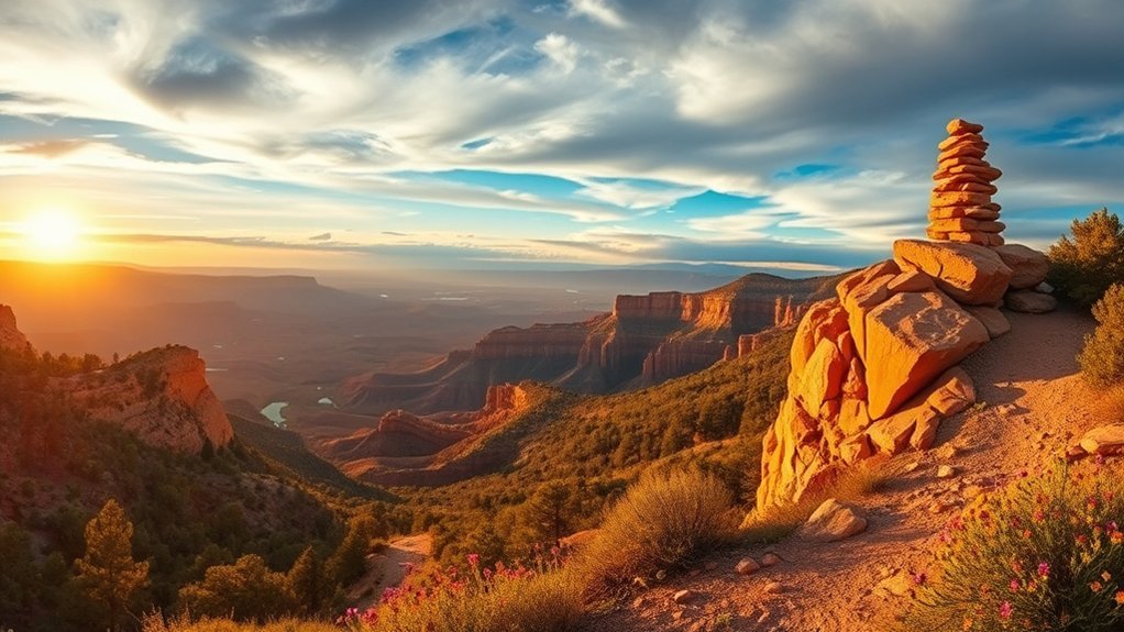
Start with the rim overlooks if this is your first visit. These stops give you sweeping canyon views, easy wildlife spotting and a fast sense of the Rim’s scale without a long climb. You can often combine several viewpoints in one afternoon, especially near Forest Road 300 and the Rim Lakes area.
Look for maintained viewpoints, signed pullouts and short trails with clear sightlines. A route such as Rim Lake Vista Trail works well when you want a more structured walk along the rim instead of only a roadside stop. The official trail description lists Rim Lake Vista Trail 622 as a 4.3-mile route from The Rim Top Trailhead to Mogollon Campground, with paved sections near the Rim Lakes Vista area.
Pack a light lunch, binoculars, a wind layer and enough water for everyone in your group. Early morning and late afternoon usually give you better light and cooler temperatures. Midday works for quick photos, but exposed viewpoints can feel hot and windy. Stay on maintained paths because rim edges can crumble and understory plants recover slowly.
Safety note: Leave exposed rim edges when thunderstorms build. The Rim Lakes Vista Trail safety notes warn that lightning storms are most common in July and August, so treat summer storm clouds seriously.
Family-Friendly Mogollon Rim Forest Trails
Choose family-friendly forest trails when you want shade, simple navigation and a relaxed pace. These routes suit kids, beginner hikers and visitors who want scenery without a demanding climb. Keep the plan short enough that you can turn around before the group gets tired.
Easy Loop Trails for Beginners and Kids
Easy loop trails work well because they reduce decision fatigue. You start and finish near the same trailhead, avoid long vehicle shuttles and keep the day simple. Look for loops near campgrounds, picnic areas and lake recreation zones where signs, restrooms or parking may be easier to find.
Bring a small daypack with water, snacks, sun protection, a rain layer and a basic first-aid kit. Give kids a simple goal, such as spotting pinecones, birds or wildflowers. That keeps the hike fun and helps them stay engaged without rushing.
Scenic Creek Walks With Shade and Water Sounds
If you want a peaceful, family-friendly route, scenic creek walks give you shaded paths, gentle grades and the steady sound of flowing water. You may pass ferns, willows, wildflowers and small cascades depending on the season and recent weather.
Do not treat creek access as guaranteed drinking water. Carry your own water, and use a proper filter if you plan to treat natural water. Keep children away from slick rocks near cascades, and avoid trampling wet riparian areas along the stream edge.
Moderate Day Hikes With Water Features
When the Rim gets warm, moderate day hikes near creeks, pools and cascades can feel much cooler than exposed ridgeline walks. These routes often mix gentle climbs, shaded sections and short side paths to viewpoints or water features.
Pick waterfall hikes or creekside routes when you want photo stops and longer rest breaks. Wear shoes with traction because slippery rocks, loose gravel and muddy banks can turn an easy step into a fall. Trekking poles help on uneven terrain, especially after rain.
Plan your turnaround point before you start. Water sounds can make a trail feel easier than it is, but you still need enough energy and water for the return. Check seasonal closures, fire restrictions and road status before you drive to remote trailheads.
Challenging Ridgeline and Loop Routes
Choose challenging ridgeline and loop routes only if you can handle exposure, loose footing and longer stretches without services. These routes can reward you with wide views and quieter terrain, but they leave less room for poor planning.
Carry a paper map, compass, GPS app with offline maps, extra food, extra water and a headlamp. Tell someone your route and expected return time. Build in a bailout option in case storms, heat, injury or slow progress force you to shorten the hike.
Rim-to-Rim Ridgeline Challenges
The most exposed rim routes demand steady footing and good judgment. You may face loose shale, exposed roots, steep pitches, sudden drop-offs and short scrambles where handholds help. Do not attempt these routes in lightning, high wind, snow, ice or heavy rain.
These hikes reward hikers who move carefully and know when to turn back. If the route requires more navigation than expected, stop early, confirm your position and adjust the plan before fatigue builds.
Loop Route Navigation Tips
A loop route can look simple on a map but feel confusing on the ground. Break the route into checkpoints tied to trail junctions, water, shade, overlooks or obvious landforms. Confirm your position at every junction instead of waiting until you feel lost.
Set realistic pace targets for each segment. Add time for elevation gain, exposed sections, photos, food breaks and route checks. Mark bailout options before you leave because storms can change Rim conditions quickly.
Backcountry and Multi-Day Trek Options
If you want deeper solitude, the Mogollon Rim area offers backcountry and multi-day options that require navigation, endurance and self-reliance. You may move beyond signed trailheads into rim-to-canyon terrain where water planning and route choice matter more than mileage alone.
Trade day hikes for deeper solitude only after you can navigate, manage water and exit safely without cell service.
You should prioritize:
- Route selection: choose mileage, elevation gain and terrain that match your real pace.
- Water planning: confirm current water sources, carry extra capacity and never rely on a creek without backup.
- Campsite strategy: use durable surfaces, respect closures and follow Leave No Trace practices.
- Emergency preparedness: share your plan, carry a satellite communicator when possible and know your exit points.
On longer treks, you will manage calories, changing temperatures and dry stretches. Careful planning can give you quiet ridge camps, star-filled nights and memorable wilderness travel. Poor planning can turn the same route into a dangerous mistake.
Seasonal Picks: Wildflowers, Fall Color and Winter Snow
For spring blooms, plan around late spring and check local conditions before you go. Wildflowers vary by elevation, snowpack, rainfall and temperature. Open meadows, sunny rocky edges and lake-area trails can offer strong color when conditions line up.
For autumn foliage, watch higher-elevation aspens and oaks as nights cool. Many visitors aim for October, but the best week can shift each year. Bring layers because temperatures swing between sun, shade and exposed overlooks.
For a winter snow hike, wait for safe access and choose shorter routes. Snow can hide trail edges, ice can form on shaded sections and forest roads may close or become difficult. Carry traction devices, warm layers, a headlamp and a backup route.
Seasonal planning helps you choose better trails, safer gear and realistic timing. The same route can feel easy in dry fall weather, muddy after rain and risky during summer lightning season.
Recommended Hiking Gear for the Mogollon Rim
The right gear depends on your route, but every hiker should prepare for fast weather changes, limited cell service and uneven terrain. Start with the basics before adding specialty gear.
- Navigation: offline map, paper map and compass for longer routes.
- Water: more than you expect to need, plus a filter for longer creek routes.
- Footwear: traction-focused hiking shoes or boots for rock, mud and loose soil.
- Weather layers: rain shell, warm layer and sun protection.
- Safety: first-aid kit, headlamp, whistle and emergency contact plan.
- Backcountry backup: satellite communicator for remote hikes where cell service drops.
Common Mistakes to Avoid on Mogollon Rim Hikes
- Starting too late: afternoon storms, heat and fading daylight can shorten your safe hiking window.
- Relying on cell service: download maps before you leave town or your lodging.
- Underestimating exposure: rim edges, wind and lightning create real risk.
- Ignoring road status: forest roads can close, wash out or become rough after storms and snow.
- Assuming water is available: creeks and tanks can change by season, drought and recent weather.
Frequently Asked Questions
Are Permits Required for Dispersed Camping on the Rim?
Many dispersed camping areas on National Forest land do not require a standard permit, but rules can vary by forest, road, campground, fire restriction and seasonal closure. Check the current Forest Service page or call the local ranger district before you camp. Developed campgrounds, special areas and high-use sites may have separate fees, reservations or restrictions.
What Wildlife Encounters Should Hikers Expect?
You may see deer, elk, jays, hawks, coyotes and black bears. Keep distance, never feed wildlife and store food securely. If you hike with a dog, keep it close so it does not chase animals or attract unwanted attention.
Is Cell Reception Available Along Trailheads?
Cell service can work near some trailheads, overlooks and roads, but it often drops in forested sections, canyons and backcountry areas. Download offline maps before you start, carry a backup battery and bring a paper map for longer hikes.
Where Are the Nearest Emergency Services or Ranger Stations?
Emergency contacts are often posted at major trailheads, campgrounds and visitor information boards. For urgent help, call 911 when you have service. Before remote hikes, identify the nearest ranger district or visitor contact for your exact trail area because the Mogollon Rim spans multiple forest jurisdictions.
Are Dogs Allowed on These Trails and Any Leash Rules?
Dogs are allowed on many National Forest trails, but leash rules and pet restrictions can vary by site. Keep your dog leashed or under direct control, clean up waste and confirm rules for your exact trail before you go. Developed recreation areas often have stricter leash expectations than remote forest routes.
What Is the Best Time to Hike the Mogollon Rim?
Late spring through fall gives most hikers the easiest access, but the best month depends on snow, heat, monsoon storms and road conditions. Start early in summer, watch for lightning and check forest road status before driving remote routes.
Can Beginners Hike the Mogollon Rim?
Yes, beginners can enjoy the Mogollon Rim by choosing short overlooks, easy loops and signed lake-area trails. Beginners should avoid exposed ridgeline routes, long backcountry loops and unmarked terrain until they build navigation and safety skills.
Sources and Official Planning Links
- Apache-Sitgreaves National Forests: Rim Lake Vista Trail 622
- Coconino National Forest: Forest Roads Status
- Coconino National Forest: FAQs and Pet Rules
- U.S. Forest Service: Dispersed Camping Guidance
- Visit Arizona: Mogollon Rim Overview
Conclusion
The best Mogollon Rim hike is the one that matches your skill, season and safety plan. Choose easy overlooks for fast views, family forest trails for relaxed half-day outings, creek walks for shade and water sounds, and backcountry routes only when you can navigate and self-rescue. Check current road, weather and fire conditions before you leave, then enjoy one of Arizona’s most dramatic high-country landscapes with a clear plan.