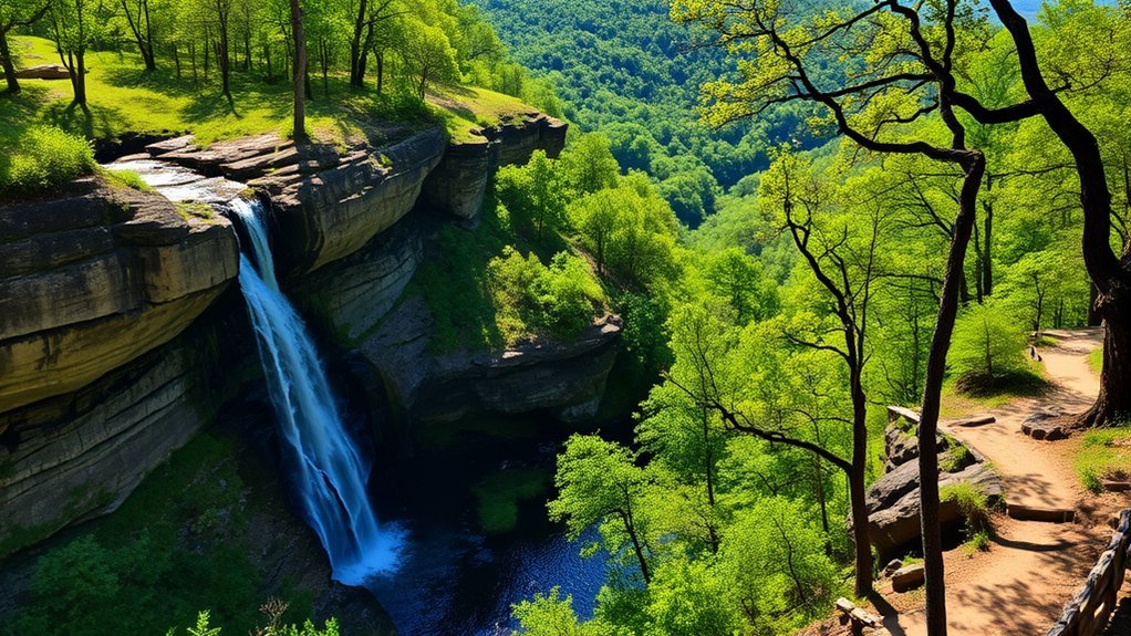
Conway gives you two very different kinds of outdoor outings: smooth shared-use paths for easy walking and biking, and natural-surface trails with roots, rocks, climbs, bluffs, and Arkansas River views. If you want a true trail hike without driving far, Cadron Settlement Park is the strongest local choice. For an easy paved outing, Kinley Trail along Tucker Creek is hard to beat.
Quick Answer
The best hikes near Conway include the paved 3.1-mile Kinley Trail along Tucker Creek, the roughly 5.6-mile Cadron Settlement Trail, the short Orange and Tollantusky trails, and easy nature walks at Jewel Moore Nature Reserve. Nearby Woolly Hollow and Petit Jean add longer natural-surface hikes and waterfall scenery.
Key Takeaways
- Best paved option: Kinley Trail follows Tucker Creek for 3.1 miles one way.
- Best longer local hike: Cadron Settlement Trail combines natural terrain, short climbs, forest, and Arkansas River scenery.
- Best short hikes: Orange Trail and Tollantusky Trail let you explore Cadron Settlement Park without committing to several hours.
- Best easy nature walk: Jewel Moore Nature Reserve protects a remnant of the historic Conway Prairie on the UCA campus.
- Important access note: Camp Robinson WMA is not a simple drop-in trail destination. Civilian recreational access is controlled by the military installation.
Best Hikes Near Conway at a Glance
| Trail | Distance | Difficulty | Best For |
|---|---|---|---|
| Kinley Trail / Tucker Creek | 3.1 miles one way | Easy | Paved walking and biking |
| Cadron Settlement Trail | About 5.6 miles on commonly used maps | Moderate | Longer natural-surface hiking and river views |
| Orange Trail | About 1.2 miles | Easy to moderate | Short hike with history and river scenery |
| Tollantusky Trail | 1.42 miles in the historic NRT record | Easy to moderate | A shorter Cadron outing |
| Stone Dam Creek Trail | Varies by access point | Easy | In-town walking and cycling |
| Jewel Moore Nature Reserve | Choose your own short walk | Easy | Prairie habitat and wildlife observation |
| Huckleberry Trail | 3.5 miles | Easy to moderate | Nearby state-park hike |
| Cedar Falls Trail | 2 miles round trip | Moderate to strenuous | Waterfall day trip |
Tucker Creek Walking and Bike Trail

The Tucker Creek Walking and Bike Trail is officially known as Kinley Trail. According to the City of Conway, it runs 3.1 miles along Tucker Creek from Tyler Street to Hogan Lane. If you walk the entire trail and return to your starting point, that works out to roughly 6.2 miles.
The paved route is a good choice when you want a relaxed walk, run, or bike ride without dealing with roots and rocky footing. Much of the route passes through developed neighborhoods while following the creek corridor, so it feels more like a greenway than a backcountry hike.
You can reach the trail from city parks including Bainbridge Park and Pompe Park, making it easy to shorten the outing. This is also a practical choice for families or anyone who wants to turn around whenever they have had enough rather than committing to a fixed loop.
Pro Tip: If you only have 30 to 60 minutes, start on Kinley Trail and use time rather than mileage as your turnaround point. You still get the creekside setting without needing to complete the full route.
Cadron Settlement Trail

If you want more of a traditional hike, head to Cadron Settlement Park. A commonly mapped Cadron Settlement Trail route is about 5.6 miles, with natural surfaces, rocky sections, short climbs, wooded terrain, and views toward the Arkansas River. Route distance can vary slightly depending on the connectors you use.
The City of Conway confirms that the 150-acre park has hiking trails, restrooms, picnic sites, a boat ramp, two reservable pavilions, and historic attractions. That combination makes Cadron one of the better places near Conway for spending several hours outdoors instead of simply taking a neighborhood walk.
The park also deserves more than a quick reference to “historical charm.” Cadron is associated with the Trail of Tears National Historic Trail. The National Park Service explains that more than 700 Cherokee were stranded here during a cholera epidemic while traveling west. Burial sites are associated with this history, and visitors should treat cemetery and memorial areas with respect.
Natural-surface sections can become slick after rain, and the river-bluff terrain makes sturdy footwear a better choice than casual sandals. Families with experienced young hikers may enjoy the route, but rocky footing and climbs make it less predictable than Kinley Trail.
Warning: Stay back from bluff edges, especially when rock and soil are wet. Do not disturb grave markers, cemetery areas, historic structures, or natural objects while exploring Cadron Settlement Park.
Orange Trail
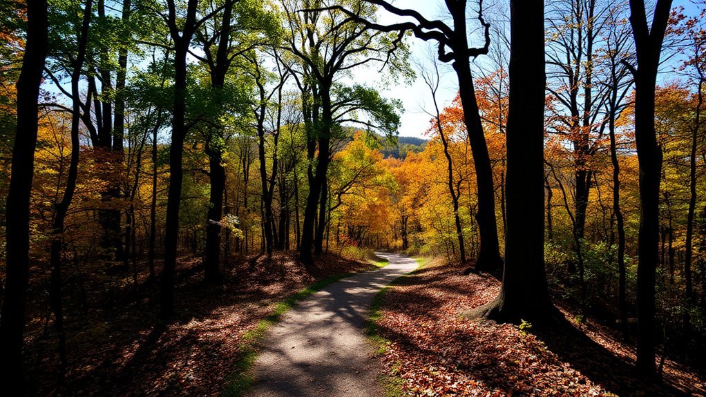
The Orange Trail is a better fit when you want Cadron’s natural setting without committing to the longer main route. Current community trail mapping places it at about 1.2 miles. It is generally described as easy to moderate, with a short climb and natural-surface footing.
The route passes an old cemetery area and reaches elevated viewpoints over the surrounding landscape. Older trail descriptions also mention painted or marked rocks along the route. Enjoy what is already there, but do not add paint, writing, or markings to rocks, trees, historic features, or grave sites.
Benches make it easier to take breaks, and the official Cadron Settlement Park information confirms that restrooms are available within the park. However, you should not depend on finding a restroom at a specific midpoint on the Orange Trail.
For most visitors, Orange Trail works well as a short stand-alone hike or as an extra loop after visiting the blockhouse and interpretive areas.
Tollantusky Trail
The Tollantusky Trail provides another short hiking option within the Cadron area. The public National Recreation Trail record lists a length of 1.42 miles and places the trail along the Arkansas River at Cadron Settlement Park.
The route has long been described as passing through cedar, dogwood, mossy, and fern-covered areas while gradually climbing toward higher ground. Older descriptions refer to Vista Point and a stone bridge in the Old Gist Mill area. Because the National Recreation Trail record itself warns that some of its trail-manager information dates from an older application and may be outdated, use the current Cadron Settlement Park information for present-day access rather than relying on old landmark descriptions for navigation.
For a casual outing, Tollantusky makes the most sense when you want more woods and history than a paved greenway can offer but do not want a five-mile hike.
| Feature | Description | Best Time to Visit |
|---|---|---|
| Trail Length | 1.42 miles in the historic NRT public record | Spring or fall |
| Terrain | Natural surface with gradual climbing | Dry daylight hours |
| Highlights | Arkansas River setting, woods, and historic Cadron area | Morning or late afternoon |
Camp Robinson WMA: Know the Access Rules
Camp Robinson State Wildlife Management Area can offer quiet woodland, prairie, birding, biking, and other outdoor recreation, but it should not be treated like an ordinary city trailhead. Current official information from the Arkansas Game and Fish Commission does not identify a named 8.5-mile public hiking route called the Camp Robinson Wildlife Loop.
More importantly, the current rules state that civilian recreational users must obtain a Recreational Pass from the Camp Robinson Maneuver Training Center. A Hold Harmless Release is also required for recreational activities. Military training takes priority and can change the areas available for recreation without notice.
That makes Camp Robinson a poor choice if you simply want to arrive, park, and start hiking with no advance planning. Birdwatchers and experienced outdoor visitors may still find the area’s oak and prairie habitats appealing, but current military access rules should determine whether you visit.
Warning: Do not enter Camp Robinson for recreation without following the current visitor and recreational-pass procedures. Hunting seasons, military training, and temporary restrictions can affect access.
More Easy Walks in Conway
Stone Dam Creek Trail
Stone Dam Creek Trail is another useful in-town choice that the original list overlooks. The City of Conway trail page explains that the route begins around the University of Central Arkansas area and continues through south Conway. The trail network includes the Dave Ward pedestrian bridge and an underpass at South Donaghey Avenue.
This is a better option for walking, jogging, or casual cycling than for hikers seeking rugged terrain. Pair it with Kinley Trail when you want an easy local outing without driving to a larger park.
Jewel Moore Nature Reserve
For a short nature-focused walk, visit the Jewel Moore Nature Reserve on the University of Central Arkansas campus. According to UCA, the reserve protects the last remaining remnant of the historic Conway Prairie and has more than 235 identified species of flora and fauna.
This is not the place to chase mileage or steep climbs. It is better for slow walking, plant observation, birding, photography, and introducing children to a small urban nature reserve. Stay on established paths and follow the reserve’s current visitor rules so the prairie habitat remains protected.
Nearby State-Park Hikes Worth the Drive
If “near Conway” includes a short drive outside the city, Arkansas State Parks gives you stronger options for a traditional day hike.
Huckleberry Trail at Woolly Hollow State Park
Huckleberry Trail at Woolly Hollow State Park near Greenbrier is officially listed at 3.5 miles with an easy-to-moderate difficulty rating. Arkansas State Parks suggests about 2.5 hours for the route. See the official Huckleberry Trail page for current trail information.
This is a good middle ground between Conway’s paved greenways and the more demanding trails at Petit Jean. Choose it when you want several miles of natural-surface hiking without making the outing overly strenuous.
Cedar Falls Trail at Petit Jean State Park
For a more memorable day hike, Cedar Falls Trail at Petit Jean State Park is 2 miles round trip. Arkansas State Parks rates it from moderate to strenuous and estimates about 1.5 to 2 hours. The trail descends into Cedar Creek Canyon and leads toward the park’s 90-foot Cedar Falls. Current details are available from the official Cedar Falls Trail page.
Do not let the short mileage fool you. The descent, rocky terrain, and climb back out make this a more demanding hike than its two-mile distance suggests.
How to Choose the Right Conway Hike
- For an easy paved walk: Choose Kinley Trail or Stone Dam Creek Trail.
- For a short natural-surface hike: Choose Orange Trail or Tollantusky Trail at Cadron Settlement Park.
- For a longer hike without leaving Conway: Choose the Cadron Settlement Trail.
- For prairie plants and wildlife: Choose Jewel Moore Nature Reserve.
- For a nearby moderate state-park hike: Choose Huckleberry Trail at Woolly Hollow.
- For a waterfall and more challenging terrain: Choose Cedar Falls Trail at Petit Jean.
- For Camp Robinson: Go only after confirming the current recreational-access requirements.
Hiking Safety and Seasonal Tips
Spring and fall usually provide the most comfortable conditions for longer hikes around Conway. In summer, an early start can help you avoid the hottest part of the day. Winter can also provide pleasant hiking days, but wet leaves and shaded rock may stay slippery.
Carry enough water, especially on natural-surface routes. Wear shoes with useful traction, bring sun protection and insect repellent, and keep a charged phone with your route information available. After storms, expect mud, fallen branches, slick rock, or temporary trail problems.
At Cadron, stay away from unstable bluff edges and respect historic and burial areas. If you bring a dog where pets are allowed, keep it leashed and under control. At wildlife management areas, pay attention to hunting seasons, access notices, and any special clothing or safety recommendations.
Note: Trail conditions and access can change after storms, construction, maintenance, hunting activity, or military training. For city trails and parks, check the City of Conway’s current information before making a special trip.
Frequently Asked Questions
Are dogs allowed on the hiking trails in Conway?
Dogs can use many of Conway’s outdoor trails, but keep them leashed and under control in city parks and follow posted trail-specific rules. The National Recreation Trail record for Tollantusky specifically lists dogs on leash. Camp Robinson has separate recreational-access rules, so do not assume ordinary city-park rules apply there.
What are the best times of year to hike in Conway?
Spring and fall are usually the most comfortable seasons for longer hikes because temperatures are generally milder. Summer can still work well if you start early, carry plenty of water, and avoid the hottest part of the day. After heavy rain, natural-surface trails may be muddy or slippery.
Is there parking available at the trailheads?
Major destinations such as Cadron Settlement Park and the city parks connected to Kinley Trail provide developed access areas. Smaller trail connections can have more limited parking, so use designated spaces and follow posted signs rather than parking along private property or restricted roads.
Can I find restrooms along the trails?
Cadron Settlement Park officially lists restroom facilities. Do not assume that every trail segment or neighborhood access point has a restroom, especially on longer greenway walks. Use available facilities before starting a longer route when possible.
What should I bring for a day hike in Conway?
Bring water, comfortable shoes with good traction, sun protection, insect repellent, a charged phone, snacks for longer hikes, and a small first-aid kit. For natural-surface routes, having an offline map or saved trail map is also useful if cellular coverage becomes unreliable.
Which Conway trail is easiest for beginners?
Kinley Trail along Tucker Creek is the easiest starting point for most beginners because it is paved and you can turn around whenever you want. Stone Dam Creek Trail is another good in-town option. Orange Trail is short but has natural-surface footing and a climb.
Which trail has the best Arkansas River views?
Cadron Settlement Park is the best local area to choose when Arkansas River scenery is a priority. The longer Cadron Settlement Trail provides the most substantial hike, while Orange and Tollantusky are better choices when you want a shorter outing in the same general river setting.
Do I need a permit to hike near Conway?
The regular Conway city parks and trails covered here do not use the same restricted-access system as Camp Robinson. Camp Robinson is the major exception: current AGFC information says civilian recreational users need a Recreational Pass and Hold Harmless Release before entering for recreational activities.
Conclusion
The best hike near Conway depends on what kind of outing you want. Choose Kinley Trail for an easy paved walk, head to Cadron Settlement Park for natural terrain and Arkansas River scenery, or slow down at Jewel Moore Nature Reserve for prairie plants and wildlife. If you have more time, Woolly Hollow and Petit Jean expand your choices with longer trails and more challenging terrain. Whatever route you choose, check current access, carry water, respect historic sites, and match the trail to your experience level.
Sources
- City of Conway Parks & Recreation: Trails — official Kinley Trail length and Stone Dam Creek Trail information.
- City of Conway: Cadron Settlement Park — park size, hiking, restrooms, picnic sites, and visitor amenities.
- National Park Service: Cadron Settlement Park — Trail of Tears history, location, and interpretive information.
- Arkansas Game and Fish Commission: Camp Robinson WMA — current access restrictions, recreational-pass requirements, and military-use notices.
- University of Central Arkansas: Jewel Moore Nature Reserve — Conway Prairie habitat and documented biodiversity.
- Arkansas State Parks: Trail Directory — official state-park trail information, including Huckleberry and Cedar Falls trails.