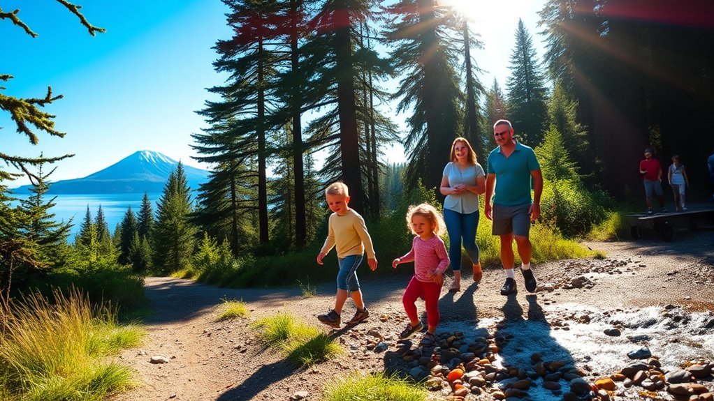
Fairbanks gives you access to everything from short nature walks and family-friendly hikes to long alpine routes that can take most of a day. The key is choosing a destination that matches your experience and checking current access before you leave. Some places commonly described as “Fairbanks hiking trails” are actually recreation areas, informal routes, or destinations with special access rules, so the details matter.
Quick Answer
Some of the best hiking near Fairbanks is in Chena River State Recreation Area. Angel Rocks is the easiest classic hike at 3.5 miles round trip, while Granite Tors is a demanding 15-mile route. Creamer’s Field and Tanana Lakes offer gentler walking, while Donnelly Dome is farther away and requires military-land access procedures.
Key Takeaways
- Angel Rocks is one of the best moderate day hikes near Fairbanks, with a 3.5-mile round trip that typically takes 2–3 hours.
- Granite Tors is much harder than many short online descriptions suggest: Alaska State Parks lists a 15-mile route taking about 6–10 hours.
- Creamer’s Field and Tanana Lakes are better choices when you want easy walking, wildlife viewing, or a relaxed outing close to town.
- Goldstream, Murphy Dome, and Piledriver Slough require more care with route selection because they are not single standardized hiking trails matching many informal descriptions online.
- Donnelly Dome is a farther-afield option on Army-managed training land, so you must check current access requirements before going.
Fairbanks Hiking Trails at a Glance
| Destination | Distance / Type | Difficulty | Best For |
|---|---|---|---|
| Angel Rocks | 3.5 miles round trip | Moderate | Classic day hike and rock formations |
| Granite Tors | 15 miles | Strenuous | Experienced hikers and alpine scenery |
| Creamer’s Field | About 3 miles of nature trails in the refuge network | Easy | Birding, families, and relaxed walks |
| Chena River SRA | Multiple trails of different lengths | Easy to strenuous | The widest selection of hikes |
| Murphy Dome | No single standardized public hike verified | Route dependent | Scenic viewpoint and route exploration |
| Goldstream Valley | Public-use trail network | Route dependent | Local multi-use trails |
| Piledriver Slough | Nature/waterway access, not a verified formal hiking route | Access dependent | Quiet waterside scenery |
| Donnelly Dome | Steep informal hiking routes | Strenuous | Experienced hikers who complete Army access requirements |
| Tanana Lakes | Mapped multi-use trail network | Easy to moderate | Families, walking, cycling, and lake recreation |
| Birch Lake | Lake recreation site rather than a major hiking network | Easy recreation | Camping, fishing, picnicking, and lake activities |
Angel Rocks Trail
Angel Rocks Trail is one of the most practical choices if you want a true hiking experience without committing an entire day. According to Alaska State Parks, the standard outing is 3.5 miles round trip and usually takes about 2–3 hours.
The trail begins near mile 48.9 of Chena Hot Springs Road and climbs from forest into exposed rock formations. The elevation and rocky sections make it more demanding than a flat nature walk, but the distance remains manageable for many reasonably fit hikers.
Angel Rocks gives you one of the quickest ways near Fairbanks to climb from Interior Alaska forest into open views and dramatic rock formations.
Wildlife can occur throughout Chena River State Recreation Area, including moose, bears, beavers, squirrels, grouse, and occasionally eagles. Treat wildlife sightings as a possibility rather than a guarantee, and give large animals plenty of space.
If you want a much longer outing, Angel Rocks also connects toward Chena Hot Springs. Do not confuse that longer route with the standard 3.5-mile Angel Rocks hike.
Pro Tip: If your group wants the scenery of Chena River State Recreation Area without the 15-mile commitment of Granite Tors, Angel Rocks is usually the better starting point.
Granite Tors Trail
The Granite Tors Trail is one of the signature hikes in Chena River State Recreation Area, but it is not a short beginner loop. Alaska State Parks lists the route as approximately 15 miles, normally requiring 6–10 hours.
The route starts near mile 39 of Chena Hot Springs Road. It climbs from wetter lowland terrain through forest and eventually reaches alpine tundra and the large granite formations known as the tors. Some rock outcrops rise prominently above the surrounding landscape.
Summer hikers may encounter alpine wildflowers, but conditions on the exposed upper sections can change quickly. Water sources are not dependable in dry weather, so Alaska State Parks specifically recommends carrying adequate water rather than assuming you can refill along the route.
This trail is best for hikers who are comfortable spending most of a day on rough terrain. It should not be described as an easy option for someone who is just beginning to hike.
Warning: Granite Tors is a long, strenuous outing. Carry sufficient water, warm layers, rain protection, insect protection, navigation tools, and appropriate footwear. Tell someone your route and expected return time before leaving.
Creamer’s Field Migratory Waterfowl Refuge
If your goal is a quiet walk rather than a mountain climb, Creamer’s Field Migratory Waterfowl Refuge is one of the easiest nature destinations in Fairbanks. The refuge combines open fields, wetlands, ponds, and boreal forest habitat and is especially valuable for birdwatching.
The Alaska Department of Fish and Game describes a nature-trail network that includes the Seasonal Wetland Trail and Farm Road Trail. The Seasonal Wetland Trail includes interpretive features and is wheelchair accessible during snow-free months.
Note: As of August 17, 2026, ADF&G marks the Boreal Forest Trail as currently closed. Check the official Creamer’s Field visitor-information page before your visit because access can change.
Spring and fall migrations are particularly active periods. ADF&G manages the refuge’s fields to provide food and resting habitat for migrating waterfowl and cranes. During the late-summer migration period, large numbers of sandhill cranes can gather at the refuge.
| What to Look For | When to Pay Extra Attention |
|---|---|
| Geese and other migrating waterfowl | Spring and fall migration |
| Sandhill cranes | Spring migration and late-summer/fall staging |
| Songbirds | Especially active during migration and breeding seasons |
| Wetland and forest wildlife | Possible throughout the year |
The trails are well suited to families, birders, photographers, and anyone who wants an easy outdoor break without a long drive or steep elevation gain. Binoculars can make the visit much more rewarding.
Chena River State Recreation Area
Chena River State Recreation Area is not one trail. It is a large recreation area northeast of Fairbanks with forest, river corridors, alpine tundra, campgrounds, cabins, and numerous trails. It contains both Angel Rocks and Granite Tors as well as longer backcountry routes.
The area works well because you can choose very different levels of difficulty. A short outing can focus on a developed access point or part of a trail, while experienced hikers can tackle routes that require an entire day or several days.
Chena River State Recreation Area offers everything from a 2–3 hour Angel Rocks hike to demanding full-day and multi-day routes.
Wildlife includes moose, bears, beavers, squirrels, grouse, and other Interior Alaska species. You may also see birds of prey, but wildlife sightings should never be treated as guaranteed.
Fishing, camping, picnicking, paddling, and winter recreation are also available in different parts of the recreation area. If you want to combine a hike with a picnic, use a developed site rather than assuming any riverbank is suitable for swimming or other water activities.
Alaska State Parks currently charges day-use parking fees at several developed access points, including the Angel Rocks and Tors trailheads. Check the current Alaska State Parks fee schedule before your trip because fees can change.
Murphy Dome
Murphy Dome is a well-known high-country destination northwest of Fairbanks and is particularly popular as a scenic and aurora-viewing area. It should not, however, be treated as one standardized 4.5-mile public hiking trail with a fixed elevation gain.
Route descriptions around Murphy Dome vary, and public access can cross a mixture of road corridors, trails, and surrounding lands. Before hiking, use a current map and make sure the route you choose follows legal public access.
Scenic Viewpoints Around Murphy Dome
The attraction of Murphy Dome is elevation and openness. On clear days, high points in the area can provide broad views across Interior Alaska rather than the enclosed forest experience found at lower elevations.
The area can also be exposed to wind and rapidly changing conditions, so a warm day in Fairbanks does not guarantee comfortable conditions at a higher viewpoint.
If photography is your priority, bring layers and allow extra time rather than depending on a precise hiking itinerary that may not match current access.
Trail Difficulty and Length
There is no single official Murphy Dome hiking route verified here that supports the previously published figure of 4.5 miles round trip with 1,200 feet of elevation gain.
Instead, treat difficulty and distance as route dependent. The Fairbanks North Star Borough trail-map directory is a better starting point for locating mapped public routes and easements in the wider Fairbanks area.
Carry offline navigation if you leave clearly established routes, and turn around if access becomes uncertain.
Best Season to Visit
For hiking, the snow-free months are generally the most practical time to explore high ground around Fairbanks. Conditions vary from year to year, especially at elevation.
Summer provides long daylight hours, while late summer introduces shorter nights and changing vegetation. Winter transforms Murphy Dome into a very different destination where snow, extreme cold, and darkness require winter-specific preparation.
Always check weather and road conditions before going rather than relying only on the season.
Goldstream Valley Trail
The name Goldstream Valley Trail can be misleading because Goldstream is better understood as a public-use area with a network of routes rather than one single, standardized trail matching the description in the original article.
The Fairbanks North Star Borough publishes mapping resources for the Goldstream Public Use Area and nearby routes, including the Big Eldorado Creek Loop. Some routes are multi-use and may see different types of recreation depending on the season.
Instead of expecting one maintained riverside path, choose your route from the current map before you leave. Trail surfaces, maintenance, wet areas, and legal access can vary across the network.
Goldstream is a useful option if you want to explore local terrain without committing to the long drive and full-day effort required for Granite Tors.
Pro Tip: Download or save your Goldstream route before leaving cell coverage. A mapped loop or public-use route is safer than relying on an informal trail name from an old blog or social-media post.
Piledriver Slough
Piledriver Slough offers a different kind of outdoor experience south of Fairbanks. It is a clearwater slough associated with the Tanana drainage and has long been used for fishing and wildlife habitat.
However, it should not be advertised as a defined, well-maintained hiking trail unless you have confirmed a specific legal public route. Official Alaska sources document the slough and access points, but not the formal winding hiking trail described in the original version of this article.
If you visit the area, treat it as a waterside nature stop rather than expecting a signed hiking loop. Stay on established legal access, respect private property, and be prepared for wet ground and insects in low-lying areas.
The combination of water, wetlands, vegetation, and wildlife can still make it worthwhile for quiet observation and photography, especially when your priority is scenery rather than mileage.
Donnelly Dome
Donnelly Dome is a striking hiking objective in the Delta Junction area, farther southeast of Fairbanks. It is better treated as a separate day-trip destination than as another quick hike immediately outside town.
The slopes are steep, exposed, and can include loose footing. Informal routes climb toward broad views across the surrounding Alaska Range and Delta River country.
Donnelly Dome can be a rewarding climb, but access rules matter as much as fitness because the area is associated with U.S. Army training land.
Before considering the hike, check the current Fort Greely recreational-access instructions. Recreational users age 16 and older must follow the Army’s current permit and iSportsman check-in requirements, and areas may be temporarily closed for military training.
Once legal access is confirmed, expect:
- Steep terrain: The ascent is much more demanding than an easy nature walk.
- Open views: Higher ground provides broad views across Interior Alaska.
- Wildlife potential: Wildlife may be present, so maintain distance and keep food secured.
- Changing conditions: Wind, rain, low clouds, and lingering snow can change the experience quickly.
Do not enter a closed military area, cross an impact area, or rely on an old route description without checking the current Army status first.
Tanana Lakes Recreation Area
Tanana Lakes Recreation Area is one of the most convenient choices close to Fairbanks when you want walking and outdoor recreation without a mountain climb.
The area includes lakes, beaches, picnic facilities, an accessible playground, hiking and ATV trails, and other recreation facilities. The Fairbanks North Star Borough publishes current summer and winter maps for the trail system.
That makes Tanana Lakes especially useful for families, casual walkers, cyclists, and visitors who want to combine a walk with time beside the water.
Scenic Lakeside Trails
Rather than relying on unofficial names such as “Lakeside Loop Trail,” “Sunset Viewpoint,” or “Wildflower Trail,” choose a route from the borough’s current Tanana Lakes trail maps.
Depending on the route and season, you can:
- Walk sections of the mapped summer trail system near the lakes.
- Combine a short walk with a beach or picnic stop.
- Use designated multi-use routes while watching for other trail users.
- Choose a shorter outing when children or less-experienced walkers are in your group.
The relatively flexible trail network makes the recreation area easier to adapt to your available time than a fixed backcountry hike.
Wildlife Viewing Opportunities
Wetlands, lakes, forest edges, and open areas can attract a range of Interior Alaska wildlife. Moose, beavers, waterfowl, and birds of prey may occur in the wider area, although sightings depend on season, time of day, and chance.
| Wildlife | Good Viewing Strategy | Safety Note |
|---|---|---|
| Moose | Scan wetland edges and quieter areas | Give them a wide berth, especially cows with calves |
| Beavers | Watch calm water near dawn or evening | Observe without approaching lodges or animals |
| Waterfowl | Scan shorelines and open water | Avoid disturbing nesting or resting birds |
| Raptors | Watch open sky and tall perches | Use binoculars rather than approaching |
Keep your camera ready, but never approach wildlife simply to get a closer photograph.
Seasonal Activity Options
Tanana Lakes changes considerably through the year, so your activity should match current conditions.
- Spring: Walking and birdwatching become more attractive as snow and ice disappear, but muddy sections may remain.
- Summer: Walk mapped trails, use designated beaches and lake facilities, or combine hiking with other warm-weather recreation.
- Autumn: Cooler weather and changing vegetation can make walking pleasant, but daylight decreases quickly.
- Winter: Follow current winter-route maps and prepare for snow, ice, cold temperatures, and limited daylight.
Check posted signs and current borough information because seasonal trail use can change.
Birch Lake State Recreation Area
Birch Lake State Recreation Site is a pleasant outdoor stop near Fairbanks, but it is better known for lake recreation than for a major hiking network.
According to Alaska State Parks, the 48-acre recreation site includes camping, fishing, a boat launch, picnicking, winter ice-fishing facilities, and seasonal lake activities.
The setting combines forested wetlands with Birch Lake, so you can still enjoy an easy walk around developed portions of the recreation site. However, do not expect a hiking experience comparable to Angel Rocks or Granite Tors.
Wildlife may occur around the wetlands and lake, and the campground makes Birch Lake practical if you want to extend a road trip overnight.
For hikers, Birch Lake works best as a relaxing add-on stop. For campers, anglers, boaters, and families who want easy access to the water, it may be a destination in its own right.
Planning Your Fairbanks Hike
Interior Alaska can make even a familiar trail feel very different from one week to the next. Snowmelt, rain, wildfire activity, trail damage, high water, military closures, and wildlife activity can all affect access.
Check Current Trail Conditions
Before driving to Chena River State Recreation Area or another state-managed destination, check the Alaska State Parks condition reports. Opening dates and trail conditions can change with weather.
For borough-managed routes, use the current Fairbanks North Star Borough trail maps rather than relying on an old screenshot or an unofficial trail name.
Bring Water and Weather Layers
Do not assume streams are safe to drink. Alaska State Parks advises hikers in Chena River State Recreation Area to carry plenty of water and purify water collected along the way.
Bring a rain layer and an insulating layer even when Fairbanks is warm. Higher and more exposed terrain can feel much colder, particularly in wind or rain.
Prepare for Insects and Wildlife
Mosquitoes and gnats can be intense in Interior Alaska, so insect repellent or protective clothing can make a major difference.
Bears and moose also occur around Fairbanks. Make noise where visibility is limited, keep food secured, give wildlife space, and know how to respond before you encounter an animal.
Warning: Do not depend only on your phone for navigation or emergency communication. Download maps before departure, carry backup power, tell someone where you are going, and give them an expected return time.
Best Time for Hiking Near Fairbanks
For most visitors interested in snow-free hiking, late spring through early fall is the most practical period. The exact start and end of the season vary with elevation, snowpack, rainfall, and the individual trail.
June and July provide extremely long daylight hours, but mosquitoes can be persistent. Late summer can bring cooler temperatures and changing vegetation. By autumn, daylight drops quickly and snow can return to higher ground.
Winter hiking and snow travel are possible in many places, but they require different footwear, clothing, navigation, and cold-weather experience. Treat winter as a separate activity rather than simply following a summer trail description through snow.
Frequently Asked Questions
What is the best time of year for hiking in Fairbanks?
Late spring through early fall is generally the easiest period for snow-free hiking. June and July provide very long daylight hours, while late summer can be cooler. Conditions vary by elevation and year, so check the current trail report before leaving.
Are there guided hiking tours available around Fairbanks?
Yes. Guided hiking and outdoor experiences are offered seasonally in the Fairbanks region and nearby Alaska Range. Operators and schedules change, so verify current availability through Explore Fairbanks or directly with the guide before planning your day.
Do I need a permit to hike these trails?
Most ordinary day hikes on established public trails around Fairbanks do not require an individual hiking permit, but site-specific rules still apply. State-park parking fees may apply. Donnelly Dome involves Army-managed training land, where current permit and iSportsman check-in requirements must be completed before entering an open recreation area.
Are pets allowed on hiking trails near Fairbanks?
Rules depend on the property. In Chena River State Recreation Area, pets must be leashed at developed facilities and kept under control elsewhere. Creamer’s Field asks visitors to keep pets under strict control. Always check the rules for the specific destination and clean up after your pet.
What safety precautions should I take while hiking in Alaska?
Carry enough water, suitable footwear, rain protection, warm layers, insect repellent, navigation, and emergency supplies. Know how to behave around bears and moose, avoid drinking untreated water, check weather and trail conditions, and tell someone your route and expected return time.
Which Fairbanks hike is best for beginners or families?
Creamer’s Field and Tanana Lakes are the easiest choices for relaxed walking. Angel Rocks is a better option when your group wants a true hike and can handle rocky, uphill terrain. Granite Tors is substantially longer and is not the best first hike for an inexperienced group.
How long does it take to hike Granite Tors?
Alaska State Parks lists Granite Tors as a 15-mile route with an estimated hiking time of about 6–10 hours. Plan it as a full-day hike, start early enough for your pace, and carry adequate food, water, clothing, and navigation equipment.
Conclusion
Fairbanks has hiking options for very different kinds of outdoor days. If you want a manageable classic hike, Angel Rocks is one of the strongest choices. If you are experienced and ready for a long alpine day, Granite Tors delivers a much bigger challenge. For easier walking and wildlife watching, Creamer’s Field and Tanana Lakes are more practical.
Other destinations require more planning. Goldstream is a network rather than one trail, Murphy Dome needs careful route verification, Piledriver Slough should not be assumed to have a formal hiking loop, and Donnelly Dome requires current military-land access procedures. Choose the route that matches your ability, check official conditions before leaving, and prepare for Interior Alaska weather and wildlife.
Sources
- Alaska State Parks — Chena River State Recreation Area Information — official trail distances, hiking times, park rules, wildlife, and safety guidance.
- Alaska State Parks — Fees by Park Facility — current parking and recreation-site fees.
- Alaska Department of Fish and Game — Creamer’s Field Visitor Information — official nature trails, accessibility information, and current trail status.
- Fairbanks North Star Borough — Trail Maps — official mapping resources for Tanana Lakes, Goldstream, and other borough-area trails.
- Alaska State Parks — Birch Lake State Recreation Site — official facilities and recreation information.
- U.S. Army Garrison Alaska / Fort Greely — Visitor and Recreational Access Information — current permit, check-in, and training-area access requirements for Army-managed lands.