Hiking in Ketchikan, Alaska, takes you deep into the heart of the Tongass National Forest—the largest intact temperate rainforest in North America. Whether you are stepping off a cruise ship for a few hours or planning an extended backcountry trek, Ketchikan’s trail system offers everything from gentle lakeside boardwalks to rugged alpine climbs that rise thousands of feet above the Tongass Narrows.
Quick Answer
The best hikes in Ketchikan, Alaska, range from the accessible Rainbird Trail (1.3 miles with scenic harbor views near town) and the flat, family-friendly Ward Lake Trail (1.3-mile loop), to the strenuous Deer Mountain Trail (climbing 2,800 feet over 2.5 miles to panoramic alpine summits). Most trails are accessible from May through October, though waterproof boots and bear safety gear are essential year-round.
Key Takeaways
- Port-Accessible Routes: Rainbird Trail and Deer Mountain Trail can both be reached via a short walk, taxi, or local bus ride directly from the Ketchikan cruise ship docks.
- Challenging Climbs: Deer Mountain is a true mountain ascent with ~2,800 feet of elevation gain; proper hiking boots and trekking poles are strongly advised.
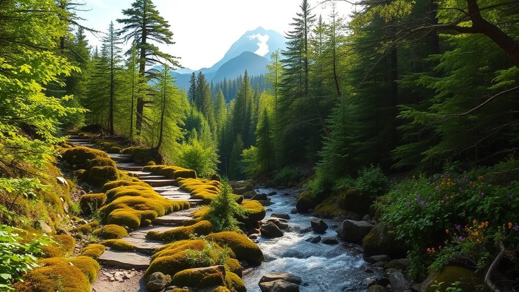
- Rainforest Terrain: Expect exposed tree roots, slick wooden boardwalks, and mud. Ketchikan averages over 140 inches of rain annually, making high-traction waterproof footwear non-negotiable.
- Wildlife Awareness: Revillagigedo Island has a dense black bear population. Always carry bear spray, make noise around blind corners, and store food securely.
Rainbird Trail
The Rainbird Trail is one of the most accessible and rewarding hikes in Ketchikan. Running along the ridgeline above the city, it offers panoramic vantage points overlooking the Tongass Narrows, Pennock Island, and the bustling cruise ship berths below.
This trail measures 1.3 miles point-to-point (approximately 2.6 miles out-and-back). The path winds through old-growth western red cedar, Sitka spruce, and dense blankets of ferns and moss. While it is classified as moderate, hikers should expect uneven surfaces, slick roots, rock scrambles, and several steep wooden staircases.
Pro Tip: There are three primary access points: the University of Alaska Southeast (UAS) Ketchikan campus parking lot, the Third Avenue Bypass, and the Schoenbar trail spur. Starting from the UAS campus offers the gentlest approach and most reliable parking.
Keep a sharp eye on the canopy for bald eagles nesting in the towering spruce trees, and watch the channel below for passing floatplanes and marine traffic.
Deer Mountain Trail
For hikers seeking an intense alpine workout with spectacular summit views, the Deer Mountain Trail (USFS Trail #715) is Ketchikan’s premier mountain hike. The trailhead begins on Ketchikan Lakes Road, roughly 1.5 miles from the downtown cruise terminals.
Warning: Do not underestimate this climb. Deer Mountain ascends roughly 2,800 vertical feet in just 2.5 miles. The upper sections feature steep drop-offs, exposed granite, and sudden weather shifts that can bring heavy fog, rain, or sub-alpine snow even in early summer.
| Trail Feature | Specification |
|---|---|
| Distance | 2.5 miles one way (5.0 miles out-and-back to summit) |
| Elevation Gain | 2,800 feet (Summit elevation: 3,001 feet) |
| Difficulty | Strenuous / Demanding |
| Estimated Time | 4 to 6 hours round trip |
| Best Season | June through October (Snow lingers into early summer) |
The first mile climbs steadily via switchbacks through dense coastal rainforest. At roughly the 1-mile mark, a scenic viewpoint offers a panoramic look over Ketchikan. Continuing past the 2-mile marker brings you above the tree line into alpine muskeg, leading to the historic USFS Deer Mountain shelter and the 3,001-foot summit ridge, where views extend across the Alexander Archipelago and into Canada on clear days.
Tongass National Forest: Ward Lake Recreation Area
Located roughly 8 miles north of downtown Ketchikan, the Ward Lake Recreation Area represents the hub of accessible trail walking in the Ketchikan Misty Fjords Ranger District of the Tongass National Forest.
This area provides trails suitable for all fitness levels:
- Ward Lake Trail: A flat, 1.3-mile gravel loop circling the perimeter of Ward Lake. It is fully accessible, making it an ideal option for families, trail runners, and casual walkers.
- Perseverance Lake Trail: A moderate 2.2-mile one-way trail (4.4 miles round-trip) that branches off near Ward Lake, climbing through temperate old-growth forest and muskeg boardwalks to a secluded mountain lake.
- Connell Lake Trail: A 2.2-mile route following the edge of Connell Lake past historic logging infrastructure and pristine trout streams.
During the late summer salmon runs (late July through September), Ward Creek fills with spawning pink, coho, and chum salmon, creating prime viewing opportunities for bald eagles, river otters, and black bears.
The Blue Lake & Silvis Lakes Trails
South of Ketchikan, past the end of the South Tongass Highway, lies the trail system around Beaver Falls and the Silvis Lakes basin, often referred to by locals in conjunction with the Blue Lake backcountry routes.
Trail Overview
The trail begins near the Beaver Falls Hydroelectric Hatchery. Hikers follow a well-maintained access path and gravel service road for approximately 1.7 miles to reach Lower Silvis Lake. For a more adventurous trek, the trail continues another 1.1 miles, climbing a steeper, rocky incline to Upper Silvis Lake (elevation 1,100 feet), where subalpine cirques frame deep blue waters.
Scenic Highlights
Along this trail, you will pass cascading waterfalls, engineered flumes, and lush hanging valleys. The contrast between coastal marine waters below and glacially carved alpine valleys above showcases Southeast Alaska’s diverse geography. Anglers frequently visit these lakes for cutthroat trout, while birdwatchers can spot varied thrushes, kingfishers, and winter wrens along the stream banks.
The Ketchikan Rainforest & Coast Trails
Ketchikan is situated within an ecosystem that receives between 140 and 160 inches of precipitation every year. This massive volume of rainfall sustains ancient temperate rainforests dominated by massive hemlock, western red cedar, and Alaska yellow cedar.
Trail Features Overview
For a coastal rainforest experience, the Rainforest Sanctuary Nature Trail in Herring Cove and the trails at Settlers Cove State Recreation Site (at the northern terminus of the highway) showcase quintessential coastal ecology. Settlers Cove features the Lunch Creek Trail (4.8 miles one way) and the Hollow Log Trail, guiding hikers across footbridges over roaring waterfalls and down to sheltered rocky beaches along the Tongass Narrows.
Wildlife Spotting Opportunities
Wildlife Note: Herring Cove and Ward Creek are world-class locations for viewing black bears during peak salmon spawning runs. To hike safely in bear country, review safety guidelines provided by the Alaska Department of Fish and Game.
While exploring coastal rainforest trails, keep a lookout for:
- Black Bears: Commonly seen grazing along tidal estuaries in early summer and fishing salmon streams from mid-July through September.
- Bald Eagles: Highly concentrated along the coastlines and tree lines near active fish runs.
- Marine Mammals: Harbor seals, sea lions, and river otters frequent the coves near trail exits.
- Sitka Black-Tailed Deer: Often encountered browsing quietly in the brush along subalpine trail borders.
The Carlanna Lake Trail
Located in the West End of Ketchikan, the Carlanna Lake Trail provides a direct escape into a serene reservoir basin nestled beneath the dramatic granite walls of Minerva Mountain.
The trail spans approximately 1.5 miles out-and-back (or roughly 2.5 miles if doing the extended perimeter exploration). The path follows the historic Carlanna water pipeline road before transitioning into a forested gravel trail with wooden bridges and boardwalk segments that lead directly to the lakeshore.
For seasoned mountaineers, the Minerva Mountain Trail / Avalanche Chute Trail branches off near Carlanna Lake, offering an intense ridge scramble that connects high alpine terrain with the Deer Mountain trail system via an advanced traverse.
Frequently Asked Questions
What is the best time of year to hike in Ketchikan?
The best window for hiking in Ketchikan is from late May through September. During these months, daytime temperatures range between 55°F and 68°F (13°C to 20°C), daylight lasts up to 17 hours, and alpine snow on high-elevation routes like Deer Mountain has mostly melted. Lowland trails such as Rainbird and Ward Lake remain open year-round.
Can you walk to trailheads from the Ketchikan cruise ship docks?
Yes. The Rainbird Trail can be reached via a 15-to-20-minute walk (or a quick 5-minute taxi/bus ride) from downtown berths. The Deer Mountain Trailhead is located roughly 1.5 miles uphill from the cruise piers on Ketchikan Lakes Road (approximately a 30-minute uphill walk or 5-minute cab ride). Other trails, such as Ward Lake and Settlers Cove, require a rental car, public city bus transit, or private shuttle.
What wildlife safety precautions should I take while hiking?
Revillagigedo Island is home to a healthy population of wild black bears (there are no brown/grizzly bears on the island). Always hike in groups when possible, talk or make noise along dense trail sections, carry accessible bear spray, and never leave packs or food unattended. Always maintain a distance of at least 100 yards from bears.
Are there restroom facilities along Ketchikan trails?
Restroom facilities (vault toilets) are available at developed recreation hubs including Ward Lake, Settlers Cove State Recreation Site, and the Deer Mountain Trailhead parking area. Primitive backcountry routes like Rainbird, Upper Silvis, and Carlanna Lake do not have dedicated restroom facilities; hikers should practice Leave No Trace principles.
Can I bring my dog on hikes in Ketchikan?
Yes, dogs are allowed on trails within the Tongass National Forest and Ketchikan city trail networks. Dogs must be kept on a leash on high-traffic trails (like Ward Lake) and under strict voice control on backcountry paths to prevent dangerous encounters with wildlife or steep cliff falls.
Conclusion
Ketchikan offers some of the most dynamic hiking in Southeast Alaska, bridging the gap between accessible urban trails and remote rainforest wilderness. Whether you choose to take in the maritime vistas along the Rainbird Trail, explore the tranquil moss-covered loops of Ward Lake, or tackle the steep vertical ascent of Deer Mountain, being prepared for rapid weather shifts and packing proper waterproof gear ensures a safe and unforgettable trek through the Tongass National Forest.
Sources
- USDA Forest Service: Deer Mountain Trail #715 — Trail length, elevation profile, and shelter specifications.
- Tongass National Forest Management — Ward Lake Recreation Area trail network and conservation details.
- Alaska Department of Fish and Game — Southeast Alaska black bear behavior and trail safety standards.
- Alaska State Parks: Settlers Cove State Recreation Site — Lunch Creek Trail information and coastal public facilities.