Phoenix gives you everything from short, easy desert walks to steep summit climbs, but the best hike depends on your fitness, the season, and how much exposure you want. This guide compares nine standout hiking areas around Phoenix and adds the trail distances, difficulty notes, fees, dog rules, and heat-safety details you need before you go.
Quick Answer
The best hikes near Phoenix range from easy Papago Park and Estrella Mountain walks to extremely difficult summit routes on Camelback Mountain and Piestewa Peak. For variety, South Mountain, Usery Mountain, McDowell Sonoran Preserve, White Tank Mountain, and Spur Cross offer excellent desert scenery with options for different skill levels.
Key Takeaways
- Best for beginners: Papago Park, Estrella Mountain Regional Park, and barrier-free options at Usery and White Tank.
- Best for a hard summit: Camelback Mountain’s Echo Canyon or Cholla Trail and Piestewa Peak Summit Trail are officially rated extremely difficult.
- Best for trail variety: South Mountain Park/Preserve and McDowell Sonoran Preserve have extensive trail systems with many route choices.
- Heat changes the risk: Phoenix restricts selected trails during National Weather Service Extreme Heat Warnings, and dogs are prohibited on all City of Phoenix hiking trails at 100°F or warmer.
- Check fees and rules: City parks, Scottsdale preserves, and Maricopa County parks do not all use the same entry, dog, or permit rules.
Best Hikes Near Phoenix at a Glance
| Area | Good Trail to Start With | Distance | Difficulty | Best For |
|---|---|---|---|---|
| South Mountain Park/Preserve | Mormon Trail | 1.1 mi | Moderate/difficult | Big trail network and city views |
| Camelback Mountain | Echo Canyon Trail | 1.14 mi | Extremely difficult | Experienced summit hikers |
| Papago Park | Double Butte Loop | 2.3 mi | Easy | Easy scenery close to downtown |
| Piestewa Peak | Summit Trail | 1.2 mi | Extremely difficult | Steep workout and 360-degree views |
| Usery Mountain Regional Park | Wind Cave Trail | 1.5 mi one way | Difficult | Elevated desert views |
| McDowell Sonoran Preserve | Gateway trail system | Choose by route | Easy to strenuous | Huge preserve and route variety |
| White Tank Mountain Regional Park | Waterfall Trail | 0.9 mi one way | Easy; first 0.5 mi barrier-free | Families, petroglyphs, accessibility |
| Estrella Mountain Regional Park | Quail Trail | 1.0 mi | Easy | Families and newer hikers |
| Spur Cross Ranch Conservation Area | Dragonfly + Spur Cross loop | About 3.5 mi | Moderate | Riparian habitat and quieter desert |
Warning: Desert heat can become dangerous quickly. The City of Phoenix restricts selected Camelback, Piestewa Peak, and South Mountain trails from 8 a.m. to 5 p.m. when the National Weather Service issues an Extreme Heat Warning. Check the Phoenix Trail Heat Safety Program before leaving.
The City of Phoenix reports that more than 200 hikers are rescued annually from its desert and mountain parks and preserves. Preparation matters even on short trails.
South Mountain Park: A Desert Wonderland
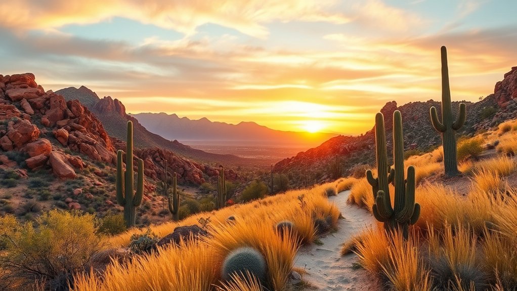
South Mountain Park/Preserve is one of the best choices when you want many trail options in one place. The preserve covers more than 16,000 acres and has more than 100 miles of trails for hiking, horseback riding, and mountain biking. You will see classic Sonoran Desert scenery, including saguaros, rocky ridges, washes, and wide Valley views.
For a challenging but manageable introduction, the official trail page rates Mormon Trail as moderate/difficult. It runs 1.1 miles with 720 feet of elevation change before connecting with the National Trail system. Easier choices are also available, including the hard-surface Judith Tunell Accessible Trail.
Pro Tip: South Mountain is a better fit than Camelback if your group has mixed abilities because you can choose from accessible, moderate, difficult, and long-distance routes without committing everyone to a summit climb.
Camelback Mountain: The Iconic Challenge
Camelback Mountain is iconic, but it is not a casual hike. Phoenix rates both main summit routes, Echo Canyon and Cholla, as extremely difficult. Echo Canyon is 1.14 miles with about 1,400 feet of elevation change, while Cholla is 1.5 miles with about 1,420 feet of elevation change.
Both routes are steep, rocky, exposed, and have very little shade. The reward is a broad summit view from 2,704 feet, but the city specifically warns that prepared hikers still underestimate these trails and sometimes need rescue.
- Stunning vistas: The summit gives you wide views across the Phoenix metro area.
- Challenging terrain: Expect steep grades, rocks, exposure, and sections where careful hand use may be needed.
- Iconic landmark: It is one of Phoenix’s signature hikes, but it is best reserved for experienced, well-prepared hikers.
Note: Parking is limited, dogs are prohibited on all Camelback Mountain trails year-round, and temporary construction closures can occur. Check the official Camelback page on the day you plan to hike.
Papago Park: Scenic Views and Easy Trails
Just minutes from downtown Phoenix, Papago Park is a strong choice for beginners, families, runners, and anyone who wants desert scenery without a major climb. The trails are generally easy, and the park’s sandstone buttes create a very different landscape from Phoenix’s steeper mountain preserves.
| Trail Name | Distance | Elevation Change |
|---|---|---|
| Hole-in-the-Rock Trail | 0.2 miles | 200 feet |
| Nature Trail | 0.5 miles | 20 feet |
| Big Butte Loop | 0.8 miles | 50 feet |
| Double Butte Loop | 2.3 miles | 50 feet |
| Papago Park 5K Fitness Trail | 3.1 miles | 70 feet |
For a quick viewpoint, choose Hole-in-the-Rock. For a longer easy walk, Double Butte Loop or the 5K Fitness Trail gives you more time in the desert without the steep climbing found on Camelback or Piestewa.
Piestewa Peak: A Local Favorite
Piestewa Peak rises to 2,608 feet and is a favorite Phoenix workout. The Summit Trail is only 1.2 miles, but Phoenix rates it extremely difficult because it gains about 1,200 feet through steep, jagged terrain, switchbacks, steps, gravel, and rock.
If the summit is too demanding, the surrounding Phoenix Mountains Preserve has other choices, including the 3.7-mile Freedom Trail and the moderate Piestewa Peak Nature Trail.
- Breathtaking views: The summit offers a 360-degree view of the Phoenix metropolitan area.
- Wildlife and desert plants: Lower trails pass native Sonoran Desert vegetation and wildlife habitat.
- Strong local hiking culture: It is a popular fitness climb, so expect company during busy periods.
Dogs are prohibited year-round on the Piestewa Peak Summit Trail, and the city may restrict the summit trail and associated trails during Extreme Heat Warnings.
Usery Mountain Regional Park: Diverse Terrain
Usery Mountain Regional Park, east of Phoenix near Mesa, has more than 34 miles of trails. The park includes short easy routes, a barrier-free trail, and harder climbs, so it works well for groups that want different levels of challenge.
The best-known climb is Wind Cave Trail, a difficult 1.5-mile one-way route with 812 feet of elevation change. Easier options include the 0.9-mile round-trip Merkle Trail, which is listed as barrier-free, and the 3-mile round-trip Blevins Trail.
As you hike, expect Sonoran Desert vegetation, mountain views, and open desert terrain. The Wind Cave route also connects to the edge of Tonto National Forest.
McDowell Sonoran Preserve: A Nature Lover’s Dream
The McDowell Sonoran Preserve in Scottsdale covers more than 30,500 acres and has over 230 miles of multi-use trails for hikers, cyclists, and equestrians. That makes it one of the best choices near Phoenix when you want a large trail network rather than a single famous summit.
- Diverse desert ecosystems: The preserve protects important Sonoran Desert habitat and wildlife corridors.
- Extensive trail system: Trailheads such as Gateway, Brown’s Ranch, Lost Dog Wash, and Tom’s Thumb give you very different route choices.
- Flexible difficulty: You can choose accessible nature trails, rolling desert routes, or strenuous mountain hikes.
The preserve is open sunrise to sunset and is free to enter. Some trailheads have water, while others do not, so check the official trailhead amenities before you start.
White Tank Mountain Regional Park: Hidden Gems
White Tank Mountain Regional Park covers nearly 30,000 acres on the west side of the Valley. It combines rugged mountain terrain with easier interpretive hikes, making it useful for both casual walkers and experienced hikers.
Scenic Trails Overview
The park has roughly 30 miles of shared-use trails plus pedestrian-only options. Three good starting points are:
- Waterfall Trail: 0.9 mile one way with 262 feet of elevation change. The first 0.5 mile is barrier-free and interpretive; after rain, a seasonal waterfall may be visible in the canyon.
- Black Rock Trail: Choose a 0.5-mile barrier-free short loop or a 1.3-mile longer loop.
- Mule Deer Trail: A 3.4-mile trail with modest elevation change for a longer desert outing.
The Waterfall Trail is named for a seasonal feature, not a guaranteed year-round waterfall. Do not plan on it as a place to cool off or swim.
Unique Wildlife Encounters
White Tank is wild Sonoran Desert habitat, so wildlife sightings are possible but never guaranteed. Watch from a distance, stay on designated trails, and never feed or handle wildlife. Snakes and other reptiles may be active in warm weather, while birds and small mammals are commonly easier to spot around dawn and dusk.
| Wildlife | Safer Viewing Approach |
|---|---|
| Coyotes | Observe from a distance; never approach or feed them. |
| Gila monsters and other reptiles | Give them space and do not touch or block their path. |
| Desert tortoises | Do not pick them up or move them unless directed by wildlife authorities. |
| Roadrunners and quail | Watch quietly from the trail and avoid disturbing nests or young birds. |
Estrella Mountain Regional Park: Family-Friendly Options
If you want an easier family outing, Estrella Mountain Regional Park has a useful mix of easy and more demanding routes. The official trail list includes the 0.5-mile barrier-free Gila Trail, 1-mile Horseshoe and Quail trails, and much longer routes for hikers who want more distance.
- Easy nature walks: Gila, Horseshoe, and Quail are approachable choices for newer hikers.
- Picnic options: The park has day-use areas where families can combine a short hike with a meal outdoors.
- Room to progress: Moderate and harder routes let experienced family members add distance without changing parks.
As with the other Maricopa County regional parks in this guide, check the current park page for hours, alerts, and day-use fees before visiting.
Spur Cross Ranch Conservation Area: A Wilderness Escape
For a greener, more rugged desert feel, Spur Cross Ranch Conservation Area near Cave Creek protects 2,154 acres of upper Sonoran Desert, archaeology sites, and riparian habitat along Cave Creek. The park has more than 12 miles of trails, with individual segments from short easy walks to challenging climbs.
A moderate option is the roughly 3.5-mile Dragonfly and Spur Cross Trail loop, which passes large saguaros and riparian habitat. Experienced hikers can consider Elephant Mountain Trail, a 2-mile segment with 638 feet of elevation change that Maricopa County rates extremely difficult.
Spur Cross charges a per-person conservation-area entry fee rather than the standard vehicle-entry fee used at most other Maricopa County parks. Bring your own water because potable water may not be available at the trailhead.
Plan Your Phoenix Hike Safely
Heat and Hydration
Start early, carry more water than you expect to need, and turn around before you are depleted. Scottsdale’s McDowell Sonoran Preserve advises drinking water before activity, drinking regularly during the hike, and turning around when you have used half your water. Phoenix also restricts selected trails during Extreme Heat Warnings.
Fees, Permits, and Parking
Normal recreational hiking does not require one universal Phoenix-area hiking permit, but rules depend on the land manager. Scottsdale’s McDowell Sonoran Preserve is free for ordinary visits, while Maricopa County’s current 2026 day-use fee is $10 per vehicle at most regional parks and $5 per person at Spur Cross. Special events, commercial guiding, filming, and organized activities may require separate permits.
Camelback parking can fill quickly, especially in winter and spring. Never wait in prohibited roadway areas or park illegally. For every park, check the official page for temporary closures and trailhead changes before driving out.
Dogs on Trails
Dog rules vary. Dogs are prohibited year-round on all Camelback Mountain trails and on the Piestewa Peak Summit Trail. Phoenix also prohibits dogs on all city hiking trails when the temperature reaches 100°F or warmer. In Scottsdale’s McDowell Sonoran Preserve, dogs must stay on a handheld leash no longer than six feet, and the city advises leaving them home if temperatures will exceed 90°F. Maricopa County generally requires pets to be controlled on a leash no longer than six feet.
What to Bring
- Plenty of water, plus electrolytes for longer or hotter outings
- Sun protection: hat, sunscreen, sunglasses, and light protective clothing
- Sturdy closed-toe footwear with good traction
- A charged phone and an offline or paper trail map
- Snacks for longer hikes
- A compact first-aid kit
- A headlamp if your legal trail time could extend near dawn or dusk
Frequently Asked Questions
What is the best time of year to hike near Phoenix?
For most visitors, October through April is the most comfortable season because Phoenix’s late spring and summer heat can be severe. Even in the cooler season, check the forecast and start early on warm days. Summer hikers should treat heat as a serious hazard and follow current trail restrictions.
Are dogs allowed on the hiking trails?
Sometimes, but not everywhere. Dogs are prohibited year-round on Camelback Mountain and on the Piestewa Peak Summit Trail. Phoenix prohibits dogs on all city hiking trails at 100°F or warmer. Scottsdale and Maricopa County allow dogs on many trails under leash rules, but temperature guidance and site-specific restrictions still apply.
Do I need a permit for hiking in these areas?
Ordinary day hiking generally does not require a special hiking permit at the parks in this guide, but entry fees may apply. Maricopa County charges day-use fees, while the McDowell Sonoran Preserve is free. Organized events, professional photography, commercial guiding, or other special uses can require permits.
What should I bring for a day hike?
Bring plenty of water, sun protection, sturdy footwear, snacks, a charged phone, a trail map, and a basic first-aid kit. Add electrolytes for longer or hotter outings. Do not assume every trailhead has drinking water.
Are there guided hiking tours available?
Yes. The City of Phoenix runs ranger-led Hike Right PHX outings, Scottsdale lists guided hikes in the McDowell Sonoran Preserve, and Maricopa County Parks schedules ranger programs and hikes. Registration requirements vary by event.
What is the easiest scenic hike near Phoenix?
Papago Park is one of the easiest places to start. Hole-in-the-Rock is short, while Double Butte Loop gives you a longer easy walk. White Tank’s Black Rock short loop, Estrella’s Gila Trail, and Usery’s Merkle Trail are useful barrier-free or very easy alternatives.
Which Phoenix hike is best for experienced hikers?
Camelback Mountain’s Echo Canyon and Cholla trails and the Piestewa Peak Summit Trail are the best-known hard summit hikes in this guide, and Phoenix rates all three extremely difficult. They are exposed, steep, and not good choices for beginners or hot-weather hiking.
Conclusion
The best hike near Phoenix depends on the experience you want. Choose Papago, Estrella, or accessible routes at White Tank and Usery for an easier day. Pick South Mountain or McDowell Sonoran Preserve for trail variety. Save Camelback Mountain and Piestewa Peak for experienced hikers who are ready for steep, exposed terrain. Whatever you choose, check current alerts, carry enough water, and turn around early if heat, fatigue, or trail conditions make the hike unsafe.
Sources
- City of Phoenix Trail Heat Safety Program – current heat-related trail restrictions and rescue-safety guidance.
- City of Phoenix Camelback Mountain Trails – official trail distances, elevation change, difficulty, and safety details.
- City of Phoenix Piestewa Peak Trails – official Summit Trail distance, elevation change, and difficulty.
- City of Phoenix Papago Park Trails – official Papago trail names, distances, and elevation change.
- City of Scottsdale McDowell Sonoran Preserve – preserve size, trail system, hours, dog rules, hydration guidance, and permits.
- Maricopa County Parks and Recreation – current 2026 day-use and conservation-area fee information.