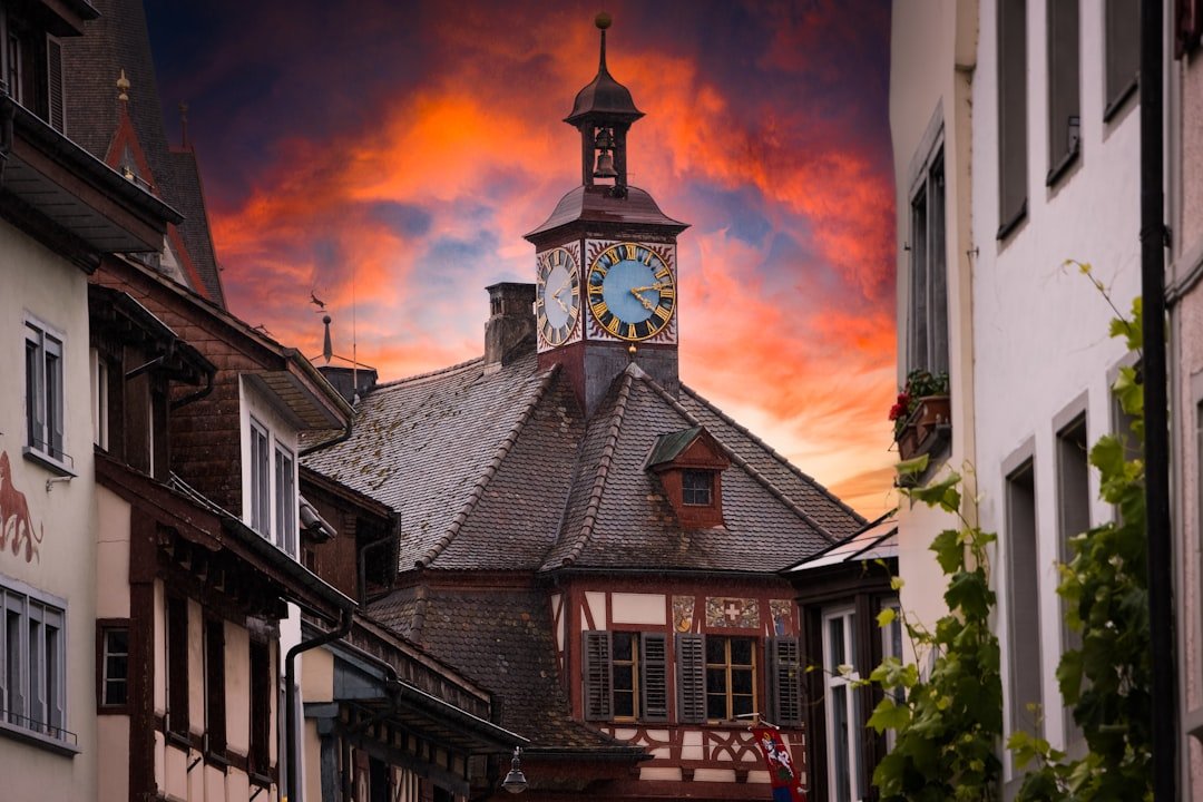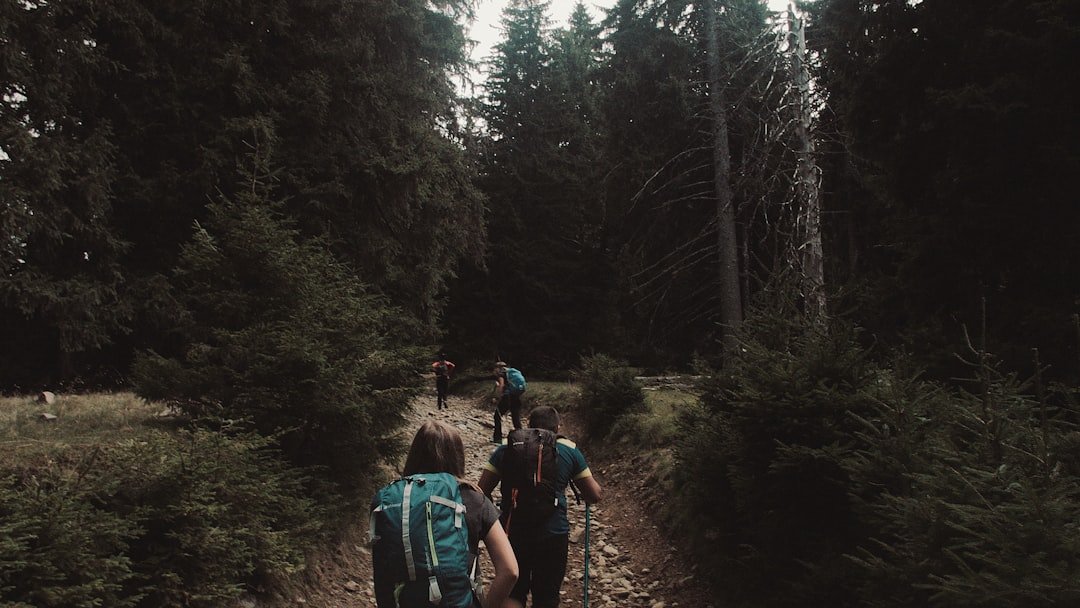
Parc Ela brings together high Alpine landscapes, historic mountain passes, traditional villages, forests, lakes, cultural sites, and the famous Albula railway in the heart of Graubünden. With an official area of 659 square kilometers, it is Switzerland’s largest regional nature park and offers everything from easy cultural walks to demanding multi-day mountain routes.
Quick Answer
Parc Ela is Switzerland’s largest regional nature park, covering 659 km² in Graubünden. Visit for Alpine hiking, historic villages, the Albula and Julier pass landscapes, the UNESCO-listed Rhaetian Railway, mountain lakes, cycling, local food, and quieter nature experiences. Summer and early autumn offer the widest choice of hiking routes.
Key Takeaways
- Parc Ela is a regional nature park in Graubünden covering 659 km², according to the Swiss Parks Network.
- Its landscape stretches from the Schinschlucht at 745 m to Piz Kesch at 3,418 m.
- Major highlights include the Albula, Julier, and Septimer pass landscapes, Bergün and Filisur, mountain lakes, cultural trails, and the UNESCO-listed Rhaetian Railway landscape.
- Activities range from easy walks and family outings to mountain biking and the demanding 18-day Parc Ela Trek.
- Public transport is useful for exploring the park, and several seasonal buses reach valleys and trailheads that are inconvenient by car.
- Mountain weather can change quickly, so check forecasts and choose trails that match your experience.
The History and Importance of Parc Ela
Parc Ela developed from a regional effort to protect valuable landscapes and cultural heritage while supporting communities and a sustainable local economy. The park initiative predates its current federal status, but Parc Ela has officially been recognized as a regional nature park since 2012.
The current park covers six municipalities or municipal areas: Albula/Alvra, Bergün Filisur, Davos Wiesen, Lantsch/Lenz, Schmitten, and Surses. Romansh, German, and Italian cultural influences meet within the wider park landscape.
The history of Parc Ela is closely connected to the Albula, Julier, and Septimer Alpine passes. These north-south routes were important long before modern tourism. Historic villages, churches, castles, old roads, and traces of earlier travel and trade still form part of the cultural landscape.
Agriculture, forestry, and mountain settlement have also shaped the scenery. Meadows, pastures, forests, dry grasslands, historic buildings, and stone structures show that Parc Ela is not a wilderness reserve where human activity is excluded. It is a living cultural landscape where nature conservation, local communities, farming, recreation, and economic activity coexist.
Parc Ela covers 659 km² and rises from 745 m in the Schinschlucht to 3,418 m on Piz Kesch, giving the park an unusually broad range of Alpine landscapes.
Wildlife and Biodiversity in Parc Ela
Parc Ela’s large elevation range creates many different habitats. The landscape includes mountain forests, hedgerows, dry grasslands, Alpine pastures, wetlands, rocky slopes, high mountain terrain, glaciers, and mountain lakes. Conditions can change sharply with altitude, slope direction, geology, water, and land use.
This variety supports a wide range of plants, insects, birds, and mammals. When walking quietly in suitable habitat, visitors may encounter familiar Alpine wildlife or signs of animals living above the valleys. Wildlife sightings are never guaranteed, and observing from a distance is better for both animals and visitors.
The park’s conservation work focuses on protecting and improving habitats, maintaining valuable cultural landscapes, monitoring biodiversity, restoring features such as ponds and dry-stone walls, and working with local communities and volunteers. That approach is more accurate than describing Parc Ela as running broad endangered-species breeding programs.
Note: Wildlife is easiest to enjoy when you keep your distance, stay on appropriate paths, control dogs where required, avoid feeding animals, and reduce noise around sensitive habitats.
Best Things to Do in Parc Ela
| Activity | What to Expect | Good Areas or Routes |
| Hiking | Everything from village walks to demanding Alpine routes | Exploratour, Pfad der Pioniere, Albula landscape, Parc Ela Trek |
| Cycling & Mountain Biking | Road, gravel, and mountain routes across varied terrain | Val Surses, Bergün area, seasonal bike-and-hike bus connections |
| Wildlife & Nature Observation | Forests, wetlands, Alpine meadows, lakes, and high-mountain habitats | Alp Flix, mountain valleys, quieter hiking routes |
| Cultural Exploration | Historic villages, churches, old pass routes, railway heritage | Bergün, Filisur, Savognin, Julier and Septimer areas |
Walk the Official Theme and Experience Trails
Rather than relying on an unverified generic “Panorama Trail,” choose one of Parc Ela’s documented theme and experience trails. Options include nature, geology, culture, local history, and family-focused routes.
The Exploratour, for example, runs from the Julier Pass area toward Bivio. The official route is about 12.1 km, takes roughly 5½ hours, and is graded as a demanding mountain hike requiring sure-footedness and suitable fitness.
Another option is the Pfad der Pioniere at Crap Furò, where a walk through a natural forest reserve leads toward the geographic center of Graubünden.
See the Albula Railway Landscape
The Albula railway is one of the park’s strongest combinations of scenery, history, and engineering. The Rhaetian Railway’s Albula and Bernina lines were inscribed on the UNESCO World Heritage List in 2008.
Between Preda, Bergün, and Filisur, the Railway Adventure Trail Albula follows sections of this famous railway landscape and explains the railway’s structures, history, technology, and relationship with the surrounding mountains.
Visit the Albula Pass and Lai da Palpuogna
The Albula Pass combines high-mountain scenery with railway and pass history. In the warmer season it can be explored on foot, by bike, bus, or car depending on current road and transport conditions. Lai da Palpuogna is one of the best-known scenic stops in this area.
Explore Bergün and Filisur
Bergün and Filisur make useful bases for combining village architecture, railway history, walking, and public transport. Their position along the Albula railway also makes it possible to plan trips where the train itself is part of the experience.
Try the Parc Ela Trek
Experienced hikers looking for a major challenge can consider the Parc Ela Trek. The current Swiss Parks listing describes an 18-day route of about 226.7 km, with roughly 14,300 m of ascent. Much of it stays above 2,000 m and uses existing hiking trails rather than a separately marked continuous trail.
This is not a casual extension of a day hike. It requires strong fitness, mountain experience, careful stage planning, accommodation reservations, suitable equipment, and close attention to weather and seasonal conditions.
Cycle and Mountain Bike
Parc Ela also offers cycling and mountain-bike possibilities across its valleys and mountain landscapes. Seasonal transport can help riders reach certain valleys, and some services accept bicycles with advance arrangements. Always confirm the current timetable, bike-capacity rules, and trail permissions before setting out.
Enjoy Winter Activities
Winter changes both the scenery and the type of recreation available. Communities in and around the park region offer skiing, snowboarding, winter walking, sledding, cross-country skiing, and snowshoeing. Snow conditions, avalanche exposure, lift operations, and winter route openings vary, so use current local reports rather than assuming a summer route remains suitable in winter.
Sustainable Tourism in Parc Ela
Sustainable regional development is central to the purpose of Parc Ela. The park’s communities work together to protect nature and landscapes, preserve cultural heritage, and strengthen the local economy.
Visitors can support those goals in simple ways: arrive by public transport when practical, use marked trails, stay in local accommodation, buy regional products, eat at locally operated businesses, avoid disturbing wildlife, and carry waste back out of natural areas.
Local farmers, accommodation providers, restaurants, craftspeople, guides, and other businesses are part of the regional economy that keeps the park’s villages active. Traditional agriculture and landscape maintenance also contribute directly to habitats such as meadows, pastures, hedgerows, and dry-stone-wall environments.
Educational walks, guided excursions, cultural programs, volunteer projects, and interpretive trails offer another way to understand the relationship between people and the landscape rather than treating Parc Ela only as an outdoor playground.
Accommodation and Dining Options in Parc Ela
Accommodation ranges from hotels and guesthouses to holiday apartments, mountain huts, group accommodation, and camping. The best base depends on which part of the park you want to explore.
- Bergün and Filisur: convenient for Albula railway scenery, village exploration, hiking, and rail-based trips.
- Savognin and the wider Val Surses: useful for mountain activities, Julier-area excursions, cycling, and access toward several side valleys.
- Bivio: a practical base for the Julier and Septimer landscapes and higher mountain routes.
- Lantsch/Lenz: useful for the northern park area and regional walking and cycling.
- Mountain huts: important for longer hikes, including stages of the Parc Ela Trek.
Camping is available at established sites, including facilities within the park region. Wild or informal camping should never be assumed to be permitted simply because an area looks remote. Check land-management rules, protected habitats, local restrictions, and fire regulations before choosing an overnight location.
Dining reflects Graubünden’s mountain traditions and the park’s emphasis on regional products. Depending on the restaurant and season, you may find Alpine cheeses, local meat products, bread and grain products, regional potatoes, soups, baked dishes, and other Graubünden specialties. Availability varies, so check individual establishments rather than expecting every restaurant to serve fondue or raclette.
The original article also included a separate food-related internal recommendation. If you enjoy reading about unusual ingredients and flavors beyond Graubünden cuisine, see Exploring the Delightful World of Asian Melon.
Best Time to Visit Parc Ela
There is no single best month for every visitor because conditions change significantly with elevation.
Late Spring
Lower valleys and village walks may become enjoyable while higher routes can still hold substantial snow. This is a transition season, so do not judge high-mountain trail conditions by what you see in the valley.
Summer
Summer provides the widest choice of hiking, biking, cultural excursions, and seasonal transport. It is also the main period for high Alpine routes. Afternoon thunderstorms are an important consideration in Switzerland’s mountains, particularly during the warm months.
Early Autumn
Early autumn can bring cooler hiking temperatures, clearer-feeling air, and changing vegetation. High routes may remain accessible during stable weather, but daylight shortens and early snow becomes increasingly possible.
Winter
Winter is better suited to designated winter trails, snowshoe routes, sledding, skiing, and other snow activities. Summer hiking times and difficulty ratings should not be reused for snow-covered routes.
Warning: Mountain weather can change rapidly. Thunderstorms may bring lightning, hail, heavy rain, powerful wind gusts, and sudden runoff. Check an official forecast before leaving, avoid exposed ridges and summits when thunderstorms threaten, and turn around when conditions exceed your experience or equipment.
How to Get to Parc Ela
Chur is a useful transport gateway for many visitors arriving from other parts of Switzerland. From there, Rhaetian Railway and PostBus connections serve communities around the park, while seasonal services extend access to selected valleys and higher starting points.
The Swiss Parks Network links directly to public-transport planning for Parc Ela, and current national connections can be checked through SBB. Because seasonal buses may require reservations or operate only during particular months, check the exact connection shortly before your trip.
The Rhaetian Railway is not simply transportation here. On the Albula route, the journey passes through one of Switzerland’s most celebrated railway landscapes, with tunnels, stone structures, viaducts, and mountain scenery.
Driving is also possible to many park communities, but a car is not always the easiest tool for point-to-point hikes. Seasonal pass conditions, winter closures, limited parking at popular locations, and one-way hiking routes can make train-and-bus combinations more convenient.
Pro Tip: For a one-way hike, check the return transport before you start walking. A route can be technically easy but logistically difficult if the final bus has already departed.
A Simple One-Day Parc Ela Itinerary
If this is your first visit and you want scenery without committing to a demanding Alpine trek, a rail-focused day around the Albula Valley is a practical introduction.
- Morning: Travel by Rhaetian Railway toward Bergün and enjoy the Albula railway landscape.
- Late morning: Walk through Bergün and explore its historic village setting.
- Afternoon: Choose a suitable section of the Railway Adventure Trail or another marked local walk based on weather, fitness, and available time.
- Late afternoon: Continue or return by rail, allowing enough time for the final connection.
For a second day, explore Val Surses, the Julier Pass area, Alp Flix, or another part of the park rather than trying to cover Parc Ela’s 659 km² in one visit.
Tips for Visiting Parc Ela
Preparation matters in Parc Ela because a relaxed valley walk and a high mountain route can require very different equipment and experience.
Understand Swiss Trail Markings
Swiss hiking routes are divided into categories. Ordinary hiking trails are generally marked in yellow. Red-and-white mountain trails can be steep, narrow, uneven, or exposed and require sure-footedness, a head for heights, good fitness, and awareness of mountain hazards. Blue-and-white Alpine routes are more demanding again.
The Swiss Hiking Trails organization provides official guidance on these categories. Choose your route by its actual category and conditions, not only by distance.
Check Weather Immediately Before Hiking
Use a current forecast rather than a forecast saved several days earlier. The official MeteoSwiss app provides forecasts, measurements, and federal weather warnings.
Carry Suitable Equipment
For mountain walks, sturdy footwear with good grip, weather protection, water, food, sun protection, navigation information, and extra layers are sensible basics. Higher, longer, or more technical routes may require additional equipment and experience.
Start Conservatively
If you are unfamiliar with Alpine terrain, begin with a lower-level walk, cultural trail, or guided outing. Parc Ela has enough variety that you do not need to attempt a difficult summit route to enjoy the landscape.
Respect Wildlife and Farming Areas
Stay on appropriate paths, close gates, do not enter restricted areas, keep a respectful distance from livestock and wildlife, and follow local instructions for dogs. Quiet behavior is especially valuable when watching animals.
Use Local Guides When Useful
Guided hikes and excursions can add context about geology, wildlife, culture, and local history. A guide is also valuable when your chosen route requires skills or local knowledge beyond your experience.
Allow Time for Villages and Cultural Sites
Parc Ela is not only a collection of hiking trails. Historic villages, churches, railway heritage, old Alpine routes, regional food, and local traditions are central to what makes the park different from a purely wilderness-focused destination.
Frequently Asked Questions
What is Parc Ela?
Parc Ela is a regional nature park in Graubünden and the largest regional nature park in Switzerland. The Swiss Parks Network currently lists an area of 659 km². Its landscape includes Alpine passes, valleys, villages, forests, mountain lakes, cultural sites, and high peaks.
What are the main attractions in Parc Ela?
Highlights include the Albula, Julier, and Septimer pass landscapes, Bergün and Filisur, Lai da Palpuogna, themed hiking routes, Alp Flix, and the UNESCO-listed Rhaetian Railway landscape. The best choices depend on the season and your preferred activity level.
What activities can visitors do in Parc Ela?
Popular activities include hiking, mountain biking, cycling, nature observation, village walks, cultural excursions, railway trips, and guided tours. Winter brings opportunities for snowshoeing, winter walking, skiing, sledding, and other snow activities in the region.
Is there accommodation available in Parc Ela?
Yes. Options include hotels, guesthouses, apartments, mountain huts, group accommodation, and established camping facilities. Bergün, Filisur, Savognin, Bivio, and Lantsch/Lenz are among the useful bases for different parts of the park.
Are guided tours available in Parc Ela?
Yes. Parc Ela works with guides and excursion leaders who offer deeper insight into the area’s landscapes, wildlife, geology, history, and culture. Available programs vary by date and season.
What is the best time to visit Parc Ela?
Summer through early autumn generally provides the widest selection of hiking and cycling routes. Lower walks can become accessible earlier, while high routes may retain snow well into the warmer season. Winter is better for designated snow activities and winter trails.
Can I visit Parc Ela without a car?
Yes. Rhaetian Railway, PostBus, and seasonal regional services reach many park communities and hiking areas. Public transport can be especially useful for point-to-point walks where returning to a parked car would otherwise be difficult.
Is Parc Ela suitable for families?
Yes, provided you choose age-appropriate routes. Village walks, railway experiences, selected theme trails, and shorter nature outings can work well for families. Mountain and Alpine trails should be selected according to each person’s fitness, experience, weather conditions, and the official trail category.
Sources
- Swiss Parks Network: Parc Ela — current park status, area, municipalities, elevation range, and general landscape information.
- Parc Ela: Theme and Experience Trails — official walking, cultural, educational, and nature-experience options.
- Parc Ela Trek — official information about the multi-day Alpine trekking route.
- UNESCO World Heritage Centre: Rhaetian Railway in the Albula/Bernina Landscapes — World Heritage status and historical importance of the railway landscape.
- MeteoSwiss: Thunderstorm Danger Levels — official information on lightning, hail, heavy rain, wind, and mountain-weather hazards.
- Swiss Hiking Trails: Trail Categories — official guidance on ordinary hiking trails, mountain trails, Alpine trails, skills, and equipment.