Pfyn-Finges Nature Park in central Valais combines one of the Alps’ largest coherent pine forests with the wild Rhône, dry rocky steppes, wetlands, vineyards, mountain villages, and high Alpine terrain. Recognized as a Regional Nature Park of National Importance since 2013, it is especially rewarding for hikers, cyclists, birdwatchers, and visitors interested in geology and conservation.
Quick Answer
Pfyn-Finges Nature Park is a 327 km² regional nature park in central Valais, Switzerland, stretching between Gampel and Sierre across 13 municipalities. Its best-known core is the protected Pfyn forest and wild Rhône landscape. Visitors come for hiking, cycling, birdwatching, geology, vineyards, and guided nature experiences.
Key Takeaways
- The full Pfyn-Finges Regional Nature Park covers about 327 km²; the protected Pfyn forest reserve is a smaller 17 km² centerpiece of the park.
- The park stretches between Gampel and Sierre and currently includes 13 municipalities.
- The official park network lists about 450 km of hiking trails, ranging from short walks to demanding mountain routes.
- Birdwatching, cycling, hiking, geology, vineyards, and guided nature excursions are among the best-supported visitor activities.
- Inside the Pfyn/Finges forest reserve, visitors should stay on marked trails, keep dogs on a lead, avoid bathing in the ponds, leave plants untouched, and never light fires.
Understanding Pfyn-Finges Nature Park
One important distinction makes the park easier to understand. The Swiss Parks Network lists the Pfyn-Finges Regional Nature Park at 327 km² and identifies it as a regional nature park since 2013. It extends across 13 municipalities between Gampel and Sierre.
The much smaller Pfyn/Finges forest reserve is the protected natural centerpiece that many visitors associate with the park. The forest reserve covers about 17 km² and has been officially protected since 1997. It includes pine forest, floodplain habitats, ponds, dry landscapes, and a section of the wild Rhône.
Note: When you see different area figures for Pfyn-Finges online, check whether the source is describing the entire regional nature park or only the protected Pfyn forest reserve. They are not the same area.
The park’s landscape ranges from the Rhône Valley to high Alpine terrain. Its official perimeter stretches from roughly 500 to 4,100 metres above sea level, creating sharp changes in vegetation, climate, scenery, and wildlife over a relatively short distance.
Getting to Pfyn-Finges Nature Park
Pfyn-Finges is a large regional park rather than an attraction with one main entrance. Your best arrival point therefore depends on what you plan to see. Sierre, Salgesch, Leuk, and nearby communities provide useful gateways to different parts of the park.
Train travel is particularly convenient. For example, several official hiking and birdwatching routes begin near Leuk or Salgesch railway stations. You can check current Swiss rail and bus connections through SBB before travelling.
The park’s Nature and Landscape Centre is in Salgesch. It serves as an information and administrative centre, while tourism offices around the wider park can help with local accommodation, activities, transport, and current conditions. Check the official visitor-information page before your trip because opening hours and local services can change.
Pro Tip: Choose your railway station after choosing your hike or activity. Leuk is convenient for several Pfyn forest and Leukerfeld routes, while Salgesch is useful for the visitor centre, vineyards, and other nearby park experiences.
Flora and Fauna of Pfyn-Finges Nature Park
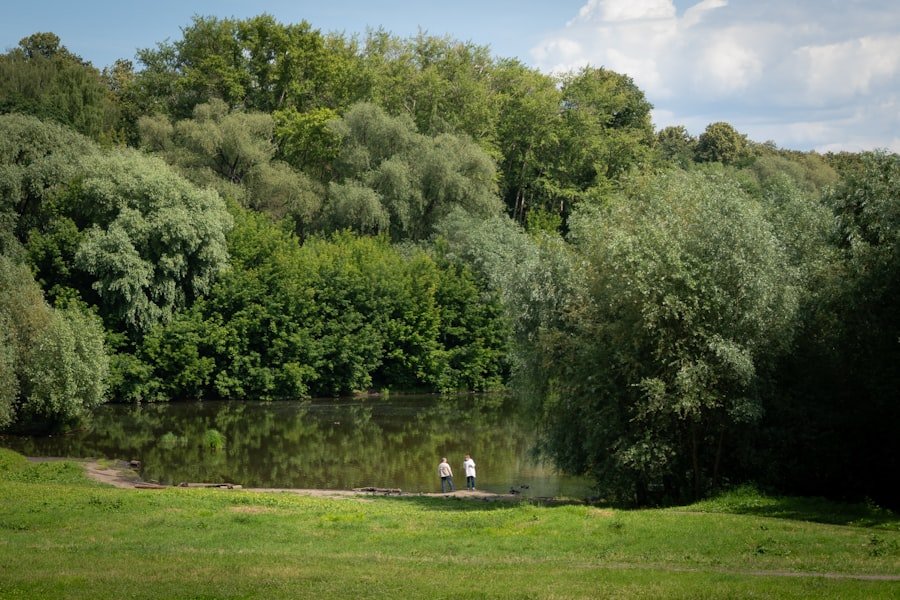
The diversity of habitats is one of the park’s defining features. The official forest-reserve information describes the Pfyn forest as one of the largest coherent pine forests in the Alps. The protected area also contains nationally important floodplain and amphibian habitats.
Elsewhere in the park, visitors encounter dry steppes, wet areas, mountain meadows, vineyards, rocky slopes, forests, and Alpine landscapes. These contrasting habitats explain why the region supports such varied plant and animal communities.
Wildlife highlighted by the park includes deer, lynx, beaver, golden eagles, hoopoes, and other birds. Sightings are never guaranteed, and visitors should observe animals from a respectful distance rather than approaching, feeding, or disturbing them.
The ponds and wet habitats of the Pfyn forest are particularly sensitive. They support amphibians, insects, and other wildlife, which is one reason bathing in the reserve’s ponds is prohibited.
Activities in Pfyn-Finges Nature Park
The park supports activities at very different difficulty levels. Instead of relying on unsourced visitor counts, it is more useful to look at the options documented by the park itself.
| Activity | Verified option | Planning information |
| Hiking | Crossing the Pfyn Forest | About 11 km and 3 hours, with roughly 180 m ascent and 260 m descent. |
| Birdwatching | Susten-Leukerfeld-Agarn area | Easy terrain; the official route recommends May to September as the best bird-observation period. |
| Cycling | Family rides, road routes, e-bike routes, and mountain-bike trails | The official park directory lists routes from short family trips to longer mountain-bike rides. |
| Guided experiences | Ornithology, geology, nature, and cultural activities | Dates, languages, prices, and registration requirements vary by event. |
Cyclists can browse the official cycling directory, which includes family rides, bicycle tours, mountain-bike trails, and e-bike itineraries. Always follow the restrictions and signs applying to the route you choose.
The official Pfyn-Finges route directory describes a hiking network of about 450 kilometres, with options ranging from easy circuits to challenging mountain tours.
Hiking Trails in Pfyn-Finges Nature Park
With roughly 450 km of trails listed by the park, there is no single “Pfyn-Finges hike.” Routes range from short nature walks in the valley to longer Alpine outings. Check the official hiking directory for current route descriptions and difficulty information.
Crossing the Pfyn Forest
This is one of the clearest choices for visitors primarily interested in the famous forest reserve. The official route is about 11 km long and takes approximately three hours. It has about 180 metres of ascent and 260 metres of descent.
The route provides a close look at the reserve’s pine forest, unusual terrain, wet habitats, and the wider Rhône landscape. Because it passes through protected habitat, staying on the marked route is important.
Illgraben and the Bhutan Bridge
Another documented option is the walking tour around the Illgraben and Bhutan Bridge. The park lists a route of about 7 km with roughly two hours of hiking and around 250 metres of ascent and descent.
The Illgraben is more than a scenic ravine. The Swiss Federal Institute for Forest, Snow and Landscape Research operates a debris-flow observation station there. WSL reports an average of three to five debris flows a year, making the catchment an important natural-hazards research site.
Warning: Treat the Illgraben as an active natural-hazard area, not simply a photo stop. Remain on official routes, obey closures and signs, and never enter channels or restricted areas to get closer to a debris flow or unstable slope.
Birdwatching in Pfyn-Finges Nature Park
Birdwatching is one of the park’s signature nature activities. Its combination of wetlands, dry grasslands, forest, vineyards, rocky terrain, and Alpine habitat supports an unusually varied bird community.
Leukerfeld is an especially useful area for birders. The park documents an easy ornithological route through the Susten-Leukerfeld-Agarn area and recommends May to September as the best observation period for that particular outing.
One notable seasonal visitor is the European bee-eater. According to the park’s information, which cites the Swiss Ornithological Institute, bee-eaters now breed locally around Leukerfeld. The area also provides opportunities to see other birds associated with woodland, wetlands, agricultural landscapes, and rocky slopes.
The official ornithology programme includes guided excursions at selected times of year.
Birdwatching etiquette: Stay on paths, keep a generous distance from birds, do not use recordings to provoke responses, and avoid flash photography around wildlife. These precautions are especially important near breeding and feeding areas.
Best Time to Visit Pfyn-Finges Nature Park
There is no single best month because the park extends from the Rhône Valley into high mountain terrain. Your ideal season depends on the activity and elevation.
- Spring: A strong choice for flowers, lower-elevation walking, and bird migration and breeding activity.
- Summer: Provides access to a wider range of mountain routes, but lower areas can become hot. Carry enough water and check weather forecasts.
- Autumn: Often attractive for hiking, vineyards, changing vegetation, and quieter trails.
- Winter: The lower Pfyn forest reserve remains accessible, but snow and winter conditions affect mountain routes. Choose trails appropriate for the conditions and your equipment.
For the official Susten-Leukerfeld-Agarn birdwatching route, the park specifically identifies May through September as the best period for observing birds.
Accommodation and Facilities in Pfyn-Finges Nature Park
Because Pfyn-Finges covers many communities, accommodation is spread throughout the region rather than concentrated at a single park entrance. Hotels, guesthouses, B&Bs, holiday accommodation, restaurants, and other visitor services are available in towns and villages around the park.
The park maintains an accommodation and refreshment directory, while local tourism offices can provide additional options.
For route planning and park information, the Nature and Landscape Centre in Salgesch is a useful contact point. Check current opening information before making a special trip because schedules may change with season, holidays, or operational needs.
Food is also part of the regional experience. Pfyn-Finges includes important wine-growing areas, particularly around Salgesch and Varen, along with producers and restaurants offering regional products. If you plan a picnic, take all rubbish with you and follow any local restrictions on where food, fires, or other activities are allowed.
Conservation and Sustainability in Pfyn-Finges Nature Park
Conservation is central to the purpose of Pfyn-Finges. Regional nature parks in Switzerland combine protection and enhancement of natural and cultural landscapes with sustainable regional development.
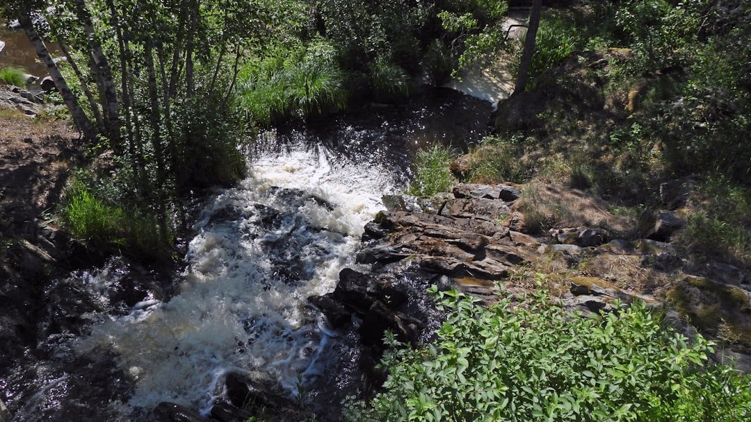
The Pfyn forest reserve deserves particular care. Its pine forests, floodplains, ponds, dry areas, and amphibian habitats are ecologically important, while the wild Rhône and Illgraben continue to shape the landscape through natural processes.
Visitors can reduce their impact by using public transport where practical, staying on designated routes, respecting wildlife, avoiding disturbance around ponds and breeding areas, and supporting regional businesses.
Protected-area rules: In the Pfyn/Finges forest reserve, remain on marked trails, do not bathe in the ponds, do not pick plants or flowers, keep dogs on a lead, take your rubbish away, and do not light fires. Fires are strictly forbidden in the forest.
Planning Your Visit
A successful visit starts with choosing one part of this large park rather than trying to cover everything in a day. A forest walk, birdwatching outing, vineyard visit, mountain hike, and cycling tour can each require a different starting point.
- Choose your activity and route before selecting your arrival station.
- Check the official route description for distance, elevation, difficulty, and seasonal conditions.
- Bring water, sun protection, suitable footwear, and weather-appropriate layers.
- Check the forecast before mountain hikes and change plans if thunderstorms or severe weather are expected.
- Follow reserve signs even when an unofficial path or shortcut appears convenient.
- Use binoculars or a zoom lens instead of approaching wildlife.
- Carry out everything you bring into protected areas.
Frequently Asked Questions
What is Pfyn-Finges Nature Park?
Pfyn-Finges is a Regional Nature Park of National Importance in central Valais, Switzerland. The full park covers about 327 km² across 13 municipalities between Gampel and Sierre. The protected Pfyn forest reserve is one of its best-known natural areas.
What are the main attractions in Pfyn-Finges Nature Park?
Highlights include the Pfyn/Finges forest reserve, the wild Rhône landscape, the Illgraben and Bhutan Bridge area, birdwatching around Leukerfeld, vineyards near Salgesch and Varen, mountain villages, and hiking and cycling routes across the wider park.
What activities can visitors do in Pfyn-Finges Nature Park?
Documented activities include hiking, cycling, mountain biking, e-biking, birdwatching, nature observation, themed walks, and guided nature, geology, cultural, and ornithological experiences.
How large is Pfyn-Finges Nature Park?
The Regional Nature Park covers approximately 327 km². The protected Pfyn forest reserve at its heart is much smaller, covering about 17 km².
What is the best time to visit Pfyn-Finges Nature Park?
Spring through autumn provides the widest choice of hiking, cycling, and nature activities. For the official Susten-Leukerfeld-Agarn birdwatching route, May through September is recommended for bird observation. Higher mountain routes have a shorter snow-free season than the valley floor.
Are there facilities for visitors in Pfyn-Finges Nature Park?
Yes. The Nature and Landscape Centre is in Salgesch, and tourism offices, railway stations, restaurants, hotels, guesthouses, and other services are distributed among communities throughout the park. Facilities vary by route, so check your specific starting point before leaving.
Can I light a fire or swim in the ponds in the Pfyn forest reserve?
No. The official reserve rules state that fires are strictly forbidden in the Pfyn/Finges forest and that visitors should not bathe in the ponds. Visitors must also stay on marked trails, leave plants untouched, keep dogs on a lead, and take rubbish away.
Sources
- Swiss Parks Network: Pfyn-Finges Nature Park – park status, area, municipalities, forest reserve, and general landscape.
- Pfyn-Finges Nature Park: Forest Reserve – reserve history, habitats, visitor rules, and Pfyn Forest hiking information.
- Pfyn-Finges Nature Park: Hiking Routes – official hiking network, distances, times, and route options.
- Pfyn-Finges Nature Park: Ornithology – birdwatching locations and guided ornithological activities.
- Swiss Federal Institute WSL: Illgraben Debris-Flow Observation Station – Illgraben research and debris-flow activity.