Burgazada rewards you with sea views almost everywhere, but the best viewpoints in Burgazada are concentrated around Kalpazankaya, Bayrak Tepesi (Hristos Hill), the harbor, and the historic village around Aya Yani Church. The island is compact, so you can combine several viewpoints in one day while also seeing its wooden houses, rocky shoreline, and literary heritage.
Quick Answer
For sunset, choose Kalpazankaya on Burgazada’s western side. For the broadest panorama, Bayrak Tepesi/Hristos Hill is the island’s main high point. For an easy view with no uphill hike, stay around Burgazada Harbor and the streets near Aya Yani Church, where the village, ferries, and Sea of Marmara fill the scene.
Last checked: October 1, 2026. Dates and figures were verified against official sources.
Key Takeaways
- Kalpazankaya is the strongest sunset choice because it faces the open western sea.
- Bayrak Tepesi, also called Hristos Hill, is Burgazada’s only main hill and reaches about 170 meters.
- Aya Yani is a Greek Orthodox church in the village, not the hilltop monastery described in the original version.
- From June 8 through October 15, 2026, Adalar Municipality says entry to forested areas is prohibited, which affects plans for wooded ridge walks.
Best Viewpoints in Burgazada at a Glance
The three most useful viewpoints cover different experiences: Kalpazankaya for sunset, Bayrak Tepesi for elevation, and the harbor and village for easy access. Türkiye’s official tourism site specifically highlights Kalpazankaya and Flag Hill, while Adalar Municipality identifies Bayrak Tepesi as the island’s only hill.
The island is roughly circular and about 2 kilometers across according to Adalar Municipality’s Burgazada overview. That compact scale makes a viewpoint-focused day realistic without rushing from one end of the island to another.
Aya Yani Church and the Village Skyline
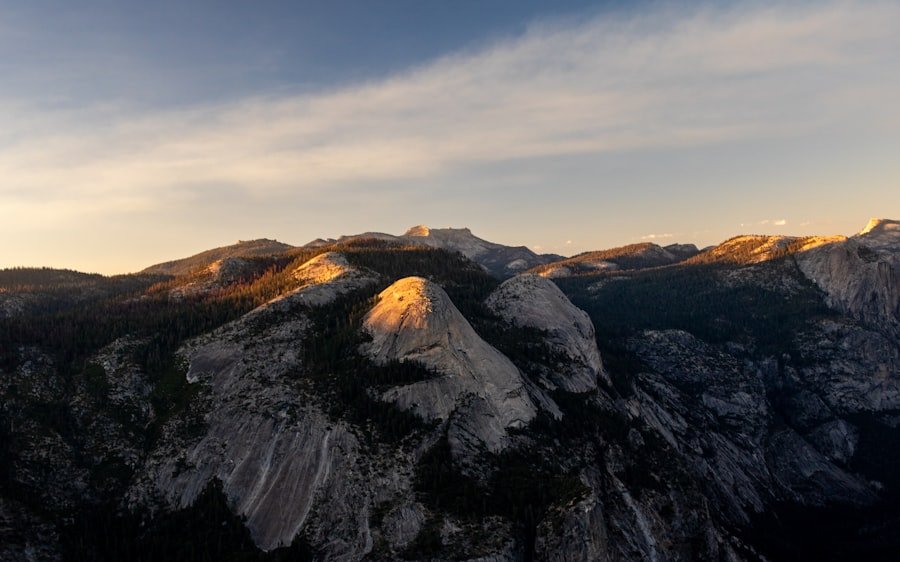
Aya Yani Church gives you a historic village setting rather than a remote mountaintop panorama. The church, formally associated with Aghios Ioannes Prodromos (Saint John the Baptist), stands within Burgazada’s settled area and helps define the island’s skyline when viewed from the waterfront.
The original article called this site the “Monastery of Ayios Ioannis,” but reliable local sources identify it as Aya Yani Church. A 2026 local history of Aya Yani Church traces the site to the Byzantine period and describes rebuilding after the 1894 Istanbul earthquake. Sources differ on whether the rebuilt church should be dated to 1896 or 1899, so the safest description is the late 1890s.
The church is also connected with the story of Patriarch Methodios, who was imprisoned on Burgazada during the iconoclast period. The original article linked to this Byzantine-era monastery reference; it is useful only as broad Byzantine context and does not document Burgazada specifically.
For photographs, use the surrounding streets and waterfront sightlines to place the church within the village. If you enter an active place of worship, keep noise low and follow any on-site photography rules.
Kalpazankaya: The Best Sunset View in Burgazada
Kalpazankaya is the clearest choice for sunset because it lies on Burgazada’s western side, facing the open Sea of Marmara. The official GoTürkiye guide highlights the area for sea views and sunset, while the municipality describes the nearby cove as one of the island’s traditional outing spots.
| Viewpoint | Best For | Access | Best Time |
|---|---|---|---|
| Kalpazankaya | Sunset and open-sea views | Road and coastal approach from the village | Late afternoon to sunset |
| Bayrak Tepesi / Hristos Hill | Highest panorama | Uphill route through the island interior | Morning or clear late afternoon |
| Harbor and Aya Yani area | Ferries, village streets, and easy photos | Immediately around the ferry pier | Morning or early evening |
At Kalpazankaya, the strongest compositions come from combining the rocky coast with boats and the horizon. Arrive before the sun reaches the horizon so you can choose a safe position while there is still good light.
GoTürkiye also notes that Kalpazankaya is a well-known place to pause for a meal while exploring the island. The view is the main draw, so you do not need a complicated itinerary: the western light and open water do most of the work.
The Charming Streets of Burgazada
Burgazada’s streets are a viewpoint in their own right because the village sits between the ferry landing, slopes, and sea. You get changing glimpses of wooden houses, gardens, church architecture, and water as you walk uphill or turn back toward the harbor.
Adalar Municipality specifically points to Gezinti Caddesi, Gönüllü Street, and Mehtap Street for the island’s notable houses and sea-facing residential scenery. These streets work best when you want photographs with local character rather than a single grand panorama.
Walk slowly and look behind you on uphill sections. Many of the best frames appear when the road drops toward the blue water and a ferry or neighboring island enters the background.
Bayrak Tepesi and Hristos Hill: Burgazada’s Highest Panorama
Bayrak Tepesi is the best choice when you want elevation and a broad panorama. The district governor’s geographic profile gives Burgazada’s highest point as 170 meters and also uses the name Hristos Hill; GoTürkiye says the summit opens views toward the other islands and the Anatolian shore.
The original article called this viewpoint “Çınar Tepesi.” I could not confirm that name in the official Burgazada sources checked for this edit. Adalar Municipality instead says the island has one main hill, Bayrak Tepesi, with Hristos Monastery on its upper slopes.
Warning: Adalar Municipality states that entry to forested areas in the district is prohibited from June 8 through October 15, 2026 because of wildfire risk. Do not use wooded ridge routes during that period unless local authorities clearly mark an allowed route.
The restriction is especially important for viewpoint planning because the most elevated scenery lies in the island’s greener interior. The 2026 forest-access notice also prohibits camping, tents, fires, barbecues, and uncontrolled swimming in forest areas.
The Picturesque Burgazada Harbor
Burgazada Harbor is the easiest viewpoint on the island because the scenery begins as soon as you step off the ferry. Ferries, small boats, waterfront buildings, and the slopes behind the village create a layered view without any climb.
It is also the most practical place to begin and end your route. Şehir Hatları currently serves Burgazada on its Princes’ Islands network, including the Maltepe–Büyükada–Heybeliada–Burgazada–Kınalıada line. The official Şehir Hatları timetable shows multiple Burgazada calls during the day.
Pine Slopes and Coastal Greenery
Burgazada’s greenery is best treated as part of the landscape rather than as a single named “Adalar Park.” I could not verify an official Burgazada attraction by that name in the sources checked, so the stronger description is the island’s pine-covered slopes, roadside vegetation, and coastal green spaces.
These areas add depth to photographs from the shoreline and village. They are especially attractive when the sea is visible between trees, but the 2026 forest-access restriction means you should keep to legally open roads and public areas until the restriction ends on October 15.
If you want a cultural stop between outdoor viewpoints, the Sait Faik Abasıyanık Museum on Çayır Sokak is open Wednesday through Sunday from 10:30 to 16:45 and is free to enter. The museum preserves the writer’s belongings, photographs, letters, and documents connected with his life on Burgazada.
Coastal Viewpoints and Swimming Areas
The coast gives you low, close-to-the-water viewpoints where the rocky shore fills the foreground. Kalpazankaya and the western shoreline are especially strong for evening light, while the eastern side near the ferry gives easier access to village-and-sea compositions.
The original article named Aşıklar Beach as a family swimming spot, but I could not verify that as a Burgazada beach in the official sources checked. More importantly, Adalar Municipality’s 2026 swimming notice says people should swim only in designated areas.
For Burgazada, the official list names the area in front of Burgazada Su Sporları Kulübü and Burgazada Deniz Kulübü. The municipality’s 2026 designated-swimming notice asks visitors not to enter the sea outside approved areas.
Aya Yorgi Garipi and the Western Shore
For a quieter historic landscape west of the main village, look toward the area around Aya Yorgi Garipi Monastery and the coastline beyond Kalpazankaya. Adalar Municipality places Aya Yorgi northwest of Kalpazankaya, while Madam Marta Bay lies to the south.
This is a more accurate Burgazada landmark than the “Aya Nikola Church” section in the original article, which I could not verify for Burgazada. In the current municipal swimming list, the Aya Nikola place name appears as Büyükada Aya Nikola Halk Plajı, while the municipality’s Burgazada overview identifies Aya Yorgi and Hristos among Burgazada’s monastic landmarks.
Do not assume that religious buildings or their grounds are always open to casual visitors. Treat the public road and coastline as the dependable viewing space unless an entrance is clearly open when you arrive.
How to Plan a Viewpoint Walk on Burgazada
A simple route is to begin at the harbor, walk through the village and Aya Yani area, then continue toward the western coast for Kalpazankaya. Add Bayrak Tepesi only when forest access is legally open and conditions are suitable.
- Start at Burgazada Harbor. Photograph ferries, fishing boats, and the village before the waterfront becomes busier.
- Walk through the Aya Yani area. Use the rising streets for views back toward the sea and church skyline.
- Follow the open coastal route west. Pause where the shoreline and neighboring islands appear between houses and trees.
- Finish at Kalpazankaya near sunset. Give yourself enough daylight to choose a safe viewing spot and return without rushing.
- Save Bayrak Tepesi for a legal-access day. It gives the highest panorama, but the current 2026 forest restriction takes priority over a planned hike.
Pro Tip: If your main goal is photography, use the harbor and village in the morning, then save the west-facing Kalpazankaya coast for late-day light. That gives you two very different looks without repeating the same scenery.
For a broader island overview, GoTürkiye’s Burgazada guide confirms both Kalpazankaya and Flag Hill as standout scenic stops. It also notes Burgazada’s rocky coastline and historic sites.
The Unforgettable Beauty of Burgazada’s Views
Burgazada’s best views are varied rather than concentrated at one lookout. Kalpazankaya gives you the sunset, Bayrak Tepesi gives you height, and the harbor and village streets give you accessible scenes of everyday island life.
The most useful improvement is to plan around verified place names and current access rules. That means treating Bayrak Tepesi/Hristos Hill as the island’s main summit, Aya Yani as the historic village church, and the western coast around Kalpazankaya as the key sunset zone.
More from TaglineToday: Exploring the Delightful World of Asian Melon.
Frequently Asked Questions
What are the best viewpoints in Burgazada?
The best viewpoints in Burgazada are Kalpazankaya for sunset, Bayrak Tepesi/Hristos Hill for the highest panorama, and the harbor and Aya Yani area for easy village-and-sea views. These locations offer different perspectives, so they work well together in a one-day visit.
What is the best time to visit Burgazada viewpoints?
Late afternoon is best for Kalpazankaya because the western coast faces the setting sun. Morning is better for quieter harbor and street photography. If you want Bayrak Tepesi, first make sure forest access is legally open; the 2026 restriction runs through October 15.
Are there hiking trails to the viewpoints?
There are uphill and coastal walking routes around Burgazada, but access can be restricted for wildfire prevention. In 2026, Adalar Municipality prohibited entry to forested areas from June 8 through October 15, so use open public roads and permitted routes during that period.
Are there facilities near the viewpoints?
Facilities are easiest to find around the harbor and village, where shops, cafes, and ferry services are concentrated. Kalpazankaya also has food service nearby. Do not rely on finding water, toilets, or shops on elevated or wooded routes.
Can I take photographs at Burgazada viewpoints?
Yes, you can photograph the island’s public streets, harbor scenery, coast, and open viewpoints. At churches, monasteries, and other active religious sites, respect posted rules and avoid disrupting worship or private ceremonies.
Is Çınar Tepesi the main viewpoint on Burgazada?
Official sources checked for this article identify Bayrak Tepesi, also called Hristos Hill, as Burgazada’s main and highest hill. I could not confirm “Çınar Tepesi” as the official name of a Burgazada viewpoint, so Bayrak Tepesi is the clearer name to use.
Can I swim anywhere along the Burgazada coast?
No. For the 2026 season, Adalar Municipality asks visitors to swim only in officially designated areas. On Burgazada, its published list names the area in front of Burgazada Su Sporları Kulübü and Burgazada Deniz Kulübü, so a scenic cove should not automatically be treated as an approved swimming spot.
Sources
- Adalar Municipality — Burgazada: Island geography, Bayrak Tepesi, Hristos Monastery, Kalpazankaya, Aya Yorgi, and village streets.
- GoTürkiye — Burgazada: Kalpazankaya, Flag Hill, panoramic views, rocky coast, and visitor highlights.
- Adalar Municipality — 2026 Forest Access Notice: June 8–October 15, 2026 forest-entry restrictions and prohibited activities.
- Adalar Municipality — 2026 Swimming Areas Notice: Officially designated swimming locations in the district.
- Şehir Hatları — Princes’ Islands Timetable: Current ferry service calling at Burgazada.
- Sait Faik Abasıyanık Museum: Current opening hours, free admission, address, and museum background.
- Ada Gazetesi — Aya Yani Church: Church identity, Byzantine roots, 1894 earthquake damage, and late-19th-century rebuilding.