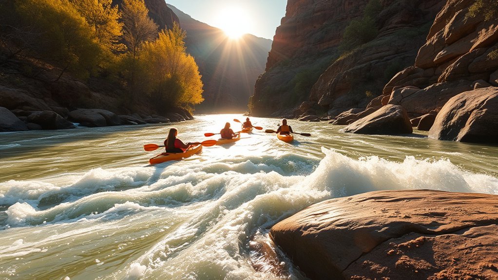
Flowing through central Arizona’s high desert, the Verde River offers one of the Southwest’s premier freshwater paddling experiences. Flanked by towering Fremont cottonwoods, red sandstone bluffs, and diverse riparian wildlife, this rare desert river provides paddling opportunities ranging from gentle Class I family floats near Cottonwood to demanding Class IV multi-day wilderness expeditions below Camp Verde. Planning a successful trip requires understanding flow rates in cubic feet per second (CFS), identifying accessible public put-in points, and preparing for unique desert river hazards.
Quick Answer
The Verde River is best paddled in spring (March to May) and fall (October to November) when water levels and air temperatures are optimal. Safe recreational kayaking requires river flows between 150 and 400 CFS at the Clarkdale or Camp Verde USGS stream gauges. Top public access points include Dead Horse Ranch State Park, White Bridge, and Beasley Flat.
Key Takeaways
- Optimal Flow Windows: Target 150–400 CFS for recreational day floats; flows below 120 CFS require frequent boat dragging, while flows above 1,000 CFS create dangerous high-water hazards.
- Distinct River Sections: The Upper Verde (Clarkdale to Camp Verde) features gentle Class I–II water, whereas the Wild and Scenic segment below Beasley Flat features remote Class III–IV whitewater.
- Seasonal Closures: Certain river banks and reaches are closed between December 1 and June 30 to protect nesting bald eagles.
- Essential Permits: Day floats on the upper river do not require river-running permits, but vehicle parking passes are required at state parks and select US Forest Service trailheads.
At a Glance
| Time Required | 2–4 hours (half-day float) to 3–5 days (multi-day wilderness run) |
| Difficulty | Class I (Beginner) to Class IV (Expert Whitewater) |
| Tools & Equipment | Kayak/Canoe, USCG-approved Type III/V PFD, paddle + spare, dry bags, throw rope, river shoes |
| Cost | $0–$10 day-use parking fees; $45–$85 for third-party commercial boat rentals or shuttles |
Why Paddle the Verde River
The Verde River is one of Arizona’s few remaining free-flowing perennial river systems. Protected in parts under the federal Wild and Scenic Rivers Act and preserved by the Verde River Greenway State Natural Area, it supports one of the most endangered and biologically diverse riparian ecosystems in the United States. Paddling the Verde gives you front-row access to ancient Native American heritage sites, dramatic canyon country, and rare desert wildlife corridors.
Unlike flatwater lakes, the Verde offers continuous motion, tree-canopied channels, and clear desert springs. Because the river navigates a delicate desert biome bordered by private parcels, state land, and national forest reserves, maintaining low-impact recreational ethics—such as packing out all trash and respecting riverbank vegetation—is vital to protecting the corridor for future paddlers.
Best Seasons, Weather, and River Flows
Timing your paddle trip on the Verde River depends on two interrelated factors: seasonal ambient temperature and water discharge rates measured in cubic feet per second (CFS).
- Spring (March to May): The prime season for paddling. Snowmelt from the Mogollon Rim and upper watersheds elevates flows to reliable cruising levels (200–500 CFS), while daytime temperatures range from a comfortable 65°F to 80°F. Early spring water can be cold, requiring synthetic or neoprene thermal layers.
- Fall (October to November): The second peak window. Air temperatures cool significantly, the dense cottonwood and willow canopy turns a brilliant gold, and steady base flows make for peaceful recreational outings.
- Summer (June to September): Extreme caution is required. June brings scorching midday temperatures (exceeding 100°F) and low water levels. July and August bring the North American Monsoon, introducing sudden severe thunderstorms and violent flash flooding downstream.
- Winter (December to February): Offers crisp, clear sunny days and uncrowded waters, but water and air temperatures can drop near freezing, sharply elevating hypothermia risks in the event of a capsize.
Warning: Always check real-time water data on the USGS stream gauge network before launching. For recreational touring kayaks and canoes, optimal flow is 150 to 400 CFS. Below 120 CFS, you will encounter continuous bottom scraping. Above 800 CFS, strainers and submerged brush become exceptionally hazardous, and above 1,200 CFS, the river enters dangerous flood stages.
Skill Levels and River Reaches
The Verde River spans nearly 190 miles from its headwaters near Paulden to its confluence with the Salt River. Paddlers categorize the river into distinct logistical sections based on technical difficulty and wilderness isolation.
| River Reach | Distance | Difficulty | Key Characteristics |
|---|---|---|---|
| Lower TAPCO to Tuzigoot | 3.5 Miles | Class I (Beginner) | Clarkdale cultural stretch, gentle riffles, clear access. |
| Tuzigoot to Dead Horse Ranch | 3.0 Miles | Class I (Beginner) | Canopied corridor, state park takeout, calm pools. |
| White Bridge to Beasley Flat | 10.5 Miles | Class I–II (Intermediate) | Open agricultural and desert valley, minor rock gardens. |
| Beasley Flat to Sheep Bridge | 38.0 Miles | Class III–IV (Expert) | Wild & Scenic canyon, Verde Falls, multi-day wilderness. |
Beginner-Friendly Stretches (Class I)
The Verde River Greenway around Clarkdale and Cottonwood is the premier section for novice paddlers and families. The stretch from the Lower TAPCO River Access to Tuzigoot or continuing into Dead Horse Ranch State Park offers steady, gentle currents with wide channels and low gradient. Hazards here consist mainly of overhanging branches (strainers) and shallow gravel bars. These reaches allow beginners to practice boat trim, eddy turns, and basic rudder strokes in a forgiving environment.
Intermediate Challenge Routes (Class I–II)
Paddlers looking to build intermediate river running skills should head to the Camp Verde Valley. Launching at White Bridge (Highway 260) and paddling down to Clear Creek Access or Beasley Flat introduces tighter switchbacks, swifter currents, minor wave trains, and occasional rock maneuvers. Boaters must actively read downstream water lines, anticipate river splits where shallow gravel bars can ground a craft, and navigate around fallen cottonwood trunks.
Expert Wilderness Expeditions (Class III–IV)
Below Beasley Flat, the Verde River plunges into a rugged, roadless volcanic canyon designated as a federal Wild and Scenic River managed by the US Forest Service (Prescott and Tonto National Forests). This 38-mile run to Sheep Bridge or Horseshoe Reservoir demands whitewater proficiency, self-rescue capabilities, and expedition campcraft.
Key technical hazards include Verde Falls (a mandatory Class IV+ drop/portage), Punk Rock Rapid, and long, continuous boulder slaloms. Once past Beasley Flat, there is no road access or cell coverage until reaching the Sheep Bridge takeout. This run should only be attempted in dedicated whitewater kayaks, packrafts, or self-bailing rafts by prepared backcountry paddlers.
Top Launch Points and Put-Ins
The Verde River Paddle Trail features numerous designated river access points developed by Arizona State Parks, the US Forest Service, and local municipalities:
- Lower TAPCO River Access (Clarkdale): Paved parking, staging area, and concrete boat ramp. Ideal launch point for upper Verde floats.
- Tuzigoot River Access (Clarkdale): Located near Tuzigoot National Monument. Offers a gravel launch with excellent access to the Middle Verde cottonwood canopy.
- Dead Horse Ranch State Park (Cottonwood): Features developed parking, restrooms, camping facilities, and an established river takeout/put-in ramp. A day-use fee or annual Arizona State Parks pass is required.
- White Bridge River Access (Camp Verde / Hwy 260): A USFS developed recreation site with paved parking, vault restrooms, and an engineered access path down to the water.
- Beasley Flat Recreation Site (Camp Verde): The final public take-out point for intermediate day floats and the mandatory staging area for multi-day Wild and Scenic wilderness expeditions. Features vault toilets and gravel boat launch ramps.
Pro Tip: When setting up a self-shuttle between White Bridge and Beasley Flat, drop your boats and gear at White Bridge with a member of your group first, park your retrieve vehicle at Beasley Flat, and drive back together to avoid leaving equipment unattended.
Gear Checklist and Boat Options
Selecting the right watercraft and safety gear is essential for navigating the Verde’s shallow rock bars and rapid-fire river bends.
Recommended Watercraft:
- Sit-on-Top Kayaks (10–12 ft): Durable rotomolded polyethylene kayaks excel on Class I–II day floats. They allow easy re-entry and easily slide over shallow gravel bars.
- Inflatable Kayaks (“Duckies”): Highly forgiving, durable, and puncture-resistant against river rocks; ideal for both intermediate day runs and the rough boulder gardens of the wilderness section.
- Canoes: Suitable for skilled open-water paddlers on the Clarkdale to Dead Horse stretches, though tracking around tight woody strainers requires synchronized teamwork.
- Whitewater Hard-Shell Kayaks: Mandatory for the Class III–IV drops below Beasley Flat.
Essential River Gear:
- USCG-Approved Type III or V Personal Flotation Device (PFD) — must be worn at all times while on the water.
- Kayak paddle with an attached leash or accessible spare paddle.
- Heavy-duty dry bags for electronics, medical supplies, and spare clothing.
- River shoes or neoprene booties with rigid soles (the Verde riverbed has sharp basalt and limestone rocks).
- Wide-brim sun hat, UV-protective clothing (UPF 50+), polarized sunglasses with retaining strap, and broad-spectrum mineral sunscreen.
- Minimum 3 liters of potable drinking water per person per day (desert arid environments accelerate dehydration).
- First aid kit, whistle attached to your PFD, and a river throw bag (rescue rope).
Safety, Regulations, and Permits
Adhering to river etiquette, state boating safety statutes, and federal environmental mandates ensures your excursion remains safe and legal.
River Hazards & Awareness
While the Verde River is accessible, it presents distinct desert hydrology challenges:
- Strainers and Sweepers: Fallen cottonwood trees and overhanging willow thickets are the most dangerous hazard on the Class I–II sections. River currents push boats into submerged branches, which allow water through but trap paddlers underwater. Always steer clear of outside river bends where currents sweep directly into bankside root balls.
- Shallow Gravel Bars: Water levels fluctuate frequently. If you get grounded on a shallow riffle, point your boat downstream, keep your weight centered, and use your paddle to push off rather than standing up in fast-moving current (which creates a foot entrapment risk).
- Hypothermia vs. Heat Stroke: In spring, daytime temperatures can reach 80°F while water temperatures remain in the 40s–50s°F. Dress for the water temperature, not just the air. In summer, excessive heat and direct canyon sun exposure create rapid heat exhaustion risks.
Permits, Rules & Access
Recreational day floats between Clarkdale and Beasley Flat do not require special river-running permits. However, several regional land use rules apply:
- Parking and Day-Use Passes: Parking at Dead Horse Ranch State Park requires state park entry fees. USFS sites along the river (such as White Bridge) may require a Red Rock Pass or America the Beautiful interagency pass.
- Bald Eagle Breeding Closures: The USFS enforces seasonal closures along specific riparian zones (e.g., the Ladders area south of Camp Verde) between December 1 and June 30. Paddlers may float through these corridors without stopping, but landing, hiking, or camping on closed riverbanks is strictly prohibited under federal wildlife protection laws.
- Private Property: Portions of the upper riverbanks pass through private land. Stay within the riverbed’s ordinary high-water mark unless utilizing designated public access points.
“Responsible river stewardship on the Verde ensures that one of the desert Southwest’s last intact riparian corridors remains wild, healthy, and open to future generations.”
Wildlife and Scenic Highlights to Watch For
Because the Verde River represents an oasis in the arid Verde Valley, wildlife activity along the corridor is dense and diverse:
- Mammals: Look for North American river otters, American beavers, mule deer, gray foxes, and javelinas foraging along shaded banks in the early morning and late evening.
- Birdlife: The Verde River corridor is an Audubon-designated Important Bird Area. You will encounter bald eagles, southwestern willow flycatchers, belted kingfishers, great blue herons, and common black hawks.
- Aquatic & Amphibian Life: Native desert fishes such as the roundtail chub and Sonora sucker share water with game fish, softshell turtles, and canyon tree frogs.
Sample Day Trips and Overnight Itineraries
1. Half-Day Scenic Float (3.5 Miles | 2–3 Hours)
Put-in: Lower TAPCO Access | Take-out: Tuzigoot Access
An easy morning paddle through Clarkdale. Features gentle Class I riffles, sweeping views of the historic Clarkdale smelter complex and Tuzigoot ridge, and minimal navigational hazards. Perfect for beginners and families.
2. Full-Day Valley Run (10.5 Miles | 5–6 Hours)
Put-in: White Bridge (Camp Verde) | Take-out: Beasley Flat
A complete journey through the lower Verde Valley. Pack a lunch to enjoy at one of the wide gravel bars near Clear Creek confluence. Expect active paddling with Class I–II riffles and isolated rock gardens before taking out above the canyon threshold at Beasley Flat.
3. Multi-Day Wilderness Expedition (38 Miles | 3–4 Days)
Put-in: Beasley Flat | Take-out: Sheep Bridge / Horseshoe Reservoir
An advanced backcountry adventure through the Wild and Scenic canyon. Requires full self-support whitewater equipment, fire pans, groover human waste systems, and Class III–IV whitewater maneuvering past Verde Falls and Punk Rock.
Note: Multi-day expeditions in the Wild and Scenic reach require packing out all solid human waste in an approved container. Dispersed riverside campsites must follow strict Leave No Trace principles.
Frequently Asked Questions
Are dogs allowed on Verde River paddling trips?
Yes, dogs are permitted on the river and at USFS access points. Within Dead Horse Ranch State Park and developed recreation sites, pets must be kept on a 6-foot leash. Ensure your dog wears a properly fitted canine life jacket (PFD) and protect their paws from hot summer rocks and desert cactus thorns.
Is cell service available along the Verde River?
Cell service is inconsistent throughout the Verde Valley and completely absent in canyon sections. Expect brief reception near urban centers in Clarkdale, Cottonwood, and Camp Verde. For remote stretches below Beasley Flat, carry a dedicated GPS satellite communicator (such as a Garmin inReach) for emergency coordination.
Where can I rent a canoe or kayak nearby?
Commercial outfitters operating out of Clarkdale, Cottonwood, and Camp Verde (such as Verde Adventures and local river outfitters) offer kayak and inflatable boat rentals, self-guided shuttle packages, and guided historic float trips along the upper river reaches.
Are there restroom facilities at launch sites?
Restroom facilities are available at developed state park and USFS recreation hubs, including Dead Horse Ranch State Park, White Bridge, and Beasley Flat. Primitive launch points (such as TAPCO or Clear Creek) have no sanitation amenities; paddlers must plan accordingly and pack appropriate sanitation kits.
Can I fish from my kayak on the Verde River?
Yes. The Verde River offers fishing for smallmouth bass, largemouth bass, channel catfish, and stocked rainbow trout in winter. All anglers aged 10 and older must possess a valid fishing license issued by the Arizona Game and Fish Department.
Conclusion
Paddling the Verde River offers an unmatched perspective on Arizona’s vibrant desert ecology. Whether navigating a gentle afternoon reach beneath the Clarkdale bluffs or gearing up for a multi-day whitewater run through the Wild and Scenic wilderness, proper planning is the key to a safe outing. Check current USGS stream gauge levels, choose a reach aligned with your group’s skill set, pack essential safety gear, and respect local wildlife closures to help protect this vital Arizona river.
Sources
- USDA Forest Service — Verde Wild and Scenic River — Official safety regulations, river reach classifications, and wilderness permit guidelines.
- USGS National Water Dashboard (Arizona) — Real-time discharge data (CFS) for Clarkdale and Camp Verde river monitoring stations.
- Arizona State Parks — Dead Horse Ranch & Verde River Greenway — Public river access points, facility amenities, and environmental conservation details.
- Arizona Game and Fish Department (AZGFD) — Riparian wildlife protections, seasonal bald eagle closure orders, and fishing regulations.