Ponte dei Salti is one of the best-known sights in Switzerland’s Valle Verzasca, but there is an important detail to understand before planning your walk: the famous two-arched stone bridge is already in Lavertezzo. A visit to the bridge itself is therefore a short local walk, while the longer riverside hikes continue from Lavertezzo toward Brione Verzasca or arrive in Lavertezzo from farther up the valley.
Quick Answer
Ponte dei Salti is in Lavertezzo, so there is no 1.5-2-hour hike from Lavertezzo to the bridge itself. From the Lavertezzo, Paese area, it is a short local approach. For a real hike, the official Lavertezzo-Brione route is 6.6 km, about 2 hours, and rated T1/easy.
Key Takeaways
- Ponte dei Salti is located in Lavertezzo itself, not at the end of a 1.5-2-hour walk from the village.
- The official Lavertezzo-Brione Verzasca hike is 6.6 km, takes about 2 hours, climbs 225 m, and is rated T1/easy.
- For a longer hike ending at the bridge, the Sonogno-Lavertezzo stage is 13.6 km, about 3 hours 50 minutes, and T2/moderate.
- The Verzasca River can be dangerous even when the water looks calm and clear. Pay attention to local warning signs, currents, water levels, and slippery rock.
- For public transport, the useful stop for Ponte dei Salti is Lavertezzo, Paese. Summer services through Valle Verzasca can be busy.
At a Glance
| Time Required | Bridge-only visit: a short local walk in Lavertezzo. Lavertezzo-Brione hike: about 2 hours. Sonogno-Lavertezzo: about 3 hours 50 minutes. |
| Difficulty | Bridge visit: easy local sightseeing. Lavertezzo-Brione: T1/easy. Sonogno-Lavertezzo: T2/moderate. |
| Gear Needed | Supportive walking or hiking shoes, water, weather-appropriate layers, sun protection, snacks, and a charged phone. |
| Cost | Official tourism pages do not list an admission ticket for the bridge or hiking trail. Budget separately for public transport, parking, food, or optional activities. |
First, Understand Where Ponte dei Salti Is
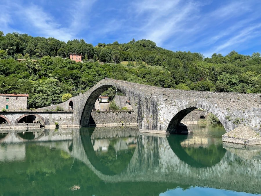
Ponte dei Salti crosses the Verzasca River at Lavertezzo. It is the famous stone bridge with two arches that appears in many photographs of Valle Verzasca. The bridge is also commonly referred to as the “Roman bridge,” although the structure visitors see today is associated with a much later period.
Official tourism information records that the bridge was partially destroyed in 1868 and reconstructed in 1960. A small 18th-century chapel also stands nearby. You can verify the current visitor information on the official Ticino Tourism Ponte dei Salti page.
If your goal is simply to see Ponte dei Salti, you do not need to plan a two-hour hike. The two-hour figure belongs to the longer Lavertezzo-Brione Verzasca walking route.
Terrain and Difficulty of the Trail
The terrain depends on which experience you choose. Around Ponte dei Salti itself, you are visiting a historic stone bridge and a rocky river landscape. The polished rocks beside the Verzasca can become very slippery, especially when wet, so supportive footwear is useful even if you are not doing a long hike.
If you continue from Lavertezzo toward Brione Verzasca, the official route is a genuine valley hike. Ascona-Locarno Tourism rates the 6.6 km route T1/easy, with an estimated duration of about 2 hours and 225 m of ascent. The route begins in Lavertezzo by crossing Ponte dei Salti and then follows the valley toward Brione.
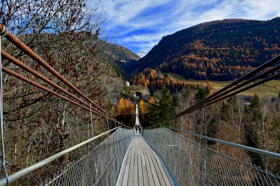
You pass riverside scenery, woodland, a picnic area, the Orgnana waterfall area, and Ganne. At Ganne, the route crosses another bridge and includes some steps before continuing toward Brione.
For a substantially longer outing, the official Sentiero Verzasca stage from Sonogno to Lavertezzo is 13.6 km, takes about 3 hours 50 minutes, and is rated T2/moderate. That route finishes in Lavertezzo, making Ponte dei Salti a natural reward near the end of the hike.
Pro Tip: Decide whether you want a quick bridge visit or a proper hike before choosing your transport stop and schedule. Many confusing route descriptions online mix these two experiences together.
Estimated Time to Complete the Walk
The time you need varies dramatically according to the route you choose. A visit to Ponte dei Salti from the central Lavertezzo area is a short sightseeing walk. You may still spend much longer there if you stop for photographs, explore the village, have a picnic, or sit beside the river.
| Option | Distance / Time | Difficulty |
|---|---|---|
| Lavertezzo village area to Ponte dei Salti | Short local sightseeing walk | Easy, although stone and riverside rock can be uneven |
| Lavertezzo to Brione Verzasca | 6.6 km / about 2:00 h | T1 / easy |
| Sonogno to Lavertezzo | 13.6 km / about 3:50 h | T2 / moderate |
Official hiking times are planning estimates rather than deadlines. Add extra time for rest stops, photographs, food, crowded sections, and any time you spend around the river.
Points of Interest along the Route
| Point of Interest | Description | Location |
|---|---|---|
| Ponte dei Salti | The famous two-arched stone pedestrian bridge over the Verzasca River. | In Lavertezzo |
| Verzasca River and polished rock | Clear water, sculpted granite and river pools create the distinctive landscape associated with Lavertezzo. | Beside and around the bridge |
| 18th-century chapel | A historic chapel noted by the official visitor information for Ponte dei Salti. | Near Ponte dei Salti |
Lavertezzo itself is worth exploring rather than treating it only as a trailhead. Traditional stone buildings, the riverside setting and the historic bridge give the village its distinctive character.
If you continue on the Lavertezzo-Brione route, the walk adds woodland and valley scenery to the experience. An official picnic area appears shortly after Lavertezzo, and farther along you can see the Cascata di Orgnana. The route also passes through Ganne before reaching Brione Verzasca.
The river’s exceptionally clear appearance is one of the main visual attractions, but the water should never be judged by appearance alone. Conditions can change quickly, and inviting-looking pools may contain strong currents or other hazards.
Getting to Lavertezzo and Ponte dei Salti
By Public Transport
PostBus identifies Lavertezzo, Paese as the stop for visiting Ponte dei Salti. Public transport through Valle Verzasca makes it practical to create a one-way hike, for example by starting farther up the valley and returning from Lavertezzo.
PostBus also warns that services in Valle Verzasca can be heavily used during summer. Check the current timetable before travelling and allow extra flexibility on busy days. See the official PostBus Valle Verzasca information for current planning details.
By Car
You can also reach Lavertezzo by road. Parking arrangements and availability can change, especially during busy periods, so follow current local signs rather than relying on an old parking price or an unofficial map. Avoid stopping outside designated parking areas simply to shorten the walk.
Note: Public transport is particularly useful for one-way hikes because both Lavertezzo and other villages along Valle Verzasca are served by the valley bus corridor.
Recommended Gear and Supplies
You do not need technical mountaineering equipment for a simple Ponte dei Salti visit or the official T1 Lavertezzo-Brione route, but suitable footwear is still important. Stone, roots and polished riverside rock can be uneven or slippery.
- Supportive walking or hiking shoes: Choose shoes with dependable grip rather than smooth-soled footwear.
- Water: Carry enough for your planned route, particularly in warm weather.
- Snacks: Useful if you are hiking beyond Lavertezzo rather than making only a bridge visit.
- Weather layers: Pack a light rain layer or extra layer according to the current forecast.
- Sun protection: Sunscreen, sunglasses and a hat are useful on exposed sections.
- Small first-aid kit: Helpful for blisters, small cuts or minor scrapes.
- Charged phone: Keep enough battery for navigation, timetable checks and emergencies.
- Camera or phone: Ponte dei Salti and the Verzasca River are popular photography subjects.
For a longer hike, a small backpack makes it easier to carry water, food and spare layers while keeping your hands free on uneven sections.
River Safety at Ponte dei Salti
Warning: Do not treat the Verzasca as a normal swimming pool. Official Ticino safety guidance warns about sudden water-level rises, very cold water, slippery rocks, strong currents, whirlpools and waterfalls. Obey all signs and local instructions, and do not enter the water when conditions are uncertain.
The clear water around Lavertezzo is visually inviting, and swimming and diving are associated with the area. However, official tourism information specifically warns that the river can hide serious hazards.
Rain elsewhere in the catchment can affect river conditions, so a sunny moment at the bridge does not automatically mean the water is safe. Check the weather before travelling and pay attention to changing water colour, speed and level.
Children require especially close supervision around the river. Keep them away from slippery edges, fast-moving water and unsupervised jumping areas. Do not assume that seeing other visitors in the water proves that conditions are safe for you.
For broader official guidance, read Safe Waters from Ascona-Locarno Tourism.
Tips for a Safe and Enjoyable Hike
Check the current weather before setting out. MeteoSwiss publishes a local forecast for Lavertezzo, which is more useful than relying on a general statement about mountain weather. Review the MeteoSwiss Lavertezzo forecast on the day of your visit.
Start with a realistic route. If you mainly want photographs of Ponte dei Salti, there is no reason to commit to a multi-hour hike. If hiking is the main goal, use a recognized route such as Lavertezzo-Brione or the Sonogno-Lavertezzo stage of Sentiero Verzasca.
Walk at a pace that lets you stay stable on uneven surfaces. Take breaks when needed and stay on marked paths rather than creating shortcuts across vegetation or steep riverbanks.
If you hike alone, tell someone where you are going and when you expect to finish. A companion can be particularly useful on longer routes, but travelling with another person does not remove the need to assess weather, trail and river conditions.
Busy summer days can change the experience considerably. If possible, allow extra time for public transport, narrow trail sections and popular viewpoints around the bridge.
Best Time and Weather Considerations
The official Lavertezzo-Brione route is presented as a year-round route, but actual trail suitability depends on current weather and ground conditions. Snow, ice, heavy rain, thunderstorms or unusually high river levels can make an otherwise easy trail inappropriate.
Warm months are popular because visitors can spend more time beside the river, but they also bring larger crowds and greater temptation to enter the water. Cooler periods may offer quieter sightseeing, although wet or icy stone requires additional care.
Instead of choosing a trip solely by month, check three things before leaving: the MeteoSwiss forecast, current transport information and any warning signs or closures encountered locally.
Facilities and Food
Do not assume that every part of the riverside trail has shops, toilets or drinking-water facilities. Carry the essentials you need for the full walking section.
The official Lavertezzo-Brione route notes restaurants in both Lavertezzo and Brione Verzasca. It also passes a picnic area shortly after Lavertezzo. Opening days and hours can vary, so hikers who depend on a restaurant should check it separately before setting out.
For a short bridge visit, Lavertezzo is much less isolated than the original article suggests. For longer walks between villages, however, carrying water and a snack remains sensible.
Alternative Routes and Extensions
If you want more than a short Ponte dei Salti visit, choose an established Verzasca Valley route rather than simply continuing until you become tired.
Lavertezzo to Brione Verzasca
This is the most natural extension from the bridge. The official Lavertezzo-Brione route is 6.6 km, takes about 2 hours, gains 225 m and is rated T1/easy. Ponte dei Salti is crossed near the beginning.
Brione Verzasca to Lavertezzo
You can reverse the same route and use Ponte dei Salti as your finish. This direction works particularly well if you want the famous bridge to be the final landmark of your walk rather than the starting point.
Sonogno to Lavertezzo
For a longer valley hike, the first official stage of Sentiero Verzasca runs from Sonogno to Lavertezzo. It is 13.6 km, takes approximately 3 hours 50 minutes, descends about 398 m overall, and is rated T2/moderate. This is a much better match for hikers who want several hours beside the Verzasca before reaching Ponte dei Salti.
Continue Farther Along Sentiero Verzasca
Sentiero Verzasca continues beyond Lavertezzo toward the lower valley and Locarno. These longer stages should be planned as proper hikes with enough daylight, water, food and transport coordination rather than treated as small extensions to a bridge visit.
Conclusion and Final Thoughts
Ponte dei Salti is an excellent reason to visit Lavertezzo, but accurate planning starts with understanding that the bridge is already in the village. A bridge-only visit can be short and relaxed, while hikers who want a genuine two-hour walk can follow the official 6.6 km Lavertezzo-Brione route.
For a longer adventure that finishes at the bridge, Sonogno-Lavertezzo offers a 13.6 km, roughly 3-hour-50-minute route through Valle Verzasca. Whichever option you choose, sturdy footwear, current weather information and careful attention around the river are more important than rushing to cover a particular distance.
The landscape around Lavertezzo combines the historic two-arched Ponte dei Salti, clear Verzasca water, polished stone and traditional valley scenery. Taking time to enjoy those features is worthwhile, but river conditions and posted safety information should always determine how close you get to the water and whether swimming is appropriate.
For verified route planning rather than unrelated travel information, use the official Lavertezzo-Brione Verzasca hiking guide.
Frequently Asked Questions
What is the difficulty level of the Lavertezzo to Ponte dei Salti walk?
Ponte dei Salti is already in Lavertezzo, so a bridge-only visit is a short local walk rather than a multi-hour hiking route. If you mean the official Lavertezzo-Brione Verzasca hike, it is rated T1/easy and covers 6.6 km.
How long does it take to complete the Lavertezzo to Ponte dei Salti walk?
There is no 1.5-2-hour hike from Lavertezzo village to Ponte dei Salti because the bridge is in Lavertezzo. A local bridge visit is short. The official Lavertezzo-Brione hike takes about 2 hours, while Sonogno-Lavertezzo takes about 3 hours 50 minutes.
What should I bring with me for the Lavertezzo and Ponte dei Salti walk?
Wear supportive shoes with good grip and bring water, sun protection, weather-appropriate layers and a charged phone. For longer hikes, add snacks and a small first-aid kit.
Are there any facilities along the Lavertezzo to Ponte dei Salti walk?
Lavertezzo has visitor services, and the official Lavertezzo-Brione route notes restaurants in both Lavertezzo and Brione plus a picnic area shortly after Lavertezzo. Do not assume that shops, toilets or drinking water are available along every trail segment.
Is Ponte dei Salti actually in Lavertezzo?
Yes. Ponte dei Salti crosses the Verzasca River at Lavertezzo. Visitors using public transport can use the Lavertezzo, Paese stop for the bridge area.
Can you swim at Ponte dei Salti?
Swimming takes place in the Verzasca, but the river can be dangerous. Official safety guidance warns about strong currents, cold water, slippery rocks, whirlpools and sudden water-level changes. Follow all local signs and stay out of the water whenever conditions are uncertain.
What is the best longer hike that finishes at Ponte dei Salti?
The official Sonogno-Lavertezzo stage of Sentiero Verzasca is a strong option. It covers 13.6 km, takes about 3 hours 50 minutes and is rated T2/moderate, with Lavertezzo and Ponte dei Salti at the end of the route.
Sources
- Ticino Tourism: Ponte dei Salti — bridge location, history and local river warning.
- Ascona-Locarno Tourism: Lavertezzo-Brione Verzasca — official distance, hiking time, difficulty, ascent, route description and facilities.
- Ascona-Locarno Tourism: Sentiero Verzasca Stage 1 — official Sonogno-Lavertezzo distance, duration and difficulty.
- Ascona-Locarno Tourism: Safe Waters — river hazards and official safety guidance.
- PostBus: Valle Verzasca — public-transport access, Lavertezzo, Paese stop and seasonal crowding guidance.
- MeteoSwiss: Lavertezzo Forecast — current official local weather information.