The Mogollon Rim stands as one of Arizona’s most spectacular geographic features, dropping more than 2,000 feet from a dense ponderosa pine plateau down into the rugged valleys of the Tonto National Forest. Stretching roughly 200 miles across central and northern Arizona, this massive escarpment delivers cooler high-country temperatures, panoramic cliffside vistas, premier trout fishing lakes, and deep backcountry solitude. Whether you are navigating the scenic dirt miles of Forest Road 300, hiking along the rim edge, or pitching a tent under starry skies, having an organized plan ensures you make the most of this elevated wilderness.
Quick Answer
The best time to visit the Mogollon Rim is from May through October, when Forest Road 300 is open and accessible. Located roughly two hours northeast of Phoenix near Payson, the Rim sits at 7,000 to 8,000 feet, offering scenic overlooks, popular day hikes like the Rim Lakes Vista Trail #113, and trout fishing at Woods Canyon and Willow Springs lakes.
Key Takeaways
- Prime Driving Route: Forest Road 300 (Rim Road) provides cliff-edge views for 40+ miles; high-clearance vehicles are recommended for unpaved sections.
- Seasonal Planning: Summer brings 75°F–85°F highs but severe afternoon monsoon lightning storms in July and August; winter brings heavy snow and seasonal road closures.
- Water Recreation: Woods Canyon Lake and Willow Springs Lake offer developed boat ramps, kayak rentals, and trout fishing stocked by the Arizona Game and Fish Department.
- Camping Rules: Developed campgrounds require early booking on Recreation.gov; dispersed camping along the FR 300 corridor is restricted to designated numbered sites to protect the rim edge.
At a Glance
| Time Required | Day trip to 3-day weekend trip |
| Difficulty | Easy (paved overlooks) to Strenuous (steep canyon descents) |
| Tools Needed | High-clearance vehicle, offline GPS/topographic maps, bear-resistant storage, rain gear |
| Cost | Free day use; $18–$35/night developed camping; AZGFD fishing license ($15–$37) |
Planning Your Visit and Best Times to Go
Planning a trip to the Mogollon Rim requires matching your itinerary to seasonal weather conditions and elevation changes. Sitting between 7,000 and 8,000 feet above sea level, the rim plateau experiences temperatures 20°F to 30°F cooler than the desert valleys around Phoenix and Tucson.
Spring (April through May): Spring brings crisp days, blooming mountain wildflowers, and melting snowpack. While daytime temperatures range from 55°F to 65°F, forest roads may remain muddy or closed by the U.S. Forest Service until late April or early May to prevent roadbed erosion.
Summer (June through August): Summer is peak season on the Rim, offering an escape from desert heat with daytime highs between 75°F and 85°F. However, July and August introduce the North American Monsoon, which produces sudden, violent afternoon thunderstorms with heavy rain, hail, and frequent lightning along exposed cliff edges.
Warning: The Mogollon Rim’s exposed cliffs are direct lightning targets during summer afternoon monsoon storms. Begin your hikes at sunrise, monitor weather radar, and clear all rim edges and open water by noon when storm clouds build.
Fall (September through October): Fall is widely considered the best time for hiking and photography. Crisp air, daytime highs around 60°F to 70°F, golden turning aspens, and rutting Rocky Mountain elk make September and October ideal for outdoor exploration.
Winter (November through March): Winter brings heavy snowfall, sub-freezing nights, and the seasonal closure of Forest Road 300. State Route 260 remains plowed, giving access to cross-country skiing, snowshoeing, and winter viewing areas, but all unpaved forest access roads are gated.
Scenic Drives, Overlooks, and Photo Spots
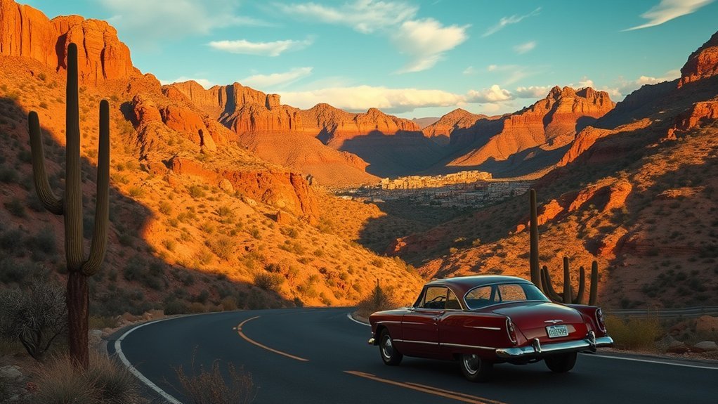
The primary route for sightseers is Forest Road 300 (Rim Road), a 43-mile scenic drive that traces the precipice of the escarpment between State Route 87 (near Strawberry and Pine) and State Route 260 (east of Christopher Creek). While the first few miles from SR 260 to Woods Canyon Lake are paved, the remainder of FR 300 is a graded gravel and dirt forest road suited for high-clearance passenger vehicles.
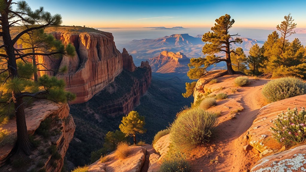
Pull over along Forest Road 300 at dawn or dusk, where layered sandstone cliffs drop 2,000 feet into endless carpets of ponderosa pine and chaparral below.
- Mogollon Rim Visitor Center Overlook: Located right off SR 260, this fully accessible paved overlook offers interpretative plaques, seasonal ranger assistance, and sweeping views across the Tonto Basin.
- Woods Canyon Vista: Situated along the paved eastern portion of FR 300, this overlook provides panoramic sightlines of dramatic canyon contours and the forested floor thousands of feet below.
- Promontory Butte & Overlook: A rugged cliffside pullout along the unpaved section of FR 300 that showcases sheer drops and layered red-and-buff sandstone escarpments.
- Baker Butte (FR 300 West): Marking the highest point on the western edge of the Rim (over 8,000 feet), this area features a historic fire lookout tower location and unobstructed 360-degree views.
Pro Tip: For landscape photography, set up at Woods Canyon Vista 30 minutes before sunrise. Morning light hits the southern face of the escarpment directly, casting deep relief across canyon ridges before afternoon cloud cover rolls in.
Top Trails and Day Hikes
Hiking trails along the Mogollon Rim range from easy, paved rim walks to rugged multi-day loops that plunge below the plateau into thick mixed-conifer canyons. Check trailhead elevations and difficulty ratings before departing, as steep climbs at 7,500 feet tax respiratory systems quickly.
- Rim Lakes Vista Trail #113 (Easy): A mostly level 3.5-mile point-to-point trail (with paved sections near viewpoints) running parallel to FR 300. It provides continuous cliff-edge views into the Tonto National Forest with minimal elevation change, making it ideal for families and casual walkers.
- Woods Canyon Lake Loop Trail (Easy): A scenic 5.2-mile loop hugging the rocky shoreline of Woods Canyon Lake through ponderosa, oak, and Douglas fir forests with frequent bald eagle and waterfowl sightings.
- Horton Creek Trail #285 (Moderate): Starting below the Rim near Kohl’s Ranch, this 7-mile round-trip trail climbs 1,000 feet alongside a crystal-clear spring-fed creek beneath a dense canopy of alder and pine.
- Highline National Recreation Trail #31 (Challenging): An iconic 50-plus-mile historic trail running along the base of the Mogollon Rim escarpment. Day hikers can tackle sections near Washington Park or Pine Trailhead to experience massive vertical rock faces towering directly overhead.
- Cabin Loop Trail System (Advanced Backpacking): A 24-mile backcountry circuit utilizing the Houston Brothers, Barbershop, Fred Haught, and U-Bar trails through deep pine canyons, perennial streams, and historic homesteader cabins.
Note: Trails that drop below the rim (such as the Military Sinkhole Trail #79 or Drew Trail) involve steep, loose switchbacks. Remember that your descent is the easy half; allow twice as much time for the return climb back to the top of the plateau.
Camping, Fishing, and Overnight Options
The Rim Lakes Recreation Area, managed jointly by the Apache-Sitgreaves National Forests and the Coconino National Forest, serves as the hub for overnight camping and freshwater lake recreation.
Developed Campgrounds: Reservable, developed campgrounds are clustered primarily around Woods Canyon Lake and Willow Springs Lake. Top facilities include:
- Aspen Campground: Featuring 136 sites nestled among ponderosa pine and oak, offering vault toilets, potable water, and coin-operated hot showers nearby.
- Spillway Campground: A small, highly sought-after campground located directly on the shoreline of Woods Canyon Lake.
- Sinkhole & Rim Campgrounds: Conveniently positioned near the Rim Road and trail networks, perfect for tent and small RV campers.
- Canyon Point Campground: Located along SR 260, offering both tent spaces and full RV electric hookups.
Reservations for developed campgrounds open six months in advance through Recreation.gov and routinely book out within minutes for summer holiday weekends.
Dispersed Backcountry Camping: Dispersed camping is widely available on U.S. Forest Service land. However, to protect fragile soils and root systems along the edge of the rim, the Forest Service enforces designated-site-only dispersed camping along high-impact corridors of Forest Road 300. Camp only in numbered, established sites marked with official USFS carsonite posts, and carry all necessary water and waste containment.
Trout Fishing: The Rim Lakes—including Woods Canyon Lake, Willow Springs Lake, Bear Canyon Lake, and Knoll Lake—are regularly stocked by the Arizona Game and Fish Department with rainbow trout, brown trout, and tiger trout. Shoreline casting with small spinners, spoons, or powerbait works well in early morning and late evening. Boat rentals and live bait are available seasonally at the Woods Canyon Lake Store.
Safety, Permits, and Leave No Trace Guidelines
Responsible recreation preserves the wild character of the Mogollon Rim and keeps visitors safe in remote mountain terrain:
- Fire Restrictions: Fire bans are frequent during late spring and early summer due to high winds and dry pine needles. Check current Stage 1 or Stage 2 fire restrictions with the Apache-Sitgreaves National Forests or Coconino National Forest before lighting any campfires or charcoal grills. When fires are permitted, drown coals with water and stir until cold to the touch.
- Bear & Wildlife Safety: The Rim is prime black bear, mountain lion, and Rocky Mountain elk habitat. Keep a clean camp: lock all food, trash, and scented items inside a hard-sided vehicle or bear-resistant food canister. Never feed wildlife or approach elk during the fall rut.
- Licenses and Passes: While scenic driving and day hiking on most Forest Service land are free, an Arizona fishing license with a trout stamp is mandatory for all anglers aged 10 and older. Certain day-use recreation areas around the Rim Lakes may require small day-use fees or a valid recreation pass.
- Leave No Trace: Stick to established trails, pack out every piece of trash (including micro-trash and food scraps), bury human waste at least 6 to 8 inches deep and 200 feet away from lakes and streams, and respect quiet hours under the pines.
Frequently Asked Questions
Are there guided cultural or archaeological tours on the Mogollon Rim?
Yes. Local outfitters based in Payson, Pine-Strawberry, and Flagstaff offer seasonal guided excursions covering natural history, geology, and ancestral Mogollon culture. Additionally, the U.S. Forest Service and local historical societies (such as the Rim Country Museum in Payson) provide interpretive historical exhibits and guided ranger talks during peak summer months.
What wildlife viewing etiquette is recommended for photographers?
Always use telephoto lenses (300mm to 600mm) to photograph wildlife without altering their natural behavior. Maintain a minimum safe distance of 100 yards from black bears and at least 50 yards from elk and deer. Never use flash photography at dusk or dawn, avoid surrounding animals, and never use electronic calls to lure wildlife closer.
Are there horse or ATV trails and rental options nearby?
Yes. Off-highway vehicles (OHVs/ATVs) are permitted on designated U.S. Forest Service motorized trails and open gravel roads (such as portions of the Black Canyon and Heber-Overgaard trail systems), provided vehicles are street-legal or display an Arizona OHV decal. Equestrian riding is permitted on most non-wilderness trails, including the Highline Trail #31 and General Crook Trail, with horse trailer parking available at select trailheads.
Can I collect rocks, fossils, or plants as souvenirs?
Under U.S. Forest Service regulations, you may collect small, reasonable quantities of common rocks and invertebrate fossils (such as crinoids and brachiopods) for non-commercial personal use on open public lands. However, the removal of vertebrate fossils, petrified wood, archaeological artifacts, or live plants is strictly prohibited by federal law under the Archaeological Resources Protection Act and Paleontological Resources Preservation Act.
Are there nearby towns with grocery stores and gear shops?
Yes. Payson (approx. 30 miles southwest on SR 87/260) is the primary gateway town, offering major grocery stores, outdoor gear suppliers, urgent care, and restaurants. The smaller communities of Pine, Strawberry, Christopher Creek, and Heber-Overgaard offer local general stores, cafes, gas stations, and cabin rentals closer to the rim plateau.
Conclusion
Visiting the Mogollon Rim provides a refreshing combination of cool high-country ponderosa forests, crisp mountain breezes, and sweeping panoramic views across central Arizona. Whether you spend a single afternoon taking in the views along Forest Road 300, paddle across Woods Canyon Lake at sunrise, or spend a multi-day weekend backpacking through deep pine canyons, careful preparation makes all the difference. Check seasonal fire restrictions, plan around afternoon monsoon storms, follow Leave No Trace ethics, and enjoy one of the American Southwest’s premier natural landmarks.
Sources
- USDA Forest Service — Apache-Sitgreaves National Forests — Official guidelines for Rim Lakes recreation, road statuses, and designated dispersed camping.
- USDA Forest Service — Coconino National Forest — Forest Road 300 seasonal closures, fire danger ratings, and trail management.
- Arizona Game and Fish Department — Trout stocking schedules, lake access rules, and state fishing licensing.
- Recreation.gov — Public campground booking windows and site availability for Woods Canyon, Aspen, and Canyon Point campgrounds.