The Saxer Luecke hike, more commonly written locally as Saxerlücke, is one of the standout mountain hikes in the Alpstein region of eastern Switzerland. The best-documented full route follows the Geological Hiking Trail from Hoher Kasten through Staubern and Saxerlücke before descending past Fählensee and Sämtisersee to Brülisau. It combines exposed ridge scenery, mountain inns, alpine landscapes and some of the region’s most distinctive rock formations.
Quick Answer
The most reliable full-day Saxer Luecke route is the official Geological Hiking Trail from Hoher Kasten to Brülisau via Staubern, Saxerlücke, Bollenwees and Sämtisersee. It is about 16.21 km, takes around 5½ hours, and follows a red-white-red mountain trail with partly exposed terrain and substantial descent.
Key Takeaways
- The official full route through Saxerlücke is about 16.21 km and normally takes around 5 hours 30 minutes of hiking time.
- The route starts at Hoher Kasten, normally reached by cableway from Brülisau, rather than starting in Appenzell village.
- It is a red-white-red mountain hiking trail rated T2 by Appenzellerland, with partly exposed sections that require sure-footedness.
- Major highlights include Staubern, Saxerlücke, the Kreuzberge formations, Fählensee, Bollenwees and Sämtisersee.
- Mountain inns provide food and rest opportunities, but opening hours and cableway operations should always be checked before departure.
At a Glance
| Time Required | About 5 hours 30 minutes of hiking, plus breaks and cableway time |
| Difficulty | Moderate mountain hike, T2; red-white-red trail with some exposed terrain |
| Tools Needed | Good hiking shoes, weather layers, water, food, sun protection and a map or offline navigation |
| Cost | The hiking trail is free; cableway, parking, meals and other transport cost extra |
Warning: Do not treat Saxerlücke as an easy sightseeing walk. Parts of the ridge are exposed, and wet rock, fog, wind or thunderstorms can make a manageable T2 mountain trail significantly more hazardous. Check the weather and current trail status before leaving.
Trail Overview and Difficulty Level
The most useful route to describe as the complete Saxer Luecke hike is the official Geological Hiking Trail. It follows Hoher Kasten → Staubern → Saxerlücke → Bollenwees → Sämtisersee → Plattenbödeli → Brülisau.
Appenzellerland Tourismus lists the route at 16.21 km, with about 652 m of ascent and 1,521 m of descent. Allow roughly 5 hours 30 minutes of hiking time before longer food, photography or rest stops.
Official full-route figures: 16.21 km, approximately 652 m ascent, 1,521 m descent and 5 hours 30 minutes of hiking.
The trail is marked red-white-red and is rated T2 on the SAC hiking scale by Appenzellerland. Hoher Kasten describes the Geological Hiking Trail as medium-difficult and notes that the ridge is partly exposed. This means you should be comfortable on mountain paths, have steady footing and wear proper hiking shoes.
Saxerlücke itself is a mountain gap at roughly 1,649 m. The route does not simply climb steadily to a high summit. Instead, it follows the southern Alpstein chain before descending heavily toward Fählensee and Brülisau.
Hoher Kasten to Staubern
The day usually begins with the cableway from Brülisau to Hoher Kasten. From the summit area, the red-white-red trail follows the southern Alpstein ridge toward Staubern. This section delivers wide views over the Rhine Valley and the surrounding mountains, but it also includes terrain where attention and steady footing matter.
Staubern to Saxerlücke
From Berggasthaus Staubern, continue along the ridge toward Saxerlücke. Geological formations become one of the main attractions here. The official Geological Trail includes interpretation panels explaining folds, faults, fossils, weathering and the geological development of the Alpstein.
Saxerlücke is especially recognizable because of the dramatic Kreuzberge rock formations beside the gap. It is one of the route’s best-known photography locations.
Saxerlücke to Bollenwees and Brülisau
After Saxerlücke, the route descends toward Fählensee and Berggasthaus Bollenwees. From there, the standard itinerary continues via Sämtisersee and Plattenbödeli before returning to Brülisau.
The large amount of descent is easy to underestimate. Even if the route’s technical rating is moderate, tired legs and knees can make the final stages demanding.
Pro Tip: Budget extra time beyond the published 5½ hours if you plan to eat at a mountain inn, stop for photography or spend time beside Fählensee. The official figure is hiking time, not a relaxed door-to-door day.
How to Get to the Saxer Luecke Hike
Brülisau is the practical starting base for the full route. The Hoher Kasten arrival guide explains access by both public transport and car.
By Public Transport
You can travel toward Appenzell and Weissbad by Appenzell Railways. From Weissbad station, a PostBus connection serves the lower Hoher Kasten cableway station in Brülisau. Check the current SBB timetable before travel because connections can change seasonally.
By Car
Drivers can reach Brülisau through Appenzell and either Steinegg or Weissbad. Paid parking is available around the Hoher Kasten lower station, with additional arrangements sometimes used on busy days. Because parking conditions can change, check the official arrival page before driving.
Hoher Kasten Cableway
The Hoher Kasten cableway carries hikers from Brülisau to approximately 1,794 m in about eight minutes. Timetables, operating status and fares change, so use the official Hoher Kasten cableway page when planning your hiking day.
Shorter Access via Staubern
If you do not want to complete the full Hoher Kasten-to-Brülisau itinerary, another approach is to use the Frümsen–Staubern cableway and join the mountain trail at Staubern. From there, you can hike toward Saxerlücke and design a shorter out-and-back trip.
Do not assume this shorter version has the same distance or hiking time as the full Geological Trail. Plan your exact turnaround point and transport before departure.
Best Time to Hike Saxer Luecke
The official Hoher Kasten Geological Hiking Trail page lists the normal hiking season as approximately late June through October.
That does not mean the trail is automatically safe throughout those months. Snow can linger early in the season, storms can arrive during summer, and autumn conditions can change quickly.
- Early season: Check for remaining snow and wet sections before committing to the ridge.
- Summer: Start early, carry sun protection and watch the thunderstorm forecast.
- Autumn: Cooler temperatures can be excellent for hiking, but daylight is shorter and early ice or snow is possible.
Note: Trail conditions are dynamic. Check Appenzellerland’s current trail-condition update and the relevant cableway status on the morning of your hike.
What to Bring and Wear for the Hike
Preparation matters on the Saxer Luecke hike because the trail includes rocky ground, exposed mountain sections and a long descent. Wear sturdy hiking footwear with good traction. Proper shoes are more important here than lightweight casual trainers.
Use layers so you can adapt to changing temperatures. A moisture-managing base layer, a warm layer and a waterproof or wind-resistant outer layer provide more flexibility than one heavy item.
A practical day-hiking pack should include:
- Enough drinking water for your planned route
- Snacks or lunch, even if you intend to stop at a mountain inn
- Waterproof or wind-resistant outer layer
- Warm layer for exposed sections
- Sun protection, sunglasses and a hat
- Small first-aid kit
- Phone with sufficient battery
- Offline map, GPX route or another reliable navigation method
- Trekking poles if you normally use them on long descents
Mountain inns can provide welcome food and drink stops, but you should never make your safety depend on a restaurant being open. Seasonal schedules, weather or operational issues can affect availability.
Flora and Fauna Along the Trail
The changing elevation, alpine meadows, rocky slopes and ridge terrain support a variety of mountain plants and wildlife. The official Hoher Kasten Geological Trail material shows alpine vegetation as well as animals such as marmots and alpine choughs, but sightings are never guaranteed.
| What You May Encounter | Where or When | Best Practice |
|---|---|---|
| Alpine flowers and grasses | Meadows and mountain slopes, especially during the warmer hiking season | Stay on the trail and leave plants where they grow |
| Marmots | Alpine grass and rocky areas | Watch quietly from a distance and never feed them |
| Alpine choughs | Mountain ridges and areas around viewpoints or inns | Do not offer food or leave scraps behind |
| Grazing cattle | Alpine pastures along regional hiking routes | Keep your distance, move calmly and keep dogs under close control |
Wildflowers add significant color to the Alpstein during the warmer months, but exact species and flowering periods vary with elevation, weather and season. Rather than picking flowers or leaving the marked path for photographs, enjoy them from the trail.
If you encounter wildlife, give animals space. Do not chase them for photographs, play calls or sounds to attract them, or leave food behind.
Points of Interest and Scenic Views
The Saxer Luecke hike is memorable because the scenery changes repeatedly along the route rather than depending on a single viewpoint.
Hoher Kasten
Hoher Kasten provides an elevated start with broad views across the Alpstein, Rhine Valley and surrounding regions. It is also where the Geological Hiking Trail begins.
Staubern
Staubern is both a scenic ridge stop and a practical rest point. Berggasthaus Staubern sits along the route and replaces the incorrectly described “Säntis mountain hut” sometimes associated with this hike.
Saxerlücke and the Kreuzberge
Saxerlücke is the signature location of the hike. The striking gap and nearby Kreuzberge rock formations create the dramatic landscape commonly seen in photographs of this part of the Alpstein.
Fählensee and Bollenwees
After descending from Saxerlücke, hikers reach Fählensee, a narrow mountain lake enclosed by steep terrain. Berggasthaus Bollenwees sits beside the lake and is one of the most useful places for a longer rest.
Sämtisersee
The return toward Brülisau passes another major Alpstein lake, Sämtisersee, adding a very different landscape to the ridge scenery from earlier in the day.
The combination of ridge walking, geological formations, mountain lakes and traditional mountain inns gives the route much more variety than a simple out-and-back viewpoint hike.
Safety Tips and Trail Etiquette
Check the weather forecast and trail conditions before leaving. Mountain weather can change quickly, and a partly exposed ridge is not a good place to discover that strong wind, heavy rain or thunderstorms have arrived sooner than expected.
Starting early gives you more time for unexpected delays and reduces the risk of finishing after dark. Tell someone where you are going if you are hiking alone.
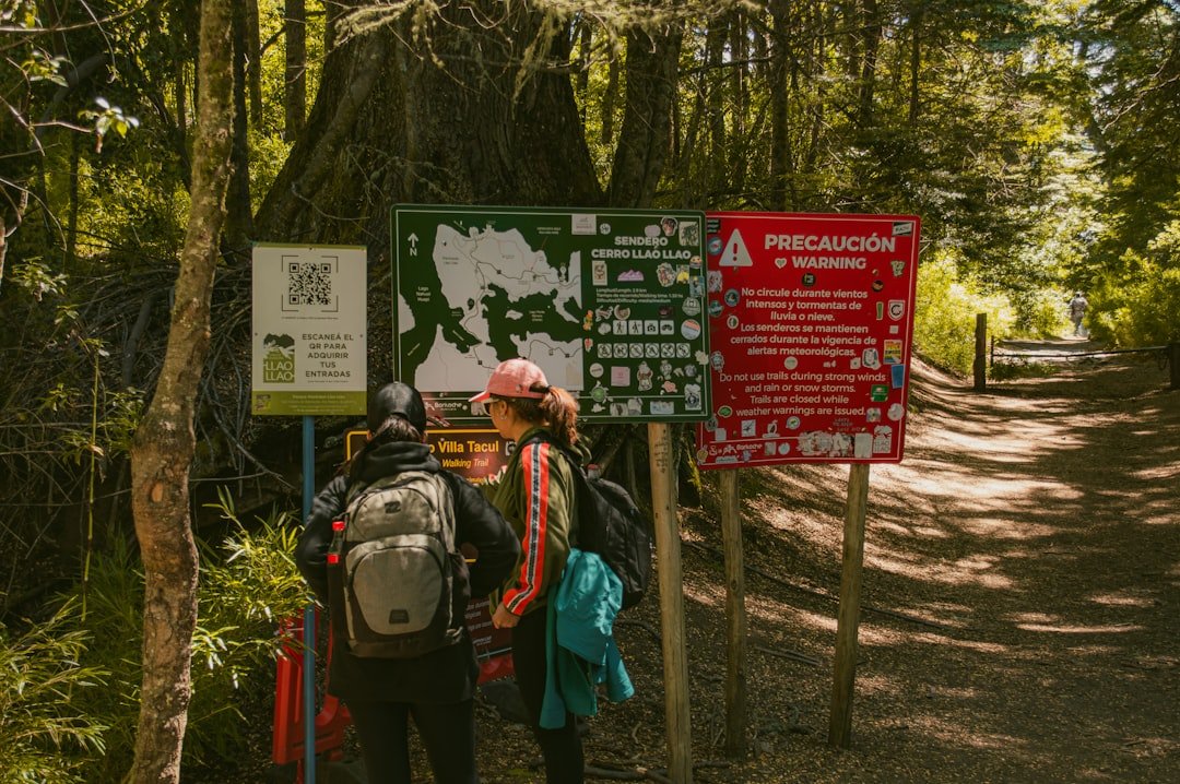
According to Hoher Kasten’s mountain hiking guidance, red-white-red trails can be steep, narrow and partly exposed. Hikers should be sure-footed, comfortable with heights, physically prepared and equipped with appropriate footwear.
- Follow official signs and remain on marked trails.
- Turn around if weather or trail conditions become unsafe.
- Carry sufficient drinking water.
- Close pasture gates after passing through.
- Give grazing livestock plenty of space.
- Keep dogs under control around cattle and wildlife.
- Pack out all rubbish.
- Avoid unnecessary noise around wildlife and other hikers.
Warning: In a serious emergency in Switzerland, call 112. For an ambulance, call 144. Give rescuers your location as accurately as possible and avoid moving into greater danger while seeking phone reception.
Is Saxer Luecke Suitable for Children?
The full route should not be described as suitable for every family simply because it is technically rated T2. It is long, includes more than 1,500 m of descent and follows partly exposed mountain terrain.
Older, mountain-experienced children who are sure-footed may be comfortable with the route when accompanied by capable adults in good weather. Younger children, inexperienced walkers or anyone uncomfortable with exposure should choose an easier Alpstein walk instead.
Trail Maintenance and Conservation Efforts
Marked mountain trails in the Alpstein depend on ongoing route inspections, signage, erosion management and responsible behavior from hikers. Staying on the official path helps limit damage to vegetation and reduces disturbance to wildlife.
Follow posted signs, close gates, avoid damaging alpine meadows and take all rubbish back to the valley. These simple actions reduce pressure on a landscape that receives many visitors during the main hiking season.
Drone users also need to know that the Alpstein has special restrictions. Appenzellerland Tourismus states that a cantonal flight ban for drones and other unmanned aircraft has applied within the designated Alpstein perimeter since November 1, 2020, primarily for wildlife protection. Check the official map and current regulations before bringing a drone.
Respecting these rules helps protect both wildlife habitat and the experience of other hikers.
Nearby Amenities and Additional Activities
Appenzell remains a useful regional base even though it is not the trailhead. The town offers hotels, guesthouses, restaurants and opportunities to experience Appenzeller culture before or after a hiking day.
Brülisau is more directly connected to the full Saxerlücke route because it contains the Hoher Kasten cableway station and is where the official Geological Hiking Trail finishes. Weissbad is another convenient nearby base with transport connections toward Brülisau.
Along the standard route, possible refreshment stops include the Hoher Kasten restaurant, Berggasthaus Staubern, Berggasthaus Bollenwees and Berggasthaus Plattenbödeli. Always confirm seasonal opening before relying on a particular stop.
Visitors who have more time can explore additional Alpstein hiking routes, mountain lakes, traditional Appenzeller villages and local cultural attractions. The region contains hikes ranging from easy valley walks to much more demanding mountain routes, so you can choose another outing based on your fitness and weather conditions.
For a completely different food-focused read after planning your hiking trip, the existing site also features Exploring the Delightful World of Asian Melon, covering several varieties and flavors of Asian melons.
Frequently Asked Questions
What is the Saxer Luecke hike trail?
Saxerlücke is a mountain gap in the Alpstein region of eastern Switzerland. One of the best-documented hikes through it is the Geological Hiking Trail from Hoher Kasten via Staubern and Saxerlücke to Bollenwees, Sämtisersee and Brülisau.
How long is the Saxer Luecke hike?
The official full Geological Hiking Trail through Saxerlücke is approximately 16.21 km and takes about 5 hours 30 minutes of hiking. Shorter hikes are possible from Staubern, so distance depends on the exact route you choose.
What is the difficulty level of the Saxer Luecke hike?
Appenzellerland rates the full route as moderate and T2 on the SAC hiking scale. It is a red-white-red mountain trail with partly exposed sections, so you should be sure-footed, reasonably fit and comfortable on mountain terrain.
What are the main highlights of the Saxer Luecke hike?
Highlights include the views from Hoher Kasten, the ridge near Staubern, Saxerlücke and the Kreuzberge formations, Fählensee beside Berggasthaus Bollenwees, Sämtisersee and the geological interpretation points along the route.
Are there facilities along the Saxer Luecke route?
Yes. The official route lists several mountain inns or restaurants, including Hoher Kasten, Staubern, Bollenwees and Plattenbödeli. Opening hours are seasonal, so confirm availability before relying on them for food or drinks.
What should hikers bring for the Saxer Luecke hike?
Bring sturdy hiking shoes, sufficient water, food, sun protection, warm and waterproof layers, a small first-aid kit and reliable navigation. Trekking poles can also be helpful because the full route includes a long descent.
When is the best time to hike Saxer Luecke?
Hoher Kasten lists the normal season for the Geological Hiking Trail as approximately late June through October. Actual conditions vary, so check current trail status, weather and cableway operations immediately before your hike.
Can children hike to Saxer Luecke?
Mountain-experienced, sure-footed older children may be able to complete the route with capable adults in good conditions. The full trail is long and partly exposed, so it is not an appropriate all-level family walk or stroller-friendly route.
Sources
- Appenzellerland Tourismus: Geological Hiking Trail — official route, distance, elevation gain/loss, hiking time, difficulty, waypoints and mountain inns.
- Hoher Kasten: Geological Hiking Trail — season, trail markings, exposure, scenery and route characteristics.
- Hoher Kasten: Trail Conditions and Hiking Guidance — mountain-trail markings, equipment and safety guidance.
- Swiss Alpine Club: Grading Systems — official Swiss hiking difficulty framework.
- Swiss Confederation: Emergencies and Danger — Swiss emergency telephone numbers.
- Appenzellerland Tourismus: Alpstein Drone Rules — wildlife-protection drone restrictions in the Alpstein.