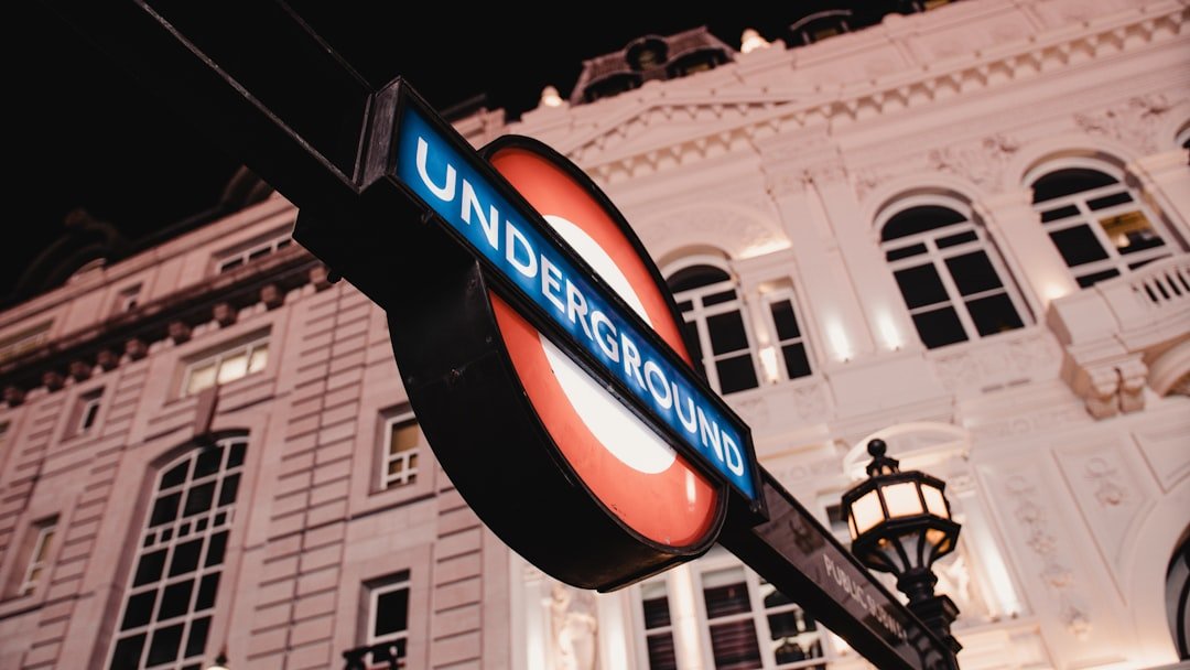
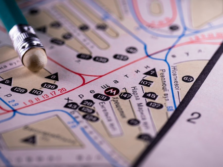
The key to effectively using a map, particularly in the context of the London Underground, lies in understanding its fundamental components. The map is not merely a representation of the physical layout of the Tube system; it is a carefully designed tool that conveys a wealth of information in a compact format. At first glance, the map may appear overwhelming, with its myriad lines, colors, and symbols.
However, once one familiarizes themselves with the key elements, navigating the Tube becomes significantly more manageable. The key typically includes essential information such as line colors, station names, and transfer points. Each line is represented by a distinct color, which helps users quickly identify their route.
For instance, the Central Line is marked in red, while the Piccadilly Line is blue. This color-coding is not arbitrary; it serves to streamline the process of finding one’s way through the network. Additionally, the key often highlights important features such as interchange stations, where passengers can switch from one line to another.
Understanding these elements is crucial for both new and seasoned travelers, as it allows for quicker decision-making and reduces the likelihood of confusion during transit.
Key Takeaways
- Understanding the Key: Familiarize yourself with the color-coded lines and symbols on the Tube map to understand the different routes and connections.
- Navigating the Lines and Zones: Learn about the different zones and lines on the Tube map to plan your journey efficiently and avoid unnecessary transfers.
- Interpreting the Symbols and Icons: Understand the various symbols and icons on the map to identify stations with accessibility features, interchanges, and other important information.
- Reading the Map for Accessibility: Use the Tube map to locate accessible stations and plan your journey accordingly if you have mobility needs.
- Finding Your Way with the Night Tube: Take advantage of the Night Tube service by checking the map for the available lines and stations during late-night hours.
- Using the Tube Map for Tourist Attractions: Use the Tube map to locate stations near popular tourist attractions and plan your sightseeing itinerary efficiently.
- Tips for Efficient Travel: Utilize the Tube map to plan your route in advance, avoid peak hours, and consider alternative routes to save time during your journey.
- Utilizing Apps and Online Resources: Explore the various apps and online resources available to access real-time updates, plan your journey, and navigate the Tube system more effectively.
Navigating the Lines and Zones
Navigating the lines and zones of the London Underground requires an understanding of both the geographical layout and the operational structure of the system. The Tube network is divided into several zones, with Zone 1 encompassing central London and subsequent zones radiating outward. This zonal system is essential for fare calculation and helps passengers determine the cost of their journey based on their starting point and destination.
For example, traveling from a station in Zone 1 to one in Zone 3 will incur a different fare than traveling between two stations within Zone 1. Moreover, each line on the Tube map has its own unique route that may not always follow a straight path. Some lines curve and weave through various neighborhoods, while others may have branches that lead to different destinations.
Understanding these nuances is vital for effective navigation. For instance, if a traveler intends to reach a specific station on the Northern Line, they must be aware of whether they need to board a train heading towards High Barnet or Mill Hill East, as these branches diverge at certain points. Familiarity with the lines and their respective zones not only aids in planning routes but also enhances the overall travel experience by minimizing delays and confusion.
Interpreting the Symbols and Icons
The London Underground map employs a variety of symbols and icons that convey critical information about services and facilities available at each station. These symbols are designed to be intuitive, allowing passengers to quickly grasp what amenities they can expect at their chosen stop. For example, a symbol depicting an escalator indicates that there are escalators available for those who may have difficulty with stairs, while a wheelchair icon signifies that a station is accessible for individuals with mobility challenges.
In addition to accessibility features, other symbols denote services such as ticket machines, restrooms, and connections to other forms of transportation like buses or trains. Understanding these icons can significantly enhance a traveler’s experience by ensuring they are well-prepared for their journey. For instance, if someone knows that their destination station has no restroom facilities, they can plan accordingly before embarking on their trip.
Furthermore, some stations may have additional services such as bike racks or car parking facilities, which are also indicated by specific icons on the map.
Reading the Map for Accessibility
Accessibility is a crucial consideration when navigating the London Underground, and the map provides valuable information regarding which stations are equipped to accommodate passengers with disabilities or those requiring additional assistance. The map often highlights accessible stations with specific symbols or color coding, making it easier for travelers to identify routes that will meet their needs. For instance, stations that feature step-free access from street level to platform level are marked distinctly on the map.
This feature is particularly important for individuals using wheelchairs or those with limited mobility. Additionally, many stations offer assistance services such as staff members who can help guide passengers or provide support when boarding trains. Understanding how to read these accessibility indicators can empower travelers to make informed choices about their routes and ensure a smoother journey through the Tube system.

Finding Your Way with the Night Tube
The Night Tube service offers an alternative for those who wish to travel during late-night hours when other forms of public transport may be limited. Operating on select lines during weekends, this service allows passengers to navigate London’s nightlife with ease. The Night Tube map is similar to the standard Tube map but highlights specific lines that operate overnight, providing clarity on which routes are available after regular service hours.
Travelers should be aware that not all stations are open during Night Tube hours; therefore, it is essential to consult both the standard map and any additional information provided about Night Tube services. For example, while the Central Line operates throughout the night on weekends, some stations may close earlier than others due to maintenance or safety considerations. Familiarizing oneself with these details can prevent unnecessary delays and ensure that travelers reach their destinations safely and efficiently.
Products Worth Considering

A World scratch off Map... as travellers our selves we always found something missing in maps, so we decided to design our own and make it the perfect scratch off Travel Map, by adding a bunch of extra features that other maps simply don't have. As well as providing complete Accessories and a fantastic name tagged Gift Box.

A United States scratch off Map... as travellers our selves we always found something missing in maps, so we decided to design our own and make it the perfect scratch off Travel Map, by adding a bunch of extra features that other maps simply don't have. As well as providing complete Accessories and a fantastic name tagged Gift Box.
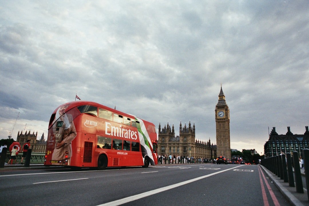
Using the Tube Map for Tourist Attractions
The London Underground map serves as an invaluable resource for tourists seeking to explore the city’s many attractions. Major landmarks and points of interest are often located near Tube stations, making it easy for visitors to plan their itineraries around public transport routes. For instance, travelers wishing to visit the British Museum can easily locate it near Holborn Station on the Central Line or Piccadilly Line.
Additionally, many maps include annotations or highlights indicating popular tourist destinations such as Buckingham Palace, the Tower of London, or Covent Garden. By leveraging this information, tourists can create efficient travel plans that maximize their time spent exploring rather than navigating complex transit routes. Moreover, understanding how to read the map in conjunction with local attractions allows visitors to discover hidden gems that may not be as widely advertised but are easily accessible via the Tube.
Products Worth Considering

easy to read, laminated, water proof, pocket size, up to date

Pocket-Sized London Guide
Tips for Efficient Travel
To navigate the London Underground efficiently, travelers should adopt several strategies that can enhance their overall experience. First and foremost, it is advisable to plan journeys in advance by consulting both the Tube map and real-time service updates. This preparation can help avoid unexpected delays due to maintenance work or service disruptions that may affect specific lines or stations.
Another useful tip is to travel during off-peak hours whenever possible. The Tube can become extremely crowded during rush hours, making it challenging to board trains or find comfortable seating. By traveling outside of these peak times—typically between 7:30 AM and 9:30 AM and 5:00 PM to 7:00 PM—passengers can enjoy a more pleasant journey with less congestion.
Additionally, utilizing contactless payment methods such as Oyster cards or contactless debit/credit cards can streamline fare payments and reduce wait times at ticket machines.
Utilizing Apps and Online Resources
In today’s digital age, numerous apps and online resources complement traditional maps and enhance navigation through the London Underground system. Official apps like Transport for London (TfL) provide real-time updates on train schedules, service disruptions, and even crowding levels at various stations. These tools allow travelers to make informed decisions about their routes based on current conditions.
Moreover, third-party apps often offer additional features such as journey planners that take into account various factors like walking distances between connections or estimated travel times based on live data. Some apps even provide accessibility information tailored specifically for users with mobility challenges. By leveraging these technological resources alongside traditional maps, travelers can optimize their journeys through London’s extensive Tube network while enjoying a more seamless travel experience.
If you’re a fan of exploring new places, you may also enjoy reading about the delightful world of Asian melon. This article on
Written by Hunter James
Hunter James is the founder of TaglineToday.com, a product review expert, and a digital trends analyst. He created Tagline Today to help everyday shoppers find honest reviews, trending picks, and practical recommendations without wasting time or money. Hunter writes about automotive products, tools, home gadgets, tech accessories, pet products, travel topics, and other consumer items. His reviews focus on product usefulness, key features, value, and real-world buying decisions. Many recent articles on Tagline Today are written by Hunter James, especially in the automotive and product review categories. Through Tagline Today, Hunter aims to make online shopping easier for readers. His content follows a clear promise: cut through hype, compare useful details, and give practical advice that helps people buy smarter.