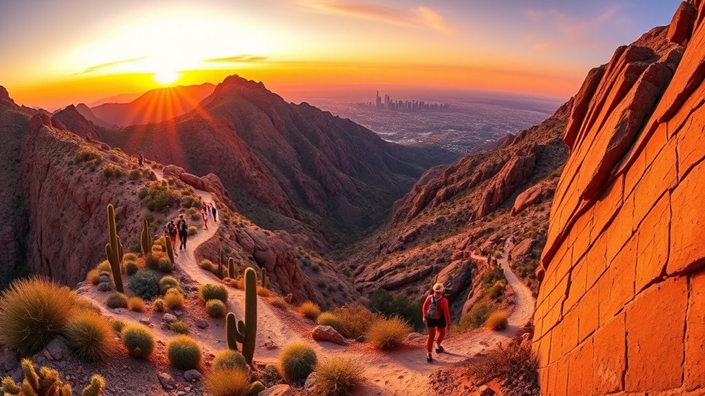
Ascending Camelback Mountain is an essential Phoenix outdoor experience, offering rugged red sandstone climbs and 360-degree panoramic views across the Sonoran Desert and the Valley of the Sun. Rising to 2,704 feet in elevation, this iconic landmark features two challenging summit routes: Echo Canyon Trail and Cholla Trail. Choosing the right path requires understanding the intense physical demands, steep scrambling sections, and strict municipal park regulations that govern both trailheads.
Quick Answer
Camelback Mountain has two official summit routes: Echo Canyon Trail (1.2 miles one-way, 1,420 ft gain), which is steeper and features intense boulder steps and handrails, and Cholla Trail (1.42 miles one-way, 1,350 ft gain), which is slightly more gradual before a final ridgeline scramble. Both are rated extremely difficult, feature free parking, and strictly prohibit dogs.
Key Takeaways
- Two Sanctioned Trails: Echo Canyon and Cholla are the only official hiking trails to the summit; off-trail climbing is illegal and dangerous.
- Strict Dog Ban: Dogs are completely prohibited on all Camelback Mountain summit trails year-round by city ordinance.
- Free Trailhead Access: Parking is free at both trailheads, but spaces fill quickly before sunrise.
- Summer Heat Closures: Both trails close from 11:00 AM to 5:00 PM on days with National Weather Service Excessive Heat Warnings.
- Mandatory Supplies: Carry at least 1–2 liters of water per person, wear footwear with aggressive rubber traction, and protect against direct desert sun exposure.
At a Glance
| Time Required | 2 to 3 hours round-trip |
| Difficulty | Extremely Difficult (Double Black Diamond / Hand Scrambling) |
| Gear Needed | Grippy trail runners/boots, 1.5–2L water, sun protection, lightweight gloves |
| Cost & Permits | Free; no permits required (park open sunrise to sunset) |
Warning: The City of Phoenix Parks and Recreation Department enforces mandatory closures on both Echo Canyon and Cholla trails between 11:00 AM and 5:00 PM during National Weather Service Excessive Heat Warnings. Attempting to hike in high heat can lead to fatal heat illness and requires dangerous helicopter rescues.
Echo Canyon Trail — Steep, Direct, and Iconic
Climbing sharply from its western trailhead, Echo Canyon Trail delivers an intense, full-body cardiovascular workout across 1.2 miles (2.4 miles round-trip) with an elevation gain of 1,420 feet. The trail begins with a steep gravel grade and a sequence of oversized railroad-tie steps before arriving at the base of the first major test: a steep rock chute equipped with a double metal handrail. This section demands upper-body assistance and confident footing on polished rock surfaces.
Beyond the handrail section, the path navigates the massive sandstone formations of the “Camel’s Head” via the Echo Canyon Saddle, which provides a brief flat spot with panoramic views of Paradise Valley. The upper half of the trail transitions into open boulder fields where you must scramble over granite and sandstone ledges. Maintain three points of contact on technical rock steps, yield to uphill hikers, and wear sturdy trail shoes with aggressive rubber grip to handle loose scree and slick surfaces.
Cholla Trail — Ridgeline Scramble with Gradual Ascent
Approaching from the east, Cholla Trail spans 1.42 miles one-way (roughly 2.85 miles round-trip) with 1,350 feet of elevation gain. The trail begins along Invergordon Road and winds steadily through Sonoran Desert vegetation, including saguaros, cholla cacti, and brittlebush. Because its lower two-thirds ascend via wide, continuous switchbacks along the mountain’s shoulder, Cholla allows you to settle into a consistent cardiovascular rhythm while soaking in sweeping views of Scottsdale and the McDowell Sonoran Preserve.
The character of the hike shifts dramatically once you reach the Cholla Saddle. The final third transitions into an exposed ridgeline scramble along the spine of the mountain. Hikers must negotiate narrow traverses, step across rocky crevices, and follow blue trail blazes painted on the rocks to remain on the safe ascent line. Morning ascents on Cholla often benefit from western ridgeline shade pockets, but the open spine remains fully exposed to wind and desert sun.
Pro Tip: When scrambling up the upper boulder fields on either trail, look ahead for the painted color markers on the rock faces. Following designated blazes keeps you on established, stable routes and prevents you from getting cliffed out above loose drop-offs.
Trail Route Logistics: Summit Traverse and Safety Compliance
Unlike park networks with multiple interconnected loops, Camelback Mountain features only two sanctioned hiking trails. Hikers looking for a comprehensive trek can complete the Summit Traverse by ascending Echo Canyon and descending Cholla (or vice versa), covering approximately 2.6 miles. Because the trailheads are located on opposite sides of the mountain, this traverse requires utilizing a rideshare service or staging two vehicles.
City of Phoenix park ordinances strictly prohibit off-trail hiking, unofficial shortcuts, and unmaintained ridgeline detours. Deviating from the designated paths accelerates severe desert soil erosion, damages native flora, and is the leading cause of emergency search-and-rescue dispatches. Sticking strictly to the marked trail alignments ensures safe passage and protects the fragile mountain habitat.
Note: Parking lots at both Echo Canyon (4925 E McDonald Dr) and Cholla (along Invergordon Rd) fill rapidly. For morning hikes from October through April, lots routinely fill 30 to 45 minutes before official sunrise. Ridesharing via Uber or Lyft is highly recommended to bypass parking delays.
“Camelback Mountain offers one of the most rewarding urban summits in North America, but its exposed rock faces demand thorough preparation, proper hydration, and total respect for desert conditions.”
Frequently Asked Questions
Is there parking, and is it free at the trailheads?
Yes, trailhead parking is completely free at both access points. Echo Canyon has a gated parking lot with roughly 135 spots at 4925 E McDonald Dr, while Cholla Trail parking is available in designated free public spaces along Invergordon Road. Neither lot charges a fee, but spaces fill to capacity very early in the morning.
Are dogs or leashes allowed on these trails?
No. Under City of Phoenix Park regulations, dogs are strictly prohibited at all times on both Echo Canyon and Cholla summit trails. The combination of intense heat, extreme steepness, sharp rocks, and metal handrails presents severe safety hazards to animals.
What are the nearest public transit options?
Valley Metro operates bus routes along East Camelback Road (Route 50) and nearby arterial streets. However, because bus stops are located 1 to 2 miles from the actual trailheads, taking a rideshare service directly to the trailhead turnaround is the most practical transit method.
Are there restroom facilities or water stations nearby?
Modern, plumbed restrooms and drinking water refill stations are available at both the Echo Canyon and Cholla trailhead staging areas. There are zero restrooms, shade structures, or water sources once you step onto the trails, so fill all hydration reservoirs before beginning your ascent.
When is the best season or time of day to avoid crowds?
The optimal hiking season runs from November through March, when daytime temperatures are mild. To avoid heavy trail congestion, start at first light on weekday mornings. During warmer months, start at dawn to complete the hike before dangerous midday heat sets in.
Conclusion
Whether you choose Echo Canyon’s steep, stair-master scramble or Cholla’s scenic ridgeline traverse, reaching the summit of Camelback Mountain is one of the most rewarding adventures in the American Southwest. Success on the mountain comes down to early timing, proper footwear, ample water, and staying strictly on designated paths. Pack smart, respect the desert climate, and enjoy the unparalleled 360-degree views across Phoenix and the surrounding desert peaks.
Sources
- City of Phoenix Parks and Recreation: Camelback Mountain — Official trail maps, trailhead hours, parking regulations, and dog prohibitions.
- City of Phoenix: “Take a Hike. Do It Right.” Program — Heat safety protocols, excessive heat warning trail closure policies, and hydration guidelines.
- National Weather Service Phoenix — Regional excessive heat warnings, desert weather forecasting, and climate data.