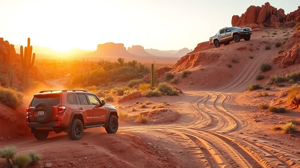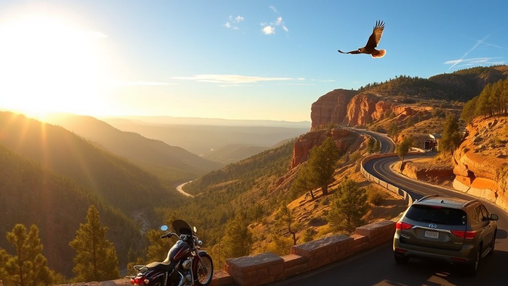
The Coronado Trail Scenic Byway is one of Arizona’s most demanding and rewarding paved drives. It follows US 191 north from Morenci through the Apache-Sitgreaves National Forest, continues through Alpine, and reaches the Eagar-Springerville area. Tight curves, steep grades, high elevations, limited services, and fast-changing weather make preparation essential.
Quick Answer
Plan at least half a day for the Coronado Trail, and allow a full day if you want overlooks, short walks, meals, or museum stops. Fill your tank before the remote section, check AZ511 and forest alerts, carry water and offline maps, and drive slowly through the steep, winding sections.
Key Takeaways
- The official scenic-road inventory lists the Coronado Trail at 103 miles, while a practical Clifton-to-Springerville drive is longer because the gateway towns extend beyond the designated endpoints.
- The actual byway runs through Morenci, Alpine, Eagar, and Springerville. Duncan, Safford, Thatcher, Pima, and the Pinaleño Mountains are not stops on the byway.
- The highway is paved, but its curves, grades, wildlife, weather, and limited services require patient driving.
- Late spring through early fall usually offers the simplest access, but monsoon storms, wildfire restrictions, snow, ice, and temporary closures can affect any plan.
- Use signed public overlooks and recreation sites. Do not enter mine property, abandoned structures, or unmarked ruins.
At a Glance
| Route | US 191 from Morenci through Alpine, then into the Eagar-Springerville area |
| Distance | 103 miles for the designated byway; roughly 120 miles for a broader Clifton-to-Springerville itinerary |
| Time Required | At least 3 hours without long stops; 5 to 7 hours is more comfortable for sightseeing |
| Driving Difficulty | Moderate to demanding because of sharp curves, steep grades, narrow shoulders, and limited passing areas |
| Vehicle | A standard passenger car is suitable in normal conditions; long RVs and trailers require extra caution |
| Cost | No general byway entrance fee; fuel, lodging, museums, campgrounds, and recreation-site fees vary |
What’s in This Article
- Getting Ready: When to Go and What to Bring
- Route Overview and Driving Conditions
- Key Towns Along the Trail
- Must-See Viewpoints and Overlooks
- Short Hikes and Nature Stops
- Historic Sites and Ghost Town Detours
- Wildlife and Plant Life to Watch For
- Dining, Fuel, and Lodging Options
- Safety Tips and Road Hazards
- Photography Tips and Best Times for Light
- Frequently Asked Questions
Getting Ready: When to Go and What to Bring
The best time for your drive depends on elevation and weather, not only the calendar. Lower sections near Clifton and Morenci can be hot while the high country near Hannagan Meadow and Alpine is cool, windy, or stormy. Late spring through early fall generally gives you the easiest chance of dry pavement, but you still need to check current conditions.
Summer brings Arizona’s monsoon pattern, with lightning, heavy rain, flash flooding, falling rocks, and reduced visibility possible. Fall can bring bright aspen color in the high country, but an early cold front may also produce frost, ice, or snow. Winter and early spring travel can be beautiful, but only when the highway is open and your vehicle is prepared for mountain conditions.
Pack water, food, sunscreen, sturdy shoes, a warm layer, rain protection, a flashlight, a first-aid kit, and a paper map. Download offline maps before leaving town. Bring a charging cable or power bank, but do not depend on cellular service for navigation, weather updates, or emergency calls.
Warning: Check AZ511, the Apache-Sitgreaves National Forests alerts, and the National Weather Service before entering the remote section. Turn around if snow, flooding, wildfire activity, smoke, debris, or a closure makes the route unsafe.
Which Direction Should You Drive?
You can drive the route in either direction. Northbound travel from Morenci gives you a long climb from mining country into forested high elevations. Southbound travel gives you a long descent toward Morenci and Clifton, so brake management becomes especially important.
Choose the direction that fits your daylight, lodging, and next destination. Avoid starting the curviest section late in the day. If you are uncomfortable with mountain driving, begin early, leave a large time buffer, and stop only at safe, marked pullouts.
Route Overview and Driving Conditions
The Arizona Department of Transportation scenic-road inventory lists the Coronado Trail National Scenic Byway on US 191 and US 180 at 103 miles. A broader Clifton-to-Springerville drive is often described as roughly 120 miles because Clifton lies south of the official Morenci start and travelers may continue beyond the designated endpoint.
The route begins in the Morenci area, climbs north on US 191 through the Apache-Sitgreaves National Forest, reaches Alpine, and continues toward Eagar and Springerville. The official Recreation.gov route description identifies Morenci, Alpine, and Springerville as the main navigation points.
The Coronado Trail is not a road to rush. The safest itinerary leaves enough daylight for slow curves, scenic pullouts, wildlife, and unexpected weather.
Road Surface and Maintenance
The main byway is a paved US highway, so four-wheel drive is not normally required. However, pavement condition can change after winter weather, heavy rain, maintenance work, or rockfall. Watch for patched pavement, gravel near shoulders, debris, construction zones, and faded markings.
Stay within the posted speed limit and slow further when sight distance is short. Do not cut across the centerline on curves. Leave extra space behind motorcycles, bicycles, trucks, and other vehicles that may need more room or time.
Weather and Seasonal Hazards
Elevation changes can produce large temperature differences in one drive. The forest reaches from about 3,500 feet on the Clifton Ranger District to much higher country elsewhere, and the byway climbs toward areas around 9,000 feet. A warm start near the mine does not guarantee warm or dry conditions near Hannagan Meadow.
During monsoon season, thunderstorms can form quickly. The National Weather Service warns that flash flooding, lightning, heat, and sudden heavy rain are major recreation hazards. Never drive through floodwater or around a barricade. If you hear thunder during a stop, return to a hard-topped vehicle or substantial building.
Note: Road status and recreation-site status can change independently. A highway may be open while a campground, trail, forest road, or fire-affected area is closed.
Key Towns Along the Trail
The route’s useful town sequence is Clifton and Morenci at the southern end, Alpine in the high country, and Eagar-Springerville at the northern end. These communities provide the best chances for fuel, meals, lodging, supplies, and local information.
Duncan is east of Clifton and is not on the Coronado Trail. Safford, Thatcher, and Pima are southern approach communities, not byway stops. The Pinaleño Mountains and Mount Graham use the separate Swift Trail Parkway on State Route 366.
Clifton and Morenci
Clifton is a practical southern gateway with a canyon setting and mining history. Morenci marks the byway’s official southern start and is dominated by one of the world’s largest open-pit copper-mining landscapes. Use only signed public roads and overlooks. Active mine areas, haul roads, fences, and restricted property are not sightseeing access points.
As you climb through Morenci, watch for the rock tunnel and public viewpoints where the road allows a safe stop. Keep your attention on traffic and curves instead of trying to photograph from a moving vehicle.
- Buy food, water, and emergency supplies before the remote climb.
- Fill the fuel tank, even if the gauge shows more than half.
- Check brakes, tire pressure, coolant, and the spare tire.
- Use only signed public overlooks near the mine.
Morenci to Alpine Route
This is the longest and most demanding part of the drive. US 191 climbs through canyon country, forest, meadows, and high ridges with many sharp curves and few services. Hannagan Meadow is the best-known high-country stop along this section, and signed campgrounds, trailheads, and picnic areas may offer breaks when open.
Do not assume a campground has water, trash service, or an open restroom. Seasonal facilities can close, and some forest sites require you to pack out trash. Check the current site page or ask a ranger before relying on a specific amenity.
Pro Tip: Schedule your longest break before fatigue builds. A short walk, water, and food at a signed recreation site can improve concentration for the remaining curves.
Alpine, Eagar, and Springerville
Alpine is the first full-service high-country community after the remote central section. It makes a useful meal, fuel, or overnight stop, but hours can be limited, especially outside busy seasons. Continue north toward Eagar and Springerville for a wider range of services.
Springerville adds cultural and historic stops, including the Casa Malpais Archaeological Park and Museum. Tours, hours, and access can change, so check before building your schedule around a visit.
Must-See Viewpoints and Overlooks
The route’s strongest views come from legal, marked pullouts rather than improvised shoulder stops. Near Morenci, public viewpoints show the scale of the copper mine and the road’s dramatic climb. Farther north, forest openings reveal long ridgelines, canyons, and distant mountains.
Hannagan Meadow is a major scenic and recreation area in the high country. Alpine meadows and the northern White Mountains add broader views and easier access to services. Nelson Reservoir and Casa Malpais are also listed by ADOT as points of interest associated with the scenic road.
- Enter and leave pullouts slowly because sight lines may be short.
- Park fully outside the travel lane and set the parking brake.
- Keep children and pets close near steep slopes and traffic.
- Do not cross barriers or stand on the roadway for a photograph.
Short Hikes and Nature Stops
Short walks can break up the drive, but choose named, signed trails instead of following an unmarked path. Forest conditions can change after wildfire, wind, snow, and heavy rain. Fallen trees, burned stump holes, loose rock, and damaged trail sections may remain even when an area is open.
Check the Apache-Sitgreaves National Forests site for current recreation status. For motorized side trips, use official travel-management information and obey all route signs. The main highway is not permission to drive on every forest road.
- Choose a walk that fits your remaining daylight and weather window.
- Carry water, a layer, rain protection, and a small first-aid kit.
- Tell someone where you are going if you leave the highway.
- Stay on durable surfaces and pack out every item you bring.
Historic Sites and Ghost Town Detours
The Coronado Trail has strong mining, transportation, Indigenous, ranching, and forest history, but the main byway is not a chain of open-access ghost towns. Avoid generic online directions to unnamed ruins. Land ownership, mine activity, unstable structures, and legal access can be unclear.
Ghost Town Detours Require Research
If you want a ghost-town detour, confirm the site name, road condition, land manager, hours, fees, and public-access rules before leaving the highway. Do not enter buildings, mine shafts, tunnels, fenced land, or signed closures. Never collect glass, pottery, metal, wood, stone, or other artifacts.
Old structures can fail without warning. Snakes, sharp metal, hidden holes, contaminated soil, and unstable mine features can turn a casual stop into an emergency. A photograph from a legal viewing area is safer than entering a ruin.
Coronado Trail History and Mining Remnants
The road developed from older travel routes and was dedicated as the Coronado Trail and Clifton-to-Springerville Highway in 1926. Its later highway designations included Arizona Route 81 and US 666 before becoming part of US 191. The route’s history is best understood through official interpretive signs, museums, and public viewpoints.
Near Clifton and Morenci, historic transportation and mining features help explain how the communities developed. Respect active operations and remember that industrial sites are workplaces, not open museums.
Casa Malpais and Springerville Heritage
At the northern end, Casa Malpais provides a specific, managed cultural stop rather than an unverified ruin. Use the Town of Springerville’s official information for tours and current access. Follow all instructions, remain with the authorized route or guide, and do not touch or remove cultural material.
Wildlife and Plant Life to Watch For
The elevation change supports desert plants, pinyon-juniper woodland, ponderosa pine, mixed conifer, meadows, and riparian habitat. Wildlife may include deer, elk, wild turkey, raptors, smaller mammals, reptiles, and many forest birds. What you see depends on season, elevation, weather, and time of day.
Wildlife is most dangerous when it enters the road unexpectedly. Scan the shoulders at dawn, dusk, and in shaded curves. If an animal appears, brake firmly in a straight line when safe instead of swerving toward a drop-off or oncoming traffic.
- Use binoculars or a zoom lens and keep your distance.
- Never feed wildlife or leave food scraps.
- Keep pets controlled and away from wild animals.
- Do not stop in a travel lane for an animal sighting.
Dining, Fuel, and Lodging Options
Do not treat the central section as a place for dependable fuel, food, or repairs. Fill up in Morenci before driving north or in Eagar-Springerville before driving south. Alpine may have fuel and food, but hours and availability can change. Carry enough water and snacks to finish the route without an open business.
Lodging is easiest to find in the gateway communities, with additional seasonal options in the high country. Campgrounds and recreation sites may be open only part of the year and may lack potable water. Verify status, fees, reservation rules, fire restrictions, and vehicle-size limits before arrival.
Note: Business hours, fuel availability, lodging inventory, campground status, and fire rules change. Confirm them close to your travel date rather than relying on an old itinerary.
Safety Tips and Road Hazards
Expect repeated curves, steep grades, narrow shoulders, limited passing areas, wildlife, glare, falling rock, and occasional debris. Drive within your sight distance. Keep both hands on the wheel, increase following distance, and use turnouts to let faster traffic pass when it is safe.
On long descents, select a lower gear and let engine braking help control speed. Do not ride the brakes continuously. If you smell hot brakes, feel fading brake response, or notice a warning light, stop at the next safe area and allow the vehicle to cool while you assess the problem.
Vehicle, RV, and Motorcycle Considerations
A normal passenger vehicle can use the paved highway in suitable weather. Four-wheel drive does not make ice, flooding, smoke, rockfall, or a closure safe. Tires, brakes, coolant, lights, and the spare tire matter more than ground clearance on the main route.
Long RVs and trailers can be difficult to manage on tight curves and grades. Before the trip, confirm that your combination is within legal size and weight limits, check brakes and transmission condition, and decide whether the driver has enough mountain-road experience. Motorcyclists should watch for gravel, tar repairs, wildlife, wind, and temperature changes.
Communications and Emergency Planning
Cellular coverage can be weak or absent. GPS satellite positioning may still work, but live traffic, map downloads, rerouting, and calls require a data or cellular connection. Download maps first and carry a paper backup.
Share your route and expected arrival time with someone. Carry water, food, warm clothing, a flashlight, a first-aid kit, basic tools, and any essential medication. If you break down, move fully off the travel lane when possible, remain visible, and avoid walking long distances unless staying with the vehicle creates a greater danger.
Photography Tips and Best Times for Light
Morning and late-afternoon light can add depth to mine slopes, canyons, forest ridges, and meadows. Midday light is stronger, but it may be useful for documenting road details, signs, and broad landscapes. Weather often matters more than a fixed shooting time.
Use a wide lens for roads and ridgelines, a longer lens for wildlife, and a polarizing filter only when it improves glare or sky contrast. A tripod can help in low light, but set it up only where you can remain fully outside the highway and away from unstable edges.
- Scout a pullout in daylight before planning sunrise or sunset work.
- Keep equipment organized so you do not stand near traffic.
- Review photos only while safely parked.
- Do not fly a drone without confirming current airspace, land-manager, wildlife, and local rules.
Frequently Asked Questions
How long is the Coronado Trail Scenic Byway?
ADOT lists the designated scenic byway at 103 miles. A broader trip from Clifton to Springerville is roughly 120 miles, depending on your exact start, end, and side stops.
How much time should you allow?
Allow at least three hours without long stops. Five to seven hours is more realistic for overlooks, food, short walks, and delays. An overnight plan is better if you want museums, camping, or longer hikes.
Do you need four-wheel drive?
No. The main byway is a paved US highway, and a standard passenger car is suitable in normal conditions. Forest side roads may have different surface, weather, and vehicle requirements.
Can you drive the Coronado Trail in winter?
You can drive it only when the highway is open and conditions are safe. High elevations can receive snow and ice, and temporary closures or travel restrictions may occur. Check AZ511 and the weather forecast immediately before departure.
Is the route suitable for an RV or trailer?
The highway can carry legal RVs and trailers, but long vehicles are harder to manage on tight curves, steep grades, and narrow shoulders. Check vehicle condition, dimensions, weather, and driver experience before committing to the route.
Are permits or entrance fees required?
There is no general entrance permit or byway fee for driving the highway. Campgrounds, museums, tours, recreation sites, or special activities may have separate fees, reservations, or permits.
Are pets allowed at stops along the byway?
Pets are allowed at many outdoor locations, but each campground, trail, museum, and cultural site can set its own rules. Keep pets restrained, carry water and waste bags, and follow every posted restriction.
Is cell phone and GPS service reliable?
Cell service and mobile data can be unreliable. A GPS receiver may still calculate your position, but live maps, traffic, calls, and rerouting may fail. Download offline maps and carry a paper map.
Are e-bikes or ATVs allowed?
Rules depend on the vehicle, highway law, forest route, trail designation, and land manager. An ATV or e-bike being legal on one route does not make it legal everywhere. Use official travel maps and posted signs.
Are guided tours available?
Guided options vary by season and community. Contact visitor services, museums, lodging providers, or local tourism offices shortly before your trip. Casa Malpais uses managed access, so confirm its current tour process directly.
Conclusion
The Coronado Trail rewards patience, preparation, and daylight. Build your plan around the real Morenci-Alpine-Eagar-Springerville route, not unrelated detours toward Duncan or the Pinaleño Mountains. Check road, forest, fire, and weather conditions; fill the tank; carry water and offline maps; and use only legal pullouts and public sites. With enough time, the drive reveals one of Arizona’s strongest transitions from mining country to high mountain forest.
Sources
- Arizona Department of Transportation: List of Scenic Roads — official designation, roadway, length, and points of interest.
- Recreation.gov: Coronado Trail Scenic Byway — official route navigation from Morenci through Alpine to Springerville.
- AZ511 Traveler Information — current Arizona highway closures, restrictions, incidents, and conditions.
- Apache-Sitgreaves National Forests — current forest alerts, recreation status, fire information, and visitor guidance.
- National Weather Service: Northern Arizona Monsoon Safety — lightning, flooding, heat, and storm-safety guidance.
- Town of Springerville: Casa Malpais Archaeological Park and Museum — official visitor information for the managed cultural site.