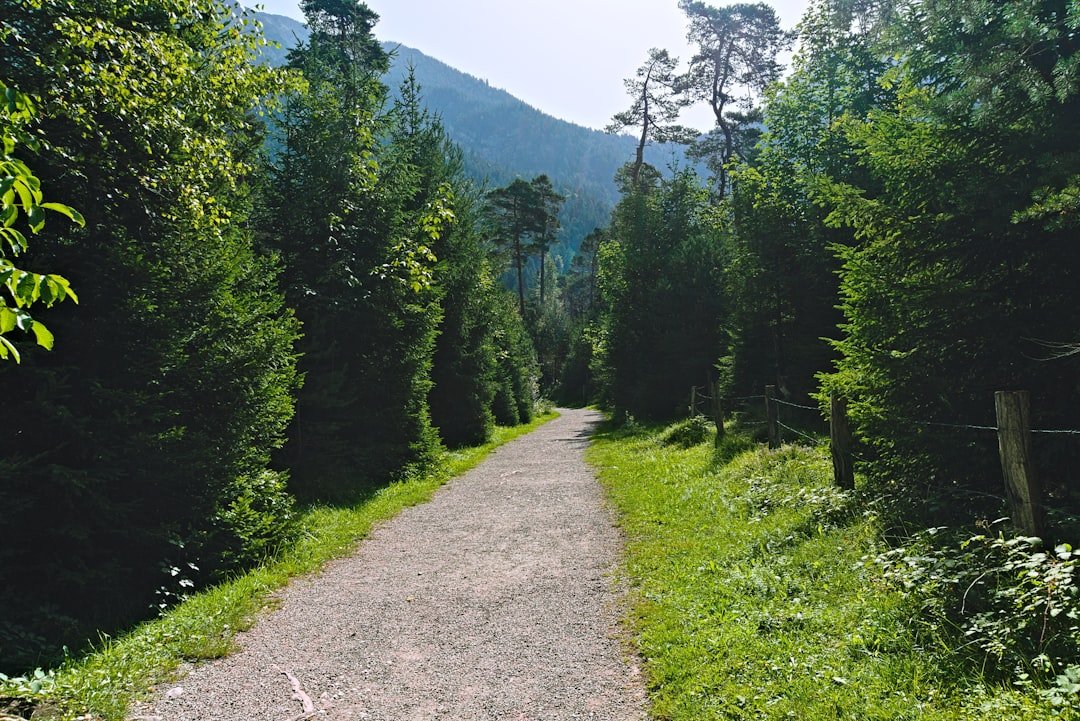
Saxer Luecke, also written Saxerlücke, is a dramatic mountain gap and hiking viewpoint in the Alpstein of northeastern Switzerland. It is not a village or a roadside attraction. Reaching it requires hiking, usually as part of a route connecting Hoher Kasten, Staubern, Bollenwees and the mountain lakes above Brülisau. The reward is one of the Alpstein’s most recognizable views, with steep limestone walls, green slopes and the striking Kreuzberge ridge.
Quick Answer
Saxer Luecke is a mountain hiking destination at about 1,649 meters in the Alpstein, not a village you can drive to. A popular official route runs from Hoher Kasten through Staubern and Saxerlücke to Bollenwees, Sämtisersee and Brülisau. Allow a full day and prepare for mountain-trail conditions.
Key Takeaways
- Saxer Luecke is a mountain gap and viewpoint in the Alpstein at approximately 1,649 meters, not a village.
- You cannot drive or take a bus directly to Saxer Luecke. Most visitors first reach Brülisau, Hoher Kasten or Staubern and continue on foot.
- The official Geological Trail via Hoher Kasten, Staubern, Saxerlücke, Bollenwees and Brülisau is about 16.21 km and takes roughly 5 hours 30 minutes.
- Mountain paths can be steep, narrow and exposed, so sturdy footwear, suitable clothing, sure-footedness and good weather judgment are important.
- Camping is not permitted in the Alpstein, and drones are prohibited under regional rules. Use mountain inns or official accommodation instead.
What Is Saxer Luecke?
Saxer Luecke is one of the best-known viewpoints along the southern side of the Alpstein. Official Appenzellerland tourism material places Saxer Lücke at approximately 1,649 meters. The location is especially recognizable for its view toward the jagged Kreuzberge rock formation.
The landscape is also geologically interesting. The official Geological Trail between Hoher Kasten and the interior of the Alpstein explains the area’s rock layers, folds, fossils and the Sax-Schwende fault. Instead of treating Saxer Luecke as a stand-alone attraction, it makes more sense to think of it as a memorable point on a larger mountain-hiking route.
The official Geological Trail is 16.21 km long, with about 652 m of ascent, 1,521 m of descent and an estimated hiking time of 5 hours 30 minutes.
How to Get to Saxer Luecke
You cannot drive to Saxer Luecke itself. The practical approach is to travel to a trailhead and continue into the mountains on foot. One of the most useful starting points is Brülisau, where the lower station of the Hoher Kasten cableway is located.
Getting to Brülisau by Public Transport
According to the official Hoher Kasten arrival information, travelers can reach the area by Appenzell Railways via Appenzell and Weissbad. From Weissbad station, a PostBus connection runs to the lower station of the Hoher Kasten cableway in Brülisau.
Check the current Swiss public-transport timetable before departure, especially if your hike depends on making a final bus or cableway connection.
Getting to Brülisau by Car
Drivers can reach Brülisau through Appenzell via Steinegg or Weissbad and use the designated parking areas near the Hoher Kasten valley station. Parking availability and payment arrangements can change, so confirm the latest details on the official arrival page before setting out.
Note: Driving to Brülisau only gets you to the trailhead. There is no public road to Saxer Luecke itself.
Popular Route via Hoher Kasten
A well-documented way to visit Saxer Luecke is the official Geological Trail:
- Travel to Brülisau.
- Take the Hoher Kasten cableway to the mountain station when operating.
- Hike from Hoher Kasten toward Staubern.
- Continue to Saxerlücke.
- Descend toward Berggasthaus Bollenwees and Fälensee.
- Continue past Sämtisersee and Plattenbödeli.
- Finish back in the Brülisau area.
The official route is rated moderate and measures about 16.21 km. The large amount of descent makes good footwear and controlled footing particularly important.
Alternative Access via Staubern
Another option is to approach the ridge from Staubern. The cableway from Frümsen climbs from the Rhine Valley to Staubern, where hikers can connect with trails running toward Saxer Luecke. This can be useful when planning a different point-to-point itinerary, but you should check current cableway and trail information before committing to the route.
Pro Tip: Plan the entire route before you start, including your final descent and transport connection. Mountain cableways and buses operate to timetables, and missing the last connection can turn a comfortable day hike into a much more difficult outing.
Top Attractions Around Saxer Luecke
Saxer Luecke and the Kreuzberge
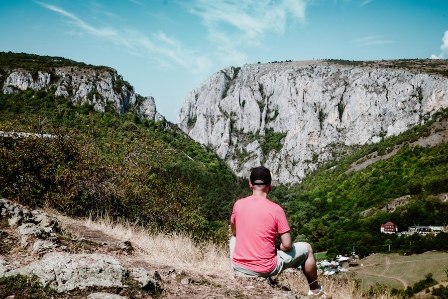
The main attraction is the mountain scenery itself. The narrow gap and nearby trail open views toward the striking limestone formations of the Kreuzberge. Changing cloud, light and visibility can transform the scene quickly, which is one reason the area is popular with landscape photographers.
Staubern and Staubernkanzel
Staubern lies along the ridge route between Hoher Kasten and Saxer Luecke. It provides another high-level viewpoint and is also served by a cableway from Frümsen in the Rhine Valley.
Fälensee and Berggasthaus Bollenwees
Descending from Saxer Luecke toward the interior of the Alpstein brings you toward Fälensee, a narrow mountain lake enclosed by steep slopes. Berggasthaus Bollenwees sits beside the lake and is a practical place for food, rest and overnight accommodation when open.
Sämtisersee
Sämtisersee is another mountain lake on the official route back toward Brülisau. Together with Fälensee, it makes the longer Geological Trail more varied than a simple out-and-back trip to one viewpoint.
Hoher Kasten
Hoher Kasten is both a destination and a convenient starting point. The cableway rises from Brülisau to the summit area, allowing hikers to begin high on the ridge rather than climbing the entire elevation from the valley floor.
Outdoor Activities in Saxer Luecke
| Activity | Suitability | What to Know |
|---|---|---|
| Hiking | Primary activity | The official Geological Trail is a moderate mountain hike of about 16.21 km and 5 hours 30 minutes. |
| Photography | Excellent from the marked trail | Use ground-based photography. Drone operation is prohibited in the Alpstein under regional rules. |
| Climbing | Experienced climbers only on established routes | Do not treat the cliffs around the viewpoint as casual climbing terrain. Use proper route information and suitable equipment. |
| Paragliding | Available in the wider Alpstein area | Launch sites, wind and operating conditions require separate planning. Saxer Luecke should not be assumed to be a general launch point. |
| Camping | Not permitted | Appenzellerland Tourism states that camping is not permitted in the Alpstein. Use mountain accommodation or an official campsite outside the mountain area. |
Hiking is the main reason to visit Saxer Luecke. The trails cross alpine meadows, rocky slopes and exposed mountain terrain, so conditions can feel very different from an ordinary valley walk.
Official mountain-trail guidance explains that white-red-white routes can be steep, narrow and partly exposed. Hikers should be sure-footed, comfortable with heights, physically fit and equipped for sudden mountain-weather changes.
Warning: Do not underestimate the route because the elevation is below 2,000 meters. Steep terrain, long descents, wet grass, loose surfaces, thunderstorms, fog and sudden temperature changes can all increase the difficulty. Turn back if conditions exceed your experience.
What to Carry
- Sturdy hiking shoes or boots with good grip
- Rain protection and a warm layer
- Sun protection
- Enough water and food for your planned route
- A charged phone
- Basic first-aid supplies
- A current hiking map or reliable offline navigation
Before leaving, check the latest Hoher Kasten trail guidance and conditions as well as local weather information.
Where to Stay in Saxer Luecke
There are no conventional hotels or village guesthouses at Saxer Luecke itself because it is a mountain location rather than a settlement. Your best choice depends on whether you want to sleep in the mountains or return to the valley.
Berggasthaus Bollenwees
Berggasthaus Bollenwees is one of the most practical mountain options for a Saxer Luecke itinerary. It stands beside Fälensee and offers accommodation as well as food when operating. Staying here can turn a long day hike into a more relaxed multi-day Alpstein trip.
Other Mountain Inns
The wider Alpstein has a network of mountain inns, including options around Staubern and Plattenbödeli. Opening periods can be seasonal, so always confirm that an inn is operating and that a bed is available before depending on it for the night.
Brülisau
Brülisau is a convenient valley base because it provides access to the Hoher Kasten cableway and surrounding hiking routes. Rössli Brülisau is one established accommodation option in the village.
Appenzell and Nearby Villages
Staying in Appenzell or another nearby valley community gives you a wider choice of hotels, restaurants and services while keeping the Alpstein within reach by public transport or car.
If comfort, flexible dining and easier transport are priorities, a valley stay is usually more convenient. If sunrise, sunset or a multi-stage hiking route is the goal, a mountain inn can provide a much more immersive experience.
Local Cuisine and Dining Options in Saxer Luecke
Saxer Luecke itself does not have a restaurant district. Food is available at mountain inns along established routes and in villages such as Brülisau and Appenzell.
Bollenwees, Staubern, Plattenbödeli and Hoher Kasten are among the places where hikers may be able to stop for a meal or refreshments when the establishments are open. Menus and opening times vary by season.
Swiss mountain dining often emphasizes filling dishes that suit a day outdoors. Depending on the restaurant and season, you may encounter rösti, cheese-based dishes and regional Appenzeller specialties.
Fondue and raclette are well-known Swiss foods, but you should not assume every mountain inn serves them every day. If a particular dish matters to you, check the current menu before planning your stop around it.
Shopping and Souvenirs in Saxer Luecke
There are no normal shopping streets or souvenir stores at Saxer Luecke. Save your shopping for Brülisau, Appenzell or another valley settlement before or after the hike.
Appenzell is a better place to look for regional food products, cheese, local crafts and other Swiss souvenirs. Buying supplies in the valley also prevents you from relying on a mountain inn for essentials that it may not sell.
If you want to bring home something connected to the hike, a regional food product, hiking map or locally made item is more meaningful than expecting a tourist shop at the viewpoint.
Elsewhere on this site: For a completely different food topic, you can also read Exploring the Delightful World of Asian Melon.
Tips for a Memorable Trip to Saxer Luecke
Choose the Season Carefully
For most hikers, the practical season is when mountain paths are free of significant snow and the relevant cableways and mountain inns are operating. Exact conditions vary from year to year, so calendar dates should never replace a current trail check.
Summer offers long daylight hours and green alpine scenery. Early autumn can bring clearer air, cooler hiking temperatures and changing vegetation, but days become shorter. Snow, ice and closed facilities can make late-season or winter travel a very different undertaking.
Check Conditions on the Day
Mountain weather can change quickly. Review the forecast, webcams, trail closures and cableway status shortly before departure. Appenzellerland Tourism and Hoher Kasten both publish current visitor information.
Start Early
An early start gives you more time for photography, food stops and unexpected delays. It also gives you a larger safety margin if weather deteriorates or the route takes longer than expected.
Respect Livestock and Nature
Stay on marked paths where required, give grazing cattle space and follow local instructions. Official hiking guidance recommends keeping dogs on a leash around livestock and passing herds calmly at a safe distance.
Do Not Camp in the Alpstein
Appenzellerland Tourism’s safety guidance states that camping is not permitted in the Alpstein. If you want to stay overnight, reserve a mountain inn, alpine accommodation or an official campsite outside the restricted mountain area.
Leave the Drone at Home
Drone operation is prohibited in the Alpstein under the regional wildlife-protection rules described by Appenzellerland Tourism. Use a camera or phone from the trail instead.
Is Saxer Luecke Suitable for Children?
That depends on the child, the route and the conditions. The full Geological Trail is a substantial mountain outing, not a short stroller-friendly family walk. Children attempting mountain paths should already be comfortable with sustained hiking, uneven terrain and exposure, and they need close adult supervision.
Families looking for an easier outing can consider a shorter experience around Hoher Kasten rather than committing automatically to the full Saxer Luecke route.
Frequently Asked Questions
What is Saxer Luecke?
Saxer Luecke, or Saxerlücke, is a mountain gap and scenic hiking viewpoint in the Alpstein of northeastern Switzerland. Official regional material places it at approximately 1,649 meters above sea level.
Can you drive to Saxer Luecke?
No. There is no public road to the viewpoint. Drivers normally park at a trailhead such as Brülisau and then continue by cableway and/or on foot.
How do you reach Saxer Luecke by public transport?
A common approach is to travel through Appenzell and Weissbad, then use the local bus connection to the Hoher Kasten cableway station in Brülisau. From there, continue into the mountains by cableway and hiking route.
How long does the Saxer Luecke hike take?
It depends on your route. The official Geological Trail from Hoher Kasten through Staubern and Saxerlücke to Bollenwees, Sämtisersee and Brülisau is about 16.21 km and has an estimated walking time of 5 hours 30 minutes, excluding long breaks.
Is the Saxer Luecke hike difficult?
The official Geological Trail is rated moderate, but it is still a mountain hike. Sections can be steep, narrow or exposed. Good fitness, sure-footedness, suitable hiking shoes and weather awareness are important.
What are the best times to visit Saxer Luecke?
The most practical period is generally the snow-free hiking season when trails, cableways and mountain inns are operating. Summer and early autumn are popular, but always check current trail and weather conditions rather than relying only on the calendar.
What are the must-see places near Saxer Luecke?
Highlights include the Kreuzberge rock formation, Staubern, Fälensee and Berggasthaus Bollenwees, Sämtisersee and Hoher Kasten. Several can be combined on the official Geological Trail.
Can you camp at Saxer Luecke?
No. Appenzellerland Tourism states that camping is not permitted in the Alpstein. Use a mountain inn, approved alpine accommodation or an official campsite outside the mountain area.
Can you fly a drone at Saxer Luecke?
Drone operation is prohibited across the Alpstein under regional wildlife-protection rules. Plan to photograph Saxer Luecke with a handheld camera or phone from the trail instead.
Sources
- Appenzellerland Tourism: The Geological Trail — official route, distance, duration, elevation change, difficulty and waypoints.
- Hoher Kasten: Arrival — public transport, driving and Brülisau trailhead information.
- Hoher Kasten: Trail Conditions and Hiking Guidance — mountain-trail classifications, equipment and safety requirements.
- Appenzellerland Tourism: Staying Safe in the Alpstein — weather preparation, equipment, livestock guidance and camping restrictions.
- Appenzellerland Tourism: Drones — Alpstein drone restrictions.
- Appenzellerland Tourism: Mountain Inns — official accommodation and mountain-inn information for the Alpstein.