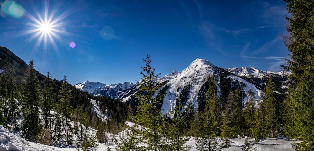
Creux du Van is a huge horseshoe-shaped rock amphitheater in the Swiss Jura, above the Val-de-Travers in the canton of Neuchâtel. Its exposed limestone walls rise more than 160 meters vertically, and the surrounding protected landscape combines panoramic hiking, wildlife watching, geology, forests, and high Jura pastures.
Quick Answer
Creux du Van is best visited from Noiraigue, where the standard circular hike is about 15 km with roughly 780 m of ascent and takes around 4 hours 35 minutes. May through October is the main hiking season. Expect steep climbing, exposed cliff edges, limited seasonal services, and changing mountain weather.
Key Takeaways
- Creux du Van is a protected natural rock cirque in the Jura Mountains, with vertical cliffs more than 160 meters high.
- The standard Noiraigue loop is about 15 km, takes roughly 4 hours 35 minutes, and includes around 780 m of ascent.
- Noiraigue is a convenient rail-access starting point, while several upper car parks provide shorter approaches during the warmer season.
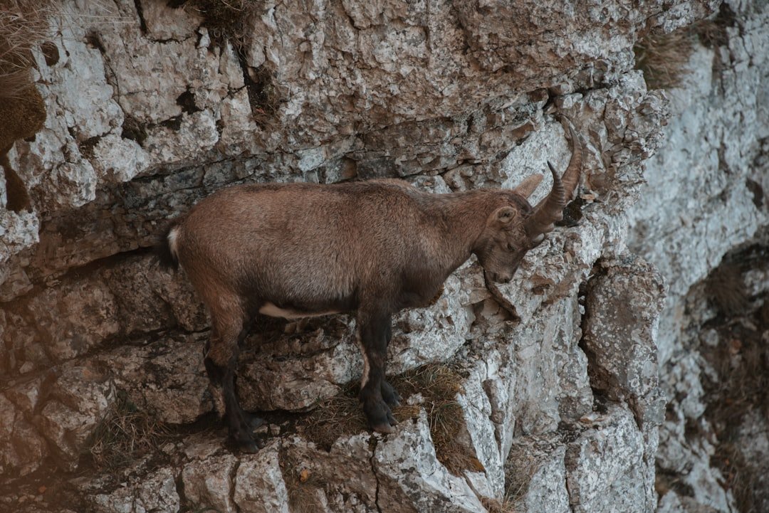
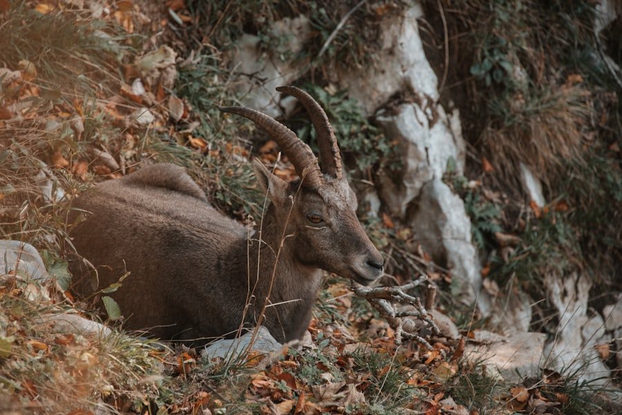
- Ibex, chamois, marmots, and birds of prey may be seen, but wildlife sightings are never guaranteed.
- Winter access is more difficult because some roads are not cleared and hiking paths can be snow-covered and very slippery.
- Dogs are strongly discouraged around the Creux du Van and Le Soliat pastures when suckler cows are present.
The landscape developed through prolonged erosion by water and ice. Rather than being a 1,400-meter-high cliff, the vertical rock wall is a little over 160 meters high; the surrounding high plateau itself lies at roughly the 1,400-meter elevation level. English-language tourism material normally leaves the proper name “Creux du Van” untranslated rather than relying on a questionable literal translation.
Getting to Creux du Van
Neuchâtel is a useful regional gateway, but the village of Noiraigue is the classic starting point for hikers. You can reach Noiraigue by train and begin the marked hiking routes close to the station. Check the current timetable through SBB before traveling, especially if you need to make connections from another Swiss city.
Getting There by Train
From Neuchâtel and other parts of Switzerland, travel by rail toward Noiraigue in the Val-de-Travers. Starting by train avoids parking concerns and lets you complete the standard circular route directly from the village. The official Switzerland Tourism itinerary starts and ends in Noiraigue.
Driving and Parking
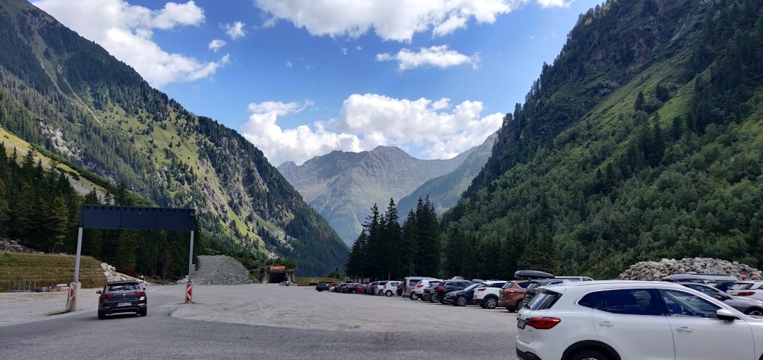
Driving can shorten the amount of walking required, but access changes by season. According to Neuchâtel Tourism’s Creux du Van access guidance, warmer-season approaches include the Soliat car park, which is only a short walk from the rim, the Ferme Robert area below the cirque, and other official parking locations.
From November through April, some upper roads are not cleared of snow. The official access guidance also notes that roads can be narrow and steep and that winter tires or snow chains may be required on specified approaches.
Note: Use official parking areas only. Parking in meadows or outside designated car parks within the nature reserve is prohibited. Seasonal road access can change, so check the official access page before driving.
Hiking and Wildlife Watching at Creux du Van
Hiking is one of the best ways to experience Creux du Van, but the standard route from Noiraigue is more substantial than a casual stroll. The official Switzerland Tourism Creux du Van route climbs through forest and pastures before reaching the rim and returning to Noiraigue.
| Standard Noiraigue Loop | Official Route Information |
|---|---|
| Start / Finish | Noiraigue |
| Distance | About 15 km |
| Hiking Time | About 4 hours 35 minutes, not including long stops |
| Ascent / Descent | About 780 m each |
| Technical Level | Easy on the official classification |
| Fitness Requirement | Medium |
| Main Season | May to October, subject to conditions |
The climb includes the well-known 14 Contours path, a succession of bends leading toward the upper plateau. Although the trail is marked, nearly 800 meters of climbing makes the complete circuit a meaningful physical effort. Allow additional time for photographs, wildlife watching, food stops, and time at the rim.
Warning: Creux du Van has high, exposed cliff edges. Do not move closer to an edge simply for a photograph or wildlife view. Keep children under close supervision, stay back in strong wind, fog, snow, or ice, and follow all barriers, signs, and local instructions.
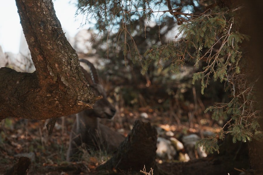
Wildlife watching is another highlight. Official tourism information lists ibex, chamois, marmots, deer, and birds of prey among animals found in the area. Wildlife is wild and mobile, so sightings should be treated as a possibility rather than a promise.
The reward for the climb is not just the panorama. Creux du Van is part of a protected landscape valued for its geology, flora, forests, and wildlife.
Early morning and later afternoon can provide quieter conditions for observation and photography. Keep your distance from animals, avoid feeding them, and do not leave marked paths merely to get closer to wildlife.
The Geology and Natural History of Creux du Van
| Aspect | Details |
|---|---|
| Location | Jura Mountains, canton of Neuchâtel, Switzerland |
| Formation | Long-term erosion by water and ice |
| Geological Features | Horseshoe-shaped limestone rock amphitheater with vertical cliffs more than 160 m high |
| Scale | More than 1 km across |
| Flora | Jura forest, high-elevation meadow plants, alpine and subalpine flora |
| Fauna | Chamois, ibex, marmots, deer, and birds of prey may occur |
| Significance | Protected landscape and nature area of major geological and ecological value |
The geology of Creux du Van is closely tied to the limestone landscape of the folded Jura. Water, ice, weathering, and erosion gradually exploited weaknesses in the rock and helped shape the immense amphitheater seen today. Official tourism information describes the formation as the result of erosion acting over millions of years rather than a feature created during one isolated event.
The cliffs also help create varied habitats. Forested slopes, scree, rock faces, and high pastures support different plant communities and provide habitat for mammals and birds. The Canton of Neuchâtel recognizes Creux du Van for its exceptional landscape, geological, and ecological value.
The area’s name is normally left as “Creux du Van” in English-language visitor information. A literal translation such as “the hollow of the van” should not be treated as an established explanation of the name.
Photography Tips for Capturing Creux du Van
Creux du Van gives photographers wide views, dramatic rock geometry, wildlife possibilities, and changing light throughout the day. Early morning and late afternoon often produce softer light and more visible texture across the cliff face than harsh midday sun.
A wide-angle lens can help show the scale of the amphitheater, while a longer lens is useful for wildlife without approaching animals. Foreground elements such as rocks, meadow plants, or the dry-stone landscape can create depth, but avoid trampling vegetation or stepping into unsafe positions for composition.
A tripod can be useful in low light or for long exposures. If you want moving-water photography, the nearby Areuse Gorges offer more appropriate stream and river scenes than the exposed cliff rim.
Pro Tip: Compose your shot before approaching any viewpoint. A dramatic photograph is never worth standing at an unstable or exposed cliff edge, especially in wind, fog, snow, or ice.
Nearby Attractions and Activities
Creux du Van is one of the main natural attractions in the region, but several nearby places can extend a day trip or weekend itinerary.
Areuse Gorges
The Areuse Gorges are especially convenient because an official hiking route begins in Noiraigue. The trail follows the Areuse through rock walls, narrow passages, bridges, and wooded gorge scenery. The official Noiraigue-to-Boudry route is about 12 km.
La Chaux-de-Fonds
La Chaux-de-Fonds is known for its watchmaking heritage. Together with nearby Le Locle, its watchmaking town planning is a UNESCO World Heritage property. Museums and the distinctive urban layout make it a useful cultural contrast to a day spent hiking.
Lake Neuchâtel
Lake Neuchâtel offers waterside walks, swimming areas, boating, and places to relax after a mountain hike. Neuchâtel itself also works well as a transport base for exploring the wider region.
Val-de-Travers
The wider Val-de-Travers area includes the historic asphalt mines at Travers as well as villages associated with the region’s absinthe tradition. These make useful bad-weather or lower-effort alternatives to another long hike.
Yverdon-les-Bains
Farther southwest, Yverdon-les-Bains combines historical attractions with its long thermal-bath tradition. It can work as a separate relaxation stop if your itinerary continues around Lake Neuchâtel.
If you are preparing your own picnic or snacks for the trip, you may also be interested in this site’s delicious homemade cottage cheese recipe. Treat it as a general food idea rather than a traditional Creux du Van specialty.
Practical Tips for Visiting Creux du Van
Proper footwear matters on the main hiking routes. Wear hiking shoes or boots with dependable traction, particularly after rain. Conditions can change quickly on the high Jura plateau, so carry an insulating layer and a waterproof outer layer even when the forecast looks reasonable.
- Water: Carry enough for your planned route rather than depending on finding a refill point.
- Food: Bring snacks or a packed meal, especially outside the main season.
- Navigation: Use an up-to-date hiking map or GPS map in addition to following trail signs.
- Weather: Check local conditions before leaving and turn back if fog, storms, snow, or ice make the route unsafe.
- Sun protection: Carry sunscreen, sunglasses, and a hat on clear days because sections of the upper plateau are exposed.
- Wildlife: Observe animals from a distance and never feed or chase them.
- Waste: Carry your rubbish out and avoid disturbing plants, rocks, or wildlife habitat.
Warning: Neuchâtel Tourism strongly advises visitors not to bring dogs into the Creux du Van / Le Soliat pasture area when suckler cows are present. Cattle can react aggressively to walkers accompanied by dogs, and visitor safety cannot be guaranteed.
Food, Restaurants, and Other Facilities
Facilities are limited compared with a town or developed tourist resort, but it is not correct to say that no restaurants exist. Regional farm restaurants operate around the high plateau, including near Le Soliat, and Noiraigue has additional services. Opening periods can be seasonal, so do not rely on finding food, drinking water, or a restroom exactly when you need one.
Carry the essentials for your hike even if you plan to stop at a restaurant. This is particularly important early or late in the season.
The Best Time to Visit Creux du Van
The best season depends on the experience you want, but the official standard Noiraigue hiking itinerary lists May through October as its main season.
Late Spring
Late spring brings greener forests and flowering vegetation, but snow or muddy conditions may linger after winter. Check current trail conditions before assuming the complete loop is ready for normal hiking.
Summer
June through August generally provides long daylight hours and good opportunities for the full hike. Popular viewpoints can be busy, especially on fine-weather weekends. An early start gives you more time and can make the rim feel quieter.
Autumn
September and October can bring colorful foliage, cooler walking temperatures, and attractive photography conditions. Shorter daylight and the possibility of early snow or frost make preparation increasingly important as the season progresses.
Winter
Winter changes the visit significantly. Official local guidance warns that hiking paths are not cleared of snow and can become very slippery. Several approach roads are also not cleared from November through April, while specific open roads may require winter tires or snow chains.
Winter scenery can be impressive, but do not treat the standard summer hike as an ordinary year-round trail. Check road, snow, weather, and route conditions and use equipment appropriate to the conditions and your experience.
Frequently Asked Questions
What is Creux du Van?
Creux du Van is a large horseshoe-shaped natural rock amphitheater in the Jura Mountains of Switzerland. Its vertical limestone cliffs exceed 160 meters in height, and the surrounding area is protected for its landscape, geological, ecological, and wildlife value.
How do I get to Creux du Van?
Noiraigue is the classic starting point and is accessible by train. From there, marked hiking routes climb to the cirque. Drivers can also use official seasonal parking areas, including upper approaches that provide much shorter walks to the rim. Road access changes in winter.
How long is the Creux du Van hike from Noiraigue?
The standard official circular route is about 15 km and takes approximately 4 hours 35 minutes of hiking time. It includes roughly 780 meters of ascent and descent, so allow extra time for viewpoints, photographs, food, and wildlife watching.
Is the Creux du Van hike difficult?
Switzerland Tourism rates the standard route as technically easy but gives it a medium physical requirement. The main challenge is the sustained climbing and descent rather than highly technical terrain. Wet leaves, mud, snow, ice, fog, or strong wind can make conditions considerably harder.
What activities can I do at Creux du Van?
Hiking, landscape photography, wildlife watching, and enjoying the viewpoints are the main visitor activities. The wider Jura region offers additional cycling and outdoor sports, but do not assume specialized activities such as climbing or paragliding are permitted at every part of the protected cirque. Check current local rules before planning them.
What should I bring when visiting Creux du Van?
Bring sturdy footwear, water, food, weather-appropriate layers, a waterproof jacket, sun protection, and an up-to-date map or navigation app. In colder conditions, additional winter equipment may be necessary. A camera or binoculars can be useful, but keep a safe distance from cliff edges and wildlife.
Are there restaurants or facilities at Creux du Van?
There are seasonal farm restaurants around the high plateau and services in Noiraigue, so the area is not completely without facilities. However, services are limited and may be closed when you visit. Carry enough water and food for your route and do not depend on finding a restroom or open restaurant at a particular point.
Can I bring my dog to Creux du Van?
Local tourism authorities strongly advise against bringing dogs around Creux du Van and Le Soliat when suckler cows are in the pastures. Cattle can react aggressively to dogs. Follow current signs and local guidance if you are considering a visit with a dog.
Can I visit Creux du Van in winter?
Yes, but winter requires much more preparation. Some roads are not cleared, and official guidance warns that hiking paths may be covered with snow and can be very slippery. Check access, weather, snow, and trail conditions before setting out and use suitable winter equipment.
Sources
- Switzerland Tourism – Sentier du Creux du Van – official hiking distance, duration, ascent, difficulty, season, wildlife, and geological overview.
- Neuchâtel Tourism – Creux du Van – cliff dimensions, wildlife, hiking overview, farm restaurants, and dog/livestock safety.
- Neuchâtel Tourism – Access and Parking at Creux du Van – seasonal road access, official parking, winter conditions, and parking restrictions.
- Canton of Neuchâtel – Protected Areas – official landscape, geological, ecological, and protected-area context.
- Neuchâtel Tourism – Areuse Gorges – nearby hiking route and visitor information.
- UNESCO World Heritage Centre – La Chaux-de-Fonds / Le Locle – official watchmaking town-planning World Heritage information.