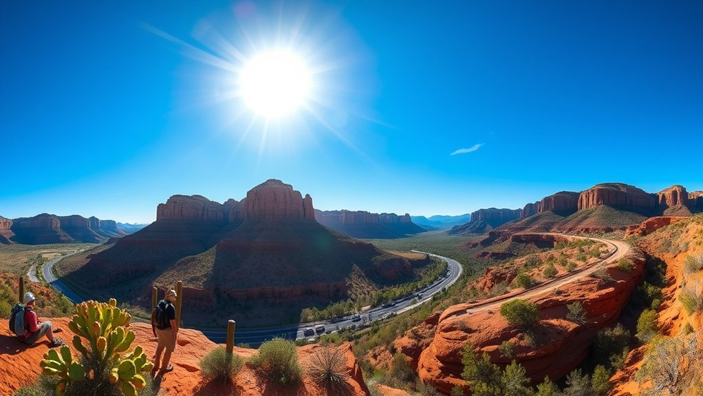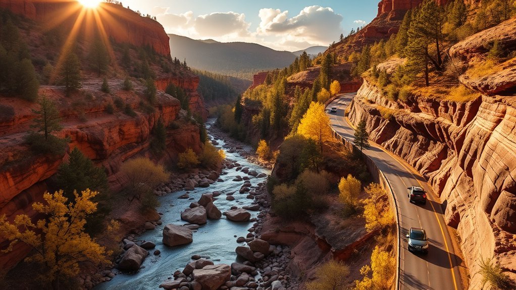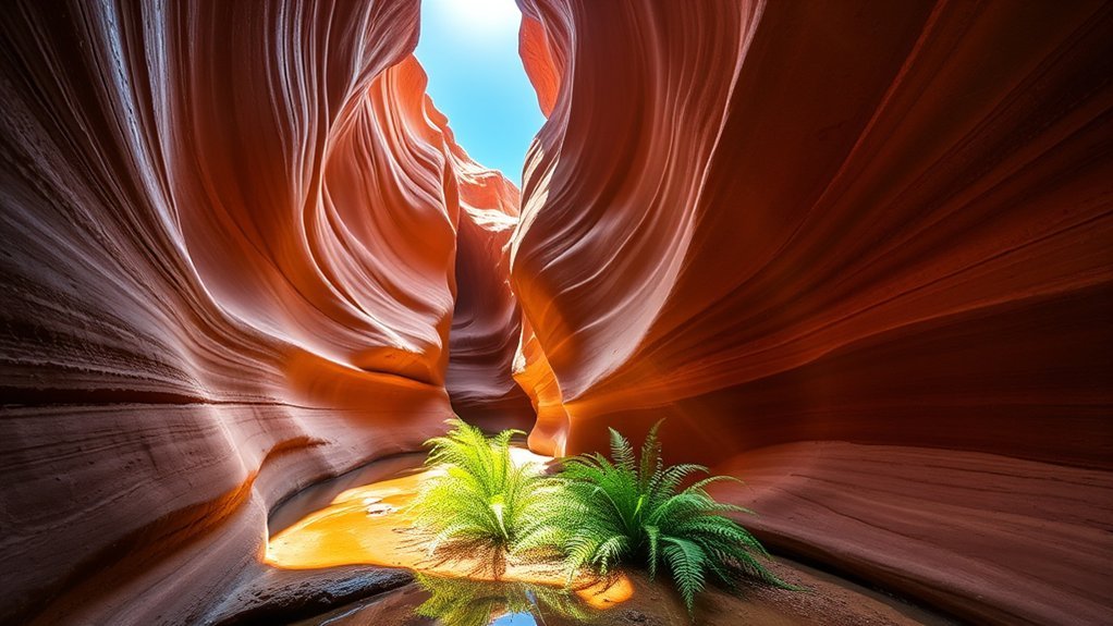
Arizona’s famous landmarks can overshadow smaller historic towns, forested canyons, river corridors, and unusual rock landscapes that deserve just as much attention. If you want to explore beyond the state’s best-known stops, places such as Jerome, Tonto Natural Bridge, Antelope Canyon, Oak Creek Canyon, Tombstone, Chiricahua National Monument, and the Verde River give you seven very different ways to experience Arizona.
Quick Answer
Some of the best hidden gems in Arizona include historic Jerome and Tombstone, the travertine formations of Tonto Natural Bridge, guided slot-canyon tours at Antelope Canyon, shady Oak Creek Canyon, the rock pinnacles of Chiricahua National Monument, and the Verde River. Each requires different planning for weather, fees, access, and pets.
Key Takeaways
- Choose Jerome or Tombstone if history is your main interest, and Tonto Natural Bridge or Chiricahua if you want hiking and geology.
- Antelope Canyon is on Navajo Nation land and can only be entered through an authorized guided tour.
- Oak Creek Canyon and the Verde River offer water-based scenery, but conditions and access rules vary by location.
- Spring and fall are comfortable for many Arizona trips, but elevation differences mean weather can vary sharply between destinations.
- Check official conditions before leaving, especially during summer heat, monsoon storms, wildfire restrictions, or periods of high river flow.
Plan Your Arizona Hidden Gems Trip
These destinations are spread across a large state, so they work better as several regional trips than as a single rushed itinerary. Jerome, Oak Creek Canyon, and parts of the Verde River fit naturally into a north-central Arizona trip. Antelope Canyon is much farther north near Page, while Tombstone and Chiricahua National Monument are in southeastern Arizona.
| Destination | Best For | Important Planning Note |
|---|---|---|
| Jerome | Mining history, art, views | Expect steep streets and limited parking during busy periods. |
| Tonto Natural Bridge | Geology, short hikes | Canyon trails are steep, rocky, and sometimes slick. |
| Antelope Canyon | Slot-canyon scenery, photography | An authorized guided tour is mandatory. |
| Oak Creek Canyon | Creekside scenery, hiking, picnics | Popular recreation sites can fill early. |
| Tombstone | Old West history | Historic attractions have separate hours and admission policies. |
| Chiricahua National Monument | Hiking, rhyolite formations, scenic driving | Bring water and prepare for rocky trails and elevation. |
| Verde River | Paddling, birding, river access | Choose a route that matches current flow and your paddling ability. |
Warning: Arizona weather can change quickly. Summer heat can become dangerous, and monsoon thunderstorms can trigger lightning and flash flooding far from where rain actually falls. Never enter a slot canyon, creek crossing, wash, or narrow drainage when flooding is possible. Check the latest forecast and warnings from the National Weather Service before heading into northern Arizona canyons.
Exploring the Historic Mining Town of Jerome
Jerome is often described as a ghost town because its population fell dramatically after the mining era, but it is not an abandoned settlement. It is a living community filled with historic buildings, galleries, restaurants, shops, and viewpoints over the Verde Valley.
The town grew around copper mining on the slopes of Cleopatra Hill. Today, much of its appeal comes from the contrast between that industrial past and the creative businesses that occupy old buildings along its steep streets.
For deeper historical context, visit Jerome State Historic Park. The park centers on the historic Douglas Mansion and interprets the area’s mining history through exhibits, photographs, artifacts, and views toward the former mining district.
Downtown, you can explore historic streets, browse local galleries, stop for coffee, and look for remnants of Jerome’s mining-era infrastructure. The well-known Sliding Jail is another reminder of how unstable ground and mining activity shaped the town.
Pro Tip: Jerome is built on a steep hillside. Wear comfortable shoes and avoid trying to rush between stops. Parking can also be easier earlier in the day than during peak weekend hours.
Discovering the Beauty of Tonto Natural Bridge
Tonto Natural Bridge State Park, north of Payson, protects an enormous natural bridge formed from travertine. The combination of rock, springs, Pine Creek, canyon vegetation, and short but steep trails makes it one of Arizona’s most distinctive geological destinations.
Unique Geological Formation
The bridge is impressive because of both its size and its material. Historical Arizona records describe a tunnel roughly 393 feet long, about 150 feet wide at its widest point, with the bridge rising about 183 feet above the creek area. Rather than treating the entire formation as a simple rock arch, it is more accurate to think of it as a massive travertine structure shaped over time by mineral-rich water and erosion.
Water still plays a major role in the scenery. Depending on recent weather and flow, you may see dripping water, springs, small cascades, damp rock walls, and lush vegetation around the canyon.
Scenic Hiking Trails
The park’s canyon trails are short compared with major backcountry hikes, but their steep grades, uneven steps, wet surfaces, and rocky creek bottom can make them more difficult than their length suggests. Arizona State Parks currently identifies the Anna Mae, Gowan, Pine Creek, and Waterfall trails as the main canyon routes.
| Trail or Area | What to Expect |
|---|---|
| Gowan Trail | A steep descent toward the creek-bottom observation area near the natural bridge. |
| Pine Creek Trail | A partly developed route that reaches rougher creek-bottom terrain where footing becomes more challenging. |
| Waterfall Trail | A short but steep route with uneven steps leading toward a waterfall-cave area. |
| Anna Mae Trail | A short connector into the canyon that links with the Pine Creek area and access toward the bridge. |
| Paved Viewpoints | The easiest way to appreciate the formation without descending the rough canyon trails. |
Wear sturdy footwear with good traction and carry drinking water. The rocks around the creek and bridge can be slick even when surrounding surfaces look dry. Trail access can also change because of weather or park operations, so check Tonto Natural Bridge State Park before your trip.
Wildlife and Flora
Tonto Natural Bridge sits where several habitats meet, which helps explain its mix of woodland, riparian vegetation, birds, and mammals. Rather than expecting a guaranteed wildlife sighting, slow down near overlooks and quieter trails and watch for movement along the canyon edges.
- Mule deer: You may spot deer around quieter vegetated areas.
- Raptors: Hawks and other birds can be seen above the canyon and surrounding forest.
- Wildflowers: Seasonal blooms add color after favorable winter or spring moisture.
- Ponderosa pine and riparian plants: The mix of forest and creekside vegetation gives the park a greener appearance than many visitors expect from central Arizona.
Note: Pets are permitted on the paved path and viewpoints at Tonto Natural Bridge but are restricted from the canyon trails. Check the current Arizona State Parks rules before bringing a pet.
Visiting Antelope Canyon
Antelope Canyon, near Page, is one of Arizona’s best-known slot-canyon landscapes. Its flowing sandstone walls, narrow passages, changing colors, and shifting shafts of light make it visually extraordinary, but visiting it is different from taking an ordinary public-land hike.
Antelope Canyon is within the Navajo Nation, and authorized guided tours are mandatory. Navajo Nation Parks & Recreation lists approved operators for Upper Antelope Canyon, Lower Antelope Canyon, and other managed canyon areas. The tribal entry fee and guided-tour price are separate costs. Review the current rules through Navajo Nation Parks & Recreation before booking.
Stunning Natural Rock Formations
The canyon’s sandstone has been shaped by water moving through narrow passages over long periods. The result is a series of smooth curves, constricted corridors, ledges, and sculpted surfaces that change appearance as the light moves.
- Curving sandstone walls: Layers and flowing shapes create the canyon’s signature wave-like appearance.
- Changing light: Sunlight entering from above can dramatically alter wall color and contrast during a tour.
- Narrow passages: Lower Antelope Canyon includes tighter spaces and stair sections, so mobility and comfort in confined areas matter.
- Navajo cultural context: A local guide adds important history, place names, safety information, and cultural perspective that a self-guided visit could not provide.
Best Times to Visit
There is no single perfect month for every visitor. Spring and fall often provide comfortable conditions around Page, while summer brings intense heat and the North American monsoon. Summer is also an important season for flash-flood awareness.
Your tour time matters because the canyon’s appearance changes with the sun angle, but conventional “golden hour” advice does not apply in the same way it does to an open desert landscape. If you want a particular type of light, ask your authorized tour operator which tour time is most suitable for that season.
Weekdays can sometimes feel less hectic than peak weekends, but Antelope Canyon is popular enough that advance reservations are wise whenever your travel date matters.
Warning: Never enter a slot canyon when flash flooding is possible. Floodwater can arrive from storms miles away. Follow all guide instructions and do not treat a clear sky directly overhead as proof that the drainage is safe.
Photography Tips and Tricks
You do not need complicated equipment to photograph Antelope Canyon well. A phone or ordinary camera can capture the sandstone effectively if you pay attention to highlights and follow your tour operator’s equipment rules.
- Protect bright highlights: If your camera allows exposure adjustment, reduce exposure slightly when sunlit areas are washing out.
- Use a wider view when useful: A moderately wide lens can show the relationship between the narrow walls, floor, and openings above.
- Keep the camera steady: Canyon interiors can be dim. Brace your arms and take several frames rather than assuming every shot will be sharp.
- Listen to your guide: Guides know the most effective angles and also need to keep groups moving safely through confined passages.
Do not assume tripods, large bags, or specialized equipment are permitted. Rules vary by operator and tour type, so check before arriving.
Relaxing Along Oak Creek Canyon
Oak Creek Canyon gives you a different kind of Arizona scenery: flowing water, cottonwoods, maples, pines, shaded picnic areas, red rock, and forested canyon walls. Rather than searching for an undefined “hidden waterfall,” focus on established creekside recreation sites and trails where access is clearer and safer.
One of the best-known hikes is the West Fork of Oak Creek Trail. The maintained portion follows the canyon for roughly three miles and crosses the creek numerous times, so expect stepping stones, shallow water, and wet footwear depending on conditions.
You can also enjoy Oak Creek from developed picnic and recreation areas without committing to a long hike. Slide Rock State Park is another well-known option in the canyon, although its popularity means parking and entry can become competitive during warm weather.
If you stop beside the creek, avoid assuming calm-looking water is always safe. Flow, water temperature, slippery rock, thunderstorms, and upstream rainfall all matter. The U.S. Forest Service notes that there are no lifeguards at its water sites.
Uncovering the History of Tombstone
Stepping into Tombstone puts you in one of Arizona’s most famous mining-era communities. The town became Cochise County’s seat in 1881, and the historic courthouse completed the following year now preserves exhibits about law, mining, ranching, residents, and the conflict associated with the Gunfight at the O.K. Corral.
- The O.K. Corral area: Learn about the 1881 confrontation involving the Earps, Doc Holliday, and the opposing cowboys. The famous gunfight is associated with the O.K. Corral district, although the actual confrontation occurred beside it rather than inside the corral itself.
- Boothill Graveyard: Explore one of the town’s best-known burial grounds and the stories attached to Tombstone’s early residents.
- The Bird Cage Theatre: See a surviving entertainment venue connected with Tombstone’s late-19th-century boom years.
- Tombstone Courthouse State Historic Park: Visit the preserved 1882 courthouse for museum exhibits that provide a broader view of the community beyond gunfighter legends.
For the most dependable historical interpretation, start with Tombstone Courthouse State Historic Park, then explore the commercial historic attractions around town. Hours and admission are not necessarily shared between attractions, so check each one separately.
Adventuring in the Unique Landscape of Chiricahua National Monument
Chiricahua National Monument in southeastern Arizona protects a remarkable landscape of rhyolite pinnacles, balanced rocks, wooded canyons, and mountain views. Volcanic eruptions laid down thick material that later fractured and eroded into the formations visitors see today.
The monument has about 17 miles of hiking trails ranging from short walks to demanding all-day routes. One of the most useful introductions is the Echo Canyon Loop, which the National Park Service lists as a moderate 3.4-mile hike. It includes steep drop-offs, rocky and uneven surfaces, and about 560 feet of total elevation change.
The loop combines the Echo Canyon, Hailstone, and Ed Riggs trails and takes you through some of the monument’s most memorable rock formations. Many hikers allow three to four hours so they can stop frequently rather than treating the route as a fitness race.
For a lower-effort visit, drive the paved road toward Massai Point and use viewpoints to appreciate the formations from above. Check the current National Park Service hiking information before relying on seasonal transportation or other visitor services.
Chiricahua is best experienced slowly: the rock formations change shape as your viewpoint changes, so even a short trail can reveal very different landscapes.
Carry plenty of water, sun protection, salty snacks or electrolytes, and footwear suited to uneven rock. Summer can bring both high temperatures and monsoon storms, while winter can produce snow or icy trail surfaces at higher elevations.
Experiencing the Verde River
The Verde River adds a ribbon of water and riparian habitat to central Arizona. Parts of the river are used for fishing, birding, picnicking, canoeing, kayaking, and floating, while a federally designated Wild and Scenic segment protects important natural and cultural values downstream.
Instead of assuming the entire river is an easy float, choose a specific access point and route. U.S. Forest Service recreation areas around the Verde include places used as canoe and kayak launches, take-outs, picnic sites, and fishing access. Conditions can change with flow, recent storms, debris, and season.
- Choose a defined access point: Developed river sites make entry and exit easier to plan.
- Check river conditions: A route that feels gentle at one flow can behave differently after rain or during higher water.
- Match the trip to your skills: Calm-water recreation and longer river runs are not the same experience.
- Respect riparian habitat: Stay on durable access routes and avoid disturbing wildlife or sensitive riverbank vegetation.
The Prescott National Forest provides information on Verde River recreation sites, while Rivers.gov provides information about Arizona’s federally designated Wild and Scenic rivers.
Frequently Asked Questions
What is the best time to visit Arizona’s hidden gems?
Spring and fall work well for many destinations because temperatures are often more comfortable, but Arizona’s elevation changes make a single statewide answer impossible. Higher places such as Jerome and Chiricahua can be much cooler than lower river corridors. Summer also brings extreme heat and monsoon storms, so check the forecast for the exact destination.
Are there entrance fees for these locations?
Fees vary widely. Chiricahua National Monument currently has no entrance or parking fee. Arizona state parks such as Tonto Natural Bridge, Jerome, and Tombstone charge according to their current park schedules. Antelope Canyon has a Navajo Nation entry fee plus the separately priced mandatory guided tour. Check official sites before traveling because fees can change.
Can I bring my pet to these attractions?
Do not assume one pet rule applies everywhere. Dogs are prohibited at Navajo Tribal Park locations such as Antelope Canyon. Tonto Natural Bridge allows pets on paved paths and viewpoints but restricts them from canyon trails. Chiricahua also restricts pets from many hiking trails through the rock formations. Verify the exact destination before bringing an animal.
What should I wear for outdoor adventures in Arizona?
Wear breathable clothing appropriate for the forecast, sturdy shoes with traction, a sun hat, and sunglasses. Carry sunscreen and enough drinking water. For rocky places such as Tonto Natural Bridge and Chiricahua, shoes with reliable grip are more useful than casual sandals. During cooler months, bring layers because mornings and higher elevations can be cold.
Are guided tours available for these hidden gems?
Yes, but the importance of a guide varies. At Antelope Canyon, an authorized guided tour is mandatory. Museums, historic sites, and parks at other destinations may offer optional ranger programs, walks, or commercial tours depending on season and staffing. Check the official destination page for current options.
Do I need to reserve Antelope Canyon in advance?
Advance booking is strongly recommended because you cannot enter independently and popular tour times can sell out. Use an operator listed by Navajo Nation Parks & Recreation and confirm the meeting point, arrival time, allowed equipment, cancellation policy, and total price before the day of your tour.
Are the trails at Tonto Natural Bridge easy?
The distances are short, but several canyon trails are steep, rocky, and potentially slippery. Visitors who do not want that terrain can still see the natural bridge from paved viewpoints above the canyon. Choose your route based on mobility and trail conditions rather than mileage alone.
Conclusion
Arizona’s lesser-known places become far more rewarding when you understand how different they are from one another. Jerome and Tombstone reveal mining and frontier history, Tonto Natural Bridge and Chiricahua showcase unusual geology, Antelope Canyon offers a guided look inside Navajo Nation slot-canyon country, and Oak Creek and the Verde River provide greener landscapes shaped by water.
Pick the destinations that fit your interests instead of trying to rush through all seven. Then check current access, weather, fees, trail conditions, and local rules before leaving. A little planning gives you more time to enjoy the landscapes and less time dealing with surprises.
Sources
- Arizona State Parks & Trails — official information for Jerome State Historic Park, Tombstone Courthouse State Historic Park, and Tonto Natural Bridge State Park.
- Navajo Nation Parks & Recreation: Lake Powell and Antelope Canyon — Antelope Canyon entry fees, access rules, tour requirements, and visitor policies.
- National Park Service: Chiricahua National Monument Hiking — official trail, terrain, weather, and hiking-safety information.
- U.S. Forest Service: Coconino National Forest — Oak Creek Canyon trails, recreation areas, and water-use information.
- U.S. Forest Service: Prescott National Forest — Verde River access, paddling, fishing, and recreation information.
- National Weather Service Flagstaff: Flash Flood Safety — northern Arizona flash-flood hazards and safety guidance.